Friday, May 27, 2011
Traveling up to Grand Portage
I woke up around 7am and started getting things ready. I was just a matter of getting some loose end items packed up and making sure I packed everything I needed. I tend to over pack, but it’s nice to have stuff in reserve just in case I need it. I got everything in the van and took a shower and I was off by 9:30. I said goodbye to my mom earlier when she got up to go to the bathroom.
Over the previous month I had been focused on gearing up. I bought a few new items to try out on this trip. Most significant was the Kelly Kettle, which I planned to boil my water. I called the guy and he said it was okay to use alcohol in the kettle, so that would be a good back up in case there is wet weather and I couldn’t get anything else to burn in it. Basically, it is a kettle with a chimney inside it, where you burn stuff to heat up the water. You can put paper, twigs and other burnables in the chimney and it will work. There are some air holes in the bottom so you can light the fire and give it air to burn.
Another new piece of equipment is the Kelty 20 degree Cosmic Sleeping bag. I really didn’t want to be cold this year. When I was at the Midwest Mountaineering Outdoor Adventure Expo in November, they had the sleeping bag on special for $99.
I was clear sailing up the interstate from Madison. I was a little bit worried that the traffic would be bad because of the holiday weekend, but everything was good. I stopped at the Gander Mountain Store in Eau Claire. I wanted an emergency Bivouac Sack for my sleeping bag. I found it and bought it for $40.
I thought it was a little high, but REI and some other stores in Madison had run out of them. I guess it is a little extra piece of mind in case things get bad.
I continued up the four lane Highway 53 with no problems. Once I got into the city of Superior, I bought gas at the Holiday Station. Last fall I had a hard time finding a gas station in Duluth, so I decided to play it safe and get gas in Superior this time. At Superior, Highway 53 ceases being a 4 lane highway and uses city streets. So, you pass many gas stations anyway. Then you cross the big bridge into Minnesota. Over in Duluth, they are working on Highway 35 which is the big 4 lane highway that
I use. But it wasn’t backed up going north, so I was lucky. Then the route goes on city streets for a few miles. That’s when I got to a back up because there was a garage sale on the route. People were crossing the street for the garage sale causing a stoppage. But soon I was on the four lane highway going to Two Harbors.
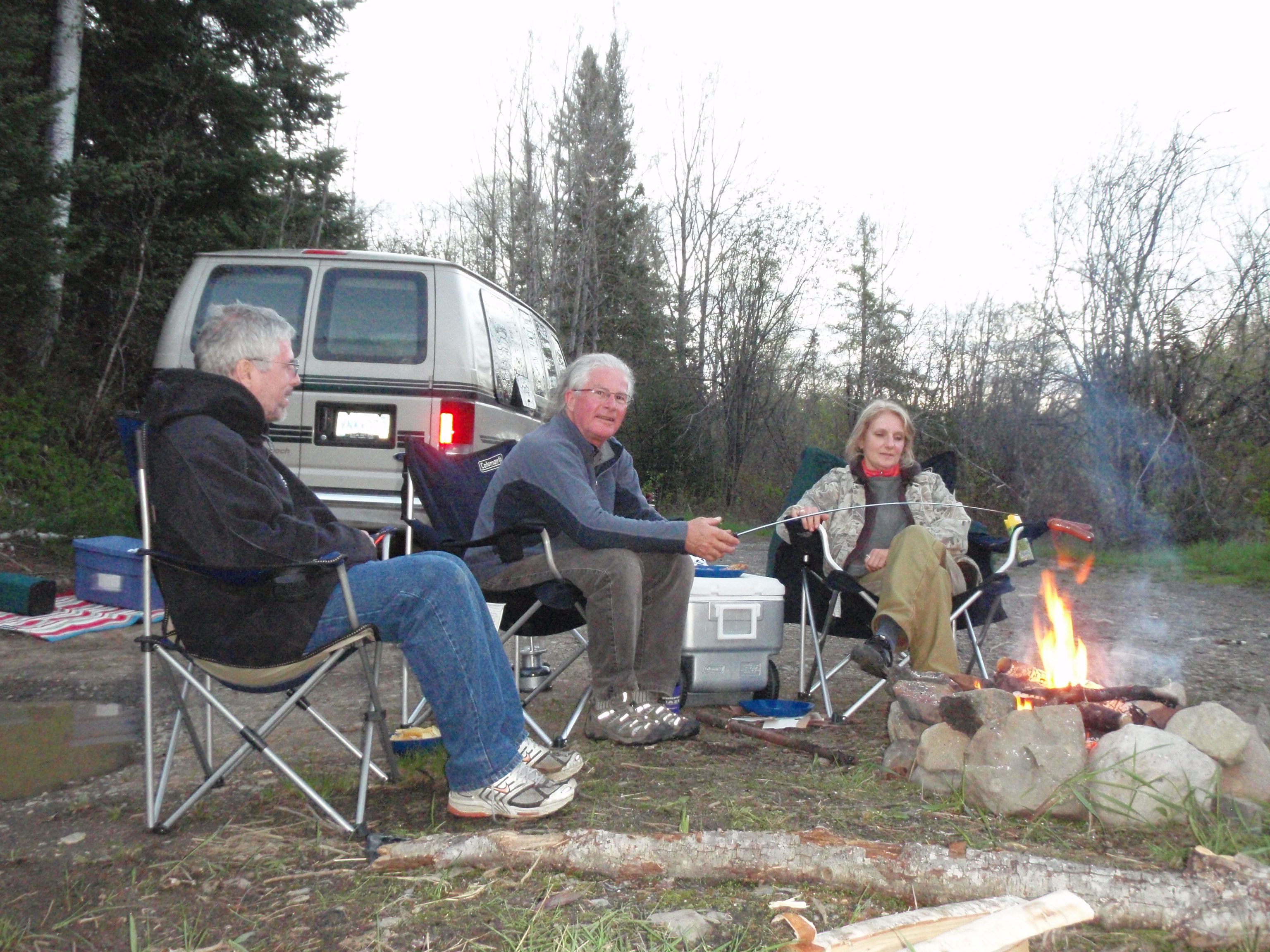
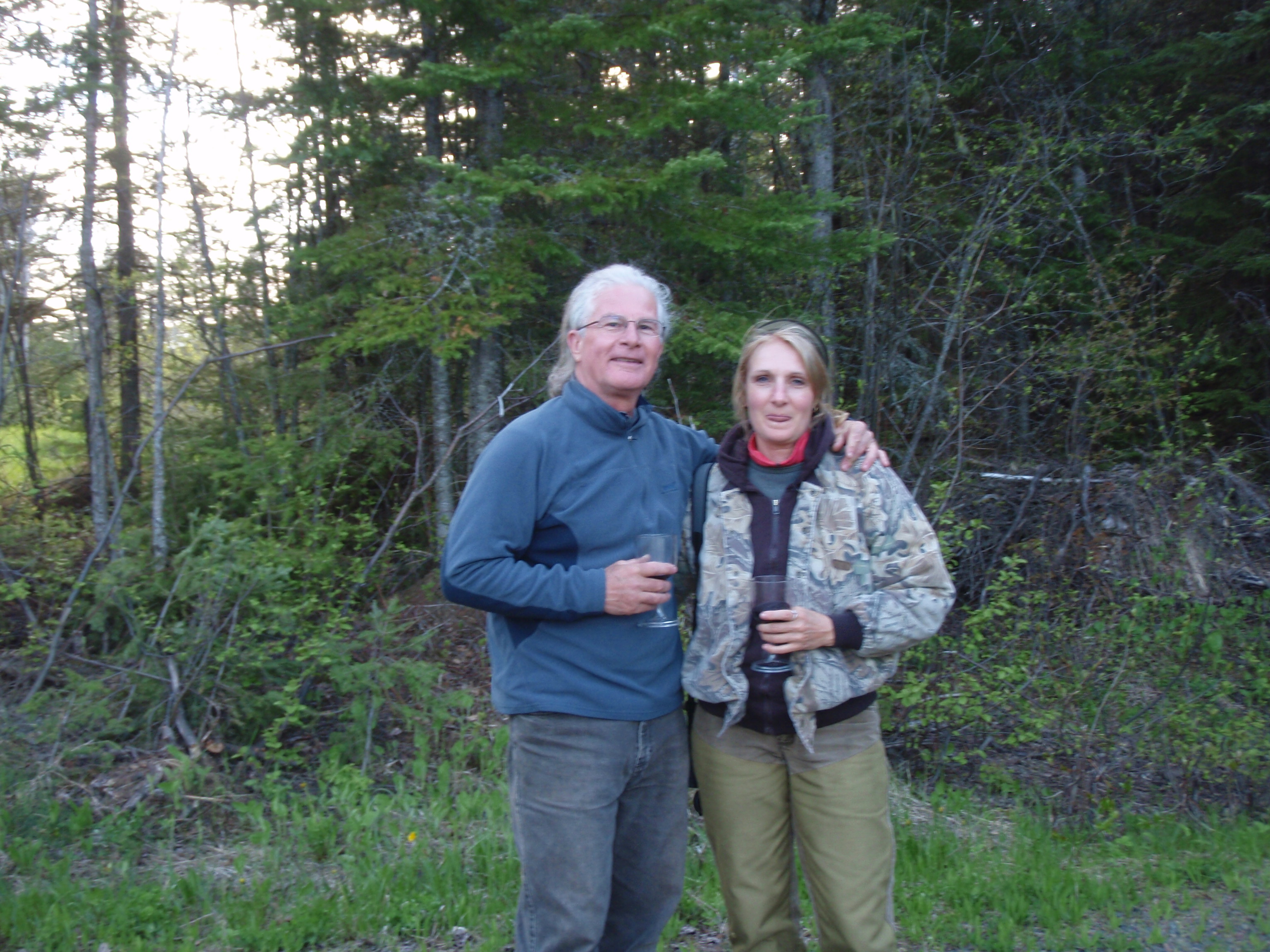
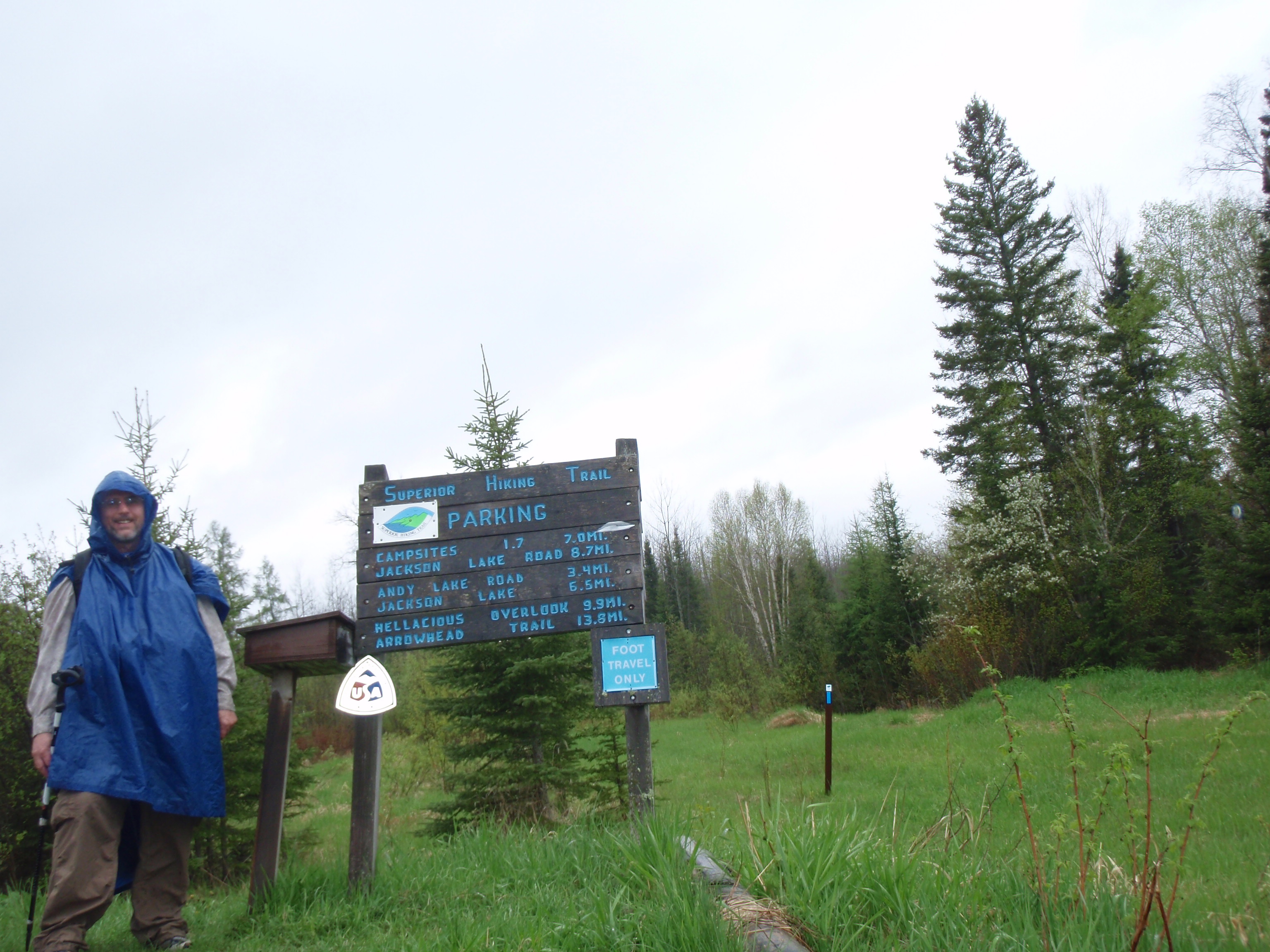
I stopped at the Superior Hiking Trail Association Office, paid my dues and bought some maps. I put the Spot Messenger out to mark my spot. Then when I left the office I met David and Judy outside. They are from White Bear Lake, Minnesota and will be hiking the SHT near Finland on the Holiday Weekend. I chatted with them, gave them an “I Saw Tman” card and took their photo for the website. They also took a nice photo of me at the Superior Hiking Trail Association sign. After the Messenger sent its message, I was off.
I decided to go to the Two Harbors Culvers. This is almost like a ritual for me. It’s the last Culver’s before Canada, as I call it. After Culvers, I headed back through Two Harbors and the traffic was backed up. The traffic has steadily became heavier while I was in Two Harbors, and now it was a traffic jam, backed up about 3 blocks from the downtown traffic light. But after getting through that, it was pretty clear sailing up to Grand Marais.
At Grand Marais, I stopped at the Stone Harbor Wilderness Supply in Grand Marais. I had met the Store Owners at the Midwest Mountaineering Outdoor Adventure Expo and also at Canoecopia. The Owner Jack had invited me to stop by when I talked to him at the Expo. I was impressed with the store, they really did a nice job. Jack says the store is really not a competitor to the Lake Superior Trading Post, but in some cases they may have the same items for sale. But I think Stone Harbor is catering to more of an upscale and serious outdoor enthusiast than the Lake Superior Trading Post. Plus at Stone Harbor they can actually be an outfitter for you canoe or kayaking trip. The canoe trips are for people going to the Boundary Waters and the Kayak trips are for people who want to kayak on Lake Superior.
I continued up the Lake Superior Shoreline on Highway 61 after getting a chocolate dipped cone at Dairy Queen. I stopped at Naniboujou Lodge near Hovland and dropped off a resupply package. I also promised to buy a Naniboujou T Shirt for my coworker Chuck Grafton. Evidently he has the Naniboujou Cookbook which he bought off the internet. So he’s a fan of Naniboujou Lodge, even though he’s never been here. The young man at the hotel had a heck of a time finding a shirt in 2XL. We look though the whole rack, and then he went back to the store room and found one.
After that it was about 15 miles to Grand Portage. I made it up to Grand Portage around 5:30 pm. I decided since I was sitting around in the van all day that I really needed to take a hike. So I drove into Grand Portage and found the Mount Rose Trail. I found a parking spot around two blocks from it. The trail starts across from the Historic Depot and near the start of the Grand Portage Trail.

To my surprise, the Mt Rose Trail is all paved with asphalt. You walk for a ways, then there are a bunch of stairs, then you walk for a ways again. You can follow this hike at my photo gallery. click here. Soon you reach the first overlook, which features the depot below, and the Grand Portage Island out in the Grand Portage Bay. They there are more stairs and you start heading back in the other direction in a switchback pattern. There is an interpretive brochure with numbered stops along the way. Most of the stops are about the type of plants, trees and rocks that you see along the trail.|

You continue to encounter stairs, overlooks and rock faces as the trail zigzags up the bluff. At one spot there is a little side trail to an overlook with a bench. As you continue on you encounter even more steps. Then the trail has a long flat stretch to walk in one direction, then it switchback going the other direction. Right where the corner of the switchback occurs, there is a bench and an open field. I decided to put my Spot Messenger out on the bench. Then I continued around the switchback headed upward along a slope. The whole trail is paved with asphalt, even way up near the top. The must have had problems with a gravel path washing out.
Finally, after encountering some more stairs, and another long stretch of trail, I made it to the final Overlook. and this is a stunning overlook with a 4 foot high stone wall to protect people from falling. You get a great view of the Historic depot below, and the Grand Portage Bay. I took a bunch of photos here including a self-shot. Then I headed back down the hill, picking up my Spot Messenger along the way. I counted the stairs steps on the way down, and there were over 180 steps. It was quite the workout, and I was getting hungry. But the hike did get me into the mood to do some more hiking. It was a good warm-up for the forthcoming hike the next day.

After the hike, I headed down to the Grand Portage Campground and took a shower. Then I headed Casino and Restaurant. I took a short tour of the Casino, then went down the hall to the bar where there were a bunch of people watching the Playoff Hockey game of Boston versus Tampa Bay. I continued into the hotel to the Restaurant.
I like the restaurant. It has some super deals and it has a good view of the Grand Portage Bay. I bought the Friday Salmon Special which was a complete Salmon Dinner including Salad Bar for $12. While I was in the hotel, I decided to charge one of my camera batteries out in the lobby. Next to a couch in the sitting area was an end table with a table lamp on it. I set my charger under the end table and plugged it into an open outlet. There was a lady sitting out there that was looking at her laptop computer, and she had it plugged into a different outlet.
The Salmon Dinner was great. It was a good meal to help power my backpacking trip which started in the morning. After the dinner I walked around the Casino. I had my Wisconsin hooded sweat shirt on, and that managed to help spark a conversations with two older gentlemen. We started talking about all the injuries and concussions in hockey. One of the men knew a NHL player from Wisconsin who had to retire because of concussions. We started talking about Hockey, and one of the men said to “Bet Everything I own on Vancouver.” he must have thought I was a betting man because I was in a Casino. But I have never gambled at the Casino, I mainly stop by for the food. I wouldn’t mind playing bingo at the Casino. But, like last year, I arrived too late to play bingo, which starts at 7 pm.
I headed for the bar just to kill some time while my battery was charging. The Bar was still fairly full of people who had been watching the hockey game. As I was up at the bar buying a beer, I met a Canadian Indian man named T-Bay. Since there was no room to sit at the bar, T-Bay invited me to sit at his table.
I’d say T-Bay was about 40 years old and he had some great stories about catching fish with his bare hands out of rivers on his reservation in Canada. T-Bay is from the Thunder Bay area, hence the name, but he had been cheering for the Tampa Bay Lightning in the hockey game, which Boston won to make it into the Stanley Cup Finals. At the table was another Native American named Richard. He was originally from the state of Idaho, and has no privileges on this reservation. He is a younger guy, I’d say in his late 20’s and he was fairly heavy set. But he did do a great job of explaining some of the things that a Native American can do that a normal citizen cannot. He also explained that everything depends on the treaty that the tribe signed. His tribe in Idaho has a different treaty than the tribe here in Grand Portage. Meanwhile T-Bay continued with his stories about his different feats back in Canada. I’m not sure if any of those stories were true of if they all were tall tales.
Well, the party was breaking up and my battery had charged for a pretty long while, so I decide to leave. T-Bay and Richard were on their way out, too. I hopped in my van and tried to find a nice dark corner of the parking lot to park and go to sleep. The problem was that they had installed a new lighting system since last year, and there wasn’t a nice dark corner of the parking lot. So I headed down to the campground and just parked near the restroom. I slid into the back of the van and started to rest. I did my daily recording on my voice recorder. At that point I wasn’t too optimistic for the hike. I wondered if it was worth it coming all the way up here to do a hike.
Saturday, May 28, 2011
Grand Portage Trail to Partridge Falls

I woke up an saw at the campground and saw a younger man packing up his stuff at a small tent down the way from me. I got up and walked down to the bathroom and stopped to chat with him. His name is Brian and he is from Madison, Wisconsin. His Girlfriend Erin was still inside the tent. I asked him if they we’re going to Isle Royale. And he said yes. It started raining so he took his gear into the bathroom and packed it up. That looked like a good idea, so after he got done, I drove the van down to the bathroom and packed up my stuff. When I got done I went down to their tent and continued talking to them. Somehow, I must have tipped them off that they were at the wrong spot. The Campground is next to the Marina, but the Ferry dock is two miles down the road out on Hat Point. I told Erin how lucky Brian was to have a woman that goes backpacking. She agreed. Evidently, she had been to Isle Royale before but he had not. It looked like Brian had a heavy backpack, so I asked him how much it weighed and he said 45 pounds. I said Ouch. But he said he had most of the food so it would get lighter throughout the hike. I took their photo, and gave them an “I Saw Tman” card. Turns out they only live about two miles away from me in Madison. It’s a small world.

I was all ready to go on my backpacking trip, having sorted through and packed everything. I headed down to the Casino to have breakfast at the Hotel Restaurant. I had a ham and cheese omelet for $8.00, but it was more than I could eat. It was really good, and after some time, I somehow managed to finish it off.
Somehow, my start for the day was a lot later than I intended. I had hoped to be at the National Monument Heritage Center right at 8:30 am when it opened and then at the Depot around 9 am. But by the time I got down to the Heritage Center it was already past 9:00 am. I had talked with Pam of the Heritage Center a few days earlier, and she gave me instructions on where to park my car and my bicycle. She had feared that someone might try to break into my van, if it was left alone and the bike was inside. So, I locked my mountain bike at the bike rack and went inside.
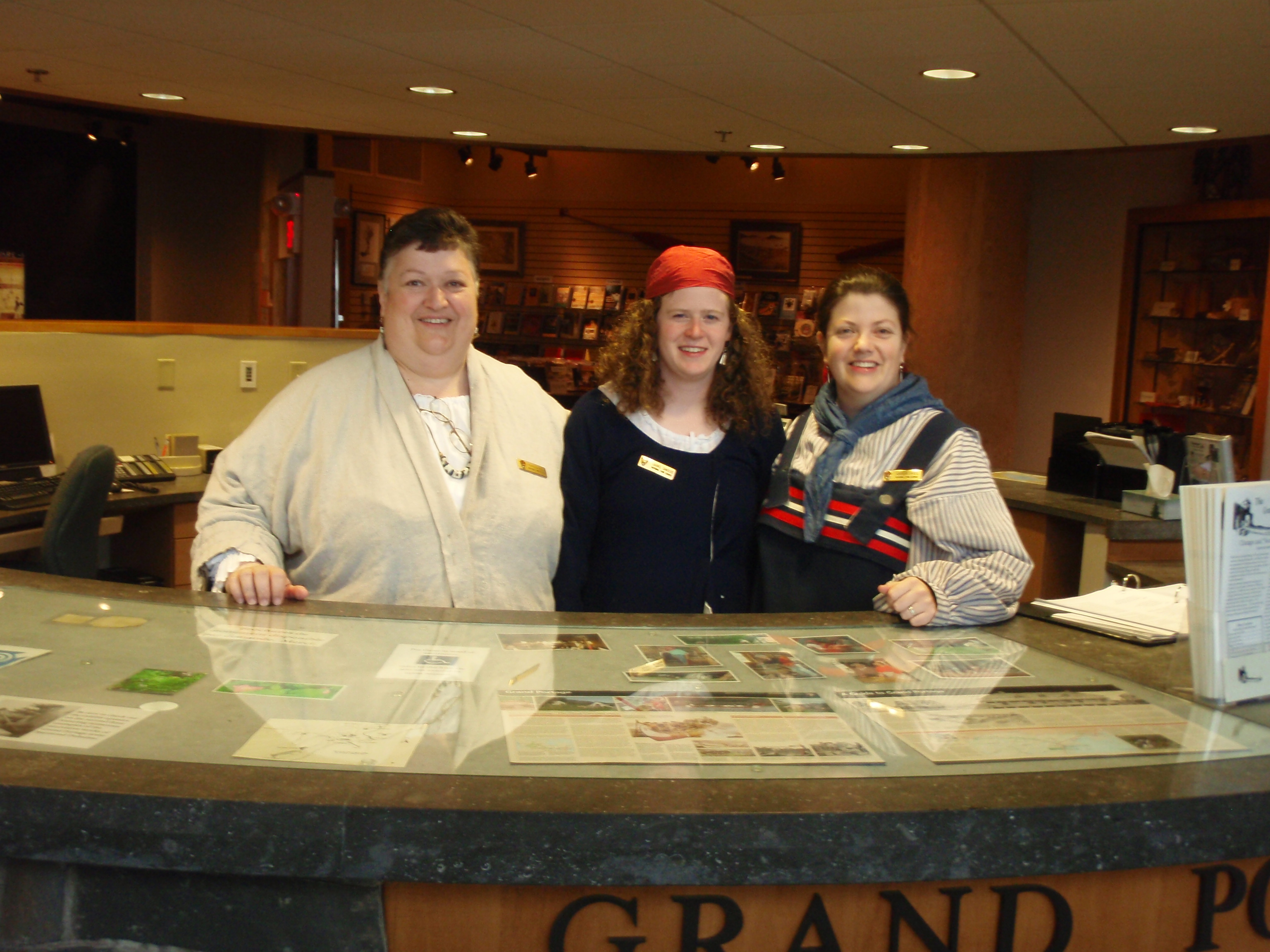
I went up to the big reception desk and met Amber. I told her that I was going to reserve a Campsite at Fort Charlotte for tonight, even though I thought I would pass it by and camp somewhere else. I thought it would be good if they had my information, and if I was feeling tired when I got out to Fort Charlotte, yes, indeed I would camp there. Amber introduced me to Pam, who I had talked to on the phone a few days earlier.
Then I looked at the exhibits inside the Heritage Center. They have a bunch of artifacts from the Fur Trading days, and some stuff from the Grand Portage Tribe. They have a Tee Pee set up with a video going inside the Tee Pee. They also have another room set up with a movie,that people can watch at specific times. One thing that caught my attention was a display with the timeline of Grand Portage.
Pam was walking around the display area, so I pulled her aside and asked her a few questions about the timeline. Then I asked her some a question about how the local tribe members feel about the National Park Service and the Monument itself. It seems to me that a lot of the story about the Grand Portage is about the white man, most notably French men who were the Voyagers. She said the local tribe didn’t feel that way because it is their history, too. She said the tribe and locals are quite good to work with. She had previously worked at another National Historic Site were the locals were always mad at the Park Service because of the historic restrictions placed on the local’s property. In other words, the locals could not build anything without being consistent with the historic aspects of the area.
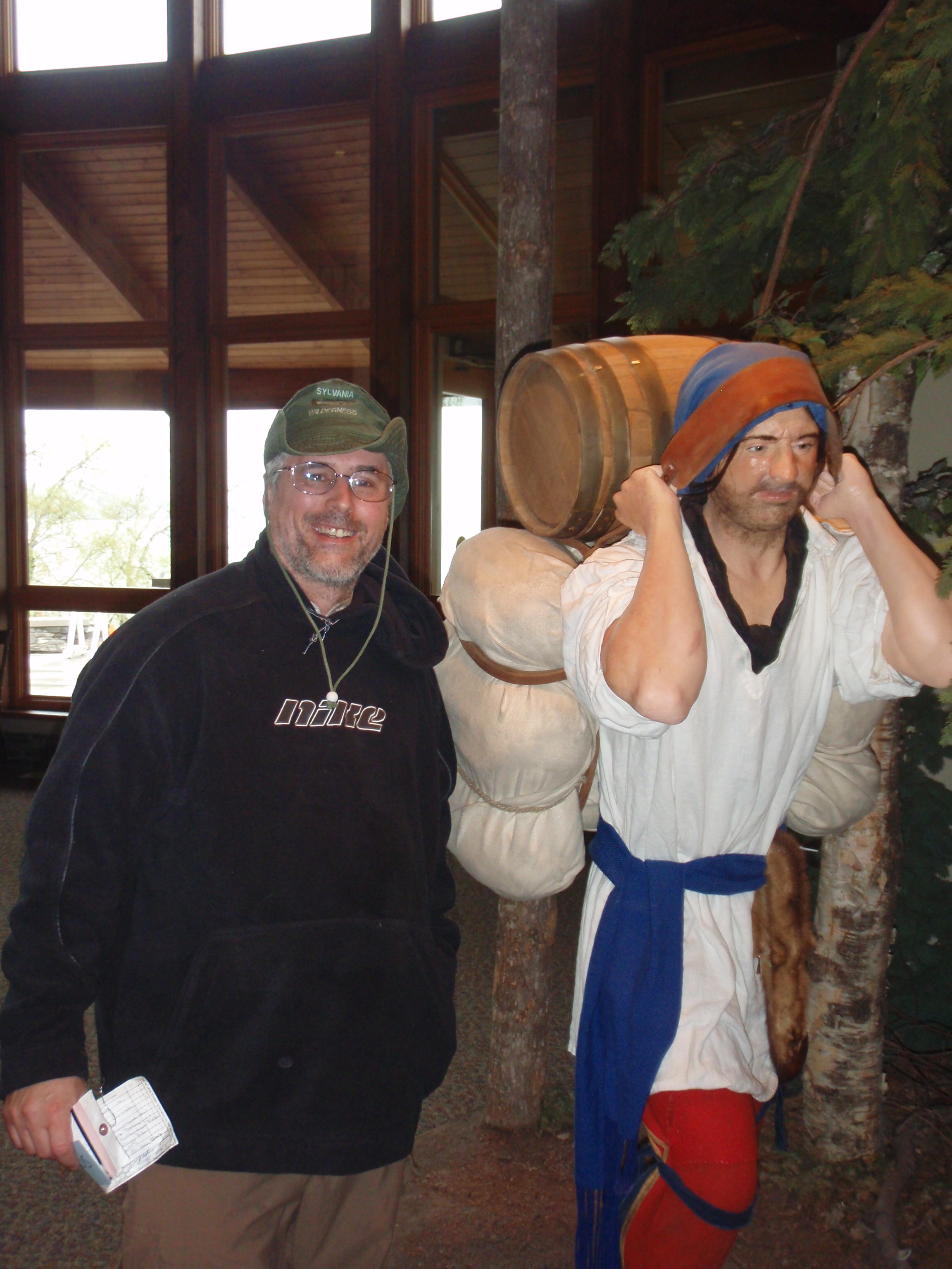
I thanked Pam for her time, and headed down to the historic depot. The depot looks like a Fort, with a high fence around it made from logs. The path going to the depot has several examples of Native American dwellings from the Fur Trade time period. I went to the warehouse building were several other people had gathered. At the warehouse building is where Carl the Canoe Builder was located. He gave an interesting talk about the Fur Trade and Canoe Building. He said there were three groups of people involved with the Fur Trade in the 1790s. There were the British who were more of the Administrative people. Where the French Voyagers were more like agents in the field. They would live with the local tribes out in the Boundary Waters each winter, and then bring the furs to the Depot in the spring. Then there are the Native Americans who actually did all the trapping of the animals for the Fur.
After the talk he answered questions. I asked about the talk fence made of log that emcompasses the Depot. Was that to defend themselves from the local Indians. He said no, that they had good relations with the local tribe at the time, but the fence was more like the fence around your local Menards. It was to protect the furs from getting stolen.

I continued on down to the main building of the depot. There was a bagpiper playing out in front of the building headed towards Lake Superior. After he got done playing, I helped some people to take their photo with the bagpiper, and then I had my photo taken with him. Then he gave us a tour of the main building.. The building was where business meeting were held for the Fur Trading Company, and they also used it as a dining hall. There are four side rooms that originally were used as bedrooms for the Company Officers, but they only had one of them set up as a bedroom, the rest are set up as other rooms that would have been in different buildings. Originally there were 14 buildings in the compound. So, one of the rooms was set up as a clerk’s office and another room was set up like a bunkhouse that an ordinary worker would stay at. I left the main building and crossed a breezeway into another building which was the kitchen. There was a lady in there cooking using the methods of the day. I took a little tour of that building then I went up into the Guard Tower and took some photos. I got a good overview of the Fur Trading history, now it was time for me to hike the Grand Portage Trail.
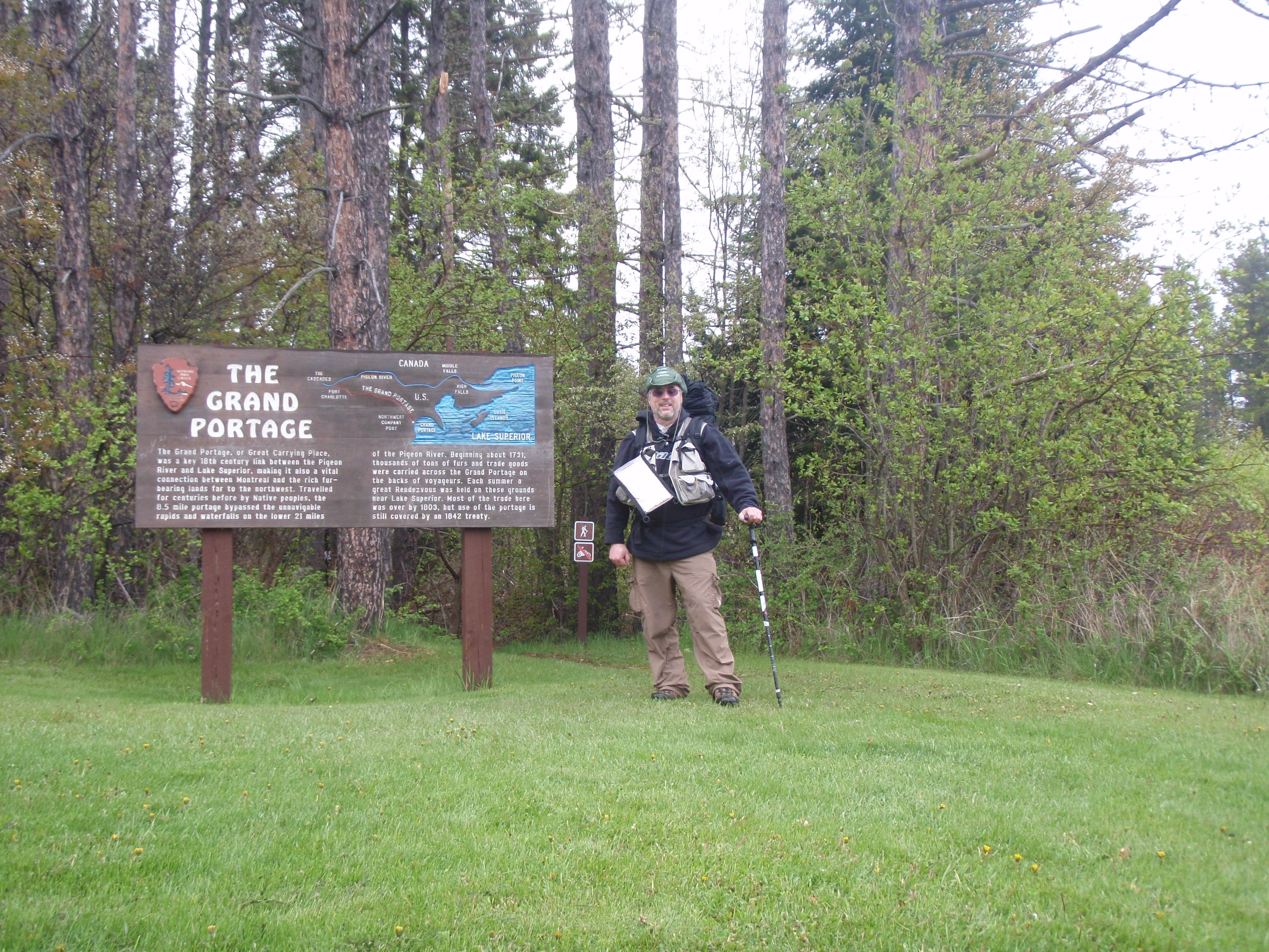
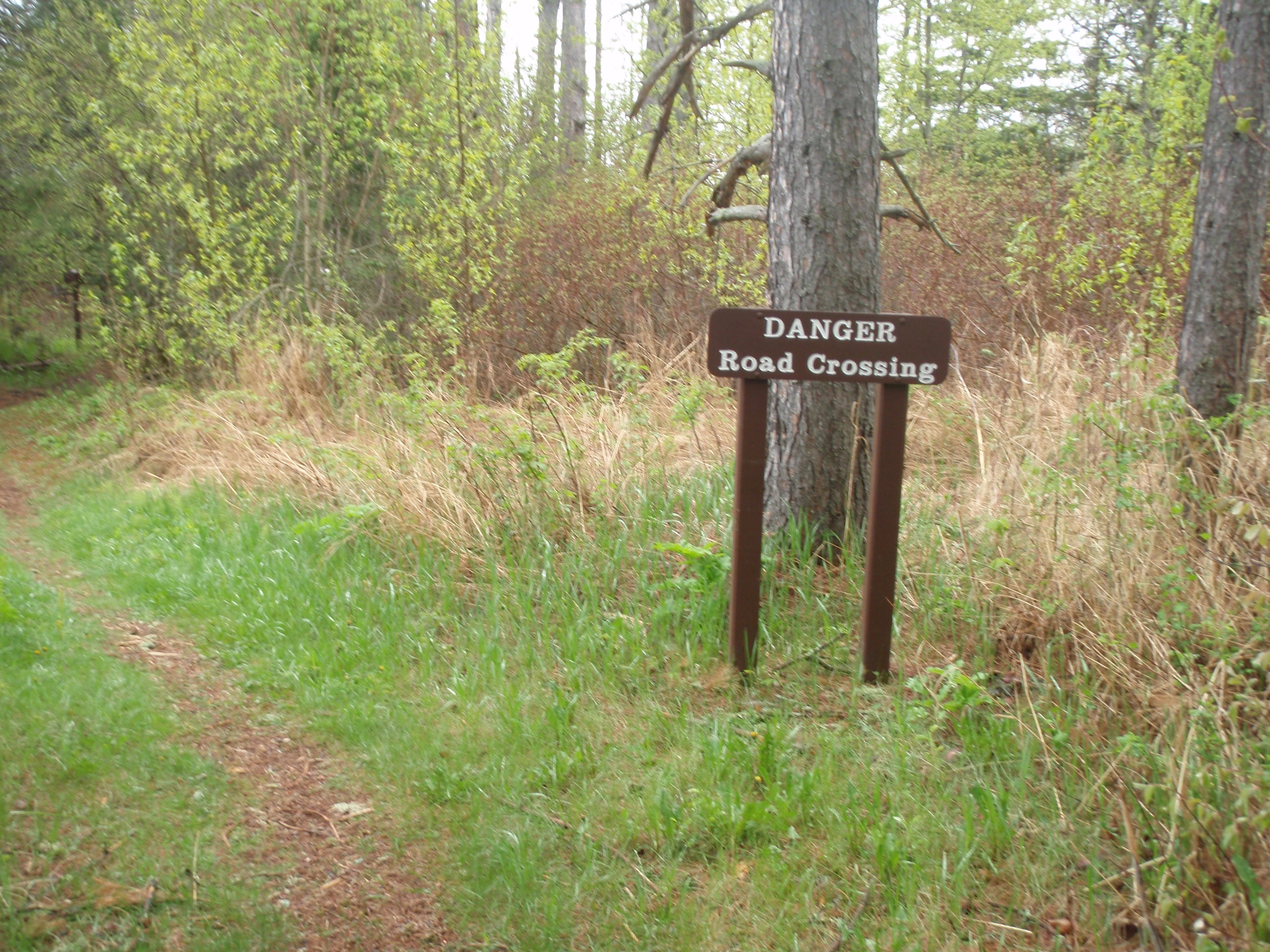
And It was just my luck that it started raining. I headed back to my van at the parking lot of the National Monument Heritage Center. I picked up my backpack, vest, and poles. I made sure I had everything I was supposed to have for backpacking, Then I locked up the van and headed into the Heritage Center. I used the facilities for once last time, then said goodbye to the staff and headed out the front door with my backpack on. Some tourists took my photo using my camera out in front of the Heritage Center. I would be starting my the hike with my rain coat on. I hiked through the Depot and headed out the other side to start on the Grand Portage Trail. Across the road from the depot is a sign marking the start of the Grand Portage Trail. I took a photo at the sign then headed out.
The first 1/2 mile of the Grand Portage Trail is what I call a Creek walk. You’re hiking right next to the Grand Portage Creek. First you come to an ATV/Snowmobile Trail Crossing. I can assure you, that’s one crossing that wasn’t there in the days of the Voyagers. In Fact, a lot of the stuff that I would be encountering would not be there back in those days, Soon I encountered some board walks going over some smaller creeks, then a larger bridge going over the Grand Portage Creek. After that I came upon an Electric Line Right of way. Another thing the Voyagers wouldn’t have seen. Mankind’s knowledge of electricity was just in its infancy when the Voyagers walked this trail back in the 1790s
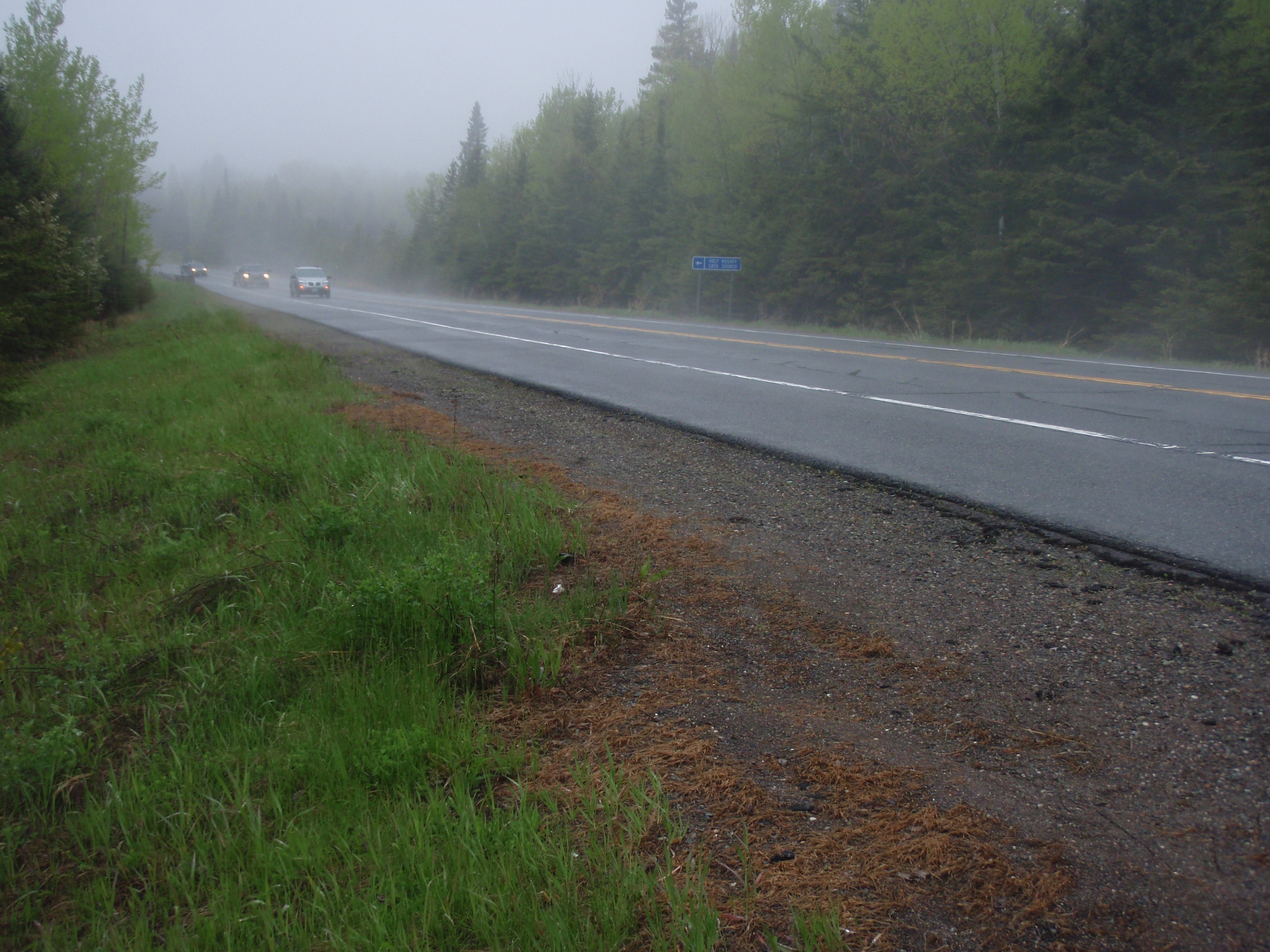
The trail heads along the creek for a little ways more, then the creek moves away from the trail. The trail is pretty straight, and heads in a steady uphill direction for the last 400 yards before making it to Highway 61. Maybe I should be calling this New Highway 61. At any rate, Highway 61 is a popular route for people with fishing boats headed to and from Canada. It was still raining and the cars left a little water vapor trail behind them as they passed by.
I crossed the highway and came to a Self Registration Kiosk on the other side. I opened it up and didn’t see anything inside it. There was another compartment that I was supposed to open and didn’t. I continued down the trail passing some rocky areas next to the trail. After that the trail would keep going in an up and down pattern for a few miles. It was more of a gradual up and down pattern with no steep uphill sections. In the lower areas there were boardwalks made from 12 inch wide, 4 inch thick and 12 feet long boards. Sometimes these boardwalks were fairly long. I also noted that there were some very straight sections of the trail, and that the trail was very well maintained, with only an occasional tree down. I did see evidence that the trail had been maintained recently, because there were freshly cut down trees that had been cleared from the trail. It’s a nice hike through the woods, but it has very few longer distance fews from the trail. At one point I could see a larger hill to the left of the trail and I wondered if that was Mt Maude. I continued on the gradual up and down and mostly straight trail for over 2 miles from Highway 61.
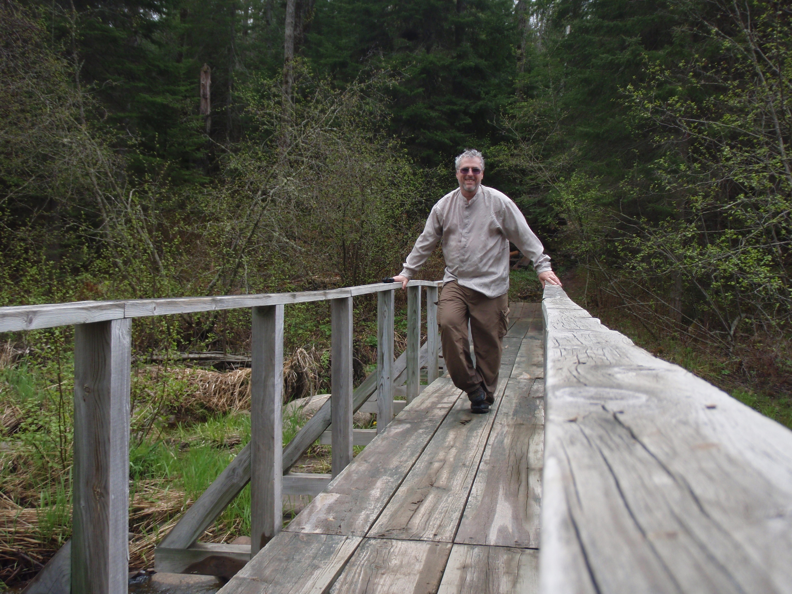
Then the trail heads downhill and I came to the Poplar Creek Bridge. It was the biggest bridge I’d seen yet on the Grand Portage Trail. I’d say it was about 40 yards long, going across a winding Poplar Creek. I stopped here and set out the Spot Messenger to mark my spot. It had stopped raining and was turning into a fairly nice day, but still very cloudy.
After my break at the Poplar Creek Bridge, I continued on the trail as it went up from the Creek. Then it continued it’s gradual up and down pattern, crossing several little creeks on the down swing. After Poplar Creek I figured it wouldn’t be that far to Old Highway 61, and I was right. It seemed like it was less than a half a mile away.
There’s a small parking lot, which is more like an extension of the road. There are signs marking the Grand Portage Trail. And when I crossed the road there was a sign saying “Cascade Trail Junction – 3 miles, Fort Charlotte – 4 miles. When I started hiking the trail again I found another one of those Self Registration Kiosks.

And this time I found the inner compartment, which I missed down at the new Highway 61. The Kiosk had a sign in logbook, asking whether you were hiking to Fort Charlotte or the Cascades, It also had some brochures featuring the plants of the trail, etc. I continued on after signing the book.
I continued on, and it actually starts becoming a rather nice day. The sun came out and I was warming up. As for the trail, it was fairly easy and uneventful for a couple miles. You are just walking through the woods on a trail that is very well maintained. The swath of the trail is at least 8 feet wide, and there are many boardwalks in the low lying areas. And it looks like they are working on the boardwalks because you see piles of boards laying next to the trail near the boardwalks.
Eventually you hit a road going in a diagonal direction and the trail turns on the road to the right. The National Monument Trail goes with the dirt road for about 75 yards, then it veers off to the left. Since the road was going in a diagonal direction, I wondered if it went out near the Cascades. But there was no sign mentioning the Cascades, so I continued on. The trail continues to be quite straight and flat.
The sun kept shining, and I kept looking for the trail going to the Cascades. I kept going and going, at really good rate because this was easy hiking. There was only a couple downed trees on the entire route. But then I came to a spot where there is going to be two down trees across the trail. The beavers had cut nearly 2/3rds of the way through two really tall aspen trees, These trees were about 5 stories tall. It’s amazing such a little critter like a beaver can bring down tall trees like that. Immediatedly after seeing the two trees, I came upon a beaver dam. But this wasn’t any old beaver dam, this was a monster beaver dam. I’d say it was over 100 yards long. And the Trail went right across the beaver dam on one long bridge. But this bridge is in disrepair right off the bat. It was quite surprising given the excellent shape that the trail was in up to this point.
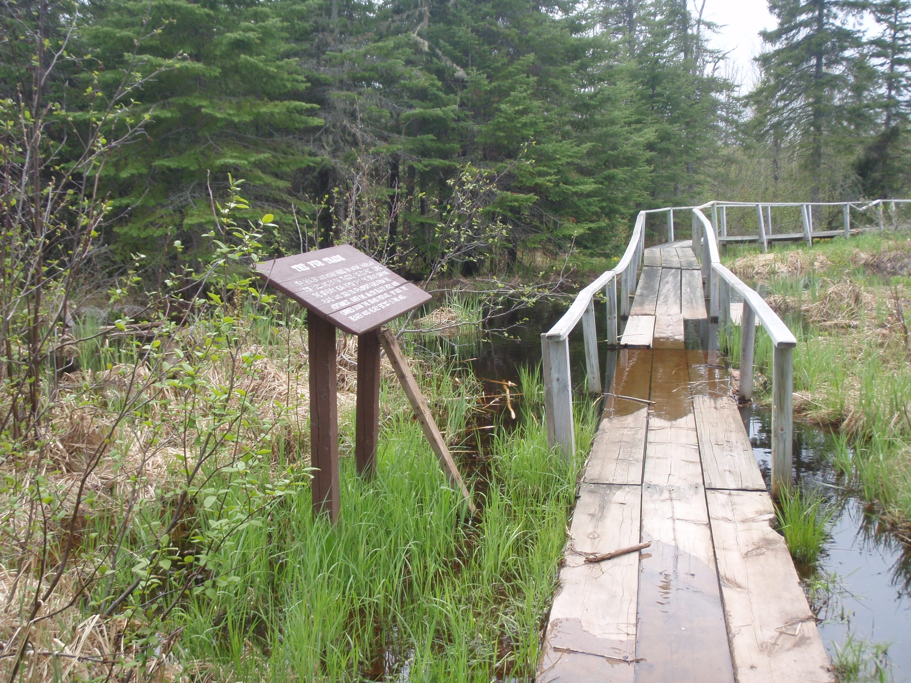
I made it past the first place the bridge was bad without getting wet. But about half way across the bridge there was a spot were the bridge was completely under water except for the hand rails. I thought about hopping off the bridge and hiking on the beaver dam, That’s what I should have done. Instead I tried using the handrails to hop across the bad area but I ending up getting both feet soaked with water.
Luckily, it was fairly warm out by now, but the wet feet cooled me off.
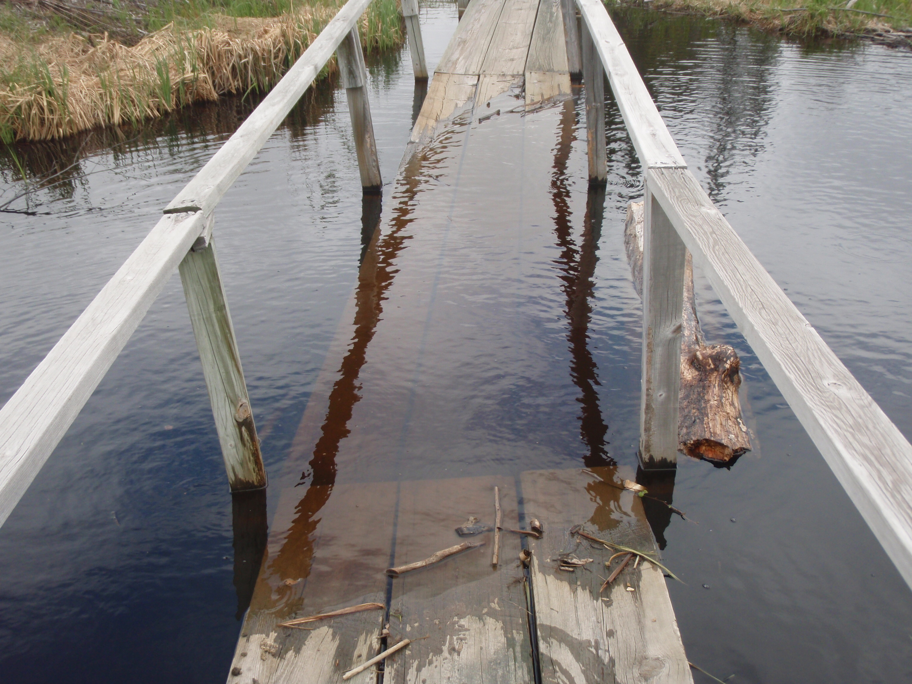
The cool thing about walking the bridge is that it goes right by a big beaver house. This thing must be about ten feet high and 20 feet across. And you also get a good up close view of one of the largest beaver dams I had ever seen. At the end of the bridge, there was another rough spot, then an informational sign about the beaver dam, also stating that the beaver was once the national symbol of Canada. I headed down the trail, still looking for the Trail Junction for the trail going to the Cascades.
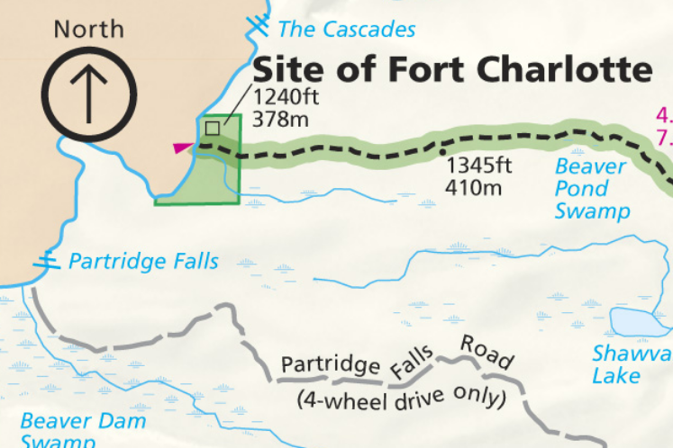
I had intended to set my gear down near the trail junction. Then I would hike out to the Cascades and take some photos, then return for my gear and hike to Fort Charlotte. I kept looking for the trail but didn’t see it. Pretty soon I did see something way down at the end of the trail, and as I got closer, I found out it was the Pigeon River, and there was a sign that said it was the site of Fort Charlotte. I had totally missed the trail to the Cascades. And I was looking for it pretty intensely. You would have thought there would have been a sign for it, but there was none that I saw. I don’t know how I could have missed it. But I had a feeling I knew what was happening. I had a feeling the tribe had something to do with it since the Cascade Trail leads you off the National Monument Trail onto Tribal Lands.
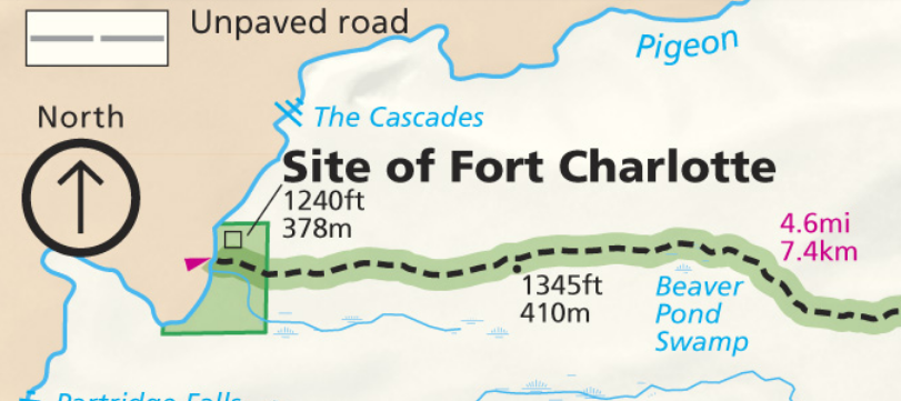
Well, I started checking out the area. Basically, at Fort Charlotte there is really nothing there except for a small clearing, a canoe landing, a backcountry registration kiosk and a couple of informational signs.
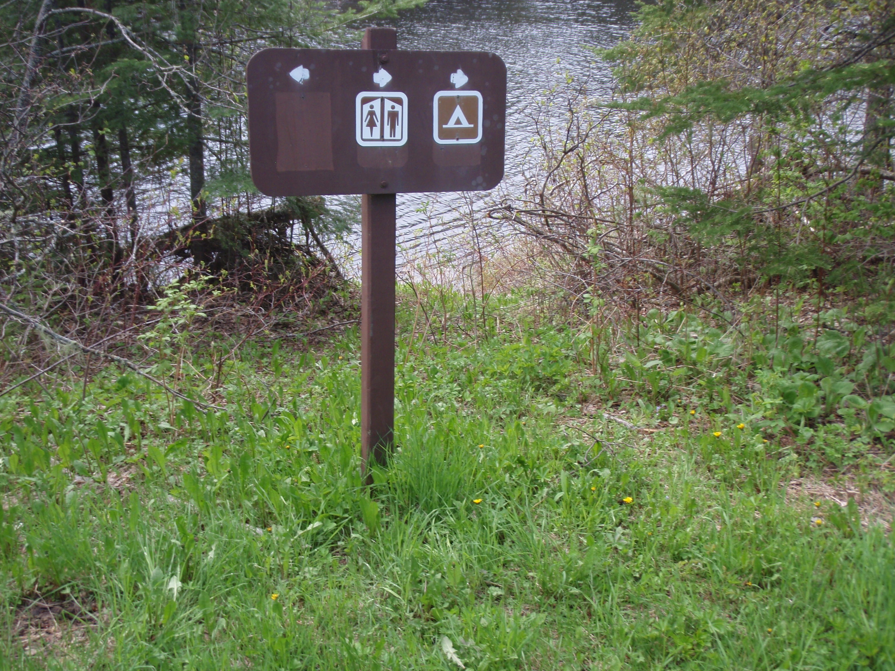
There are trails headed to the left and to the right along the river. I set my gear down and started hiking to the right to where a campsite and a outhouse are supposed to be, according to one of the signs.

I hiked down about 30 yards and sure enough there was a trail leading to the right to an outhouse. It was a fairly nice outhouse, too. It was deluxe accommodations for the backcountry, for sure. Then I went into the campsite that had one old picnic table, two newer tables and a fire grate. There were several nice tent pads. I’ve heard of Scout Groups using this site when taking a canoe trip that retraces the routes of the Voyagers. But carrying a canoe on that 8 mile Grand Portage Trail does not sound like fun to me. I bet a lot of people leave their canoes at that diagonal road crossing that I walked on a while back.
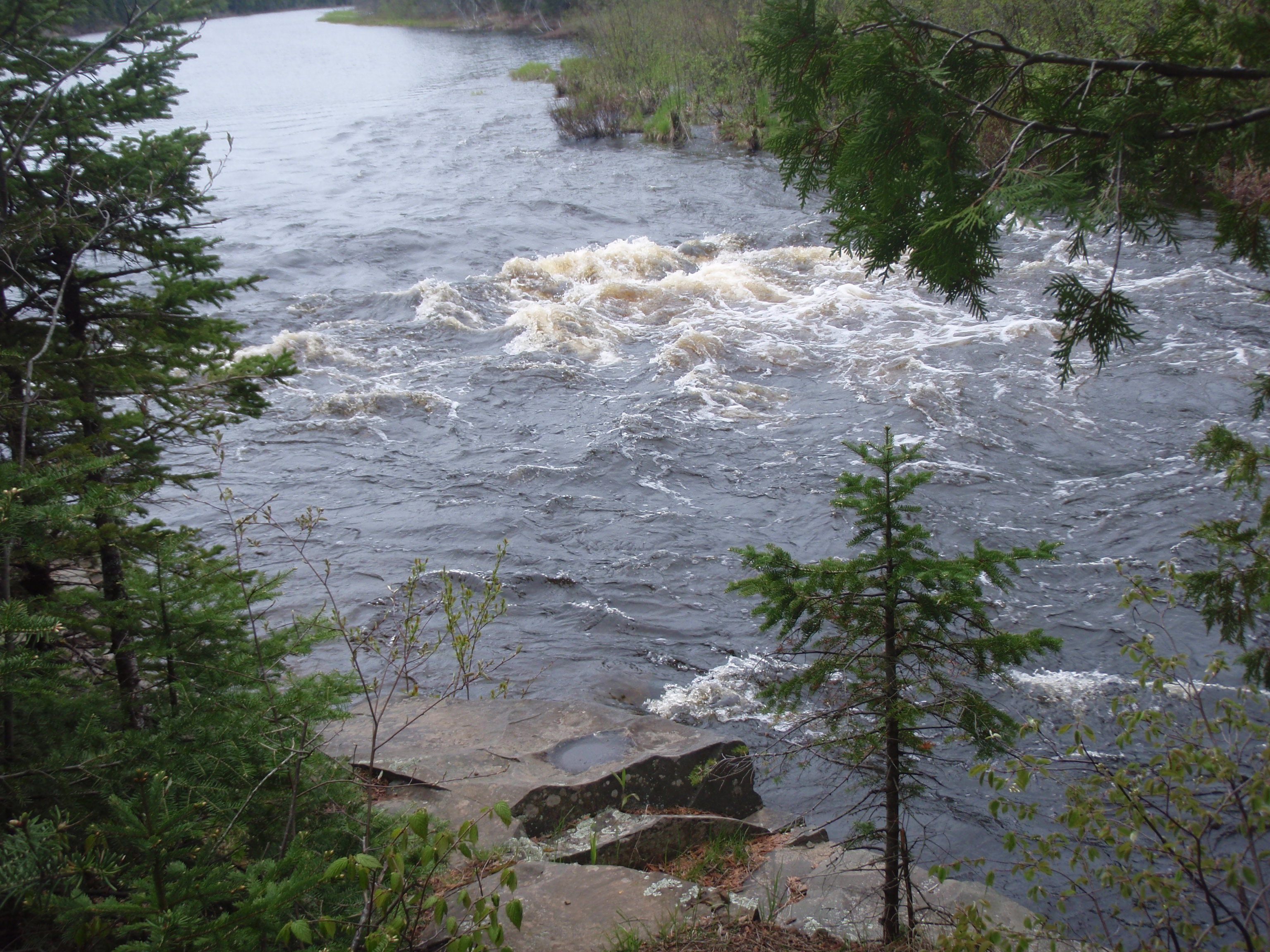
The Trail continues going on the bank of the Pigeon River with a view of some rapids. I thought maybe the trail might go all the way to the Cascades, but the trail soon fizzled out into nothing. I think it was more of a trail for people at the campsite to go pick up firewood. So my attempts to go to the Cascades were officially over. And now I set my sites on going to Partridge Falls.
I went back to Fort Charlotte
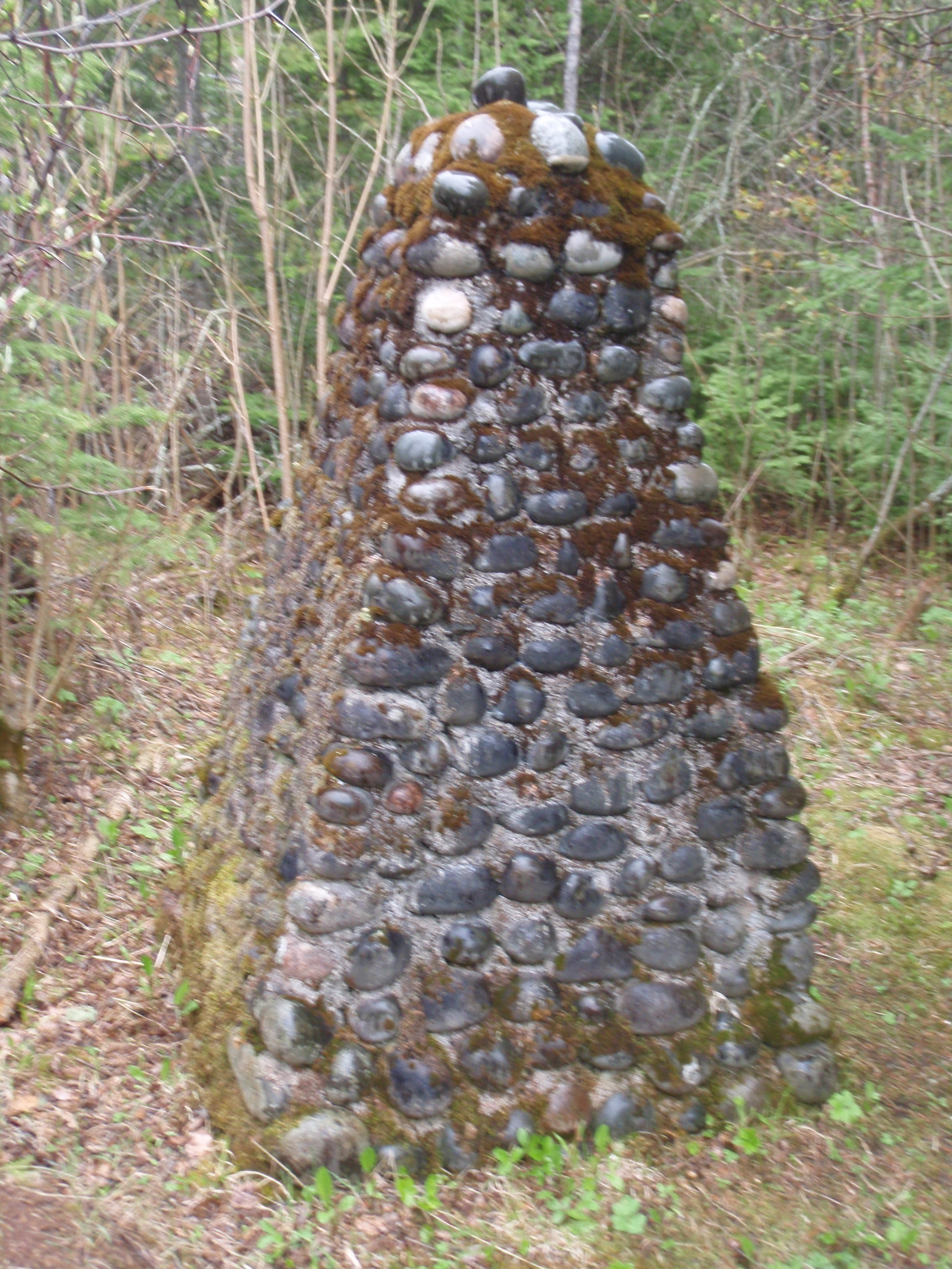
and took a photo of me in back of a historical sign about the Fort. Then I picked up my gear and headed down the trail to the left. It was headed in the direction of Partridge Falls and that was good enough for me. Soon I came to a monument of sorts. It looked like a pile of cannon balls stacked up, but instead it was a piled of rocks that were cemented together to make a pillar of sorts.
I’ve got a call into the National Monument staff and found out that the monument was actual build by the Civilian Conservation Corps back in the 1930’s. That was a surprise to me, because I had originally thought that it may have been part of Fort Charlotte, or something the tribe a put there. At any rate I continued on the trail next to the Pigeon River for about 200 yards and came to a bridge.
The bridge was a rather long bridge. I’d say it was about 40 yards long or so. It crossed a marshy area and a stream. The Bridge looked to be in good condition, but when I got to the other side it was in disrepair. But I managed to get across and walk up some steps on the bank.
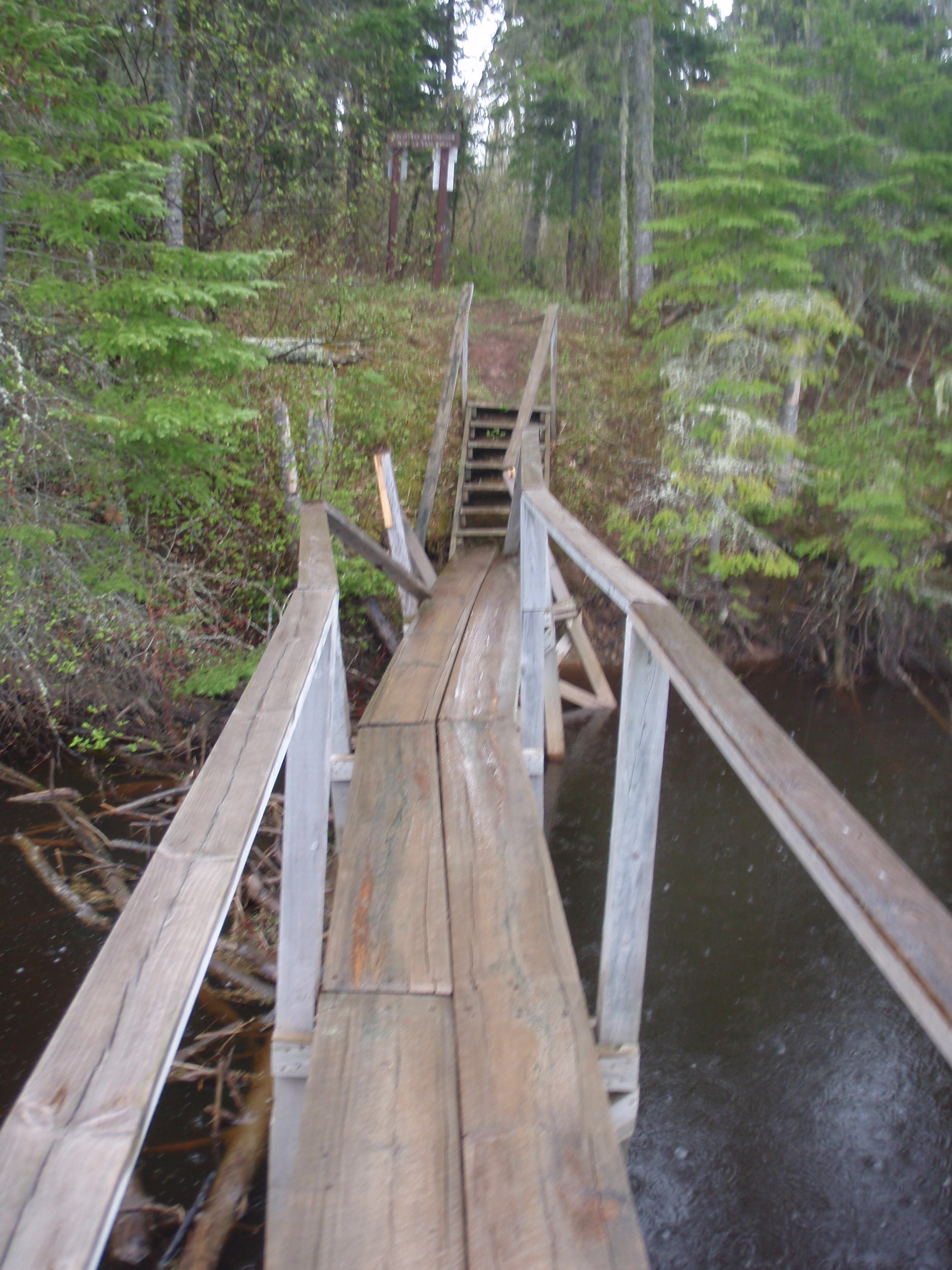
Then I was greeted with a sign. The sign said “Trail Not Maintained Beyond This Point.” This was a surprised to me, because all the trails had been maintained pretty well up to this point, except I couldn’t find the Cascade Trail. But I continued on down the trail, and the sign was right, it wasn’t very well maintained. But there was some orange ribbon marking the trail from time to time, so knew I was on the trail. There were several down trees and wet areas, but nothing too burdensome. But the trees and brush were still wet from the rain, so I was getting soaked just walking this unmaintained trail. I kept going and soon I came out on a dirt forest road. It didn’t look very well maintained either. There were some downed trees along the way, and some muddy areas. Soon I made it to a dead end at the river. I did not see Partridge Falls or anything that looked like a path going towards Partridge Falls. Instead I saw some Government Boats and a shack. The Shack must house stuff for the boats. I didn’t look too closely at the boats, but I’m betting they are for customs agents to use.
I headed back from the dead end and passed the place where the trail junction was. I kept going down the road with lots of muddy spots, and made it to a junction of forest roads. I decided to go to the right to stay parallel to the river. This road seemed a little better than the other one. After hiking on this road a ways, I started to hear rushing water, so I knew I must be getting near the falls. Soon I found an Arrow on a tree and a trail leading away from the road. Could this be the way to Partridge Falls? I hoped so, The trail descended at a pretty good rate, but came out at a canoe landing. I was disappointed, but I could still hear the rushing water down the river. I figured this trail must have been part of the portage going around the waterfall. So I headed back up towards the road. I wasn’t too happy about hiking uphill after finding another dead end.
When I got back to the dirt road, I started hiking west again, over a steep but short uphill section. Then it went gradually down hill and was easy hiking. I could hear the rushing water, it was getting louder and louder. Soon I came to a path leading to the right and I found the campsite on top of Partridge Falls.
It was a bi-level campsite. It had some tent pads, then there was a 3 foot high rock ledge that lead down to a campfire area. Beyond that was the river, and the spot where you could see the water drop over the edge. You could look down and see the gorge down below, way down below, but you don’t really have a view of the waterfall itself.
I decided this would be the spot where I was going to camp for the night. I had hoped to make it to Finn Camp, which was in the middle of the 4 mile unmaintained section of the Old Border Route. But it was past 7 pm, now, after doing all those detour hikes, and I wanted to explore the area around the falls. So I set out my Spot Messenger to mark my spot. Then I started looking around. I found a steep gully where you can walk down to the bottom of the falls. But it looked very dangerous and treacherous, so I decided I would wait until the Spot Messenger sent it’s message, then I would take the Messenger with me when I went to the bottom. What a fool I would be if I broke my leg on the bottom and my emergency beacon was still sitting at the top.
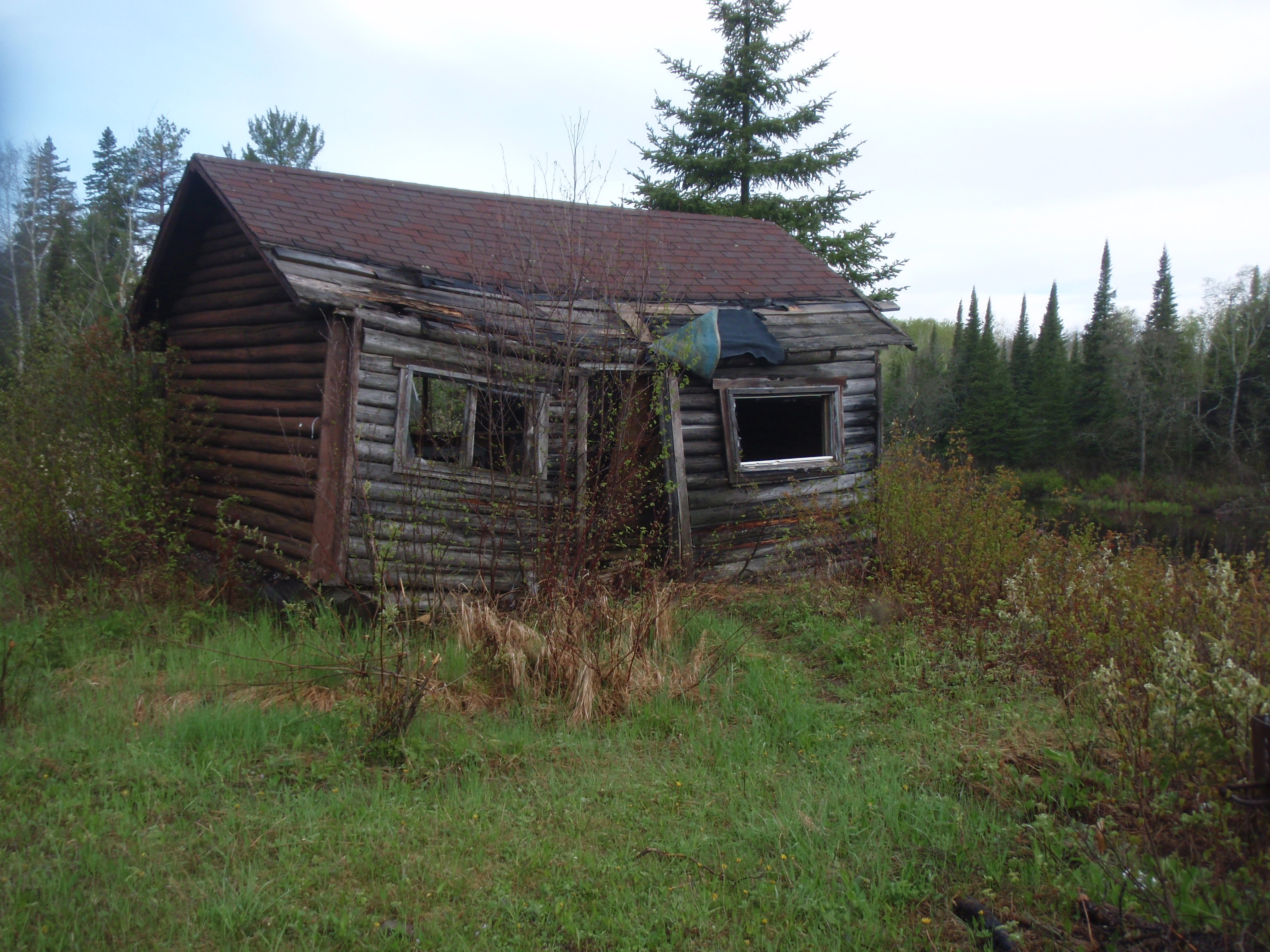
So, I decided to explore some other areas around the campsite while I waited for the Messenger to send its message. I walked down the road to the west. It had pools of water and was muddy in a couple spots. Soon I found the old broken down Partridge Falls Cabin and a much better road coming from the left. The Pigeon River was still on my right. So, the better road deadended at the cabin and it was wider there for turning around. Even though it was a better road, it was still only suitable for jeeps, trucks and SUV’s where the road I had been on was maybe only passable by 4 wheel drive Jeeps. I went back to the campsite and the Spot Messenger had sent its message. So I grabbed it and headed down the steep gully to the bottom of Partridge Falls.
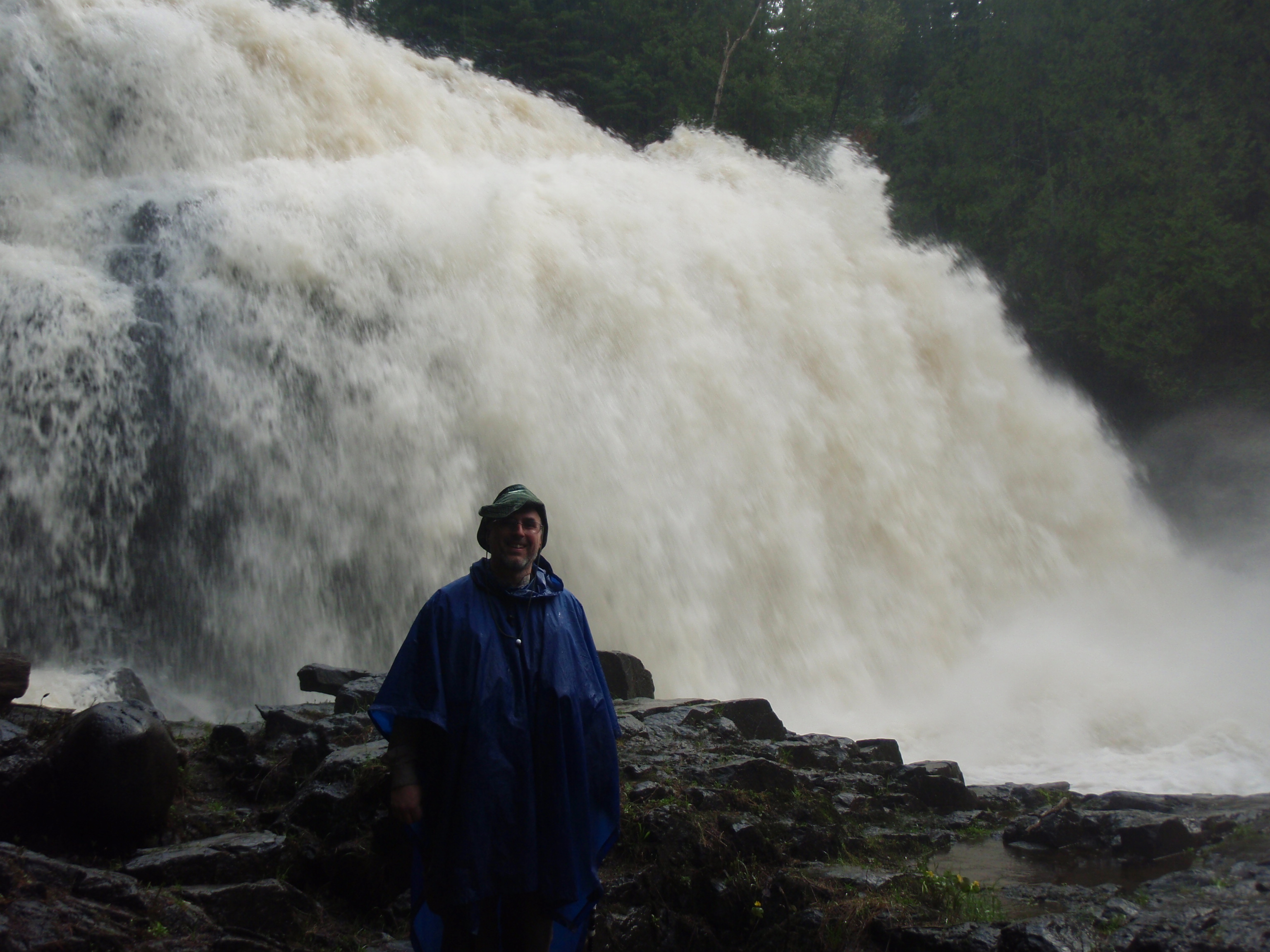
The descent was scary. I took my time and grabbed onto trees and roots. Hopefully, none of them would break while I was holding on to them. But I finally made it down to the bottom and what a spectacular sight. There is a wall of water coming down from about 3 stories high, and it was fairly wide. The falls had one step in the middle of it. It came down from the top to this level spot, then it came down again. Water was just gushing down the falls, and there was a steep banked rock gorge down at the bottom of the falls. I took lots of photos including a self-shot of me. I wasn’t planning on coming down the steep gully again, so I wanted to take as many photos as I could. Then I headed back up the steep gully next to a rock face.
I took it slow, again hanging on to roots and trees. What made it even worse was it had rained earlier in the day, making the footing slippery. I was glad when I made it back to the top. I decided I’d better stop lollygagging around and start making camp. After all, it still was getting cloudy again and could start raining. I set up my tent, and put out my Kelly Kettle to cook some hot water for my dehydrated meal.

When I bought the Kelly Kettle, I called the company and the guy said that alcohol would work in it. If you are unfamiliar with a Kelly Kettle, it is a pot with a chimney coming up through it. You burn stuff in the chimney and it heats the water. Most of the twigs and branches around the campsite were wet from the rain that had occurred earlier. So I was glad I bought some alcohol.
I put some twigs in the chimney, poured some alcohol down the chimney, and lit it. The water inside the kettle started boiling in 3 or 4 minutes. I wasn’t ready for that. I quickly got my dehydrated meal unpacked and ready. Then I carefully poured the water into the meal. The kettle takes a little getting used to. I stirred the Spaghetti meal, sealed it up and let it sit like the instructions say. The alcohol had finished burning so all I had to put out was the twigs that were in the fire. After that I sat on the 3 foot high rock ledge in the campsite and ate my meal.
The dehydrated Spaghetti was my favorite dehydrated meal, so I enjoyed it. But it was too much for me. So I sealed it up and walked down the road to two tall trees and proceeded to put up my rope for my bear bags. I found a small oblong rock that I tied the rope to, then after a couple tries I threw it across a branch that was about 15 feet high. Then I pulled most of the rope through, tying the other end of the rope to the tree. Then I threw the rock with the rope tied to it over another branch of another tree, about 15 feet up, I was all ready to hang my bear bags. The Sky looking more like rain by the minute, so it was a good thing I was getting all this stuff ready.
But I had to finish my meal and put the spaghetti bag in my one of my bear bags. So that’s what I did, I polished off the spaghetti, and grabbed my two bear bags and proceeded to hang them up between the two trees. And when I got finished hanging them the skies let loose.
It wasn’t a light rain either. It was a hard rain, but since it wasn’t very windy, it wasn’t a driving rain. I headed straight for the tent and zippered it up. Everything was inside the tent, except for the bear bags and the Kelly Kettle, but I had a new problem. The tent is 3 foot high, and none of my stuff was laid out in it. Normally, I get everything ready, then I go inside the tent. So now I had the awkward tasks of setting out my pad and sleeping bag, and also changing clothes.
My first awkward task was to take off my boots. This was no small task in the small tent. Then I laid out my sleeping pad and put my sleeping bag on it. I decided to just sleep in my clothes I was wearing on top of my sleeping bag. Put I was getting too cold for me to sleep. So, I managed to take off my day clothes and put on my thermal underwear, and then tuck into my sleeping bag. All of that took what seemed like ten times longer than it usually takes. Once I was finally cozy in my sleeping bag, I decided to do my voice recording for the day. You can hear the rain hitting the tent on the recording. It was still a steady rain. At the end of the recording, I wondered what was going to happen the next day. What would I find when I hike the Old Border Route that hasn’t been maintained in 13 years? I was still raining when I fell off to sleep.
Sunday, May 29, 2011
Partridge Falls back to Grand Portage
I woke up in the morning and heard the song of water. But it wasn’t raining, it was the water going over the falls. I unzippered the tent and saw blue skies. I thought to myself that god had given me a good day.
I had a miserable night.
It was still cold, so I bundled up in my jacket. And I figured the thing that would warm me up would be a hot chocolate and hot oatmeal breakfast. So I got the Kelly Kettle ready. I had to wipe out some water that had collected in the chimney part of the kettle. Then I put some water into the kettle and some denatured alcohol in the chimney. This time I didn’t bother putting any twigs or anything like that in the chimney. I made sure I had my food all ready this time, before lighting the kettle, I had taken the trip to retrieve the bear bags and I also had set out the Spot Messenger to mark my spot. I threw a lit match in the chimney and it started burning. Again, it only took a few minutes and it was boiling. I had my oatmeal ready, so I poured the hot water in the oatmeal. I had to let it cool a little bit before eating. Then when I almost finished the oatmeal, I put some hot chocolate in the bowl and put some more hot water in.
Well, that warmed me up. I took some photos around the camp, but I wasn’t going to go down to the bottom of the falls, especially after it had rained for an extended period. The sun was shining on the waterfall, so it would have been a good shot. But the gully going down to the waterfall would have been even more treacherous than last night
I started packing up and it didn’t take me long. The main problem was all my clothes were wet except for the night clothes I had on. So I decided I would hike in my long underwear. But the underwear didn’t have the hole to go pee in the front of it, so maybe it wasn’t all that obvious that it was underwear. Besides, who’s going to see me? I didn’t see anybody yesterday hiking a well-known trail. Today, I would be hiking a little known trail, if there is a trail at all.
I got ready fairly quickly. I put away the tent wet. I bunch of other stuff was wet including the boots I had on. But I had used the old ziplock bag trick. I had some dry socks, and I put them on my feet. Then I put a ziplock bag over my socks and put my foot in the boot. This seemed to work well to keep my feet from getting soaked from the wet boots. That’s why I always carry extra ziplock bags in the size that will fit over my feet.
I got ready and took one last photo of me at the campsite, then headed out. I headed west on the muddy road down to the broken down Partridge Falls Cabin. I continued west from there and soon I found the stream that the Border Route Guidebook said would have to be forded. The path that I was on lead up to the near side of the stream, where it looked like it was a canoe launch for going into the Pigeon River. But the far side of the stream looked all thickety and brushy. There was no sign of a trail over there.
I couldn’t see the bottom of the stream, so I thought it was fairly deep. I really didn’t want to cross the stream there, so I decided to look for another place to cross it.
So I went back to the Partridge Falls Cabin and started hiking down the road that lead away from the Pigeon River. Soon I found an area that had a bunch of impoundment ponds to the right of the road. And then I saw it. I saw a moose on that was wading in the far impoundment pond. Wow. There was 3 impoundment ponds that I saw, and each of them were the size of about a half of a football field, I could tell they were man made because the were fairly rectangular. There was a faint road going next to one of the ponds, so I hiked down that way because perhaps I could find a way to cross the creek.

I was also headed in the direction of the moose, who apparently had not seen me yet. It was a big bull moose because I could see the antlers. I would walk a ways then stop and take photos. Then I would walk a ways, and stop and take photos. I was getting closer, and eventually the moose saw me and decided to lumber away. But for about 10 minutes I was watching it and it was really cool.
Then I decided I’d better concentrate on the task at hand, finding a place to cross the creek. And I did. There was a little dam on the creek to create the impoundment ponds, so I could walk right across the dam. I’m not sure what the impoundment ponds were being used for. Perhaps it’s some sort of fish hatchery. But these ponds are infested with beavers, and the beavers had embellished the dam with more branches and stuff.
When I got to the other side of the creek I saw a woodduck house then the landscape became quite thickety. I had hoped the little road that I was walking on would continue, but no such luck. I spent some time thrashing around the area looking for the Old Border Route. I did not see any sign of it.
I decided to give up and walk around instead of trying to get through the unmaintained section. I had established that there was no trail on this end, just a thickety mess. And I would check out the Rengo Road end of the Old Border Route. So maybe I would have better luck going from that direction.
Or maybe I would find some other forest road that would take me across.
Basically, the layout of the land goes like this. The Partridge Falls Road goes in an east-west direction, then to the south there are the impoundment ponds, then there is a big swampy area. After that there is a huge ridge where Rengo Road goes on. If I could somehow find a way across the swampy area, I could go up the ridge and make it to Rengo. So I headed down Partridge Falls Road looking for any path or forest road heading to the right.
The worst case scenario would be that I hike all the way back to Old Highway 61, which I estimated to be about 4 miles, then go south on Old 61 for one mile to Rengo Road, then take Rengo for about 8 miles to the Superior Hiking Trail Northern Terminus.
I was already wary of the Old Border Route when I talked to Scott Rademaker who him and his wife Teresa are the last known Backpackers to hike the Partridge Falls to Rengo Rd route. They had camped at Fort Charlotte, then came over to Partridge Falls, which I think is about a 2 mile hike. After that they started on the Old Border Route, which is 4 miles, But they did not make it through in one day. They camped about a mile from Rengo Road near a creek. So, they must have spent the better part of the day struggling with the thicket.
Maybe even the 13 miles going around might be faster than walking through the thicket. But maybe I would find a forest road to the right, and find a short cut. I set sail down Partridge Falls Road.
It was easy enough walking down the road, and this road did seem a little better build than the forest roads I walked on to get to Partridge Falls. After about a mile or so I came across to forest roads heading to the left. That’s not what I was looking for. I was looking for something headed to the right.
After another stretch of road I found an area that was very rocky area to the right side of the road, and it looked liked there was a path headed that way. So I set my gear down, and set out my Spot Messenger to mark my spot. I wanted my contacts to know that I wasn’t hiking the unmaintained Old Border Route, and that I was going a different way.
So, I hiked down what I thought was some type of path and it soon fizzled out. Then I came back to my Spot Messenger, sat down and ate some food. The sun was out, and it was warming up, and I was soaking it in. The Spot Messenger sent it’s message and I was soon on my way.

But, now I had devised a new plan for my hike. I felt I was getting closer and closer to Old Highway 61, and there would not be a short cut. In that case, then I could walk 1 mile south and hit Rengo Rd, then hike about 8 miles to the SHT Trailhead. That’s a total of 9 miles. If I took a left on Old Highway 61 then walked about two miles to the Grand Portage Trail, then walk 3.75 miles, I would be back to my van. That would be less than 6 miles. I could also stash my gear on Old Highway 61 and come back to get it with the van. So, it would be a lot easier walking.
I passed a clear-cut area on the left side of the road, then walked a long straight stretch, and there it was, Old Highway 61. By this time I was clearly convinced to head back for the van. So, I stashed my gear on the side of the road near the intersection. I made sure I got my keys from the diddy bag inside my backpack, then I headed down the road to the left. All I had was the gear in my vest, which included two platypus bags of water, and my hiking poles.
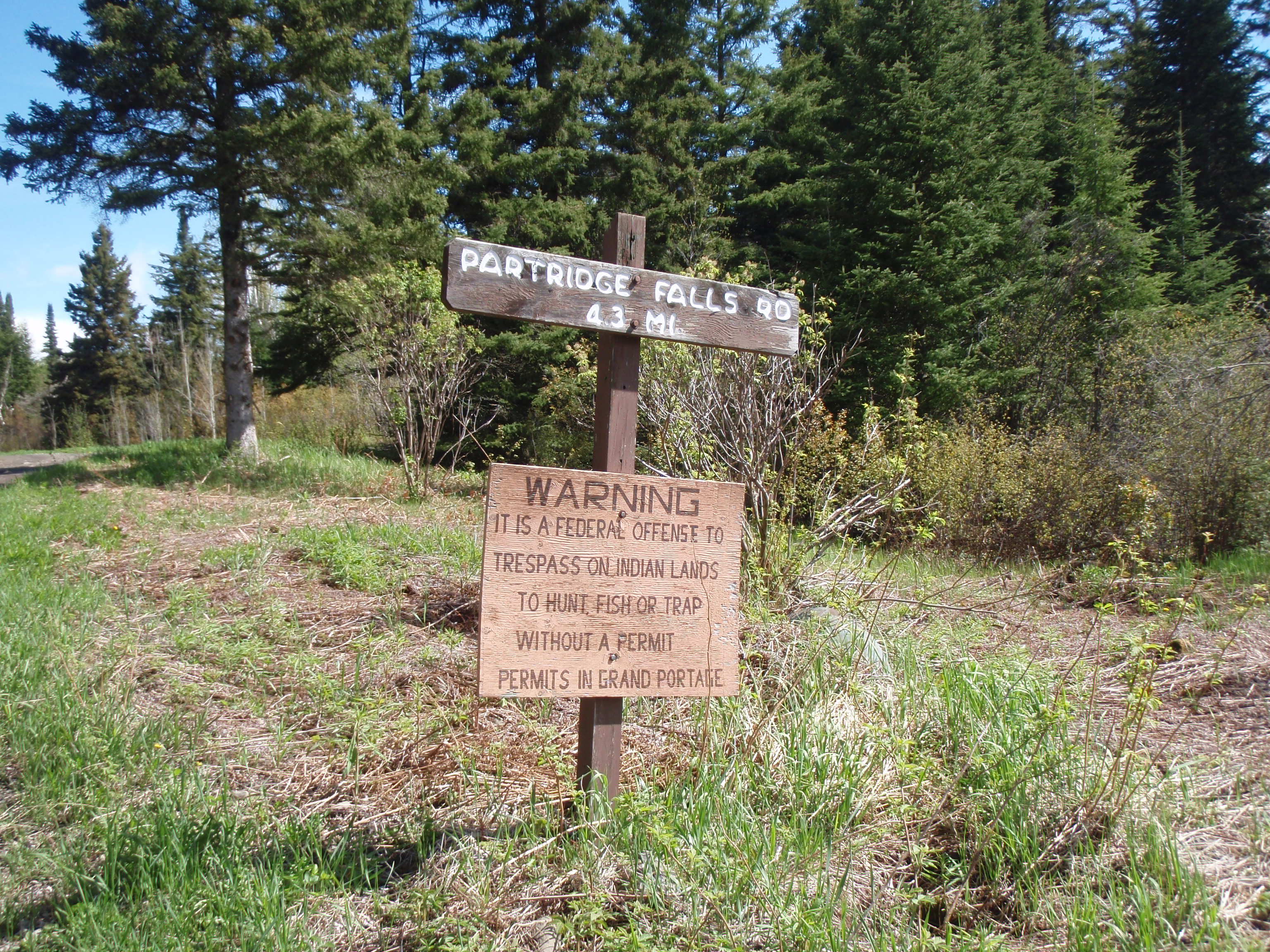
At the corner of Partridge Falls Road and Old Highway 61 there is a big sign that says “It is a Federal Offense to trespass on Indian Lands to Hunt, Fish or Trap without a Permit. Permits in Grand Portage. So it seems as the Tribe is very serious about their fishing and hunting rights.
I thought maybe someone might come along and I might get a ride back to Grand Portage. One SUV came along and I waved at them, but they didn’t stop. Maybe I should have stuck out my thumb.
I kept going and it seem to take a little bit longer than I expected to get down to the Grand Portage Trail Junction, but I finally made it. Then I decided to take a break. Actually, I was kind of waiting to see if that SUV would be coming back this way, because they went down the direction of the Old Highway 61 dead end. I rested for a little while, then I went and signed out of the logbook at the backcountry kiosk.
I headed down the trail.
This time it would be faster because I didn’t have any gear, and I already have this segment photographed from hiking up it. So I didn’t have to stop that much to take photos. I was pretty much just barreling down the trail with a certain amount of reckless abandon. I made it to the Poplar Creek bridge pretty fast, and I didn’t stop for a break like I did the day before. I just had a break at Old 61.
I just kept going and going. It didn’t seem to take that long and I was down to the new Highway 61, then I headed down the creek walk section into Grand Portage. I made it back around 1 pm. Not bad, over 10 miles in less than 5 hours.
On my hike through the Depot, I talked with a National Park Ranger. I told her that the bridge over the big beaver dam that is past Old Highway 61 is in disrepair. She said they would be working on it. I also told her that the bridge to the west of Fort Charlotte is in disrepair and she said that bridge would be taken out because it leads people onto tribal lands. I also noted that I did not see the trail to the Cascades, and she said it is pretty obscure now. And the Old Border Route between Partridge Falls and Rengo Road does not exist. I also went to the Heritage Center and talked with the people there. But the main thing was that I was back to my van.
I got in my van and drove up to the intersection of Old Highway 61 and Partridge Falls Road and retrieved my gear. I really needed a shower, so I headed back to the Grand Portage Campground and parked at a tent site next to the Restrooms/Shower house. I proceeded to lay out all my wet gear on a picnic table. It was fairly windy, considering it is right next to Lake Superior, so I put some heavier stuff on top to hold my wet gear down. I put my wet socks in the on the fire grate, which was somewhat shielded from the wind. I got some clean clothes and my shower kit then headed to the shower house.
Boy that felt good.
Now I was starting to formulate a hiking plan for the next day. I would drive up the Arrowhead Trail, and take Jackson Lake Road to the Trailhead that is on it, and I would lock up my bike there. Then I would drive up to Otter Lake Road and stay overnight at the Swamp Lake Campsite. I would also have plenty of time this evening to check out the Old Border Route from Rengo Road. That’s what I decided to do. I headed down Highway 61 towards Hovland.
I wasn’t going to use Rengo Road to cut over to the SHT Trailhead because I thought it was a little rough for my minivan the last and only time I drove on it during my trip last year. Besides, if I’m leaving my bike at the Jackson Lake Road Trailhead, it wouldn’t make much difference. So, I drove about 15 miles down to Hovland and turned north on the Arrowhead Trail. I drove on it for 5 miles and turned right on Jackson Lake Road. Then I drove about 4 miles down to the Jackson Lake Road Trailhead and locked up my bike. It was a small parking area, with only room for about 4 cars, and it’s down the road a ways from the trail crossing. Then I headed up Jackson Lake Road to Otter Lake Road/Rengo Road. This would be a fairly long bike trip. Although the SHT from Otter Lake Road to Jackson Lake Road is about 9 miles, the bike trip back is longer.
I drove up to Otter Lake Road/Rengo Road a found the spot where the Old Border Route is supposed to be. I parked my van next to the road, and started hiking. The first 300 yards is an old forest road that they still must use today for firefighting purposes. You walk downhill gradually and get to a dead end of sorts and the Old Border Route goes to the right on the remains of an old forest road. But it is blocked off with a bunch of stumps and other logging debris. It was easy enough to walk through, but it would block any ATV riders from taking the trail. At this point, it was a fairly recognizable old logging road. After another 300 yards there was another pile of logging debris blocking the trail. I walked past that. At no point did I see any marking of the Border Route, but I knew I was at the right spot because of the location of the trail compared to the Gravel Pit and Prout Lake on Otter Lake Road. Plus, this trail that I was following goes exactly like what is shown in the Border Route Guidebook.
After the pile of debris, the trail is still pretty easy to follow, but it keeps getting worse and worse. Finally I got to the point where I wasn’t sure there was a trail. Then I made a big circle trying to find anything that looked like a trail. But I didn’t find anything. It was one big thickety mess. I thought about continuing to try to find the creek where the Rademakers camped near last year, but I said to heck with it, and started back for the van. Now, I was totally convinced that the Partridge Falls to Rengo Road route of the Old Border Route is not a viable trail and should be avoided by everyone except people who love bushwacking. I got back to the van in short order, then I headed west on Otter Lake Road/Rengo Road. I intended to camp at the Swamp River Campsite near the Border Route Trailhead, and just 1/4 mile from the SHT Trailhead.
So I drove down the road and found out there was already someone camping there. I parked at the Border Route Trailhead, and walked down to the campsite. This is where I met Jeff and Beth. They are a couple in their 50’s, who to my surprise are SHT Trail Volunteers. They had done their trail work down near Valley Road on Saturday, and today they came up to this campsite and are just hiking and relaxing. I told them there is a great hike from here on the Border Route Trail up to a 270 degree Overlook which is less than a mile away. They said that they already hiked up to it.
Then, I asked them if they could help me out with some shuttling in the morning, and I would be willing to pay them for it. I wanted to shuttle my van down to the Jackson Lake Road Trailhead, and have them bring me back to the Otter Lake Road trailhead. They said yes they would do it, but I didn’t have to pay. They said they didn’t want to wake up too early, so they would like to do it around 9:00 am. That was Okay with me. They asked me where I would be staying at, and I said I was going to sleep in my van up at the Border Route Trailhead. So, it was arranged, and now I could hike a day with a lot less gear, which would be nice.
Beth had seen a tick on me, and I saw another one. Dang, I thought, I should have never taken that Old Border Route hike in my non-hiking clothes. I wore blue jeans and a T Shirt. My hiking clothes are treated with Peretherian, which repels ticks. And it had worked good because I had not seen a tick on me during the whole two days of hike out to Partridge Falls.
It was past 7pm, and I was getting hungry, so I excused myself and headed back to the Border Route Trailhead. I had the whole trailhead to myself, which is kind of sad because it would have been great to see some cars parked here. That would mean some people were hiking the trail. This is a good spot to stay because there is an outhouse in the woods across from it. People using the campsite also use the outhouse. I looked down Otter Lake Road to the west and saw the spot where it was blocked off due to a bad culvert. It didn’t hike all the way down there, put it looked like it was a matter of getting an excavator to dig up the culvert and put in another one. I had heard about the road closure on the SHT Hiker Yahoo Group bulletin board.
I was getting my supper stuff ready. I set out the Kelly Kettle and a camp chair I brought. Meanwhile, Jeff and Beth had taken a walk down the road towards the Superior Hiking Trail Trailhead, and they were coming back in this direction. So, I decided to wait to boil the water. Jeff and Beth were coming closer to the Border Route Trailhead, and I invited them to come over and take a look at a new piece of equipment that I bought for this hike. They came over and I showed them my Kelly Kettle. I showed them where the water goes, then I put some denatured alcohol down the chimney. I said that you can put any burnables in the chimney, like twigs and paper, and it would still work. I just use alcohol because it is faster and there is no cleaning up afterwards.
I lit the alcohol in the chimney, and within 3 or 4 minutes the water was boiling. They were impressed. They had never seen anything like it. So, I put the hot water into my dehydrated meal, stirred it and let it sit for a while. Jeff and Beth invited me to come down to their campsite in at about 8:30 for a campfire. I said I would be down. They headed back to the campsite.
I ate part of my meal, then set it down and did some other stuff. I sorted out my gear for the hike the next day. Obviously, since I would be day hiking, I wouldn’t need the tent or sleeping bag. While I was working on that stuff, a car pulled up and was going to go down into the Swamp River Boat Landing and Campsite. Since they did not have a boat to launch, I figured they were planning on camping. I waved at them and went over to talk to them. I told them that there were some people already camping down there. But they said all they wanted to do was to fish from the shore. They were Steve and Carolyn, and they looked to be in their late 20’s. So, they headed down into the campsite.
I went back and finished off my dehydrated meal, which was beef tips and rice. It was really good, and hit the spot. It was getting about time to head down to the campfire, so I got everything into the van except for the camp chair, and I proceeded down to the campsite with the chair.
Jeff had the campfire going and was sitting by it. Beth was getting some stuff out of the van. I put my chair facing the campfire next to Jeff, and I sat down. I said hi to everyone, including Steve and Carolyn who were fishing along the shore. Jeff said that Steve had caught a nice fish right off the bat. Steve looked like he was really into fishing where Carolyn was fishing, but not really that into it. Beth brought over a cooler with some food, and gave me a bowl with some chips and then she sat down. We were just relaxing, having a nice conversation, and watching Steve and Carolyn fish. It was still light out, but dusk was soon approaching.

I must have been bad luck for Steve and Carolyn, because they didn’t catch anything while I was there. Soon, Steve had enough, and told Carolyn that they would be leaving soon. Steve said since he only caught one fish, that he was going to return it to the water. I said that I would take a photo of him with the fish and that he could download it from my website. So, I went over there and started taking photos
He grabbed the fish off the grass and held it up for a photo, then he went in the water with his waders and gently moved the fish back and forth to get revived. Then he finally let the fish go. Then I took a couple photos of Steve and Carolyn with their fishing gear and I gave them a “I Saw Tman” card. Steve and Carolyn are from the Twin Cities, and they are staying at their family’s vacation house near Hovland for the Memorial Day Weekend. And when they come up to the vacation house, they go on little fishing excursions like the one they are doing now.
Steve and Carolyn left, and I went back to the campfire with Jeff and Beth. Jeff decided it was time to break out the hot dogs, He had a metal grilling stick and he got a hot dog out of the cooler. He asked me if I wanted one and I said that I ate that whole dehydrated meal earlier, which was actually meant for two people. The chips were more than good enough for me.
Jeff and Beth are interesting people. I asked them if they were married and they said no, that they had been dating for ten years. Were they thinking about getting married? They said no, they had been there and done that. They each had separate houses in the Twin Cities, and they were happy with it this way. Jeff recently quit his job as an Engineer. Evidently he is financially sound enough to do that. He said he was tired of it, and the engineering firm that he worked for was going through some changes. Evidently, the changes were not for the better. He just wanted to get a part time job like at a hardware store or something like that. I told him that I had worked part time for several years being an Epson Representative at Best Buy. Maybe he could get something like that. Beth is a Polution Control Agent for the Minnesota DNR. She seemed a little worried about her job given all the political turmoil of late. Living in Madison, Wisconsin, which is ground zero for the turmoil, I knew all about it.
I asked them when they would be headed back to the Twin Cities and they said Tuesday. I asked them what they were planning to do on Monday, and they said they were planning on doing some hiking. So I started discussing some nearby places that I thought might be good spots to hike. I told them about Mt Rose in Grand Portage. I also told them about Partridge Falls and how to get there. I showed them pictures from my camera of Partridge Falls and the Moose I saw near there. I also told them about the John Lake Overlook hike on the Border Route Trail at the top of the Arrowhead Trail.
Beth told me that she had hiked the entire Superior Hiking Trail, and that’s how she got interested in doing Trail Clearing. And the section they clear is near Bally Road, when earlier I thought she said Valley Road. I said that’s a section north of Cascade State Park, and she said yes. I told her that I had hiked that section back in 2009 and had camped at the North Bally Creek Campsite. To this day, that is still the only SHT campsite that I have actually camped at.
It was dark by now, and Jeff stood up and shown his light onto the bank of the other side of the river. He wanted to see if any moose had come down to the water to drink. But he didn’t spot any. I told them my plans tomorrow I would be hiking down to Jackson Lake Road, and then the next day I would be hiking to the Arrowhead Trail, then road walking back to my van. Beth said that she had actually done that loop herself. I’m telling you, any woman who has actually hiked the whole SHT is a keeper. I wish Jeff and Beth all the best. They are great people to spend an evening with.
It was getting late, and I decided I should be getting back to the van. Jeff and Beth were talking about turning in also. But before I left, I grabbed a piece of paper from my pocket and explained to Jeff and Beth that I wrote down on the paper all the stuff I need to let go of. I had written down a list of stuff I need to put behind me. I had written the list when I was relaxing while eating supper. I put the paper into the fire and watched it burn. Beth gave me a few words of encouragement.
So I headed back to the comfort of the van. I had a nice set up for sleeping which included 2 extra thick sleeping pads. Tonight would be a lot more comfortable than last night. God had given me a good day.
Memorial Day, Monday, May 30, 2011
Otter Lake Road to Jackson Lake Road
Here’s a new feature for my hikes. It seems like I’m always hiking on Memorial Day. So, if I’m always hiking on that day, I might as well remember somebody. And today I’m remembering Jerry Carey. Back in the late 1980’s I was involved with Boy Scout Troop 29 of Bashford United Methodist Church. Jerry’s son Bill joined the Troop and Jerry signed up on the Committee. Jerry was previously involved with the Pack at Marquette Elementary. To tell you the truth, Troop 29 was at a low point. I had signed on to help keep the Troop afloat. There were thoughts going around about shutting down the Troop because we only had 7 boys. But with the eternal optimist Jerry around, we kept going. Jerry wasn’t the greatest outdoorsman. He didn’t go on all the outings. But what he did do, he did great. He was the Troop’s Advancement Coordinator, and was always doing other things, too. He was a Pharmacist by trade and an upholsterer by hobby. And he was the best volunteer we had. We kept the Troop going, and eventually it picked up again. And it is a thriving Troop to this day. I last saw Jerry in September of 2009 when he was visiting his brother at the nursing home that my mother was staying at for recovering from the Shingles. Jerry looked as good and energetic as always. Gerald “Jerry” Carey died on February 17, 2001 from Cancer. I carried Jerry’s prayer card with me for this whole week of hiking. My sympathies go out to his wife, Charlotte, and his son, Bill. God must have needed someone to do some upholstery work on the throne.
I thought I woke up in plenty of time to make breakfast and be ready by 9:00 am when Jeff would shuttle me. But I was wrong. Jeff came up to the BRT Trailhead and I was still eating breakfast. I asked him to give me ten more minutes and he did. I scarfed down my oatmeal and hot chocolate and quickly got my stuff together. In ten minutes, I was ready to go.
So, we drove down Otter Lake Road to the east and turned south on Jackson Lake Road. Then it was about 8 miles down to the Jackson Lake Road Trailhead. When I got down to the Trailhead, I saw that my bike was still locked where I had put it. I grabbed my hiking stuff and went into the front passenger seat of the van. To my surprise, Beth was sitting in the back of the van. We headed back up Jackson Lake Road. I was really thankful for the shuttle because that saved my about two hours of bike riding on theses gravel roads. Plus, it had started raining during the shuttle. Riding my bike for 10 miles in the rain did not sound fun.
We got up to the SHT Trailhead on Otter Lake Road and I realized I could not find my plastic pocket with my maps in it. I use a caribiner to attach it to the front of my hiking vest. I told Jeff and Beth that I must have left it in the van because I knew I had it at the BRT Trailhead. But the SHT is such a good trail that I really didn’t need a map. But Beth gave me one of her SHT maps from for the upper section of the SHT. These maps cost 50 cents at the SHT Store. I thanked Jeff and Beth, and offered to pay them but they said, no. I got out of their van, and they were on their way back to the Swamp River Campsite.
I hiked down the long driveway into the SHT Trailhead. There were 3 cars in the lot, which is good because it means there are some people hiking the trail. Maybe I will bump into some of them. I set out my Spot Messenger on the SHT sign and I proceeded to start writing in the SHT logbook located in a wooden box. While I was writing I heard some honking and I turned around to see Jeff and Beth’s Van pulling into the SHT Trailhead. They pulled up and rolled down their window and said that they found my map pocket at the BRT Trailhead. Wow, they saved me again, thank you Jeff and Beth.!!!
Well, that was my first misadventure of the day. But I would soon have another one. I had lost the black clip for the belt of my hiking pants. Now my pants were threatening to fall off. I looked in my first aid kit and found a safety pin and used it to tighten up my pants. The Spot Messenger sent it message so I started hiking down the trail. It didn’t take long and the safety pin popped open and I was in danger of having my pants fall off. So I pinned my pants up again and continued walking. But it popped open again so I decided to start walking for a while with one hand holding up my pants.
The trail up here is quite flat and goes through some scrubby grasslands. The trail is quite wide, good enough for a ski trail, and looks like it is mowed perhaps every year. I suspect that it is and old logging Road. The Trail has some 25 foot high pine trees on each side of the trail. These pines are just the right size to cut down and use as a Christmas Tree in the State Capitol. From time to time, the trail is wet. It’s raining, so it doesn’t really matter if the trail is wet. I have a nice cozy van sitting down at the end of the hike, so that changes my attitude a quite a bit.
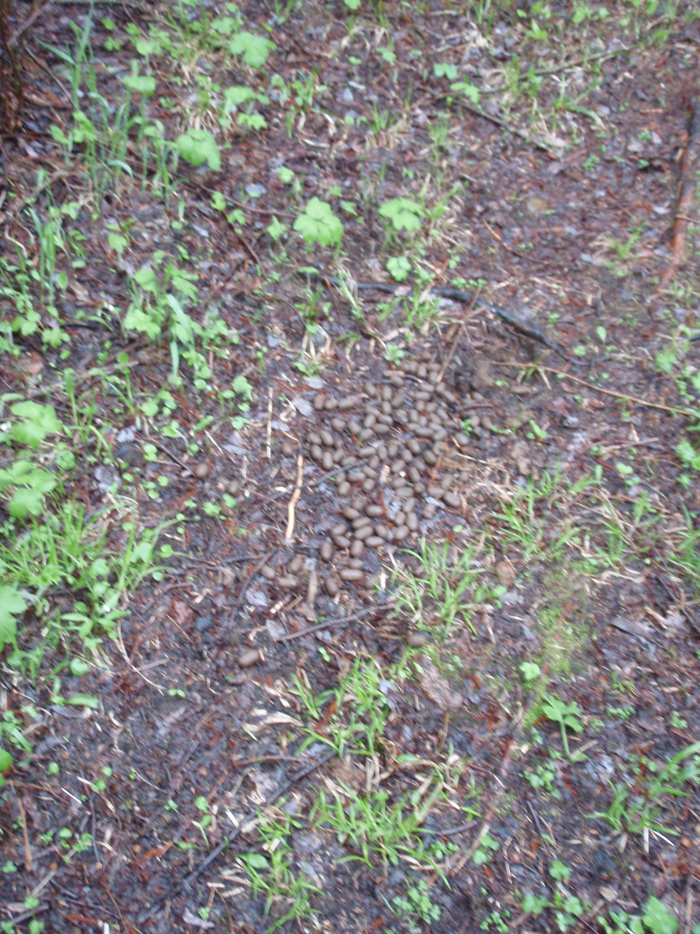
After hiking a half-mile or so the SHT takes a sharp right hand turn into some pine woods. There is a sign with an arrow at the turn. At this point, the trail narrows and is no longer an old logging road. This is a combination of pines and grassy areas. In other words, this woods isn’t as dense as most other woods in the area. There are some views of the surrounding area, but no major scenic views Maybe the description of this area is called Pine Barrens. The trail has some straight sections, and some grassy sections. In on of the grassy sections, the soil is upturned like someone was trying to dig up the sod. The grass was kind of flipped over, exposing the soil below. I’m told bears do this as a way of finding grubs and worms. But I had not seen any bear poop anyplace, yet. However, I did see plenty of moose droppings. In fact, there was one spot that must have been some moose’s favorite spot to stand, because the trail was totally covered with moose droppings.
As I continued on, I encountered a wet stretch of around 30 yards. This is to be expected in the spring, especially with all the rain that has been falling the last few days. It was still falling. Speaking of stuff falling, my pants were falling from time to time. I had put two safety pins on my pants, but they kept popping open. I felt like some of the kids I see in my neighborhood in Madison. They walk around with their pants falling off their butt. Most of the time I think it’s fairly comical because they are doing it on purpose. Meanwhile, I’m trying to keep my pants up and I’m having a hard time doing so.

After the wet area I got to a short boardwalk and then another wet area. Then I saw a bridge, it was a rather large bridge for going over a creek. It must have been at least 30 yards long. But it wasn’t just a creek, the bridge went across a marshy area, with the creek being in the middle. This must be Andy Creek I thought, and soon afterwards, I made it to the Andy Creek Campsite.

Making it to the Andy Creek Campsite reminded me that I had not seen a downed tree over the trail for the whole length of my hike so far. That’s because Tony Yarusso and his dad had cleared the trail and stayed at the Andy Creek Campsite on Saturday night. At least that’s what his plan was during an exchange of emails on the SHT Hiker Yahoo Group Site. I have never met Tony, but he is a regular on the hiker group. So, thanks Tony and his dad for volunteering on the trail. I was enjoying hiking their part of the trail, even though it was raining and part of the trail was wet. And then there was the perpetual hazard of my pants falling down
 The woods are not as dense here as other places on the Trail. So maybe fallen trees are not that much of a problem for the Trail Maintainers here. It says in the SHT Guidebook that the trail gets weed whipped here. So, maybe weed whipping is the main responsibility of the volunteer trail maintainer. I know that they make special mowers with a weed whipper string on it instead of a blade. These mowers are especially made for trail use. Maybe that’s what they used here.
I stopped at the Andy Creek Campsite and pinned up my pants again. This time I used duct tape to cover the head of the safety pin. That seemed to work a little better. Even though the Andy Creek campsite doesn’t have much of a view, the one excellent thing about it is that you can find a nice grassy spot to pitch your tent on. The campsite did have the usual campfire ring with 2 x 12 planks for seating. That’s always a nice feature of a SHT Campsite.
I started out again through the scrubby Andy Creek area. It was good walking now. It seems as though the elevation was just a little bit higher and there was lots of solid ground beneath my feet instead of wet areas. And there were some really straight stretches of trail where you could build up a head of steam. I walked for a fairly long time during these conditions, and then it happened. I found my first downed tree of the trail. It wasn’t much of a downed tree and was easy to walk over. It seemed that it was there for a long time because the bark was worn off in the area that people walk over. Then I walked for a long time through the scrubby woods without seeing another downed tree.
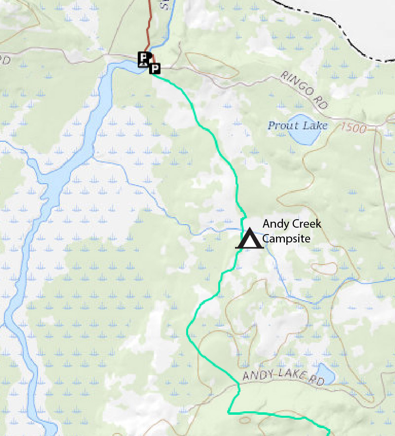
But what I did see was an enthusiastic young man coming my way. This is where I met Kyle. He seemed happy and was abounding with energy. I asked him if he was hiking alone, and he said no, there were two more guys coming. But these two guys didn’t look so happy. It was still raining at everything was wet, so it wasn’t a Chamber of Commerce Day for hiking. The other two guys were Ted and Tim. I told them that the trail was fairly easy the rest of the way, but there was some wet spots. The one guy had on an open shoe design for his shoes, so I said it must be fun walking through the water in those. He seemed to agree. I took their photo and gave them a “I saw Tman” Card, and they were on their way.
After that I went over a little bridge and encountered a little bit of wet trail, but then it was a dry trail for a long time. Again, I was walking through a scrubby area, perhaps it was logged off many years ago. Eventually I hit an area that was more wooded, and also found more downed trees. But I didn’t encounter anything too bad. Then I headed through a scrubby area again and finally made it to Andy Lake Road. It’s a gravel road, but it’s not as nice as Jackson Lake Road or Otter Lake Road. It’s more of a two track road with gravel. There are SHT signs on each side of the road giving mileage to the next trail landmarks. There is also a pile of dirt and rocks sitting next to the road. Maybe it was left over from building the road. The sign said it was 1.5 miles to the highest point on the trail, so I started walking up the hill.

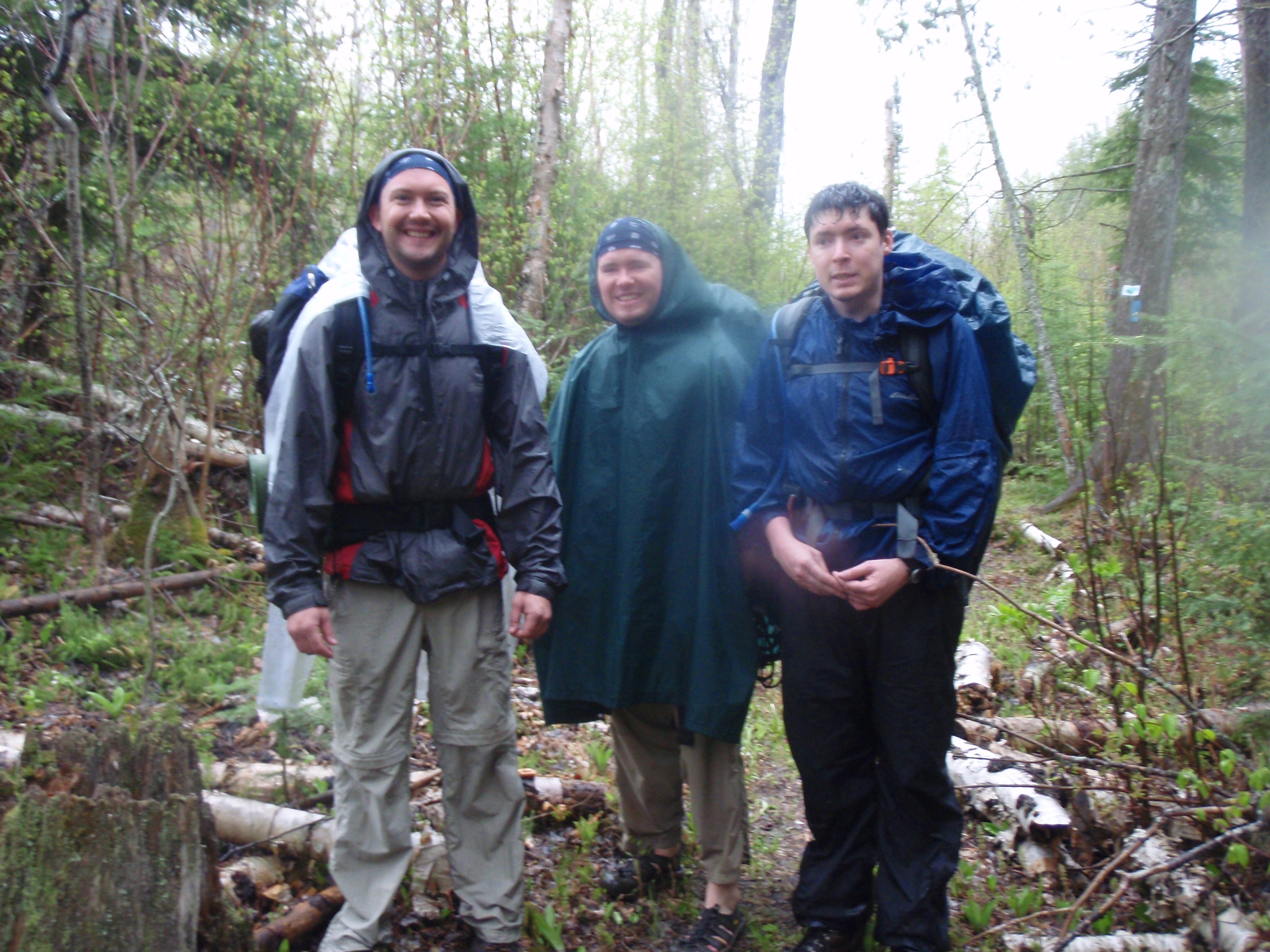
The Trail goes up at a gradual and steady rate, but nothing overwhelmingly steep. Eventually when you get close to the top, you get to a spot where the trail takes a turn to the left. Then the trail is fairly flat, and you are walking this big circular pattern until you’re headed back to the right again. Then you hike in that direction, which would be heading east, for a long time. But it was easy walking up there on top of the ridge. I was walking through a real woods now, ever since Andy Lake Road, not a scrubby woods. But still there were not many downed trees. I walked and walked, and surely I thought I must have passed the place that was the highest elevation on the trail. Then the trail went downhill, so surely I thought I must have passed it. Then it must have went gradually uphill because eventually I made it to the sign that said it was the highest elevation on the trail. I could have sworn that I went downhill to get to it. At any rate, there is no view there, but I took a photo of me standing next to the sign.
I kept going, and every once in a while you would get a little glimpse of a view but not a full-blown overlook. Then you get to a spot where you see a fast downhill area to the left of the trail and the trail descends sharply at what I call the dicey spot. It’s a very narrow and scary section, but it doesn’t last long. Thank god.
Then you’re headed down for a ways, then it gradually goes up again until it starts looking like you’re getting on top of something at a rocky area. That’s where you get to an overlook. It’s a nice overlook, but the trees are starting to get in the way. After the overlook, you start encountering some downed trees at a more frequent rate. And because we are hiking in a regular forest with more mature trees, some of the downed trees are big gnarlies that are hard to get around. The trail heads gradually down for a ways then gradually goes back up. Then you see Jackson Lake down the hill ahead of you. The trail takes a right hand turn, then you are hiking parallel with the lake, except you are up on a ridge looking down at it. And there are some good spots with overlooks of the lake. I looked down to see if I could spot any moose, but I didn’t see any. I bet if you stayed there all day, you’d see some, especially in the morning and evening. I did see some moose droppings on the trail. The Trail keeps going on the ridge above the lake for quite some time.
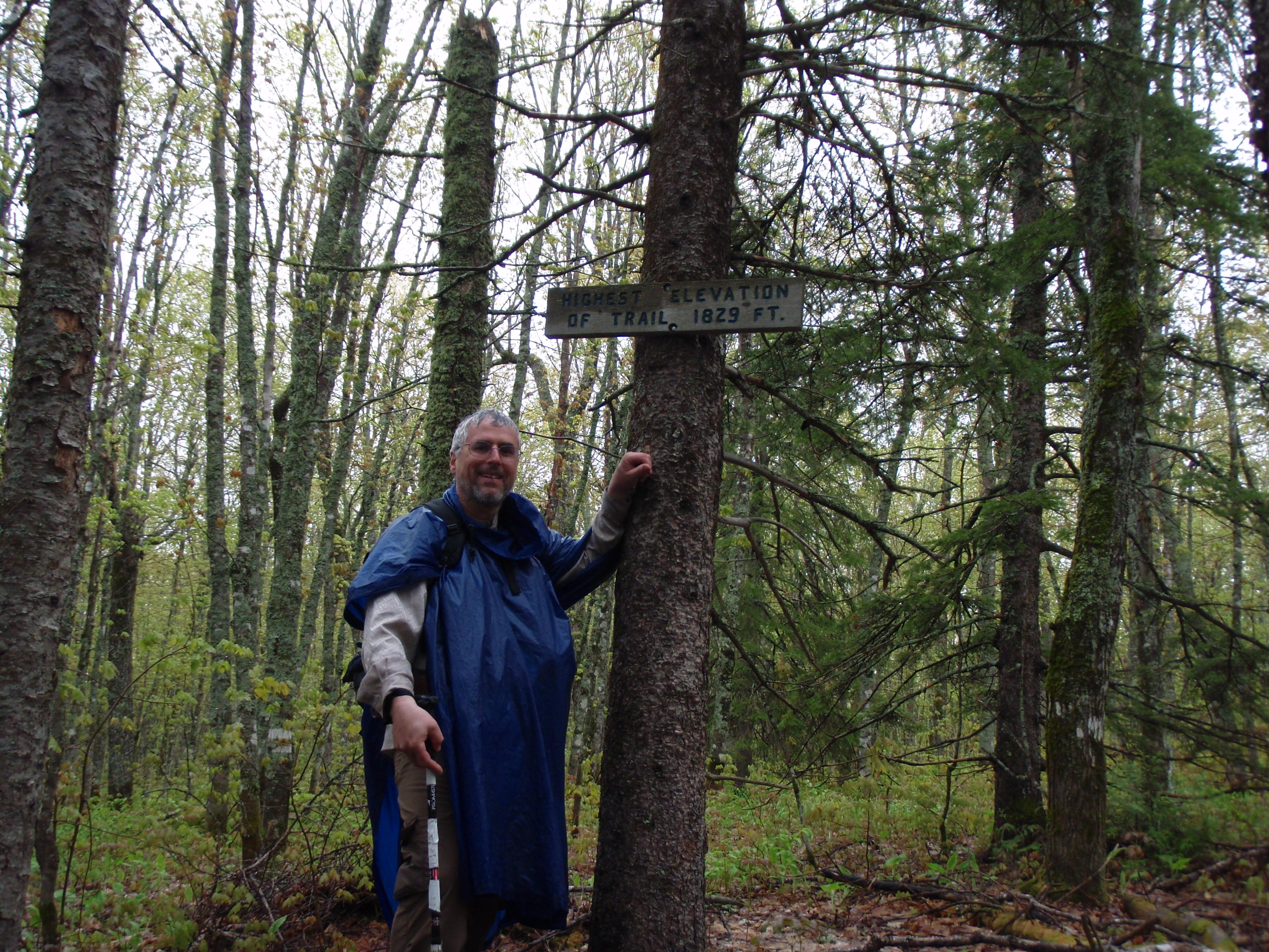
Eventually, you get you start a gradual descent of the ridge. This is where I met Randy and Danny, a father and son duo who were backpacking. They looked to be fairly experienced backpackers, except they didn’t have hiking poles. They were from Elk River, Minnesota, which they described as being about 40 miles northwest of the Twin Cities. Danny said that the campsite is about a half mile away. I told them that it seemed like I was hiking on this ridge above Jackson Lake for a long time, and I was looking forward to getting to the campsite because it was my next landmark. I took their photo and gave them an “I saw Tman” card, and they were on their way.
 I was a little disheartened that the campsite was still a half-mile away. I had imaged the campsite to be on Jackson Lake, which I had pretty much completely passed by now. But when I read my copied pages from the SHT Guidebook, they call the campsite the Jackson Creek Pond Campsite. So the campsite is not on Jackson Lake. Eventually I did find a rushing creek that was damned up by beavers to make a marsh pond. The bridge over the creek was pretty unique. There was a downed tree that was about 2 feet in diameter. They build the bridge right on the
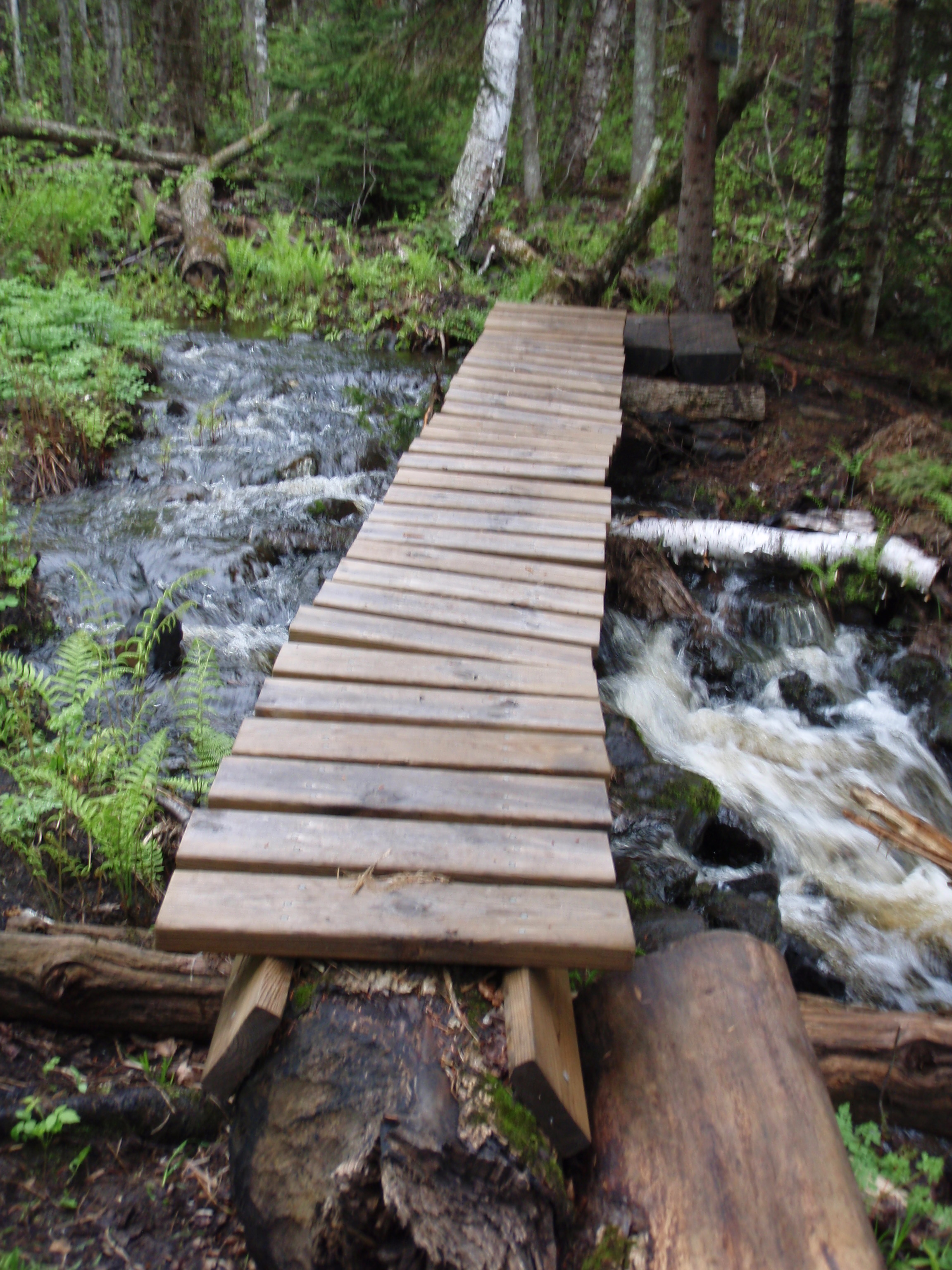
tree, using the tree as the support for the bridge.
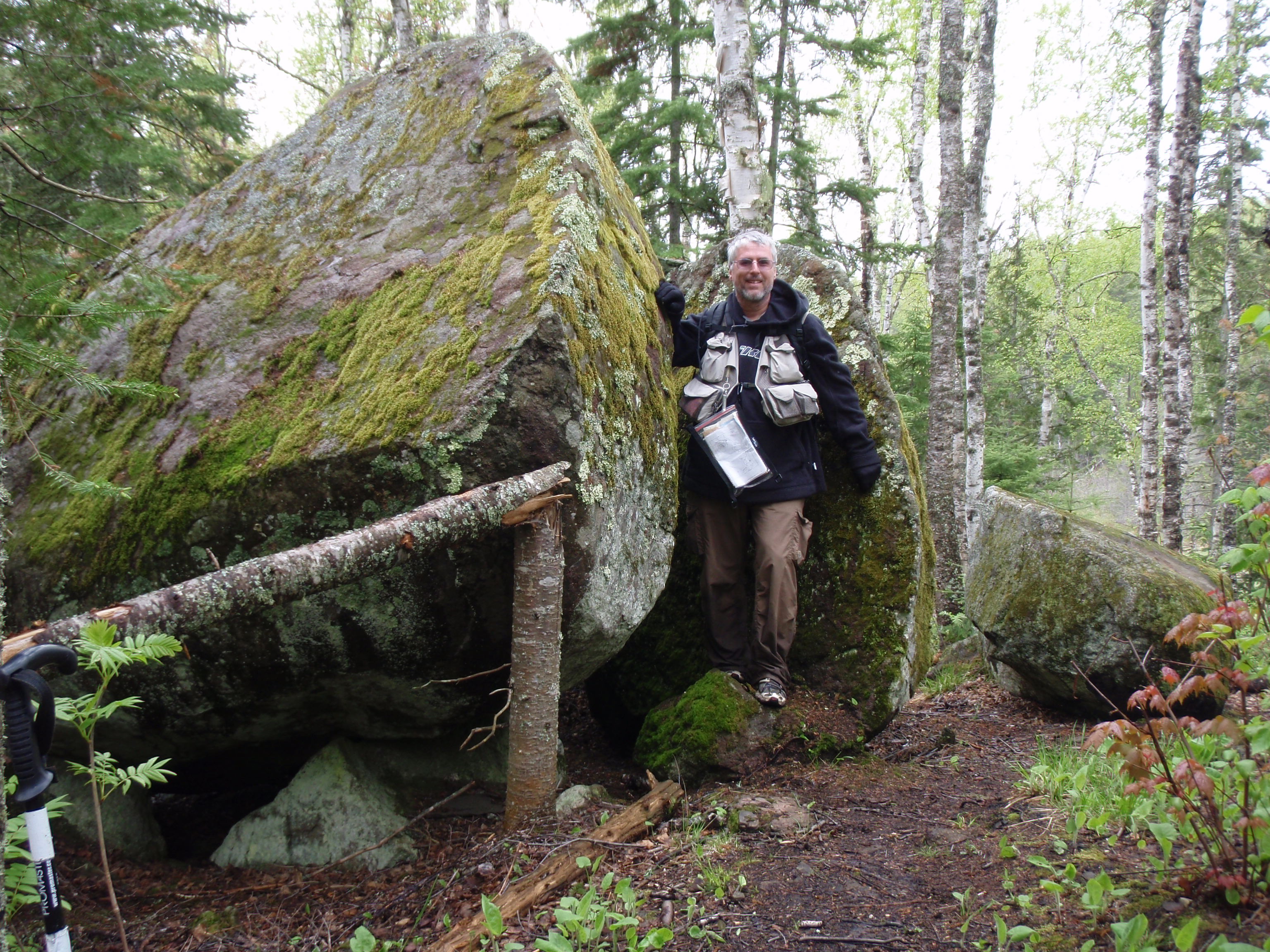
Then there were a series of other bridges, and a sign that said “Jackson Creek.” After the creek you go uphill for a little bit and see a big boulder. According to the SHT Guidebook this is called Jeremy’s Rock and it is a large glacial erratic. Whatever they call it, it’s cool. It’s split in half, and there is a crevice that’s big enough to stand inside. Just a few yards away from the rock is the Jackson Creek Pond Campsite. I set my gear down on the wood benches of the fire area, The fire area is very cool because there is a tipped over tree at the one end of the fire area. So there is a big chunk of earth sticking up with the roots, providing a windshield. This campsite had some worn earth spots for tent pads, which is not as nice as having a grassy spot like at the Andy Creek Campsite. But the Andy Creek Campsite looks like it could be hot during the summer, with little shade, where this campsite was in the middle of a regular forest, with plenty of trees for shade.
At the Jackson Creek Pond campsite is where I finally settled my pants issue. I got a piece of rope out of my diddy bag and used the rope to hold up the pants in a suspenders fashion. It worked. It had stopped raining and I was in a good mood. I knew it was less than two miles back to the van. I took a nice break at the campsite with some food and drink. I went down to Jeremy’s rock and took a photo of me in the crevice. After the photo, I went backed and picked up my gear and headed out.
I encountered a couple downed trees after the campsite, then I encounter a boardwalk. And this wasn’t just any old boardwalk, this boardwalk kept going and going. There were bridges crossing creeks on this boardwalk. There were built in benches to sit down on this boardwalk. Pretty soon I saw a lake to the right of the boardwalk. According to the maps, it’s supposed to be a pond, but it looked much bigger than a pond. This was a full-fledged lake. Perhaps the beavers had been busy in this area and made the pond much bigger. At any rate, the boardwalk was getting closer and closer to the lake and the boardwalk kept going and going. And for the full length of the Boardwalk the trail goes through a medium pine forest. The Boardwalk was getting closer to the lake and finally it comes right up to a branch of the lake, where it looks like there is a canoe launch of sorts. Fishermen must haul in their canoes to this location from Jackson Lake Road.
Shortly after meeting up with the lake, the boardwalk ends and the trail goes uphill. It goes steadily uphill for a few hundred yards, then levels off and there is another much shorter boardwalk. After that the trail goes level or slighty uphill for a long ways. But the woods have changed here. I was no longer walking through a regular forest or a pine area, I was walking through a scrubby, thickety area. The trail is maintained good throughout this area, so it really didn’t matter. I eventually saw a pothole pond on the left side of the trail. I had seen hundreds of pothole ponds when I hiked the NCT in North Central Minnesota, but this was the first one I saw over here.
Then the woods changed again, now I was walking through a mainly aspen and birch forest. But that didn’t last that long because I reached Jackson Lake Road. Wow, I made really good time considering my wardrobe malfunction that slowed me down. But none of the hike was overly difficult. I had started out around 9:30 or 10 at Otter Lake Road, and I made it down to Jackson Lake Road around 4:30 pm.
I decided I would drive up to the Swamp River Campsite on Otter Lake Road and see Jeff and Beth. So, I drove up there and Jeff and Beth were gone. Perhaps they moved on to one of the other places I told them about.
Then I decided that I still had several hours of daylight left. Why not go on another hike. I would not make it on the Hellacious Section, but perhaps some smaller section would work. I immediately thought of the 2 mile section between the Pincushion Trailhead and Tower Road. That would have been the last section I would have hiked, but why not just get it over with. It doesn’t matter if the photos are out of order on my camera card. When I get home, I will be breaking them down into different albums anyway. So I drove down to Highway 61 and headed toward Grand Marias. Once I got to Grand Marais, I took the Gunflint Trail up the hill past the water tower and turned into the Pincushion Mountain Trailhead, also known as the Grand Marais Overlook because there is a fantastic view here.

I pulled into the trailhead and parked. It was about 6 pm, and I thought I still had plenty of time to do the hike because it doesn’t truly get dark until around 9 pm. Then I saw two younger guys walking with backpacks on. This is where I met Eric and Peter. Eric is a taller guy with black hair where Eric is a medium sized guy with blonde hair and a pony tail. I asked them if they were hiking the Superior Hiking Trail and they said yes. Then I asked them where they were planning on camping tonight. I knew that the next campsite on the SHT is North Bally Creek, which is around 8 miles away. They would never make it before dark. They said they were planning on camping at the Grand Marais Municipal Campground. I offered to give them a ride down into town and they accepted. Once we got down into Grand Marais, I asked them if they wanted to take a tour of the town. They said yes, and wanted to know where they might get a good burger in town. I told them the best burger in town is Burger Night on Wednesday at the American Legion. But this is Monday, so the other place that would be open for a burger would be the Gunflint Tavern. I showed them places to get gear including the Ben Franklin/Jones Department Store and the Lake Superior Trading Post. I showed them Sven and Ole’s Pizza which is the best known Pizza place up in this region. They seemed to be interested in going there. I showed them Artist’s Point, The Beaver House, Whole Foods, Stone Harbor Wilderness Supply, the Post Office, IGA Foods, Dairy Queen and then I headed for the Campground and gave them a little tour of it. We finished up at the Campground Office where they had a sign telling campers to pick a site and then pay in the morning. I dropped Eric and Peter off at the Office. They said the first thing they were going to do was take a shower. They headed to a shower house near the office.
It was getting to be about 6:30 pm, so I decided it was too late to do the Pincushion Mountain Trailhead to Tower Road Hike. Taking a shower sounded like a good idea so I wheeled my van around the campground to the newer shower house back by the ball diamond. I grabbed my shower kit and some clean clothes and headed in. Boy, that shower felt good.
After the shower, I decided that I would go round up Eric and Peter to go to Sven and Ole’s, I would treat for pizza. They seemed a little down on their luck, so this could be something to cheer them up.
I drove around the campground and found Eric. I offered to treat for Pizza and he said sure, but he needed to do some stuff first. I asked him where Peter was, and he said he was still in the Shower house tending to a foot issue. So, I helped Eric set up their tent, and he also hung a rope in a tree for putting their wet clothes on. I decided to walk down and check on Peter. He was in the shower house doing something to his foot. I told him that I was treating for pizza and he said he was almost done. I helped him carry some of his gear back to the tree where Eric was hanging up wet clothes. After Peter finished hanging his clothes, the birch tree was fully loaded with clothes. It looked comical, so I took a photo of it. Even though it was a little bit cold out, they said the clothes would still dry. There was a good wind off of Lake Superior, so that would help.
I noticed on their shower house there was a sign saying that it was $3 for a shower for people who are not a registered camper. They did not have that sign at the newer shower house that I use back by the ball diamond. But this shower house is closer to the beach, where more people who are not registered campers must come and shower. Now that I knew about the $3 charge, I would have to stop by the office some time and pay up.

We all hopped in the van and I drove about 6 blocks to Sven and Ole’s. Swen and Ole’s wasn’t very crowded which surprised me. Last year when I went on Memorial Day Saturday the place was jammed. But it was Memorial Day Monday now and the story was different. There were about 5 or 6 tables filled. We agreed on the pizza and I ordered the Meat Lover’s Pizza, with extra ham instead of Pepperoni. I’m not a Pepperoni Lover.
We sat down at a booth and talked. Eric just finished the semester at College and Peter just came back to Minnesota from another state, so they both had a time slot for hiking. They were planning to do the whole SHT, and some friends would be joining them along the way. We talked about the trail, I gave them some tips on the next leg they would be doing, and they gave me some tips on the next leg I would be doing. The pizza came and it was really good. I enjoyed it and Eric and Peter ate their share of it in short order.
Eric was talking about going to the Gunflint Tavern for a beer, since the mezzanine bar at Sven and Ole’s was not open. But Peter wanted to right back to the campground and go to sleep. It was around 8:30 pm and Peter commented that it would be the second day in a row that he would be asleep before it was dark outside. So, I took them back to the campground and dropped them off. Good Luck on your hiking adventures.
I headed over to the Best Western. I walked in and saw that there were customers using the computers. I walked up to the counter anyway, and gave the lady an “I Saw Tman” card. I told the lady that I was hiking the northern section Superior Hiking Trail and I was wondering if I could come back later, when the computers weren’t being used and file a Trail Report. I made it sound like it was some sort of official duty I had to perform. She said yes, I could come back and use the computer. I was happy about that.
Just to kill some time, I decided to head over to the Birch Terrace for a Beer. I wanted to find out if they still have Karaoke on Thursday, Friday and Saturday nights. So, I pulled in to their parking lot, and when I was walking in I saw a big beer sign advertising Karaoke on Thursday, Friday and Saturday Nights. I guess that answers my questioned. But I needed to kill some time, so I headed in for a beer.
I took my SHT Guidebook and map with me, because I wanted to figure out what I was going to hike over the next couple days. Inside the Birch Terrace they have a horseshoe shaped bar. I sat at the far end of the horseshoe. It was the only spot at the bar that was open. This is where I met Jan and Kathy. Jan is a taller rough around the edges guy and Kathy is a shorter Martha Stewart type clean around the edges lady. They say opposites attract.
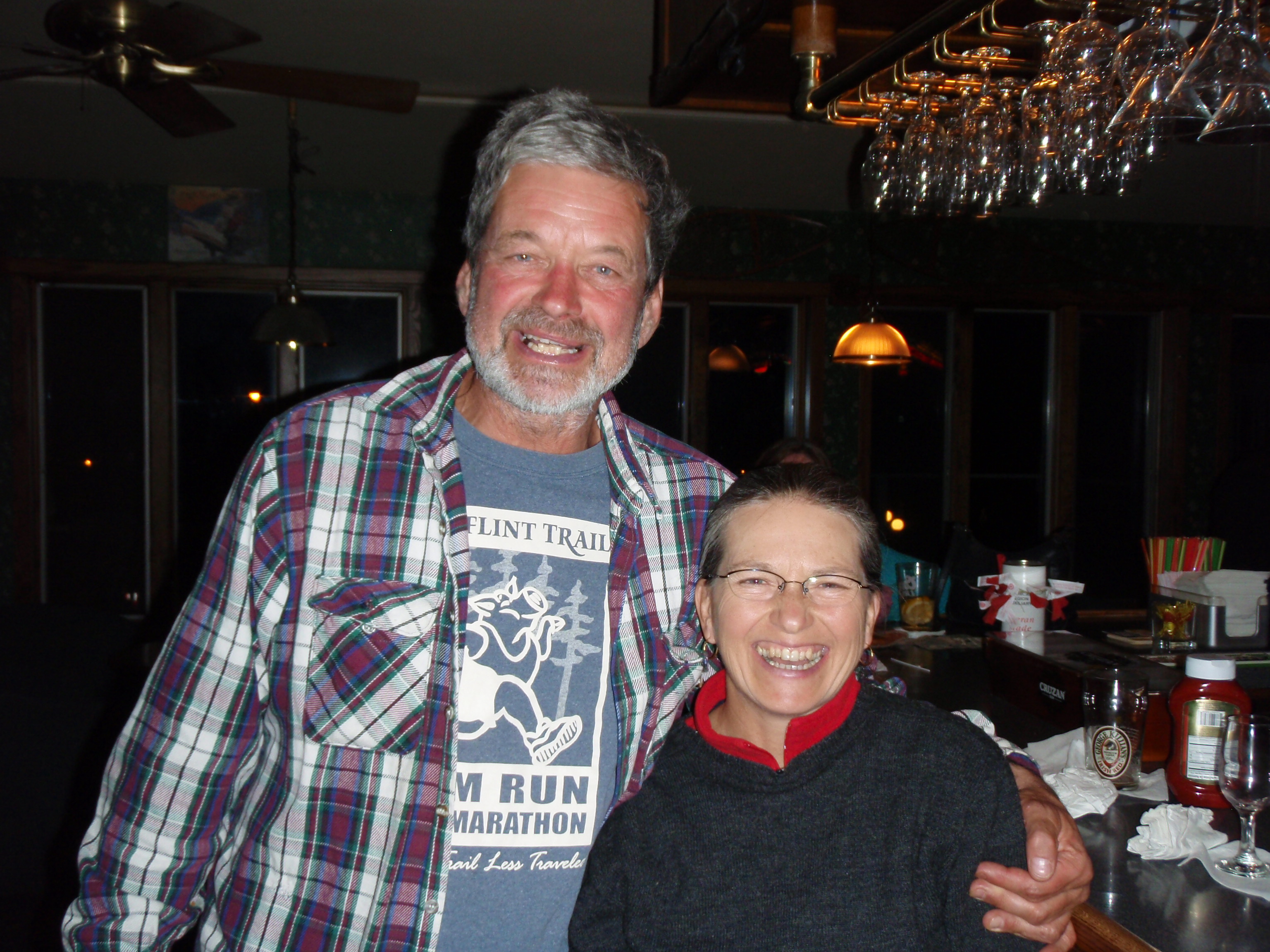
Jan and Kathy own the Cobblestone Cabins Resort down near Tofte, and Jan maintains several miles of the SHT. He is one of the few locals that work on the trail. A lot of the trail volunteers drive up from the Twin Cities. We started talking about the trail and their resort. I asked them if they rent out their cabins by the night, and they said no, they only rent them out by the week. Then they only have to clean cabins on two days a week. But, Jan said that if I come up to help him clear the trail next year, he’s let me have a cabin for the night. I thought that was pretty interesting. Jan said that he had met a famous hiker named Tumbleweed. I said that didn’t ring a bell, but after he described the hiker I figured out it was Nimblewill Nomad. Jan talked about his encounter with Nimble at the Holiday Gas Station in Tofte. I told Jan that I correspond with Nimble from time to time, and that he’s planning to do the Ice Age Trail this year, and I’ve volunteered to be his Southern Wisconsin Trail Angel. We continued to talk about the trail for a while, then I gave them an “I saw Tman” card and took their photo. They invited me to stop by their resort on my way back to Madison. I said I would. They had dropped off a Department of Corrections van at Judge Magney State Park. Evidently, there is some type of corrections boot camp for women that the last week of the boot camp, they go on a backpacking trip. They started off at Lutsen, not far from Jan and Kathy’s Resort, and are going to end up at Magney. It’s interesting the odd jobs people get up here on the Arrowhead. Maybe it’s not a job, just a volunteer thing. I didn’t ask.
Jan and Kathy decided it was about time they headed out. That sounded like a good idea because I thought I had killed enough time and I could go back and use the computer at the hotel. So, I said goodbye to Jan and Kathy, and we all left. I headed back to the Hotel where now there were no customers on the computers. I told the lady I was used to staying up late because I worked second shift. I got on the computer and updated my website mentioning what sections I had already hiked and that I would be going over Hellacious tomorrow. I also tried to write a post on the SHT Hiker Yahoo Group, but the computer would not allow me to do so. So, I wrote the following email to Ed Solstad of the Border Route Trail Association and Tom Salwasser, moderator of the SHT Yahoo Group
Hi Ed and Tom
The Old Border Route Trail from Partridge Falls to
Otter Lake Road is no longer a viable route.
I searched the route from both ends and it
dissipates into a thicket in both directions.
Plus, It will no longer be possible to get
from Fort Charlotte to Partridge Falls because
the Snow Creek Bridge is in disrepair and they
will be taking it out. It is a rather long bridge, I’d say
at least 30 yards long, so it will be impossible to
traverse the creek. The bridge will not be replaced
due to the wishes of the tribe.
If someone wants to hike from Otter Lake Road
to the town of Grand Portage, the correct route
now should be to take Otter Lake Road east
until it becomes Rengo Road. Keep walking
on Rengo Road to Old Highway 61 (not sure of
Mileage, but estimate 6 miles on Rengo). You can
take a left on Old 61 walk for about 3 miles
and connect with the Grand Portage Trail. Then
walk 3.75 miles into town.
The computer I am using right now will not let me
post on the SHT hiker group, so will one of you post
this?
Thanks, Todd
I wanted to get that information out, because there was another hiker on the SHT that was planning to hike to Grand Portage to the Isle Royale Ferry, after completing the SHT. After completing my computer duties, I thanked the lady. Then I drove the Van up to the Pincushion Mountain Trailhead, also known as the Grand Marais Overlook, and I parked for the night. I climbed into the back on my sleeping pads and did my daily voice recording. A lot had happened today. This morning when Jeff and Beth shuttled me seemed like a long time ago.
Tuesday, May, 31
Jackson Lake Road to the Arrowhead Trail, then the Lakewalk
I didn’t wake up particularly early at the Pincushion Mountain Trailhead/Grand Marais Overlook. I rolled down into Grand Marais and got gas and some breakfast at the Holiday Station. I got an Egg McMuffin type sandwich and a hot chocolate for the ride up to Hovland. Then I drove up to Hovland and took the Arrowhead Trail crossing of the SHT. I locked up my bike there. Then I drove up a few Hundred yards from the crossing, and turned right onto Jackson Lake Road. It was about 4 miles down to the same trailhead where I ended my hike yesterday.
I started hiking around 8:30 am, which I thought was rather late. I started on the “Trail to Hellacious.” The first part wasn’t that bad, in fact there is a good sized boardwalk for a ways. But it is not a level boardwalk, it seems like it goes slightly uphill. But after the boardwalk, it really goes uphill. There are some fairly steep stretches of the trail, and other sections that a not steep but are still going uphill. Then you get to catch your breath because it’s flat for a ways. But there were a few downed trees in the way. Now I was hiking through a regular forest again, just like going over Rosebush. Maybe loggers don’t like logging on top of hills, or the forest service protects the top of hills. Then the party is over because you hit another uphill stretch. You start to get glimpses of a view, then you come to a sign that says “Hellacious Overlook.”

I set out my Spot Messenger. set down my gear, and started hiking down a ways to find places to photograph. This Hellacious Overlook goes on for a long time, I’d say an 1/8th of a mile or more. You are supposed to be able to see Isle Royale from here, but there were clouds over Lake Superior preventing it. I spent some time on the Overlook. I was in no hurry because I knew this section was only a 6 mile hike, and I had all day to do it. I probably would not venture past the Arrowhead Trail today, unless I decided to go backpacking for real. I took a bunch of photos then took some self shots at two different locations. Then I headed back, got my gear and Spot Messenger and headed out. Again, this overlook lasts a long time on this ridge. Then the trail heads down a ways, and I saw the sign at the other end which says “Hellacious Overlook.”
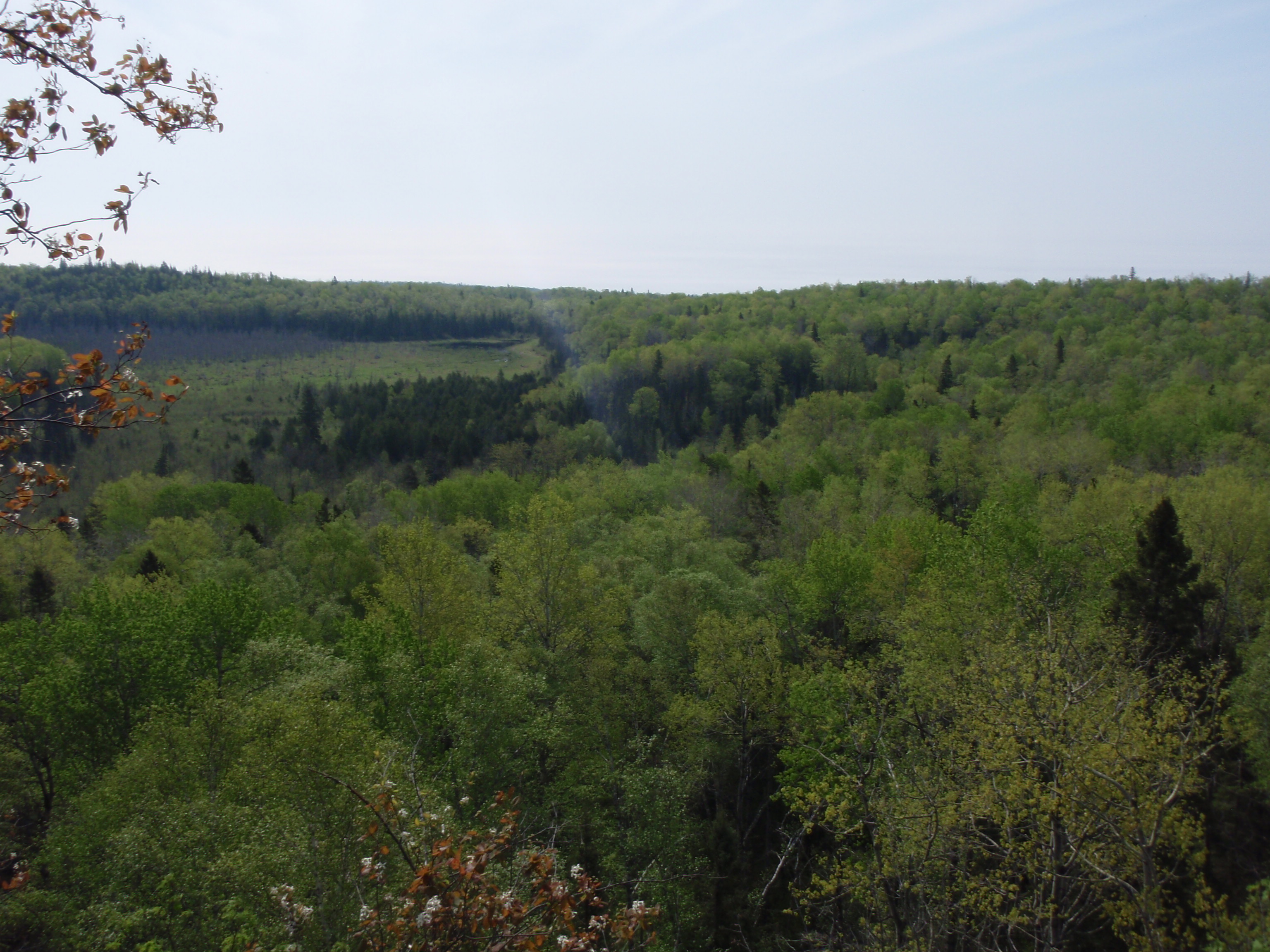
Then the trail goes in a slightly down pattern for a long time. Your going down and around, but nothing too steeply down. Then the trail turns to the left and goes along a creek for 100 yards or so. Then I came to a gnarly pine tree, which was really hard to get around. I tried getting around it to the left, but then I didn’t see the trail down that way, so I came back to the trail, and went to the right. I was hiking around to the right when I saw the trail across the creek. I wasn’t that big of a creek, plus it had some rocks in it, so I decided to hop across the creek and make it to the trail. Then I decided to walk down and look at that downed tree from the other side. I found a nice bridge over the creek and on the other side, the downed tree was just at the right spot to block the bridge.
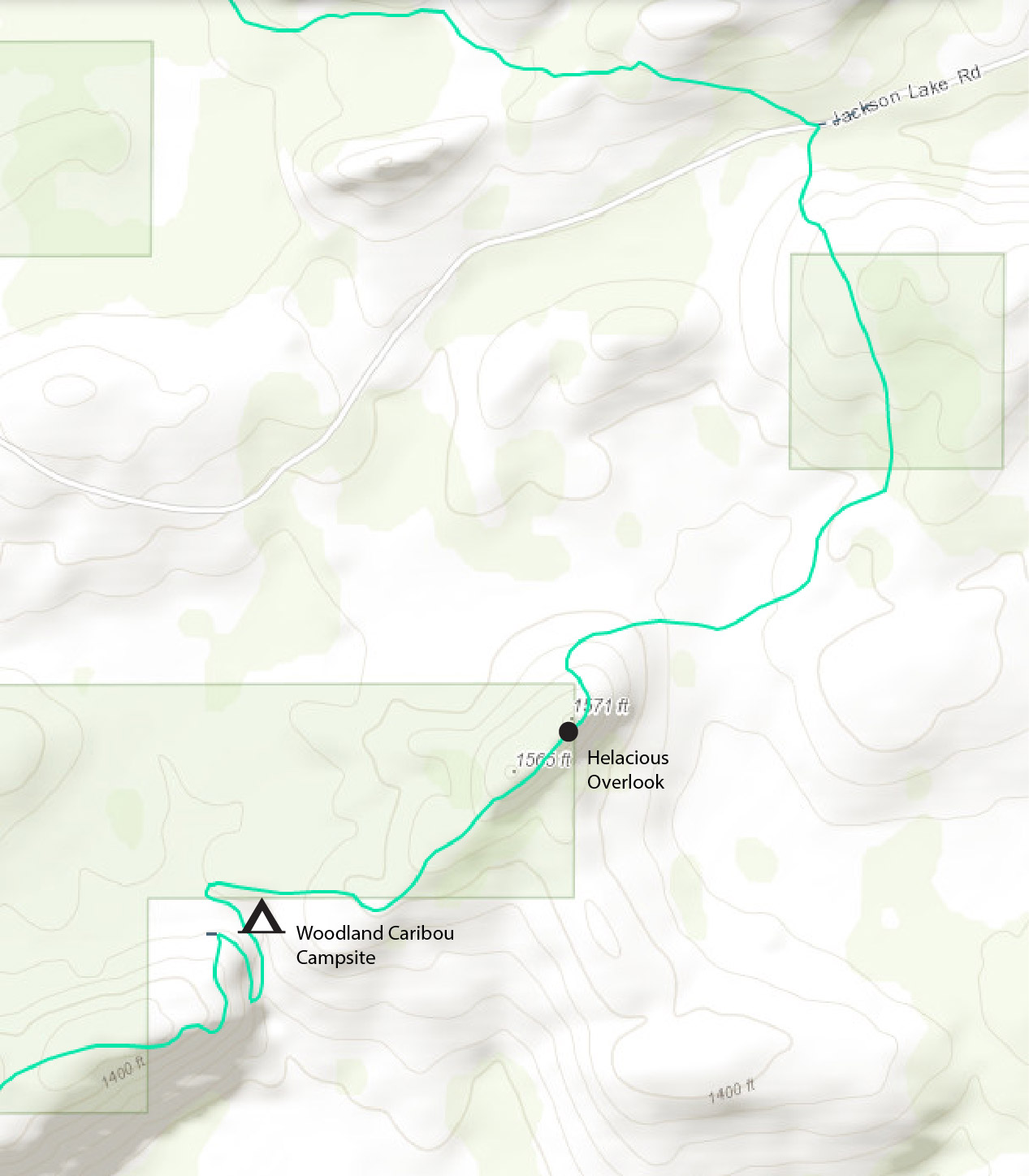 What happened here is the trail goes in a zigzag pattern. It zigs along the creek coming down from Hellacious, then you cross the bridge and the trail zags back the other way. And not far down the zag I found the Woodland Caribou Campsite. First I saw a tent pad area, then I saw another tent pad area, then I saw the Campfire Ring area. I took a break here. This campsite is set up different than most SHT Campsites. Most SHT Campsites have a central Campfire Area then tent pads around the Campfire Area. But this campsite has everything in a line between the trail and the creek.

Evidently the creek doesn’t have a name, or else the campsite would be named after it. On the SHT there are lots of campsites named after Creek. For Instance, yesterday I encounter the Andy Creek Campsite and the Jackson Creek Pond Campsite. And down by Lutsen, I had camped at the North Bally Creek Campsite in 2009. But since this creek apparently didn’t have a name, they called the campsite the Woodland Caribou campsite, after the animals that once inhabited this area. There are no Woodland Caribou in the area anymore. That sure would have been a sight.
I came up with one of my goofy ideas. Since the creek doesn’t have a name, why don’t we name it after the campsite. It could be the Woodland Caribou Creek. Since there are so many campsites named after creeks, turnabout is fair play.
After taking a nice break, I decided to leave the Woodland Caribou Campsite and Woodland Caribou Creek. The trail zigs back the other way and sharply goes away. It also starts another uphill run. Pretty soon you’re up on the ridge any with some more overlooks. This is another spot where the overlooks keep going for a 1/8 mile or longer. There is a good view of a beaver pond across the way, I was hoping to see a moose over there. There must be some type of coexistence and dependence that moose have with beavers. A moose’s diet is totally made up of aquatic plants and the beavers make ponds where aquatic plants live.

This is a nice series of overlooks, just as good as Hellacious. But this overlook doesn’t seem to have a name. perhaps it could be called Hellacious West. There is one notable cairn along the way, so I took a photo by it, because there was a good view there. The photo did turn out so well because you couldn’t tell there was a view there. I kept going and eventually the trail goes back into the woods away from the overlook. It crosses a lot of rocky spots where the rectangular blazes are painted on the flat rocky areas. This stretch of trail is pretty flat or slightly downhill. There are a few downed trees. On one of the down trees I found a yellow rope that must have gotten snagged there from somebody’s backpack. Somebody must have been surprised when they couldn’t find their rope to put up their bear bag.
The trail goes along another rocky area with a view, but this time it didn’t last that long. But It looked like the clouds were starting to darken up. Then the trail goes on a downhill pattern to a beaver meadow. There was a beaver pond, but most of the area looked like a dried up beaver pond. Perhaps this area is too hellacious for the beavers. The trail crosses the creek about 50 yards down from the beaver dam. Then the trail goes on a uphill tear for a short ways until it starts looking like you’re getting on top of something. And you are. It’s another series of overlooks. And this time the clouds really look threatening, and there are little clouds down in the valley. It starts raining and I duck under a pine tree to change into raingear.
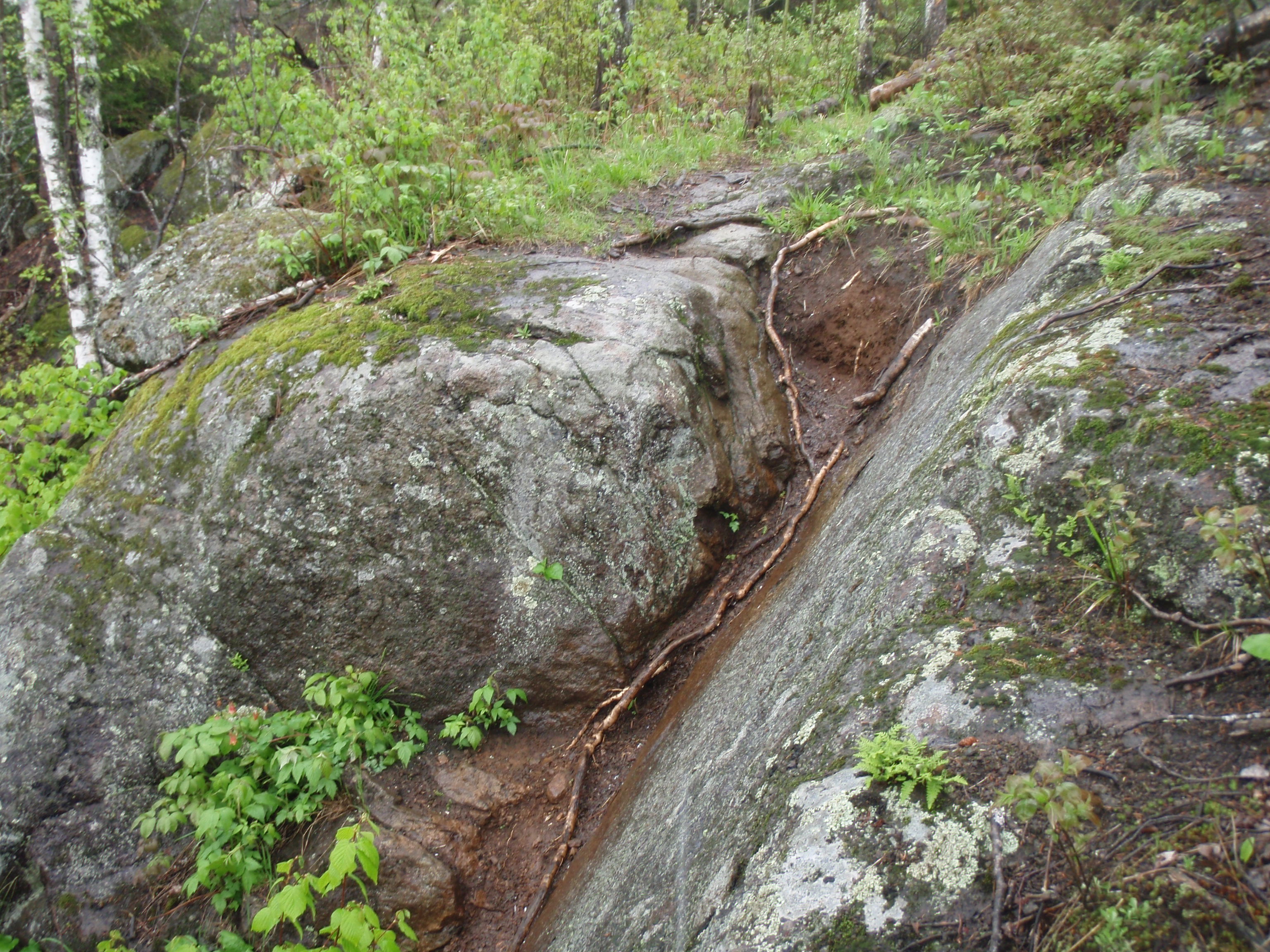
A pattern emerges. First you see an overlook, then you hike through the pines with flat rocky areas. then you see another overlook, then you hike through some pines with flat rocky areas. This pattern goes on for over a 1/2 mile. Then the trail turns and you get to the worst spot. It’s the “V Rock” This is two rock faces that form a V about 10 to 12 feet high. and the trail goes up the V. I was lucky I was going down the V, because with it raining I don’t know if I could have gotten up it. This spot made me cringe, but I made it down all right. Then there is some more rocky areas to descend, but theses were not that bad. After that, it’s a nice hike in the woods over to a creek. Then you go along the creek and hit a bridge going off to the left, but the regular trail keeps going straight. Going across the bridge is the spur trail going to the Arrowhead Trail Parking lot. There’s a sign at the bridge. It would still be 1.4 miles on the regular trail to get to the Arrowhead Trail Crossing where my bike is stashed.
 So I continued straight on the trail as it went along the creek for a short ways. Then there are some steps going up a small hill, which led me away from the creek. It wasn’t that bad of an ascent and once I was on top of it there was easy walking again. The forest I was walking through now had some scrubby elements to it, but there were also some mature elements to it. Normally when they say it’s a mixed forest it means there is a variety of trees in it including hardwoods and softwoods. But this seemed like a mixed forest because it had younger and older trees in it. This type of forest lasted for over half a mile. And sometimes the forest would be more mature, and sometimes it would be more scrubby. At one point there was a downed tree on the trail, and it was just the right height for me to sit down and rest. So that’s what I did. I had been going really slow. Perhaps Hellacious had a Hellacious effect on me. whe I started hiking again I soon saw a large marshy area in front of me. It looked like there were 3 or 4 creeks that converged in a small pool. And the rest area was a grassy marsh. I wondered if this was the North Carlson Pond, and soon I found the North Carlson Pond Campsite, so it must be.
The main great feature of the North Carlson Campsite was that it has a built in table next to the Campfire area. So, at one part of the campfire area, you can sit on the bench facing the fire or you can turn around and sit at the table. That was a unique set up that I hadn’t seen before. The other nice thing about the campsite was it had nice grassy areas for tent pads. The campsite was located in a somewhat scrubby area, thus allowing sunlight for grass, but still it had a few taller trees for shade.
Then the trail goes on a route that takes it around this large marshy area. You’re skirting around its edge. This large marshy area is truly a Creek Convergence, because as you hiking around the marshy area you cross 4 or 5 bridges over creeks. Creek Convergence sounds kind of like a new aged event that’s held on a day when the planets align. After crossing all those creeks you are hiking next to a creek again. According to the SHT Guidebook this is Carlson Creek. After a few hundred yards of following along the creek you come to the Arrowhead Trail.
I set out my Spot Messenger, and decided to rest on the grassy bank of the road. I was more or less waiting for a car to come by, so I could hitch a ride back to the van. I kept waiting and waiting and no car came up the road. If it were a weekend, it probably would have been a different story. But nothing came for over 25 minutes. I was looking at my route for the next day. The trail cuts across from the Arrowhead Trail to Camp 20 road (highway 70) and it didn’t look like a very good route for a hike and bike. You would have had to bike a quite a long ways to get back to the Arrowhead Trail. But then I thought, it’s 13.7 miles to the Judge CR Magney State Park lot, perhaps I could hike there and wrangle a ride back from some tourist or camper. The last couple days I had started my hike late, and ended it early. If I start early, I should be able to make it. Plus there is two road walks on this route which are normally easier to hike. There is Tom Lake Road, a dog sledding road that the SHT uses for 1.3 miles and there is Camp 20 Road, which the SHT uses for 1.8 miles. So over 3 miles of the 13.7 miles would be road walk.
It was still very early. I think I arrived at the Arrowhead Trail around 3:30. I had lounged around for about 25 minutes, so I decided it was time to take some action. I changed into my biking gear, and made sure I had my keys. I got my bike up on the road and was about ready to hop on it when I saw a vehicle coming up the road. The vehicle got closer and I put my bike in the ditch and came back to the road and stuck out my thumb. This is where is met Pete, a local resident who was going up to cut some would. I told him I would pay him to drive me 4 miles down Jackson Lake Road to where my Van is parked. He said I didn’t need to pay him, because he was driving down Jackson Lake Road anyway. He rearranged his front seat and I hopped in. Pete is retired from the Forest Service and has hiked the whole northern section of the trail. He said going over Hellacious is quite the hike. I agreed. This was only about a 5 mile ride, so it went quickly. At the end, he still refused money, but I took a photo of him and gave him an “I saw Tman” card. He dropped me off and was on his way. Thank you very much, Pete.
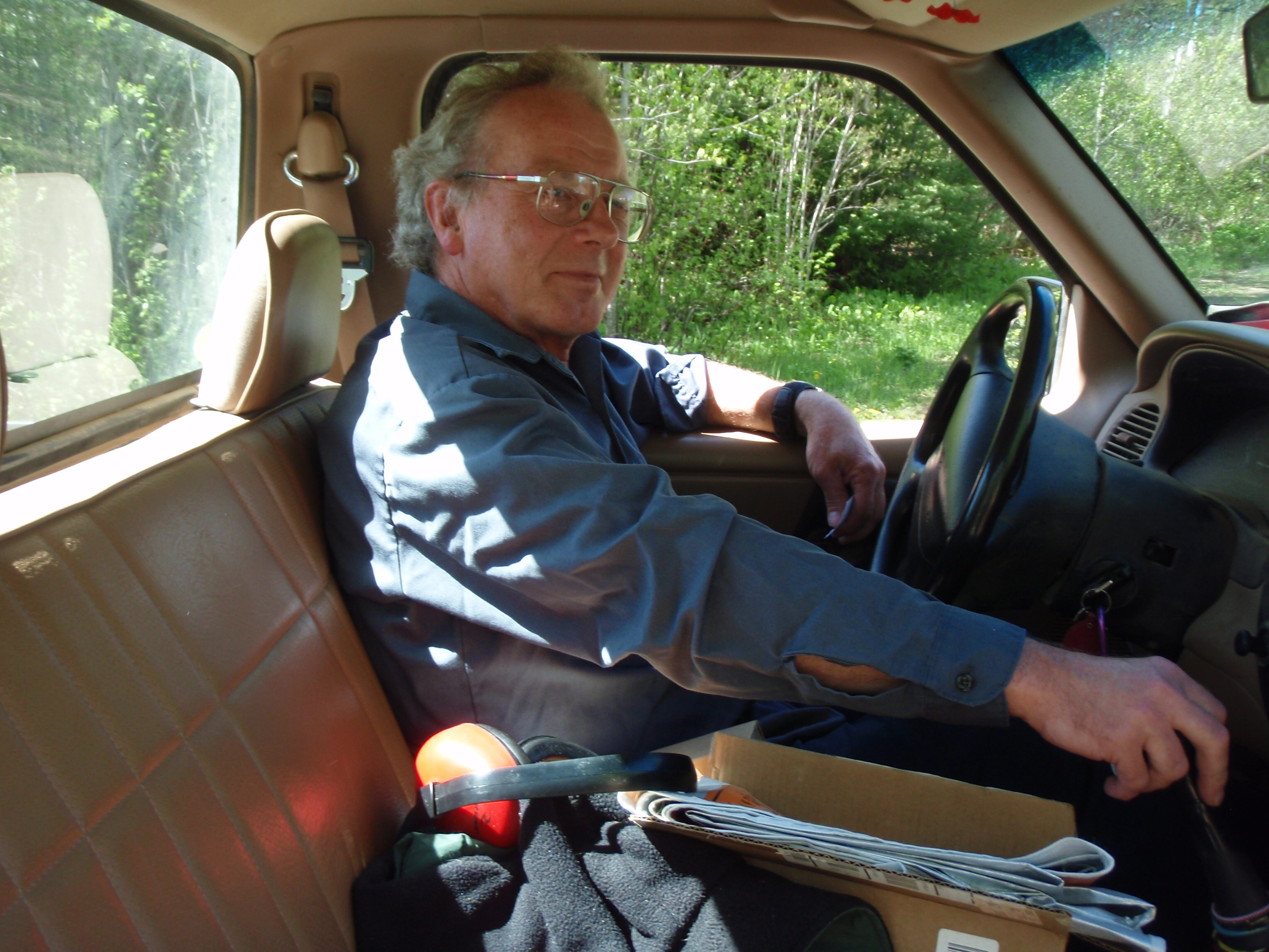
Boy that was a streak of luck, getting a ride, and it was still, very, very early. Then I drove my van back to the Arrowhead Trail and picked up my bike. I headed down the Arrowhead Trail to almost Hovland. Then I took a side road over to Highway 70 and drove up to the SHT Trailhead. I was checking out the roadwalk here and to see if I could see any big hills I would be hiking over. Didn’t see any big hills. Then I drove down to Judge CR Magney State Park. I wrangled up a Park Ranger and she went over to the little entrance building and I bought a Park Pass from her. It was $25 for a May to May pass. If I would have waiting another day it would have been a June to June pass, but I didn’t know that. I talked with the Park Ranger and told her that I would be to Magney from the Arrowhead Trail tomorrow, and that if there was anyone around to give me a ride back to my van, I’d be willing to pay. She said she’d keep that in mind. She seemed like a nice lady.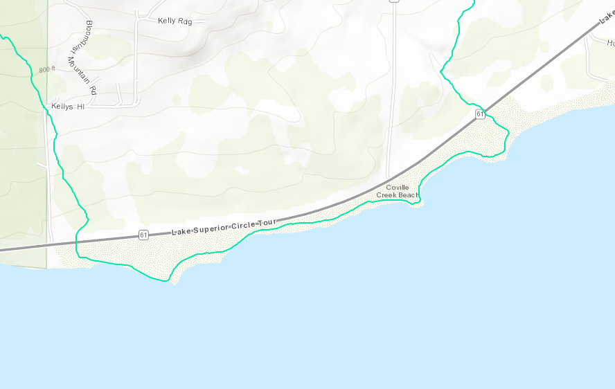
I took a quick tour of the park and noticed what looked like a MCC crew working on the campground. They were doing some sort of landscaping project. But it was still early, and I was feeling pretty good, so I felt like doing another section. I decided to do the Lakewalk, that sounded fun. So I drove down highway 61 about 4 miles from Magney and put out my hiking gear at the east end of the Lakewalk. There doesn’t appear to be a parking area nearby. So, I headed down to the west end of the Lakewalk and changed into my biking gear. I have a florescent orange shirt that I use for such occasions, so I put it on. I started up Highway 61 on my bike, and boy, let me tell you, that was fun. Highway 61 has an extra wide paved shoulders just for bicyclist, so it was a great surface to ride on. I seemed to be able to get up to a good speed on my crachety old mountain bike. It felt like the wind was coming from behind me and pushing me. It didn’t take very long, perhaps 10 to 15 minutes, and I was finished with the 1.5 mile long bike trip. I locked up my bike near the Superior Hiking Trail sign, put on my hiking vest and poles and was ready to go.

You hike through the windswept grasslands for about 100 yards until you get up to the beach where there is a SHT sign with an arrow pointing to the right. This beach is a spectacular sight. There is a big rock island out in the Lake in front of where you come on the beach. I took a photo of that. Then to the right, there is a rocky island with some pine trees on it. This island was very picturesque and was very close to the shore. So it would be an easy walk without getting too wet to get to the island. But I declined walking out there. Instead I stayed on the beach, which changed from being a pebble beach to being a rocky shoreline. They did have a couple blazes painted on the rocks to let you know you were going in the right direction. I took some self-shot photos with the rocky piney island in the background. I continued on and the shoreline turned back into a pebble beach again.
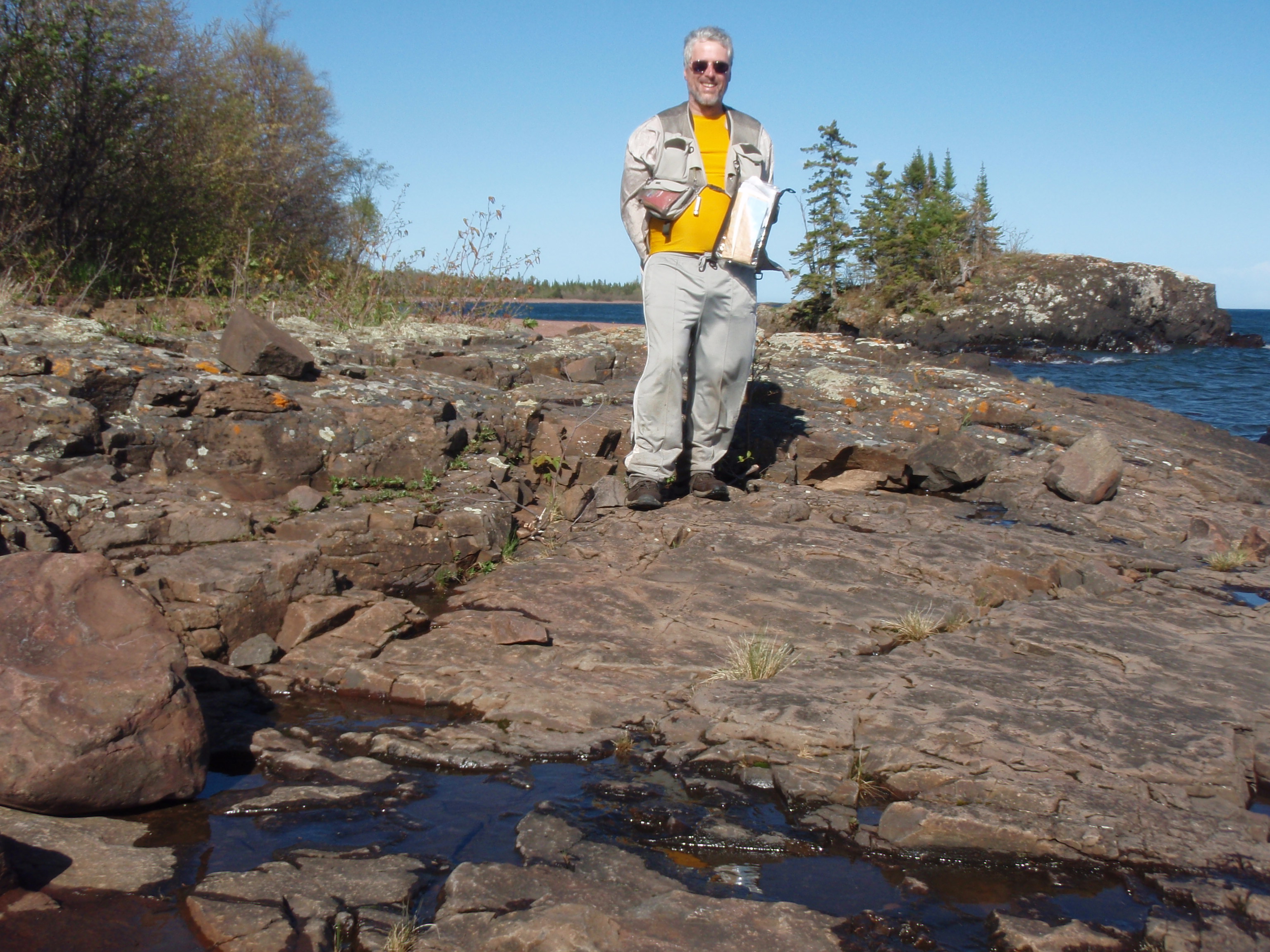
They say the pebble beach is more difficult to walk on than a regular trail, but I didn’t find it to be that bad. But then I wasn’t hiking it with a heavy backpack on. Having the extra pounds on your back would sink you into the pebbles more, thereby making it more difficult. Now, I was hiking a long stretch of beach up to a point. The wind was blowing and it was a little cold but I was really enjoying it.

Before I got to the point I saw a trail going to the right. I took the trail and found a campfire area and perhaps a place to camp. The trail kept going and I figured out that it was a short cut for avoiding the rocky point. But I wasn’t planning on avoiding the rock point so I went back and hiked it, and it really wasn’t that bad hiking.
I kept walking seeing some more Campfire areas up from the beach. I saw a road ending at the beach so I went up and looked at the sign there. It said “No Camping, Mn/DOT.” I had heard that the Minnesota Department of Transportation had bought this land from the University of Minnesota. Evidently, people camping here was a regular thing, there was even some sort of camping event held here. But now the story is different. Interesting enough, there are no signs along the beach saying no camping. I walked down around a point and found another road with the same sign. I believe the roads used to be part of Highway 61 but the Lake eroded away the shoreline and they had to reroute the road. I kept going and found another sign up from the shore. It said “Sensitive Wetland, No Motor Vehicles allowed beyond this point.” And sure enough, Highway 61 had turned away from the shore and now there was a wetland between the shoreline and the highway.
I continued walking down the shoreline where there is a big rocky island that looks like a whale swimming in the ocean. I could have walked out on it, because it wasn’t that far from the shoreline but I declined. After passing that point I wondered how far it would be to my van. Or even if I passed my van without seeing it. I kept hiking away from the water, up on the very top of the beach, so I could see my van. I did see another sign about the sensitive wetland. Then the wetland seem to end and I saw my van up ahead. I got up to my van and set out my Spot Messenger out on the beach near the van. I thought to myself, what’s a Lakewalk, without a little dip in the water. So I walked out by the Lake, and set up the shot. I took off my shoes and socks then hit the timer on the camera and walked out into the water. It would have been a better shot if waves were hitting me, but never the less, it was a good shot. It was windy and there were some good waves in the background.
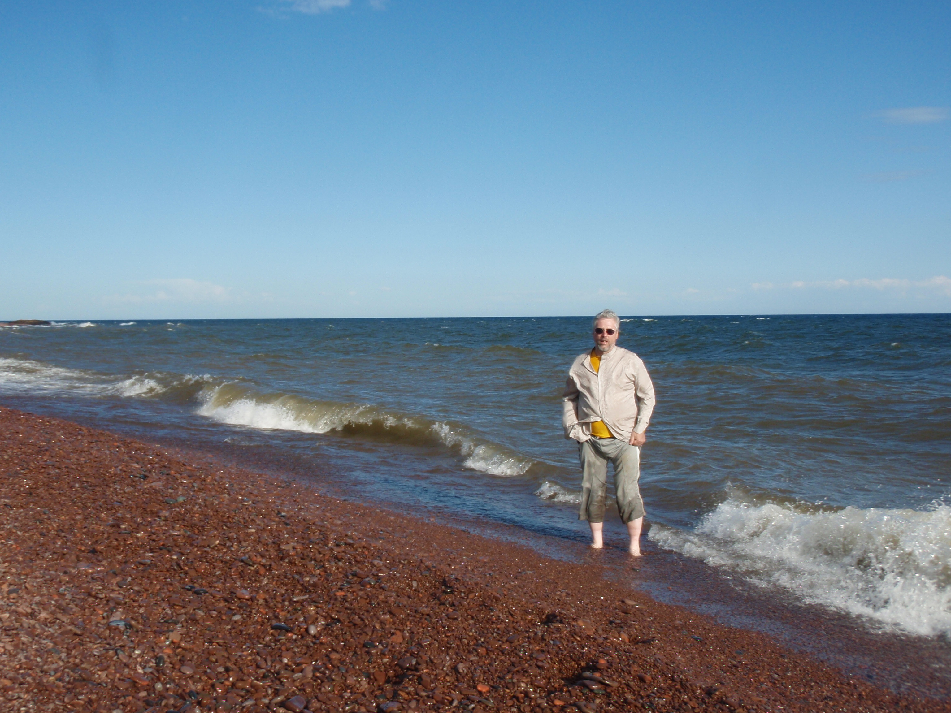
I had a really good time hiking the Lakewalk. It lifted my spirits. And it was nice knowing I would not be hiking up some Hellacious Hill. Everything was flat on the Lakewalk. So, I hopped in my van and rode down to the other end of the Lakewalk. I put my bike in the back of the van and headed into Grand Marais. When I was driving down Highway 61 in Grand Marais by the Municipal Campground, I saw Eric and Peter walking down the sidewalk towards the Campground. I thought they would be long gone. So I pulled into the campground and met up with them.
And there was bad news. Peter had went to a doctor today, and the doctor said to quit hiking. His foot was in that bad of shape. That’s bad news. I offered to drive them down to Duluth, where they could get a bus back to the Twin Cities. But Eric was busy rounding up a Kayak Trip for him, Peter and some friends that would be coming up. They would be showing their friends some sights on the North Shore, then they would be going down to the St Croix River in Wisconsin and doing a float trip with Kayaks.
I asked them about the section I was about to hike since they had recently hiked it. Peter said the section between the Arrowhead Trail and Camp 20 road (highway 700 was pretty easy except there was a 50 yard stretch of trail that was under water. But they said they didn’t get all that wet because they walked on the tree roots. Peter seemed to think the only really strenuous sections were in Magney. But that would be only the last 4 miles of the trip, the other 9 miles sounded pretty good. This solidified my choice of doing the 13.7 mile section from the Arrowhead Trail to Magney. I would get up early and have a early start. Surely, I would make it. I asked them if they were going out for supper, but they said they had more than enough food and would have to eat some of it. They wished me luck and I wished them luck. I went on my way back to the shower house near the Ball diamond. I showered, put some cordizone cream on some body parts that need it and got dressed. I was in Grand Marais, so I called my mom while I had cell phone coverage. Then I headed down to the Gunflint Tavern for Supper.
The last time I was in the Gunflint Tavern was Two years ago on a Saturday Night. There was a folk bank play and it was a hopping place. This time I wouldn’t exactly call it a hopping place. There were a few people in it, but not many. Most of them were some of the hipper locals, along with a few straggler tourists left over from the weekend. I ordered a beer and looked on the menu for the Salmon Dinner I ate two years ago. It appears they now longer have that dinner. So I ordered the Walleye Sandwich.
Now from talking with people down at the American Legion, the locals feel that the Gunflint Tavern is a little overpriced and has too flowery of food. I got my walleye sandwich and it had a side garnishment on the plate that was flowery. This place was pretty dead. I talked with the bartnder and she was worried that the weather was going to be crappy the next day when she was planning to have a campfire on the beach for her birthday. No wonder I saw so many campfire areas on the Lakewalk.
The food was good and the beer was good. I paid up the damages and left. It was dark by now. I headed up the Gunflint Trail and parked at the Grand Marais Overlook/Pincushion Mountain Trailhead.
I crawled in back and just went to sleep. Tomorrow would be a big day.
Wednesday, June 1, 2011
Arrowhead Trail to Judge Magney State Park
A Major Malfunction and Misadventure Morning!!!
I woke up in my van at the Pincushion Mountain Trailhead/Grand Marais Overlook. I rolled down into Grand Marais to the Holiday Station for an Egg McMuffin-like sandwich and a hot chocolate. I had gotten gas, too. As I walked back to my van by the gas pump I knocked the hot chocolate out of my hand. It smashed to the ground and splashed all over the place. I picked up the cup and threw it away. Then I made a quick attempt to clean it up with the paper towels at the gas pumps. That didn’t work very well. It was around 6:00 am in the morning, and I blamed it on getting up too early.
I had a bottle of water in the van that I could wash down the egg sandwich with, so I just headed out. What’s the sense of going in to get another hot chocolate, only to spill it again. I headed up Highway 61 to Hovland, then went up the Arrowhead Trail to Jackson Lake Road then turned around and parked on the side of the road near the SHT crossing. There is no SHT parking lot here, but there is a spot where you can see that other people have parked. I got out and started looking through my gear for my Spot Messenger, so I could mark my spot, but I didn’t find it anywhere. The last place I remembered using it was on the beach at the west end of the Lakewalk last night. I wondered if I left it there. So I hopped in my van and drove 5 miles down to Highway 61, then went about 7 miles west to the west end of the Lakewalk. I turned into the parking lot and parking then went out on the beach and found the Spot Messenger right where I left it. Boy, I was lucky that Eric and Peter had declined me taking them to Duluth. Because if I got down to Duluth, it’s hard telling where I would have went after that. And the Spot Messenger would have still been sitting here on the beach.
I made it back up to the Arrowhead Trail crossing of the SHT, and was getting my gear ready again. Only this time I managed to lock myself out of my van. Oh, my god, this has been one Hellacious morning. I went in back to the L vent window that I sawed open last year, and broke it open. I got up on the bumper and managed to wiggle into the van. The first thing I did when I got my keys was to open the driver’s side window, so I wouldn’t get locked out again.
Finally, at around 7:30 am, I had all my stuff together correctly. I closed the window, locked the car and I was off. Yes, at last I was OFF!! Halleluiah, I was OFF!! I was onto the trail, hopefully all that bad stuff that happened would be left behind me. And I needed to leave all that stuff behind.
So much for a super early start, but at least it wasn’t a super late start. 7:30 am is a respectable time. The trail started off as I left it yesterday. It was a creek walk along Carlson Creek. The trail goes along Carlson Creek for quite some time, through some tall pines then some scrubby areas. Pretty soon the trail went into a scrubby area away from the creek.
The fact that I was hiking next to Carlson Creek reminded me of my Scouting Friend John Carlson. Back from 1995 to 2002 I served on the Key Committee for a Boy Scout Camporee called Baraboo Circus Heritage in Baraboo, Wisconsin. John and I worked together on the staff for all those years. John continued on as the Chairperson for the event, until this year, when he is allegedly stepping down. But John has Baraboo Circus Heritage in is blood. Some might say he is Baraboo Circus Heritage, at least it’s heart and soul. I’m sure he will be around in some capacity. Meanwhile, I stepped down from that event and was working on the All Scouter Pow Wow staff for several year until I stepped down after serving as Co-Chairperson.
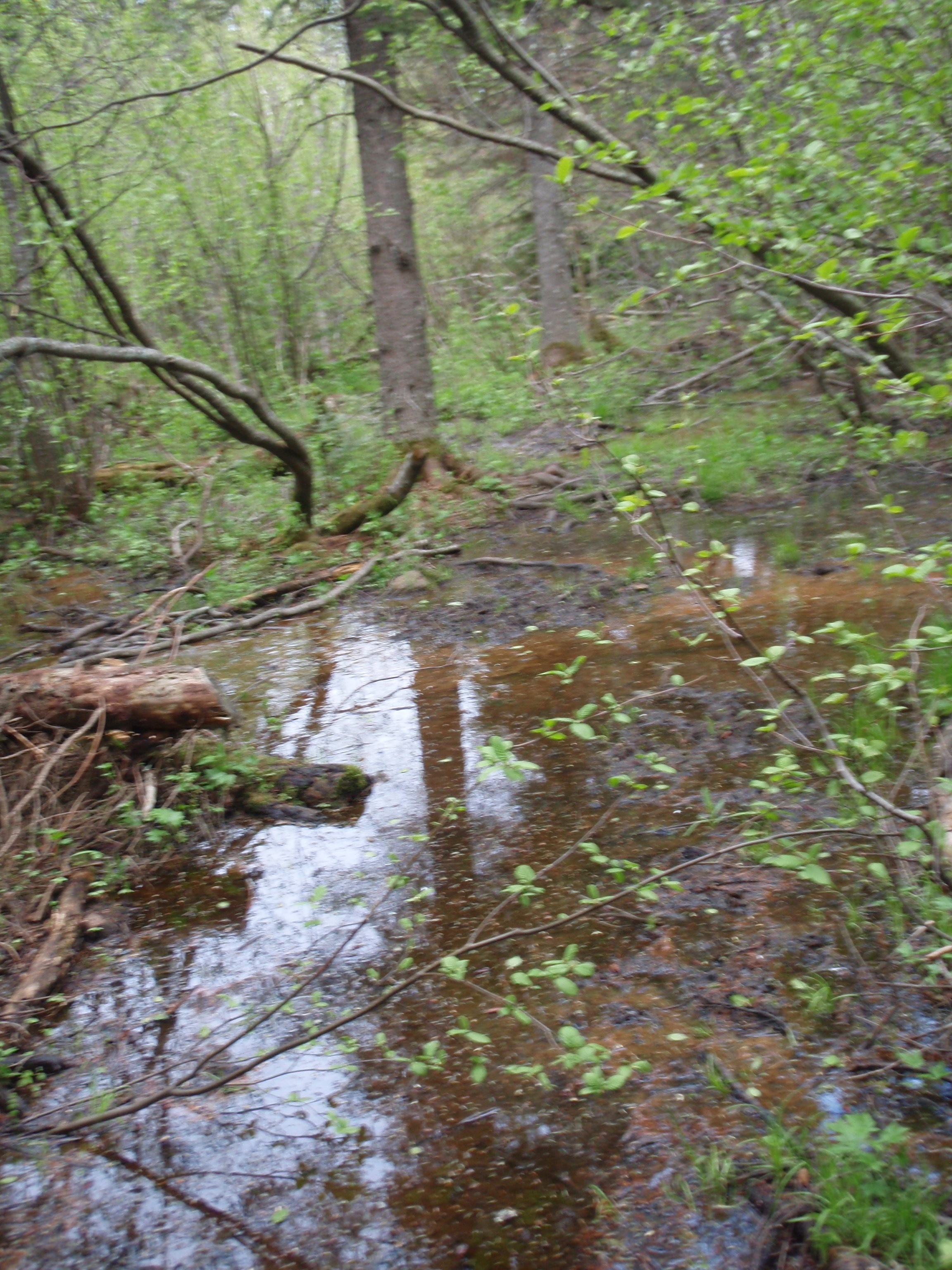
The trail continued through the scrubby woods crossing some boardwalks. Then I found the spot where the trail was flooded, just like Eric and Peter had mentioned. I too hopped across the area on tree roots. I did get a little wet, but I didn’t mind. Then to add insult, right after the flooded area there was a boardwalk. Where was the boardwalk when I needed it?
The trail didn’t seem to be that well maintained here. There were more frequent downed trees than I had experience so far on the trail. I hoped that would not continue to be the case, because it would slow me down. But Eric and Peter said this section was pretty easy walking, so I had faith. I saw a little beaver lake ahead to the left of the trail. I wondered if the trail would go over that way, but it didn’t. I didn’t want to see that lake anyway, there could have been a moose lurking over there.
I continued to a spot where a bunch of birch trees had been cut down on the right side of the trail. I’m not sure how that happened, but I blamed beavers who had made an ill-fated attempt at making a Beaver Pond. They should have stayed over by the lake where the moose was lurking.
The area around the trail was increasingly becoming scrubby. There were some mature trees but the scrubby trees were taking over. And you know who likes scrubby areas, it’s moose, and I did see some moose dropping on the trail. The trail never did make it over to the little lake, even though I saw it several times out in the distance.
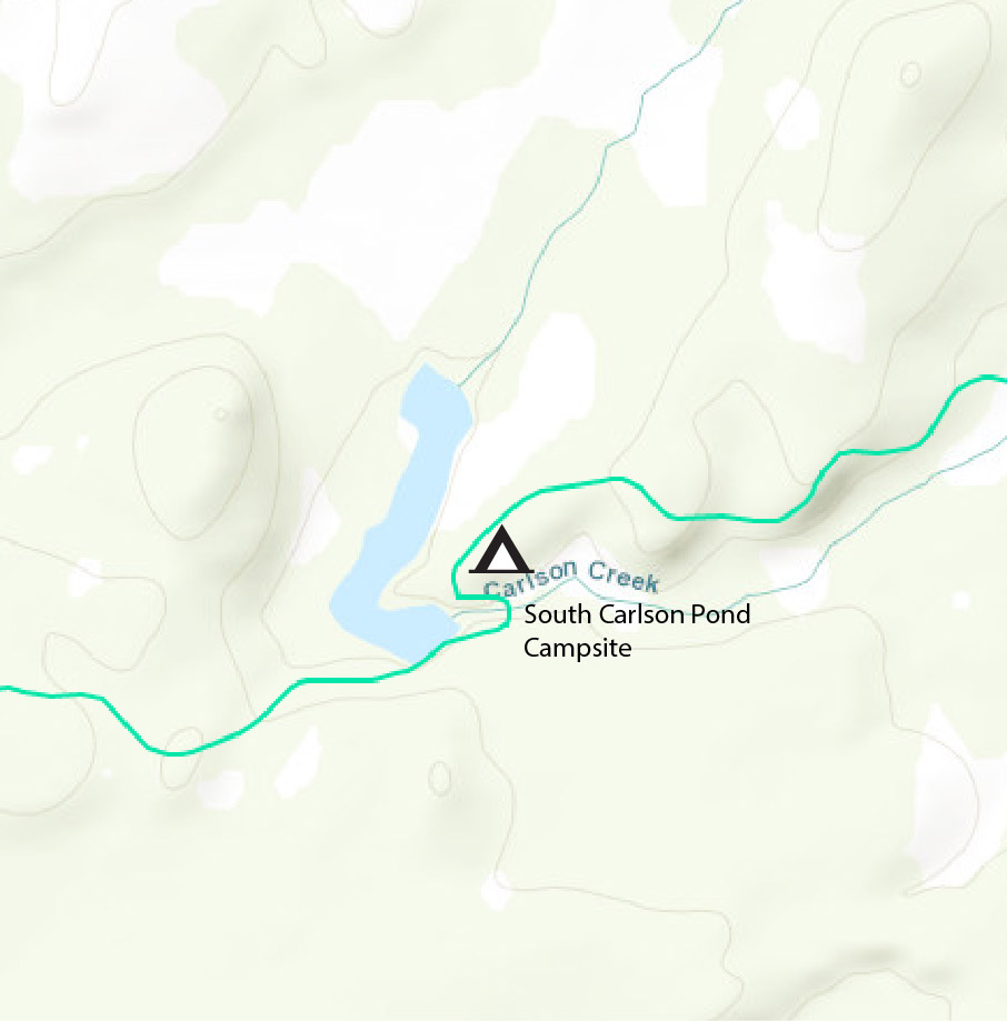 Soon I made it to a more mature woods, with a variety of trees including birch and pines. I was hiking on a small hill and soon I came up to a big swampy area down the hill on the right side of the trail. It was a huge area. I must have walked about 200 yards along the trail, up the hill from this big marshy area, then I came to the sign that said Carlson Pond with a trail going down to a pier made of logs. Going up the hill from the trail was a sign for the South Carlson Pond Campsite. The campsite trail went up a small hill. I went up there, and this is a really cool campsite. There are wetlands to the left of this hill and wetlands to the right.. It seemed as though this campsite was an Island, but it wasn’t. I inspected the campsite, which had lots of room for tents. The campsite had something like a 270 degree view of wetlands, but it was up from the wetlands, not right next to them. This is a cool campsite.

I went down the trail near the log pier and took some photos of the massage Carlson Pond. It was a pond, but there were marshy areas back a quite a ways. Then I headed back on the SHT. The SHT skirts the wetlands down from the campsite. You see the big beaver dam that created Carlson Pond and all the wetlands, then you’re hiking along the creek that has some wetlands with it. You get to the spot where there is the creek crossing. But the little bridge is in disrepair. Somehow I manage to make it across it. Then the trail takes a right and you’re hiking past the beaver dam again and seeing the pond with the big marshy area. It truly is a beautiful spot.
The SHT gently ascends a hill, giving you view of the big marshy area from time to time. Then, finally you are away from the pond and hiking through some mature woods. And again, this is some really easy walking with not many downed trees in the way. Thank you Trail Volunteers!!
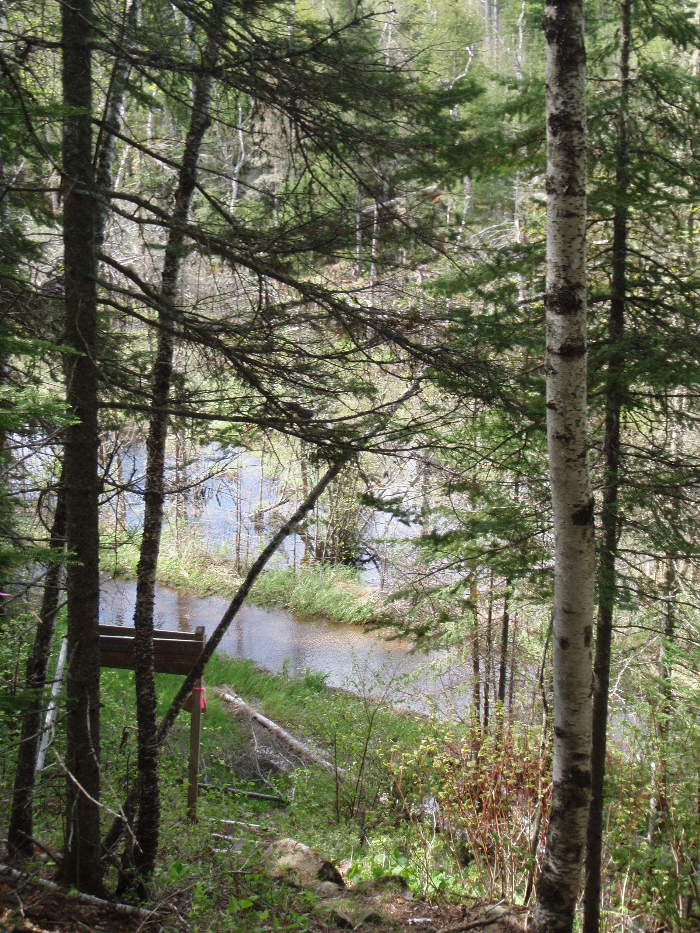
The trail keeps going in an uphill pattern, but it is really gradual and not painful at all. It continues the same for I’d say about 3/4 of a mile. There’s really no distinguishing landmark along this stretch until you get to a really tall pine tree. Then you head downhill on a series of steps and hit Tom Lake Road which is flooded. But don’t worry, they have a detour. The detour goes around a marshy area at the base of the hill you just came down. Eventually it hits a much drier Tom Lake Road. Then you go up the hill on Tom Lake Road. After that, it’s pretty easy walking. I set sail down the road.
The road is an old two track logging road which is now a dog sledding road. So it doesn’t matter if the road is flooding for dog sledding, it will just be ice anyway. It probably is good training for the dog team. I really don’t think a vehicle can get down this road anyway, because it is not cleared wide enough for a jeep or truck.
The road went through pines mostly, some of which are starting to encroach upon the road. I kept going at a good pace because there really wasn’t any good view or attractions to look at on this road. It’s a nice enough area, but had no lakes or vistas. After huffing it, I soon made it down to where the SHT departs Tom Lake Road. There’s a normal SHT sign there, giving you distances to upcoming destinations. The Hazel Campsite would be in 0.4 miles and Camp 20 Road would be in 2.6 miles. The Magney Parking Lot, my final destination for today, was still 9.3 miles away. Now I would be entering the Hovland Woods Scientific Area. I wondered if I would meet up with some scientists. The Hazel Campsite is allegedly a waterless campsite. The SHT Guidebook warns you to bring some water with you to the site. But I kept crossing several little creeks on the way to the campsite. But those creek would probably be dried up later on in the summer.

I made it to the cross trails of the Hazel Campsite. To the left was the trail to the campsite, to the right was the trail to the latrine. I stopped at the campsite and took a break, which would be my first break of the day. I was making really good time, and it was easy hiking like Peter and Eric said. The campsite had the normal wooden planks for benches around the campfire area, plus there were some nice grassy areas to pitch a tent because the woods around the campsite were a little scrubby, letting the sun shine in. This site might be a little hot in the summer.
After my break, I continued down the SHT and found another little creek not far down the trail. So much ado about being a waterless campsite. But that creek too looked like it could dry up. The area around the trail was now decidedly scrubby with very few mature trees. And the only trees that were mature, were too mature, and dead. After a while I crossed another boardwalk with a little creek under it.
Then I came to a fairly tall pine tree which didn’t fit in with the scrubby area. This was the begining of a different type of forest. It wasn’t exactly a pine plantation, but it sure seemed like it. It had pine trees in a variety of sizes, except for the super tall pines.
As I was going through the pines, I came to a spot where you could see a river system off to the left. Either it was a river, or the backwaters of a river, or both. I figured this was the Flute Reed River because the SHT Guidebook said we would be crossing bridges over tributaries of the Flute Reed River.
I kept going through the pine meadows and soon I encounters some boardwalks, but no bridges for tributaries. Then I saw a backwater area or pond not far from the trail to the left, Soon I came to a sign that said, Private Land, Stay on the Trail, no campfires or camping and then I crossed my first bridge going over a tributary. It wasn’t all that big of a bridge, but still I had made it to a landmark listed in the guidebook. It looked like they would be working on the bridge, because there was a pile of new wood nearby. I walked through some piney meadow area some more, then there is a SHT sign with an arrow pointing to the right, so the trail takes a turn. Plus there was another private land sign, too. The pine meadows keep going and going. At one point there is a nice view of some hills in the distance, but for the most part you’re walking through grassy piney area, trying to decide what tree you’d like to cut down for Christmas.
Then you go into a scrubby area and cross a bridge over the second tributary of the Flute Reed River, Now were making some progress. Then, the trail goes into a mixture of scrubby woods and mature woods for a while, then you come out at the Camp 20 Road Trailhead. I thought I was making real good time. I was definitely going to make it down to Magney before dark. I took photos of the fairly large trailhead, and started down the road. The reason the trailhead is large is that there is no parking on the road due to construction trucks using the road. Evidently there is a gravel pit nearby. I set sail down the road.

This definitely was a nicer gravel road like the Arrowhead Trail or Jackson Lake Road. It must have to be for the construction vehicles. This would be an almost two mile roadwalk, and I welcomed it. There were some very straight sections of the road, but it had a few curves. I just concentrated on walking, taking the occasional photo. I was in a groove. It was a 1.8 mile roadwalk, and I didn’t time it, but I bet ya I did it in less than 40 minutes. I can easily do a mile within 15 minutes on a treadmill, and this was just like the pace I use on a treadmill. Maybe a wee bit slower, but not much. I made it down around a curve and saw the SHT sign ahead, next to the road. The sign said Devil’s Kettle 3.9 miles, Magney Parking lot, 4.9 miles.
Immediately when you leave the road the trail descends on a series of steps and in less than 100 yards from the road you see the Flute Reed River Bridge. It’s a fairly good sized bridge, and you have to step up 3 steps to get on top of it. The river is a smaller river. not navigatible by a kayak or canoe. But it is a fairly fast moving river. The trail takes a left turn after the bridge and follows the river for a ways. The trail goes flat for a ways, and I encounter something that I haven’t seen before. It’s a boardwalk where smaller logs cut in two foot sections are placed side by side. I think this is called a cordoroy boardwalk. After I finished I did encounter a regular boardwalk. The trail eventually starts an uphill run. It wasn’t the worst uphill run I have ever encountered, there were no stairs, but the 9 miles of relatively easy hiking I had already done that day were starting to catch up with me.
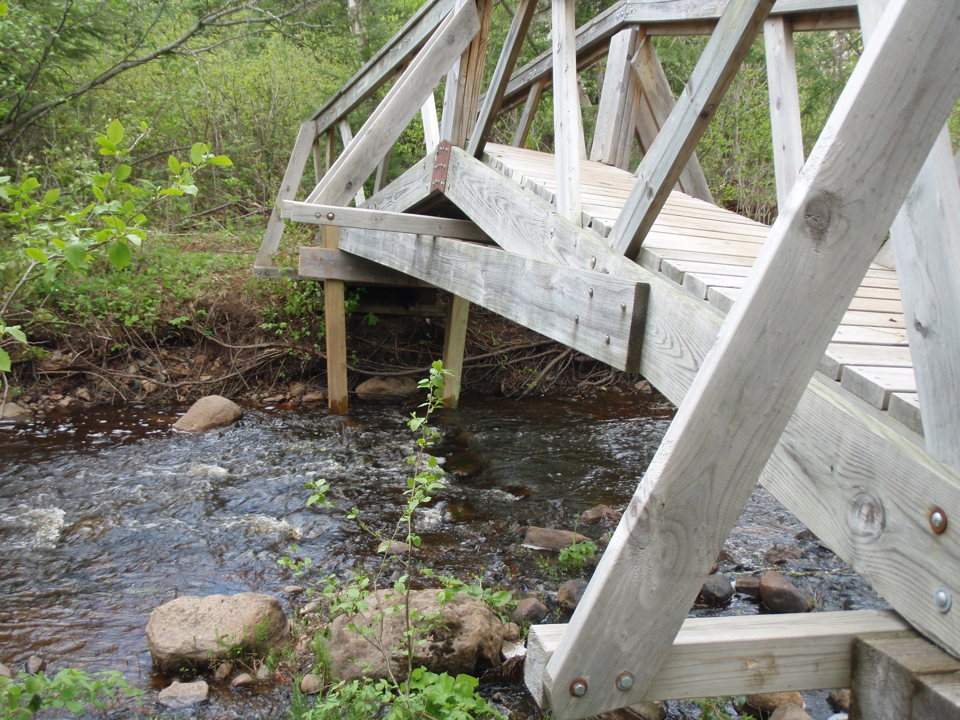
As went higher I started seeing some rocky and grassy sections of the trail. I got to a spot where there was a grassy two track road. Perhaps the Park Rangers use it to work on the upper part of the park. I continued to see grassy rocky areas along the trail until the trail goes into a big grassy field on top of the hill. It had a great view. I was on Rocky Knob.
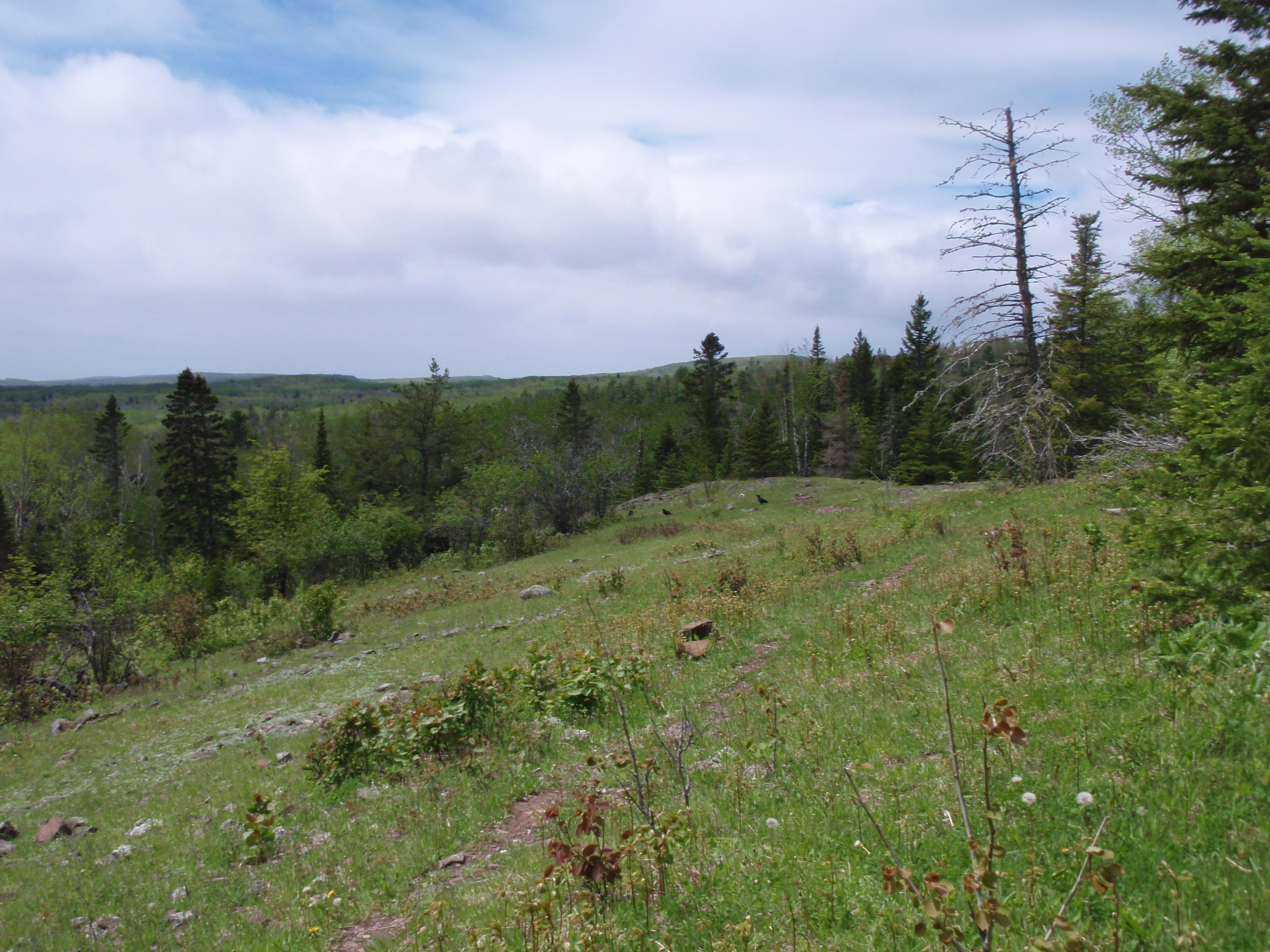
Again, I supposed to have some views of Lake Superior. But there were some white clouds over there, blocking the view. At least they weren’t dark clouds like when I went over Hellacious. After crossing the big grassy rocky field on top of Rocky Knob, the trail descends at a pretty good rate through some rocky areas. Once I passed those areas, I was walking in a regular forest. That’s when I came upon a tree with some orange and black shelf fungi hanging on it. I just had to take a photo of me by the tree just to prove what a fungi I am.
There seemed to be a few more downed trees along this section ever since Highway 70. It was nothing too drastic, but maybe they need a trail maintainer here. A ways after Rocky Knob, I start walking next to a deep gorge, where I can hear the river down below. It’s the Brule River. And According to the map, The Brule River and the Flute Reed River are only about a half a mile apart but they never meet because they have Rocky Knob separating them. I keep walking along this gorge for a long time. sometimes seeing the rocky hill on the other side of the gorge, but never seeing the river down below. There are too many trees in the way.
According to the SHT Guidebook, the Trail meets the river two miles from the Magney Parking Lot. That was my next landmark. But I was hiking along this gorge for a long ways. The trail would start going down a ways, then perhaps cross a little creek, then it would go up again. Every time it started going down I thought this was the descent to the river, only to be disappointed when the trail went up again. This happened over a half a dozen times. I was getting tired of it. I started thinking of Brian Ferry’s song “Take me to the River.” I’m sure it’s been recorded by other people, too, and wasn’t his original song, but that’s the version I remember.
The trail goes right next to the gorge in places, with steep views down. But the river is too far down, you can’t see it. Maybe in November, when all the leaves are off the trees you cans see it. And at some places, you’re getting some views of the hills beyond, but never of the river below. This trail keep going and going along the top of this gorge. But then at last you get to a spot where the trail gets serious about going down. It takes a hard right hand turn and starts going down using some tree roots as steps. Then there are some real steps and the trail curves around and keeps going down to some more steps. Pretty soon you see two benches at the bottom and river is beyond them.
I’m not saying that they put the benches at the wrong spot, because it is a nice spot to set down your gear and go explore the river like I did. But, I’m sure the people going the other way would appreciate a bench at the top of that long climb. But I WAS AT THE RIVER. It was only two miles left until the Magney Parking lot. But what a two miles that would be.
The river that I saw was just a channel of the river. I walked down a ways, and the channels came together and it was a wider more spectacular river. And the water is moving really fast. Oh what it must be like to Kayak this river, if it’s even allowed. I checked the internet and it says the following about kayaking the river. The REI Whitewater Paddling website: “The Brule roars through one big, distinctive rapid after another as it races toward the big lake. Big drops don’t give you much notice. The take-out to portage Devil’s Kettle is really tricky, and the penalty for screwing up is severe – maybe fatal.”

Now the trail continues along the shore of this cascading river. And it keeps cascading and cascading. Sometimes it seems to split apart and go into different channels through a thickety area. Then the channels merge again. There is a place where it looks like a couple cascading creeks up into the river. This cascading river walk goes for about a mile. Then you get to a spot where the other side of the river is a cliff, and this side of the river is starting to look the same way up ahead. I got to the spot where the trail veers up a rocky hill to the left and you can see the river vanish over the falls to the right. I walked up the hill, seeing glimpses of the falls from time to time and hear it constantly. Pretty soon I came to a sort of deck affair that I walked out on to see the magnificent Devil’s Kettle Falls. That was quite the sight.
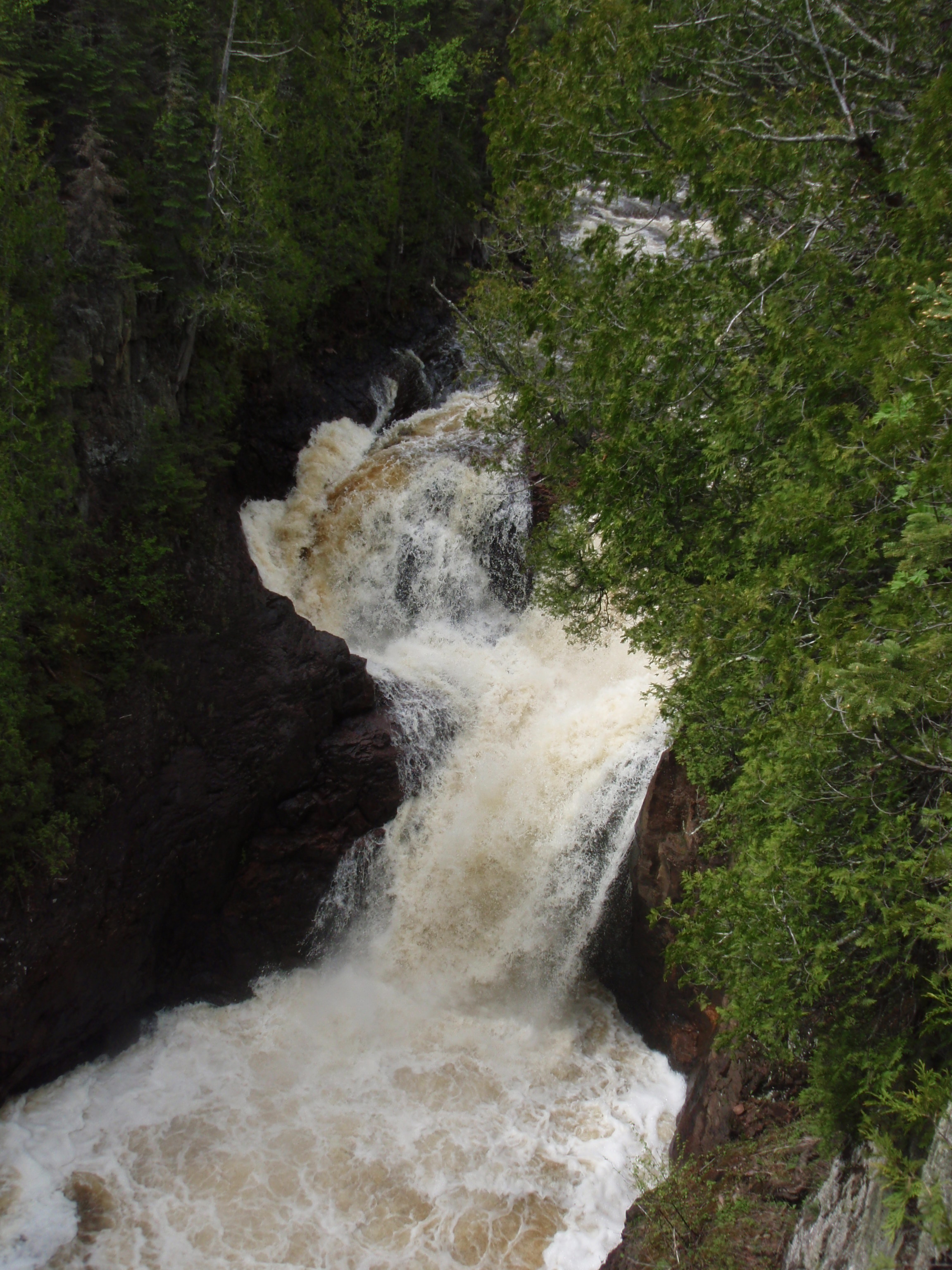
I took several photos there, and I continued on the trail, which is a nice wide trail now because of all the tourists that come down just to see the falls. Then I came upon a long section of stairs, gently heading downward. This section of the trail had handrails. When I got done with that I found a stairway to the right that led down to the river. The trail continued straight, but I took the stairway to the right down to the wonderful Lower Falls. Water was just gushing over these falls. After spending about 15 minutes taking photos, including some self shots, I headed back up the staircase. Then I turned right and continued down the path. But it wasn’t a dirt path now, it was a series of bridges with handrails on both sides. Just then, I saw a couple coming toward me along this bridge system. This is where I met Larry and Jill. I asked them if they’d like me to go down to the falls with them and take there photo by the falls. And they said yes.

So, I went down and took several photos of them standing with their camera in front of the falls. Then I gave them a “I saw Tman” card and told them that I take photos of the people that I meet for my backpacking website, and they agreed to get their photo taken. I was nice meeting them. I forget where they said they were from, but they were definitely not locals.
I head up the staircase again and down the series of bridges. Then I saw one of the worst sights for hikers ever. There’s a massive staircase ahead. And I mean massive. I headed up the staircase and it kept going and going. Luckily there are some built in nooks with benches every so often on the staircase. I had to stop twice and rest. Finally, I got to the top, and there are two benches on the top. Just then a fairly tall white haired man came walking down the path towards me. I told the man that I didn’t know if he wanted to go down there because the it’s a long ways down. He said that his wife already gave up on hiking it, but he was going to give it a shot. So he went down the staircase. I continued on. The path is going along the gorge, here, and time to time there is a metal fence because the bank of the gorge is eroding away. Eventually they’re going to have to move the path. But along that path there are some places where you can get some good shots of the river below.
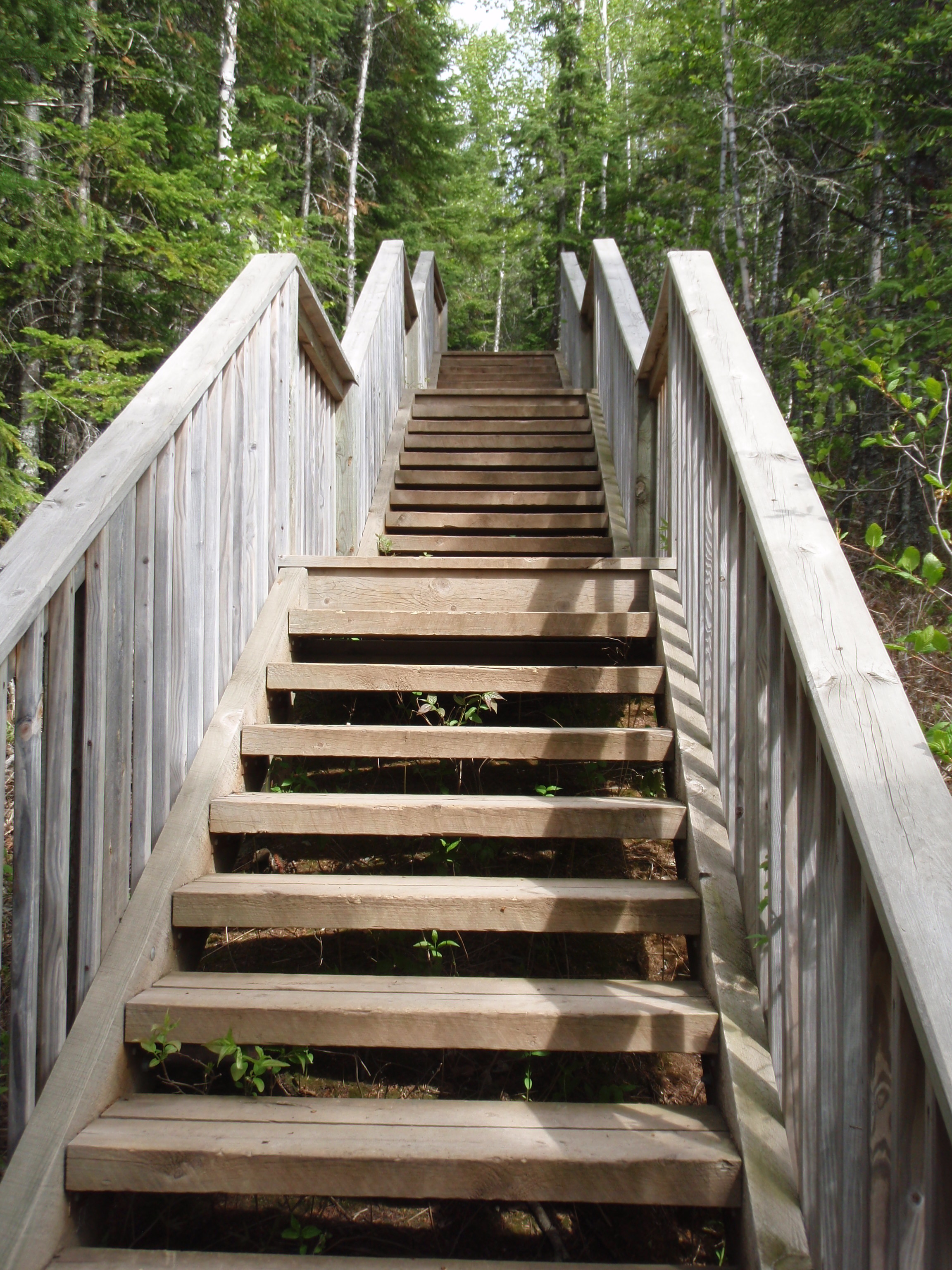
The path continued on a gradual downhill trend for the next 1/8 mile or so. At the top of the stairway, I’d say you were hiking at least 100 yards above the river. But because of the downward trend, eventually you are only about 15 yards above the river. Then you get to a picnic area. And that happened just at the right time, because my camera battery died right then. So I set my backpack down on a picnic table and found my diddy bag with the batteries in it. I thought this would also be a good time for a break, so I ate a snack and drank some water. Then I started taking photos. There’s a long metal and concrete walking bridge spanning the river here. There are picnic tables, an outhouse and some signs at this location. Plus there is a two track forest road headed down the east bank of the river. That must be for the Park Rangers to do maintainence, and also for the sewage truck to come pump out the outhouse. It also may be a good way to connect with Naniboujou Lodge, which is located on the east side of the river down by Highway 61. When I walked on the pedestrian bridge, I could see the highway 61 bridge down about a 1/8 of a mile.
Then I saw the man with the white hair coming back my way. I asked him if he gave up on going down those stairs, and he said no, he went all the way down and saw the falls. He said he was a pretty good hiker. Then I told the man that I could use some assistance. I had hiked 14 miles today, and I’m willing to pay someone to take me 8 miles back to my car. I showed him the map and explained why the hiking trail was longer. We got across the river on the bridge, and he said he’d have to talk with his wife about it. I said that I talked with the Park Ranger yesterday, and maybe she wrangled me up a ride, so I would be heading down towards the Ranger station to the left, where he would be heading towards the parking lot to the right. So, if he decided to give me a ride, I would be at the ranger station.
It was around 4:45 pm, so I had made incredibly good time, even though Magney was a hiking buzzsaw on me. I made it to the ranger station and saw a woman who I thought was the nice Ranger I saw yesterday. She was standing out by her car, getting ready to leave. I thought I got her just in the nick of time. She was still a little ways a way from me, so I spoke loudly saying that I had made it all the way to Magney.
As I got closer, I asked her if there was anyone around could give me a ride, and that I’d be willing to pay. Then I realized this wasn’t the same Ranger I had talked to yesterday. This Ranger Lady started giving me a lecture. She said that Rangers aren’t allowed to give people rides. Maybe she didn’t realize that I didn’t necessarily want a ride from a Ranger, perhaps there was a Campground Host or other volunteer around. She said I should go over by the Entrance Building and call Harriet Quarles who shuttles people. She’d give me her number. and it was a local call, so the call would be free on the phone. Well, at least that was a useful bit of information. I didn’t tell the ranger that I already have Harriet Quarles Phone Number. But I thought it would probably be a rather expensive proposition having her come up all the way from Grand Marais. I thought that there would be someone in Hovland that the Ranger knew that will shuttle people.
The Ranger was in full lecture mode, when a newer extended cab metallic brown pickup came rolling up. A woman opened up her passenger side door and said “We’ll give you a ride.” I was saved by the bell. This is where I met John and Ann from South Dakota. They are retired and spend the summer volunteering at the Voyagers National Park Visitor’s Center. So they must be used to helping out wayward hikers and canoeists. They drove me up to Hovland, and turned on Arrowhead Trail. John and Ann were out touring the North Shore, and they had some sort of Article that told them where to visit. I bet it was the Midwestweekends.com North Shore guide, but I didn’t confirm it. I felt bad that Ann could not make it down to the waterfalls at Magney, so I told them they need to visit Cascade State Park, where the waterfalls are an easy hike from the Parking Lot. Ann checked the article, and it was listed. Then I told them that there is a spectacular overlook near Grand Marais. Just drive up the Gunflint Trail out of town, and when you pass the Grand Marais Water Tower the road to overlook is about a half mile on the right. And the road goes right to the overlook. You don’t have to get out of the truck if you don’t want to. Ann said the overlook was not listed in the article.
I gave them an “I saw Tman” card, and asked if I could take their photo for my backpacking website. But they declined, oh well. I offered them some money for driving me, but they declined that, too. They got me to my van, and made sure it started, then they were on their way. They are great people, Thank you for helping me out. Have a good time at Voyagers National Park this summer. They were my saviors this day.
I headed back to Judge CR Magney State Park to explore it. By this time, the Ranger Lady had gone. I drove into the campground. There was a big sign saying “Registered Campers Only.” I ignored the sign and kept going. There were no campers, except for the campground host. I went to the far end of the loop and stopped at the rather new restroom and shower house. I went in and looked, and it was a nice set up. I tested the shower, and it didn’t seem like there was any hot water. So, I used the toilet, then headed out. I figured I would be headed down to Grand Marais anyway, so why not take a shower at the Grand Marais Campground where they have warmer water. It was still early, and I had thought about hiking another section. But, it’s Burger Night at the Grand Marais American Legion, so Naaaw, I’m not going out hiking some more today. Plus the library is open late on Wednesday Night. So I headed south on Highway 61 to Grand Marais.
The first thing I did was stop at the Library. And when I was headed in, John, the guy who gave me a ride back to my van was walking out. I thanked him again and asked him if they went up to the Grand Marais Overlook that I told them about. I he said no, but they would do so in the morning. He said he had been in the library checking his email, and I said that’s what I was about to do. So, he headed off and I went into the Library.
I managed to get a computer right away. I checked my email and sent a couple. Then I posted the following on the SHT Hiker Yahoo Group. There was a posting about the “Secret Trail between Partridge Falls to SHT Northern Terminus.” Somebody was wondering about it. What wonderful timing I thought. And I had the latest Information about it, here it is
Re: Secret trail from Partridge Falls to SHT northern terminus
I hiked this section from both ends on Sunday at
it should not be attempted. There is no trail
and it is very thickety. Bottom Line, the tribe
really doesn’t want people straying off the Grand
Portage Trail. They taken steps like obscuring
the trail to the Cascades, and they will be taking
out the failing Snow Creek Bridge that people can
take to Partridge Falls.
I hiked from Grand Portage to Partridge Falls on
Saturday. I hiked back to Grand Portage on Sunday
after checking out the non trail. Then I checked out
the Rengo Road end, and it eventually becomes a thicket.
On Monday, I hiked from Otter Lake Road to Jackson Lake
Road (8.9 miles). On Tuesday I hiked from Jackson Lake Road to
the Arrowhead Trail Crossing (6.5 miles), and I also did the
Lakewalk (1.5 Miles). And today I hiked from the Arrowhead Trail
Crossing to Judge Magney (almost 14 miles). On the Lakewalk I rode
my bike back to the van, but on the other occasions I’ve been
lucky getting rides and being spotted. Since the Grand Portage
fiasco, I’ve been day hiking instead of Backpacking.
Tommorrow I plan to do a bike and hike between Magney and
the Lakewalk and then the Lakewalk to Kadence. That might
be it as far as the camera cards.
As far as problems, there is a 50 yard section that is
full of water, about 3/4 mile west of the Arrowhead Trail
Crossing. And the bridge below the beaver dam at
North Carlson is in disrepair. The other water spot
was between Otter Lake Road and Andy Lake Road.
It’s Burger Night at the American Legion in Grand Marais, so I
gotta get going.
Regards from me, Todd
I was wrong in that posting, the place that had the bridge in disrepair was near the South Carlson pond.
I finished up on the computer and headed down to the Municipal Campground and took a shower down at the shower house by the ball diamond. The Campground Office was closed, but I would have to go down to the Campground Office sometime when it was open and pay for the showers, now that I know that there is a $3 charge for non campers. They only had the $3 sign on the shower houses near the beach, so I never knew about it until I went over to talk to Peter on Monday Night.
I finished up and went over to the American Legion for Burger Night. It was around 8 pm, and there were only a few customers in the American Legion. That surprised me. Elizabeth, the same bartender I had last year, was tending the bar. She said it was really busy earlier. I had just come a little late. But Burger Night is still going on until 8:30 pm. I was the only non-local person in the bar. And the locals were talking about how bad things were getting in town. One guy who owns a local business said that his sales were a third of what they were 3 years ago. People used to come up to Grand Marais 3 or 4 times a year, but are only coming up once a year now. Another guy had just moved back to Grand Marais, which is the town he grew up in. He was rooming with a friend, but trying to find his own place. The conversation at the bar continued to be about the local economy, and they were wondering how certain businesses were going to make it. One guy predicted that a certain bar would not make it to October.
I ate my burger, which as usual was really good, I finished off my beer and headed out. It was getting dark out. I went down to the Municipal Campground and pulled up to a picnic table that had a street light near it. I set most of my gear out on the table and started sorting it out. As you read in my SHT Hiker Post, I was planning to do a bike and hike the next day, so I was sorting out into three piles: biking gear, hiking gear and stuff I didn’t need. I wanted to make sure all my gear was in order, especially after the Spot Messenger Fiasco that I had in the morning. After getting my gear in order, I drove up to the Grand Marais Overlook and went to sleep.
Thursday, June 2, 2011
3 Different Hikes
Judge CR Magney Parking Lot to the Lakewalk
I didn’t wake up particularly early and I was not all that hungry because of Burger Night at the American Legion the night before. So, I just headed up Highway 61 from Grand Marais. I stopped at the east end of the Lakewalk and locked up my bicycle and biking gear. Then I took the 4 mile drive down to Judge Magney State Park. I rolled into the parking lot and parked next to a picnic table. I set my Spot Messenger out on the picnic table to mark my spot, then put the rest of my hiking gear out on the picnic table.
While I was getting my stuff ready, the Park Ranger that had lectured to my last evening pulls up and rolls down her window. I said hello and she did the same. And I told her that I was getting ready to do a Hike and Bike. I would be hiking down to the Lakewalk where my bike is locked up, then I would be biking back. But she didn’t she too interested in my itinerary. Evidently, she was pissed that she didn’t get to lecture me enough last night, so she started in again. She said that only registered campers were supposed to use the shower house and that I should not have taken a shower there last evening. I told her that I didn’t take a shower, and that all I did was go down and check out the facilities for future reference. I did go to the bathroom while I was there, but that’s all I did. She said that I wasn’t supposed to be even doing that. I replied with an “oh Well.” I could have told her that I needed to check out the facilities for my backpacking website. Or I could have done a smart alec response and said I’m a registered camper with the Superior Hiking Trail Association. But I was just getting tired of talking with this lady. I really didn’t like her attitude towards backpackers. She must have gotten tired of talking with me, because she decided to go. Oh well.
I was trying not to get wound up about it, but I was. Do you know how much time and effort has been spent making the Superior Hiking Trail? As a say frequently, the Superior Hiking Trail is one of the greatest achievements in Ecotourism in the Midwest over the last 25 years. It is magnificent trail. And now we have some rules lawyer Ranger treating backpackers like second-class citizens. That burns me up.
Evidently there’s been a problem with backpackers sneaking into the shower house taking a shower. But I know what the problem is. The problem is that the State Parks are not serving its customers. Backpackers are customers just like anyone else. And most Backpackers are more than willing to pay $3 for a shower. That’s reasonable. What’s not reasonable is to make backpackers pay $18 to reserve a campsite, to take a shower. I could see if you had 6 people in your backpacking party, you could pay $18 to reserve a campsite, then it would be $3 a piece for a shower. But most hiking parties are 2 to 4 people. I can see if you arrive at Magney around 6 pm, you might want to stay overnight. But if you arrive around noon, you’d like to take a shower and continue on.
And the problem is just going to get worse and worse. This upper portion of the SHT is going to be getting more popular. A lot of people I’ve chatted with on the SHT Hiker Group have done the lower parts of the SHT where the shuttle runs. So, a lot of people who have completed the lower sections are now looking to hike the upper SHT section. It will become a more popular route. And Magney is the logical place on this section to stop in and take a shower. If they thought they have a problem now, just wait. But the real problem is with the Parks Department. I’m calling them and expressing my concerns about this. And I’ve read trip reports of the Superior Hiking Trail where it says the people “sneaked in to take a shower.” I really didn’t think anything of it until now.
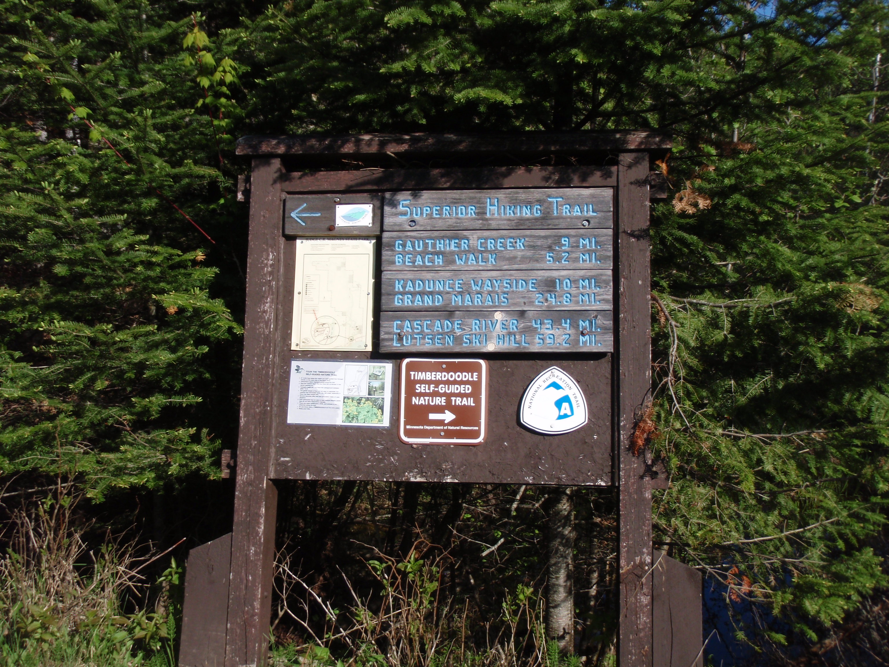
I got my stuff ready and headed out the back end of the Parking Lot. The Trail uses a two-track grassy forest road here and soon it comes to a T and you can see the campground area to the left. There’s a sign headed towards the campground that says “registered campers only.” This would be the spot where if a backpacker wanted to sneak in to take a shower, they could do so. But I would stash my backpack in the woods someplace so the Ranger doesn’t see you with it on. Because if they see someone with a backpack on, they are on high alert that you might take a shower. Just take the items you need for the shower, and head over there.
Not that I’m encouraging people to sneak in to take a shower, because that would be breaking a rule. According to Scouting Doctrine, if I find a rule or law to be unjust, I should not break the rule or law, I should work to get it changed. But I suppose a broke a rule when I went into an area that was for “registered campers only.” Oh well.
I took a right at the T and headed down the State Forest Trail. It’s pretty easy walking on the two-track road. Pretty soon you come to a pile of brush and wood debris on the side of the road. This must be the Park’s burn pile. They stack up the debris here, and then in the middle of the winter when the fire danger is low they probably pour some gas on it and burn it. We’re definitely in the back forty of the park. After walking on the forest road over a 1/4 of a mile, I came upon a big pine tree that had fallen across the road. This was a big gnarly, and took a couple minutes to get over. I climbed up on the tree and jumped down on the other side. Soon after that the forest road curves to the right. And right at the curve, the SHT splits from the road to the left. So, I was back on a regular hiking path again, instead of a two track road.

The trail here goes along Gauthery Creek for quite some time. The one thing that surprised me about Judge Magney State Park was that they didn’t have any backpacker campsites back in the remote areas of the Park. It would have been nice to have one along the Brule River before you get to the Devil’s Kettle Falls. There were plenty of places along there that would work for a backcountry campsite. Cascade State Park down near Lutsen has several Backcountry Campsites including a shelter on top of Lookout Mountain. I’m not sure why they don’t have any at Magney. But anyway, walking along this creek I spotted a few places that might be good for a campsite. Eventually the trail left the creek and then left the State Park Property. When the trail left the State Park Property there was a sign that said “Private Property, please stay on the trail, No camping or fires.” Well, it’s nice of the property owners to allow us to walk across their land. There have been other places where it has been difficult to build the trail because property owners will not allow it.

The Forest on the Private Land is a mixture of pines and aspen, and a mixture of somewhat mature trees and not mature trees. It’s a real mixture. This lasts for about a mile until you come to a small grassy field and then a dirt road. The SHT Guidebook shows that mile section as being perfect straight, but it doesn’t seem perfectly straight when you’re walking it, but there are no major turns. I didn’t even notice the 90 degree turn that the trail made, then according to the book the trail goes straight again for a little bit. I’m wondering if the trail goes right along somebody’s lot line. After all that you come to a small grassy field then a gravel pit road on the other side of it.
After the gravel pit road, the trail continues on through some woods much like the woods before the gravel pit road. It’s still a mixture of pines and aspen of various ages. But not far after the road, you hit a wooden sign facing the other way on the trail that says “private land, please stay on the Trail…,” which meant I was again hiking on Public Land. The trail crosses a boardwalk then a creek, then you come up to a trail crossing of sorts.

The Trail going to the right was going to the Northwest Little Brule River Campsite and the trail going to the left was going to the North Little Brule River Campsite. The Little Brule River was ahead of me on the SHT. I turned to the right and went took the trail to the Northwest Little Brule River Campsite. After walking about 75 yards I found the campsite. It’s a nice campsite in the young aspens. It has all the accoutrements of a SHT campsite, plus it had some tent pad areas carved out of the young aspen forest. It looked as though it wasn’t immediately next to the Little Brule River. I didn’t walk down the water path to see how far it was.
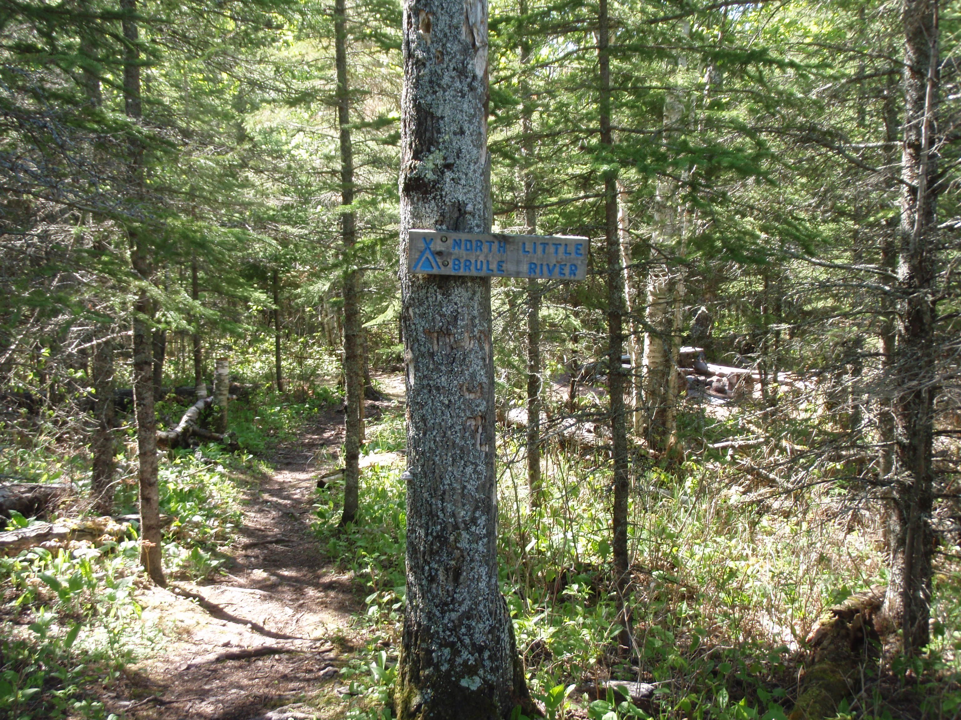
Then I walked back to the SHT and hiked into the North Brule River Campsite. This campsite is right near the SHT. Again, there wasn’t anything overly outstanding about the campsite, it is just a typical campsite that you see along the SHT. I headed back to the SHT and started hiking west again, I could see the Little Brule River Bridge down the hill in front of me. I went down a short series of steps and made it the Little Brule River. It’s a nice little river in this region, with rocks and little waterfalls. After the Bridge the Trail takes a left and is going along the river for a long ways. At first you are hiking with the river about five feet below you, but then you ascent as you walk along the river, and you are walking along a river gorge. It keeps becoming more and more of a gorge as you continue hiking. This lasts for over a 1/4 of a mile. I knew I was coming up to another campsite, and I wonder how in the heck would people camping at that campsite would get water because the gorge is too deep. Soon I did find the sign for the South Little Brule Campsite and took the trail.
I followed the trail down about 50 yards and found the campsite. At first I thought this campsite was going to be just another typical campsite along the SHT. But it’s not. This campsite is right on the edge of the gorge. And the water trail is fairly steep down to the river. The gorge isn’t as deep here as some of the other places I had just walked past, but it’s still a gorge. And the coolest thing about this campsite is there is a tent pad right next to the gorge, and down below the tent pad in the gorge is a waterfall. How cool is that? You could be one with the waterfall, just like I was one with the waterfall when I camped at the Agamok Falls Campsite on the Kekekabic Trail. This campsite was definitely the coolest campsite I had seen in a while.
After the South Little Brule River campsite, the SHT goes away from the Little Brule River. Then it starts on a series of smaller ups and downs. First you would be on a small hill then you would hike down and go over a creek then go up on top of another small hill. This pattern continued 4 or 5 times.
Then I got to a wooden sign that said “Private Land…..,” well you know what the sign says by now.
Now I had a new problem, my camera card was filled up. I looked in my didde bag and found my other camera card and put it in the camera. But that camera card was filled up, too. I had left the empty camera card back in the van. What a misadventure? So, I put the most recent camera card back into the camera card and went back and deleted some photos. I hate deleting photos because I always think I’m going to make a mistake and delete the whole works. Then I would have to take the card into a camera shop in Madison, and have them recover the photos. That’s about a $40 proposition. So, I was really careful and deleted about 30 blurry or bland photos.

I continued on, over a boardwalk and thru some scrubby areas. Then I came to an electric line right of way. I looked down the electric line right of way to the left and saw a deer standing down there about 100 yards away. And while I was taking photos of the deer, the camera card filled up again. I decided I would not delete any more photos. Usually, electric line right of ways are fairly close to a road. I would walk down to Highway 61 and then come back an rehike the trail here and take photos when I have a fresh camera card. So I took off down the trail, and the section between the electric line right of way and the road is a creek walk. There is a creek on the left hand side of the trail and you walk next to it for a few hundred yards and you get to Highway 61.
I stashed my hiking gear, which consists of my hiking poles and my vest, then I got my biking gear on which consists of a florescent orange shirt and my bicycle helmet. I started riding west on Highway 61 that has the extra wide paved shoulder for biking. This would be a longer bike ride than when I did the lakewalk. The lakewalk bike ride was about 1.5 miles where this ride I estimated to be about 4 miles. The SHT from Magney to the Lakewalk is 5.2 miles, but the bike ride up Highway 61 looked to be much shorter. I took off up the highway.
And it was another fun bike ride along Lake Superior. I would see people out walking on the beach and pickup trucks hauling fishing boats up to Canada. I was a pretty flat bike ride except for a mile before Magney there is a hill. I ended up hopping off the bike and walking for a ways. But then when I got to the top it was all downhill to Magney, That was lots of fun.
The momentum from the quick made me zip passé the Park Entrance building and also the Ranger’s building. I did see any Rangers there, or I might have stopped and gave them a little talk about treating backpackers like second-class citizens. I was probably better that I didn’t see a Ranger. I hopped in my van and drove back down to the east end of the Lakewalk and grabbed my hiking gear. I changed my camera card. then I hiked back to the electric line right of way, and took photos of the trail along the creek.
The Lakewalk to the Kadunce Wayside
I got in my van and drove down to the west end of the lakewalk. I set out my hiking gear, then I drove down to the Kadunce Wayside and got my biking gear on. I was in a zone now. I really liked the bike and hike concept, and it seemed to work well along this stretch of Highway 61. I rode my bike down Highway 61 to the west end of the Lakewalk. I estimate the length of the bike ride to be about 1.75 miles. I locked up my bike and put on my backpacking gear. This would be a 2.3 mile hike to the Kadunce River Bridge on the SHT, then I would have to hike .7 miles along the Kadence River along a Spur trail to get back to the van. I headed out.
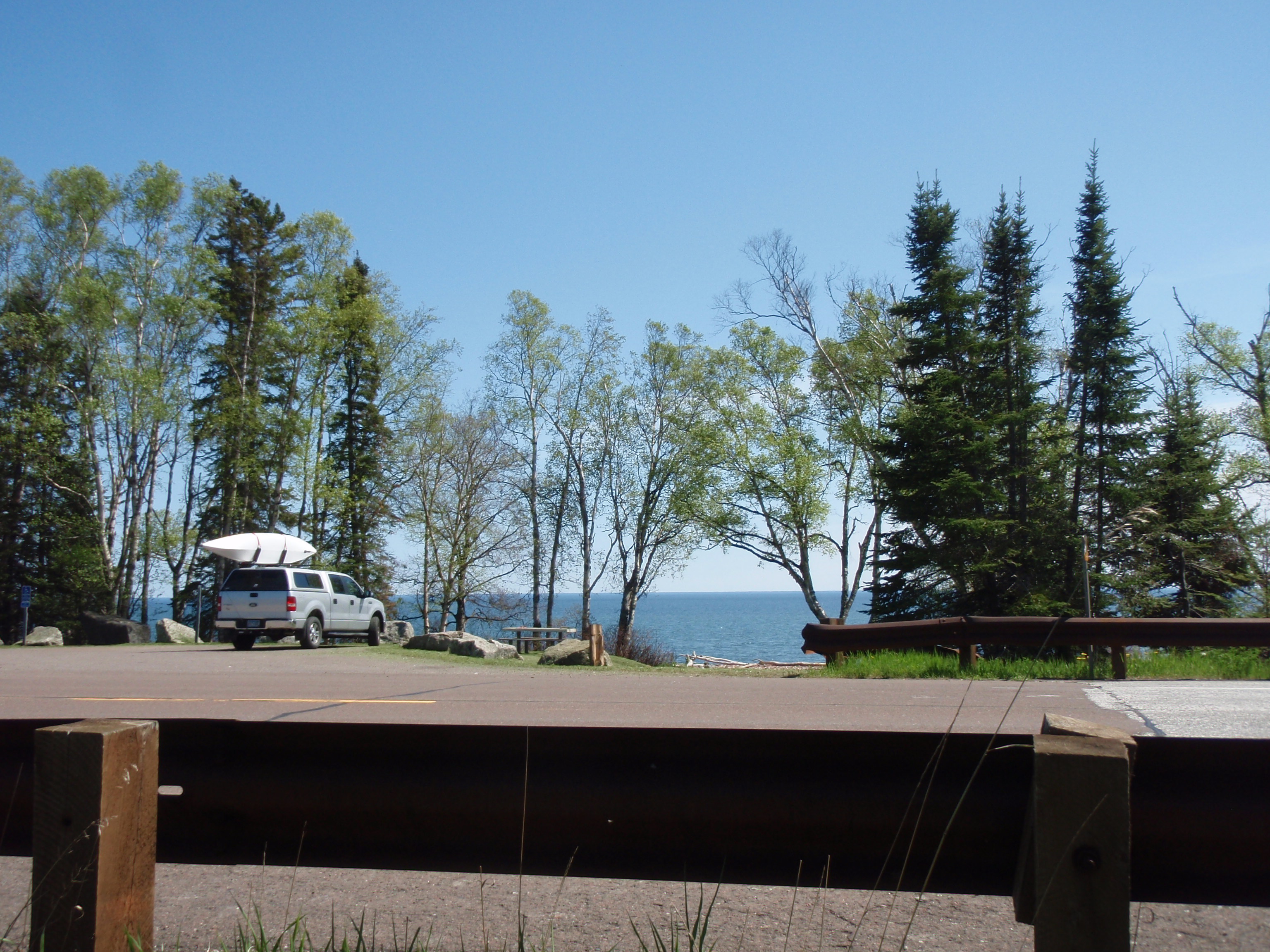
I wondered if this would be the last section I would be hiking. The Kadunce Wayside seemed to be a logical place to end the hike if I didn’t have enough Camera Card space left to go all the way back to Grand Marais. I had already filled two 2 gigabyte camera cards, and only had a 1 gigabyte card left that was in the camera. Basically, I had about 3 options. The first option was to head into Grand Marais and see if the Radio Shack has an XD Card. That would be the only place north of Duluth that would have an XD card. Unfortunately, the XD card is becoming less popular and harder to find. Olympus and Fuji Cameras were the manufacturers that used the XD cards, and now on their most recent models they have switched over to the more popular SD Card. I decided that when I got back to my van at the Kadunce Wayside, that I would run into Grand Marais and see if the Radio Shack had a XD card. But I doubted they would. If the Radio Shack doesn’t have a XD card, then I would have to explore some other options. They would include taking less photos and deleting some photos off the cards I already have. Those options don’t appeal to me that much. The other option would be just to end the hike at Kadunce.
I hiked across Highway 61 from the west end of the Lakewalk. Immediately there is a boardwalk. It was a short boardwalk, but it did get my mind back on the trail instead of all the other crap that was going on. The Trail goes in a slight uphill pattern, going through the mixed woods of Aspens and Pines. After hiking less than a half a mile, I came upon a Electric Line Right of Way, and also a Road. This is Kelly’s Hill Road. I crossed the gravel road and saw the SHT wooden sign. It said it was 2.5 miles to the Kadunce River and 14 .2 miles to the Grand Marais Overlook. I was definitely making some progress getting back to Grand Marais. After Kelly’s Hill Road, the trail continues on but now it is much more of a pine forest. And the trail starts a new pattern. The trail descends a little and crosses Timberwolf Creek, then it head up a few steps and continues on a uphill stretch again, until it starts going downhill to cross another creek. Then it ascends a small hill again, until it decides to go downhill again to cross another creek. After a few times, this gets to be a little annoying. But it could be a lot worse, so I don’t know why I’m annoyed.
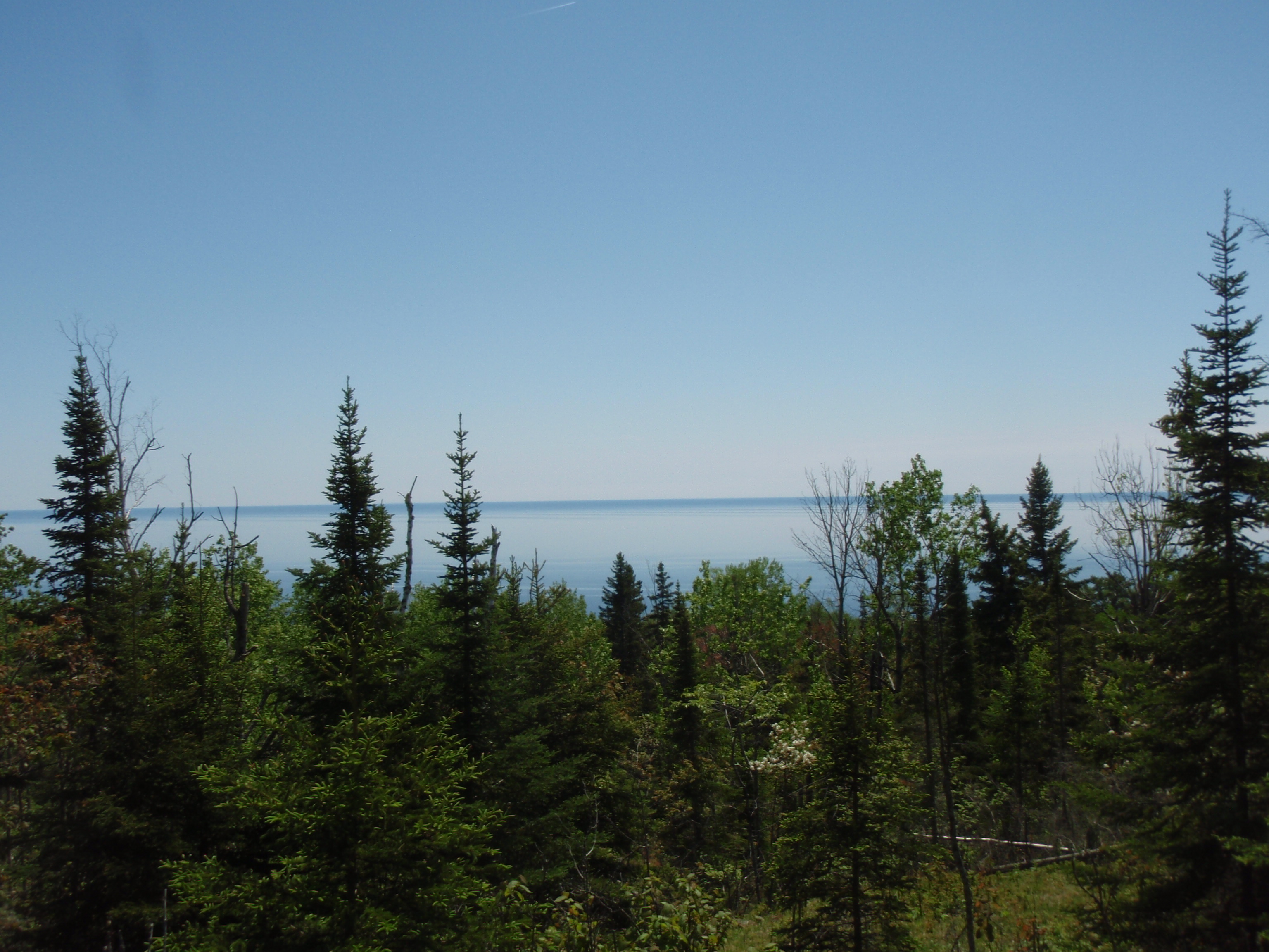
Then the trail goes on an extended uphill stretch, until you can see something ahead. Then I arrived at Blueberry Overlook. You can see the trees down the hill, and Lake Superior on the horizon and that’s about it. It would be better if there were actually a ship out on Lake Superior, but there wasn’t. It’s a nice overlook, but nothing fantastic. Up at the overlook the trail goes through what I call a pine meadow. There are medium sized pine trees plus lots of grassy and flat rocky areas.
The pine meadow went on for a few hundred yards then the trail descended gradually into a mixed woods. After spending some time in the mixed woods, it became a young aspen woods. After that it returned to a mixed woods, and I met up with 4 college students from Northwest University in Iowa.
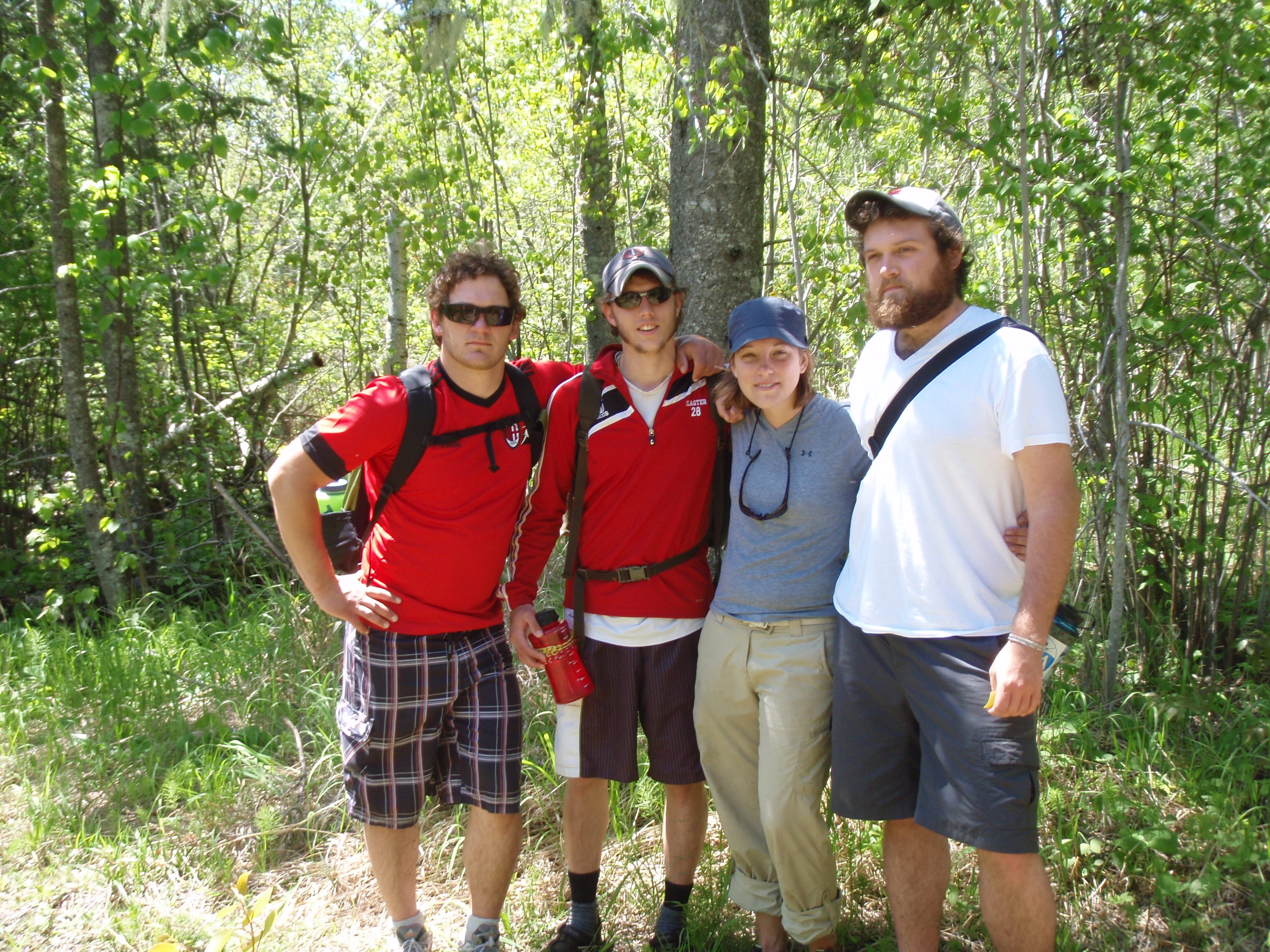
They were Josiah, Ted, Morgan and Isaac. I commented that I never met a Josiah before. They agreed that it was a rare name. They seemed to be enjoying the beautiful day by taking a day hike. They had some gear with them, but it was obvious they were out on a day hike. I took their photo and gave them an “I saw Tman” card, and I was on my way.
Shortly after meeting the College students, I came upon the Kadunce River Campsite. It was a nice enough campsite, but the Kadunce River didn’t seem that close. So I started hiking on the SHT again, and after heading down a hill I found the Kadunce River. The trail takes a left and starts following the Kadunce River. I hiked along the river, seeing little waterfalls and rapids. Then I saw something rather unusual on the trail. It was a shoe from a young child, perhaps a toddler. Then the trail went up over a small hill and then down the other side of the hill I saw a couple, where the lady was carrying a small child. I called out to them saying “hello, there.” Then I asked them if their child had lost a shoe, and they said yes. I said I would go back and get the shoe, so they didn’t have to walk up the hill. So, I did.
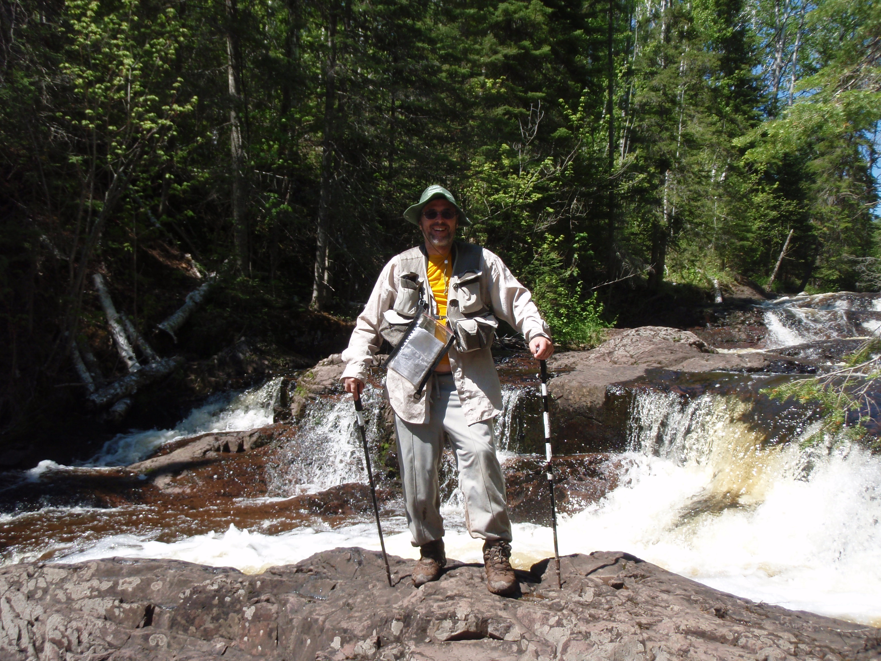
This is where I met Adam and Katie. I didn’t get the name of the child. They were standing at a really nice waterfall, so I offered to take their photo at the waterfall, and they accepted. I took some shots of them on their camera. Then they took my photo using my camera. Unfortunately, I didn’t get a very good photo of them using my camera. But I gave them an “I saw Tman” Card, and I was on my way.
The trail continues up a side of a hill next to the river. Then it veers away from the river to a clear cut opening. This clear cut opening had some amenities. There were chairs and a table made from the cut logs. There was also a fire pit there, too, making me believe that this was also used as a campsite. I continued on the trail on the hill next to the river. Then, suddenly you see the Kadunce River Bridge and the Trail descends to it. It’s an nice bridge. I believe it was built in the last year, and looked very substantial. Although the river doesn’t look that deep or wide here, so it could be forded. But going down the bank to the river, and climbing up the bank on the other side would be a pain.

There’s a wooden box with a logbook right at the bridge, so I stopped to sign it. Then instead of crossing the bridge, I took the spur trail towards the parking lot. This is a ,7 mile spur trail that goes along the river gorge. That’s right, the river after the bridge become more of a gorge river, with plenty of rapids and little water falls. The trail when in an upward pattern, and soon I was hiking 20 to 30 feet above the river on the side of the gorge. That was pretty cool. I could see some waterfalls below and the cliffs on the other side of the gorge. Eventually the trail descends to be closer to the river, but for a while, it was a really cool gorge hike.
Once the trail gets down next to the river again, it wasn’t long before I saw the Highway 61 bridge ahead, and then I was back to my van. I hopped in my van and headed into Grand Marais. I parked in front of the American Legion and walked across the street to the Radio Shack. This would be the moment of truth. This would be a moment that would definitely change my hiking strategy.
I walked into the Radio Shack and showed the clerk my camera, pulled out the XD card and said that I need one. The clerked walked over to a wall that had the camera accessories and said he had one left. Whew!!!! It was a 2 gigabyte card, that was about $30. That was fairly reasonable considering we’re almost in Canada.
Needless to say, I was one happy camper. Now I could keep on shooting photos in my same old reckless style of taking photos whenever I felt like, instead of being real choosy. I’m not sure what I would have done if I didn’t get the camera card. The options were deleting photos I already took, being real choosy about what photos I take, or just ending the hike at Kadunce. But now I had a new lease on life and I celebrated by having a vanilla cone dipped in chocolate at the Dairy Queen.
The Kadunce Wayside to Highway 14
It was around 3:30 pm, and I thought I had enough time for another Hike and Bike. The next section from the Kadunce River to Highway 14 was 2.4 miles long, plus the .7 mile spur trail from the Kadunce Parking lot. I figured I would have plenty of time to do that Hike and Bike. But I was missing one key ingredient for a Hike and Bike. That would be the bike, I had left it locked up at the west end of the Lakewalk, so I had to drive there and retrieve it. So, that’s what I did. Then to the Kadunce Wayside and stashed my hiking gear, and put the Spot Messenger out on the beach to mark my spot. Then I drove back to Highway 14 and headed uphill about 1/2 mile to the SHT Trailhead. There isn’t much of a trailhead here. It’s just a little loop drive that you park on. It’s pretty narrow with barely enough room for a car to pass you if you’re parked there. So, I parked and got my biking gear on. Boy, it was fun riding down that hill going back to Highway 61. Then it was an easy ride on the wide paved shoulder of the road, back to Kadunce. When I got to Kadunce, I locked up the bike, retrieved my Spot Messenger, then put on my hiking gear. But when I got back to Kadunce, there was a guy loading up his kayak onto a uhaul type trailer.
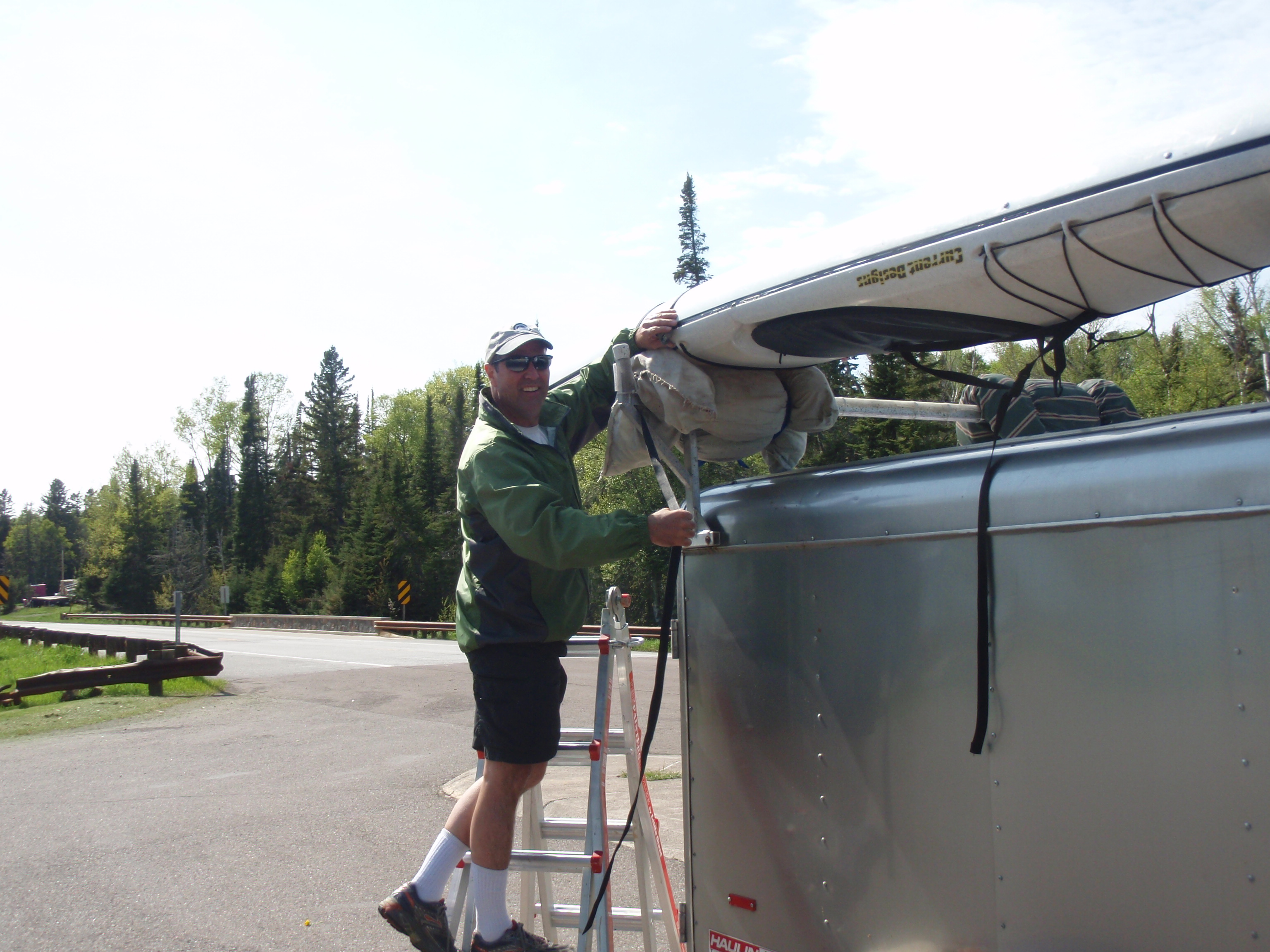
This guy had quite the setup. He had a SUV that was pulling this trailer that had all his gear. I went over to talk with him. This is where I met Steve from Rochester, Minnesota. Rochester is known for the Mayo Clinic, so I asked him if he worked at the Hospital there, and he said yes. Steve looked to be a little younger than me, maybe in his 40s, and he was in pretty good shape. I told him I was doing what I call a Hike and Bike. I biked from the Highway 14 trailhead to here then I’m going to be hiking back. He said that he just did a Kayak and Bike. Kadunce Wayside seemed to be a favorite spot for Sea Kayakers to put in. Perhaps it’s just the right distance from Grand Marais for a day trip.
I took Steve’s Photo, gave him an “I saw Tman” Card, and I was on my way.

I hiked the .7 mile spur trail back to the bridge in a fast time. I had already photographed this section so I didn’t need to stop and take photos. I got to the bridge and headed across. It’s a great bridge, really well built. They won’t have to worry about it for years to come.
The trail follows the Kadunce River for a little ways on the west bank. Then it veers away and starts doing an up and down pattern again going over some little creeks on the down swing. Then the trail goes on the bank of a little bigger creek and I could see a bridge up ahead. The bridge goes to the right across the creek, while there is a path going straight. This is the path to the West Fork of the Kadunce River Campsite. I took the path down to the campsite. It was about 50 yards long until I made it to the usual campsite fire ring area, with 2 x 12 plank seating. This was a good campsite, but there was nothing unusual or overly memorable about the campsite. I head back to the bridge, when I discovered there was something unusual about the bridge.
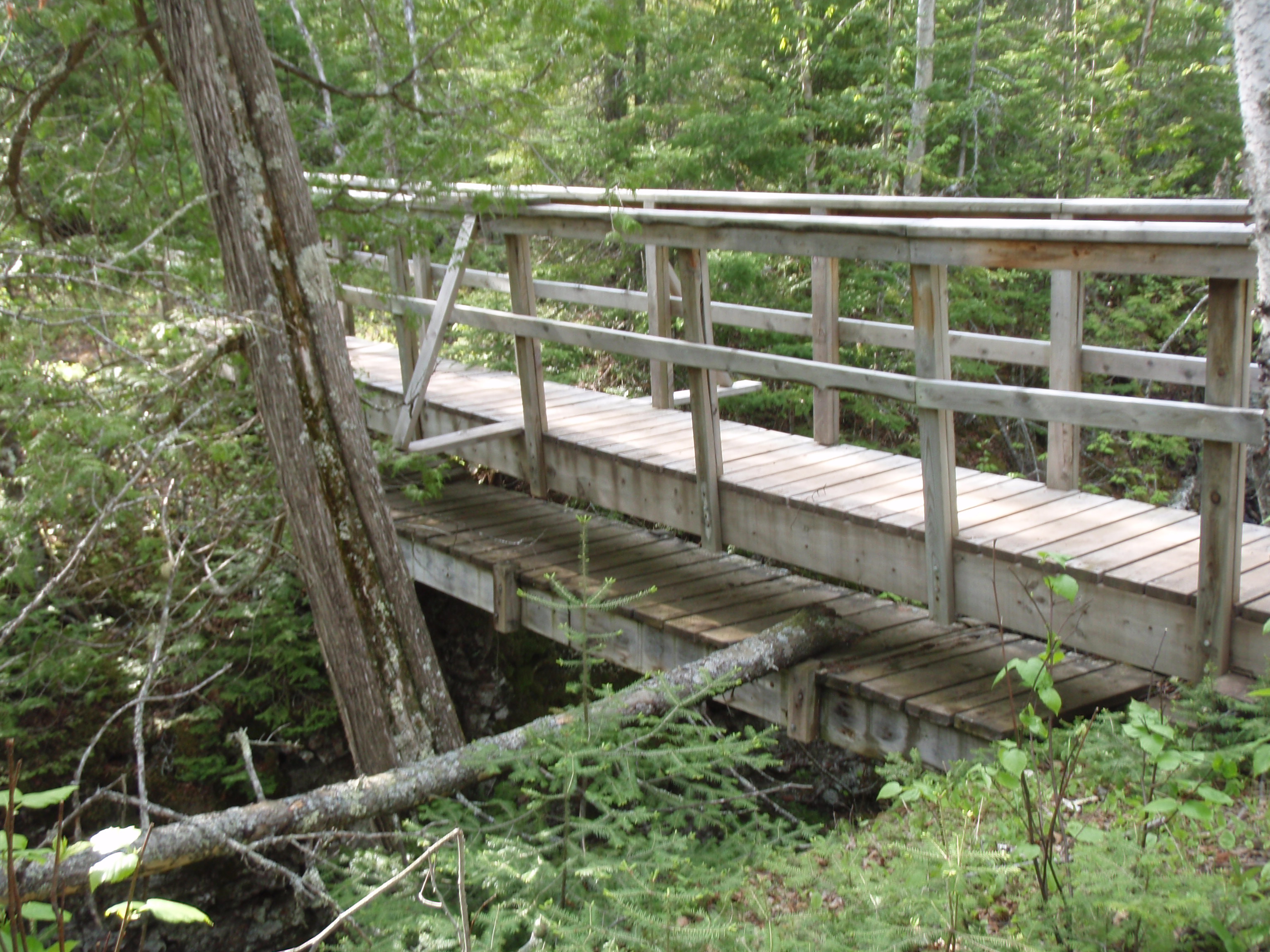
There were actually two bridges. The original bridge was under the current bridge. This looked whimsical to me. It looked like there was a bridge for trolls underneath the regular bridge. I had to take some photos of that. Then the trail continued on a slight up and down pattern, going up a small hill then down to a stream crossing then up a small hill. This time it came to a more substantial creek with a bigger bridge. After that I saw the sign for the Crow Creek Campsite. The campsite trail goes uphill for about 50 yards to the campsite. Again, it was a nice campsite, but nothing out of the ordinary.

All the campsites that I had encountered today were starting to merge together. The only one that I remember as being overly outstanding or different was the South Little Brule River Campsite that had the Tent Pad next to the gorge above a waterfall. That was really cool. All of the other campsites were good campsites. All had nice flat tent pads and a benched seating area for the campfire area. I would not describe any of these campsites as being bad.
I went downhill on the path back to the Superior Hiking Trail. Then I headed west on the SHT and immediately encountered a stairway going up a hill. After finishing the first set of stairs, there was another small set of stairs and then I was on top of it. The trail continued it’s uphill pattern then came down to a rather substantial bridge for going over a creek. Then the trail went uphill again. Who would have guessed?
The trail goes up to an area that looked like it had been blown over. There were a lot more blown over trees here and the forest did not look as dense as over places, mainly because of the blown over trees. You did get some views of Lake Superior, but nothing really expansive. Even though there were lots of tipped over trees here, there were very few downed trees on the trail. Those volunteers have done a great job. The trail keeps going even higher, then goes on a decidedly downhill run. The area becomes a regular forest again, and not a tipped over tree forest. Soon I came upon an Electric Line Right of Way.
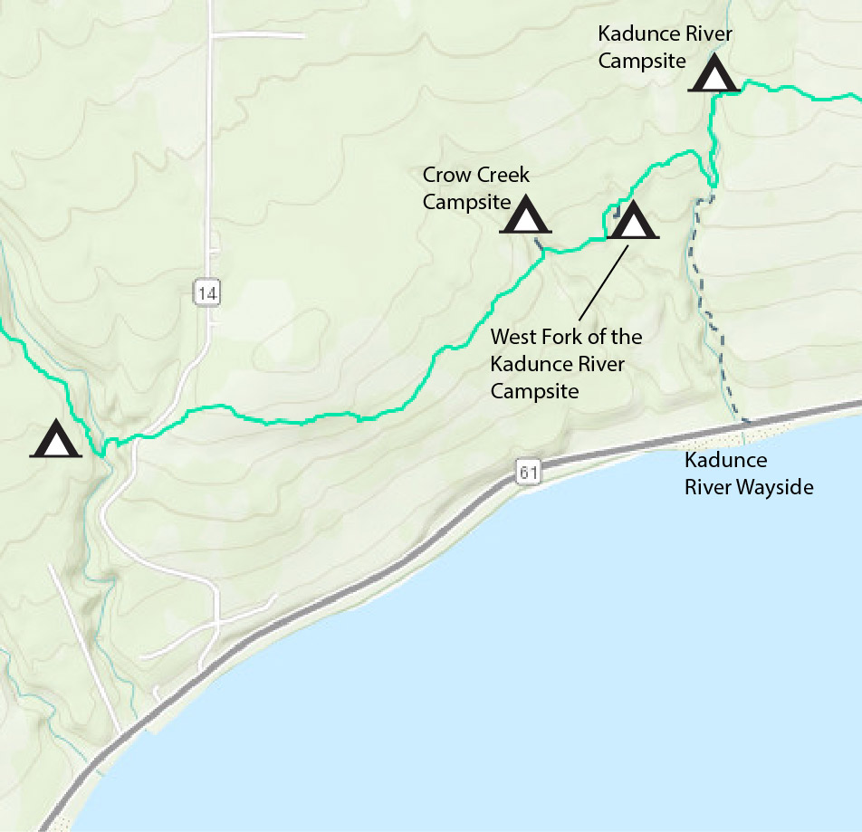 I looked to the left and saw a view of Lake Superior. I looked to the right and saw the electric lines connecting with Highway 14 about an 1/8 mile away. So I headed straight on the SHT and knew I would be getting to Highway 14 soon.
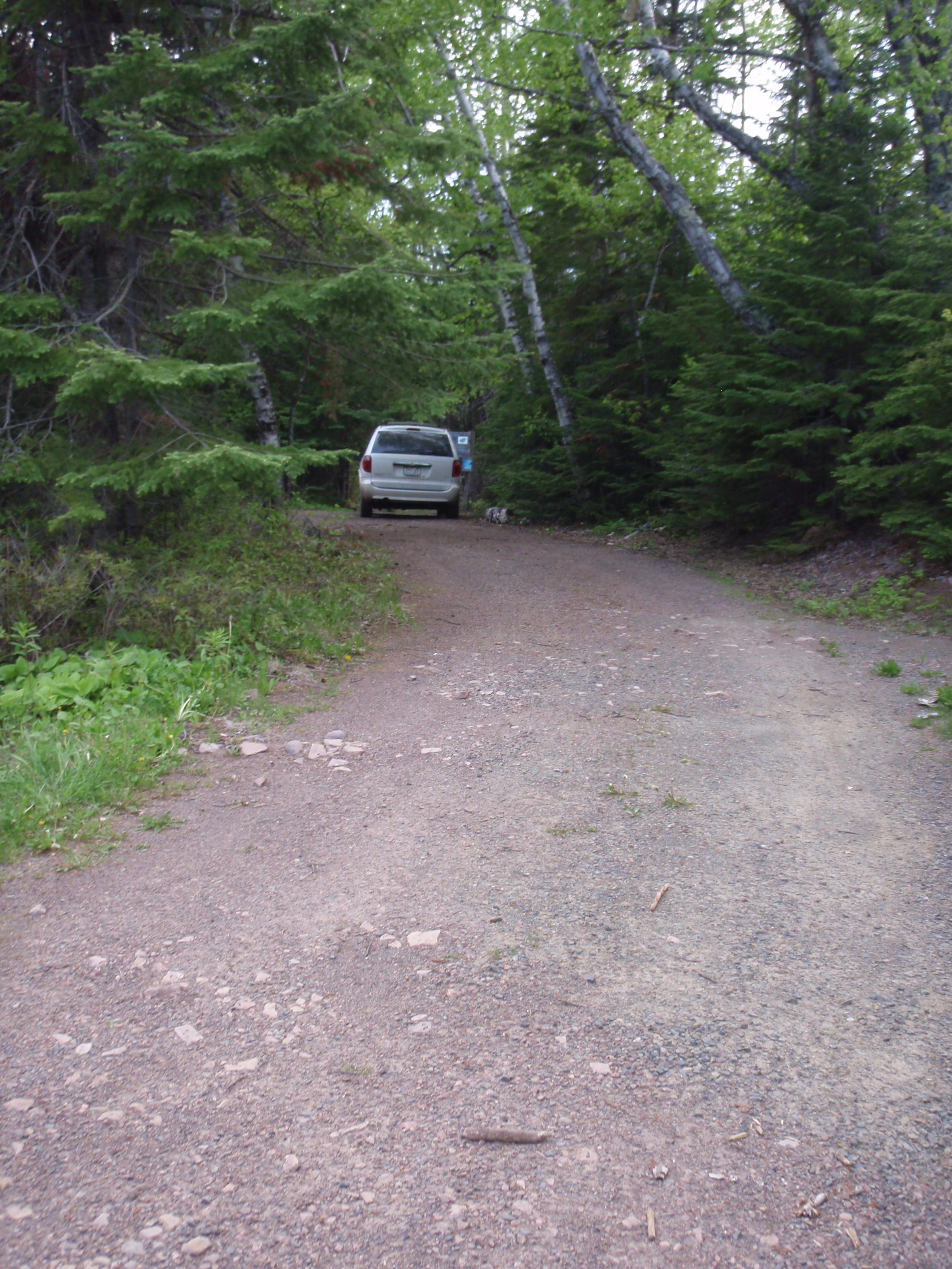
At this point I knew what I would be doing when I got back to the van. I would be heading up to Grand Portage and staying over night at the Casino Hotel. At this point I knew that I would be completing my hike back to Grand Marais on Friday. There was only about 11 miles left to the Pincushion Mountain Trailhead, also known as the Grand Marais, then after that it was a 2 mile walk up to Tower Road where I started my hike in 2009. Surely, I would complete all of that within the next day or two. I know had enough camera card space so there was only one problem, I needed to recharge some camera batteries.
So, why not stay at the Casino, where they have a $49 June Sunday through Thursday deal. They’d probably have a deal at the restaurant, too. Plus, maybe I could do my wash at the Hotel.
Soon, I made it back to the van at the Highway 14 Trailhead. I set out the Spot Messenger to mark my spot, and proceeded to sort out my clothes that needed to be washed. When the Spot Messenger sent it’s message I headed out. It was around 6:30 pm. I was looking forward to sleeping in a real bed. So, I headed up Highway 61 towards Grand Portage. When I got up near Judge Magney State Park I realized that I left my bike back at the Kadunce Wayside. I thought about just leaving it there for the night, since it was locked up, but I headed back and got it. I must have gotten up to the to the Casino around 7:30 pm. I asked the lady at the desk if they still had a room and the $49 special, and she said yes. But I the special was for Casino Players Members only. I wasn’t a member, so she said I had to go over to the Casino and register as a Players Member. I walked down the hallway to the Casino and in the matter of about 10 minutes I came back with my Players Member card and booked the room.
But, as it turns out, they don’t have any washing machines at the hotel. I could go down to the Campground and wash my clothes, but that seemed like too much work. Besides, I still had some clean clothes packed away, and I would be home in a couple days, so I decided to skip washing clothes.
If it were convenient, I would have washed my clothes.
So, I went up to my room and found the Camera Battery Charger and started charging up a battery. I immediately took a shower and put on some clean clothes. It was after 8 pm, and I knew the restaurant closes at 9 pm, so I couldn’t take my time. I headed down to the restaurant, and was seated. I asked the waiter what the special was, and he said it was Prime Rib for $9.99, but I needed a coupon from the Casino. I said I would be right back and I walked down the hall to the Casino, and went back to customer service. I gave them my Player’s Club card and they printed me out a coupon for the Prime Rib. I headed back to the Restaurant and ordered the Prime Rib. It was a really good meal.
After the meal, I headed up to my room and changed into my swimming trunks. I headed down to the pool area, hoping they would have a whirlpool. But they didn’t have a whirlpool, which was a little bit of a disappointment. The water in the regular pool was pretty warm, but I decided to go into the sauna instead. There was a man in the sauna and we started talking. He works for an Air Conditioning Company in Duluth that every year spends a week working on the Air Conditioners on the Reservation. He said they stayed at the Casino Hotel during the week and they should be finished within the next two days. I told him I was out hiking the Superior Hiking Trail for several days and was taking a well-deserved break. Well, it was getting too hot for me, so I decided to leave. And as I was leaving the guy said I had a bullet rash on my back, and I should get it looked at. Wow, the only time when I found a tick on me was when I hiked the Old Border Route in my blue jeans. Otherwise, I had always worn my hiking clothes that had Peretherian on them, and that seemed to repel everything. The guy said that he had Lyme Disease and it’s no fun, but if I got antibiotics right away, it would kill it. I thanked the man for spotting it. I went back to my room, looked in the mirror and sure enough, I did have a bullseye rash. It was right in the middle of my back, where it would have been hard for me to see on my own. I would have to call my doctor the next day when I got into cell phone range. Boy, I was lucky that I decided to stay at the hotel tonight.
All the little up and downs of the day had caught up to me. I was out like a light.
Friday, June 3, 2011
Hwy 14 to the Pincushion Mountain Trailhead
Boy that felt good sleeping in a real bed. On Thursday night I had eaten at the Casino Restaurant at about 8:15 to 8:45 pm, I went to the Swimming Pool area at around 9:00 to 9:30 pm. I came back to the room and just crashed. So, I was definitely sleeping by 10:00 pm, which is pretty early for me because I work second shift. I woke up sometime in the middle of the night to go to the bathroom and change batteries in the camera charger. I woke up at around 6:30 am, put the TV on the Weather Channel and started to get my stuff together. I looked like there was going to be rain today, nothing too heavy, but still rain. I packed up and went down stairs to get a hotel cart to haul my stuff on. I was out of the hotel by 7 am.
It was raining lightly in Grand Portage, and I could here thunder up in the hills. Maybe I was in for a major rainy day. We will see what happens. I went to the Gas Station/Convenient Store that is up from the Casino. I was looking for my usual egg muffin-like sandwich that I always got at the Grand Marais Holiday Station. But they didn’t have anything like that. So I got a donut and a hot chocolate, and hit the road.
As I left Grand Portage, all of a sudden I had plenty of questions and feelings about Grand Portage. I guess my main question was, would I ever come back here? Now that I would be completing the Superior Hiking Trail to Grand Marais, there would really be no reason for me to come up this far on the Arrowhead. Of course, there are a few trails and a few sights that I had not seen in the area. I had not hiked out to see the waterfalls at Grand Portage State Park. I had not done the Mt Josephine or Mt Maud Trails. If I ever worked on a Border Route Trail Crew again, especially if it is a Trail Crew that departs from the Arrowhead Trail, I could always take the side trip up to Grand Portage. Or Maybe I would decide to take a backpacking trip on Isle Royale and come up to Grand Portage to take the Ferry. But none of that stuff is in my immediate plans.
My other question was about the Grand Portage National Monument Trail. Was that a gigantic waste of my time? The main reason I hiked it was to find out whether the section of Old Border Route from Partridge Falls to Rengo Road is a viable route. Nobody seemed to know what the condition of that section was. I decided I would go out and check it out for myself, and that’s what I did. And I did find out that it is not a viable route. I guess I did my little service project for the hiking world. But shouldn’t have the Border Route Trail Association kept better tabs on that section? After all, they did publish that route in their latest guidebook from 2007. But the BRTA has its hands full maintaining one of the toughest wilderness trail sections anywhere. So, I can’t blame them too much. I did see the spectacular Partridge Falls, and I did see a moose at a nearby impoundment pond, so I guess my Grand Portage National Monument Trail hike was worthwhile. But it just didn’t feel like it. And while I was in Grand Portage I did learn about the interesting history of the area at the National Monument Heritage Center and Depot. Plus I hiked the beautiful Mt Rose Trail.
Over the last couple of years I’ve felt my mission or calling is to hike and photograph parts of the North Country Trail. Going on the Grand Portage National Monument Trail took me away from that. There are still plenty of places on the NCT that could use a little extra publicity from me hiking it. There are plenty of underused sections of the “Big Trail.”
I headed down highway 61 away from Grand Portage. I had a fairly simple strategy for today’s hike. It was “just hike it, and worry about the ride back later.” I really didn’t think this section was all that easy for a “hike and bike.” So, I was just going to hike the trail, and see what happens. I could always call Harriet Quarles to come pick me up and shuttle me back. I made it up to the Highway 14 trailhead, and set out the Spot Messenger. I got my gear ready and around 7:45 am, after the Spot Messenger sent its message, I headed west on the SHT.
 From the trailhead going west, the trail just plummets. You go down a series of steps, then you hike on the trail, which is dug into the hill, then you hit another series of steps. This zigzags around in switchback fashion and you see more steps farther down the hill. Finally, you see a bridge at the bottom and you’re done going down. Hurrah, I thought. I was glad I was coming down those stairs instead of going up.

The bridge goes across the river to the right. But there is a path leading straight that goes to the Kimball Creek campsite, so I took the short walk up there. The campsite has something I had not seen yet at a SHT Campsite. It has a metal grill that’s on a pole. It looks like it may have been made from a 55 gallon drum. At any rate, the rest of the campsite was the standard affair for a SHT campsite. The tent pads looked a little barren, but it is in a regular woods where it doesn’t get much sunlight for growing grass. Still it is a very nice campsite, with the regular 2 x 12 plank benches for sitting around the campfire. And the water trail is an easy walk over to Kimball Creek. The campsite overlooks the creek.
I headed back to the bridge and headed across. The bridge is a fairly substantial bridge, not just a plank affair. After the bridge you come to a sign that says the Kimball Creek Trail. Evidently this is a fisherman’s trail that goes up and down the creek. The creek looked pretty shallow for fish, but maybe there are pools at places where fish can live. It must be, because there are fishermen that must come out and use the trail, therefore it exists.

After the bridge, the SHT turns to the left and gently goes uphill. Then all the gentleness is over with, because there is a full-scale staircase heading up a hill. This staircase was just as bad as the stairs I had came down just a few minutes ago. At the time I thought I was lucky going down the stairs. Now my luck had run out.
I get to the top of the stairs and the trail starts going in a gentler uphill pattern. Right at the top of the stairs would be a good place for a bench. But I didn’t find a bench, I found something a little less comforting. As I’m walking in the gentle uphill pattern through the mature woods, I find a sign. Remember that I am pretty much winded, and worn down at this point. The sign reads “Cascade River, 24.8 MI, Lutsen Ski Hill, 59.2 MI.” I’m lucky if I’m gonna make it another 100 feet down the trail, and their worried about stuff that is 24 and 52 miles away. This sign HAS TO BE somebody’s idea of a joke. I feel like coming back and putting up another sign that reads ‘Grand Marais ER, 11.1 MI.” Unfortunately, that would not be a joke because I’m reminded of Peter who I met earlier in the week. He went to the ER after hiking Otter Lake Road to Grand Marais, and the doctor told him to stop hiking his foot was so bad. I hope he’s doing all right.
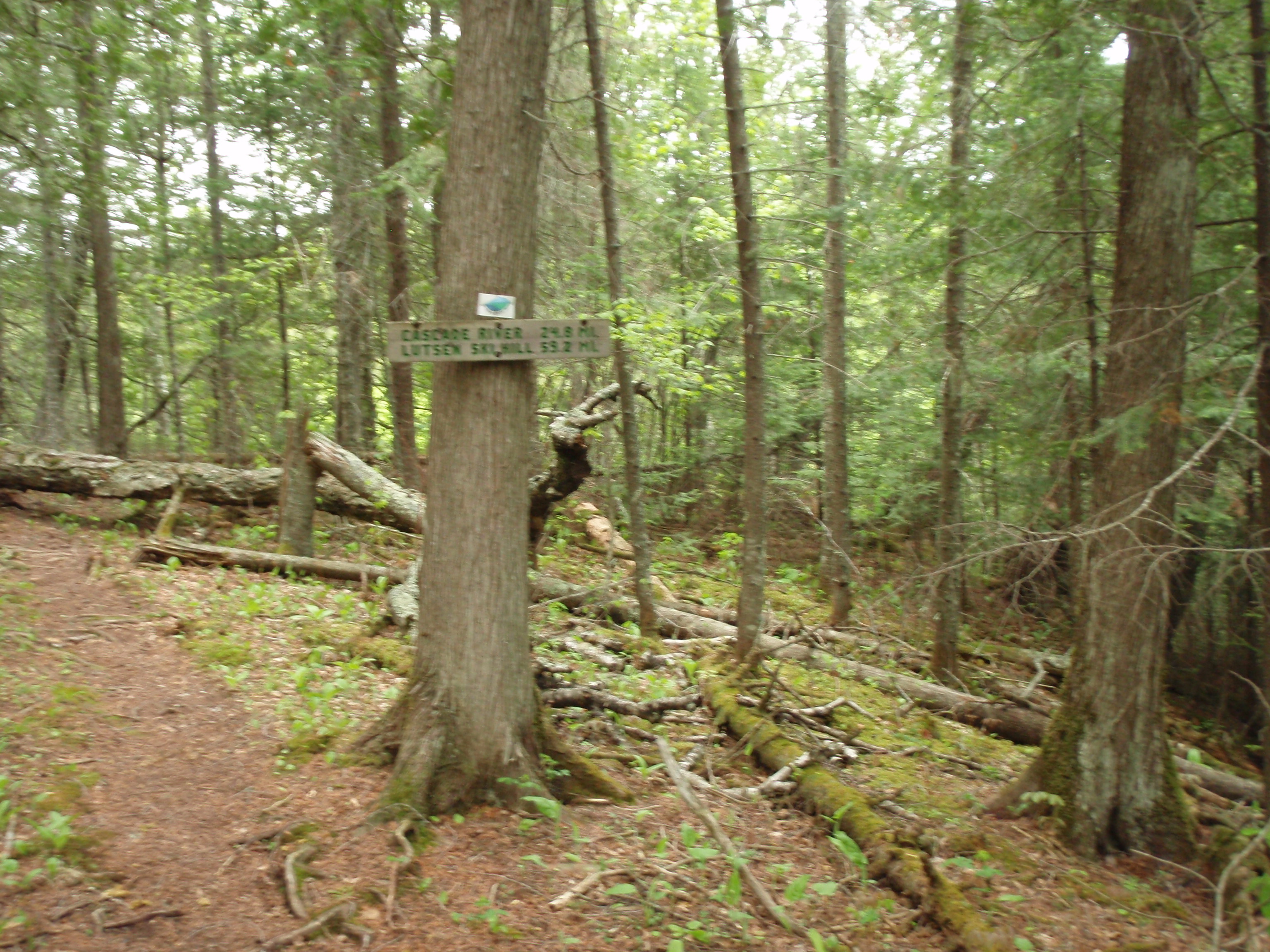
Then the trail is fairly flat for a ways. At one point you’re hiking on the edge of a slope, with a deep, dark woods going down to the right of the trail. Then the trail goes on another uphill tear, this time it’s not quite steep enough to have stairs. It starts looking like you’re getting on top of something and you are. I made it to the Scrub Oak Overlook, and saw lots of pine trees. I guess there were a few scrub oak but they are not the dominating feature of this overlook. It’s actually a quite nice overlook, given the scrubby name. The trail goes into a fairly large grassy field with scattered pines and scrub oak. Perhaps this was a homestead at one time, because it’s cleared. But there is an excellent view of Lake Superior and the land leading down to Lake Superior. I tried looking for the town of Grand Marais off in the distance but could not see it from this vantage point. Grand Marais has a little peninsula called Artist’s Point sticking out into Lake Superior, so it is very recognizable. I figured if I could see Grand Marais, then I was making some progress. But I didn’t see it.
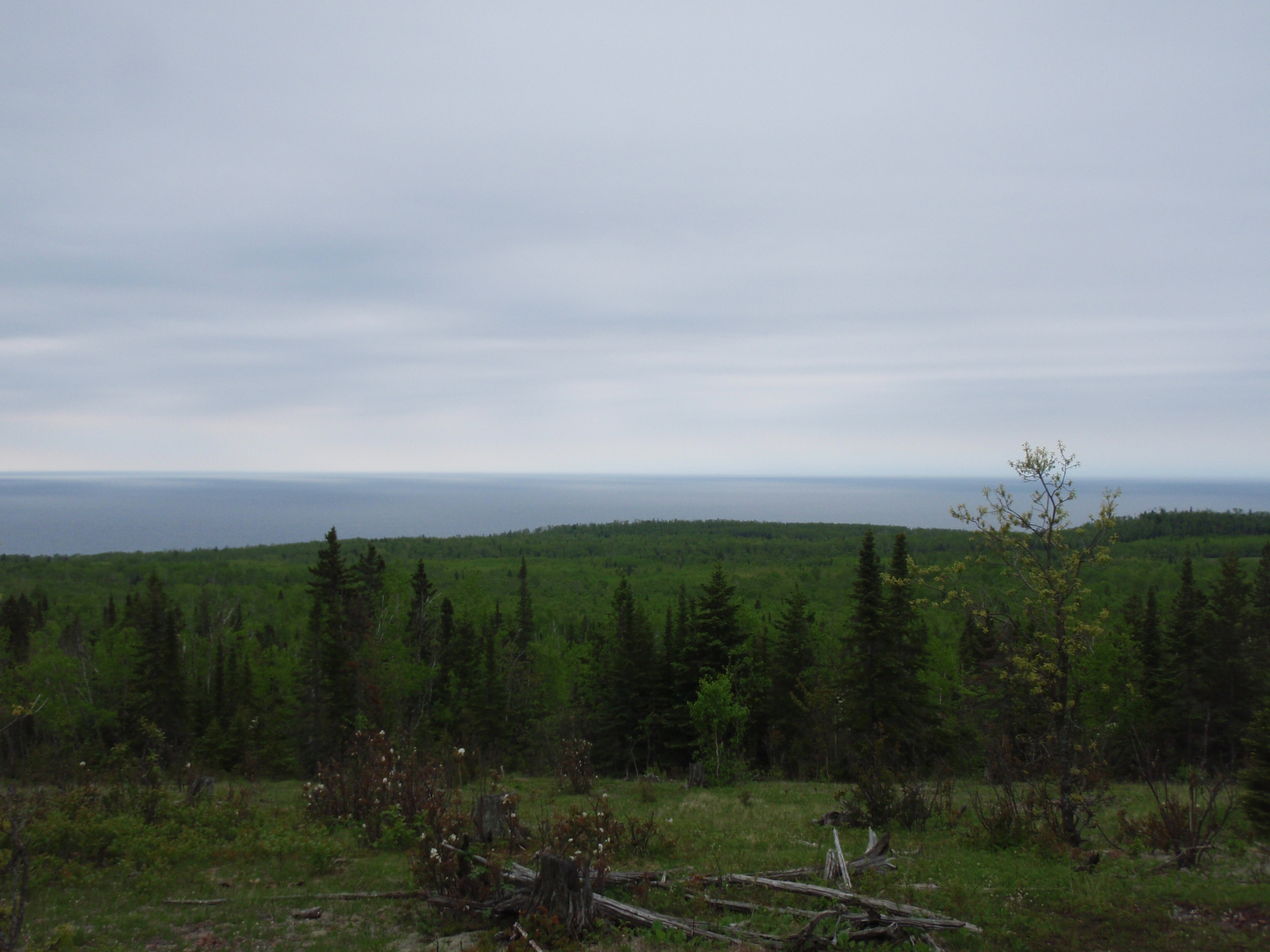
After the Scrub Oak Overlook, the trail goes in a generally downhill pattern for quite some time. Eventually you get to a small creek with a plank going over it. Then you go gradually uphill and downhill to another plank creek crossing. Then you go gradually uphill and downhill to another creek crossing. But this creek is a bigger creek requiring a bridge with railings. I had made it to Cliff Creek. Cliff Creek is your normal rocky, rapidy creek that’s typical of this area. After the creek, the trail goes up a stairs for about 20 steps. When I say stairs, it’s always wooden 4 x 4s that are built into the ground. It’s more of an erosion control system that makes it easier to walk uphill. At the top of the stairs there is a sign for the Cliff Creek Campsite, so I headed down the path to the left.
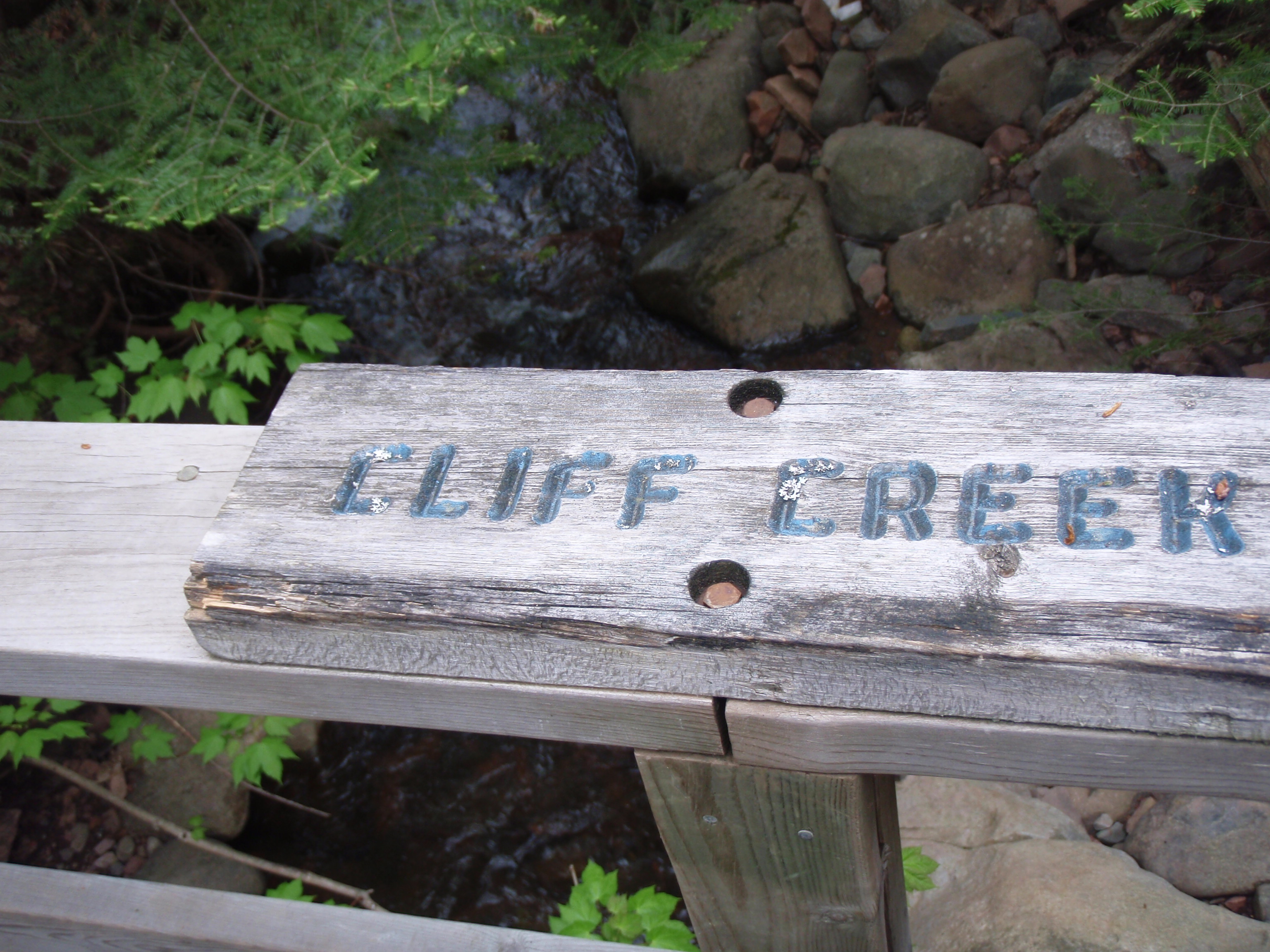
The campsite is situated on top of a small hill overlooking the creek. The water path really isn’t that steep getting down to the creek. The campsite has all the usual stuff, plus about 6 or 7 tent pads. This is a Multi-Group site, which means it has more tent pads than a regular site. The tent pads are fairly grassy but not overwhelmingly so. The campsite seems like it does get some sunlight, even though it’s in a regular woods.
I continued on the SHT and it continues to go gradually uphill then downhill to a plank creek crossing, then uphill and downhill again to another plank creek crossing. It does this 7 or 8 times, crossing a two-track forest road at one point. Then you go on a downhill tear and get to a more substantial A Frame Bridge crossing a more substantial creek. I had made it to Durfee’s Creek.
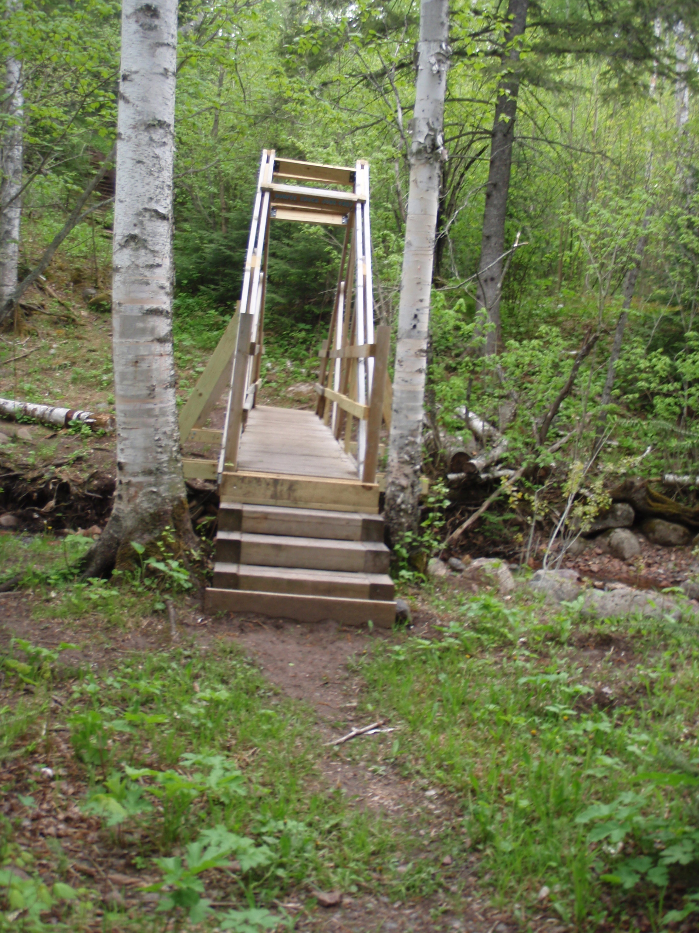
I looks like a fairly new bridge. There’s a sign on it that reads “Durfee’s Creek June 2007,” so it is fairly new. After crossing the creek, there looked to be a faint trail headed along the bank of the creek. That must be one of those fisherman trails. But also after the bridge, the trail goes up a short series of stairs built into the hill, and at the top of the stairs, there is a sign for the Durfee’s Creek Multigroup Campsite. I was experiencing Déjà vu, because this set up was the same as the Cliff Creek Campsite. You go down the trail, and the campsite is on a little hill overlooking the creek. There are about 6 or 7 somewhat grassy tent pads, and the usual 2 x12 plank seating for the campfire area. This campsite wasn’t quite as flat as the Cliff Creek Campsite, it seems to slope towards the creek. Maybe the reason the Cliff Creek Campsite is so flat is that there is some sort of cliff there. But I didn’t see any.
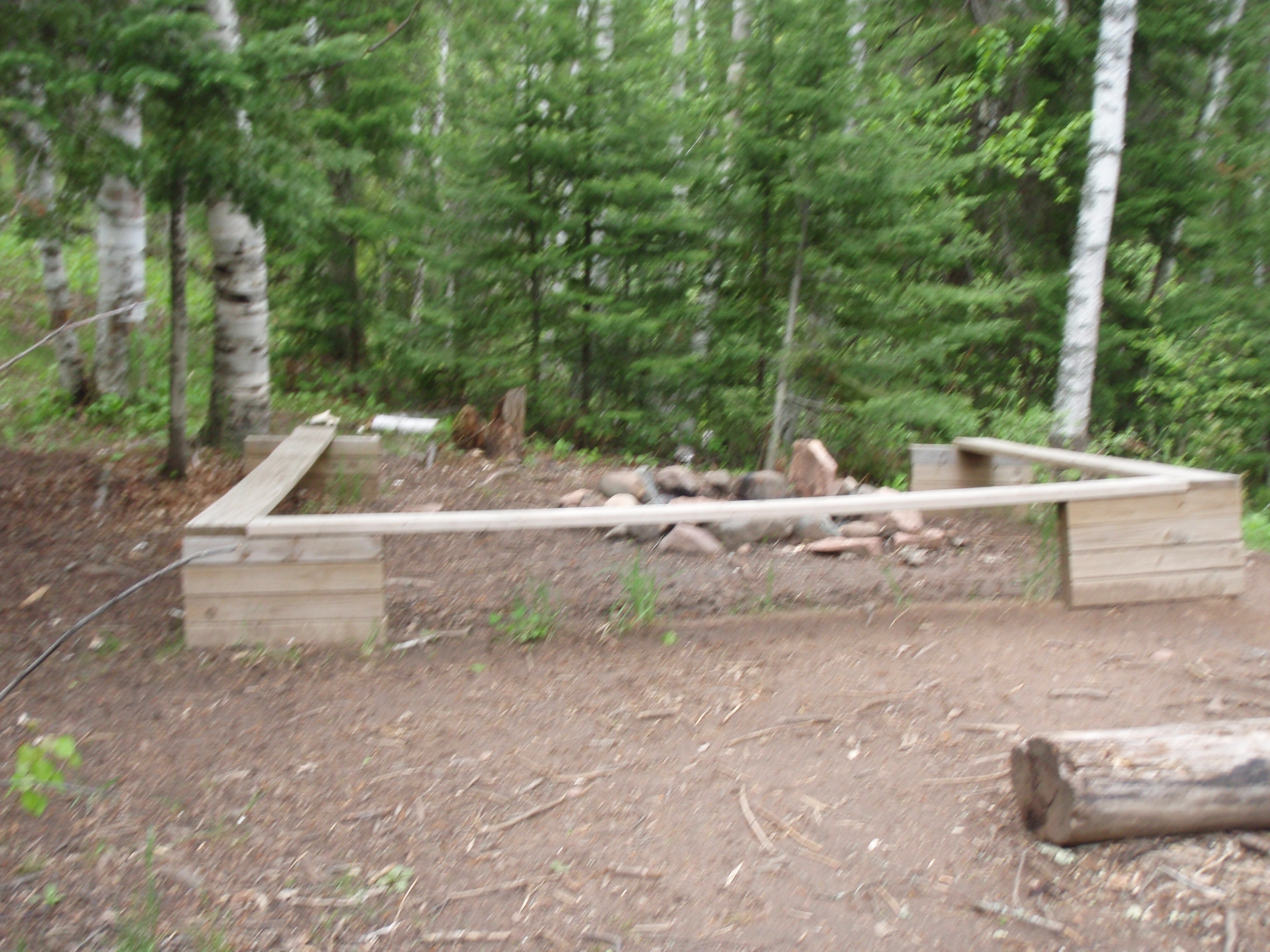
The trail goes on a couple more gradual up and downs to small creeks, then it goes on a decidedly uphill stretch, but not too bad. Then you come to a big clearing and there is a tremendous view. The first thing I noticed was five mile rock out in Lake Superior straight down from the overlook. I looked to the southwest along the shoreline to see if I could see Grand Marais, but I couldn’t. It appears that Pincushion Mountain is in the way. But I could see Maple Hill, also known as the Sawtooth Bluff off to the west. I can tell it was Maple Hill because it had radio towers on top of it. That was comforting because I am finishing my hike at Tower Road on top of that hill. So I could see the finish line now, so that was a little bit encouraging. The Superior Hiking Trail Guidebook really doesn’t have a name for the overlook I was at. But I do believe I’ve seen it referenced as Wildflower Hill on a map that I have. That’s kind of funny because this is a much better overlook than the Blueberry Overlook and the Scrub Oak Overlook which both have names in the SHT Guidebook. In fact, both Blueberry and Scrub Oak have arrowhead reference points on the SHT Guidebook Maps, where this overlook is just mentioned in the text. At any rate, this is a very good overlook, and I took several photos here including some self-shots.
After the overlook, the trail goes on a gradual downhill run. Apparently, we are done with the small ups and downs to creeks. Then the trail goes on the side of a hill, which makes you feel like you are gorge walking again, but it’s not quite cliff-like enough to be a gorge. Eventually, you get to the point where you can see Wood’s Creek down below the trail, so it does get to feel more like a gorge walk. I would more accurately call it a hillside creek walk. So, I’m going on the side of the hill, and the trail goes closer to the creek then farther away. There are some short uphill stairs and short downhill stairs. This keeps going for over a half a mile.
Then, I made it to the Wood’s Creek Campsite. This campsite is located in the deep dark woods right next to the creek. In fact, it looks if there was some sort of flash flood, you’d be in trouble. But if it’s raining that bad, you shouldn’t be there. At any rate, it’s a cool creeky campsite. The tent pads look a little barren because it doesn’t get much sunlight to grow grass in the deep dark woods.

The campsite is about a half mile from County Highway 58. So, it might be a good site to hike into if you are arriving late on a Friday night, and want to get to a campsite in short order. I continued west on the SHT and the trail starts looking like more of a gorge hike instead of a hillside creek walk. Now there are more cliff-like sides along the shoreline of the creek. And it’s a really nice little creek, with little waterfalls and rapids. In some places the trail goes right next to the creek. Soon, I saw a big white cement culvert ahead, and I knew I was coming up to Highway 58. I took a short uphill climb and hit the road.
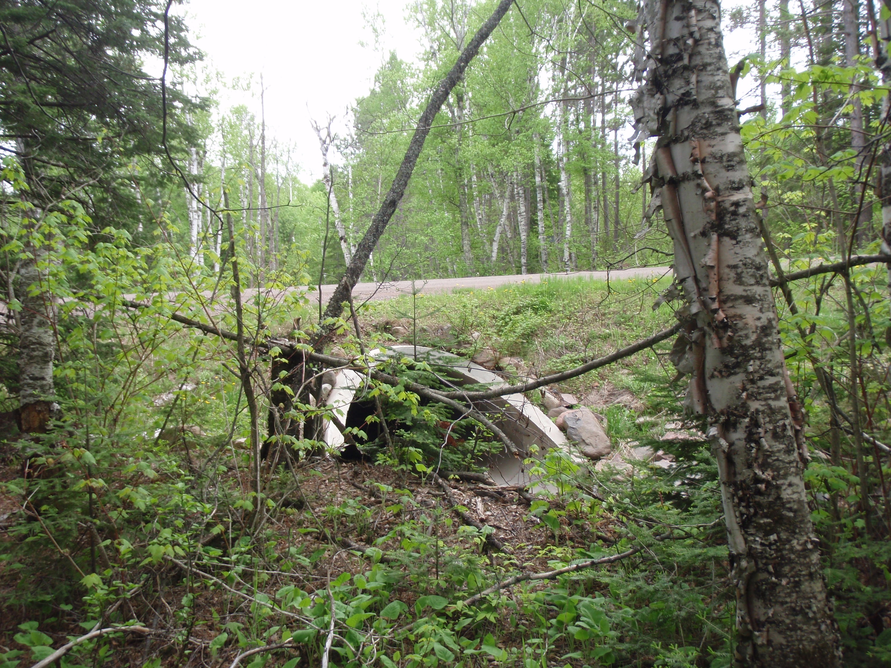
Highway 58 looks like a really nice gravel road. Once you get there, you kind of hike kiddy corner and start up on the trail again. Before Highway 58, the trail is on the left side of the Wood’s Creek. Now after 58 the trail is on the right side of the creek. Also on that side of the road is a really nice Trailhead. There’s a nice big parking lot, with enough room for about 10 cars. You can tell this area is a little more popular that the Highway 14 trail head. After all, this is the gateway to the Devil’s Track River Gorge.
The trail goes parallel to Wood’s Creek for a little ways, except the trail is up a small hill from it. Then the trail veers away from the creek and starts going through some tall pines. It goes across a small bridge then a boardwalk, then starts going gradually uphill. Pretty soon you’re hiking next to a gorge, and it isn’t a gorge for Wood’s Creek, it’s the full-fledged Devil’s Track River Gorge. And this is a magnificent gorge, with a sharp cliff and the river is at least about 50 yards below.

There is one spot with an excellent view of the gorge. At first, that didn’t quite seem possible, at first I was walking not that far up from a creek and now I’m hiking next to a cliff with the river way down below.

Then the trail went down to a fairly substantial bridge with railings over a small creek. This creek was going down a sheet of rock, and it was going down fast. Part of the footings for the bridge was built using a criss-cross log cabin style method. That was the first time I had seen something like that. After the bridge, the trail takes a left and goes sharply uphill. At first there are no steps, but then you see to rather long series of steps up the hill. Oh, my God. I’d say there was about 35 steps total, here. Once I got on top of that, the trail went fairly flat for a short ways, then there was another set of stairs. Again, after that it was flat for a good distance. I seemed like I was walking right next to the gorge, but there were not any really good views for a ways, then you get to some. Here you can see the red cliffs on both sides of the canyon and Lake Superior on the horizon. Yes, it definitely started looking more like a canyon than a gorge. Then you descent a steep series of steps until you get to a spot were you can see the river way down below you, and I mean way down there. From there the trail goes up, using mainly tree roots as steps. It seems a little treacherous, but a this point the trail is not right next to the rim.
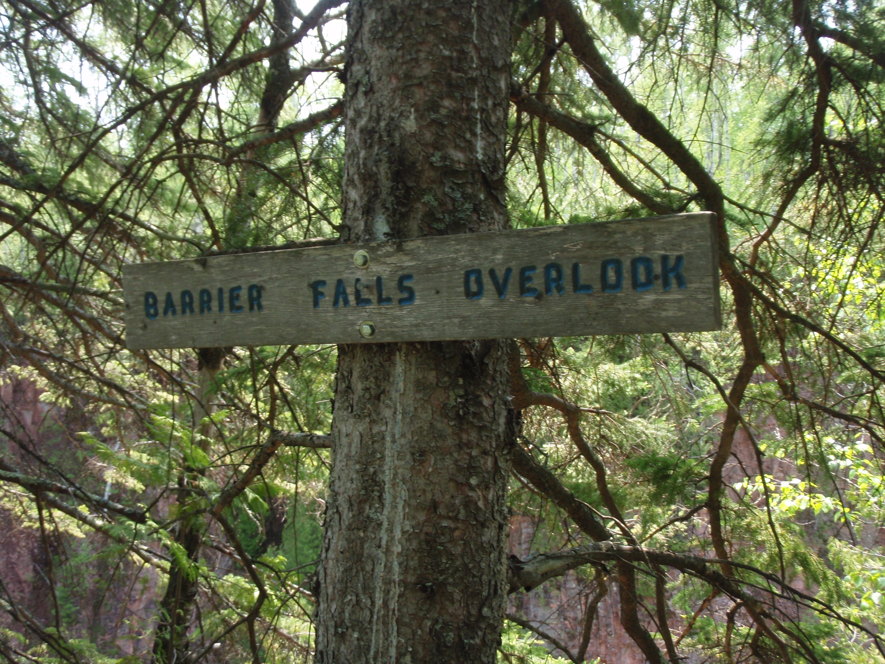
But it takes you there, and there’s a sign that says “Barrier Falls Overlook.” Unfortunately, there was too much foliage in the way for me to see the falls way down in the canyon. At one spot, there seemed to be a trail going down the steep hill from the SHT. I’m not sure if that was a fisherman’s trail or a trail to go look at the falls. But I wasn’t going down there, it was too steep to get back up.
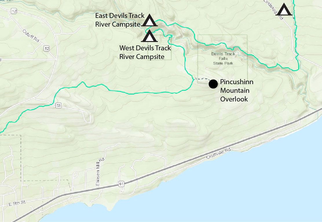
After the Barrier Fall Non Overlook, the SHT goes down on a series of steps, then goes up about twice as far as it came down. That was a pain in the butt. Then, it’s fairly flat until you go down to cross a creek on a sturdy bridge that had a handrail on one side of the bridge. After that, there is another long tedious series of step, going up in a more gradual fashion, but still going up. The trail then continues go up, but now it was a steady upward haul that didn’t need steps. You’re still going up for quite some time and then you hit another one rail creek bridge. But this time, instead of going down to hit the creek, you are still going up. And you’re still going up after the bridge, you keep going and going. Every once in a while you get a glimpse of the canyon to your left, but there wasn’t anything that was a super overlook. Eventually, you get to one last short but steeper uphill stretch and when your on top of it you see a bench off to your right. Then I saw a sign attached to a tree that said “Spruce Knob.” I was on top of it. But I was spent.
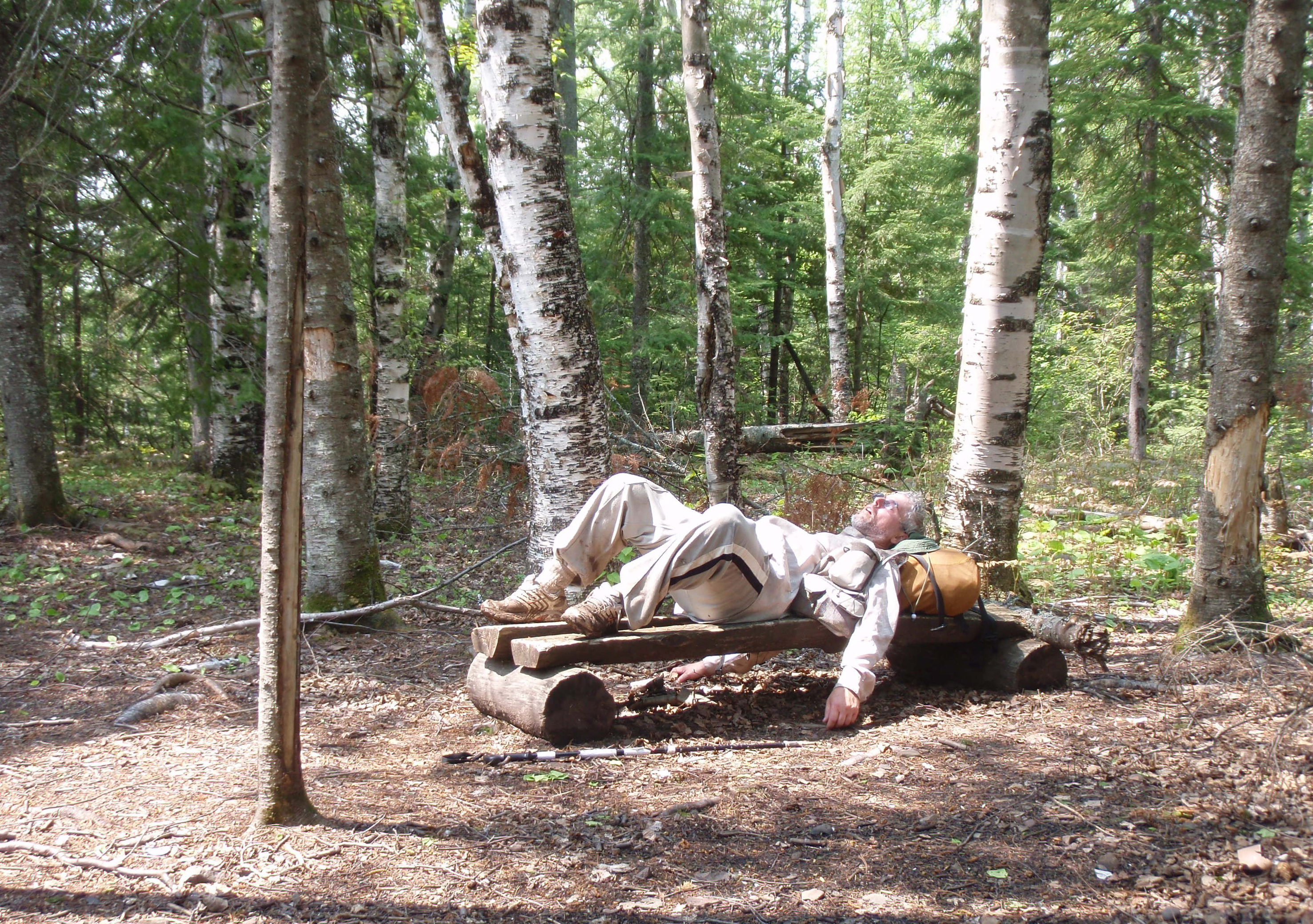
I used the bench as a bed for a while. On the way up to Spruce Knob, I had paused several times to catch my breath. On one of those times I called my doctor’s office and told the nurse about the target rash on my back. Now she called me back saying the doctor had approved an antibiotic for me. I told her I would be home sometime the next evening, then I would pick it up at my normal pharmacy on Sunday Morning. She seemed to be okay with that.
After resting, I took a self-shot of me lying on the bench. This Devil Track segment was kicking my ass. But it was a beautiful afternoon, after expecting much worse earlier in the morning. At least I wasn’t hiking up this Devil Track tract when it was raining. Thank God for that.
After Spruce Knob the SHT goes on a steep downhill tear, using several series of steps. It keeps going, down, down and more down. I could hear the river getting closer and closer. Then all of a sudden I see the sign for the East Devil Track River Campsite. I got a little confused here and started going down the SHT instead of the Campsite Trail. But, I came back and found the campsite. This campsite is very small and very close to the river. The river is coming down at a pretty good rate here. You can see it curve around the campsite. The river curves from the right up above the campsite and curves to the left down below the campsite. And this river must drop 20 feet in that distance. It’s a total fast moving and rapidy river.

The East Devil Track River Campsite is a really small campsite, with only two tent pads. And one of those tent pads is more suited to a small tent. There is a very small campfire area with a smaller bench around it. Both tent pads are barren, but the campsite does seem like gets a fair amount of sun light. I think the soil here is too rocky to grow grass. Plus this campsite looks a though it gets a lot of use.
I headed down for real the SHT that I had mistaken for the campsite trail. Within about 75 yard I came to a big A Frame bridge over what now was becoming the Devil Track River gorge. This is an elaborate bridge that must have been fun to build. Just hauling in the wood for it must have been a real chore. Once you’re on the bridge, it’s a real good spot to take photos of the river below. And that’s exactly what I did. I could see a small waterfall about 50 yards downriver from the bridge. It was really becoming a gorge down that way, with 15 to 20 feet high cliffs on each side of the river. Also, on the bridge I could see the West Devil Track River Campsite. It was at the far end of the bridge on a little butte like rise. So, I went across the bridge and walked up on some rocks to the campsite. This is a really nice and really big campsite. Unlike the other Devil Track Campsite, this one seemed like it had a lot of space. There were some really huge tent pads and the campfire are had some more room to pitch tents around it. And surprisingly, everything was nice and flat. I thought this area was an anomaly in an area where everything was sloping down with the fast falling river.

Near the bridge is a wooden box with a log book in it. I wrote the following in it. “It’s a really beautiful day but this Devil Track is kicking my butt.” I rested at this campsite, and called Harriet Quarles. I was about 2 pm now, and I told her that I would be at the Pincushion Mountain Trailhead in a couple hours and I needed a ride back to the Highway 14 Trailhead. She said she was still down in Miami, but she would get someone lined up to pick me up. She said she was driving back up to Grand Marais starting the next day.
Harriet Quarles life is kind of an oddity. She goes down to Miami in December and shuttles people to the Cruise Ships for several months, then during the summer, she shuttles people in the Grand Marais Area. So you could have the same person shuttle you to the ship in February that shuttles you to the Trailhead in August.
I continued on as the trail follows the river in downward pattern. Soon I got to a spot where I could walk out and see a close up of the waterfall that I saw on the bridge. And that was really a cool spot with cliff walls on each side of the gorge. The river is really narrow in this section, and that’s probably why they built the bridge where they did. I took a self shot photo of me in front of the waterfall.
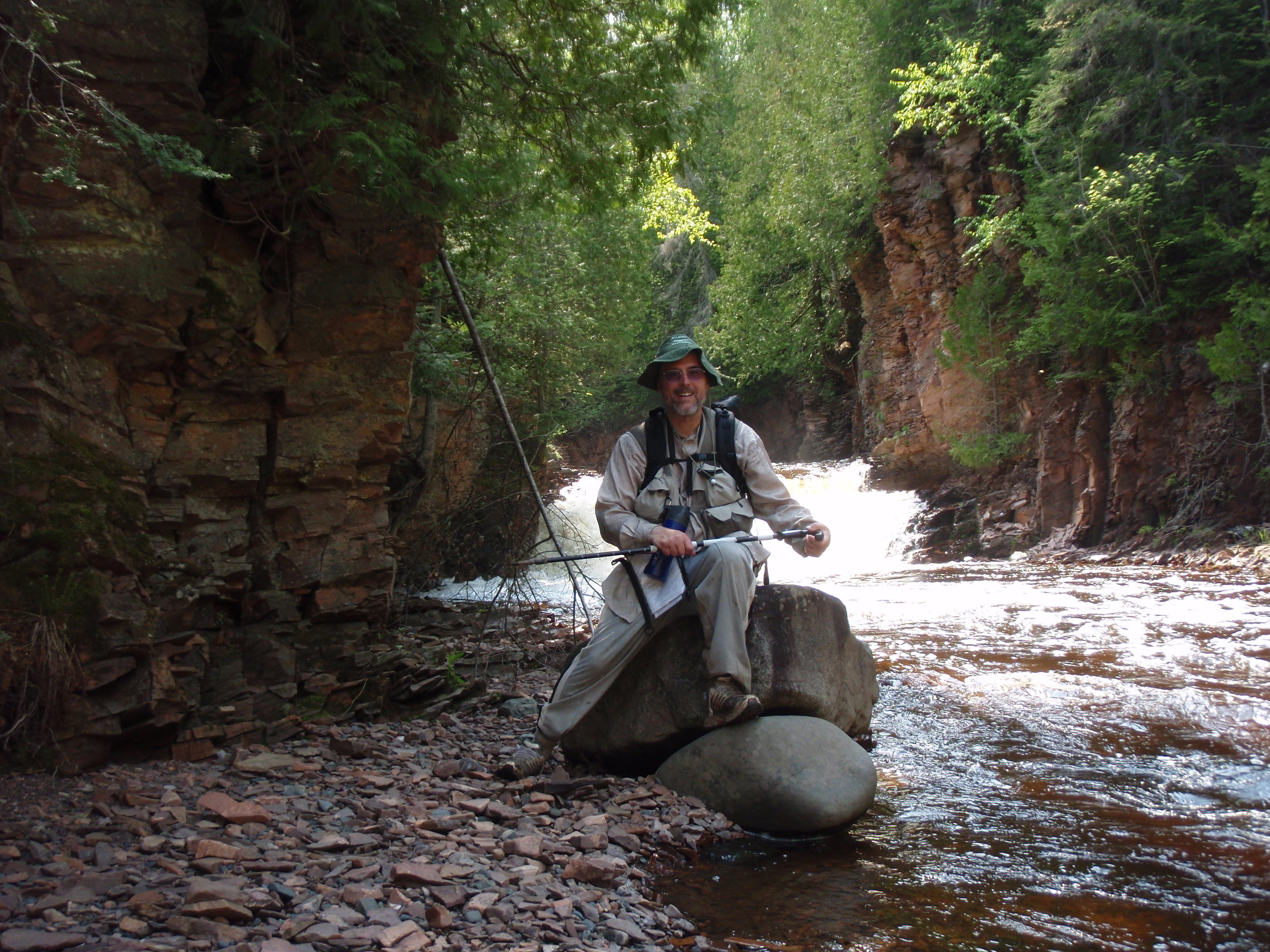
The trail continues along the river for a short ways, then there is a short set of stairs where the trail starts moving away from the river. Those two Devil Track River Campsites were really cool. It would be good to camp there just to explore the river for a day or two. As the trail moves away from the river, you get to another little set of stairs at a curve in the trail. I thought it was a little set of stairs, but when I got there I found a long steep staircase, which was hidden from view initially because of the curve in the trail. This is not what I needed. I started up the staircase and it keeps going and going. Boy, it must have been fun to bring in the wood for that bridge. Then the staircase stops shortly so you can walk up over some tree root, then it starts up again. Finally I made it to the top, where there’s a well placed bench.

At that point I checked the phone and saw that I had gotten a message. It was from Dave, one of Harriet Quarles associates, so I called him back. He told me that when I got to the Pincushion Mountain Trailhead to call him, and he would drive up to pick me up, I said I thought it would be at least an hour before I got there. I headed out, and I was easy walking up there, that’s a change. It didn’t take very long and I arrived at a junction of a ski trail. There’s an SHT wooden sign there pointing to the left and it said “Pincushion Mtn – .5 MI, Parking Lot – 1.7 MI.” Now I was making some real progress.
And it continued to be easy walking on the ski trail. It didn’t take very long and I was at the Junction of the Pincushion Mountain Spur Trail. I started hiking that trail. You get to a spot where there is a big rock face that you have to walk up and over. They have rectangular blazes painted on the rocks to guide your way. Then you come to a tremendous Overlook looking towards the north into the mainland area. Continuing on for another few hundred yards you get to the east end of the mountain where there is another tremendous overlook. The best shot here is looking north east, but at this point you can see Grand Marais down to the South west. I’d say that this overlook was at least a 250 degree overlook. This is well worth the effort getting out to the overlook. And it wasn’t very bad of a hike. Definitely easier than the staircase I just walked up from the Devil Track River. I was a happy camper now. A tired out camper, but happy. And it continued to be an absolutely gorgeous day. Evidently it was a gorgeous day for hiking gorges.
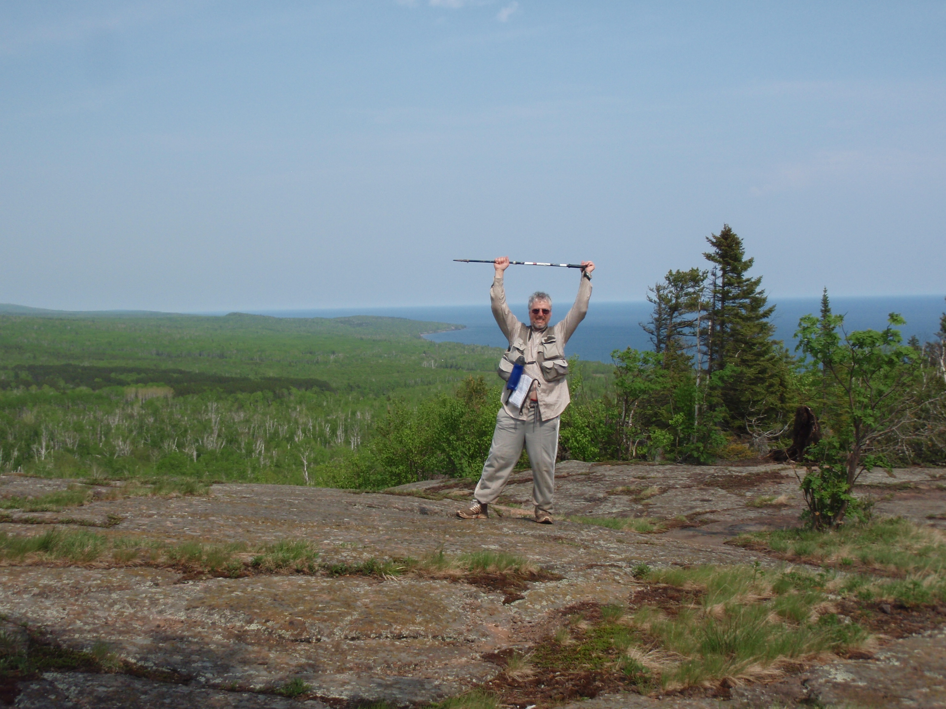
Originally I thought the Pincushion Mountain Spur Trail was a loop trail, but I didn’t see a loop, and after further consulting with the SHT Guidebook it seemed like it was more of a out and back trail. So I hiked back the way I came. Once I got back to the ski trail, I took a left and continued on my easy walking adventure.
At the trail junction, they had a map of all the ski trails, and it looked like I was on the far reaches of the ski area. I walked at a pretty good rate consider all I had been through. The finish line is approaching and I was encouraged. This is a really elaborate cross-country ski area which attract skiing enthusiasts to the area every winter. This ski area is also the home field of the Grand Marais High School Cross Country Ski team. And they hold High School races here. I had seen a calendar in town that had all the Grand Marais High School Team schedules listed on it. And the Cross Country Skiing and also Downhill Skiing Schedule were listed on the calendar. I thought it was unusual that there were Skiing teams on the High School level. Down in Wisconsin we have skiing clubs on the high school level, but not teams. But this Northern Minnesota, where snow is king.
The Ski Trail keeps going and going. At places there are 12 foot wide bridges crossing little streams. The whole trail is wide here. I suppose they need it that way for skier to pass other skiers in the ski races. This ski trail keeps going and going and finally I made it to another junction and I looked at the map posted there. It showed that I was making some progress. I was over 2/3s of the way back to the Parking lot from Pincushion Mountain. I kept going and at the next trail junction there was a SHT sign with an arrow pointing to the right. I turned right onto another ski trail. This trail didn’t seem as wide as the other ski trail I was just on. Perhaps this is just a short cut back to the parking lot, and it’s not used for any ski race. I walked up over a hill and down the other side, then found a big open field about the size of a football field. This field has lights around the edges of the field. I theorized this field is where people can come and practice skiing at night. There was a warming house up to the right. Soon after the field, I saw the Parking lot, and the magnificent view of Grand Marais below. I had made it!!!!!
I was about 5 pm on a great day. I called Dave to come pick me up. Then I met two locals named Brian and Bonnie. I commented on their big pickup truck which looks almost like a monster truck. Bonnie said they needed it to get up her driveway in the winter. Wow, she must have one hell of a driveway. She said her brother Brian was visiting and they were out looking at the sights. They both looked to be Native Americans, especially Brian. I talked to them about my hiking trip, gave them an “I saw Tman” card and took their photo for my website. They just seemed to be out enjoying the nice day.

It wasn’t very long then all of a sudden a pick up pulled up and it was Dave coming to give me a ride. Dave has a real nice pick up truck. I hopped in and he asked me how I was doing. I said that I was tired, and the Devil Track had kicked my butt. He said that he used to be an EMT and on a few occasions he had to haul people out of the Devil Track, and it wasn’t very fun. He said he couldn’t do anything like that now because he was disabled. Nevertheless, I thought Dave was a pretty cool guy, being an EMT at one time.
To me Dave didn’t look all that much like a Native American. I asked him if “Indian Dave” was really his nickname. And he said it was. I said that I didn’t feel comfortable calling him that because it sounds a little racist. But he says that’s what people call him and he didn’t mind it a bit. I told him that I am from Madison, Wisconsin, which is the Politically Correct Capitol of the Midwest, so maybe I’m more sensitive or aware of stuff that some people think is offensive.
Dave didn’t appear to be overly native, so it might be hard for people to realize that he is a native. Perhaps that’s the reason for the “Indian Dave” nickname. Dave drove down the Gunflint Trail into Grand Marais, then took Highway 61 up the coast. We started talking about the tribe. I asked him if he gets any money from the Casino. He said no, that all the money from the Casino goes toward programs for the tribe members. So when he goes to the Tribe’s Health Care facility, it’s free for him. I thought that was a pretty good benefit.
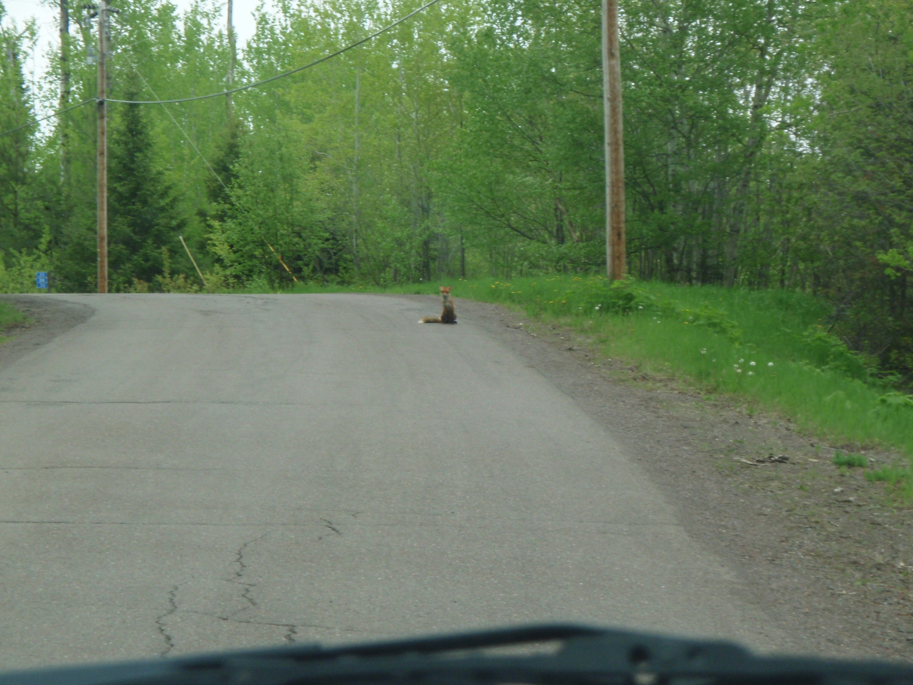
We made it down to Highway 14 and Dave turned and started going up the hill. But he stopped because there was a red fox sitting on the road up the hill a ways. The fox was just sitting there minding it’s own business. At one point it yawned and then stretched. Dave said he would sneak up on it. So he slowly drove up a little bit. Meanwhile I was taking photos of it. Dave drove up a little bit more, and it didn’t seem to bother the fox. Pretty soon the fox was right next to the truck. Then it decided to scamper away. But for about 5 minutes, that was the coolest little wildlife observation. It must be some sort of sport up in these parts to see how close you can get to an animal. We drove up to the trailhead, and I asked Dave how much I owed him, and he said he’d have to charge me $30. I thought that was a fair price. But I didn’t have any 10s so I gave him two twenties. I thanked Dave and he headed out after I got my van started. I really liked Dave. Be well my friend.
I thought about doing the last two miles up to the Sawtooth Bluff. But I was already pretty tired, and was planning on staying overnight near Grand Marais, so I thought I could do it in the morning. Besides it’s Chicken Night at the Grand Marais American Legion. So ixnay on another hike tonight. I headed into Grand Marais and my first stop was at the Municipal Campground. I was going to take a shower and also pay for all the showers that I had taken during the week. Unfortunately the Campground Office was closed. I thought the office would be open a little later because it is a Friday night when many campers might be coming to the campground. So I headed down to the shower house near the Ball Diamond and took a shower.
After getting refreshed and cleaned up at the shower house, I headed over to the American Legion for Chicken Night. The first thing you notice is that Chicken Night is not nearly as popular as Burger Night. And I was at the American Legion at around 6:30, pm, which would have been prime time for people to be there. There were a few people there, but on Burger Night, the place is packed. I went to the back of the American Legion and put in my order then I moseyed up and found a seat at the bar.
Again, Elizabeth was my bartender.
This was starting to feel like my “End of The Hike, Victory over the Wilderness Dinner” that I have after my hikes. I still had a two-mile walk to do, but that seemed more like a victory lap at this point.
I had conquered the Devil Track. The worst part had to be over. Yes, I would be walking up a bluff for the 2 miles, but it was only two miles. I was planning to sing Karaoke at the Birch Terrace later, so it seemed even more like a celebration. I told Elizabeth that I was singing Karaoke at the Birch Terrace tonight and that she wouldn’t be able to hear me this year because she works at the Birch Terrace on Saturday Night. She said she would be able to hear me, because she’s going over to the Birch Terrace after the American Legion closes. Evidently, the American Legion Bar closes earlier than the Birch Terrace, which surprised me because I thought they both would close at bar time. Perhaps there isn’t enough business for the American Legion to stay open that late. My chicken dinner came and it was really good. It was still pretty early when I finished up at the American Legion. It was about 7:30 or so, too early for Karaoke. I was tired so I drove up to the overlook and took a nap.
The Devil Track had taken a big toll on me. I was much more tired out today than on Wednesday when I hiked almost 14 miles to Magney. On Wednesday I was ready to do another little hike, but it was Burger Night so I declined. Today, there was no way I was taking another little hike. The hike on Wednesday did have a couple uphill climbs especially Rocky Knob and the staircase in Magney. But at Devil Track it was a prolonged uphill event that lasted several hours. I think I’ve gotta give the Devil Track the prize for the most strenuous section of the SHT that I’ve hiked. I think it beats Cascade State Park.
I woke up and it was dark. The first thing that I thought was that I had missed Karaoke all together. But I checked the time and it was 10:30. So I had a full 2 1/2 hours of Karaoke ahead of me. So, I rolled down into Grand Marais and headed to the Birch Terrace. I headed into the bar where Dave the Karaoke DJ was singing a song. After the song was over he just start playing music. After a couple songs Dave decided to do a Karaoke song again. And I turned in a slip for “Wild World” By Cat Stevens. “Wild World” is usually the song I start out with when I’m singing karaoke when I’ve been hiking. I was my turn to sing and I told everyone that I was Tman from Madison, Wisconsin, and I was up in Grand Marais hiking the Superior Hiking Trail. So I know it’s a Wild World. I completed the song and was pretty happy with it. Soon, the evening became a Todd and Dave sing off, as we rotated songs for the next hour or so. We had a six song run from Steve Miller. Dave had started it off with “Take the Money and Run. I did “Fly Like an Eagle,” “The Joker,” and “Abracadabra,” while Dave did “Jet Airliner” and “Wild Mountain Honey.” Dave decided to do something else, so the Steve Miller singathon was over. But it still was only Dave and I doing songs, until a young lady came up and did “Son of a Preacher Man.” She really rocked the house and got everyone dancing. That kind of opened the flood gates and a bunch more people signed up to sing. To slow things down near the end of the night I sang “Don’t know what you Got till it’s Gone” by Cinderella. I thought that might be a good song for people who wanted to slow dance.
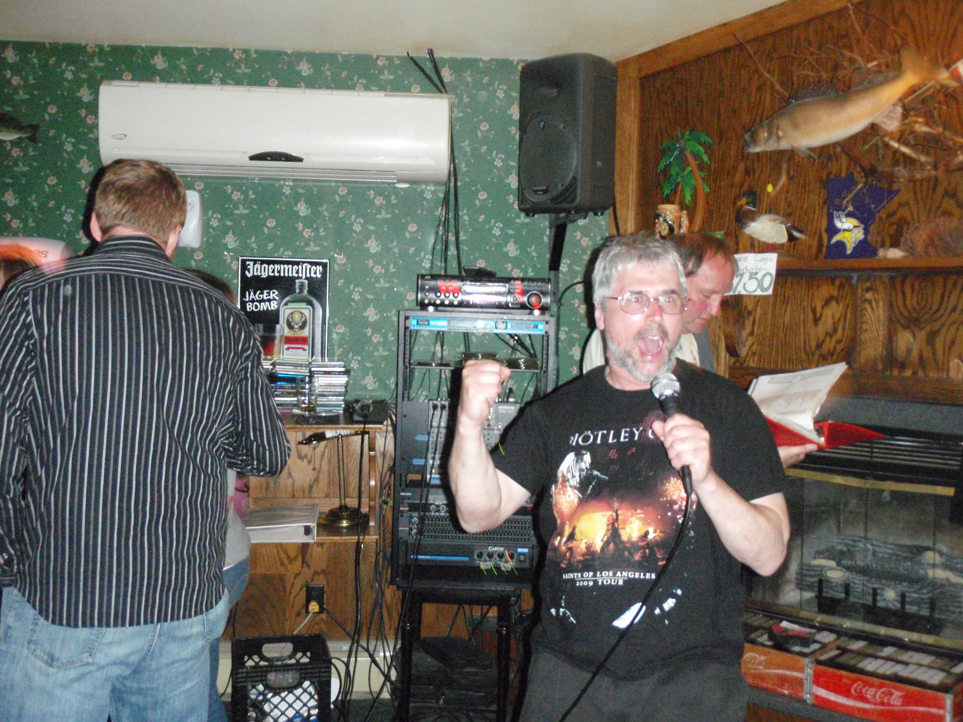
It seemed like I was the only non-local person in the bar, except some college students from the University of Minnesota-Duluth. I talked with one of them and congratulated him on UMD winning the National Championship in Hockey. There were a couple other things that happened at the bar, but let’s just say that I was still too tired out from doing the Devil Track to pursue any of it. The last song of the night was by a local guy who did “Sing that Funky Music White Boy.” That’s the only song he did all night and evidently it’s some kind of tradition for him to finish the night of Karaoke with it.
I drove up to the Grand Marais Overlook and parked to go to sleep. But there was someone out in the parking lot with a telescope. I walked over and talked to the guy and he had quite the telescope. He said it was the first night in a couple weeks that had been clear enough to go stargazing. His telescope had a small computer on it that you could select what constellation you wanted to look at, and the telescope would locate it. Wow, that was very cool. He said the telescope costs around $5000 used. He must be very serious about it. I went back to the van and went to sleep. The Devil had left tracks on me.
Saturday, June 4, 2011
Pincushion Mountain Trailhead to Tower Road
I woke up around 7:45 and decided I would place the bike up on top of the Sawtooth Bluff, also known as Maple Hill. Maybe Maple Hill is just part of the Sawtooth Bluff. At any rate, I took a right onto the Gunflint Trail and took a left at the next road, which is Tower Road, and drove up to the SHT Crossing. There’s a little parking lot there and it’s probably also used by snowmobilers and dogsledders in the winter, because the SHT uses the wider North Shore Trail here. I headed back down to the Pincushion Mountain Trailhead/Grand Marais Overlook. When I got down there, I was getting ready to hike when a car pulled up, and it was the Student from the University of Minnesota-Duluth that I had talked with the night before.
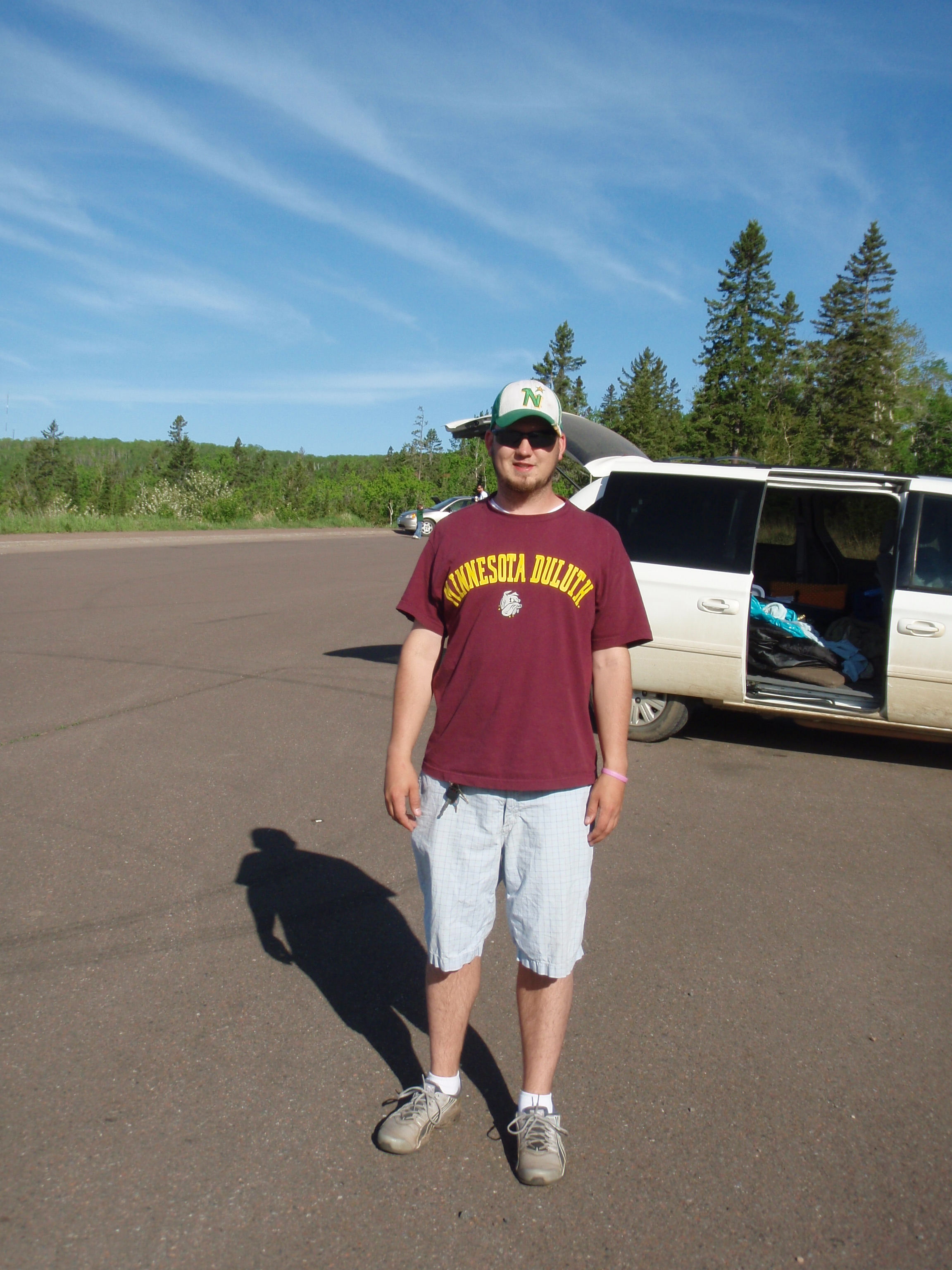
His name is Dave, and he was wondering what I was doing. I told him that I was getting ready to hike up on top of the bluff. He said the rest of the Students were still sleeping but he had to get up and do something. I told him he should hike out to Pincushion Mountain, and that it was about a mile one way. It’s got some spectacular overlooks and it’s not that hard of a hike. There would be a map of it up on the Kiosk above the parking lot. He seemed to be happy about that. I took his photo and gave him an “I saw Tman” card. He left to go on his hike.
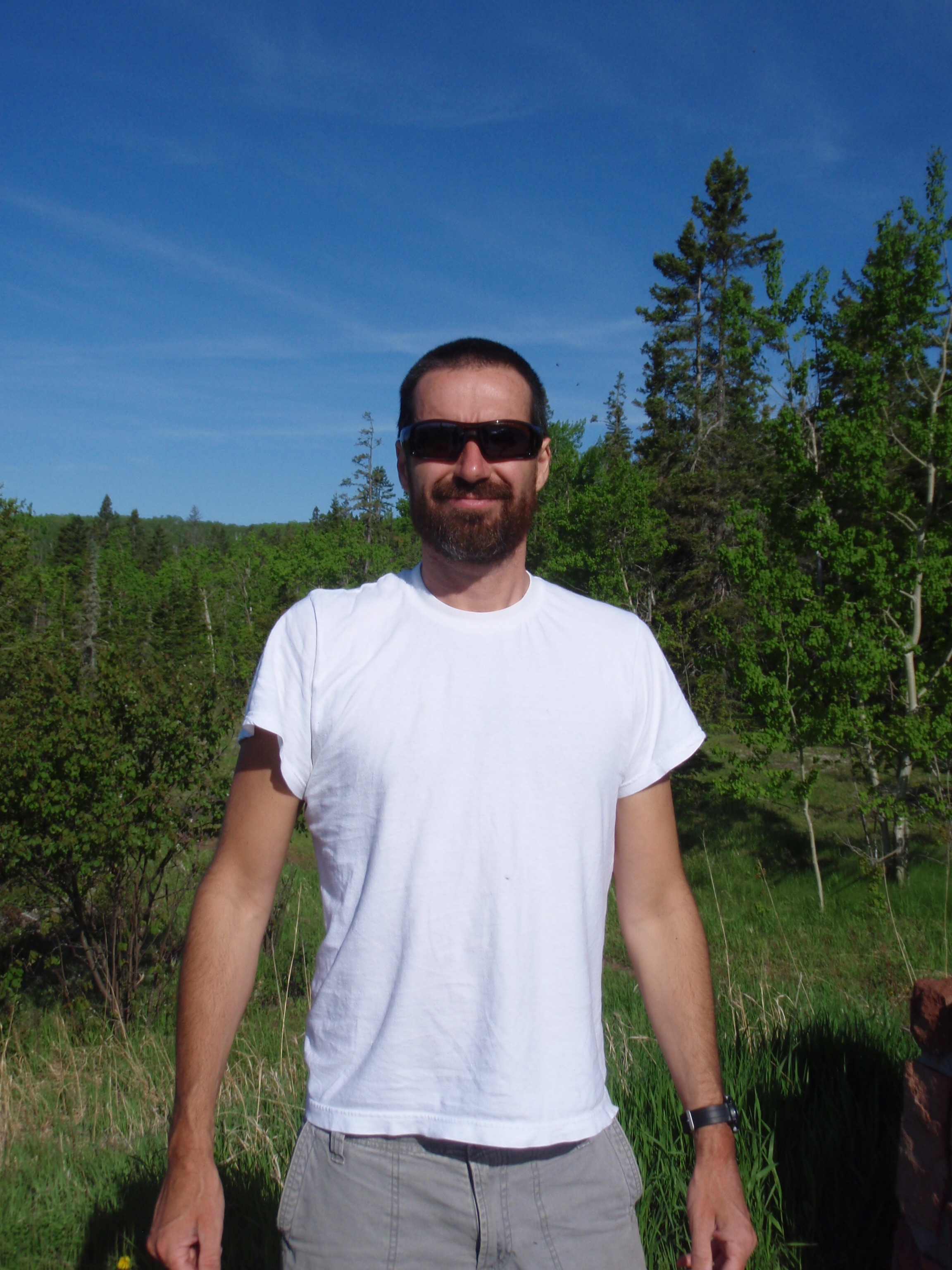
After that, I was still waiting for the Spot Messenger to send its message when another car pulled up. This is when I met Lance and his daughter. His daughter looked to be about 3 years old and she immediately needed to go to the bathroom, so they went inside the nearby outhouse. I started talking to him and he is from Chicago, but he was spending some time up in Grand Marais this summer with the mother of his daughter. I took his photo and gave him an “I saw Tman” card. I wish him well with that, hopefully it will work out.
Well, the Spot Messenger sent it’s message and I headed out around 8:30 am, before anybody else showed up. I was hiking on a nice and wide ski trail again, and would be doing so for about .8 miles to where the SHT splits off from it. I was headed in a mainly west to southwest direction and it was generally downhill. I wasn’t very happy about it going downhill, because I knew every step going downhill would have to be made up by going uphill to the top of the Sawtooth Bluff. It was easy walking for now.
I walked past a couple of Ski Trail Junctions and across a couple of those wide bridges again, and then I came to the junction where the SHT leaves the Ski Trail. There is a SHT sign with and arrow pointing to the right there. Evidently, if you keep going on the Ski Trail, there is another path that will take you into Grand Marais. I headed down the path to the right and I was walking in a generally uphill direction, crossing a couple little streams on the way. I was walking on the regular SHT now, not a ski trail. Then I encounter a steeper section of uphill trail, and made it to the Gunflint Trail. It’s a nice extra wide paved road here. And if you look to the left, you can see the Grand Marais Water Tower down at the curve about a 1/4 mile away.

After the Gunflint Trail, the SHT goes up at a rather steep rate. There are steps in some places, and just upward trail in other places. This lasts for a good 300 to 400 yards, then the trail takes a left and you are walking on the side of the hill, so it isn’t that bad. While you’re walking on the side of the hill, you start getting glimpses of Grand Marais down below. This keeps going for another few hundred yards until you get to a spot where there is a pretty good overlook of Grand Marais. There are a few trees in the way, but it’s still a good view. Then the SHT takes a sharp right hand turn and they have a SHT sign with and arrow pointing that way.
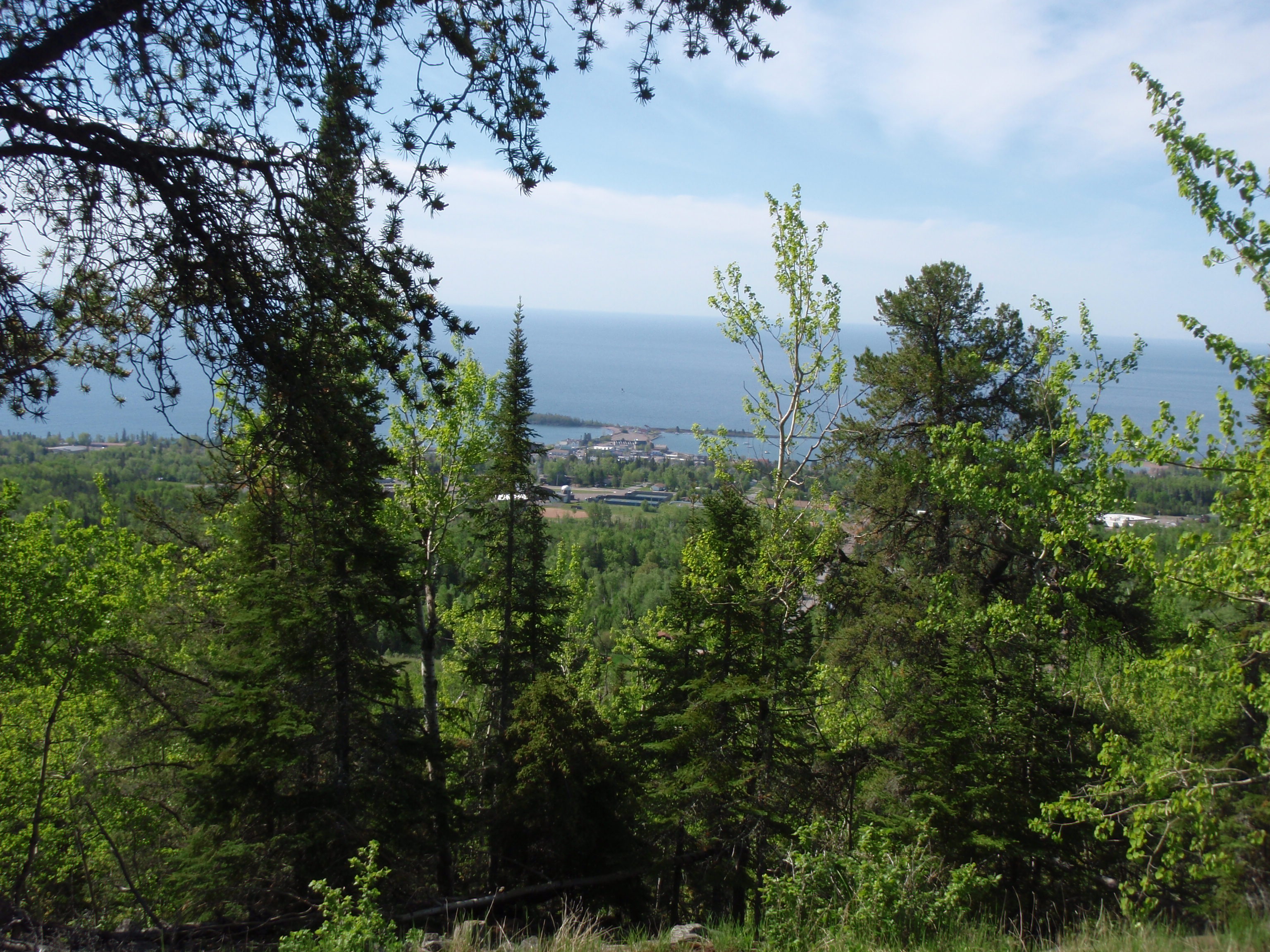
I had been wearing my cowboy styled soft hat with a head net over it. It seemed like it was kind of buggy when I first started the hike, so that’s why I wore it. But now, I was getting too hot, and the bugs were non-existent, so I took off my hat and head net and stuff them loosely in my vest. After the right hand turn, the easy walking is over, as you head vigorously uphill for a short ways. Then the trail flattens out and you hit a boardwalk. It always amazes me how there can be wet areas on top of hills. And this is no minor boardwalk, it’s a pretty good sized affair. The section since the turn is a very straight trail. This straight section was what I thought was the Electric Line Right of way, back in 2009. That Electric Line Right of way must be west of here a few hundred yards. Then the boardwalk ends and you walk a little ways to another shorter boardwalk. After that it is easy walking in a gradually uphill direction until you hit a snowmobile/dogsledding trail. This trail is the North Shore Trail, and is very wide. The SHT takes a left onto the North Shore Trail, and less than 200 yards I make it to my bike at Tower Road.
I WAS DONE.
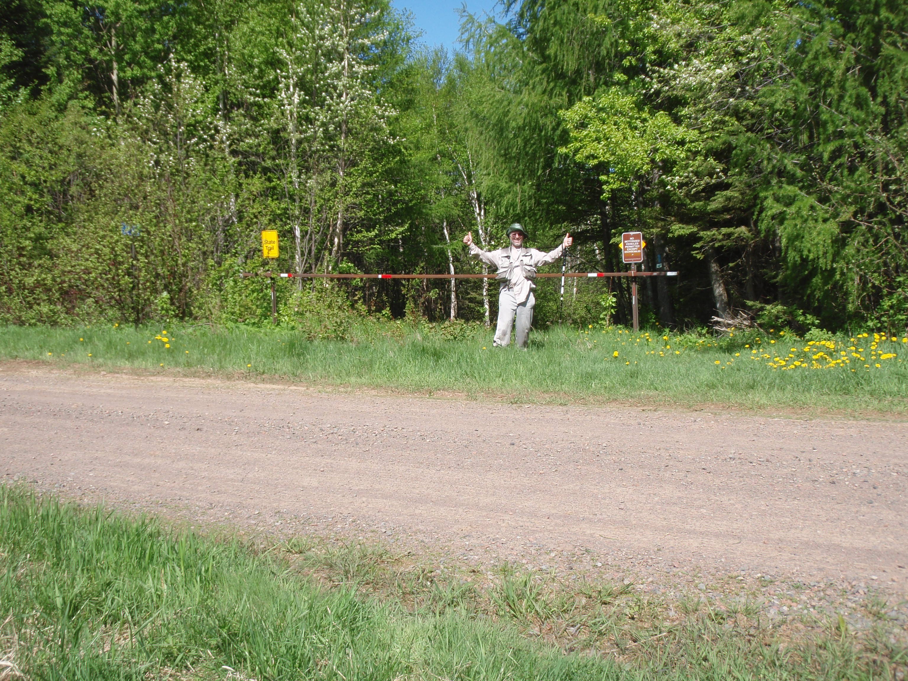
I was very happy until I found out that I lost my hat and head net somewhere along the way. I had stuffed them in loosely between my shirt and vest, and they must have worked their way out. It was my own fault, I broke one of my rules of hiking. The rule is that everything must be tied on or snapped in. I guess I hadn’t had a misadventure for a couple days and I needed one last misadventure to make this hike a real hike. I started back on the North Shore Trail, then turned on the regular SHT. I knew I wouldn’t have to walk all the way down the hill, because I had stuffed the hat and head net in my vest along the hike on the hillside. I walked down past the first boardwalk then on the second boardwalk I found my Hat and Head Net. I must have been powering through the boardwalk, and not paying attention. At any rate, I was happy that I only had to walk back less than a 1/4 mile. I had to find the hat because it was my famous Sylvania Wilderness hat I wear on all my backpacking trips. I could not proceed without that. Well, I walked back to my bike knowing my last misadventure of this hike was over. When I got back to Tower Road, I took some Victory Shots at the Trail Crossing. I was a happy camper.
I set out the spot messenger, put on my biking gear and stashed my vest and poles on the side of the road. It was really fun biking down Tower Road. At first I thought it might be a little hard going on the gravel road, but it was mostly in a downhill direction so it was easy. I really flew down the road. Then when I got to the paved Gunflint Trail, it was all down hill to the Trailhead. I flew even faster there, and coasted the last block into the trailhead. My victory lap was over.

I put the bike in the van, then headed back up Tower Road to pick up my gear. The Spot Messenger had sent it’s message, so I was set to go. I went down to the Grand Marais Water Tower on the Gunflint Trail and took my photo in front of it, much like the photo I took in 2009 when I was hiking up from Grand Marais to Tower road to connect with the SHT. The Electric Line Right of Way that I walked up in 2009 is right behind the water tower.
I rolled down into Grand Marais to the Library. I wanted to update my website and send a post to the Superior Hiking Trail Yahoo Group. It was about 10:30 now, and the Librarian said the computers were booked up until 11:30. I signed up and said I would come back later. I headed down to the Stone Harbor Wilderness Supply where the young lady who sang “Son of a Preacher Man” the night before was working at the counter. I asked for Jack and she said he was in back. He had asked me to stop by and tell him the conditions of the trail. I said the trail was very good except for a spot west of the Arrowhead Trail where there is a prolonged area of wet trail. He seemed to think that the trail wasn’t very developed up in the northern sections, but I told him the trail is very good, and easy to follow. There were just a few wet spots, which are probably drying out since we haven’t had rain for a few days. He seemed to be happy with my report, and went on to help some people who were renting some sea kayaks.
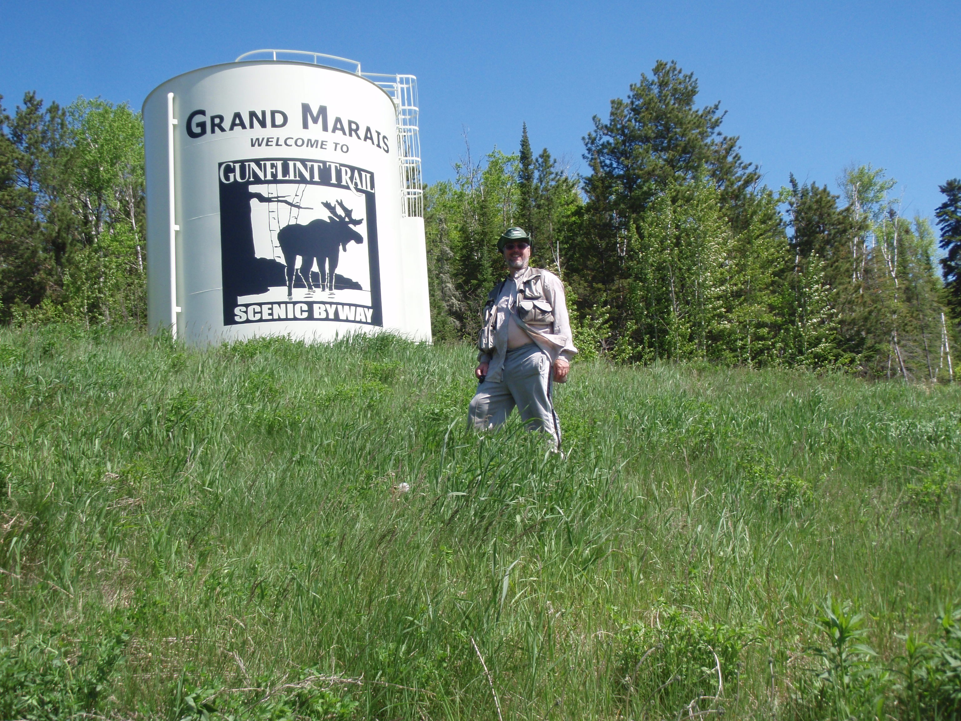
I went back and parked on Main Street in front of the Library. I crossed the street and got a vanilla cone dipped in chocolate at the Dairy Queen. I said Hi to the owner who I had met at the American Legion and Birch Terrace during the week. I walked slowly back to the library and met the guy who sang “Play that funky music white boy” at karaoke the night before. It’s a small town, within the last few hours I had met 3 people that were at Karaoke last night. After I finished off the cone, I headed into the library. It was before 11:30, but they had a computer open now. I updated my website and wrote the following on the SHT Hiker Yahoo Group.
Hi Everyone
I have completed my hike from Otter Lake Road
to Grand Marais. I’ve taken over 2500 photos
and will be sorting them out and posting them
on my website sometime in the next week or two
Heading back to Madison, seeya
Todd
After that I left the library. I had one last task to do in Grand Marais. I went down to the Municipal Campground and the Office was open. But it was more than just an office. It was a little store with camping items, souvenirs, and even an ice cream treat freezer. I paid my shower bill and talked with the lady there. She said that the Campground has over 100 sites that are rented for the full summer, and the sites are $600 for sewer, water and electricity. That’s not counting people who come up for a week or weekend. Sounds like it is really a good thing for the economy around Grand Marais. After settling up my bill, I headed out. I headed up over the hill, and soon I was out of town.
I didn’t put a lot of thought to it. I just had finished up everything I had to do in town, and decided it was time to go. I know I’ll probably be back, because it’s my favorite little town. It kind of reminds me of Cicely, Alaska, the town in the TV show Northern Exposure. I hope Grand Marais has a great summer.
When I got down to Cascade State Park, I pulled in and talked to the Park Ranger at the Entrance Building. The Entrance Building here is also a little store, which I thought was interesting. I asked the woman ranger who was behind the counter if it is true that backpackers cannot take showers at the Campground, unless they sign up for a campsite. The lady said unfortunately, it is true. I said wouldn’t it be better just to charge $3.00 for a shower so backpackers don’t have to sneak in to take a shower. Just then a male ranger walked into the store from an office. He must have been overhearing my conversation. He said that it was a rule they were trying to get changed, and I should call the Minnesota State Parks Department and express my concerns. I told him I would, and thanked both of them, and headed out.
Right about at Cascade State Park is where you get back into Cell Phone Coverage, So I called Kathy and Jan at the Cobblestone Cabins. Kathy answered the phone and I told her I was at Cascade heading south, and that I wanted to stop by and see their resort. For those of you who might have missed it, I met Jan and Kathy at the Birch Terrace in Grand Marais on Monday Night May 30. She said that it would be a good time to stop by, and would be seeing me in a little while. It didn’t take me very long at all and I was down to their resort near Tofte.
You pull in their driveway and the first thing you see is their garden. Then you cross the Gitchi Gumi State Bike Trail and then I parked down by the cabins. Jan was out in the yard and he came over to greet me. He looked like he was out doing some work around the resort. He took me on a little tour. We went out in the yard where there is a cliff going down to Lake Superior. There is a stairs going down but we stayed up on the grass. Down below is a little building on the rocky shoreline, which Jan said is the Sauna. Then there is a rocky shoreline going out to a point to the right of the sauna. There was a lady sitting out on the point just relaxing and enjoying the day. Then Jan showed me one of their bigger cabins. This cabin can be converted into a yoga room, where Kathy can teach up to 9 students. Wow, that was pretty cool. They seemed to combine two business interests at once, having a cabin for yoga.
Jan always had an interesting story or two. He told me about some backpackers who were not prepared for mosquitoes on the worst mosquito weekend of the year. He also told me about when he bought the resort. He came to look at the resort 35 years ago, and within the first 10 minutes he told the guy he wanted to buy it. Wow, what a life changing moment. Perhaps it was a life defining moment. I thought back trying to decide my life defining moment. Maybe it was when I decided to hook up with D instead of K.

We went over to the house where Kathy was relaxing on the back deck. I talked with her for a little bit, then decided it was time for me to get going. I thanked them, then on my way out, Jan showed me his garden. They have quite the plot, including a small greenhouse to start the plants early. The garden is right on the Gitchi Gumi State Bike Trail. I always like seeing gardens and people’s back yards when I’m out biking on a State Bike Trail. It’s a slice of Americana that you don’t normally see. I’d like to ride that bike trail, but what bike trail wouldn’t I like to ride? I said goodbye to Jan and was on my way. Have a good summer at the resort, and happy hiking down in South Carolina this winter.
I headed down Highway 61 and it was good driving until down past Beaver Bay. Then the traffic just stopped. I’m not sure what was going on, because there was a long line of cars. I could see the Split Rock Lighthouse down the road in the distance. The traffic didn’t move for over 20 minutes. I looked at my Minnesota State Map and saw a county road going the back way between Beaver Bay and Two Harbors. Again, the traffic still had not moved. I wondered if there was a problem in the tunnel down around the curve. Still everything was stopped, so I decided to turn around and take the back way. This turned out to be a rather long detour. Everything was fine at first, it was a nice paved County Road, but then it turned into a gravel road. I went on that for several miles and it finally changed back into a paved road. I went through I little town, then saw the Two Harbors Water Tower. I had finally made it around.
In Two Harbors, there is my mandatory stop at the Culver’s. Maybe it’s some sort of ritual I have. Maybe it’s a signal I coming back to the civilized world, which we all know isn’t very civilized. I jumped on the four lane Highway 61, and was down to Duluth in no time. Then to compensate for going fast on a four lane Highway, you have to go on city streets for about 3 miles. I took a little detour into a commercial area looking for an Anytime Fitness. I didn’t find one, and decided to stop putzing around and keep going. I went over the big bridge into Superior. I was back in Wisconsin.
I was looking for an Anytime Fitness along the way in Superior, but didn’t see one so I kept going. After leaving Superior I was back on a four-lane highway again. I decided to call my sister. My brother in law Keith answered and said Carol was working. I asked him if he could look on the computer at Anytimefitness.com to see if there is an Anytime Fitness in Spooner or Rice Lake. He checked and there are not any. So, I asked him about Eau Clare, and he said there are two locations in Eau Clare and one in Chippewa Falls. I asked him the name of the street the one in Chippewa Falls was on, and he said it was on Bridge Street. I thanked him and kept going down the Highway. The stretch of Highway 53 between Superior and Eau Clare seems like a very long stretch of road. It seems longer than going from Madison to Eau Clare. But I kept going and made it down to Chippewa Falls and turned off. I was a little bit hungry, so I turned into a Burger King and got something. I asked the people in the Burger King where Anytime Fitness is and they gave me directions. I bet they don’t get that question asked very often.
The Anytime Fitness is on a street in downtown. I thought it would be in a strip mall on the outskirts of town, like many locations seem to be. I parked on the Bridge street and put my spot messenger on the windshield of my van. There didn’t seem to be a lot happening in the downtown area at that time. I suppose you’re wondering why I’m going to Anytime Fitness. Well, it’s because I’m a member and I know that they have showers at every location. So, I grabbed my shower kit and my cleanest dirty clothes and headed in.
The Anytime Fitness is in an older building in downtown Chippewa Falls. I headed into the back hallway and found the men’s restroom. And sure enough, it did have shower. I was still in my hiking clothes, so it felt good to get them off, take a shower and put on some decent clothes. It was around 7 pm when I got done. I found the Highway 53 again, and headed to Highway 94 down by Eau Clare.
I think I made one other stop on the way back to Madison, just to get an Ice Cream Cone.
It was around 10:15 when I made it back to Madison. I headed down the beltline and got off at South Town Drive. I drove a few blocks and parked right in front of Dave’s South Bay Lounge. I set out the Spot Messenger on the windshield of the van, then I went inside the bar. Dr Karaoke does Karaoke on Saturday night at South Bay. It wasn’t very busy considering it was a Saturday Night and Dr Karaoke usually packs them in. I signed up for “Home Sweet Home” by Motley Crue. Dr Karaoke was amused that I came to Karaoke before going home. But I told him that I did clean up at an Anytime Fitness on the way back. I obtained a beer and shortly it was my turn to sign. It was the first time I had ever did that song, because somebody else usually sings it. I don’t like singing other regular singer’s regular songs. But this was a special occasion, and also, the other singer was not there. I sang the song, finished the beer and said goodbye to Dr Karaoke.
“I’m on my way, I’m on my way, Home Sweet Home”