Trail Crew Experience and Backpacking Trip.
I had been planning this trip for months. Originally, I was to hike into the Border Route on the Daniels Lake Access Trail, where I had ended the hike last year. The Daniels Lake Access Trail is a 3 mile Trail from Clearwater Road, that connects with the Border Route. It is a former Railroad Bed, so it is easy walking.
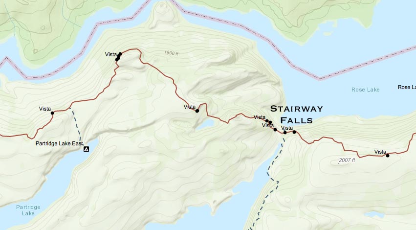
But then I heard on the Border Route Meetup website, that there would be a Trail Clearing Trip starting on May 20, which would be clearing the Border Route east of Stairway Falls. Stairway Falls is 4 miles west of the Border Route/Daniels Lake Access trail junction. So if I worked on the Trail Crew, I would be really near where I wanted to start my hike, and I would only be hiking 1 mile more, because the distance from Stairway Falls is 4 miles, and the Daniels Lake Access Trail is 3 miles.
Plus, maybe I could get someone from the Trail Crew to either pick me up in Grand Marais, where I would be leaving my van, or drive my van back to Grand Marais from the Boat Launch. I emailed Tom Suter, the Trail Crew Leader, and explained the situation, and wrote back that he would be able to work out something for me.
So that was the plan, I would drive up to Rockwood Lodge on Thursday, May 20, work on the Trail Crew on May 21, 22, and 23, then start my hike on Sunday May 23. This seemed like it would work out well for me. It cost me $55 to be on the Trail Crew, which includes meals, etc, but it would have cost me $65 for me to have Harriet Quarles Transportation drive me from Grand Marais to the Daniels Lake Access Trail on Clearwater Road. Plus, I would be giving back to the trail, especially after last year when I was saying how overgrown the trail was on my website.
So I’ve been out gear hounding for the last month or two before the trip. I have most of the basic gear, but there are a few major items that I need. For one thing, I lost my Spot Messenger, somewhere in Southern Michigan on December 31, 2009. So I’ve been checking out the new version, which seems to be quite a bit better. First of all it’s smaller. It also has covers for the 911 and Help buttons so you don’t accidentally press them. It also has a GPS that tells you if you are in GPS Range or not. Spot had a $50 rebate if you bought the new version plus a year of service. Plus I had a $34 dividend coming back from REI. So I pulled the trigger on it.
I also bought a new pair of hiking boots made by Merrill. They are lighter than my other boots plus they have a waterproof liner like gortex. I also bought a trout fishing vest. I like it because it has all sorts of different sized pockets and it is made with some mesh material which looks really breathable. I also bought a new pair of hiking pants which my sister sewed some Velcro on some of the pockets. I have to have every pocket with the ability to shut firmly. Or else, when you’re hiking over or under a deadfall, stuff might fall out.
The two items that I decided not to buy were a new sleeping bag and some sort of water filtering device. I have a sleeping bag, the Alps Mountaineering Crescent Lake, which is plenty warm enough for those cold Minnesota nights, but it is a little bulky in my backpack. It would be nice to have a sleeping bag that packs down to the size of a football, and is still warm enough. I decided to go with the Aqua Pills again over a water purification system. I was considering the Steripen, because Joan Young gave a good review of it. The only problem with the pill now, is that it now says it takes four hours to kill everything, including Criptospiridium, when previously it said that it took only a half hour. I figured I would make sure all my water bottles were filled at night, then as soon as I drank a liter in the morning, fill it up and put the pills in.
This year’s trip would be quite a bit different than last year’s trip, mainly because I would be driving my newly acquired Town and Country Minivan. I would be storing extra gear in the van, a mountain bike, plus I have a thick sleeping pad and a sleeping bag so I could stay overnight in the van at selected locations.
The Trip Up to Grand Marais
So, on the morning of Thursday, May 20, I finish loading up the van, and head out around 8:30 in the morning It is a four lane freeway from my house to Superior, Wisconsin. And I made it to Superior with only one incident. Near Spooner, Wisconsin, a timberwolf jumped out onto the highway and crossed it right in front of me. I barely missed it, but it scared the beejeebers out of me. At Superior, the freeway ends and the highway goes on city streets until reaching a big bridge that goes to Duluth. Once reaching Duluth, there is a freeway going north through downtown, but it eventually ends and the highway uses city streets for a few miles.
Then the highway becomes a freeway again to Two Harbors. At Two Harbors, I wanted to stop at the Superior Hiking Trail office, which I thought was right on Main Street. But I didn’t see the sign. So I called the SHT Office and Gayle Coyler told me that it was on Main Street and gave me directions. It turns out that there was a construction crew doing work right in front of the office, and the equipment had obscured the sign. I stopped in, bought some maps, postcards and signed up as a member. One of the reasons I signed up as a member was because there is a deal if you are a member of an affiliate trail, then a North Country Trail Association membership is only $16. I had set out my Spot Messenger on the front porch of the SHTA office, to mark my spot. I also stopped for supper at the Two Harbors Culver’s, which I call the “last Culvers before Canada.”
After Two Harbors I traveled Highway 61 up the North Shore Coast. This is the real scenic part of the trip, with great views of Lake Superior, two tunnels, the Split Rock Lighthouse and plenty of State Parks and Waterfalls. Plus on many parts of the highway there is a nice little bike trail next to the road. The only slowdown on Highway 61 wer construction areas near Split Rock State Park and Tofte.
As I was driving up to Grand Marais, I remembered that I forgot to stop in Duluth for some Denatured Alcohol for my Alcohol Stove. Now, I was hoping that the combination Gas Station/hardware store/bait shop/ and yard store in Grand Marais would have some. If not, hopefully they have the Heet in the yellow bottle, which will also work in my alcohol stove.
So, I make it up to Grand Marais, and the first thing I do is pull into the Hardware Store, and yes, they do have Denatured Alcohol. They have Heet in the yellow bottle, also.I also bought some work gloves at the hardware store.
When I went out to the van, I noticed I had a message on my cell phone. It was Tom Suter. He was wondering how I was doing and said the Trail Crew would be going out to supper at the Trail Center, which is near the Rockwood Lodge. But I still needed to take my resupply package to Nanaboujou Lodge near Judge Magney State Park. This is about a 15 mile detour up Highway 61 from Grand Marais. So I headed up that way, and Nanaboujou Lodge gladly excepted my package. I had heard on the Superior Hiking Trail Group Message Board that Nanaboujou Lodge was very hiker friendly. It is a stately old landmark, with a colorful grand hall used as a restaurant. The Lodge is right on Lake Superior, across Highway 61 from Judge Magney State Park.
On the way back, I decided to take a County Road to connect with the Gunflint Trail, instead of going all the way back to Grand Marais. The route looked shorter and it was paved. But it was only paved for the first two miles, then it turned into a gravel road. So I slowed down going on the gravel road, which didn’t turn out to be much of a short cut.
But eventually I made it up to the Gunflint Trail. It definitely was a change of scenery compared to Highway 61. It was mostly dense woods with some farms scattered in. I headed up the Gunflint Trail, and after about 30 miles I made it to the Trail Center. I stopped in and met 5 other members of the Trail Crew that had finished eating Supper.
I said hello, but said I needed to get up to Rockwood Lodge to buy my Boundary Waters permit from Lynn, who I had contacted earlier. So, I headed down the road about a mile and saw the Green and Yellow Rockwood Lodge sign. I navigated down past a few cabins to the main lodge on the shore of Poplar Lake. Lynn was working late in the Lodge, and started working on my Entry Permit.
I had emailed Tom Suter several days earlier, and he said I needed my own separate Entry Permit because I was going on my backpacking trip after the Trail Crew work was completed. Lynn input the data onto the computer system, which she says is a very complicated system, which is difficult to navigate. She eventually printed out my entry permit. In the meantime, we were having a nice conversation.
She told me that her and her husband had own the Rockwood Lodge about six years, and were trying to build up the customer base again. The previous owners didn’t know what they were doing, and had lost many repeat customers. Previous to owning the Rockwood Lodge, Lynn and her Husband ran a resort on an Indian Reservation in North Central Minnesota. They found it difficult to operate the resort with all the rules and regulations that the tribe imposed. But now they are having some good success with the Rockwood Lodge. They are not the biggest resort on the Gunflint Trail, nor do they want to be. They want enough business to keep them going but not to be too overbearing.
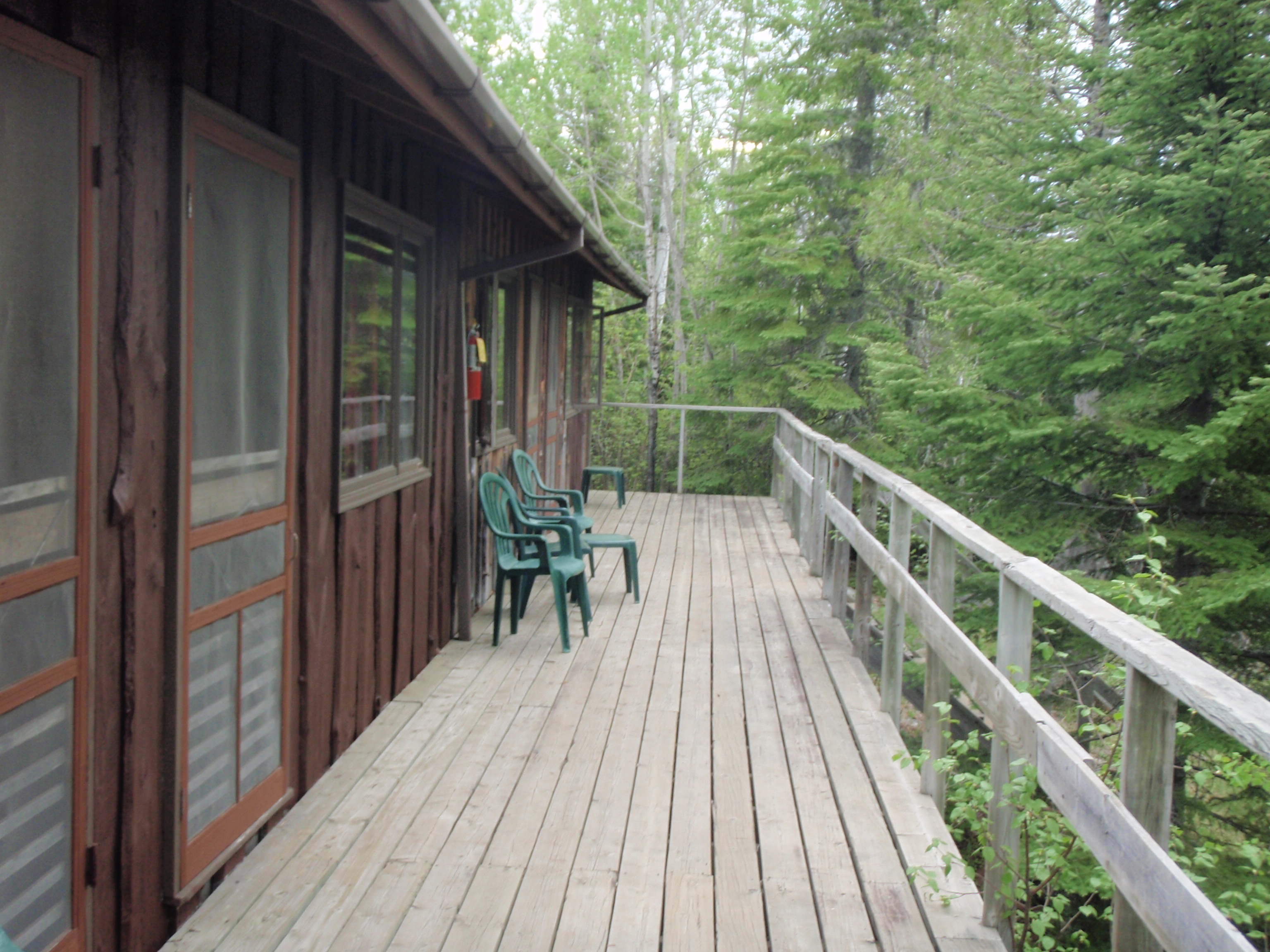
Lynn showed me on a map where the bunkhouses were. It was a hill from the main lodge and the lake, so I drove my van up there. This was one long bunkhouse with 4 units. Each unit had bunks for 8 people, and a bathroom with a shower. This was pretty deluxe for a bunkhouse. Most of the time the bathroom and showers are in a whole separate building from the bunkhouses. So we had bunkhouses with indoor plumbing. The Trail Crew had bunked in the two middle units. The nearest unit to the parking area was being painted and the far unit was being fumigated. Evidently, there were some carpenter ants in the far unit.
So far we had six of the Trail Crew member at the bunkhouse. I decided that I was going to sleep in my van, because I was set up for it, and because I still needed to organize my gear. It was dark when the last three members of the Trail Crew arrived. And they decided to move into the far unit that had been fumigated. They seem to think it was just fine, with no bad smell. So I decided to move my gear into the first unit that was being painted.
I really needed to get organized. I basically had 3 packs to pack. The first was my backpack for my backpacking trip. The second was a weekend pack for the Trail Crew Weekend, and the Third was a daypack, for when I was out on the Trail Crew. I wouldpack the daypack inside the weekend pack, for the canoe trip in to our campsite. I finally went out to the van and went to sleep.
Friday, May 21, 2010
Trail Crew Experience east of Stairway Falls
I had a good nights rest and in the morning I woke up and began fidgeting with gear again. Jim Rowan came out to the back end of the parking lot, away from the cars, and set up a camp stove for cooking hot water for coffee. On the walkway of the bunkhouse, Tom had set out some granola bars, fruit, breakfast cereal and powdered milk. We were having a cold breakfast.
I had mentioned to Jeff that I was still agonizing over gear. He said that I was in the Boundary Waters now, and that I shouldn’t be agonizing over anything. I said that the moment I wouldn’t be agonizing over gear would be the moment when we are in the canoes paddling away from the canoe launch. He smiled. I ate some granola bars and some bananas and went back to the van for one last look at the gear. I had the disadvantage that my gear had to last me up to a week, where everybody else only needed gear for the weekend. If they made a gear mistake it would only hurt them for a couple days.
After we got done with breakfast, Tom had us all head down the hill to pick up the Trail Crew Gear. We went down to the Summer Help apartment, where the Forest Service had left the gear. Actually, I’m not sure who brought the gear to that location. Everyone needed a hard hat, paddle and a life jacket. Then Tom started sorting through the Bow Saws, Cross Cut Saws, Lopers and Scythes. Evidently, there was another Trail Crew that would be using part of the gear. And sure enough, the other Trail Crew arrived. It was the Al Ringer Trail Crew of 4 people who were going to be working around Topper Lake.
At any rate, while all this was going on I snuck down to the Rockwood Lodge and bought a tall metal mug. It had come to my attention during breakfast that I had nothing to drink from. So, I talked with Lynn some more, and then scampered back to haul trail gear up the hill. Tom had seemed to be preoccupied with the other Trail Crew.
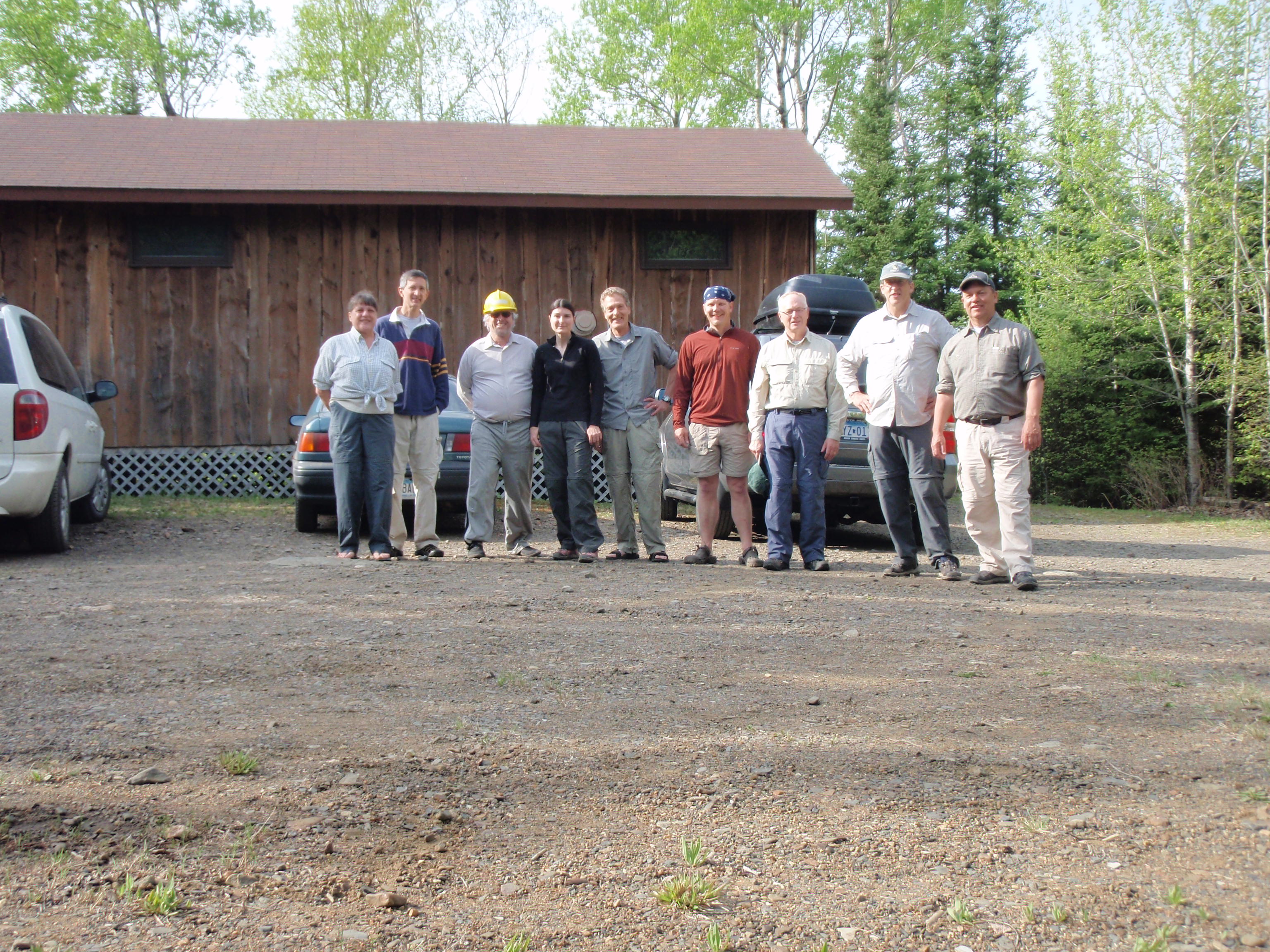
Finally, Tom made it back to the bunkhouses. I got my camera mounted on my hiking stick, and we did a timed photo of the trail crew, so I could be in the picture. Then we were off.
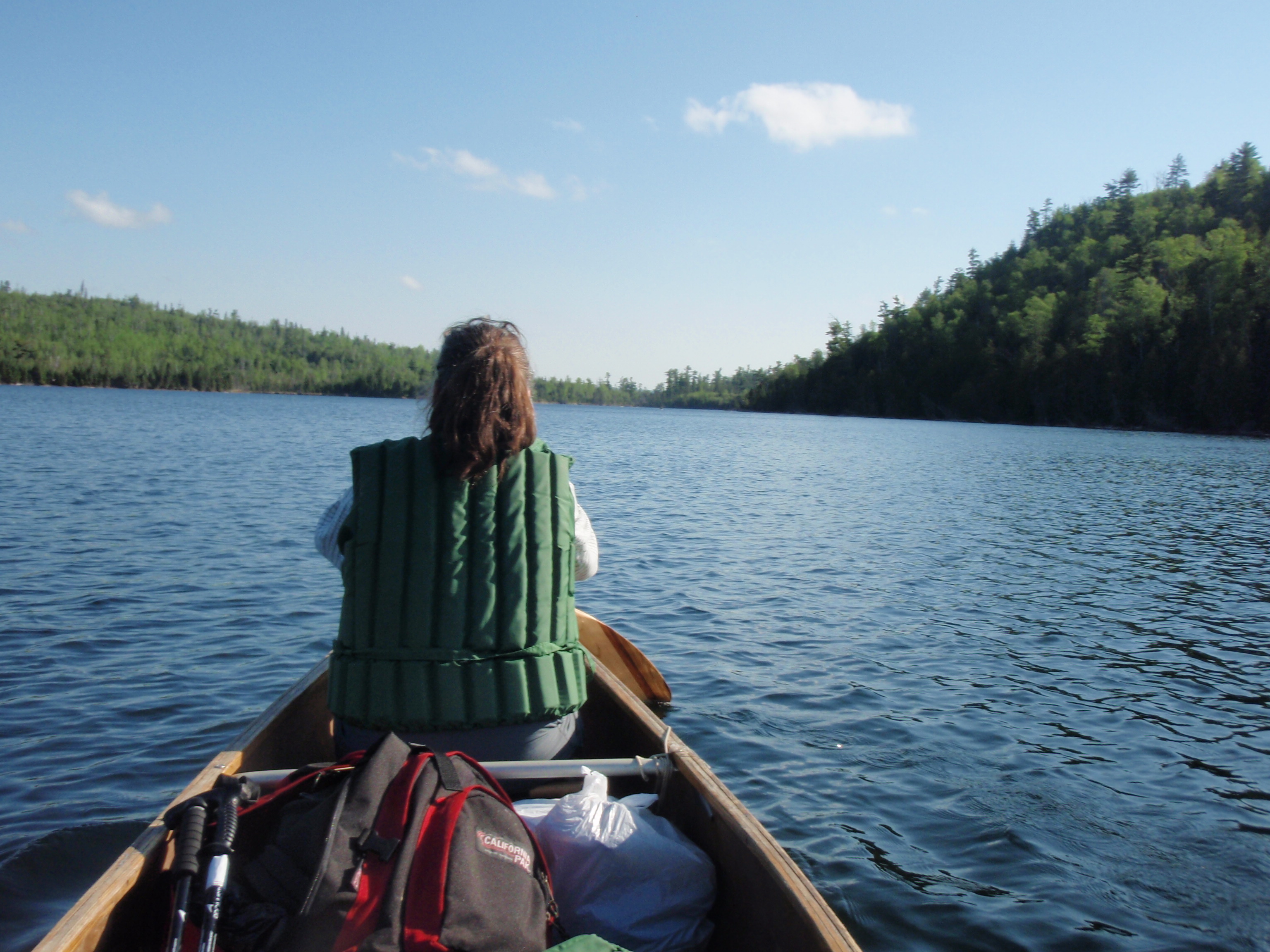
We drove down the Gunflint Trail for a couple miles, then turned down a gravel road. I’m glad Tom was leading the caravan, because it seemed like a labrynth of roads going to the West Bearskin Lake boat landing. We final made it to the boat landing and everyone was pulling out gear from there cars, But Tom said we needed 8 people with paddles and life jackets to walk down to Camp Menogyn and get the canoes. It wasn’t a very long walk, maybe 200 yards. In the emails previous to the trip, it made it sound like we were getting the canoes from a private launch at the Camp. But the Canoes were stashed in some thick woods next to the shoreline, I would hardly call it a launch. In fact, Walli and I were having trouble getting our canoe maneuvered in the trees to the shore. It took some extra gymnastics.
On the walk down to Menogyn, Walli and I decided to be boat partners. She is an experienced kayaker, and I haven’t been canoeing seriously for several years. So I let her take the back end of the canoe where the steering is done. We canoed back to the real canoe launch and started packing up. Walli and I were packed up fairly fast, We took our own personal gear along with some Duluth Packs of Trail Crew Gear and also some Trail Crew Equipment. We headed out on the lake, just to get away from all the activity at the launch. But we lurked around the launch just in case we needed to haul some more gear.
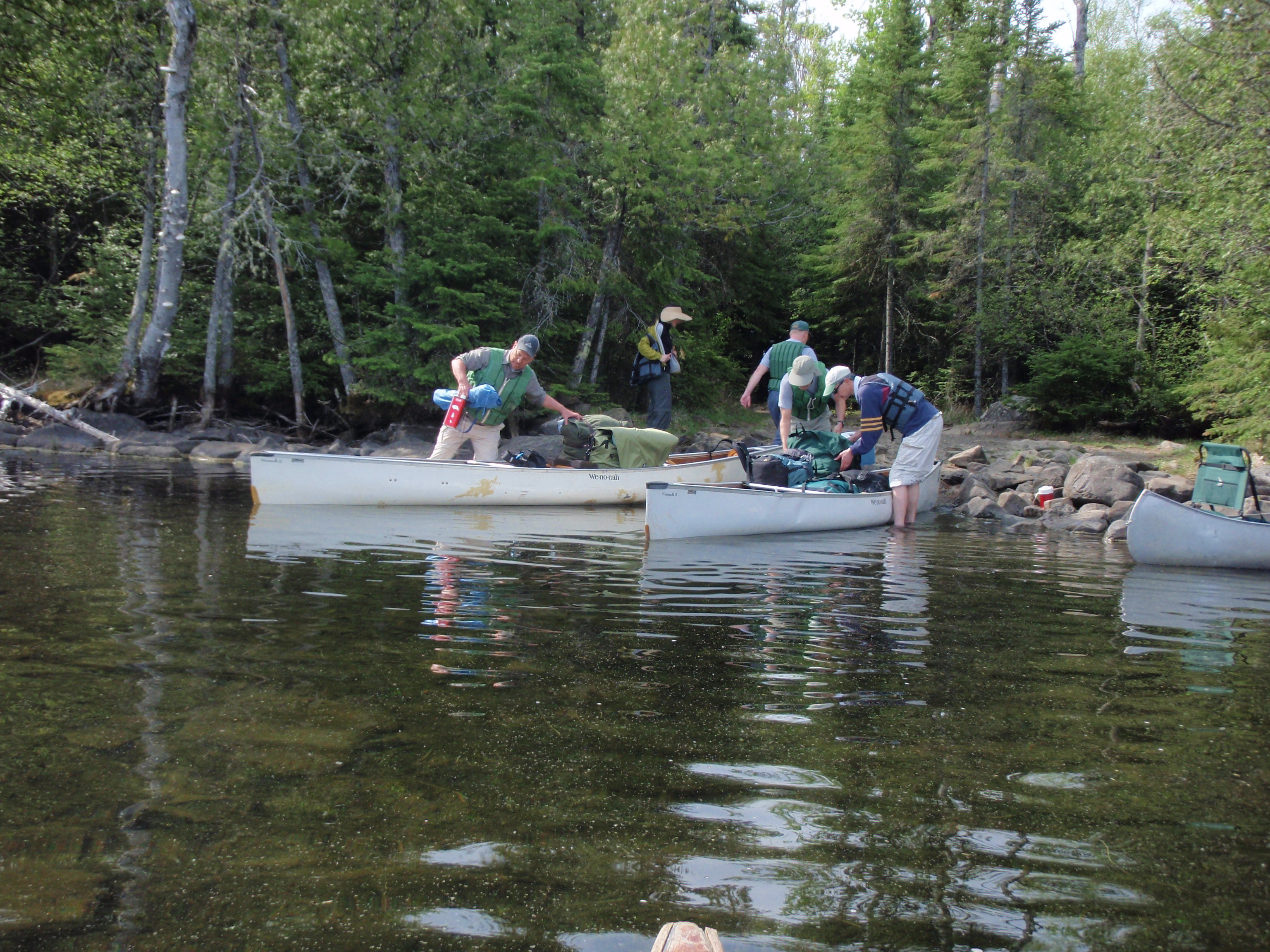
Soon it was decided that the remaining boats could handle all the rest of the gear. Plus, Illona would be riding in the middle of one of the canoes, because we had a odd number of people. Tom and Jeff were leading the way to the portage, Walli and I followed, and the other two boats were a ways back. We canoed past a penisula and into the most western bay of the lake.
As reached the portage, we immediately began to unload everything out of the canoe. Then other two canoes made it to the portage, and we started carrying gear to the next lake, which is Duncan Lake. Walli and I carried the canoe for a ways, then I decided that I could handle the canoe all by myself. The canoes were made of Kevlar, so they are not as heavy as other canoes. Maybe it was 60 to 70 lbs. There was a hill in the middle of the portage, but it wasn’t very steep. I just concentrated on looking for obstacles on the trail, such as rocks and tree roots, so I wouldn’t stumble and fall. I made it over to the Duncan Lake landing without any bad incidents. Then I headed back for some more gear.
The portage was about 4 or 5 football fields long, and I noticed a trail intersection with the portage. Later on, after I looked at the map at the campsite, I realized that it was actually the Cariboo Rock Trail that intersects the portage. The Trail didn’t looked very wide. But it did look like a trail, rather than an animal path. We all got packed up and headed out on Duncan Lake. The plan was to cross the lake and camp at the middle campsite of the 3 campsites on the western side of Duncan Lake.
The northern most campsite on the western side of Duncan Lake, was deemed to be too small for a trail crew of 9 people. That would be the Campsite closest to Stairway Falls and Stairway Portage. Tom and Jeff were leading the way, and they made it over to the campsite to find that it was full. Walli and I stopped paddling, and decided to wait to see if a campsite could be found. Tom and Jeff checked out the southern campsite on the Western side of Duncan Lake, and it was full, too. I thought that we might have to pile into the campsite that was deemed too small. But then Tom pointed his paddle to a campsite on the eastern side of the lake, and we started paddling towards it. Walli wanted us to paddle over to a campsite that looked nice on the South side of the lake, But another canoe had make it to the campsite that Tom was pointing at and it was open. So we had found our campsite. We did a lot of extra paddling considering the campsite we eventually settled at was the campsite closest to the portage.
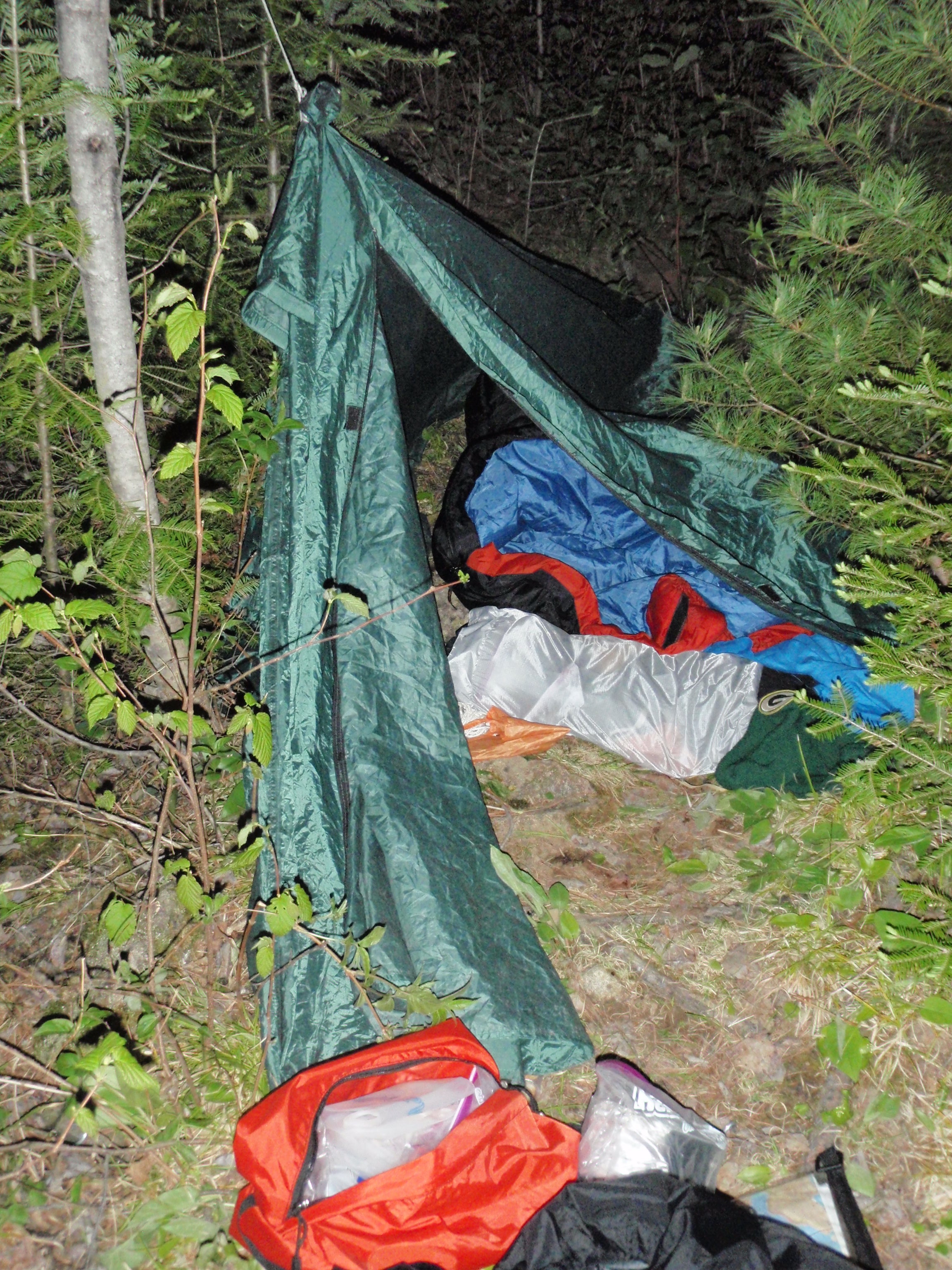
It’s a nice big campsite, with plenty of spots for tents. The women, Illona and Walli decided they would share a tent, But everyone else had their own tent. I set up my tent at a fairly bumpy spot just up from the water. The Campsite was on a little peninsula, with a little swampy bay to the south. Everyone had set up their tents, two of which were actually hammocks. I hung up my two bear bags away from the campsite down near the little bay to the south of the campsite.
Then Tom said that we should eat lunch, before we head out to do trail crew work. It was getting to be around 11 or so, and it sounded like a good idea. So we ate lunch, but I can’t remember what it was. Maybe it was sandwiches using lunchmeat. At any rate, we finished lunch, and I got my daypack ready, with my water bottle, work boots, snacks, and some other items. Walli and I were intentionally the first canoe off to the Stairway Portage.
Walli wanted to stop and check out the northern campsite that was deemed too small for our trail crew. It was on the way as we headed for the Stairway portage. So we paddled north and the lake starts getting more narrow. But it still pretty wide at the northern campsite where we stopped. I did think it was too small for our trail crew, with only two tent pad areas, but Walli seemed to think we could have fit in there, especially since two people had hammocks. But it was a moot point now, because we were all set up at the other site.
Then we head down the northern stretch of the lake where it is really narrow. I had a hard time seeing the landing, but when we got near the end of the lake, there it was to the left. So we all piled in at the landing, and hauled our canoes onto the shore. There was this nice rock that was around 10 feet long and 2 feet high, which made the perfect spot to change into work boots.
After we all had changed into work boots, Tom gathered us together and talked to us on how he wanted the trail cleared. He wanted it cleared 6 feet wide to meet National Trail Standards. He also talked about the tools and the best way to use them.
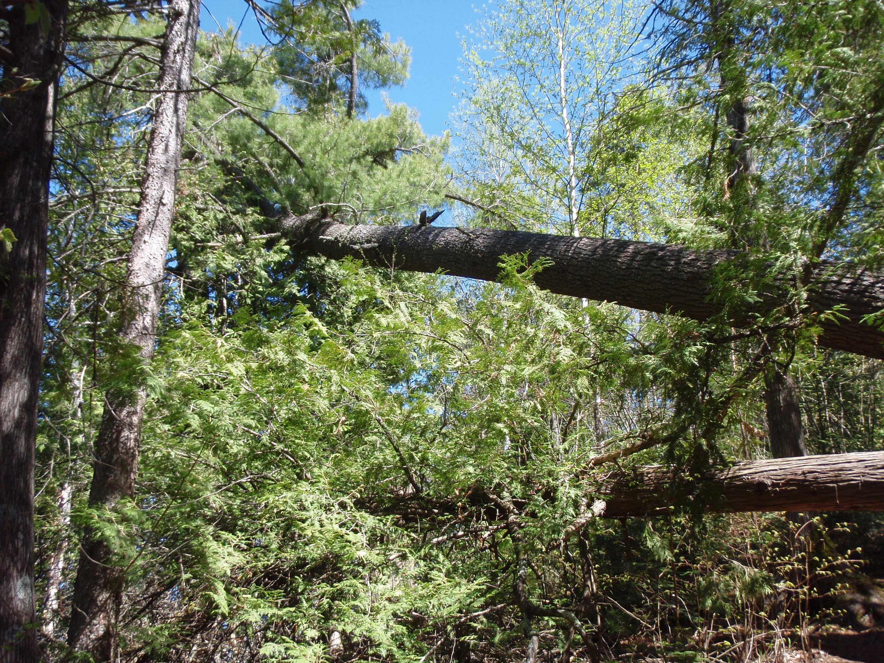
Then we started hiking. We hiked down the portage, then turned right onto the Border Route and crossed the bridge just above Stairway Falls, After the bridge is the rocky area where I put my gear last year. Then you start heading up a hill, where a gigantic pine tree has fallen. But the tree is still alive because the top of it is still green. Nevertheless, it is a sad sight to see such a majestic tree that has fallen.
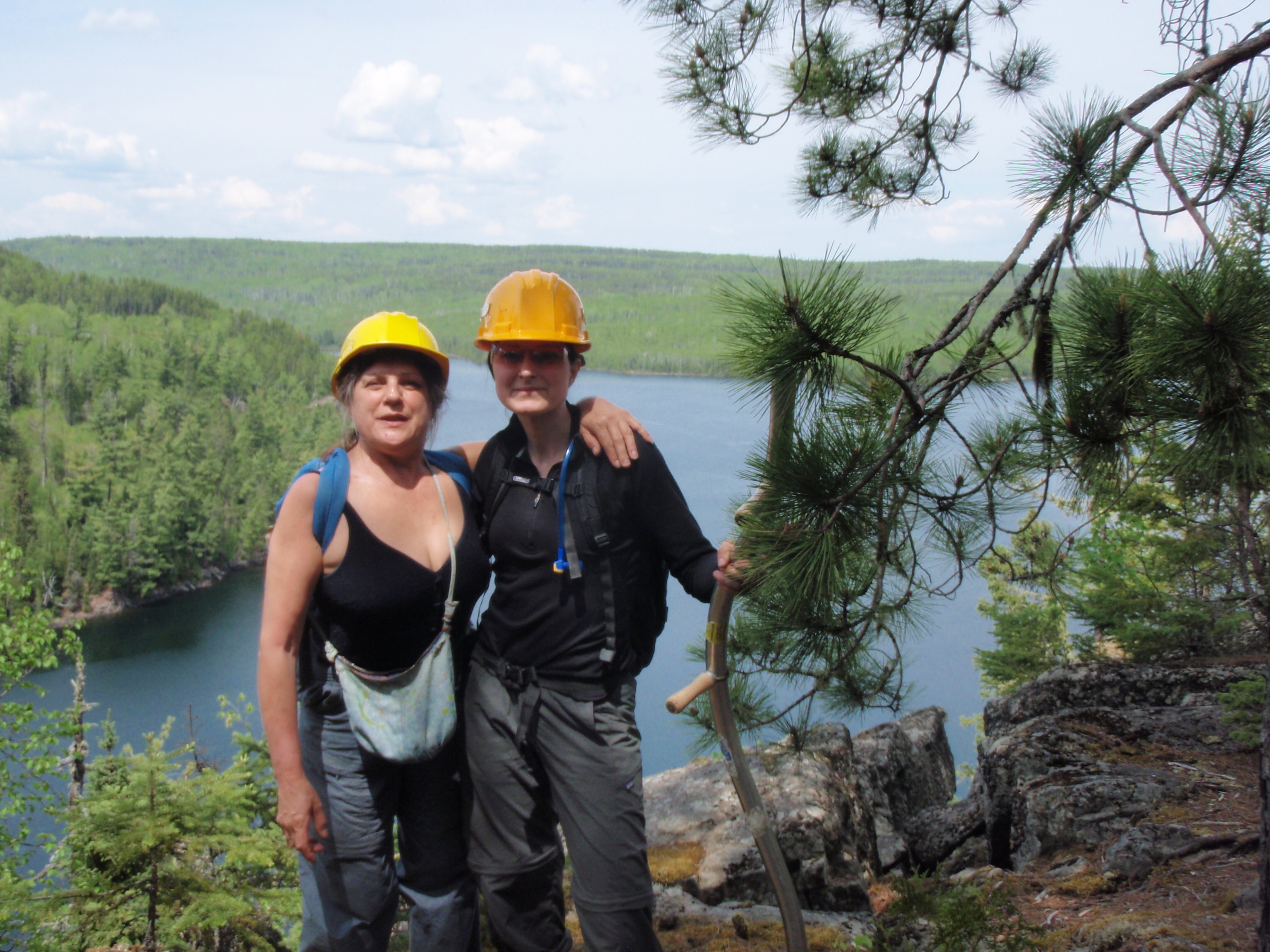
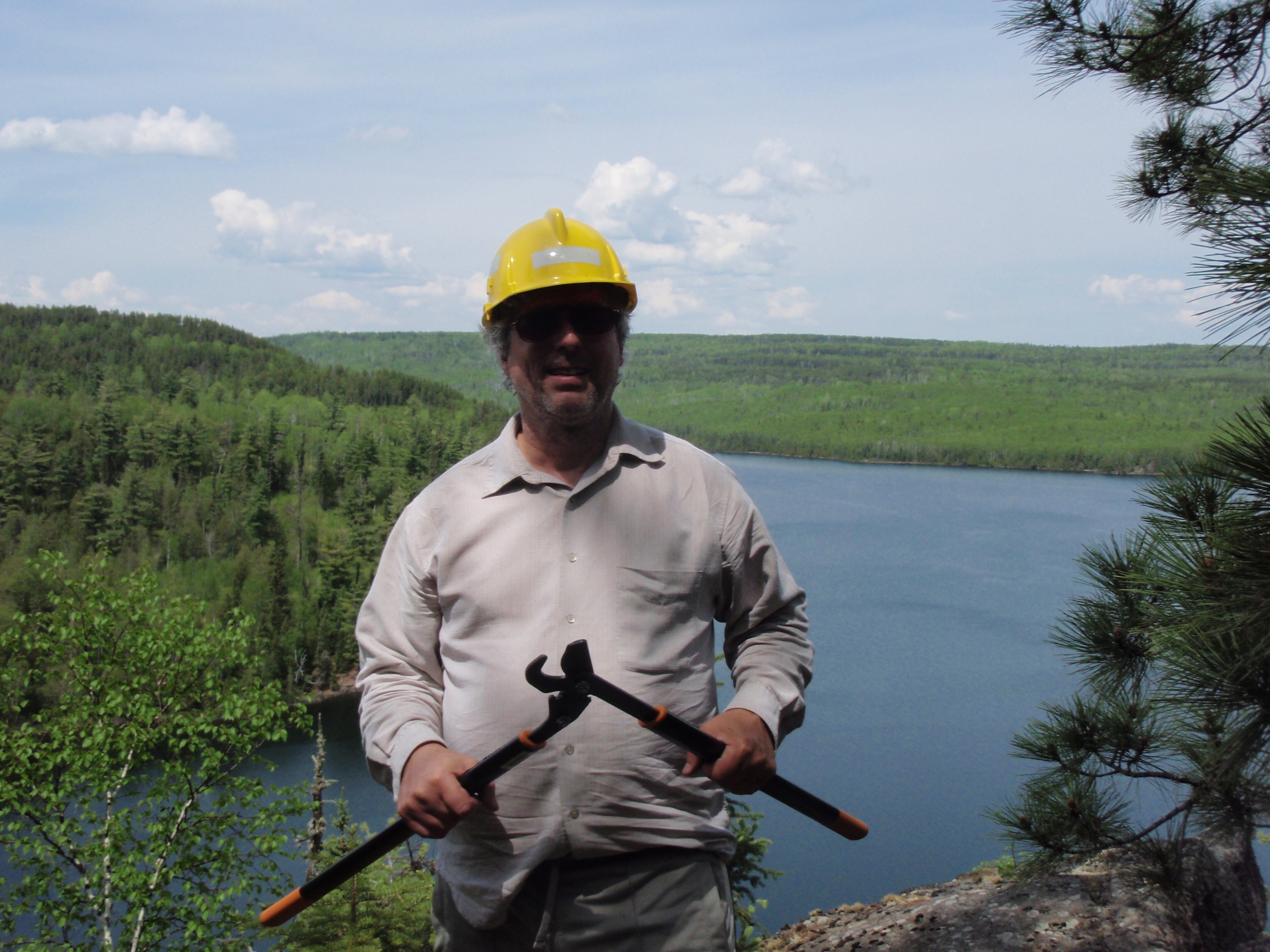
Up we hiked until we found a fantastic overlook of Rose Lake. Some of us stopped to take photos while others continued on. I took photos of Walli and Illona, and Walli did a shot of me holding up my lopers. We headed on, and soon Walli remembered that she forgot her lopers back at the overlook, so she went back for them.
Soon I caught up to the rest of the trail crew, and we were heading up a big ascent. It was painful. The Trail was thickety in parts, and we were wondering why we couldn’t just start clearing right there. But Tom said we needed to start where the other Trail Crew from Rose Lake had previously left off. So we kept going up, and it was really tiring.
We had past over several deadfalls and had also went by the Notch Log, when Tom stopped and told the Cross Cut Crew of Jeff and Jim that they could start cross cutting the deadfalls. The Notch Log was a deadfall that was too big to be cut, so a previous Trail Crew had just cut a notch in it, to make it easier to get across. Around the Notch Log the trail was flat for a ways, then there was a big uphill section. After that there were a couple small uphill sections, then we reached the spot where the other Trail Crew had stopped. After we reached that point I walked back a ways on the trail and started working on what I call the Z section. It’s a little uphill spot where there is a rock face. You hike to the left to get to the top of the rock face, then once on top you turn right and hike along the rock face, then take a sharp left away from the rock face. I was working with a lopers and a small bow saw. I thought we should spread out, so that’s why I walked back a ways.
I remember that Walli was working on the trail a ways up from me, and Paul was working on the trail a ways down from me. I cleared the area on top of the rock face, then headed down and cleared on the way. Soon I was down next to the rock face.
It took me a while to get the hang of using the lopers. The lopers worked on trees that were two inches wide or less. If it was a bigger tree, the loppers wouldn’t make it through, and you’d have to try making another cut on it. I found the lopers pretty labor intensive. You had to open up the lopers all the way, try to find the base of the tree, then push the handles back together. The handles were about two feet long. I found out that the best way to use the lopers was to kneel on the ground. That way it was easier to find the base of the trees. I would basically knee down and cut several trees in an area, then I would stand up and throw the trees off the trail. I would leave the trees that were bigger than 2 inches, then I would come back with the bow saw and cut them.
I was working on my section of the trail for over an hour. Eventually, Tom Suter, Illona, Dick, and Martin, who had been working on the farthest section of the trail up from me, past me by and started working on the trail somewhere down from me. The only person that was up the trail from me was Walli.
Soon, I reached the point where Paul had cleared the Trail. So, it was time for me to move down the trail. Walli was moving down the trail, too. At this point she seemed to take on the role of clean up person. She would clean up stuff that other people had missed.
We all kept working on the trail, but it was a fairly hot day for May in the Boundary Waters. I was getting to the point where I felt a little dehydrated. I had brought only one liter of water in my nalgene bottle, plus I had eaten my snacks. At about 1:45 in the afternoon, I asked Tom Suter if anybody had brought a Water Filter. He said that he did.
I said that I had run out of water, and if it was alright that I went down to Stairway Falls and fill up everyone’s water bottle. He said that would be alright. So I collected 5 or 6 water bottles and headed down the hill.
Tom had told me to ask the Cross Cut Crew of Jeff and Jim to come up the hill because there was a bunch of stuff up here to cross cut. Well, I started down the hill. I kept going and going. I didn’t see the cross cut crew anywhere. I seen where they had done some work, but I didn’t see them.. Finally I made it down to the overlook which is an eight mile above Stairway Falls and Jeff was sprawled out upon the overlook resting and Jim was sitting on a log with his shirt off looking rather beat. I told them that Tom had wanted them to go to the top for some cross cut work. But Jeff said they would do it the first thing in the morning.
I gathered their water bottles and headed for Stairway Falls. I got down there rather quickly after the overlook. There is a nice little section of rocky rapids right below the trail bridge and right above the falls. It seemed like the perfect spot for filling water bottles. So I sat on a rock next to the rapids and started pumping. It took me quite a while to fill up my nalgene water bottle. That’s because I kept drinking it. I must have drank at least a full liter, and I decided I better start filling up other people’s water bottles. So, I started working on therm.
While I was pumping, two young men, I think there names were Shawn and Brandon, came up to the rock ledge on the other side of the rapids. I chatted with them, took their photo and told them about my website. Since they were on the other side of the rapids, up on a ledge, I wasn’t able to give them one of my cards.
Also, when I was pumping, I saw that Jeff and Jim had made it down near the Falls and was working on a downed tree. Water pumping seemed to be going fairly slow, and I wanted to start hiking back to the top so those crew members could have water. So, I decided not to fill Jeff’s and Jim’s Water Bottles, and started up the hill. I went over and told them that I really needed to start hiking back up, and I was wondering if they could fill their own water bottles. They agreed, so I left them the water filter, and I was off.
Again, I would be challenged by the uphill sections going up from Stairway Falls. Luckily, I was freshly re-hydrated, or else I would have had a much worse time of it.
Finally, I had made it up to where I met some crew members. The said that we were stopping for the day. It was right before a big uphill stretch, so I was glad that I didn’t have to walk up it. At the top of the big uphill stretch, Tom was stashing a bunch of tools in a big clear plastic bag. It was no use hauling them down, just to haul them back up in the morning.
I gave everybody back there filled water bottle, and I felt kinda bad because I made it there right when we were quitting. But, Dick said he really needed the water. So I felt good that I made the trip. I was also glad that the Cross Cut Crew had not come up the hill with me, just to find out that we were shutting down for the day. We headed back down the trail. Some of the lower areas seemed more thickety than what we were working on up above. Instead of small trees, there was some type of long stemmed brushy plants, In some spots they had taken over the trail.
We headed down past Stairway Fall and traveled on Stairway portage back to the Duncan Lake landing. Several people sat on the rock at the landing to change into there boating shoes. And soon, we were off.
Walli and I were taking it easy paddling. We were just trying to rest and enjoy the ride. Soon the other 3 boats were way out in front of us by around 2 or 3 football fields, but we didn’t care. There was really no rush to get back. We just leisurely paddled. On the way back, I came up with a new plan for my backpacking trip. I had asked Walli if she thought we would do any Trail Crew work on Sunday Morning. She thought the Trail Crew would just be heading out, and there would be no trail crew work.
In that case, then why should I make someone paddle me back to Stairway Portage on Sunday morning, and why should I have to walk up that big bluff east of Stairway Falls on Sunday morning. What I could do is take my backpacking gear with me on Saturday, then when Tom says that we are finished for the day, I’ll change into my backpacking clothes and start hiking east towards the Rose Lake campsites, and the Trail Crew will head west towards Stairway Falls and go back to their campsite on Duncan Lake. I figured this plan may save everyone a little pain.
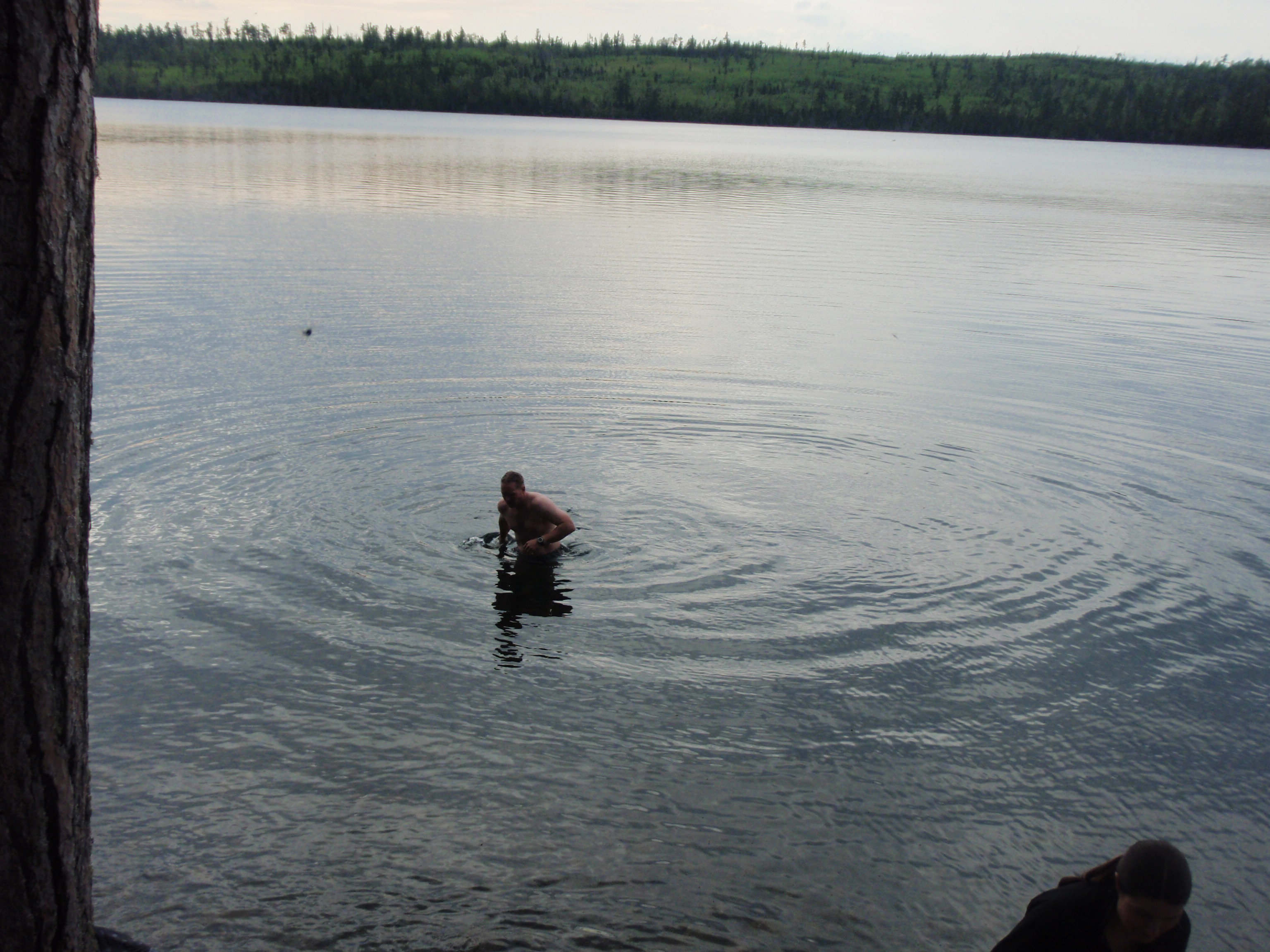
When we got back to the campsite, Jeff had taken of his shirt and shoes and was headed into the lake for a swim. He went in the water and the two ladies, Illona and Walli also went swimming. Martin took a dip over in the little cove to the south of the campsite.
I wanted to take a dip, but I didn’t have any shorts. So after Jeff, Illona and Walli had cleared out of the area, I decided to take a dip in my underwear. They were the extended brief type underwear, so they kinda look like swimming trunks anyway. I walked in to about waist deep water, and it was really cold. I really didn’t want to go all the way into the water, but I splashed some water onto my upper body. At one point, I almost fell when stepping on slippery rock, so my body would have been dunked in then, but I managed to stay upright. The whole bottom of the lake is covered with bread box sized rocks.
After my swim, everyone was lounging around the campsite. Several people were sitting around the campfire area, and they had started a small campfire. Again, this campsite had the usual forest service cast iron grate, which I always like to dry my boots and socks on. But, that wouldn’t be needed today, my boots were perfectly dry.
Tom had brought up a bucket of water from the lake and set it next to a log at the campfire area, and he was pumping water from it using a water filter. Meanwhile, Jeff had a different water purification system. It had a bag that you fill up with water from the lake, then you hang the bag from a tree and the water goes down a hose through a water filter. It is gravity fed with no pumping. This bag system suddenly got real popular with the crew members. I explained to Jeff that I was using the Aqua Pills for my backpacking trip, but now the Aqua Pills say that they take 4 hours to completely purify the water. Jeff was a little concerned, especially with all the heat. We discussed perhaps me using his water bag system for my backpacking trip.
Tom started getting the cooking area ready. He had a two burner stove, which he had set on the ground, a large pot which he would be cooking some chicken breasts in. He started cooking, and everyone else was relaxing around the fire. I think Illona got some French Bread rounded up, and we started cooking it on the wood coals in the fire place.
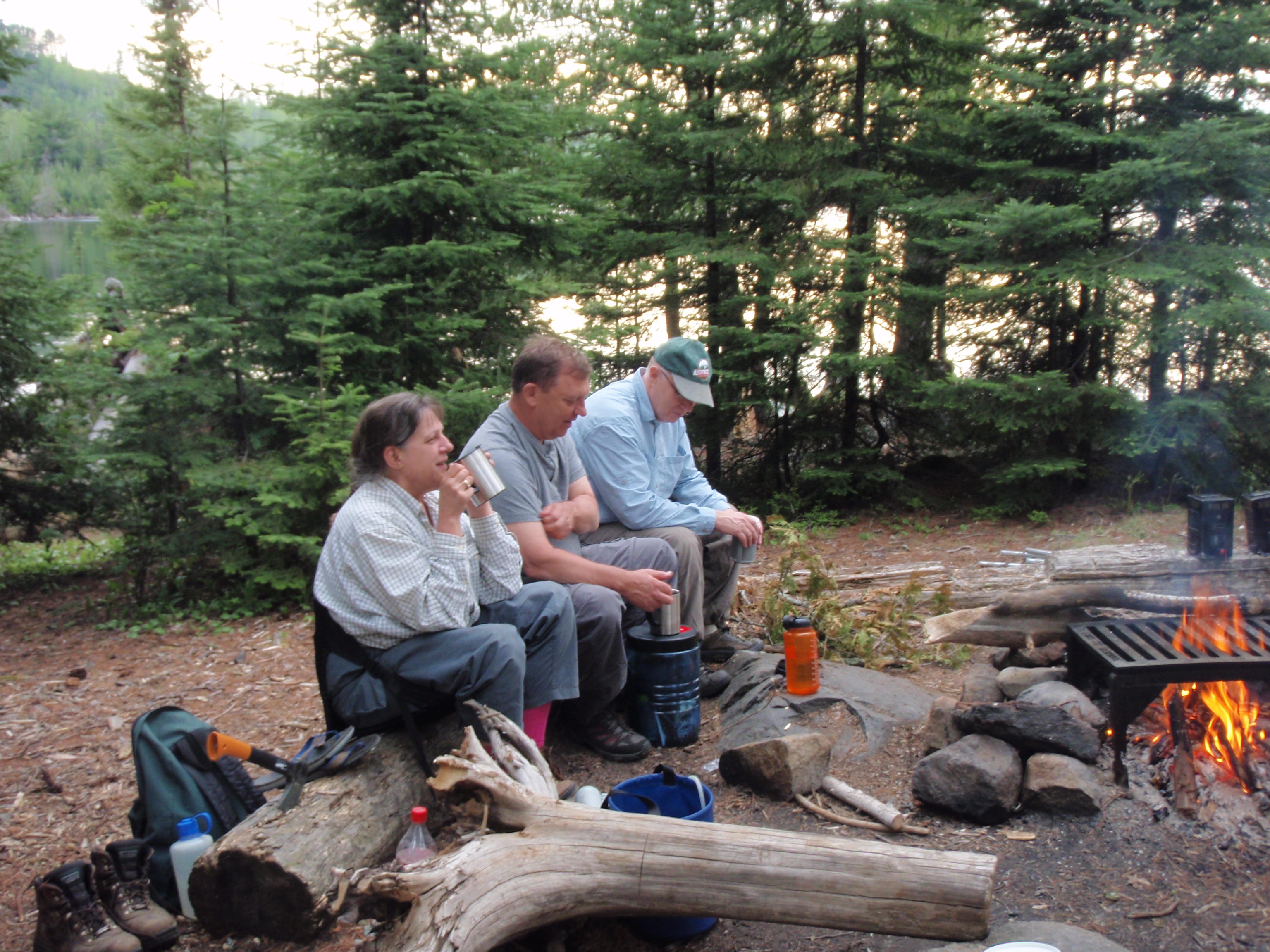
Meanwhile, Martin had set up two boxes of wine, so people could have an after dinner drink. I pumped up all my platypus bags full of water, and also my nalgene bottle using the pump that Tom had previously been using with the bucket of water.
After I finished filling my water containers, I went over to my tent and grabbed my voice recorder. I wanted to do a profile of every person on the Trail Crew for my website. So I asked everyone to say stuff about themselves into the Voice Recorder. Some of the Stuff they could say is where they are from. who their family members are, what school did they attend and what job they have. We had quite a diverse group of people. Dick is a newly retired IT specialist for an airline, Paul is a financial advisor, Walli is a paralegal and Illona is a silversmith.
I was under the impression that Tom thought too many cooks would spoil the soup, so to speak. He was patiently working on cooking the chicken. Jeff went over to check on things and started helping Tom. It was a long wait, but the meal was done. And it was worth it. It was Chicken Breasts cooked in some yellow sauce, plus French Bread.
I devoured it, and really enjoyed it. Some of the other people were partaking in the wine, but I told them that I wasn’t very much of a wine person. I took a small sip of wine, and confirmed that I really don’t like it. If it was beer, it would be a different story.
After Supper, Walli volunteered to do the dishes and was heating up some water. Tom was relaxing in the camp chair he brought. I asked him whether we would be doing any trail work on Sunday, and he said no, we would just be canoeing back to the boat landing on West Bearskin Lake. I told him I was thinking about taking my backpacking gear with me when we are Trail Clearing the next day (Saturday). And when we were finished Trail Clearing, I would start backpacking east. He said that would be okay. Now that Tom wasn’t busy cooking, I had him say his profile on my voice recorder.
Tom is a quiet leader. He really knows what he’s doing and leads by example. I thought maybe he was quiet was because he was concentrating on making the trip a success. This was the first trip where he actually is the Crew Leader. He had been on many other Trail Clearing Trips, since he started doing them in 2002, but this was the first where he was the Crew Leader. But Tom was very prepared for this trip. For instance, he had taken the water filter with him when we were out working on the trail. I would rather have a quiet leader who was prepared and knowledgeable than someone who is a smooth talker and not prepared.
We all talked around the fire as it grew dark. I decided it was time for me to go to bed, so I said goodnight and retreated to my tent. I tucked myself in my tent, laid inside my sleeping bag and did my voice report of the day’s activities using the voice recorder. At the end of the voice report I said that I was really beat, and I wondered if it would affect my ability to go backpacking.
Saturday, May 22, 2010
Stairway Falls to the Clearwater Lake Campsite
I woke up fairly early and pulled my stocking cap over my eyes and went back to sleep. But it wouldn’t last long. Soon I heard people milling about the campsite, and I had the urge to pee, so I thought I’d better get up. After all, I had a lot of work to do. I needed to completely pack up this morning, and get ready for my backpacking trip. I took a photo looking from my tent of the lake in the morning.
I usually wear a stocking cap when I camp for sleeping. It keeps my head warm on cold nights, and I can use it to cover my eyes and ears, making it easier to sleep. When I got out of my tent, Jeff started razzing me because I had a Green Bay Packer stocking cap on. Evidently, he thought that it was a bold move on my part considering everybody else on the Trail Crew was from the Twin Cities.
I walked up to the latrine and did my duty. Then I came back to the campsite and started packing up. The first thing I do when packing is to stuff my sleeping bag all the way down into the bottom of my backpack. The sleeping bag is rather bulky, and takes up the bottom third of my backpack. Then I retrieved my two bear bags that were hang near the south bay and put them in my Backpack. That took up another third of the backpack. Then I packed up my tent and some other items and put them on top. I had an orange bag with a zipper on it that I used to carry miscellaneous items that I might need more frequently. Stuff like the trowel to make a cat hole, extra batteries for the camera, voice recorder and Spot Messenger, extra camera cards for the camera, the first aid kit and more essentials.
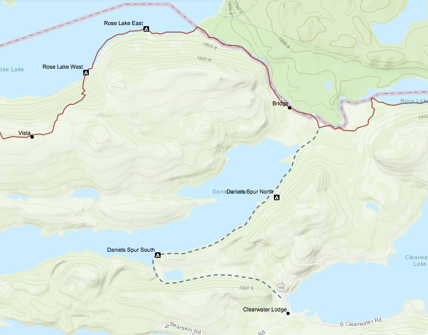
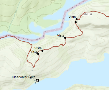
Tom saw that I was packing up and he came over. He asked if I was going to start my backpacking trip today after we got done trail clearing, and I said yes. Yesterday, I had said that I was thinking about it, when I talked to him. He told me now that he thought that I was a smart Idea. We looked at some maps together, and I said that I was hoping to reach the “Campsite at the Notch” as I call it, on Clearwater Lake to camp tonight. Tom called it the “Two Mile Campsite” because it is two miles from the western end of the lake. Evidently, Tom had been on some Trail Clearing Trips where they used that campsite. The reason I call it the “Campsite at the Notch” is when you’re walking east along Rove Lake, eventually you get to the Rove Lake/Clearwater Lake Portage, which goes up through a notch in this big hill. And down on the other side is the campsite.
I asked Tom if I could borrow one of his Water Filters for my trip, because Jeff was concerned about me just using Aqua Pills in the hot weather. Tom said yes I could borrow one. I didn’t want to borrow Jeff’s bag filter system because it was being used quite frequently by the trail crew. In fact, they were filling up a big 5 gallon collapsible water container using the bag purifier.
Tom seemed to be in a good mood this morning. It was a beautiful day and the trail crew was really coming together as a group. I continued packing while everyone was starting breakfast. I announced that I would be starting my backpacking trip today after we finished the trail work. And I asked if someone could carry my daypack up to the top of the hill, because I would be carrying my backpack. Dick volunteered to do it. I was happy about that. Perhaps, he volunteered because I hauled water up the hill yesterday, and he really seemed to appreciate it
They were just about finishing breakfast when I scurried over there with my mug. They were having oatmeal with all the fixings. I put two packs of oatmeal into my mug, and I pack of hot chocolate, then filled it with hot water and stirred it. Then I put on some toppings like brown sugar and walnuts and stirred it some more. This is the more deluxe version of the choco-oato that I usually have. It was really good.
I finished packing up. I again was using the 3 bag system. I had my backpack, then I had the weekend pack, and then there was the daypack, which would travel inside the weekend pack. The weekend pack was a much larger pack, almost like a Duluth Pack. It was called a California Pack. The whole front of it zipped open to make it easier to put things in. It also had several pockets. In the weekend pack I had my work boots, and several other items that I wouldn’t be needing for my backpacking trip. In the daypack, I had my backpacking clothes that I would be changing into later that day, all of the water bottles and bags, plus some snacks.
We started canoeing back to Stairway Falls. This time I was in the back of the canoe doing the steering. We made it over to the Stairway Portage Landing, and I was fidgeting with gear for the last time. I showed Tom where I put the keys for my van. They were located in the side pocket of the California Pack. Tom was going to drive my van down to Grand Marais on Sunday, after the trail crew had returned to the boat landing. I gave my daypack to Dick, who was hiking it up the hill for me. I changed into my hiking boots and away we went.
Walli and I stopped for photos at Stairway Falls, but the angle was pretty bad on the east side of the falls, and we didn’t have enough time to hike around to the other side. Then we also took photos at the overlook up from Stairway Falls. We continued on up the bluff. This time it didn’t seem so bad. Maybe because it was because we were fresh in the morning or maybe it was because we knew what to expect this time. Walli and I were lagging behind, and after we went up one big uphill section, I seen the 5 gallon collapsible water container sitting on the side of the trail, full of water. Again, Tom had taken steps to make sure we were prepared. I guess I was paying all my attention to packing my own gear that I hadn’t noticed that they had brought that water container until seeing it on the side of the trail.
We made it past the Notch Log then up the big uphill section where the tools were stored at the top. My daypack was sitting there. Thank you Dick for carrying it. I decided that I would leave my backpack sitting here for the day, because there were some other packs there, too.
So, Walli and I grabbed our lopers and a small bow saw, and off we were to start working on the trail. I was working for a while when I came to an area were there was a downed tree. It was about fifteen inches in diameter and it crossed the whole trail at a height of 2 and a half feet. While I was trail clearing in the vicinity of the downed tree, the Cross Cut Crew of Jeff and Jim came along and started working on the tree
It was then that I realized that I had not taken very many photos of the actual trail being cleared. After all, if I wanted to document what it is like being on a trail crew, I’d better take some photos. So, I took a little rest from doing Trail Clearing and photographed the sequence of Jeff and Jim cutting the downed tree.
First they cleared out an area on the left side of the trail so they had enough room to cut the tree. Then they cut the log from the top down about half way using the Cross Cut Saw. Then they under cut the log from the bottom using the Cross Cut Saw. When it was almost all the way cut through, they stopped with the Cross Cut Saw and used the Bow Saw to complete job on the left side of the trail. Then they worked on the log on the right side of the trail. On the right side, they cut from the top down, and that was it, a 6 foot section of log dropped to the ground. Jim wrangled the log off the trail while Jeff cut off a pointy piece of wood that didn’t fall with the log.
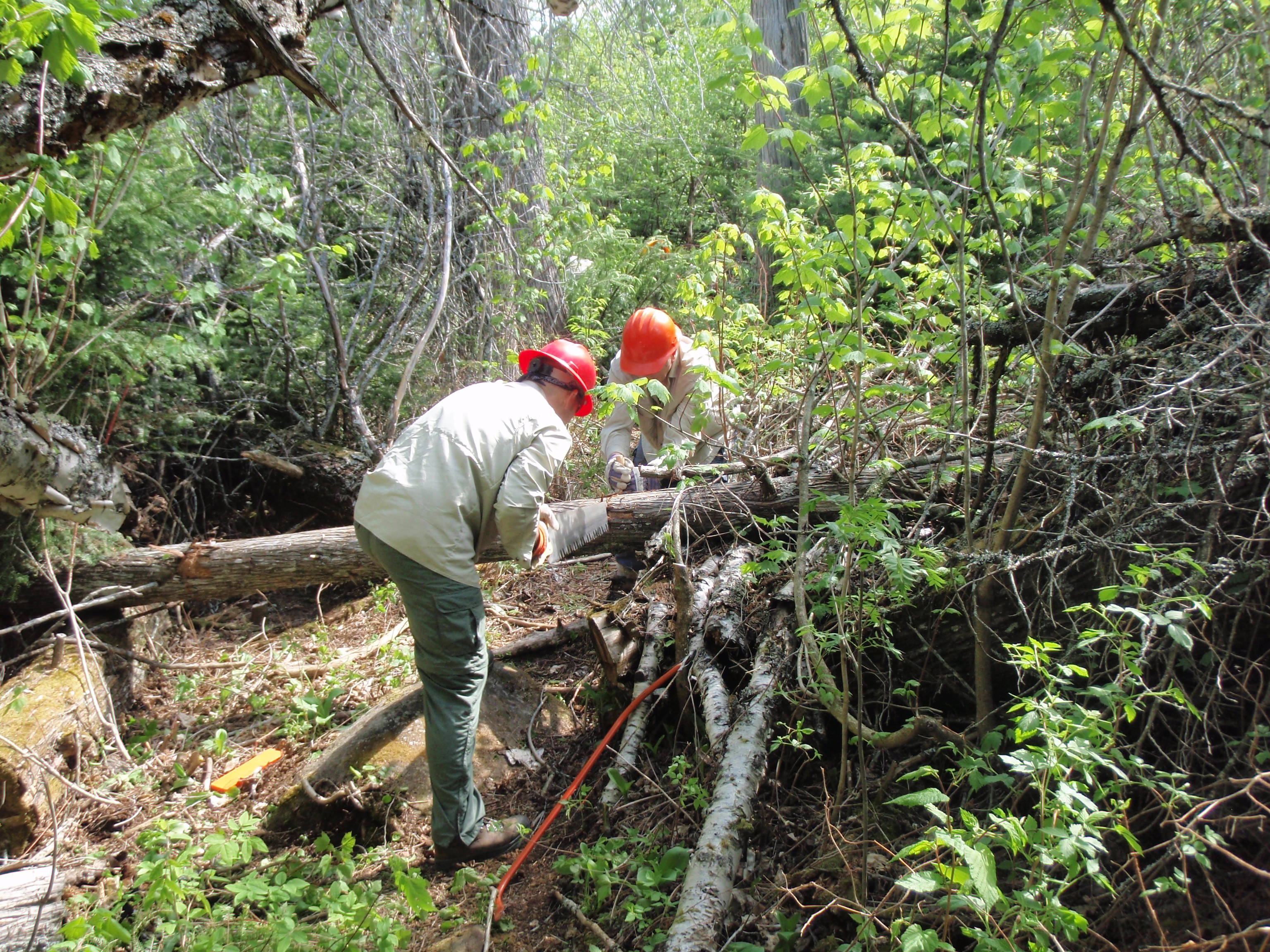
This whole sequence just took less than five minutes, and it was a lot more complex than I thought it would be. Jim is an engineer with an energy company, so perhaps it comes naturally to him. Jeff never told me where he worked, so I don’t know what his background is. But Jeff must have went through the Cross Cut Saw Training this spring, because this is his first Trail Clearing Trip and he is certified for the Cross Cut Saw.
Again, now I realized that I needed to take some more photos of the Trail being cleared. I had taken photos at our Campsite, at Stairway Falls and at the overlooks, but I didn’t take any Trail work photos. How else could I show the complete story of being on a Trail Crew on my website. So every chance I had a moment, I took a photo of one of the crew. I wanted to take at least one good action shot of every crew member doing trail work. Sometimes that is a little hard because the digital camera still has a little lag in it.
And by the time you take a photo, the person has already moved to a different position, which isn’t a very good shot. I tried to take a photo of Tom, throwing some brush off the trail, and it didn’t work out.
Today, we had a bunch of people working in a closer proximity than yesterday. Perhaps we were more confident using the tools, and felt we wouldn’t accidentally hurt someone else. I had developed a system where I was working well with Martin. I would use the lopers in an area on the trees that are smaller than 2 inches, and then Martin would come along and bow saw the trees that were larger than 2 inches up to about 4 inches in diameter. Again, Walli was taking the far end position on the trail, cleaning up the stuff that others had missed.
We just kept working on the trail. I would set my daypack down then work on a section of the trail. Then, when I completed that section, I would walk back and get my daypack and move it down the trail. Usually, I stop and drink some water, and have a snack, when it was time to move the daypack down the trail
Sometime in the morning, I noticed that Jim was working on the trail next to me. I took his photo, and realized that Jim and Jeff must have completed the Cross Cut Saw work, so now Jim was working on the trail with lopers and a bow saw.
At around 11:30 am, we had cleared down to where I had left my Backpacking Backpack. It was on top of a big uphill section, which had now been cleared. Tom said to wait there, and he would go down and get the rest of the Trail Crew, and we would have lunch.
Soon, everyone was gathering for lunch. Martin sat down on the side of the trail and pulled up his pants legs to show a scraped up area on his leg. But he was taking it all in stride and was even joking about it. We all sat around at the top of the uphill section and rested while eating lunch. And everyone looked a little worn down so they really needed the rest. It was a really warm day for May in Northern Minnesota.
Tom had brought some tortilla bread and some fixings, so everyone made some sandwiches. Dessert was Sandies Cookies. I had tried to have a complete trail crew photograph, at that point, but not everyone was in the shot. I also took some photos of people just relaxing.
Illona was wearing a full net jacket, compete with a net hood that covered her face. She said that she had bad reactions to mosquito bites, so she liked wearing it. It looked like a good idea, and she said it only cost her around $35. I also remember that Walli asked Tom if we could go down and clear the most dense and thickety part of the trail. But Tom said that the alder plants would just grow back next year, and he wanted us to concentrate on clearing trees that take longer to grow back.
So, we finished lunch and went down the big uphill section and started Trail Clearing on the bottom. As we were Trail Clearing in the afternoon, there were two central things I was thinking about as the day wore on.
First, I was hoping some backpackers would come along. Wouldn’t it be great if some backpackers would come along and enjoy the section of newly cleared trail. I think it would be great for the backpackers, to see that a bunch of people are working on the trail, so the backpackers have a better trail to hike. And it definitely would be great for the Trail Crew to see someone using the trail. After all, it’s for all the backpackers and hikers why we are out here clearing the trail.
The Trail Crew had met some people. But the people we met were canoeist and fishermen down near Stairway Fall. They were taking a side trip to look at the falls. They were not actually hiking the Border Route Trail. I was hoping to see some actual Border Route Trail hikers or backpackers.
The second thing I was thinking about was how labor-intensive using lopers is. It is fairly slow to get the loper jaws lined up around a small tree then cut. If I had a motorized brush cutter I could cut down ten trees by the time the lopers cut one tree. Plus, to be at the right angle to find the base of the tree and cut it with the loper, I had to kneel down.
But the Forest Service doesn’t allow motorized equipment in a Wilderness Area. I can see why they don’t allow chain saws, because they are very loud and you can hear them for over a mile. But, a 4 horsepower brush cutter doesn’t make that much noise and would be the best tool for this job. Besides, we didn’t need a chain saw anyway, the Cross Cut saw crew had already cleared all the downed trees and were now helping us make the trail wider by cutting small trees with lopers and bow saws.
As time and work progressed in the afternoon, the trail crew made it down to the spot where trail was overgrown with alder plants and other thickety plants instead of trees.
Soon I saw that Jeff was using a scythe to cut these plants, Since there was a long section of these plants, I ask Tom if I could use a scythe, too. So Tom assembled a scythe, and I started using it.
I wanted to use the Scythe for two reasons. First, I wanted to see what it was like, and secondly, I wanted to do something different than using the lopers, which I had done all day. The Scythe looks like an old time hand thresher that farmers would use to harvest wheat, before the invention of the tractor. It had a curved stem, with two handles on it, one for each hand, and on the bottom of the stem there is a foot long blade.
You use the scythe in a circular motion, and twist your body around like doing an exercise. I didn’t take long until I was tired of it and Jim took over. We had decided that we would switch off with it. But the main thing I didn’t like about the Scythe was that it didn’t do a particularly good job. Sure it would cut the plants, but it would leave a stem of 2 to 4 inches sticking up from the ground. Tom was right, they would just grow back again next year. This is again where I wish we could have had a weed wacker. With a Weed Wacker, we could have cut the plants at ground level and perhaps stunted their growth a little more.
But the Forest Service doesn’t allow motorized equipment in a Wilderness Area. But the Boundary Waters Section of the North Country Trail Reroute will be perhaps the longest and most difficult section of National Trail to traverse a Wilderness. Both the Border Route Trail and Kekekabic Trail have over 35 miles of trail in the Boundary Waters Wilderness Area. And these wilderness miles are often very difficult to maintain because of the effort it takes just to get into these remote areas.
Contrast this with other Wilderness Areas in the Midwest that the North Country Trail passes through. In Northern Wisconsin, the Rainbow Lakes Wilderness has 6 miles of the trail and the Porcupine Lake Wilderness has about 7 miles of the trail. Meanwhile, in Upper Michigan, the McCormick Wilderness has 8 miles of North Country Trail. All of these Wilderness Trail sections are meager compared to the 70 miles within the Boundary Waters Wilderness. I think the Forest Service should cut us some slack, and let us use brush cutters and weed wackers in the Boundary Waters.
I continued to trade off the Scythe with Jim. But one time when I was working with the scythe I had Walli take some photos of me with it. Then, Tom came along and announced that we were a 6 minute walk to the water container. I decided that I would take the 6 minute walk to get some more water. I had been drinking water at a pretty good rate, and needed my bottle and platypus bags filled. So I walked the mostly brushy, thickety trail to the water container. When I got there, Jeff was sitting in the shade across the trail from the water container. He looked really beat. I had a short conversation with him while I was filling up my water containers, then I headed back.
We worked on the trail for a while more, then after 3 pm, Tom came along and said we were calling it quits for the day. He said the crew could go down and spent a little time exploring around Stairway Falls. Then I asked everyone that came along to wait at the water container while I changed. Meanwhile, Tom had gotten some orange ribbon and tied it to a tree, thereby marking where the trail crew had stopped. I hiked up the trail and found a spot to change. I had put my backpacking clothes in a ziplock bag in my daypack. I quickly changed into them, and placed my grungy trail crew clothes into the daypack.
Then I walked down to where the Trail Crew had gathered. We took one last photo of the Trail Crew, perhaps to have an “after” photo. Never the less, it would be the last time we would all be together, because I was backpacking east. After the Trail Crew photo, I summoned Tom forward and told him I would like to take a photo of me handing him back the hard hat that I had used. Walli took the photo, it was really special.
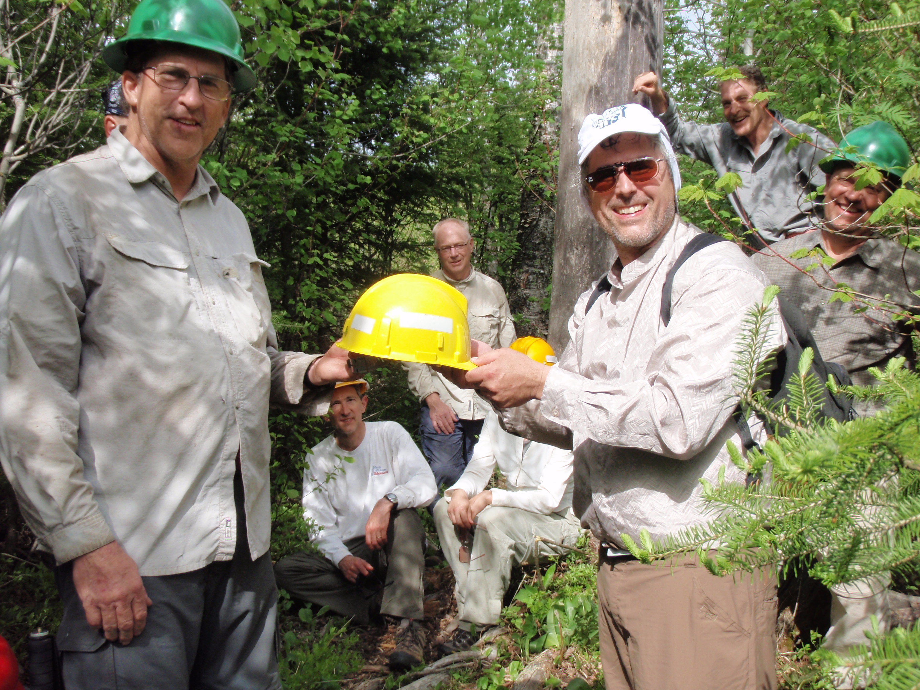
Then I shook the hand of every trail crew member and said something like “On behalf of backpackers, I thank you for your hard work on the trail.” To each one of them I did it. Tom, Jim, Jeff, Walli, Illona, Dick, Paul, and Martin all took there turns at the final handshake. The person I remember most in this sequence was Martin, because he said to me that he was glad someone was hiking the trail.
So, I gave my daypack back to Dick to hike down the hill, and I grabbed my water bottle and platypus bags, and I was off, heading east. The daypack would be hiked back down to the canoes where it would be placed inside the weekend pack. Then the Trail Crew would take the weekend pack back to my van at the boat launch on Sunday, and Tom would drive my car down to the Pincushion Mountain Trailhead near Grand Marais, where I would eventually hike to.
Meanwhile, while I was hiking east the trail all of a sudden got a lot lonelier. It reminded me of the movie “Before Sunrise.” A young couple had met on a train decided to get off the train together in Vienna, Austria. Through the course of the evening they met several different people at several different locations. They met some actors on a bridge, a poet along the riverwalk and had eaten food at a pub. During the evening all these places were bustling with people and activity. Eventually, the couple fall asleep on the grass at a park. Then the movie cuts to early the next morning. It shows the bridge, riverwalk area and pub all empty in the morning, where the night before it was bustling with activity. That sequence in the film really left me with an empty and lonely feeling.
I felt the same empty and lonely feeling as I walked back on the trail that we spent the last day and a half clearing. I walked over the notch log that is now cleared of brush. I walked up the uphill stretch and made it back to where we had shared lunch together.
My backpack was there. I packed up my water containers, hoisted my backpack, and continued east. I was still in the area that we had cleared. I saw the log that I photographed Jim and Jeff cutting earlier this morning. I continued on a saw the trail section that we worked on yesterday. Then I finally made it back to the “Z” section, as I call it, where I started working yesterday. I walked left next to a rock face to get on top of the rock face, then I walked to the right along the top of the rock face, then the trail turns to the left again. That’s the spot where I first learned the techniques of using the lopers.
Soon, I was out of the territory that our Trail Crew had done. I wondered how they all were doing down by Stairway Falls. I wish I could have gone down there and explored it with them, but I really didn’t want to walk up that hill again. I wondered whether Tom was looking for possible campsites in the area. There was a campsite just a short ways west of Stairway Portage on Rose Lake, I wondered if there is already a path that connects to that campsite. Perhaps there is a nice place for a campsite on the Cariboo Rock Trail. It’s definitely worth exploring. Finding places for campsites is one of the things that the Border Route Trail Association would be concentrating on over the next year or so.
Campsites are especially needed along the route of what will become the “Stairway Loop.” The Border Route Trail Association is working on building a trail on the south shore of Moss Lake. The Trail will connect the Caribou Rock Trail with the South Lake Trail. The loop would make a nice extended weekend hike for backpackers. They can hike from Hungry Jack Lodge north on the Caribou Rock Trail. When they reach Stairway Falls they would head west on the Border Route Trail. That section has some really spectacular views on the Rose Cliffs. Then, after hiking west about 4 miles, you hit the intersection of Border Route and the South Lake Trail, Hike South on the South Lake Trail several miles until getting to the yet to be built Moss Lake Trail. The 2.5 mile Moss Lake Trail will take you back to the Caribou Rock Trail, where it’s a short distance back to Hungry Jack Lodge.
I’m not sure the exact mileage of this loop, but the loop is intended to get more people out hiking some of the most scenic miles of the Border Route. You may ask yourself where did the idea come from for this loop. Well, I hate to take exact credit for any of it, but last year I pointed out that the Kekekabic Trail had several loops attached to it such as the Snowbank loop, Dissapointment Loop and Old Pines Loop, and the Border Route had none. Ed Solstad picked up on the idea, and knew exactly where the best place for a loop would be. Ed pitched the idea to the Forest Service and they agreed that it was a good idea and approved the concept. This spring the BRTA has had some Trail layout hikes to explore possible routes for the trail. And they have been flagging the best route for the Forest Service to approve. Hence, the creation of the Moss Lake Trail. Well, it’s not created quite yet, but hopefully will be within the next year.
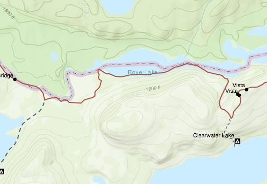
Back on the Border Route, I’m hiking east on the bluff that’s east of Stairway Falls. The trail is in great condition because it has been cleared within the last few weeks by a different trail crew. I knew that my next few miles of hiking would be perhaps the easiest miles of the trip. It was all flat or downhill going to the Rose Lake West campsite, then I would travel along the lake to the Rose Lake East Campsite. After hiking along the lake again, I would reach the Long Portage, which is a former railroad bed. I would have easy hiking on Long Portage for another mile or so. I knew this part of the trail because I hiked it last year before I left the Border Route on the Daniels Lake Access Trail, which connects to the Long Portage.
On top of the bluff I was traveling in mostly sunny areas without many tall trees. Perhaps this was one of the areas that were hit by the 1999 Big Blowdown, which toppled many trees in the Boundary Waters. One of the problems with the Boundary Waters is that it is very rocky and there isn’t much topsoil. Trees have a hard time putting a taproot into the ground. Instead, they have what’s called a pan root that spreads out on top of the rocks. Not having a taproot makes these trees more susceptible to tipping over in the wind. I did see a few glimpses of Rose Lake way down below while I was on top of the bluff.
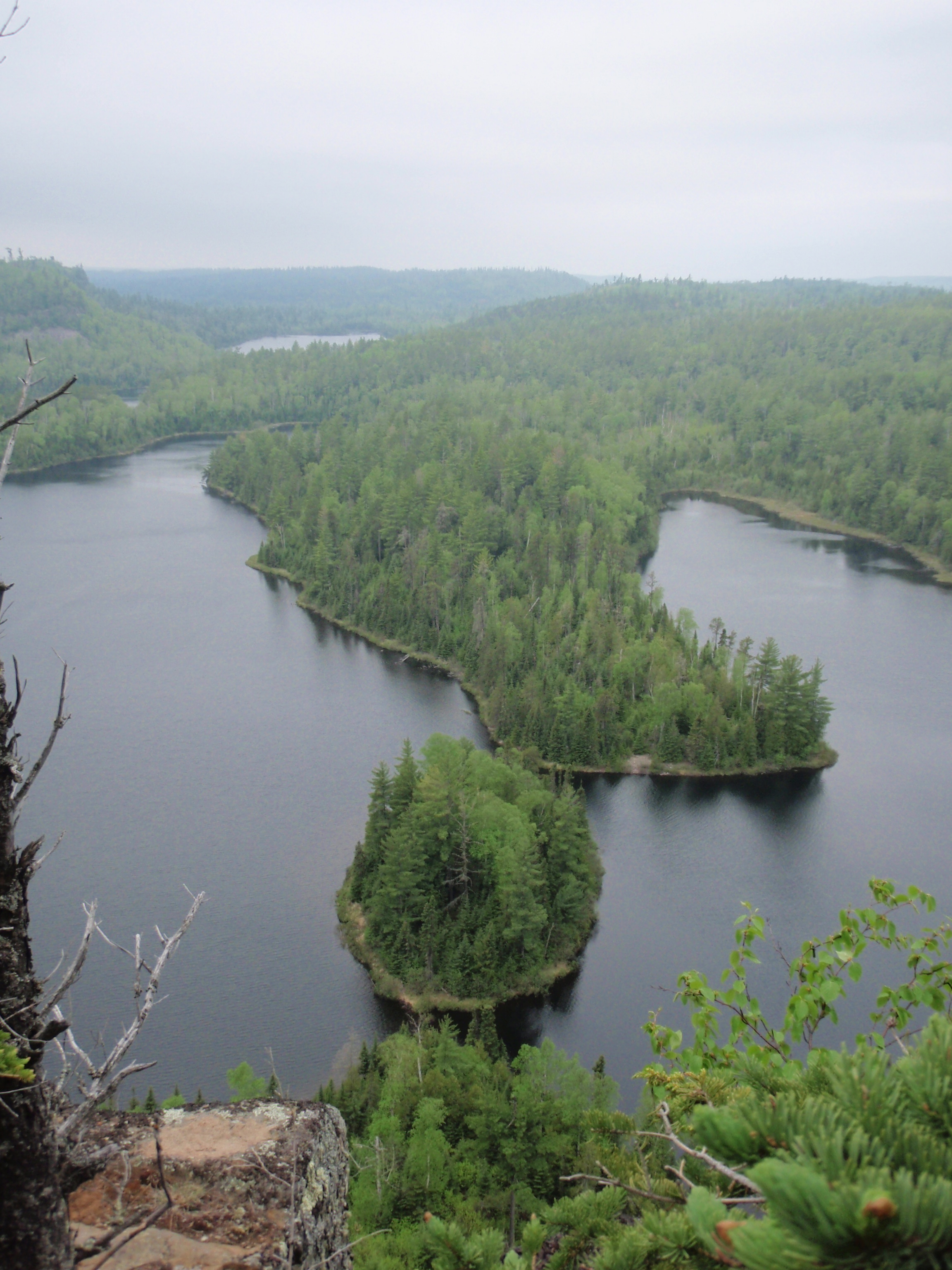
After being on the sunny hill top, the trail starts down the hill in a big loopy affair. The trail heads back and forth several times in a switchback system. I was getting closer and closer to the lake, but I couldn’t see it very well because I was in a deep, dark woods on the side of the hill, as opposed to the sunny area on top of the hill. Soon I was down near the lake and I made it to the Rose Lake West Campsite. It’s a nice little campsite in the woods up from the lake about 50 yards. The site was empty. I went down to the canoe landing and took a look, then I headed east along the lake shore.
The Trail is pretty easy along the shore. I saw a nice rocky spot along the Shoreline, so I walked out there and took some photos. I didn’t see any boats on the lake. I continued east and soon made it to the Rose Lake East campsite. And this campsite was occupied. There were two tents, some kitchen gear, and a bunch of clothes that had been set out to dry on the logs around the campsite. But nobody was home. I went down to the shore to see if I could if I could spot any boats in the vicinity. I did see one really long canoe, with 4 people in it, but it was way across the lake, so I wouldn’t be able to talk with them. But I did take some photos while I was down by the shore. I got a good shot of the big cliff across the lake in Canada.
I went back to the fire ring and got one of my “I saw Tman” cards out. I wrote something like “I stopped by here while I was hiking the Border Route Trail, Sorry I missed you. Check out my website.” I put the card down on the fire grate and put a small rock on top of it. I wrote on another card and put it in a tent so it wouldn’t blow away. I would hate for a quick rainstorm to come through, because nothing was buttoned up in this campsite. All the tent windows were open, and everything would be soaked. But it was a beautiful day with no sign of rain anywhere. I continued on down the lakeshore to the east.
It was an easy hike in the woods along the shore to get to Long Portage. I stopped at the Canoe Landing and took some photos. I noticed there was a water bottle that was left at the landing. When I examined it closer, it said “oil” on it. I was thinking about taking it. But maybe the rightful owner would be back to claim it. Besides, I was already carrying more weight than I wanted. Then I headed down Long Portage. It was just as I remember it, flat and easy walking.
There were several areas that had boardwalks to make it even easier. To the left of the trail was a little river, and beyond that, Canada. Over the next mile or so, the river changes. First it is a little rapidy river, then there are some beaver dams which make beaver ponds where the river travels slower. Eventually, the river becomes one big marshy area. Along the way on Long Portage, I was looking for possible campsites for the Border Route. But because this is a former railroad bed, it made it difficult to find a possible campsite location. On the left side of the trail was a river, and on the right side there was a little drench where they had dug dirt from to make the railroad grade. But perhaps a campsite along Long Portage is not a necessity. There were the two campsites that I walked through west of Long Portage, and there is a nice campsite south of Long Portage on the Daniels Lake Access Trail.
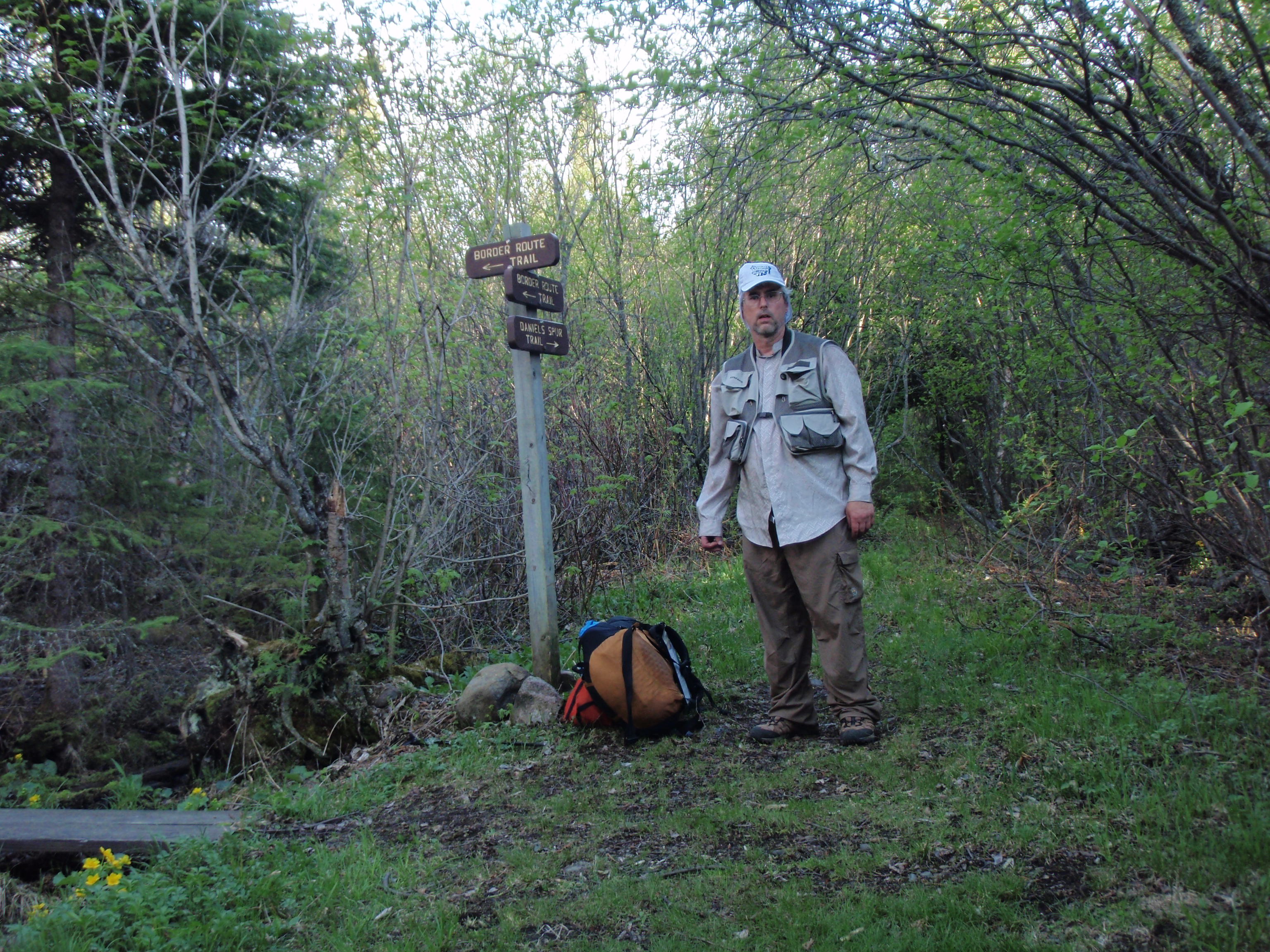
Finally, I made it to the intersection of the Border Route and the Daniels Lake Access Trail. This was the spot where I left the Border Route last year. Now I would be hiking east on a section of the Border Route I never hiked before. I set down my gear at the sign at the intersection, and took a photo of me pointing east, towards the section of the trail I soon would be hiking. Then I picked up my gear and started hiking into the new territory.
I had a new piece a gear that I was using for the first time on this trip. I was wearing a fisherman’s vest. This vest had many pockets to put things in, which I like. I put my spot messenger in one pocket, and my phone and voice recorder in another. There were more pockets for snacks, Aqua pills, and my “I Saw Tman” cards. On the inside of the vest, there was a big pocket on each side of the vest, presumably to put fish in. They were big enough for me to put my platypus bags of water in, so I did. This vest made everything really handy to get.
I hiked east towards Rove Lake. This is a portage too, but it wasn’t a former railroad grade, so it isn’t as easy as Long Portage. It isn’t a overly difficult portage, but it has a few little up and down sections. And the Trail was clear, after all, it was a portage, and the Forest Service makes sure the portages are good.
 On the McKensie Map, I saw another trail connecting with the portage, going into Canada. I looked for the trail, but saw none. Besides, that trail looked like it would be going through the big marshy area that had some water areas. I don’t think a trail would be able to make it through it.
When, I was walking on the Long Portage, the big marshy area was to my east. On the portage that I was walking on now, the big marshy area was to my north. Technically, I was walking on the Portage between Daniels Lake and Rove Lake. Soon, the trail turned to the north, and the big marshy area was to the west. This meant that I was getting closer to Rove Lake, and sure enough when I got up on a little hill I could see the Lake at the end of the trail.
Now I could see that the sun was getting low in the sky and the shadows were getting long. In fact, the sun was getting so low that it made it difficult to take a photo of the big marshy area that is now to the west. The sun was getting lower, but all I had to do from here is walk down the shore of Rove Lake, hike the portage up the hill through the notch and down the other side to the campsite on Clearwater Lake.
I made it down to the Rove Lake Landing and took a couple photos. There was nobody on the lake, but why should there be, there are no campsites on Rove Lake shown on either map. I started hiking along Rove Lake. At first I thought it was going to be a short distance to the portage. It’s a little difficult to gauge using the Border Route Guidebook because Map 3 ends a Rove Lake and Map 4 begins at Rove Lake. But I looked at my McKensie Map, and it showed that the trail along Rove Lake was at least a mile.
I kept going, looking for the portage. Since there was a big hill to my north, everything seemed to be a little darker than when I was hiking next to the big marshy area. I came up to a path that led to the water. I thought this was the portage, but it was a false alarm.
I believe it was just a path so you could get water and look at the lake. I didn’t see any other reason for it being there. I continued on the Border Route along Rove Lake. The trail was not very difficult along the lake, with only a couple downed trees.
I finally hit the portage and went down to check out the landing. But the last few yards before hitting the shore is straight downhill, so I took my backpack off and went down. I was starting to feel the effects of all the Trail work I did over the last couple days and I was getting tired. When I made it to the shore, I took a photo of a big hill with cliffs that is across the lake in Canada. Then I returned to my backpack and got ready for the most rigorous part of today’s hike. I would be hiking uphill through what I call the notch. It was at least a half of a mile straight up.
But right before the trail went up the hill, there was a nice flat grassy spot that would make a good campsite. Perhaps people have used it in the past, that’s why it looks so cleared out. But I didn’t see any evidence of a campfire. so maybe the people were using low impact techniques.
I headed up the hill and it was hell on wheels. It was steep, with rocky and muddy sections. I took it slow. All I needed to do was get to the top and go down the other side and I would be at the Clearwater Lake Campsite. But it was getting darker and darker.
I kept going up and up, and was getting more wore down and more wore down. Finally, I made it to the top where there is a Border Route Trail/Clearwater Campsite sign. Nowall I had to do is walk down the hill, and it was shorter than the hill I just walked up.
I decided that I would hang the bear bags up at the top of the hill, then in the morning I wouldn’t have to haul them up the hill. I would just take what food I needed down the hill. So,1 took the two bear bags out of my backpack and worked on hanging them between two trees. This took around ten to fifteen minutes and it definitely was dark by now. But I could see the lake down below, so I thought I could make it to the campsite.
I was thinking about just putting up my tent at the Border Route/Clearwater Lake Trail Junction. There was enough space to do so, and it was flat. But, in the Boundary Waters the regulations say you need to camp at a designated campsite. So I was bound and determined to continue on even though it was dark.
I headed down the hill with my headlamp on. I could see pretty good using the moonlight and my headlamp. It kept going down and down, but it wasn’t as steep as the hill that I had just came up. Instead it twisted around in a wide switchback affair.
I could see I was getting closer to the lake, and I shouted out “Ahoy Campers, I’m a Backpacker hiking towards your campsite.” I thought this would give campers a warning so they didn’t think a bear was trampling near their campsite. But I got no response to my shout.
The trail kept going and going, and then I hit a dark spot on the trail, where there was some trees overhanging the trail. All of a sudden, I didn’t have any moonlight, and my flashlight wasn’t good enough to see the trail. I was beat and bewildered. I turned back a walked to a flat part of the trail. This is where I would pitch my tent. I took my backpack off and found my tent inside it. I unrolled the tent. I took the rope off the back end of the tent and tied it to the peak of the tent. I tied the peak of the tent to a tree that was next to the trail. Then I stretched out the tent. I put a bread loaf sized rock on the back end of the tent after I stretched it out. Then I went inside the tent and started staking down the tent using the grommets from the inside. This is something I have never done before. The tent as I set it up was only about 2 feet wide, which is the width of the trail, when the tent is normally about six feet wide when set up correctly.
I grabbed the bag with the food in it and walked down the trail back down to the dark spot and I just set the bag down. I figured this would be far enough from the tent so animals after the food would not bother me. I came back to the tent, unfolded my sleeping pad and put the sleeping bag on top of it. I closed up the tent door and laid on top of my sleeping bag. I didn’t bother to change my clothes, I just tried to adjust my body so it wasn’t laying on top of a rock that was jutting up.
I decided to do my trip report while I was laying on top of my sleeping bag. So I turned on my voice recorder and the first words I said was “Oh Man, this was a bit more than I bargained for.” I continued on with my trip report and was getting some of the names of the lakes wrong. I was giving a rather ramblin and repeating report, and in one spot on the recording I paused like I was going to sleep. The voice recorder would have kept recording all night if I fell to sleep with it on. But I manage to recover and repeat some stuff I said earlier in the report. The last thing that I said on the voice recorder was “Hopefully, everything will be better in the morning.” Then shut off the recorder and I fell asleep immediately.
Sunday, May 23, 2010
Clearwater Lake Campsite to Lake Gogebic Campsite
I woke up in the morning really early. It must have been 5:30 or 6 pm. The only thing I could say was gray. It was a gray morning. And I was feeling a little gray, as my body felt a little worn down. The first thing on the agenda for this morning was to get water from Clearwater Lake. But I was not sure how far it would be to get to the Clearwater Lake Campsite. The night before I had quickly pitched my tent on the trail going down to the campsite. I was exhausted and at my wits end.
So, I grabbed my nalgene water bottle and two of my platypus bags and headed down to the campsite. Just a little ways down the trail, I found my bag of food that I had left there the night before. It was untouched by the critters. That was good news.
I found the spot where the canopy is over the trail, instead of having clear sky over the trail. This was the spot where it was too dark for me to continue the night before. It’s the spot where I had turned back. But this morning I could see just fine. I continued on from that spot and after about 100 yards I found the Latrene Trail for the campsite and about 50 yards after that I made it to the campsite. So, last night I was less than 2 football fields distance away from the campsite when I franticly decided to pitch my tent on the trail. Oh, Well.
It was a big campsite. It would have easily accommodated our large trail crew. And, according to Tom, it had been used as a Trail Crew Campsite on a few occasions.
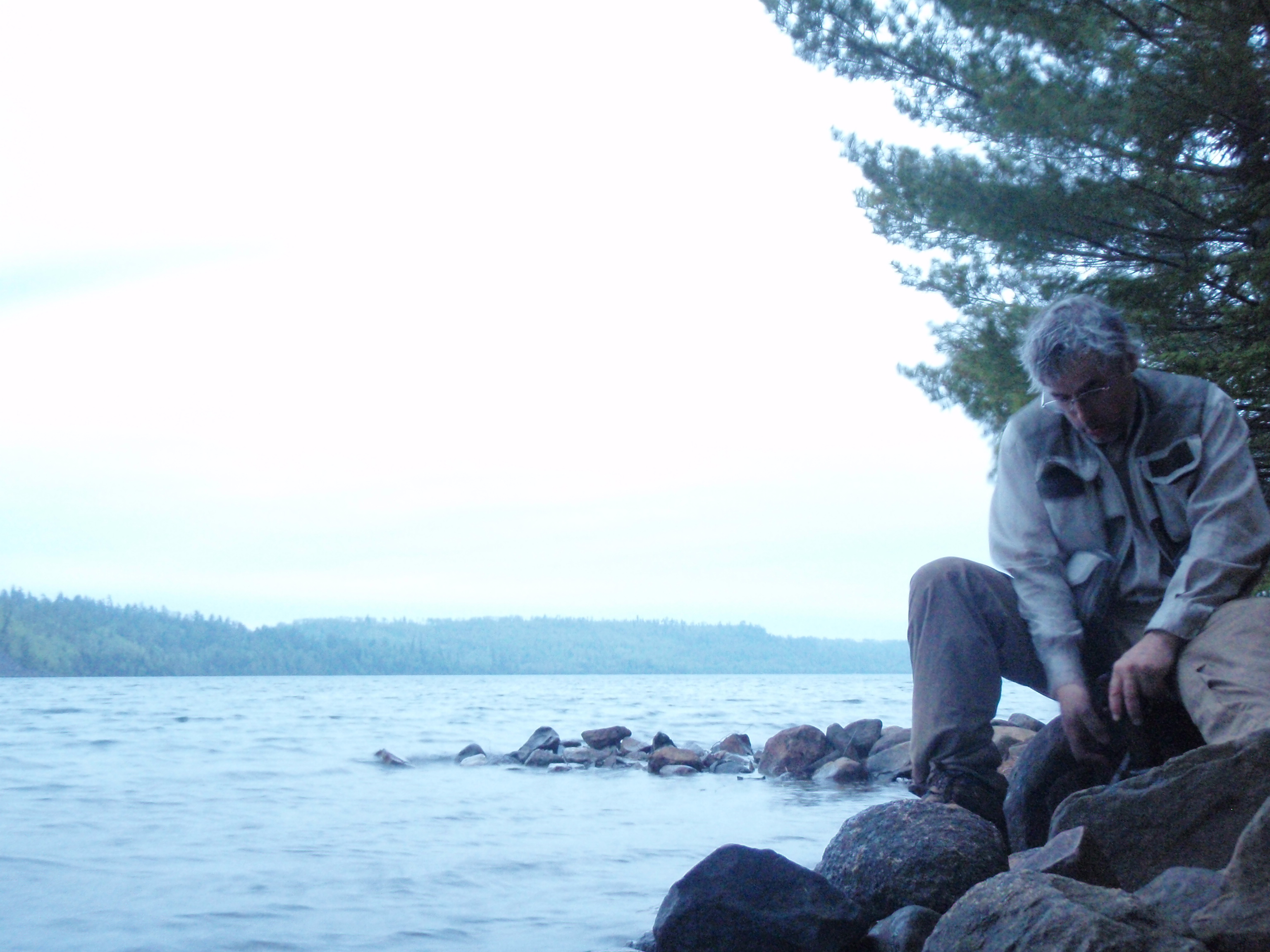
I headed down to the water to start pumping water. And all I could say was gray. Everything was gray, the water, the sky and my mood. There is a big bluff with rock outcroppings across the lake from the campsite. It was gray. I found a nice spot to pump water. But the nalgene bottle was not filling up very fast. This is because I was drinking the water as soon as I got done pumping a few cup fulls. The water pump wasn’t pumping that fast to begin with, and then I was drinking it right away.
Again, while I was pumping I was thinking that these water pumps would soon become extinct. Jeff’s bag system was very simple and much easier to use, plus you could do other things while your bottle is filling up. Water Pumps will soon be history.
Finally, I had filled up both a one liter platypus bottle and .5 liter platypus bottle, when I decided to fill up the nalgene bottle and put Aqua pills in it instead of pumping. I figured the 1 and a half liters would last me the 4 hours that is needed for the Aqua pills to work.
I had eaten some food while I was down pumping water. I ate an energy bar and some trail mix. That was part of the reason why I was drinking the water right away was to help wash the food down.
I grabbed my spot beacon, which I had placed out on a rocky canoe landing. It had sent and “I’m Okay” message. Then I came up from the shore and inspected the campsite one last time, then headed up the trail past the latrene to my tent. I decided that I would hastily pack my backpack, then head up the hill to get the bear bags and pack it good up there. But then when I was stuffing my sleeping bag into the bottom of my backpack, I decided I might as well do a good job of packing the first time, then I would only be adding the bear bags to the top section of my backpack, when I got up on top of the hill.
So, I pack up and started up the hill. What a drudgery it was walking up the hill, I thought. If the Border Route Trail Association would build a campsite at Rove Lake, the extra side trip to the Clearwater Lake Campsite would be eliminated. It wasn’t an overly steep climb going up the hill because the trail looped around in a wide switchback. But nevertheless, it was uphill all the way. Finally, I made it back to the bear bags near the top of the hill.
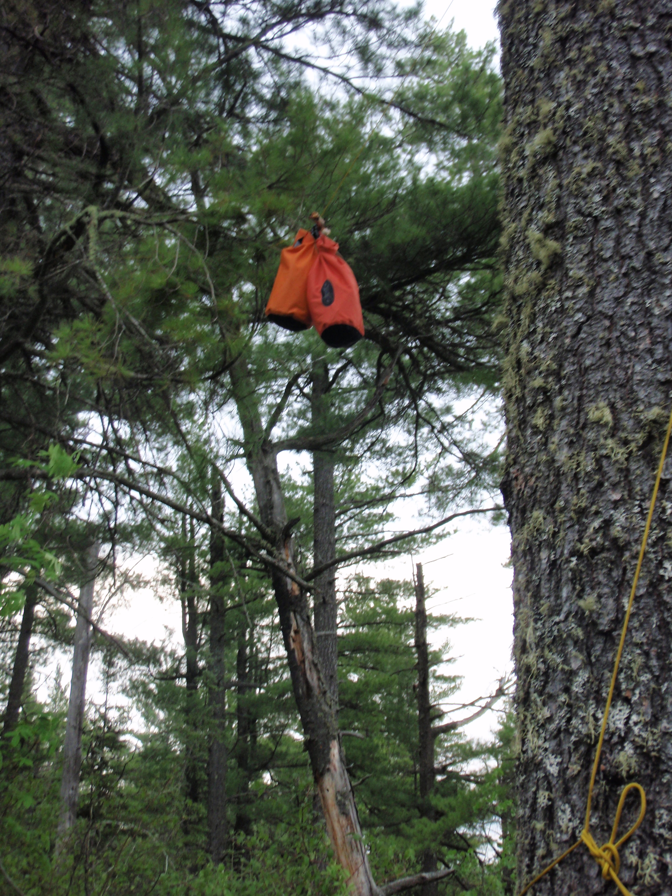
I had named the two bear bags the night before. I called them CP3O and R2D2 after the Star Wars Droids. In the scene where Luke Skywalker trashes Jabba the Hutt’s party barge, both the droids fall into the sand below. As they were leaving on the shuttle craft, Luke tells Lando Carisian “not to forget the droids.” So they pick up the droids with magnets, and away they went.
I was thinking the same thing about the bear bags. When I got to the top of the hill I had to “not forget the bear bags.” Hence, I made the comparison between the bear bags and the droids. One of the Bear Bags was longer and orange in color, so that one was CP3O while the smaller one was R2D2. At any rate, I took down the bear bags and went to the Border Route Trail/Clearwater Campsite sign just a short distance away.
At the junction I took two photos. In the second photo I shrugged my shoulders and put my arms ups as to say, “oh Well, I really goofed up here.” Then I packed up and headed east.
As I left the Junction trail continues uphill. As I had written before, I called the Clearwater Campsite the “campsite at the notch,” meaning that there was a notch in the hill up from the campsite. So naturally, even though I was on top of the hill up from the campsite, I was still at the low point of the ridge. I noticed in the Border Route guidebook that there were stars on the map that meant I would soon be encountering some overlooks. Soon I reached those overlooks, but I wouldn’t really call them an overlook, it was more like a glimpse of the scenery below.
After I past a couple of the “Glimpses,” I started hiking the top of this huge bluff, which I call the “Clearwater Bluff.” It is fairly flat and easy walking on top of this bluff for a ways. There were several rocky spots that no vegetation would grow on that the trail would pass over. I was good walking on top of this bluff for a long time. I had seen freshly cut logs where trail work had been done recently. The trail was very clear, except for maybe a couple recently downed trees.
 Good hiking continued for a while. The trail went downhill for a stretch and I saw a big huge bluff that I knew I would be hiking up. But it wasn’t overly difficult going up the bluff. It wasn’t as difficult as I had imagined when I first saw the bluff. I noticed on the Border Route Guidebook map that I was approaching some more overlooks. And when I reached the top of the uphill section, there was a spectacular overlook. This overlook was truly deserving of a star on the map, where the previous stars were merely glimpses. I sat down my gear at this overlook, and decided to take a break.
I believe this overlook is called the Watap Cliffs because Watap Lake is directly down below the cliffs. Then to the west, I could see Rove Lake. This must have been the large bluff that I had seen from Rove Lake when I was taking photos. I enjoyed this overlook. I took photos including a panoramic shot, I ate the peanut butter and bagel combination, and I rested. It was a wonderful thing, after I had such a rough night.
I also took the time to do a trip report on the Voice Recorder. It was a 19 minute extravaganza that chronicled my efforts to get to the Clearwater Campsite. Then I loaded up my gear and headed east again.
The first thing I noticed as I hiked east was that the trail wasn’t as cleared as before the overlook. The Trail Crew must have finished up at the overlook. There were a lot more downed trees and the trail was thickety in spots. In other spots the trail was clear because it went across rocky areas. There were a lot of rock areas on to of this bluff, which I’m still calling the Clearwater Bluff because Clearwater Lake is to the south of it. After hiking at least 20 minute to a half hour on the bluff from the overlook, I come upon a small stream at a short downhill stretch. There was a log next to the stream that looked like the perfect place to pump water from. So, I unloaded my gear and started pumping some water.
It was a very small stream, but it was running fairly fast because it was going downhill at a pretty good rate. I wondered if this stream dries up in the middle of the summer. I sat on the log and pumped water for a while. Then I put the water filter in the side pocket of my backpack and continued on.
While I was hiking, I checked my phone, which is in one of the pockets in my vest. The phone actually had 2 bars of signal strength, so I decided to call my mom. And it actually worked. I connected with my mom and told her that I was on top of a huge bluff in the Boundary Waters, and that the signal strength wasn’t very good. I told her that just in case we were disconnected. I said I was doing alright and was surprised I could make a phone call from here. She said everything was going alright at home. Well that was good. I kept the phone call short and sweet because it sounded like the signal could die at any moment, but it was great to call home.
I continued to hike on top of the “Clearwater Bluff” encountering small glimpses of the lake below. After a short distance from the creek I happened upon a big gnarly downed tree on the trail. This one was a “Crawl Under.” I have different categories of downed trees. There are “Crawl Unders”which you have to crawl under. So all of these names for downed trees basically describe the action taken to get to the other side of the tree. There are “Step Overs,” “Nut Huggers,” “Duck Unders,” “Head Scratchers,” “Go Around,” “Climb up and jump down” and “Crawl under.”
So I crawled under the big gnarly. Then I walked a few feet to a rocky area and started taking some shots of Clearwater Lake below. I turned back to take one last photo of the big gnarly that I had crawled under and I saw Tom’s Water Pump laying on the ground by the big gnarly tree. Damn, I thought. I must have gotten sloppy and not tied it into my backpack after pumping water at that creek. So, I took off my gear and decided to take a break. I needed to dig a cat hole someplace to go to the bathroom, anyway. While I was going to the bathroom, I confirmed something that I knew was happening. My nether regions were getting all rashed up. My crotch was all red, on both legs. I searched my first aid kit to try to find something that would help it. I tried an antibiotic pad and it stung like hell. I took off my underwear and would be just hiking in my pants. I figured that might help reduce the friction and increase the airflow.
I continued hiking on the huge bluff which I call the “Clearwater Bluff.” It kept going and going and seemed to take forever to get any place. The trail went every which way. The trail is supposed to be going in an eastward direction, but it seemed like it was twisting around every direction. I went north, south, east, and even west it seemed. There was usually a lake down below me which I could see glimpses of. For the most part I thought it was Clearwater Lake, but then in one section, I thought I was hiking up from the Watap Portage that goes between Watap Lake and Mountain Lake. I could definitely see a stretch of land between two lakes, and it kind of looked like the configuration of lakes.
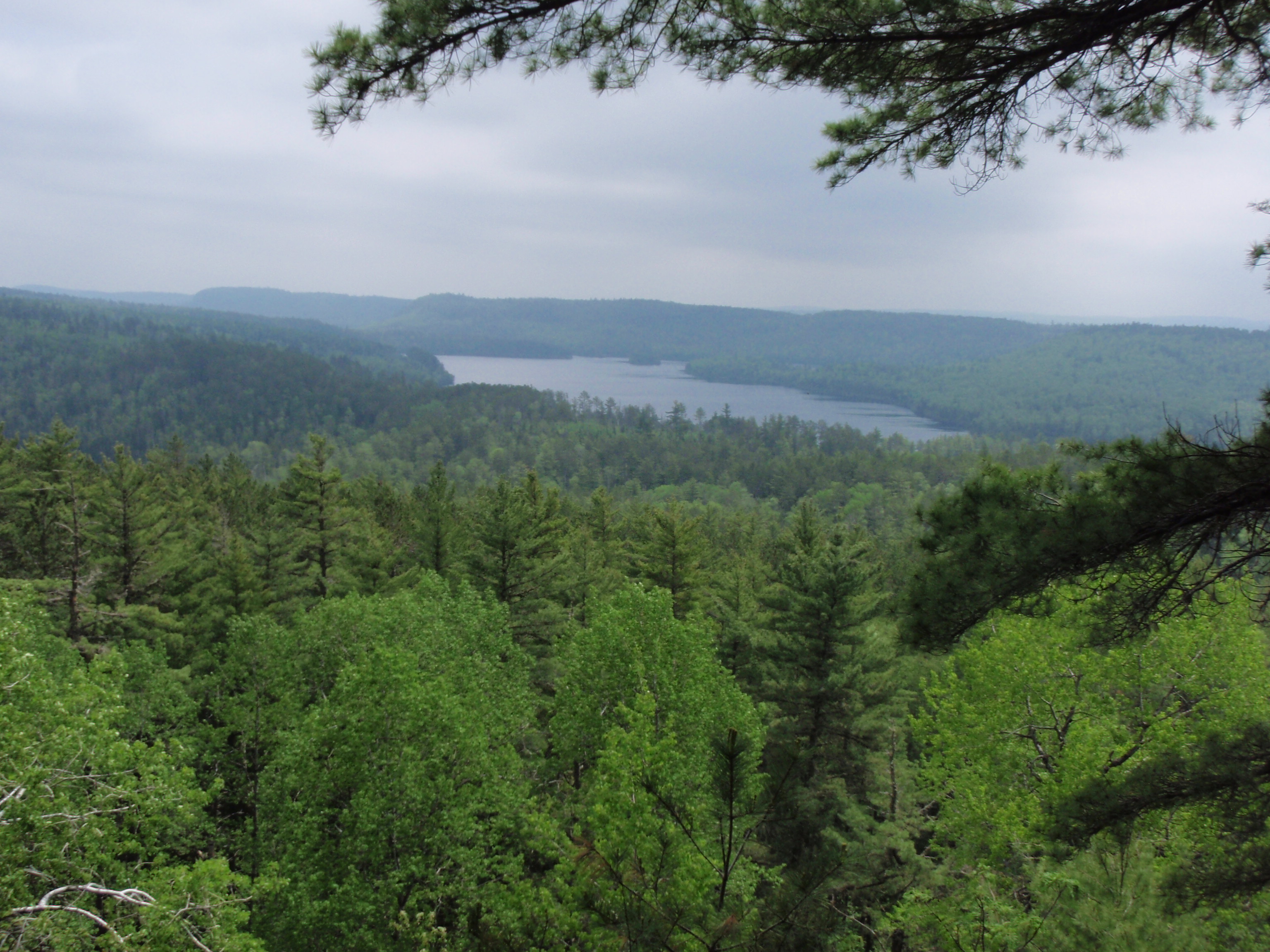
Then I walked to a great overlook of what I thought was the east end of Clearwater Lake. It was off in the distance, but nevertheless looked like the eastern end of the lake. It was a hot and muggy day, and the eastern end looked like it was in a haze.
It was easy hiking on top of the bluff, with only the occasional downed tree. The trail was a little thickety, but not too bad, not even as bad as other places on the bluff. It wasn’t very long after the Clearwater Lake Overlook that I arrived at another spectacular overlook. But this time it was of Mountain Lake. I could tell it was Mountain Lake because it has an island and a peninsula at the western end of the lake. It was unmistakable. Now, it would be less than a mile, all downhill to the Mountain Lake/Clearwater Lake Portage.
At least it looked all downhill on the maps. In reality, it was mostly downhill but had a few uphill sections, one of which was fairly steep. There was also one muddy section of the trail. I remember it seem to take longer than I thought it would to get to the portage.
Eventually, I came across a spot where I could see Mountain Lake just barely through all the trees. Then I made it to the rocky intersection of the Border Route Trail and Mountain Lake/Clearwater Lake Portage.
At this intersection is where a debate raged within me. Should I go down to either Mountain Lake or Clearwater Lake to get water. On the map it shows a pretty severe downhill portage going either way. The portage wouldn’t have been very long either way, perhaps an eight of a mile, but coming back uphill would be the bummer. Plus I would be hiking uphill for the next half of a mile or so as I hike to the east.
I seemed to have a good amount of water from pumping water at the small stream on top of the bluff. Plus, now I would be able to drink from the Nalgene bottle that I put Aqua pills in this morning. I was set to continue, and not go down to one of the Lakes. My next water opportunity that I knew of for sure was at the eastern end of Clearwater Lake near were a portage goes to West Pike Lake. And when I got up to the overlooks that were about a half mile from the portage I was presently at, it would be all flat or downhill to get to the eastern end.
I went for it, and started hiking east. Boy, the next half mile was really a bear. It was all uphill. It wasn’t as bad as going up the hill after Rove Lake, which I encountered the evening before, but it was a steady up hill climb. After toiling for a while, I came to an overlook that made it all worth it. It was a tremendous overlook of the western end of Mountain Lake. The little peninsula was jutting out to the west and the small island was now directly to my north. I stopped here for some photos including a group of photos I’m hoping to stitch together as a panoramic shot.
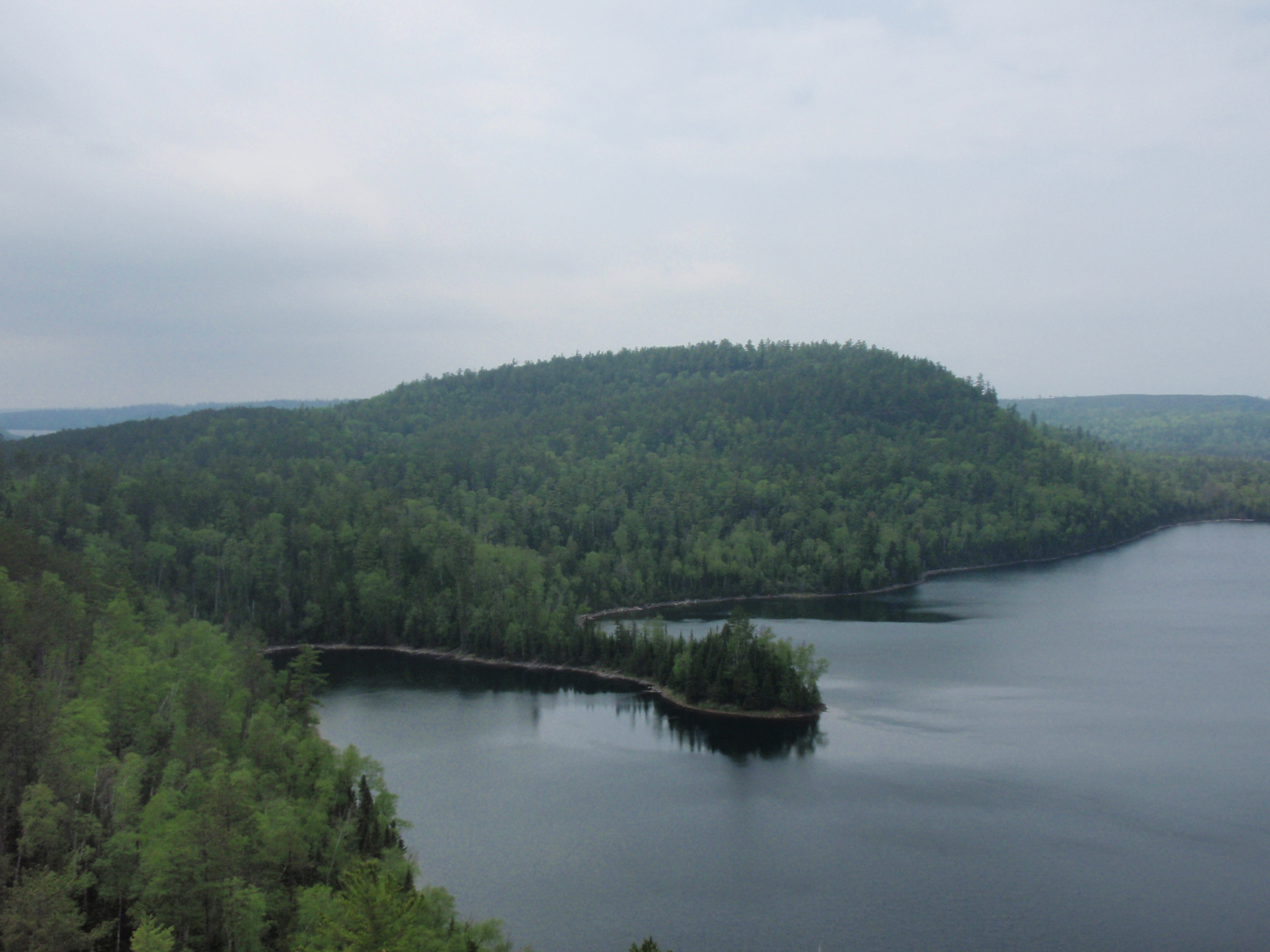
As I walked away from the overlook, I immediately found another trail going down to another overlook. This one was down lower and to the right of the other overlook. Actually this made for a multi level overlook, which was the first such overlook I had ever encountered. I took some more shots from the lower overlook. A got a better photo of the small island in the lake at this location, because at the upper overlook there was a rock formation and tree blocking the view of the island.
I walked away from the multi-level overlook and immediately I noticed that the trail wasn’t as good as before the overlook. The Trail Crew must have stopped at the overlook again, just as I thought they stopped at the Watap Overlook when I was hiking after the Clearwater Campsite incident. The trail was much more brushy. There were several downed trees and there were some places where little pine trees were encroaching onto the trail. There were some clear areas, but they were rocky spots where nothing would grow.
But I was right about the trail at this point. It was either flat or going downhill, with no uphill sections. But again, there were many more obstructions on the trail than what it had previously had. It didn’t seem to take very long and I reached the spot which I call the “false alarm” spot. The trail goes close to Clearwater Lake, making you think that you are approaching the eastern campsite and portage to West Pike Lake, but then the trail juts back into the woods and there is a peninsula between you and the lake.
After about another 3/8ths of a mile I found the cairn for the Campsite at the eastern end of the lake. This is where another debate occurred.
Should I hike in to take a look at the campsite? I couldn’t see the campsite down the spur trail, and it was my impression that I’d have to hike a ways to get to the campsite. I really didn’t need to go down to the campsite to get water, because soon I would be reaching the Clearwater Lake/West Pike Lake Portage where I could get water in Clearwater Lake. But, I decided that I needed to take a crap, and it would sure be nice to use the latrene instead of a log. So, I headed towards the campsite.
The Spur trail was hard to follow. Not because it was overgrown, but because there was no growth. Under the pine trees it must be hard for vegetation to grow, plus people probably hiked out from the campsite to get wood, thereby clearing the areas. I had gotten to a eastern point when I had reached the cairn on the Border Route Trail, and now I was hiking back in westward direction onto a peninsula. I wasn’t overly thrilled about that. Soon I was thinking to myself that it wasn’t worth it. I saw a big flat rock next to the shore in front of me, and I said to myself that if I didn’t see the campsite when I got on top of the rock, I would turn back.
I had to go up a few feet to get on top of the rock, then the rock continued to be flat for about 15 yards, and when I got to the far end of the rock I could see the campsite. I headed down into the campsite. It was the biggest campsite that I had seen yet. It was huge. You could almost hold a camporee here. I hiked around the campsite seeing more and more tent pad areas and there were 3 or 4 canoe landings. At one of the landings, I set out the spot beacon to mark my spot. Then I took off my vest and set it in a bush nearby. It was fairly windy, so I didn’t want my vest to blow into the water, so I put it in a bush.
I grabbed the toilet paper and headed for the latrene, which was up from the campsite. I had an extended bathroom break, then I went down to the shore to check on the Spot Messenger. It had not sent out the “I’m Okay” message. I decided that I would hike back to my gear with the Spot Messenger in my hand. Perhap, it would then send the message.
So, I started hiking back, and I found a trail leading away from the campsite, which looked like the spur trail. But then again, it got to an area where everything looks like a trail because there is no ground cover. I continued on until I was almost back to my gear. Then I realized that I didn’t have my vest on. I had left the vest in a bush at the campsite.
I was pretty irritated with myself. I set the spot messenger down near a tipped over tree, so I could find it when I came back. Then I high tailed it back to the campsite and retrieved my vest. I had taken the vest off so I could be more comfortable using the latrene, but I managed to forget it when the Spot Messenger distracted me.
I made it back to the Spot Messenger by the tipped over tree. It had sent its message. Then, it was only a short ways to my gear. I again headed east on the Border Route Trail.
After the cairn to the Spur Trail, it is less than a 1/8th of a mile down to the Portage Landing. The Landing was near the eastern end of the lake. I noticed behind the landing there was a big cleared out grassy area that looked big enough to be a campsite. I figured that this must be some type of staging area for the Forest Service. On Clearwater Lake, 10 horsepower motorboats are allowed. So, maybe the Forest Service shuttles personnel and equipment down to this location using motorboats. At any rate, this was my theory.
And I have another theory when it comes to 10 horsepower motorboats on Clearwater Lake. If the Forest Service allows 10 Horsepower Motorboats on Clearwater Lake, then what’s the difference about having a 3 horsepower Weed Wacker or Brush Cutter for Trail Clearing on the Bluff next to Clearwater Lake. People who might happen to hear the brush cutter will just think it’s a motorboat. Some parts of the bluff are really thickety and could use a good weed wacking.
At the portage landing was the place that I had planned on pumping some more water. But I had a new plan. Yes, I would be pumping water, but now I wanted to pump the water while sitting in the water. I felt this would be good for my rashed up nether regions. So, I changed into my extended briefs, which looked kind of like a swimming suit anyway, and I sat in the water. Boy that felt good.
I relaxed and enjoyed life sitting in the water, pumping water and eating some snacks.
Then, after I completed filling my water bottles, I decided to take a timed photo of me in the water since I enjoyed it so much. I set up the camera, and hit the timer, but I did not make it back into the water in time. The shot was of me trying to get into the water, oh well. Then I got back out of the water, changed back into my pants and got ready to hike.
I was taking my time, enjoying life. There was no rush because it was a fairly short distance to the campsite that I would be staying at for the night. All I had to do wasgo down the portage to West Pike Lake, then cut over to another portage from West Pike Lake to Lake Gogebic where the campsite is. It was still very early in the evening, so I had plenty of time to do the mile to 2 miles to the campsite. There was no point going further than Lake Gogebic because the next Campsite would be six miles away from it.
At the landing, there is a Border Route sign that points to the west. This presumably this is so that portagers don’t get mixed up and start hiking west to get to West Pike Lake. Instead, there is another portage trail, which the Border Route follows to the east that goes to West Pike Lake.
I started down the portage and immediately saw a canoe sitting off the trail. At first I figured it was a canoe that the Forest Service had stashed there. But, then when I got close to it I saw that it had been recently used, and had a life jacket in it. It also had an Illinois boating liscense sticker on it. I figured maybe someone was taking a day hike over to West Pike Lake or Lake Gogebic, where the Trout fishing is supposed to be good.
I continued down the portage, which was pretty flat at this point, but very rocky. I kept walking and when I got down to the small pond next to the portage, I saw a guy carrying a canoe over his head. Then there was another guy carrying a life jacket and a bunch of fish on a stringer. I said hi to the first guy, with the canoe, and took his photo, then I talked with the second guy, took his photo and gave him one of my “I Saw Tman” card.
Then I went on, and soon I saw two men carrying a canoe. But they were intend on carrying the canoe and keeping track of the rocks on the trail. They had the canoe over their heads, so I couldn’t get a good shot of them. They whizzed on by, and the guy in the back waved at me. Then I saw two more guys coming towards me. I reached inside one of my vest’s pockets and retrieved my voice recorder and turned it on. These two guys were just carrying fishing poles, paddles, and a backpack. I had a fast but fact filled conversation with those two guys. All of the guys in the fishing party were from Illinois and they had just taken a day trip to West Pike Lake to do some fishing. They told me all of the guys names, and said there were some more people following them.
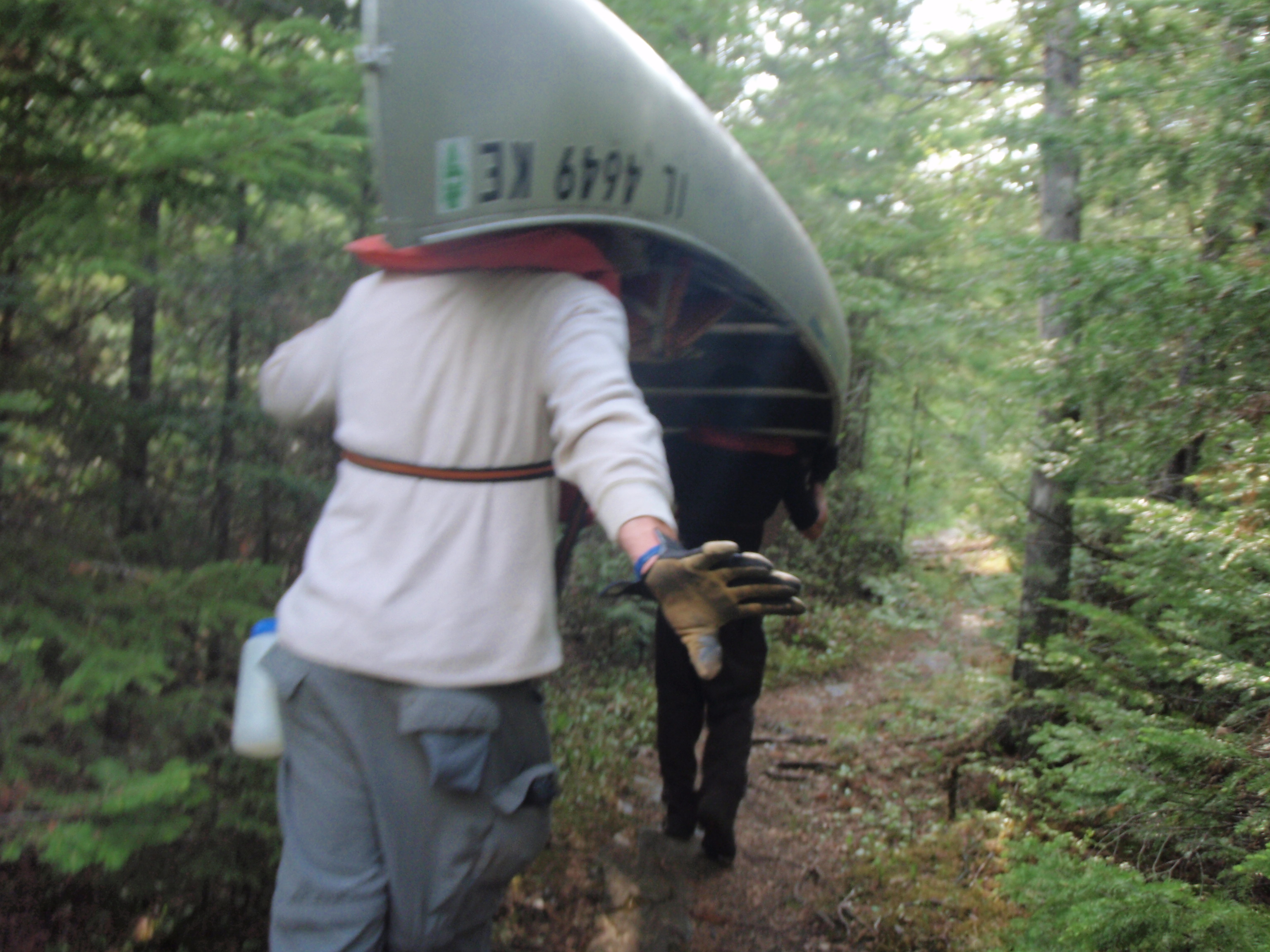
The fact that they all were from Illinois jived with the fact that the canoe left by Clearwater Lake had an Illinois sticker on it. Plus one of the guys had a Cubs T-shirt on.
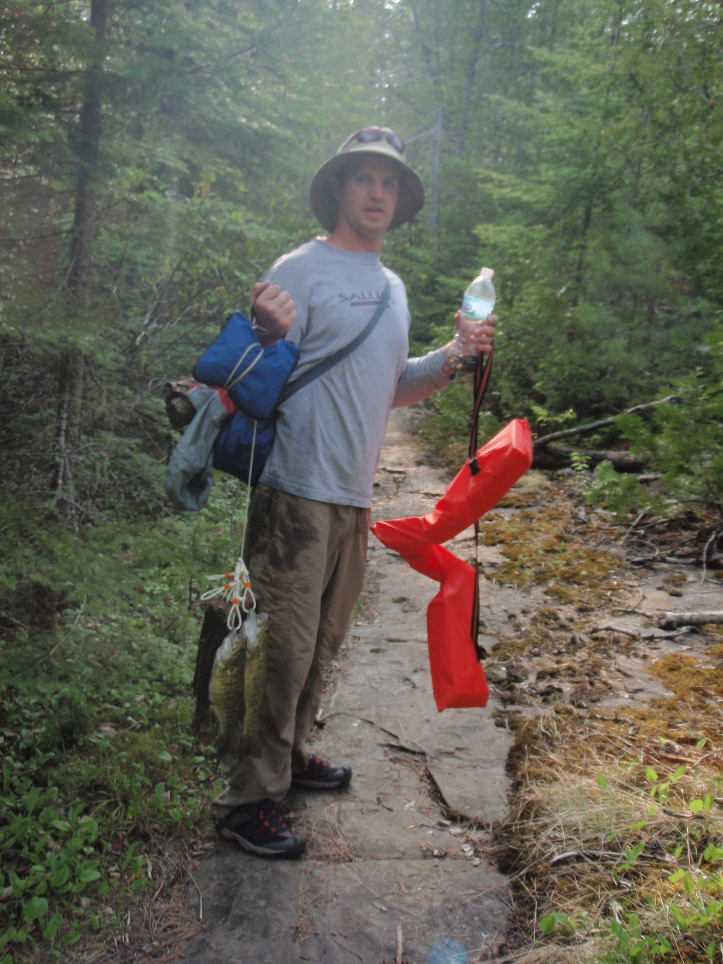
All of these guys were younger men in their 20’s or early 30’s. It was great to see some young bucks enjoying the Boundary Waters. So many young men are sitting at home vegetating while playing Grand Theft Auto on the computer. I reassured me to see a younger generation out in the outdoors.
I continued on down the rocky portage, expecting to see some more people. The portage was fairly flat, but eventually it when down two large rock fields to get to West Pike Lake. At this point I realized that the guy was wrong, there were no other people behind him. While at was at the West Pike Lake landing, I look to the right on the shoreline to see if I could see the landing for the West Pike Lake/Lake Gogebic Portage. I didn’t see the landing, but I did see a hill that I would have to walk up to get to Lake Gogebic. Great, and I thought this was going to be easy. I also realized that I missed the turn off for the Border Route Trail. So I began to hike back up the portage across the rock fields. I got discouraged and set my gear down and started searching for the trail. I went down one path and determined it must have been an animal trail. Then I headed up the portage across another rock field and found the trail.
It would have been nice if the Border Route had a sign at that junction. They had a sign almost everywhere else there was a junction. I had missed the junction because I was looking for more people on the portage. I piled up some rocks for a cairn at the junction. That would be my Trail Work for the day. Hopefully it will help the next person coming down the trail.
I headed back down across the rock field and retrieved my gear. What a drudgery it was going back up over the rocks. I made it to the junction where I made the cairn then started down the trail. After about 20 yards I came to a sign that said Border Route, with an arrow heading east. Lots of good it did me there. I could have used that sign right at the junction. Oh Well.
Just a short ways after the sign, I came up to a bridge. The bridge was crossing a fairly big stream that was from Clearwater Lake, running down through the pond I walked by, then down to West Pike Lake. The stream was very rapidly at this point, having lots of little waterfalls.
After the bridge, the trail kept going steadily up hill. After a while I was getting really weary and I decided to set down my gear and go look for the West Pike Lake/Lake Gogebic portage that I was supposed to be connecting with. I walked down the trail a little ways and I didn’t see the portage anytime soon. I walked back to my gear feeling dejected. It was still early, but I feared this would be another Clearwater Lake Campsite disaster like I had the night before.
I continued on up the trail and finally I came to the portage. But this was no consolation, because the portage going up to Lake Gogebic was a much worse uphill stretch than the section I had just walked. It kept going and going uphill. I thought that Lake Gogebic must be some sort of alpine lake because I had to hike so far uphill to get to it. And I thought this was going to be easy.
I was thinking that at some point this portage must start going downhill to Lake Gogebic.But it didn’t happen until I could see Lake Gogebic. Perhaps the last 40 yards were slightly downhill. But I was real glad I made it to Lake Gogebic.
The McKensie Map shows a Campsite just a short ways down the shore to the left of the portage. The Border Route goes to the right, and there is another campsite listed both on the McKensie Map and Border Route Guidebook down that way. But I started hiking to the left to see if there was actually a campsite over there. I figured there would be some type of beaten down trail from that campsite to the portage, since it looked very close.
But I didn’t see such a trail and I saw no evidence of a campsite down that way.
Then I started hiking on the Border Route Trail to the right of the portage. It was easy walking along the shore of Lake Gogebic. Soon I came to a spot that was a canoe landing, then, I saw a small campsite next to the lake. I’m home.
 It was a small campsite, but it was more than adequate for me. It had some rocks piled up for the fire ring, not the official Forest Service fire grate. And I didn’t see a trail for the latrene, so I deduced that there was no latrene. I thought since Lake Gogebic is such a small lake compared to those around it, and because it had a fairly hard portage to get to the Lake, that a toned down campsite like this was to be expected.
I set up my tent. Then I put up the rope for my bear bags down from the campsite at another canoe landing area, which also could be used as a tent pad. I started a small fire in the fire area and then I made a dehydrated meal boiling water on my alcohol stove. Then I sat in the water and pumped water again. Then I went to bed.
When I got in my tent, it wasn’t even totally dark out yet, but I was tired. I tried something from my first aid kit for my rashed up crotch. But it stung like hell, too.
Finally, I decided I would sleep nude on top of my sleeping bag, so that my nether regions could get some fresh air to heal. Except for the rash, I couldn’t have asked for a better evening. Gogebic must be the Ojibwa word for heaven.
Monday, May 24, 2010
Lake Gogebic to the West Pike Lake Overlook
I woke up really early in the morning. It must have been 4 or 5 and I had to take a pee.
So I got out of my tent nude, and found someplace nearby to relieve myself. Then I went back in the tent. I remembered that I forgot to do my trip report for Sunday, so I grabbed the Voice recorder and started talking. It was a long winded affair, rehashing the Cleawater Campsite Disaster, hiking to the overlooks, the Mountain Lake/Clearwater Lake Portatge, the Clearwater East Campsite, meeting the young bucks on the Clearwater/West Pike Lake portage, and hiking uphill to get to Lake Gogebic.
This was a 35 minute recording, quite the extended message while I was lying nude on top of my sleeping bag. And then there is my rashed up crotch to talk about also.
After that I just went back to sleep, because it was too early to get up and do stuff. It was still dark out. I woke up again at around 8:30 am and started to get my stuff together. I boiled some water on my alcohol stove and made my famous Choco-oato breakfast. Two packs of oatmeal and 1 pack of hot chocolate all mixed together with hot water
My sleeping bag felt a little dewy, so I set it out on a big flat rock near the canoe landing so it could dry a little bit. All my stuff was all spread out. Some of it was spread out in the tent, and some was spread out around the Campfire area. But now it was time to get my stuff together. I unstaked the right side the tent, and flipped it up over the left side of the tent, This opened up the whole side of the tent, making it easier to pack up stuff.
My sleeping bag was dry after breakfast, so I stuffed it into the bottom like I usually do. Most of the clothes that I put into my backpack I wasn’t using. I wasn’t using the long underwear, and I wasn’t using my warm polyester pullover jacket except for using it as a pillow. I leisurely packed up my stuff. I enjoyed my time here at Lake Gogebic, except for getting to Lake Gogebic. But I knew I had a major undertaking in front of me. After I rounded the lake this morning, I would be hiking up a big bluff.
I got my gear packed. I decided not to wear my long sleeve polyester shirt. The bugs weren’t bad so I decided to go with just my vest. Besides, it already was tuning up to be a very hot day. I got my white first aid bandana wet and put it on my head. I posed for a timed photo before I left the campsite. I looked just like Rambo, with the bandana. I put on my backpack and away I went.
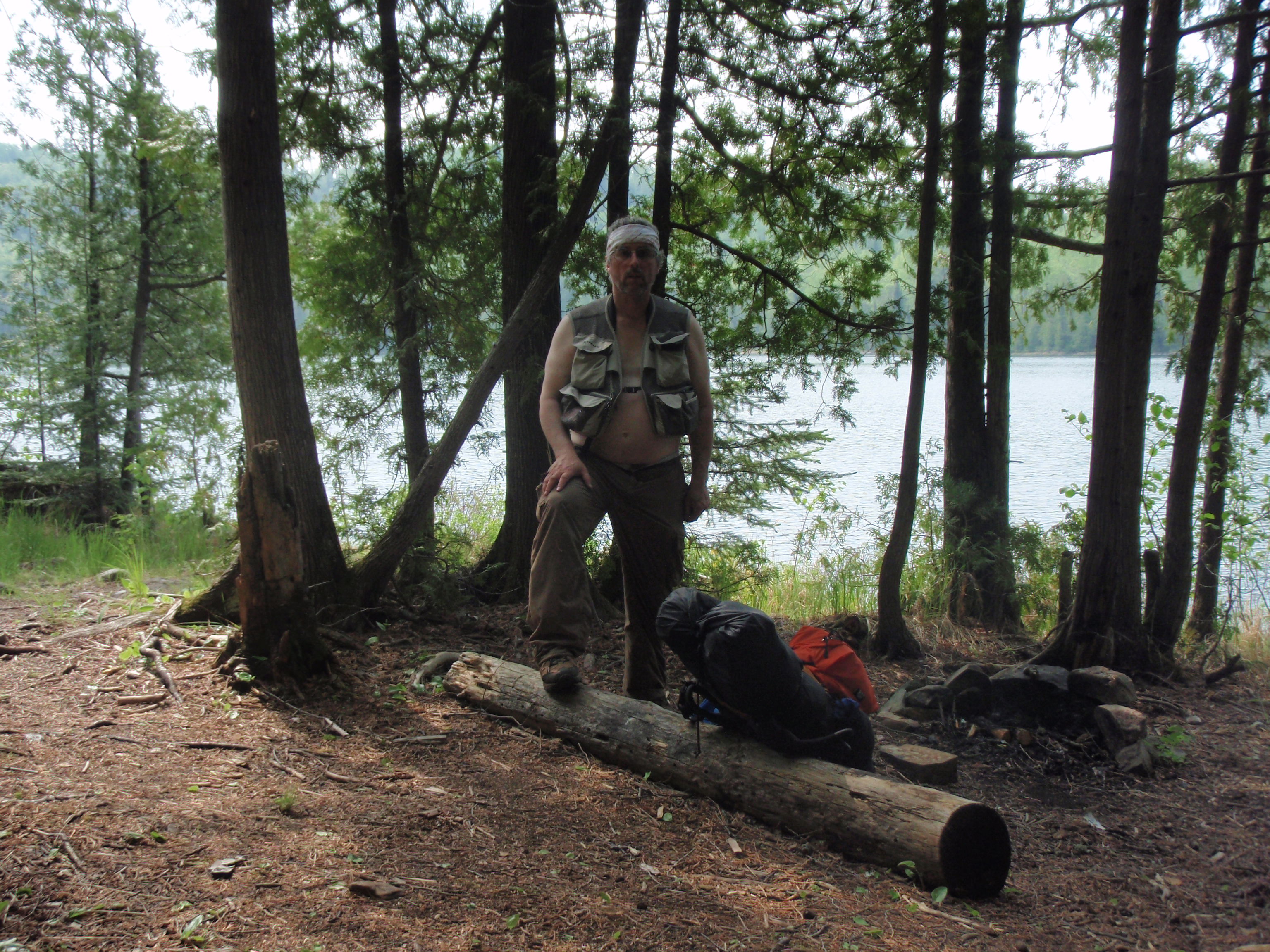
It was easy hiking along the shore of Lake Gogebic. As I walked I found some more places down the trail that could be used as tent pads. Also there were some nice spots to go fishing on the shore of the lake. I headed down the shore about 3 or 4 football fields length from my campsite and all of a sudden I seen something blue ahead of me. As I got closer I realized it was a tarp that was strung up. As I got closer, I realized that I was coming up to the real Lake Gogebic Campsite, and it was occupied.
I walked into the campsite and met two men named Pat and Jason from Wausau, Wisconsin. Pat was the taller of the two, with a short beard and dishwater blonde hair pulled back into a ponytail. Jason was quite a bit shorter with black hair and a goatee for facial hair.
We chatted for quite some time. I told them that I had camped at a campsite just a short ways down the trail. I saw that their campsite had the official forest service fire grate, and I asked them if the campsite had a latrene and they said yes. I told them about my website, took their photo and gave them an “I saw Tman” card. They sat down on a log under the tarp to have a cigarette and we continued talking.
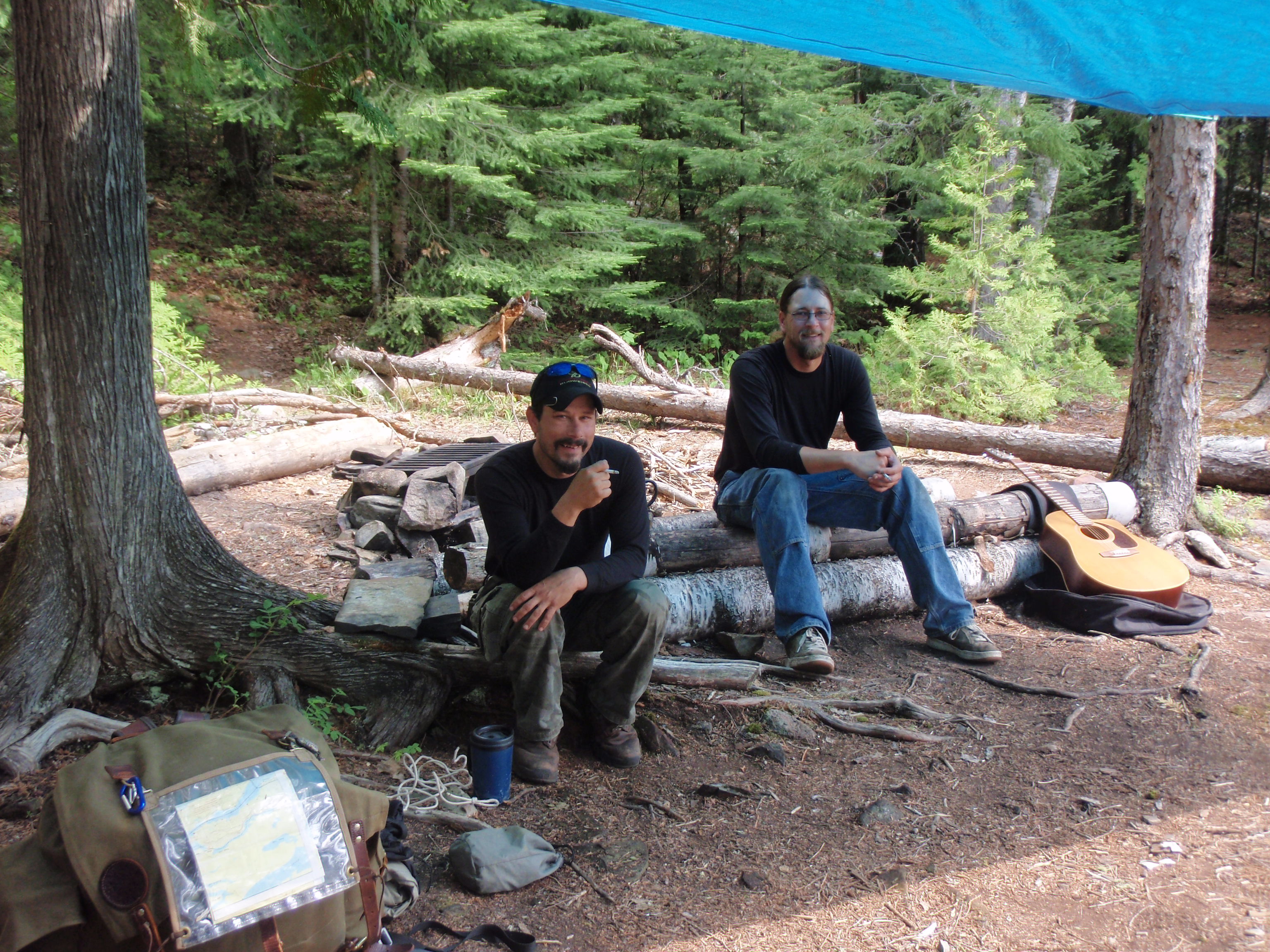
Pat said they had seen another campsite across the lake, and I might run into it as I walk around the lake on the trail. They also said that a female moose came down to the water every day with a young moose in tow. They asked me if I had seen it, but I said no.
I asked them if they had any medicine that would work on a rash. Anything like baby powder or hydrocordisone cream. They said they didn’t have anything like that.
They said that they were going on a day trip to some other lake that I never heard off. They looked like they were packing up and I didn’t see a tent so they must have all ready packed it. I did see some fully packed Duluth Packs and a guitar. They looked to be packing fairly heavily. It must have been a pain getting all that stuff up the portage from West Pike Lake. I asked them what time it was and Pat said 10:30. I asked them how long they would be in the Boundary Waters and they said that they were leaving on Thursday. I wished them well and went on my way.
It was fairly easy walking going around Lake Gogebic. The trail did go up a small hill but then descended to go across a beaver dam, which created a sort of backwater pond back from the shore of the lake. Yes, it was easy walking there, but I knew the real challenge was soon to come. I would be walking up a big bluff after the trail left the shore of Lake Gogebic. I looked across the lake and saw that the blue tarp was being folded at the Campsite. That’s about all I could make out.
Soon I arrived at the foot of the bluff where the trail goes uphill. There is a path there that leads to the shoreline. Presumably, the path to the shore is for people coming from the east. Perhaps this would be the first chance for them to get water that they’ve had in quite some time. I decided to hike my gear up the hill a ways, then take a rest by coming back down with just the water filters and bottles to pump some water.
I took the water path and soon I was pumping water. At this point, I could not see the Campsite where Pat and Jason were camped. But I expected to see them canoe by on the way to the portage. But it never happened. They looked to be taking it easy when I was in their campsite, so maybe they were still taking it easy.
When I was pumping the water, I deduced that I had lost the lid to one of my platypus bottles. Damn, I thought. I looked all over in the grass next to the lake and I couldn’t find it. The lid was black in color and blended in to the black areas deep in the grass.
I ended up filling the nalgene bottle and just two of my platypus bottles. I had given names to the platypus bottles. They were Papa pus, Mama pus, and Baby pus. Papa Pus and Mama pus were both 1 liter bags while Baby pus was half a liter.
I hiked back up to my gear, put the backpack on and continued up the hill. This wasn’t the worst hill I’ve hiked up while backpacking, but it was damn close to it. It kept going up and up and more up. After going around Lake Gogebic, pumping water, and going up the hill, it must have been around noon when I made it to the top of the hill. And it was a very hot and very muggy top of the hill.
Joan Young, the notable hiker and backpacker, hiked the Border Route last May. I emailed her and asked her what the trail conditions were like on the eastern part of the trail. She wrote back that the bluff east of Lake Gogebic was the worst section of the trail on the eastern half. But Tom Suter told me that it all had been recently cleared except for about 3/4 of a mile. As I walked along on top of the bluff, I soon started seeing freshly cut downed trees that had been cleared from the trail. Boy, I thought, that must have been a lot of fun just getting a Trail Crew in here to work on the trail would be a major challenge.
From the west, the trail crew would have to put in at the west end of Clearwater Lake and canoe the whole 6 miles of the lake. Hopefully, there is a resort that could motorboat the Trail Crew and canoes to the eastern end of the Lake. Up here in the Boundary Waters many Resorts have specially built pontoon boats that will haul several canoes and people. This saves people a lot of canoeing time, especially on the big lakes that can take all day to get across.
Once your trail crew made it to the east end of Clearwater Lake, they would have to portage into West Pike Lake, then take the uphill portage into Lake Gogebic. Once they set up camp at Lake Gogebic, they could then canoe across the lake to the water landing that I pumped water at, and then walk up the hill.
Once hiking up the bluff, like I had just done, the elevation changes over 350 feet in about a mile and a half. This was a real killer for me.
A Trail Crew coming from the west to work on this section of the trail would not have it any easier. They would have to put in on McFarland Lake on the Arrowhead Trail. Then they would have to canoe the entire length of McFarland Lake, which is over two miles, and hike the short portage into Pine Lake. Once into Pine Lake they would have to canoe about 3 miles to the West Pike Lake/Pine Lake portage, where there is a campsite. They would then hike up to the portage to the Border Route. The Border Route goes uphill from there. There is an elevation change of over 400 feet within the first mile of leaving Pine Lake, which includes the portage and some of the Border Route.
Plus, it’s a stretch of trail over 5 miles long between Lake Gogebic and the portage, so trail crews might have to hike 2.5 miles once connecting with the Border Route.
As I was hiking on top of this bluff on a very hot day, my crotch region was really getting sore with a very red rash. I wasn’t hiking with any underwear on, which seemed to help the airflow, but now things were getting worse. I decided to hike with my zipper open to further increase the airflow to the nether regions. I felt like a pervert hiking with my zipper open and having no underwear on. And if I saw someone hiking towards me on the trail, I would have to quickly stop and zipper up. But I haven’t met anyone yet who actually hiking or backpacking the trail. The people I had met were canoeists that were portaging or camping in a campsite. Perhaps, I was the only backpacker on the Border Route right now. But, from reading posts on the Border Route Meetup Website, I thought I read that there would be a couple on the eastern part of the trail that I might run into. I continued to hike with my zipper open all day.
The trail kept going and going. It went up and down and all around. It went from shaded woods to massively sunny areas. On one downhill section early on I came across a small stream. I still had quite a bit of water so I didn’t stop. It looked like a very small stream that might dry up in the middle of the summer. Or in fact, it might dry up at any moment now because it was so hot out.
There were several stars on the Guidebook map indicating that I would be encountering several overlooks. And I walked by several places where I could see a glimpse of the lake below. During the early stages I thought I was seeing Lake Gogebic down below me to the north, then as the day continued I thought I was seeing the west end of West Pike Lake below me. The west end of West Pike Lake is long, and that’s what I thought I was seeing. The problem with the Guidebook is that in some places the stars that indicate overlooks are merely glimpses of the lake below, and in some cases the stars on the map are full blown spectacular rock outcrop overlooks. At any rate, I walked past a half a dozen places that might be good enough to be called an overlook by the glimpse standard.
And the trail kept going up, down and all around. The condition of the trail ranged greatly. Sometimes it would be very clear because it was going across rocky areas, and sometimes it would be overgrown and thickety. Soon I met up with another stream. This one was bigger than the one that I previously encountered. I still had over a liter of water, plus I thought I would be getting to that West Pike Lake/Pine Lake portage pretty soon, so I didn’t stop for water. There are 4 overlook stars on the map, and I had already past at least 6 or 7 places that maybe could be overlooks, so that portage should be coming up.
This is the disadvantage of not having a GPS system. I figured that I already have enough electronics with the Spot Messenger, Olympus Camera, Cell Phone and Voice Recorder. And I know how to read maps pretty well. But the problem with walking on this bluff is that there are very little landmarks to tell you where you are on the map.
Plus, the Border Route is the only trail around, so there is little possibility that I would stray off onto another trail.
The trail just kept going up and down and all around. Every time I started on a downhill section of the trail I thought maybe this time I would hit the portage. But it didn’t happen.
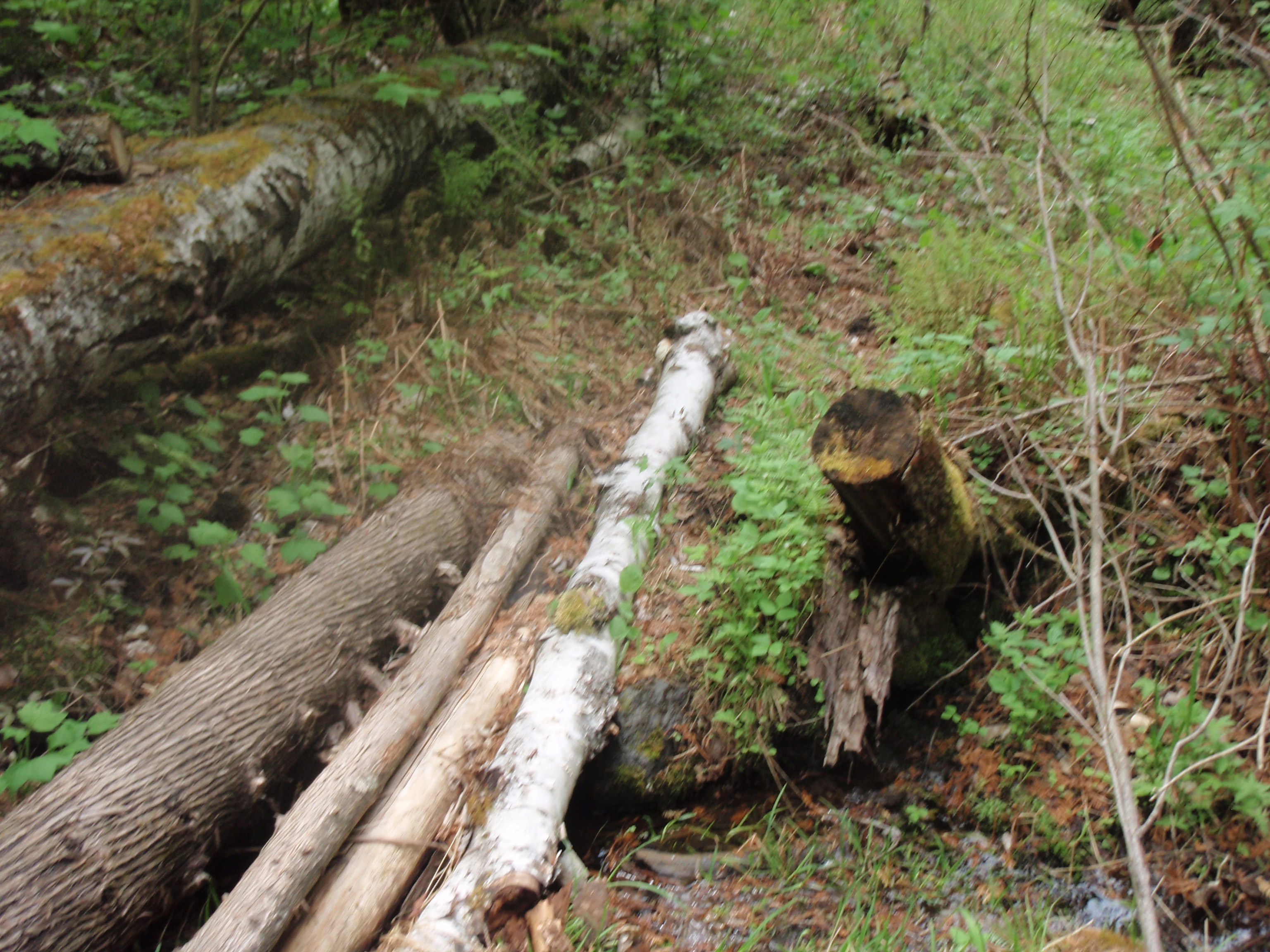
I kept going and going and was starting to get low on water. It’s not a wise thing to do. And I had bypassed getting water at the last stream, which now was a long ways back. I was so sure I would be getting to the portage.
I checked my telephone and it was getting to be early evening. I had a couple bars of signal strength listed on the phone, so I tried calling out. The phone showed me the time, but the numbers on the phone didn’t work. I didn’t know if the heat had bothered it, or if somehow it had gotten wet. It was just in a pocket in my vest, I didn’t have it in a ziplock bag. So then I finished some trail mix that was in a ziplock bag in another pocket, and put the cell phone and voice recorder in that ziplock bag and placed them back in a pocket.
I was hoping that soon I would be getting to the portage. At this point I was planning on setting up my tent right at the portage junction. Sometimes at junctions, the area is more cleared out because backpackers set their gear down on the edge of the trail so that they can go get water. So the junctions are usually much wider that the normal trail would be.
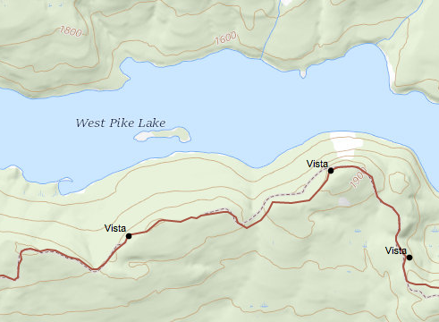 But instead of going down to a portage, I was going up to a beautiful overlook. I immediately checked the map to see where I was. I saw a small island down to the left of me. The island was in the shape of a hatchet. It was narrow and then had a wider spot at the one end that looked liked the blade part of a hatchet. So, I started calling it Hatchet Island. I looked on the map for it to discover that I was at an overlook that was about a mile from the portage. Damn, I thought. I looked at my cell phone for the time and it was 7:30 pm. I thought I could make it to the portage because I still had an hour and a half of daylight. Plus the trail looked liked it went mostly downhill from here, but with my luck there still would be a bunch of up and down sections. I was definitely at the high point of this section of the trail at an elevation of 1940 feet.
I set my gear down at the overlook. On the overlook, there was two big rocks about 3 feet tall, and to the left of them there was a small grassy spot just perfect for a wedged shaped tent like mine. I figure some people might have camped here before. But I didn’t see any evidence that someone had made a campfire nearby. That is good, because getting water to put out a campfire that got out of control here would nearly be impossible. If anyone had camped here they must have been using low impact techniques.
I took some photos at the overlook and decided I needed to take a crap. I grabbed my trowel and toilet paper and headed off to find a log to make a cat hole by. I found a log and dug a cat hole then sat down. I was trying to go to the bathroom when suddenly I started heaving up. At first I had two dry heaves, then I actually threw up some stuff.
Wow, I felt like crap instead of taking a crap. This was definitely my lowest point of the hike, and it happened at one of the highest points.
I drank some water to try to recover. Now I had less than a half a liter. As I rested I remembered a scene from the movie Silverado. The sheriff and posse where chasing the lead characters out of town into the rugged desert countryside that had rock formations. It got to a point where the Sheriff, played by John Cleese, got his hat shot off. The Sheriff then said his juristiction ended here. But the deputy said, no your juristriction goes much further into the country. But the sheriff said, “Today, my juristiction ends here.”
That’s what I was saying to myself now. “Today, my hike ends here.” Perhaps the heaving was a sign of heat exhaustion. I needed to stop now, and not push it getting to the portage. If I pushed it, I might not make it to the portage ever. I ate some dried cranberries out of my trail mix. I only ate the cranberries because even though they were dried, the still had some moisture in them. I didn’t want to eat nuts and other stuff that would make me more thirsty, because I didn’t have much water left. I was saving the water in case I needed to take some type of pain pill. But, I could see plenty of water from where I was. Right down below me there was plenty of water in East Pike Lake.
But it was a serious drop off to get down to the lake. I believe I was about 400 feet above the lake. And it was what I call a 4:30 angle to get down to the lake. When the hour hand on a clock is at 4:30, that’s what type of angle it is.
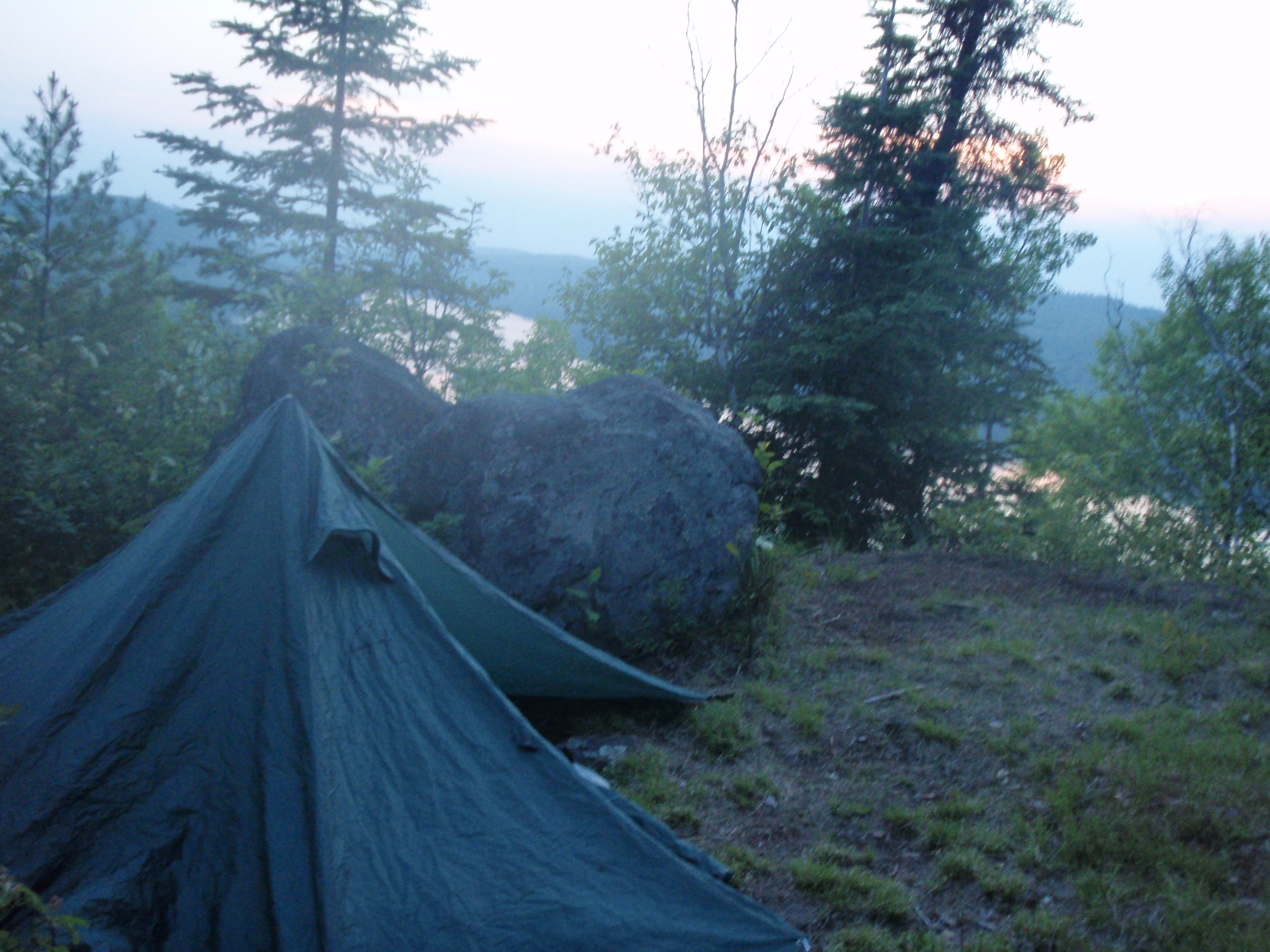
So, I set up my tent in the wedged shaped space next to the two rocks. I laid out my sleeping pad and sleeping pad and rested nude on top of them. It was still light out and the sun had not gone down yet. I couldn’t get to sleep so I decided to do a trip report. When I was about 13 minutes into the report, I noticed it was going to be a spectacular sunset. I got out of my tent and noticed the sun had already gone down but the sky was still a beautiful orange/red color. I took some photos.
Then I went back into the tent and laid on the sleeping bag again. I started the voice recorder again and did another 13 minutes worth. Then, while I had the voice recorder, I listened to some off the earlier recording from this trip. I listened to the recording where all the Trail Crew Members where giving their profiles. There was Jim, Dick, Jeff, Illona, Walli, Martin, Paul and our fearless leader Tom. I remember how they encouraged me on top of the bluff east of Stairway Falls when I left them. They encouraged me now that I was at my low point at the high point. I went to sleep knowing that I need a good rest so that I could move on tomorrow.
Tuesday, May 25, 2010
West Pike Lake Overlook to Johns Lake Overlook
I woke up in the middle of the night and I thought someone was shining their flashlight onto my tent. It took me a few seconds then I realized it was the moon. My tent was on the overlook, with not many trees around it to block the moonlight. I went outside to go to the bathroom and I also took a photo of the bright moon. Then I went back to sleep.
I woke up in the morning pretty early. I was determined that I would not make the same mistakes as yesterday. Yesterday, I got going too late, I skipped taking water at stream and I walked in the heat until I puked. Today, will be different. Today, I will get started early, I will get water at every occasion it is available, and I will be taking an extended break in the middle of the day when it is the hottest. I got up and started packing up. I was feeling pretty good. The night’s rest as really refreshed me.
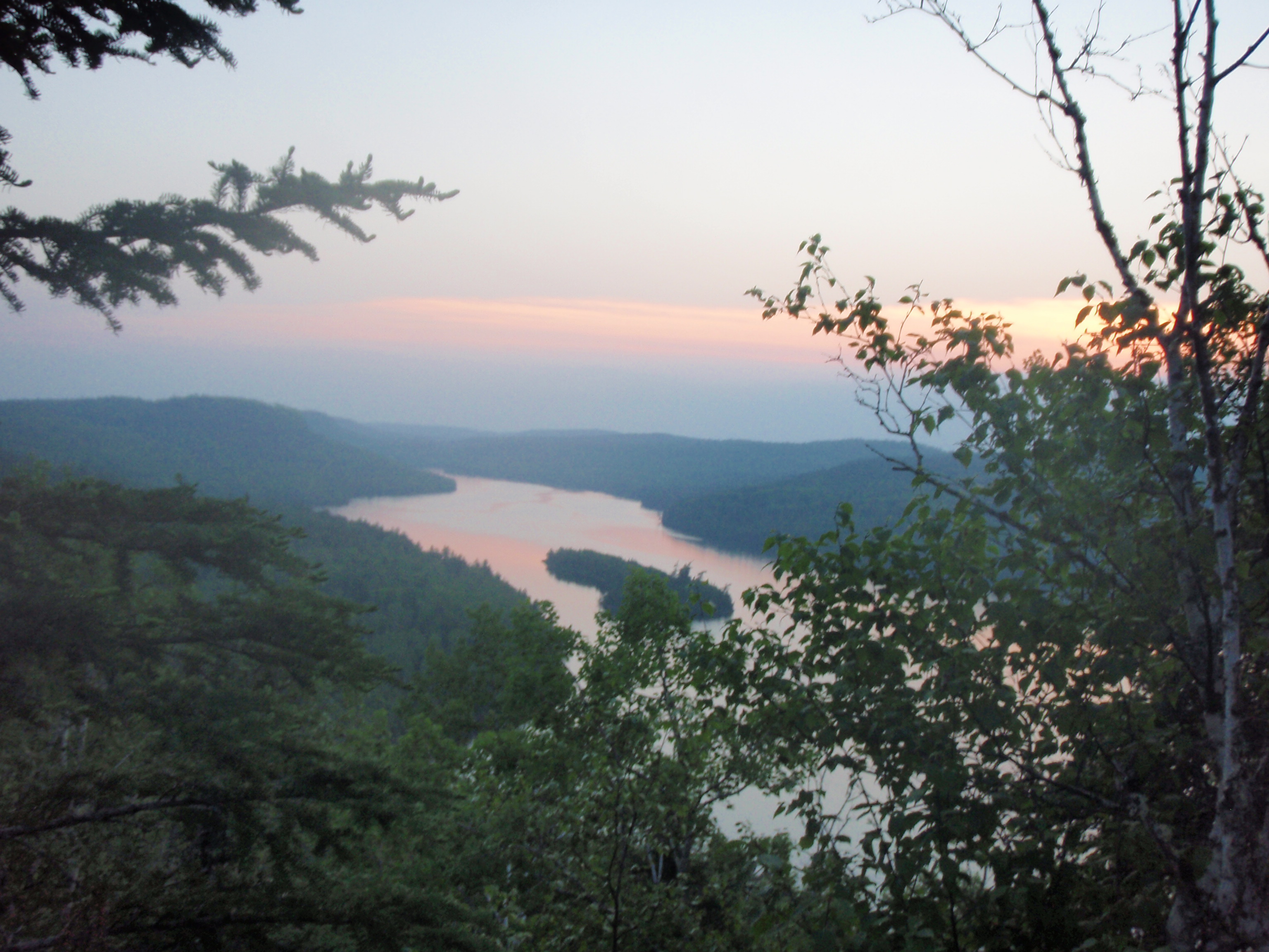
It was a very hazy morning, again, I took some photos of West Pike Lake including the island that I call Hatchet Island. I took the bear bag named CP30 down from where I has strung it up a ways down the trail. I really didn’t want to eat anything because I didn’t have any water to wash it down.
I decided I would do something different about my rashed up crotch. My first aid kit contained a gauze pad that is about 4 inches by 4 inches. I would cut the pad in half so that I have 2 pads that are 2 inches by 4 inches, then I would tape each pad on the inner section of my leg in the crotch region. I figured this might reduce the friction on my crotch and give the red skin some protection. So I proceeded doing so, using one of the 3 foot high rocks next to my tent as a table to put stuff on.
I proceeded to pack up. My tent was really wet from the heavy dew. I checked on the back portion of the tent to see if there were any water puddles, but there was not. I shook the tent to see if the dew would form into puddles. But there wasn’t enough dew to make that happen. Last year when I camped at Aganok Falls it had rained a little bit during the night, and I was able to collect a few cup fulls of water that was in puddles on the back portion of the tent. That’s because I was not pitching the tent like a teepee or pyramid, instead of extending the back part of the tent out and putting a pole there. The way I pitched it now was more than big enough for me. If I ever have someone else share the tent with me, I would have to extend it.
I packed up fairly fast, leaving the wet tent as the top item. I took one last photo of the overlook and I was on my way. The trail traveled on a little ridge. From looking at the map, it looked like there were 4 or 5 little hills on this ridge. Each of the little hills were shorter than the next, so I would be going mostly downhill. But there was the possibility that I would be doing some up and downs right away today.
So, I headed off, and the trail was fairly flat for a ways, then it went gradually uphill. When I got to the top of the uphill section, I had made it to the other overlook that was marked with a star on the guidebook map. Boy that was fast. I wasn’t expecting to reach it that fast. The overlook wasn’t as scenic as the one that I pitched my tent at, and it didn’t have a good view of the lake below. But it had a couple big rocks at this location, so I took some photos of the rocks and the view and continued on.
The trail was mostly downhill or flat from there. As I was walking down to the portage, I was thinking about the movie Sahara. I had not seen the original movie with Humphrey Bogart, but I did see the more recent made-for-TV movie starring Jim Belushi. The setting was the Sahara Dessert in World War II. The Bogart/Belushi character was an American tank captain. They had picked up some Allied stragglers that were separated from their unit. They also shot down a German Plane and captured the pilot. From the pilot, they found out that the Germans were headed for an ancient Roman well for water.
The Bogart/Belushi character decided that they would try to get to the well first, and they did.
They fortified the well building and dug in their tank. The German came and the Allied group successfully defended the well. But the problem with the well was it had dried up and was barely dripping, But the Germans didn’t know that. They continued to battle from time to time and the Allies continued to defend the well even though they only had 9 people. But again, the Germans didn’t know they only had 9 people. This went on for a few days, and at one point the Germans put up the white flag for a ceasefire and wanted to talk. But the Allied said there commander could not talk right now because he was taking a bath. It showed the commander coming out and washing himself. The water was dripping back down into a pan that the commander was standing in, but the Germans couldn’t see it. This was quite the demoralizing to the Germans. They really needed water to drink but the Allies had so much water they were bathing in it. The Germans finally did get to talk to the commander and wanted some water. Some of the German soldiers had died from the heat, so they really needed water. But the Allied Commander said they would have to surrender if they wanted water.
The German Commander went back to his troops and they made one final assault using everything they had at the Well building. They were blowing up the Well building pretty good using missiles from their tanks. But all of a sudden in the middle of the battle the Germans stopped shooting and just surrendered. After they surrendered they all dropped their guns and started running up near the well building. The Allies didn’t know what was going on. But what had happened is that one of the missiles from a tank had opened up a water gusher near the well, and all the Germans were running to the water.
I felt like the Germans, I really needed water. I was saving my last swallows full of water in case I started to cough or choke. Soon, I hiked down a big downhill stretch and made it to the Portage. And getting to the portage was a joyous occasion. I took a photo of me hugging the Border Route Sign at the portage. I unloaded my gear, and set my tent out on some limbs to dry. I packed up some food and the alcohol stove in my bear bag named R2D2, grabbed the water filter and water bottles and off I went to West Pike Lake.
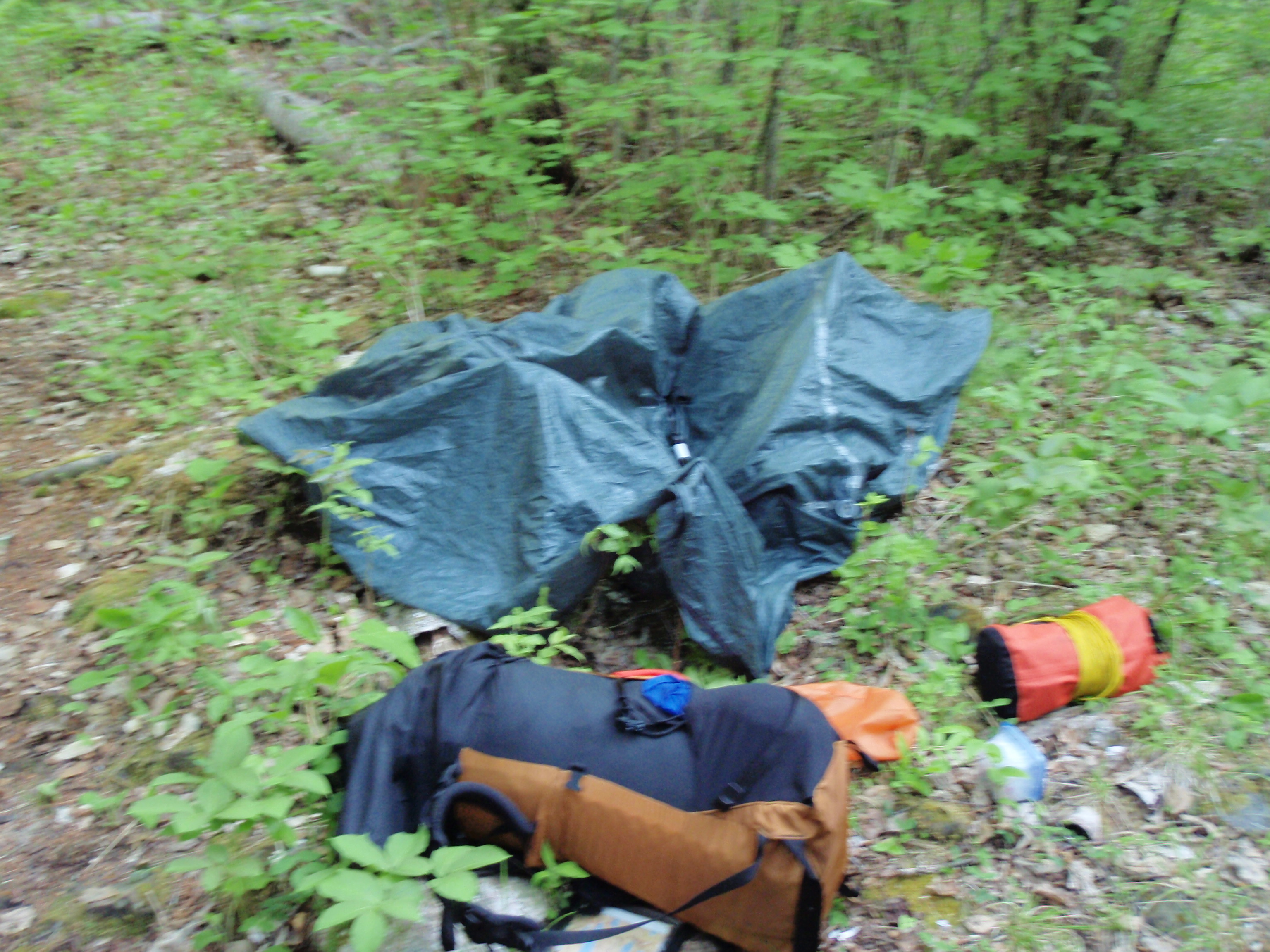
Going down to Pine Lake would involve going down around 15 contour lines on the map and was over a mile in distance. Going to West Pike Lake involves going down around 7 contour lines and a distance of 3/4 of a mile. Actually, going down wasn’t the problem it was coming back up afterwards. Plus, on the West Pike Lake direction of the portage, it looked like the portage went over a creek. So, maybe I could get water at the creek.
Going down the West Pike Lake part of the portage was pretty easy. It was a gradual downhill, and wouldn’t be too bad coming back up. It did take a while because it was about 3/4 of a mile. After hiking for some time, I came up to a puncheon over a creek. I wondered whether I should take water from the creek or continue down to the lake.
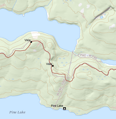 I decided I would walk down the trail to a curve and see if I could see the Lake, and sure enough I did. So I continued on to the lake. I figured it would be better down by the Lake than back in the woods by the creek where there might be more bugs.
Well, I made it down to the West Pike Lake landing and started my little holiday. I found this nice rock about two feet high that had a curved indentation that was just perfect to sit on. I sat on it and took off my pants. The gauze pads down by my crotch had already disintegrated. So I took them off and put the remains in my trash pocket.
I got the water pump and read the instructions. It came with a scrubby pad, so after reading the instructions, took apart the water pump and scrubbed the ceramic cylinder.
I reassembled the water pump and started pumping. I sat down in the water and started pumping water. It filtered the water much faster now. But my Nalgene bottle was not filling up very fast because I was drinking the water as soon as there was a few cups in the bottle. But, I did manage to fill my Nalgene bottle eventually.
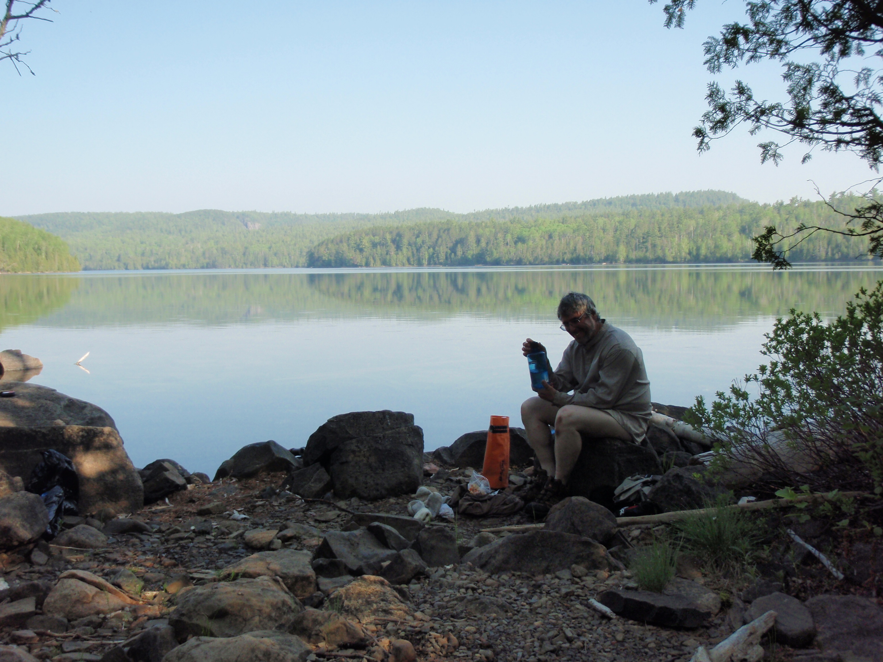
Then I got out of the water and sat on my favorite rock to sit on. I searched through R2D2 for some food, and laid it out on the nearby rocks. I thought I had brought a dehydrated meal to cook on the alcohol stove, but I couldn’t find it. Instead I had a whole bag of beef jerky, some trail mix and an energy bar. I started eating. I was living the High Life at the West Pike Lake Portage Landing. I would eat food for a while, then pump water while sitting in the water. Then I would get out of the water and eat more food while sitting on my favorite rock to sit on. Then I would go back to pumping some more water. This was truly the High Life, all I was missing was the beer.
All good things must come to an end. I need to get going so I put my pants back on. This time I decided to put medical tape on my crotch to cover up my rash. I figured this would protect the skin and cause less friction. It might be real painful to take the tape off, but I’ll worry about that when the time comes. I will probably soak it in water, then it might come off easier. After taking care of that and getting my pants on, I put on my socks and shoes. At least I thought I put on my socks and shoes. Afterwards, I look down and saw a wool sock that I had missed. I did put on the liner for my left food. Then I just put the boot on without the wool sock, which goes over the liner. So I had to redo it. Even the simplest things were becoming difficult to concentrate on.
I had eaten all the food that I brought down to the landing. I stuffed the other gear in R2D2 and hung it and the water filter from my hiking stick. I would be hiking back up to the Border Route Trail hobo style with everything hanging from my hiking stick, and my hiking stick going over my shoulder. I really enjoyed my time at this landing. And I think the Border Route Trail Association should investigate having a campsite near this location. Like I said before, I believe it is a much easier hike down to West Pike Lake than going to Pine Lake. Plus, West Pike Lake does not have any campsites within a mile of the portage, so it might be a good location.
When I started up the portage I wondered where the portage to East Pike Lake was. It connects with the West Pike Lake/Pine Lake portage and goes east to East Pike Lake. As I walked back I was making a concentrated effort on finding the trail. And sure enough after I crossed the puncheon over the creek, I saw the trail veering off to the left. When I was coming down the portage earlier, I was so excited about seeing the water in the creek that I totally missed seeing the portage to East Pike Lake.
I continued up the portage I was on. It was a fairly easy ascent, but at one point I saw something shiny on the trail. It was my dehydrated meal. I had dropped it out of R2D2 on the way down to the lake. I picked up the meal and continued back up to the trail junction and packed up my gear. I made sure the water filter was looped into the backpack strap correctly, then, I was on my way.
The trail goes up from the portage like the trail usually does near a portage. A portage is usually at the low point between two lakes, so naturally, I would be hiking uphill afterwards. It was a fairly easy ascent compared to some other that I encountered on this hike. I had made it to the top of Pine Ridge. I know that it is called Pine Ridge because my next landmark is called the Pine Ridge Campsite. But, that campsite is over 3 miles from the portage. But it is one continuous ridge, which is located between East Pike Lake and Pine Lake.
Once in a while I would get a glimpse of East Pike Lake, but there are no overlooks marked on the map for this section. So, I can now overlook the problem of whether it is a real overlook or not. I had problems on other days deciding what was an overlook that is marked on the guidebook map with a star. Some of those overlooks were just glimpses of the lake below. Now I was getting several glimpses of East Pike Lake.
I figured that this would be another up and down day hiking on a big bluff, just like the last few days were. And it was another up and down day and all around type of day. The trail didn’t seem as it had been cleared recently, but it was still in reasonable condition. Yes, I did encounter some dead falls, but most were easy to get over or around. Yes, the trail was thickety in some spots, but in other spots it wasn’t bad.
Early on in the hike, I encountered an interesting tree configuration. At first, I thought it was two trees that were growing extremely close together. But when I got up close I realized that it was a large pine tree whose top had tipped over on it self. Thus, it looked like two trees right next to each other. Also early on in the hike I encountered a small stream. I know I had the rule of getting water at every occasion, but I would break that rule already, as I skipped getting water there. I had found the top to one of my platypus bottles that I thought I had lost. So now I had one nalgene bottle and 3 platypus bottles all pretty much full. Plus I had rehydrated myself really good when I was down at the portage. The creek that I skipped was very small and looked as though it would dry up in late summer.
I would be hiking on Pine Ridge for about 4 miles. It would give me a chance to think about things. I had made some mistakes on this hike. It gave me a chance to go over them. First of all, the concept of going on a Trail Crew Trip, then going on a backpacking trip immediately afterwards was an ill fated concept. I should have taken at least a days rest before going backpacking. But it seemed like a great opportunity, mainly because the trail crew would take me near where I wanted to start backpacking, and I would get my van driven back to a location that I could hike to. As Spock’s father Sarek said, “it seemed logical at the time.” He said that about marrying a human woman. Taking a backpacking trip after being worn down from doing trail crew work was definitely a bad idea.
Another big mistake I made was pushing myself too hard at times. Yesterday, I pushed myself trying to get to the portage. And Saturday, I pushed myself trying to get to the Clearwater Lake Campsite. Today, I know it will be different. I will be taking a nap in the middle of the hot afternoon, then walking later when it is cooler. Also, yesterday another mistake was not getting water from that stream I encountered. I was so sure I would be hitting the portage soon. But it didn’t happen yesterday, I made it there this morning. Today, I had much more water to work with because I found the missing bottle cap.
Another really big mistake I made was not bringing something to take care of a rash. From now on, rash medicine would be the most important thing in my First Aid Kit. My crotch is really hurting. And it may have contributed to my overall exhausted feeling that I had last night.
Another small mistake was not putting my phone in a plastic bag. Now my phone is not working properly because it may have gotten wet from the platypus bottles that I carry in my vest next to it. But who knows what’s wrong with it. It could be just that I am out of Cell Phone range.
Other stuff that I have done, may or may not be viewed as a mistake. For instance, I got a late start yesterday at Lake Gogebic, thereby making me walk more in the heat of the day. But, my body really needed to sleep in, so maybe it wasn’t a mistake. Maybe the mistake was not staying at Gogebic for another day and just resting.
Also, I was hauling too much gear. I was hauling long underwear tops and bottoms, plus I was hauling a warm jacket. I really don’t count that as a mistake either because if I had not brought those items it would surely be really cold. Last year when I hiked during the same time period, I froze every night, and sometimes during the day. Last year my biggest mistake was not bringing enough gear to stay warm. I was making sure I didn’t repeat that mistake.
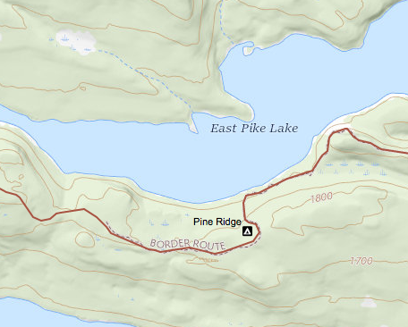 Today, I knew that I had a 4 mile stretch on top of Pine Ridge before the trail hits the East Pike Lake/McFarland Lake portage while yesterday it was a 6 mile stretch before I hit the portage. So, today, I would surely make it to the portage. I wondered if I would make it out to the Arrowhead Trail today, It would be an eight mile hike from where I started this morning, and I only hiked about 5 miles yesterday. But I got a 4 hour head start today, and was refreshed at the portage. I definitely would not push it to make it to the Arrowhead Trail. The worst case scenario was that I would make it out to the Arrowhead Trail sometime tomorrow. I figured if I made it out today that I could hitch a ride this evening with a fisherman that was coming off the lake. I definitely would be taking a break from backpacking once I reached the Arrowhead Trail. Hopefully, I could get someone to give me a ride down to Highway 61, then I could hitchhike down to Grand Marais, back to my van.
I kept going on top of Pine Ridge. Again I was going up, down and all around, but mostly east. The day wore on, and soon it was the middle of the afternoon. I decided I would find a place to lay down. As I hiked I saw a really shady area under a pine tree. It seemed more shady than other areas that I had looked at. So, said to myself, this is the spot for a nap. I set my gear down, and set out my spot messenger on a pine tree branch. It wasn’t windy, so I thought I would stay on the branch okay. I laid out my poncho in the shady spot, put my backpack on one end of the poncho. Then I dragged over a small downed pine tree to the other end of the poncho. I would be using my backpack as a pillow and the small tree to put my feet up. I took a nap.
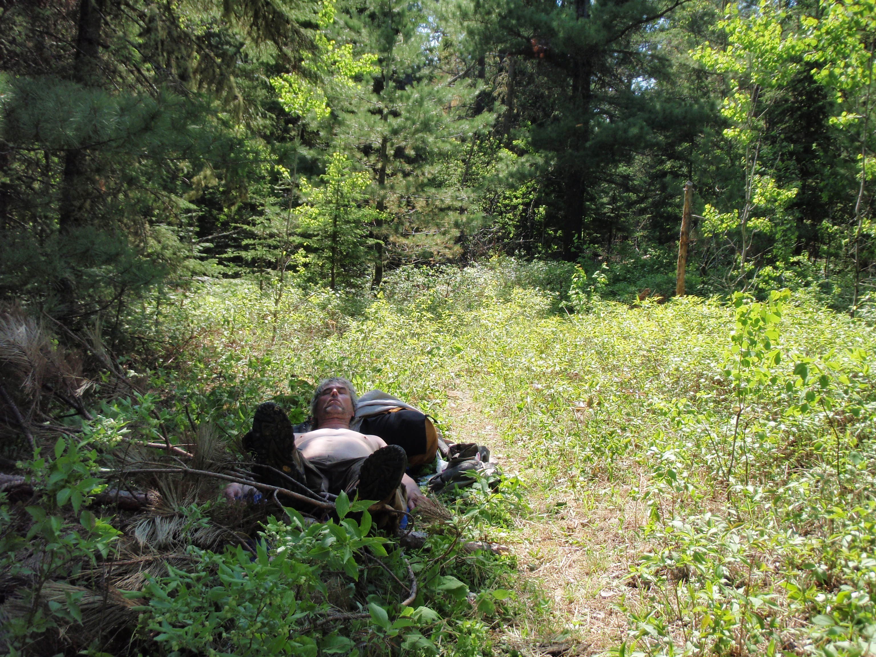
I took a nap in the shade for at least 40 minutes to an hour. When I woke up the shade had moved until the sunny area was right next to me. I set up a timed photo of me taking a nap, then I grabbed my spot messenger. I’m not sure if it sent and “I’m okay” message, I packed up my poncho and left. The Super Shady Pine Tree had served me well.
I continued hiking on the Pine Ridge, and soon I reached a trail intersection with a blue arrow pointing to the left. I wondered if the Border turned here or if this was a trail to the Pine Ridge Campsite, also known as the “Campsite in the Woods.” I went down the trail and found the campsite.
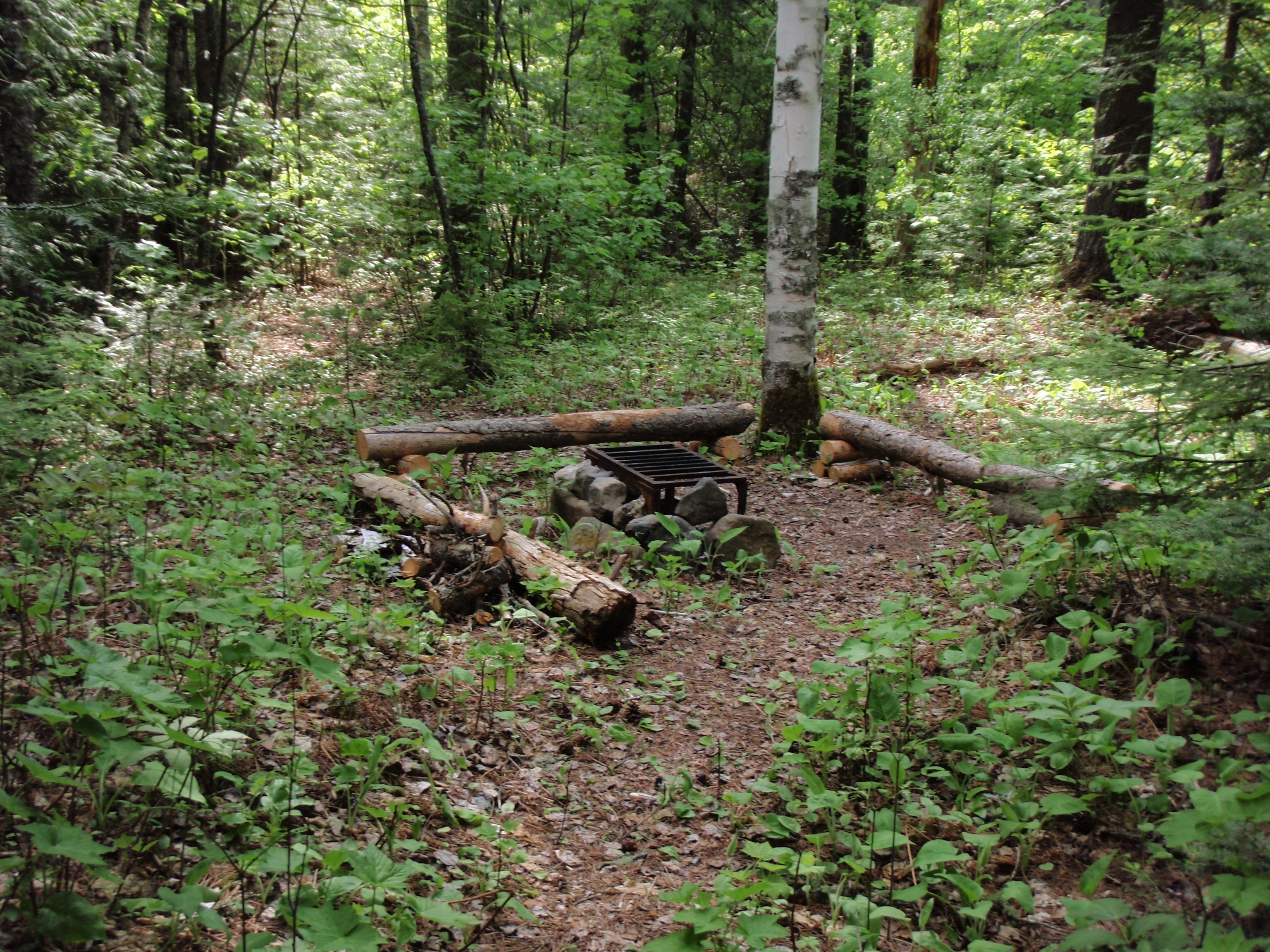
It’s a nice and flat campsite, with a forest service iron fire grate in the fire area, with nice log benches. The campsite has some nice flat grassy tent pads. I didn’t see the Latrene, but I saw a trail leading away from the campsite. The Pine Ridge Campsite is a nice enough campsite, but….BUT, IT’S A VERY BAD IDEA!!!
You see, the campsite is near the East Pike Lake/McFarland Lake Portage. Once you get on the portage, it is 1/4 mile down to the East Pike Lake Landing. If a fire ever got out of control at this campsite, it would take you at least 10 minutes to run down to the lake to get water, and probably 15 minutes to carry a fair amount of it back. By that time the fire would be too big to contain. I’m thinking this campsite is a forest fire waiting to happen.
If the campsite is 1/4 mile away from East Pike Lake, why not just put it on East Pike Lake. It would get a lot more use, because canoeist would use it, and it wouldn’t be a fire hazard in my mind. Plus, there isn’t another campsite on the lake within a mile of the portage. Let’s make everybody happy and just move that campsite down to the lake. I headed back to the Border Route Trail and hiked east again. Soon I hit the East Pike Lake/Pine Lake portage. At the portage, it looks as the Border Route once headed straight, but a bunch of logs were piled up to prevent you from going that way. I turned left and headed down towards the lake. Within sight of the lake, the Border Route turns right, and there is a Border Route sign with an arrow. I set my gear down at the sign and took the water filter and water bottles down to the lake.
As I was pumping water, I looked to the left and saw some clouds moving in. I continued pumping and then noticed the clouds were really moving, they had already made it half way across the lake. It was a freaky storm front, with clouds whirling around as if they were going to start a tornado. I began thundering, so I thought I’d better cut my water pumping session short, and go back to my gear. I was actually scared for the first time.
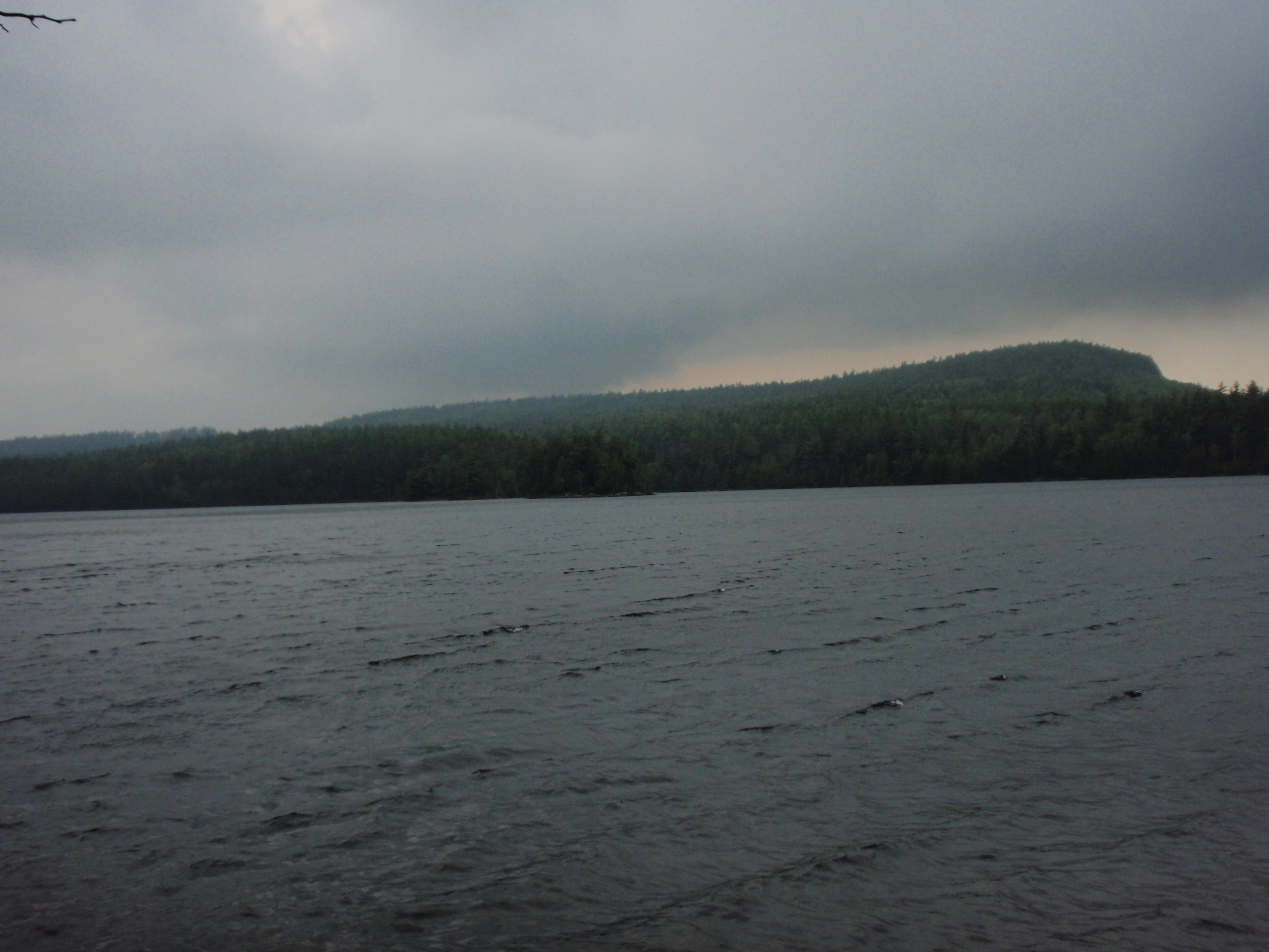
I went back to my backpack, and immediately put on my poncho. I had not used it except for a ground cloth up until this point. I thought I would be in for a major rainstorm. It would be a deluge. It had started raining softy, but I just knew I was in for a beating. I thought I should high tail it for the Arrowhead Trail, which was about 3 miles away.
I continued up to the top of a ridge seeing glimpses of East Pike Lake to my left. It was slow going because it was raining and the trail was wet and slippery. But the rain kept falling softy, and the major drenching did not occur. Finally, it quit raining, and my fears subsided. It was quite the scary storm front, but it was more bark than bite.
I continued walking through the woods on top of the ridge. My next landmark would be an overlook, Then it would be a less than a mile, all downhill to the Arrowhead Trail. Plus I would be crossing a creek on the section after the overlook and I would be leaving the Boundary Waters, so there might be a sign. I kept going on the ridge. It wasn’t as up and down and all around as other ridges I had walked on, including the Pine Ridge this morning. There were uphill sections, but they were gradual and fairly easy to ascent.
I came across one creek early on. I figured it was too early for it to be the creek on the map that was close to the Arrowhead Trail. I had water from East Pike Lake, so I continued on.
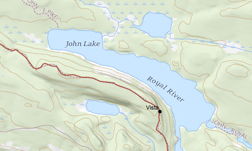 I started seeing glimpses of a lake to my left, and I wondered if one of these glimpses was the overlook that was marked on the map. Every time I went downhill for a little bit, wondered if this was the start of going downhill to the Arrowhead Trail. The Guidebook stated that after the overlook it was all downhill. I continued on the trail, and it continued to be in a reasonable condition. It was mostly clear, will a few downfalls and brushy areas. I walked through the woods and started to see a better view of the lake below. Then all of a sudden I came upon a beautiful overlook. It was spectacular. John Lake was down below me, and to my right off in the distance I saw some cliff-like hills which I thought were the Pigeon Cliffs.
I set down my gear and looked at my cell phone. It said it was 9 pm. Wow, I didn’t think it was anywhere close to being that late. Maybe the cell phone was wrong and was an hour off. So, maybe it was 8 pm. Nevertheless, it was late.. The overlook had a nice flat area that would be good to set up a tent, so I did. I wasn’t going to push it to get out to the Arrowhead Trail, and have another disaster.
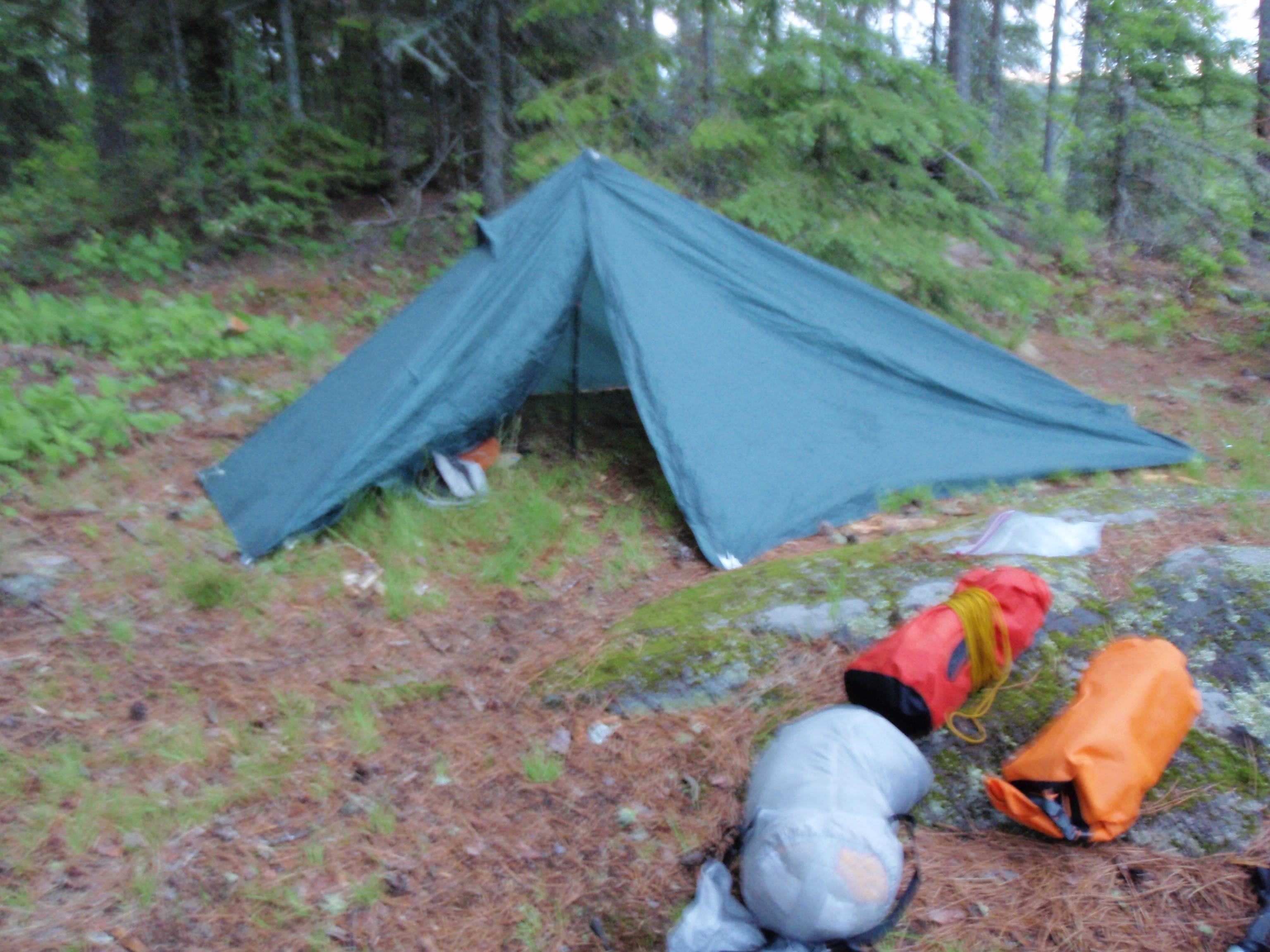
I know, I know, I know, I’m supposed to be camping at a designated campsite when I’m in the Boundary Waters Wilderness. That’s the rule. And I am not usually a rule breaker when it comes to the outdoors. But, am I really camping? Or am I just crashing? I haven’t been at a designated campsite yet on this trip. I am setting a really bad example. The first night I tried like hell to make it to the Clearwater Campsite, and made it within 200 yards before I couldn’t see the trail anymore and just crashed on the trail. The second night I thought I was at a designated campsite at Lake Gogebic, but it turns out I wasn’t. And last night, I puked at the West Pike Lake Overlook and decided to stay there for the night.
Again, I really didn’t feel that I was camping. I was just pulling in for a few hours of rest. The only place that I had a campfire and used my alcohol stove was the night at Lake Gogebic, when I thought I was at the real campsite. It had a boat landing, fire ring and tent pads, although it didn’t have the official Forest Service fire grate. However, I did think it was the official campsite. In the morning I was proven wrong.
I ate some dried food and set the bear bag C3PO down the trail from the overlook. I was tired and really didn’t feel like stringing it up. Besides, I was less than a mile from the Arrowhead Trail, if something got into my food now, it wouldn’t be that big of a deal.
Hopefully, I would be able to hitch a ride down to Highway 61 in the morning when I get to the Arrowhead Trail. I am not planning on finishing the Border Route right away. Instead, I would like to rest a couple days. I went back to my tent and turned in. It was a beautiful, peaceful night, and I had a good rest.
Wednesday, May 26, 2010
Johns Lake Overlook to the Arrowhead Trail, Then to Grand Marais
In the morning, I woke up before sunrise, proceeded to pack up and take photos of the sun rising. I went down the trail and retrieve my bear bag C3PO. No animals had touched it. I ate an energy bar and some trail mix. I packed up my backpack and I was off. No one would be able to tell that I slept at the overlook. I did not have a fire, or even use my alcohol stove. I can see the headline now, “Scout Leader starts Boundary Waters Fire.” I’m not taking any chances being so far from water.
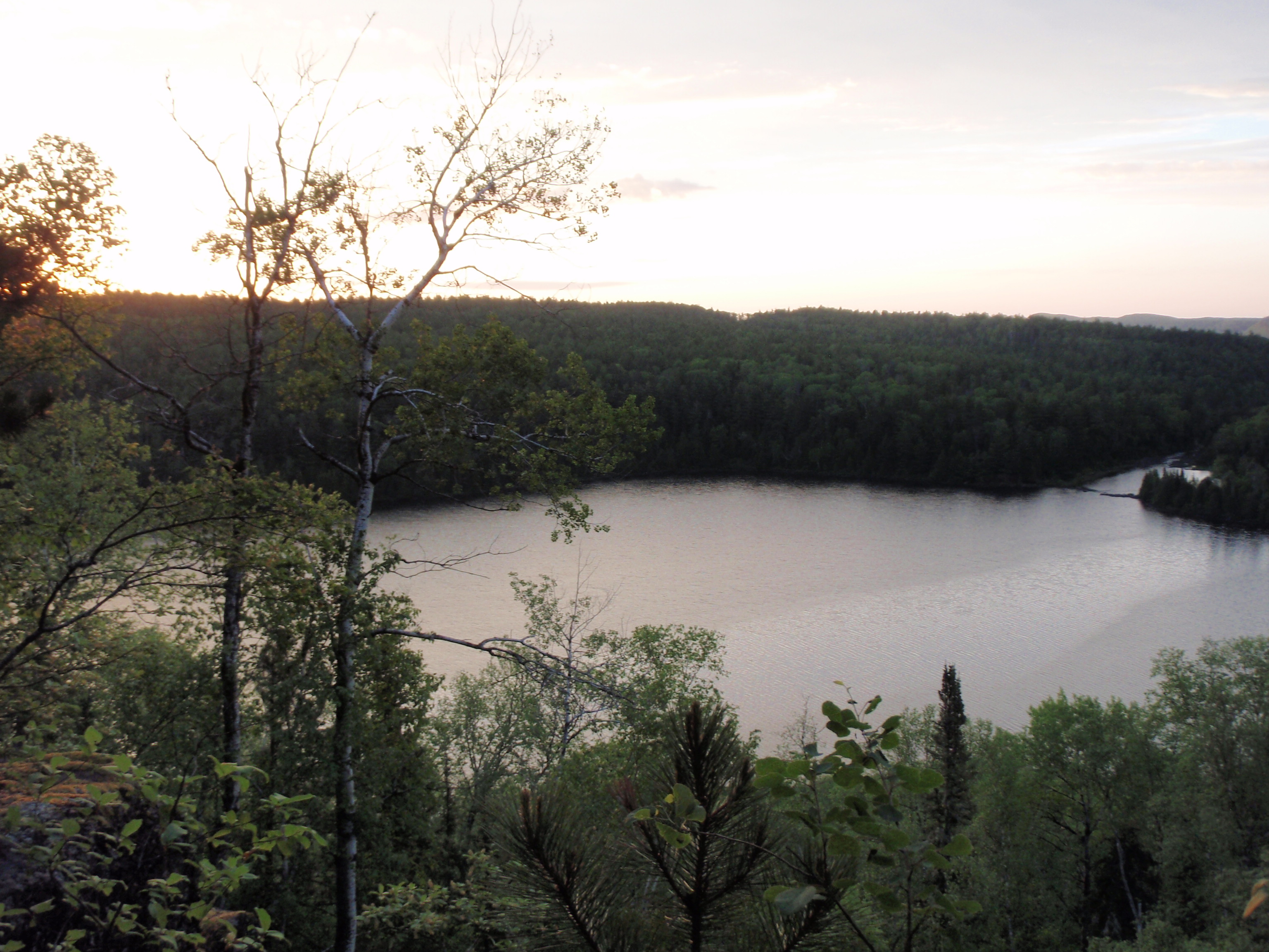
The Guidebook was right, it was all downhill from the overlook. Soon I got to the point where there was a Boundary Waters sign, so I was officially leaving the wilderness. I stopped and took a timed photo of me next to the sign. Then I came across a small creek and wondered if it was the creek shown on the map. But it looked pretty small. I continued on a found a boardwalk going over a bigger creek. That must be the creek shown on the map. I noticed that the trail was pretty cleared now, with some deadfalls being recently cut. I continued and crossed some more boardwalks and BADA BOOM
there was the road. I HAD MADE IT TO THE ARROWHEAD TRAIL!!!! Praise the Lord!!! There was a Border Route Sign at the Road. I turned to the left and started walking down to a road intersection. It was the intersection of the Arrowhead Trail and Ary Pt Road.
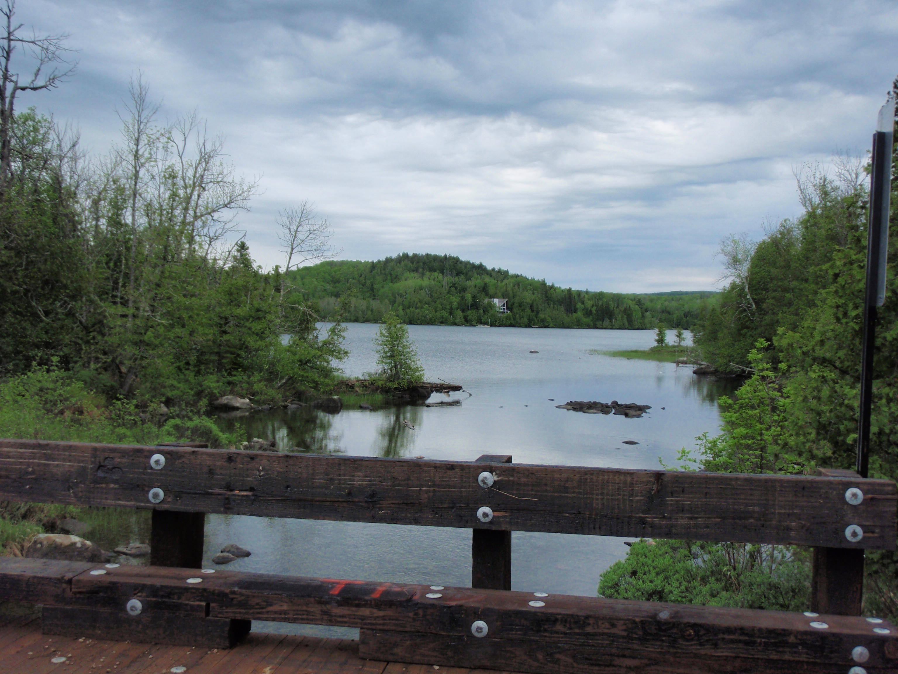
At the intersection, the Arrowhead Trail turns left and then I could immediately see a bridge. I walked down to the bridge and saw two beautiful lakes. Little John Lake was to the left of the bridge and McFarland Lake was to the right of the bridge. Both Lakes were named after prospector John McFarland. As I walked on I saw a boat ramp with a pier to the left going into Little John Lake. Then I saw a parking lot, which is actually the Trailhead for the Border Route Trail. The BRTA has a nice kiosk sign there, and the Border Route going East starts right behind the kiosk. There were several cars parked in the parking lot. This raised my hopes that I would find
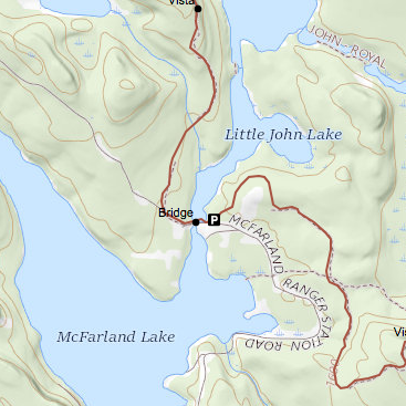 someone to drive me down to Highway 61.
As I continued down the Arrowhead Trail, I saw a cleared out area, which was the Firefighting Heliport I had heard about. It had a sprinkler system around it. The Border Route used to go right through the Heliport until last year when they moved the trail around the Heliport. I walked up to the McFarland Lake Campground of the Grand Portage State Forest. Maybe there would be someone here that could help me.
As I walked up the campground road, I heard voices to my left. I turned left on a dirt road and walked into a campsite that was occupied by 4 men. They had quite the layout. They had a big white cabin tent, some great cooking gear and a trailer to store stuff in.
I walked into the campsite and introduced myself and told them I was from Madison, Wisconsin. They introduced themselves and told me that they were from Wisconsin Rapids, Wisconsin. They were up here fishing. There were 3 older gentlemen who I would guess were in there 60’s and one younger man who I thought was around 35. Unfortunately, I didn’t remember their names and I didn’t have my voice recorder on. I said that I was backpacking for the last 4 days and that I was worn down more than I expected to be. One of the older men said it was no wonder because Minnesota had record temperatures for May the last few days. It was in the 90’s. Wow, I thought, no wonder I was doing so bad.
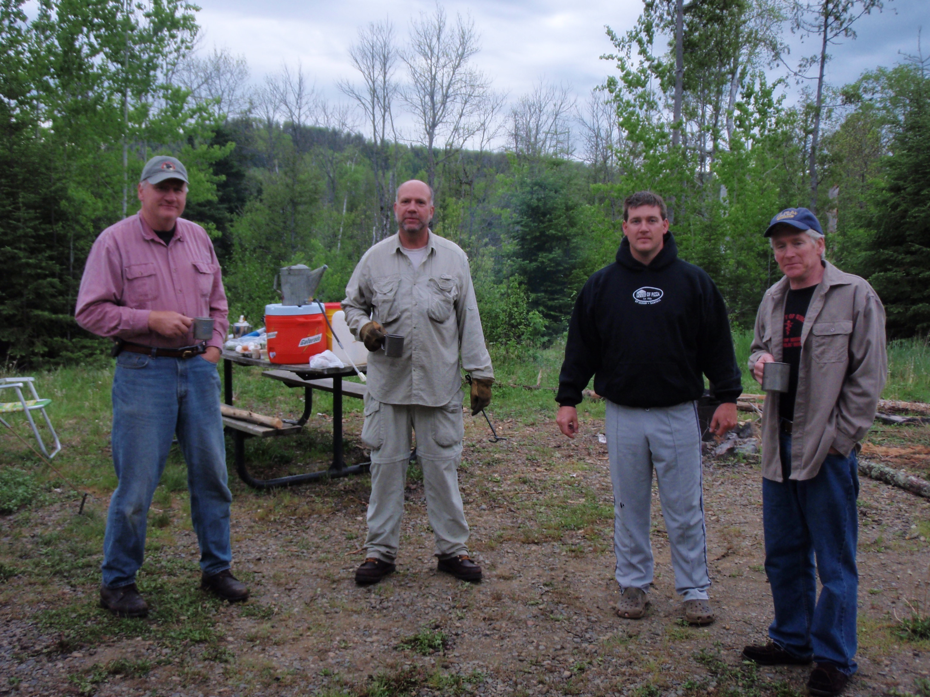
I said that I was planning to hike some more, but now I too worn down. And that I would be willing to pay someone to drive me down to Highway 61, where I maybe could get another ride into Grand Marais. The younger man asked one of the older men how long it would be until breakfast was ready. The older man said about a half an hour. Then the younger man said that he would take me down to Highway 61. But first I took a nice photo of all four of them and gave them each a “I Saw Tman” card.
Then the younger man went over to his truck and opened up the tailgate. When he did so I saw that the back of his jacket said “SHERIFF.” So as we got in the truck I asked him if he was in fact a sheriff. And he said yes, that they all worked for the Sheriff’s Department in Wisconsin Rapids. But the rest of the men were all retired. I told him that my sister is a Police officer for the State Capitol in Madison.
Off we went, down the Arrowhead Trail. And my conversation with younger Sheriff proved to be very inspirational. But it will have to wait, because this is the Trip Report for Tuesday, May 25 and we are now way into Wednesday morning. I just wanted to let everyone know that I did get a ride. You’ll have to read the next installment to find out about the inspirational conversation. And it wouldn’t be the only inspirational conversation for Wednesday.
Just a quick synopsis of what happened so far on May, 26. I crashed overnight a the John Lake Overlook. I packed up really early and hiked out to the Arrowhead Trail. Once out onto the Arrowhead Trail I walked across the bridge separating McFarland Lake and Little John Lake then I walked past a boat launch, Border Route Trailhead, Firefighting Heliport and then into the Grand Portage State Forest Campground. I walked into a campsite that was really well furnished, and talked with some fishermen from Wisconsin Rapids, Wisconsin. The younger man of the 4 fishermen agreed to take me down to Highway 61. When he put my gear in his truck, I noticed it said SHERIFF in big letters on the back of his jacket. I asked him if he was a sheriff and he said yes, and that the other three men were retired sheriffs.
So, I hopped in the younger Sheriff’s truck, and down the Arrowhead Trail we went. He seemed to know this road really well for someone who lived in Wisconsin. He was driving fairly fast and with confidence. I said something like “wow, you seem to know this road pretty, well.” And he said yes, that Wisconsin Rapids really wasn’t that far away from here, and that he came up here 3 or 4 times a year. He started talking about the Arrowhead Trail. He said that the first two miles up from Highway 61 were paved. Then the next 8 miles were a gravel road, but a better it was a better quality gravel road then the last miles of the road. The Arrowhead Trail is about 17 miles long. He also said that the Arrowhead Trail went through a virgin forest at one point. He was very knowledgeable about the road. He said that he would drop me off at a store that is near the Arrowhead Trail down on Highway 61.
Well, we were getting down to where I could see Lake Superior, and we got on the paved road portion. So I asked him how much did I owed him for taking me down to Highway 61. After all, I did say back at the campground that I was willing to pay someone for taking me. He said that I owed him nothing. He said that’s what people are for is to help other people. He asked me if I had seen the storm yesterday. And I said yes, I was pumping water at the East Pike Lake Landing when it rolled in really fast. He said that they had been out on the water when it hit and that one of their boats tipped over and they lost some gear. But then he said that someone that they didn’t know came over and helped them. Evidently, they would have been in a real pickle if these people didn’t help. So, now he’s returning the favor by helping me.
Wow, what an incredible story. I wondered how I would return the favor by helping somebody else.
We got down to Highway 61 and turned right. Down about a block we turned into the Chicago Bay Marketplace. The younger Sheriff got out and helped me get my gear out of the back. I put my gear on the porch of the store, and we went in. The younger sheriff was buying two bags of ice and 4 cinnamon rolls. And they were huge cinnamon rolls. Evidently, the Chicago Bay Marketplace is the Cinabon of the north shore. It’s their specialty. I offered to pay for the ice and rolls, and at first the younger Sheriff said no. But I said that I was in the wilderness the last 5 days and I had not spent any money. And that I appreciated him giving me a ride. He let me pay, and then he was off so that he wouldn’t miss breakfast back at the camp. I sure hope those Sheriffs enjoyed those buns.
Thank you very much for helping me!!!
The Chicago Bay Marketplace is part Restaurant, part Grocery Store, part Deli, part Cinabon and part Camping Supply Store. Plus there’s a pay phone outside that many people use because cell phones don’t work too well up here. When you walk in there is an area to the left that has several tables to eat at. If you head straight there is the Deli counter, groceries and supplies. And to the right is the cash register area and the kitchen.
The lady who works there is tall with long blonde hair pulled back into a ponytail. I’m not sure how old she is, but I’d guess at least 40. She walked really slow like she had some type of injury from a car accident or something, But she did a good job. She had been back in the kitchen area making another batch of cinnamon buns. I ordered a cinnamon bun and some chocolate milk. She said that I would have to go to the back wall of the store and grab the chocolate milk from the refrigerator with the sliding glass door. I did so. I came back and ate at a table next to the front door. I set out my Spot Messenger out on the front porch to mark my spot.
I ate my bun and drank my chocolate milk. While I was sitting there, I took out a sheet of paper from my clear plastic map holder and I wrote the letters GM on it. Each Letter was about 8 inches high, so that people could read it while I was hitchhiking. There was an older man in the table section eating breakfast. I asked him if he was headed into Grand Marais, but he said he wouldn’t be going into town until later on this evening. Oh, Well.
I finished up my food and asked the lady if they had anything that would help a rash. She said there was some Hydrocordisone Cream on the back wall past the cooler where I got the Chocolate Milk. I went back and found it. It was very reasonably priced, considering this was the only store within 15 miles. I bought the cream, and went into the bathroom and applied it to my nether regions. Boy did that feel good. From now Hydrocordisonne Cream is a necessity in my first aid kit for Backpacking.
I gave the lady at the store a “I saw Tman” card and told her I would be hitchhiking into Grand Marais. She said good luck and off I went. I walked down Highway 61 a little ways and set down my gear and stuck out my thumb. I didn’t think it would take very long for me to get a ride because I read a post on the internet saying that hitchhiking by backpackers is fairly common in the Boundary Waters. I stuck out my thumb at every car and was not having very much luck. I thought my GM sign would help, because people would then know all I wanted was a ride into Grand Marais, and not Duluth or someplace like that.
I stood there for a long time. There wasn’t really all that many cars coming down the Highway, maybe 1 or 2 every 5 minutes. At any rate, I got tired of waiting after about 15 cars had passed. I decided that I would put on my backpack and start hiking. I did have a strategy. I would hike a couple miles down the road to Nanaboujou Lodge, where I had left my resupply package. Then I would decide what to do once I got there. Perhaps, I would rest and stay overnight at the lodge, or perhaps I could talk a hotel guest into driving me into Grand Marais. Lord, knows I was willing to pay someone to take me in.
But that strategy didn’t come into play, because I was still sticking my thumb out and showing my GM sign to every car that came by. And when I was walking by a church, my prayers were answered when a compact car pulled over and stop for me. As I was walking up to it I saw the trunk pop open, so I put my gear in. Then I went to the passenger door and the man driving said, “Do you need a ride to Grand Marais?” and I said yes. I hopped in the car and met Grand Portage Tribe Member Ed Olson. I introduced myself and told him I was from Madison, Wisconsin. He looked to be retired, perhaps in his late 60’s or 70’s. He told me that he was born out on an island in the Grand Portage Bay, where is Grandfather had a Trading Post.
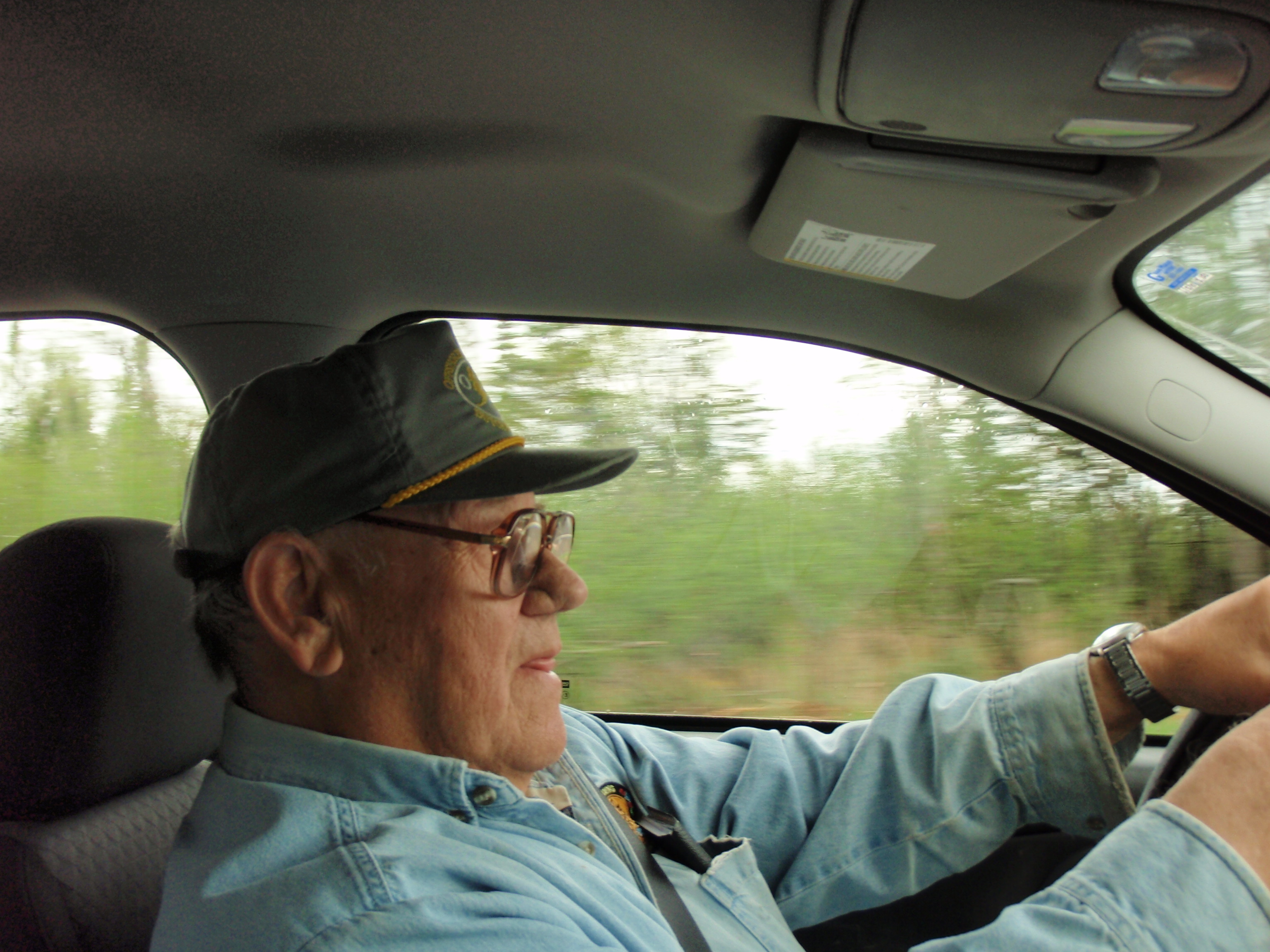
Wow, having Ed as your driver is like having your own personal tour guide. He would point out things while he was driving. It was great. I asked Ed what his job was up at Grand Portage. And he said his last job was taking care of the Transfer Station. I wasn’t quit sure what that was, so I asked him. He said that it wasn’t a dump, but it was the place people would bring their garbage. But, the garbage would not remain at the station, it got hauled away by truck. Again, Ed would be pointing out stuff along the way.
Since he said it was his last job, I asked him what other jobs he had. He told me that back in the 70’s he worked for a big fishing company managing a facility in Northern Alaska. I said Wow,that must have been really something. He said that it was an interesting job, but it was in a really remote location. He said that his brother was shot to death up here on the reservation on New Year’s Day, and he had a heck of a time trying to get back for the funeral. Just getting to Anchorage was tough enough, he said. But he did manage to make it back for the funeral. I said that I sorry to hear about his brother, and to have to come back from Alaska in the middle of the winter would not have been fun. I didn’t tell him that I have actually had two brothers that have died. But it sounded like his brother was murdered, which definitely sets it apart from my brothers.
Ed pointed out the File Mile rock, out in Lake Superior, which is 5 miles from Grand Marais. It was at this point were I told Ed that where I really needed to go is the Pincushion Mountain Trailhead, which is a mile or two up the Gunflint Trail from Grand Marais. I said I could pay him to take me up there. He looked at his watch and said that he had a 10 am appointment at a car dealer to get his car checked out, so he should have plenty of time to take me up there. But he didn’t know exactly where the Pincushion Mountain Trailhead was. I said that it wasn’t more than 2 miles up the Gunflint Trail from Grand Marais.
So, we headed into Grand Marais. Ed was still pointing out stuff to me. He pointed out his nephew’s house, the old school and the new hospital. In that regard, Ed kind of reminded me of my dad. My Dad was a construction worker who worked for the Laborer’s Union in Madison, Wisconsin. Whenever we would drive through Madison, my dad would always be pointing out buildings or streets that he worked on. He had worked on lots of streets in Madison, doing what he called “Raising Manholes.”
Ed drove up the Gunflint Trail and I saw the sign for the Trailhead, and he turned in. We drove down about a block, and then there is a long curved parking lot that overlooks the City of Grand Marais. Then it loops around and there is a smaller parking lot on the other side of the loop. All of a sudden Ed knew this place. The locals probably just know this place as the Grand Marais Overlook, and not the Pincushion Mountain Trailhead. He said that his nephew got married over there in the smaller parking lot. I asked how much that I owed him for bringing me up there, and he said nothing. He had to go to get to his appointment, so I grabbed my gear out of his trunk, and away he went. I waved as he looped around. Be well my friend.
The trailhead looked as through it was fairly recently built, probably within the last 5 years. It was all nicely paved and it even had a small brick building for restrooms. And there is a sweeping view of Lake Superior and Grand Marais. I took a bunch of photos here including a series of photos for a panoramic shot.
It felt good to be back at my van. I put my gear in the back and grabbed a clean shirt from a tote. Away I went to explore the City of Grand Marais. There is a big city park with a campground on the western bay area of Grand Marais. I had never been there, so I decided to go check it out.
I went down and turned into the campground from Highway 61. Once you turn in, the indoor Municipal Pool is on the right hand side. It looks to be about 25 to 30 years old with brown wood siding. As you drive in on the left hand side is the campground office which is an old house. Also to the left is the Marina and a restroom/shower house. Continuing on, there are campsites for Rvs, a picnic shelter and the beach. At the far end of the beach is the hiking trail to go out on the harbor breakwater. As I loop around to the right I found a bunch more campsites, the city ball diamond and another restroom/shower house. The restroom/shower house looked pretty new. All and all the campground facility was first rate. It was fairly well occupied considering it was the Tuesday before Memorial Day Weekend. I suppose in a few days it will be packed.
I drove out of the campground and headed to downtown Grand Marais. I pulled into the Dairy Queen at about 10:10 am and was their first customer. I ordered a vanilla cone dipped in chocolate. I remembered that it was a Vanilla only Dairy Queen, meaning they don’t have chocolate ice cream. So to get some chocolate, I would have to have it dipped in chocolate. After eating the cone, I headed for the hotel.
The Grand Marais Best Western was bustling with construction workers. I walked in and asked for a room. The manager said he would have to check to see if there was one ready yet. And sure enough, he had one open. So I got it. Then I asked the manager if they had a Cell Phone store in Grand Marais, because my Cell phone wasn’t working properly.
He said no, but let him take a look at it. He started to press a bunch of buttons, and couldn’t get anything to work, then handed it back to me. I said I would call the manufacturer. So I went in the Breakfast Room and got on the computer to find the manufacturer’s number. I also updated my website, stating that I had hiked out to the Arrowhead Trail and that I’m taking a couple day’s rest in Grand Marais.
Soon the guy who was in charge of the construction came in and talked to me. He said they were building two computer stations across from the front desk and would have better internet, so next time I visit it will be upgraded. I said that was good because the main reason I choose this hotel is that it has internet so I can update my backpacking website. He seemed happy that I was using the computer for such a good purpose.
I went to my room and called the cell phone manufacturer. After several minutes of talking to them, it was decided that they could not fix the phone over the phone. So, when I get back to Madison, I’ll have to figure out what to do with it. I figured that some moisture from my platypus bottles may have gotten into the phone. I the hotel room there is a big air register on the outside wall that will give you cold air, or hot air, depending on what you need. I opened up my phone and took the battery out. Then I put the cell phone in one of the vents of the air register, and started the fan. I figured this would dry out my cell phone if any moisture got in it.
I called my mom on the hotel phone, and told her I was doing alright. Then I called my sister, who was a little ticked at me because I had not sent a Spot Messenger Message on Tuesday. I remember trying to send a message at the Super Shady Pine Tree, but it must not have been sent. Then I must have forgot to put out the Messenger at the John Lake Overlook where I crashed for the night. I must have gotten sloppy about the message, due to the freaky storm, and the fact that I would be making it out to the Arrowhead Trail soon.
After the phone calls were done, I took a bath. That felt real, real good. Then I slathered myself with the hotel lotion, and my rashed up nether regions with Hyrdocordisonne Cream. Then I took a nap. Boy did it feel good to be in a real bed.
I woke up in the early evening. I went down to the front desk area and was going to use the computer in the breakfast room, but the breakfast room was all decked out for a party. and it said “Happy 80th Birthday Warren.” The lady at the front desk said that the party would not be starting for an hour yet, so I could go in and use the computer. So I did some more updating on my website. I decided that it was about time to head out for supper, so I grabbed my camera from my room, and started walking in downtown Grand Marais. I had intended to go to the Gunflint Tavern for their Salmon dinner. But first I just was taking photos of the colorful little town. I took photos of the Art Gallery, Beaver House, Lake Superior Trading Post, Jones Department Store (Ben Franklin), Gunflint Tavern, Java Moose, Gunflint Reality and more. I was headed back to the Gunflint Tavern when I went by the American Legion. It was Burger Night at the American Legion, so I went in to check it out. I asked a gray haired man that I walked in behind Burger Night was pretty good, and he said that it was good. And there were a lot of people in the American Legion, I’d say around 40 or 50. It was a hopping place.
So, I decide to stay at the American Legion for Burger Night. I walked to the back and ordered my burger at a table that a waitress was manning. She gave me a number, just like at Culvers. I told her I would be up at the bar. The bar is a U shaped affair. I sat down on the far side of the U and ordered a beer. The bartender was named Liz and she has long light brown hair. A local customer across the bar from me was teasing Liz saying stuff like “A guy would die of thirst over here before he got a beer.” Liz seemed to be entertained by him. The local guy said that he would be going to Alaska in a few weeks, so then Liz could take it easy. So, I guess I call that guy Mr Alaska. He was in his 60s and looked like he hadn’t shaved in a few weeks. He was saying that Grand Marais isn’t the same town anymore, that Twin City money had changed the town. He said that the American Legion was the best place to eat, because the rest of the places now had overpriced flowery food meant for tourist and people from the cities.
Down the bar from Mr Alaska were three working guys that seemed to keep pretty much to themselves. I was at the bar for a while, waiting for my burger. I saw that there were still 3 or 4 people sitting around with numbers on their table, including the man that ordered directly in front of me. Then something totally weird happened. A guy came in the bar who was a friend of Mr Alaska. They sat at the bar and were talking about the Milwaukee Brewers. I don’t hear very many people talking about the Brewers in Madison Bars, but yet I travel 400 miles into another state that has their own Professional Baseball team, and I hear a couple guys talking about the Brewers.
After a while, I finally received my burger and started eating. Then two working men sat down at the bar down from me. The three guys on the other side of the bar, who were keeping to themselves, started talking to the two guys that just came. Evidently, the two guys are construction workers who are working on widening Highway 61. The three guys were asking about the dynamite that the road crew was using. The two guys said that it was a liquid dynamite that they poured down in the holes after the holes were drilled. I believed the Nobels would be pleased that their invention was being used to build such a lovely highway. These are the same Nobels that have the Nobel Prize. They wanted to be known for more than just making dynamite, which at the time was often used for military and illegal uses. And that’s how the Nobel Prize got started.
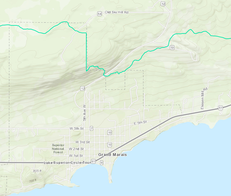 I ate my very good burger and finished off my beer then I headed out. I needed to take a walk to help digest the burger, so I headed out towards the Coast Guard Station. On the street heading out to the station I passed a Fudge Shop, a bicycle shop, the historical Museum and an Ice Cream stand that has a rooftop deck. Once I got out to the Coast Guard Station I needed to make a decision on whether to turn right or left. If I turned left it would take me out to the little peninsula known as Artist Point. If I turned right, I would be going out on the concrete breakwater to the harbor lighthouse. I decided to turn left.
I was walking out on the large concrete breakwater. For the first part, there was still a rocky shoreline along the breakwater. Then I got out to the point where the breakwater was leaving the shoreline. All of a sudden a large dog ran past me and jumped in the water. I looked back and its owner was a man in his 40’s that was paying more attention to his cell phone than his dog. The dog splashed around and came back up on the rocky shore. I continued on out to the lighthouse. I took a bunch of photos out by the lighthouse. It was a real photo opportunity for me. Then I headed back to the Coast Guard Station.
Once I made it back to the Coast Guard Station, I decided not to go out to Artist’s Point. Instead, I would walk along the shoreline back to my hotel. This part of the shoreline is made up of small rocks. I walked past the Ice Cream Stand again, and past a hotel that had a terrace coming out towards the shore. I walked past some local high school kids that were just hanging out. Then I made it down to a spot where 2 kids were playing with a rather large dog. They were throwing a log out into the water, and the dog would retrieve it. Soon I noticed that a couple down the beach were parents to the two children. As I walked by parents I said something like “it’s amazing that your dog can fetch that log” And they said that it wasn’t their dog. The owner was up on the terrace. Then I realized that it was the same dog that I seen out on the breakwater. And, its owner was still fidgeting with his cell phone. I figured this was the type of person that “Mr Alaska” was describing when he said that people from the Twin Cities were ruining their town.
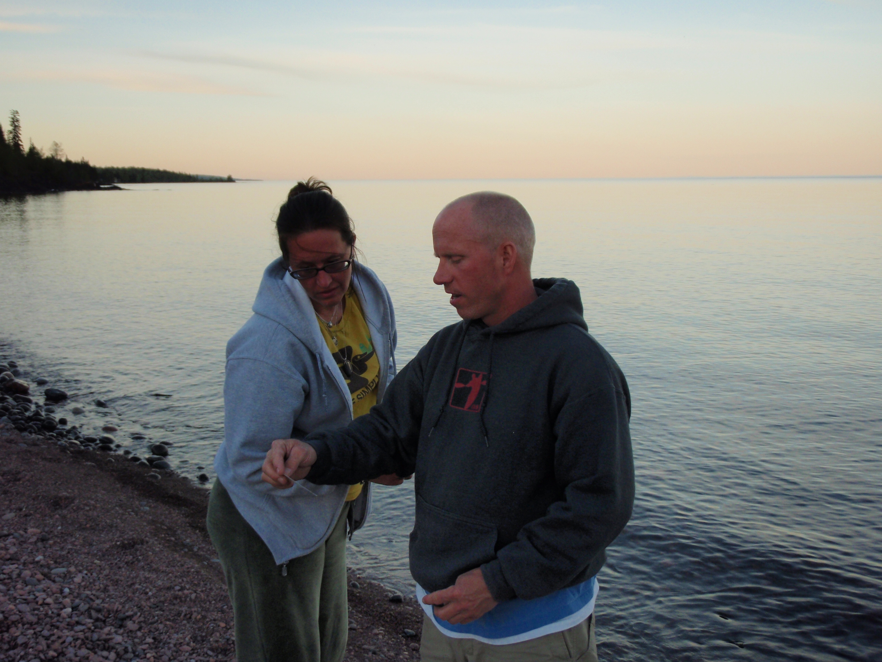
I talked with the Terri and Ty for a few minutes, and gave them a “I Saw Tman” Card. They were vacationing in Grand Marais, and were staying at the Best Western too. Their kids were really enjoying playing with the water dog. I continued on down to the hotel and went to my room. I wanted to go to the hotel Hot Tub, so I took a shower and put on my swimsuit.
I headed down the long hallway to the Hot Tub. When I got down there I found out there was three guys already in the Hot Tub. But there was plenty of room for me. I didn’t realize it at first, but these were the same three guys who were at the American Legion earlier that were talking with the road construction workers. It turns out that these three guys are also in the construction business, too. In fact they were the worker that are working on the hotel.
One of the guys said he was working in the lobby when I checked in and overheard me saying to the manager that I was out backpacking. Soon the whole conversation was about backpacking. They asked me lot’s of questions like, what do you do with the poop? Do you have to carry it out in a plastic bag? I said that in most cases that you can dig a cat hole at do your duty in there, then cover it up. I told them how the Superior Hiking Trail, Border Route Trail, and Kekekabic Trail were all hopefully going to be a part of the North Country Trail. Then one of the guys perked up and said that they have the North Country Trail over by where he lives. The Construction Company they work for is based out of Detroit Lakes, Minnesota, which is much farther to the west in Minnesota. He said that a bunch of trail work was being done near Frazee. And I told him that Frazee was going to be a first rate trail down because they are very supportive of the trail. The Construction worker was suprised that I knew about the town of Frazee, considering I had told them that I was from Madison, Wisconsin. But I told them that I read about Frazee some North Country Trail Newsletters, and in the North Country Trail News blog on the internet. All of a sudden I felt like some sort of Trail Ambassador while I was talking to these construction workers. Finally, I had enough of the Hot Tub, said goodbye, and headed off to my hotel room for a good night’s sleep
Thursday, May 27, 2010
Zero day in Grand Marais
I woke up in the morning really late. I looked at the clock and it was 9:45. I figured that I should head down to the breakfast room before they closed breakfast at 10:00 am. I hate missing breakfast at the Hotel. On New Year’s Day when I had been hiking in Battle Creek, I got up too late for breakfast at the Hotel. Of Course I had been out to the Firekeeper’s Casino the night before celebrating the New Year. So I skidattled down to the breakfast room.
And at the Breakfast Room, I met someone very interesting. His name was Warren Woodard, and he was the person they were having the 80th birthday party for in the breakfast room the night before. I got to talking to him, and he is actually from the State of Oregon, but he was taking a trip here to show his family the places were he grew up. Warren looked in really good shape to be 80, and he had already been down to the County Courthouse in Grand Marais this morning and had gotten his parent’s marriage records. Warren had lived as a child in a small town called Mineral Center. It is a town that doesn’t exist anymore. The town was located up on the Grand Portage Indian Reservation, and back in the 40’s all the white families had to move off the reservation because of a treaty. Each family was given $500 to move. That was pretty good money back in those days. Then Warren’s family moved to Denver, and after that Oregon.
Warren had several family members with him including his children and grandchildren. They had been up to the Mineral Center Cemetery yesterday, and that’s all that’s left of the town. And you have to know where the cemetery is to find it. But, he says that the tribe has done a good job of keeping up the cemetery. Warren’s Grandparents are buried there. Also, Warren said that they found the foundation of the house he used to live in and they hiked up to the lookout tower on Mount Maude.
This trip that Warren was taking with his relative reminded me of a trip I took out to South Dakota with my dad about 6 years ago. My dad showed me all the places where he lived. Towns like South Shore, Marvin and Albe, South Dakota were all within a few miles of the Minnesota border. And like Mineral Center, there isn’t very much left of Albe south Dakota. At age 16 my dad and his brother hopped on a train going south from Albe. But that’s another story.
After talking with Warren, I realized that he was on the other end of the stick from Ed Olson, the Grand Portage Tribe Member that gave me a ride on Wednesday. But they both were good men and I was glad I had met both of them. Before I went back to my room, Warren gave me some birthday cake that was left over from the night before. He said he still had plenty extra. It was good cake. I didn’t have my camera with me, so I didn’t get a photo of Warren.
I went back to my room and did a Trip Report on my voice recorder while the Warren Woodard story was still fresh in my mind. Then I figured I better be getting my butt moving. All my stuff was all scattered all over the room and on top of the extra bed. I started packing my backpack for real. I figured I would start hiking the Border Route at the Arrowhead Trail on Friday Morning, and complete it sometime on Saturday. It was a 13 mile section. Then I would ride my mountain bike back to my car.
I slowly packed up, being thorough, and also enjoying my last few minutes of being in the hotel. It was after noon when I hauled my stuff out to the van, I looked up and saw the construction workers working on top of the 3 story roof. They said hello and I said that I didn’t think I could work up there so high. One of the guys said that it’s great up here, I can see for 50 miles. And the other guy said that you get use to it. I took their photo and was on my way. I swung around to the front desk and made sure everything was allright. Then I drove down to the bicycle shop in downtown Grand Marais.
I walked into the Superior North Bike Shop. There was a guy in the front manning the cash resister and a guy in the back working on a bike. I went to the back and asked the bike technician if he could come out and take a look to see if my bike needs adjusting. So, he did, and I rode my mountain bike down the sidewalk a little ways for him. He said the bike fit me allright, but I might want to change the handle bars to make it easier to brake. He went in and showed me a “customer toolbox” that I could use and I thanked him.
I had a great experience at the bike shop, but the shop is kind of hidden. That’s because Beth’s Fudge Shop sign next door blocks the view of the bicycle shop. I put the bike back in the van and headed for the World’s Best Donuts shop. It’s a quaint little shop with lots of news clippings and photo-montages on the wall. They actually have a contest for the people who are not locals. You write your name next to a number on this big sign, then, next year if you remember the number, you get a free donut and drink. I signed up for number 165. They also have something for the locals. The have shelves of coffee cups on the walls of the store, and each coffee cup belongs to a local person. That person can come down and get a free cup of coffee using their cup. I ordered a donut and chocolate milk. I casually asked the manager that since they are called the “World’s Best Donuts” if they ever had someone come in claiming they got a better donut someplace else. And she said that it has never happened. I ate my donut and couldn’t disagree with the World’s Best claim. I left the donut shop and had someone take a photo of me next to the World’s Best Donut” sign.
I wandered around downtown. I headed for the Lake Superior Trading Post to see if they had anything I needed. The Lake Superior Trading Post is like the REI of the north shore, except they have more touristy stuff besides the outdoor stuff. They have a big stairway in the middle of the store that you go up to get to the more touristy stuff. Then I walked down the street to the Jones Department Store/Ben Franklin. They have a lot of camping stuff too, but it’s more for the average camper, not a backpacker. But they have lots of Tshirts and other touristy stuff, plus tons of everyday stuff you need. I bought a Grand Marais Tshirt for myself and a refrigerator magnet for my mom.
It was around 3 pm. I figured that I had stalled long enough and had better get going to the top of the Arrowhead Trail. But before I left Grand Marias, I stopped back at the hotel and used the computer one last time. Then I headed out. I drove up to Hovland and turned on the Arrowhead Trail, just past the Chicago Bay Marketplace. As I was heading up the Arrowhead Trail, I was starting to get tired. Eventually, I was really starting to look for a place to pull over and take a nap. I found a place called the Portage Brook Overlook, so I pulled in. It’s a short driveway to the overlook which is a big circle area. It is a very beautiful view. I pulled over to the part of the overlook that had some shade, then I went in the back of the van to take a nap.
It was all set up for sleeping in back. I already had a pad laid out and a sleeping bag on top of it. I think I was sleeping for about 40 minutes when a funny thing happened. My Cell phone rang. It was somebody from my Epson Job, wondering if I could work this weekend. I explained that right now I was over 400 miles away from Madison, and wouldn‘t be returning until Monday. I had already let them know I was out of town. They just must be double checking.
I checked my cell phone, and miraculously, my cell phone worked just fine. All the numbers were working when previously all the numbers didn’t work. Maybe putting it in the fan vent at the hotel helped it dry out. Or maybe there is some magic in the air at the Portage Brook Overlook. At any rate, I was very happy that my phone was working Okay again.
I finished my nap and continued down the Arrowhead Trail to explore the top end of the road. I pulled into the Grand Portage State Forest Campground and noticed that the fishermen that helped me out on Wednesday were gone. I walked around the campground. Only one campsite was being used, and it must be a bunch of fishermen that were camped down to the right of the boat launch. Then I continued up the Arrowhead Trail and explored the area north of the bridge that separates McFarland Lake and Little John Lake. There looks to be just some cottages up that way, and eventually I got to some No Trespassing Signs so I turned around.
Then I decided that I would go down and take my mountain bike to the eastern end of the Border Route and stash it there. Then when I finished the Border Route, I would ride my bike back to my car. So I headed down the Arrowhead Trail about 6 miles, and took a left on Otter Lake Road. After 3 miles, I found the Border Route Trailhead. I looked at the trailhead, then continued down the road over a bridge and checked out the Superior Hiking Trail Trailhead just down the road a little ways. No cars were at either trailhead. Then I came back and parked at the Border Route Trailhead. I decided I would hike down and check out the Swamp Lake Campsite, which is down a little road that has a boat launch.
I walked down to the campsite and low and behold, there was a backpacker camped there. This was where I met Parker, who was in Minnesota working for the Minnesota Conservation Corps for the summer, and had the weekend off so he was hiking the Border Route. We got to talking when something Parker said I found to be very curious. He said that he started hiking the Border Route at the Arrowhead Trail this morning, and that he would be continuing on the Border Route tomorrow. I thought it was funny how he said that. Then I said, don’t you mean that you’ll be continuing on the Superior Hiking Trail tomorrow, because you’re at the eastern end of the Border Route. And he said no, that he wanted to hike the Border Route. I went back to my van and showed him my Border Route Guidebook. He was definitely at the eastern end of the Border Route.
He thought he was hiking west, when he left the Arrowhead Trail. This was a complete surprise to him that he was at the eastern end of the Border Route. Evidently, he didn’t have enough money to by a map, when he was at the Forest Service Office in Grand Marais when he bought his entry permit. Parker reminded my of the Viking football player named Jim Marshall who had recovered a fumble, go spun around and ran for a touchdown into the wrong end zone. Parker went the wrong way at the Arrowhead Trail.
But let’s give Parker a break. The maps on the kiosk at the trailhead are not very good. The Border Route needs to make them clearer, and put up a sign explaining how to hike to the West.
I told Parker that if he really wanted to hike the Border Route West, that I would take him back to the Arrowhead Trail Trailhead. He agreed and started packing up his stuff. I still had to stash my mountain bike someplace. I decided I would put it in the woods across the road from the Border Route Trailhead. I looked for my keys for the bike lock, but could not find them. I have two sets of keys, one on a UW Milwaukee Lanyard, which is Black and Gold, and one on an Epson Lanyard, which is yellow and blue. I looked all over for my UW-Milwaukee Lanyard but could not find it. I wondered if I left it back at the hotel. At any rate, I stashed my bike in the woods across from the trailhead, and figured nobody would bother it so it wouldn’t matter if it is locked. When I went into the woods, I noticed a Latrene. This was the latrene that’s mentioned in the Border Route Guidebook. Unfortunately, you cannot see the latrene from the Trailhead. It’s a nice latrene, but doesn’t look like anybody has been using it. Maybe it’s because nobody can see it.
Parker got packed up and we headed back to the Arrowhead Trail Trailhead. Parker is a younger guy, in his early twenties, I asked him where he went to school, and he said that he was going to a University in Virginia, where he is from, but he lost interest in it. But he was very interested in working for the Minnesota Conservation Corps. I told him maybe he should go to a school that has a good conservation program, and I suggested UW Stevens Point. But he said that he had a couple other places in mind.
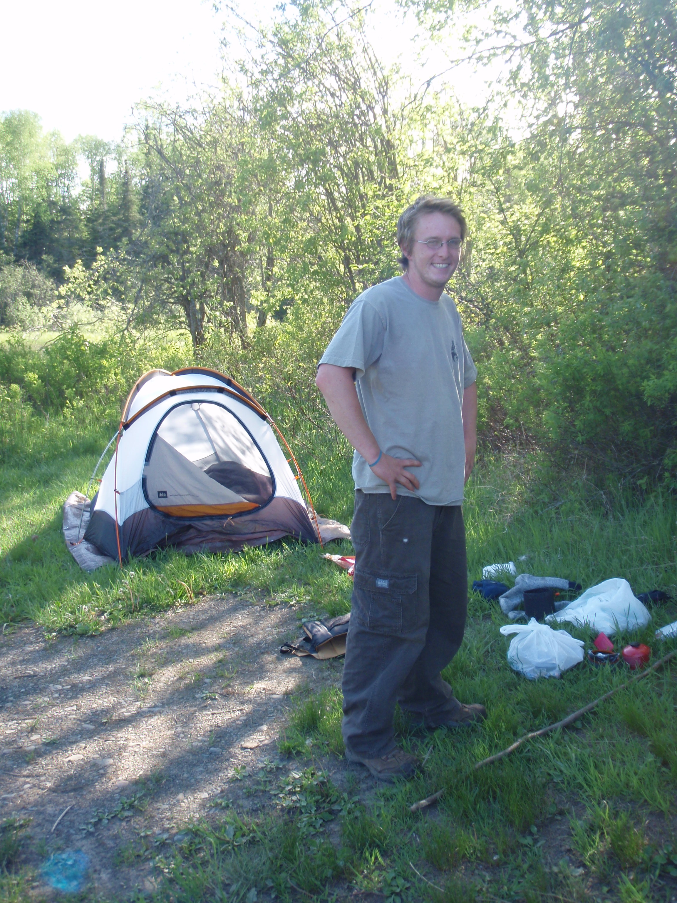
We began talking about the trail. He had walked the 13 miles that I would be walking next. He said the reason why he went to the Swamp Lake Campsite was that the previous Campsite (Portage Brook) was too sunny, and it was too early in the day to stop there. He said that I should make sure that I am prepared for all the ticks. Evidently, ticks are bad on this portion of the trail. I had not encountered very many ticks so far hiking the trail, so this was news to me. I showed Parker where the Border Route goes to the west then dropped him off at the Trailhead, and asked him if he wanted to go down to Nanaboujou Lodge for supper. He said that he didn’t want to, and that he would be camping at the Campground. I said I would be camping at the Trailhead in my van when I returned from Nanoboujou Lodge.
So I drove down the Arrowhead Trail towards Hovland. I stopped at the Portage Brook Overlook and made a phone call to the Grand Marais Best Western. And sure enough, I had left my keys with the UW Milwaukee Lanyard next to the computer in the breakfast room. They would save the keys for me.
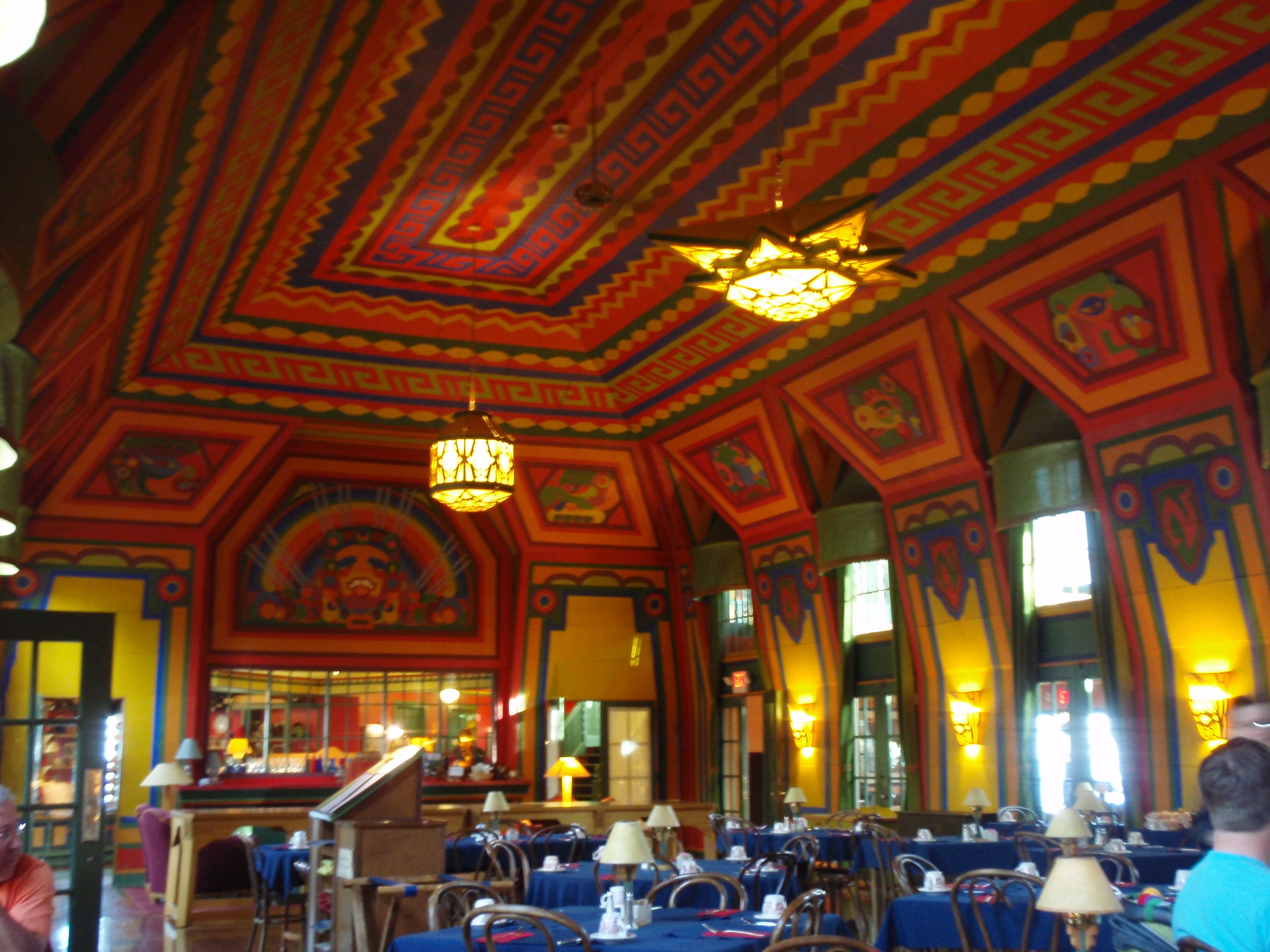
Then I continued down the Arrowhead Trail to Highway 61. I turned south and headed 3 miles down to Nanaboujou Lodge. The Lodge is located on a nice estate on the shore of Lake Superior. The first thing I did when I got there was to retrieve the resupply package that I left there last Thursday. The lady at the front desk got it for me. Then I went into the majestic dining room and was seated at a table near an electrical outlet, so I could charge my phone. The Hall is a two story high room with a huge fireplace at one end. The hall is brightly painted using a Native American theme. I ordered the Salmon dinner for about 20 buck. The meal was good, and I was satisfied. I walked around the Lodge taking some photos. It is quite the historic landmark. The Lodge was first built as a hunting lodge for rich people like Babe Ruth who was a member of the exclusive club. But that folded in the 30’s with the Great Depression, and was refurbished in the 70’s and made into a hotel and restaurant. It’s a beautiful Lodge, and from what I hear the rooms are very reasonably priced at around $80 a night. But there is no air conditioning, so it might be bad in August. But there is always a breeze of Lake Superior.
I had a quarter of a tank of gas in the van, so I asked my waitress whether there was a gas station in Hovland. She said no, I would have to go to either Grand Marais or Grand Portage, both of which are 15 miles. I decided that a quarter of a tank should be good enough to get me back from the top of the Arrowhead Trail, and that I would not have to make a side trip tonight.
Then I drove back up the Arrowhead Trail to the Border Route Trailhead and went to sleep in my van. I was all set to complete the Border Route over the next couple days.
Friday, May 28, 2010
Arrowhead Trail to Otter Lake Cutoff
I woke up and did something stupid right away in the morning. I went outside to take my morning pee, and I locked myself out of the van. Damn. Luckily, I had all my clothes on when this happened. The Trailhead is right next to the road, so a car could easily drive by and see me. So I made sure I had clothes on.
I went over to the Grand Portage State Forest Campground to see if I could find Parker. I figured if I could find Parker, I could get him to drive me into Grand Marais to pick up my other set of keys that I forgot at the Best Western. But I didn’t see Parker anyplace. There were a group of fisherman camped to the right of the boat launch, so I went up and talked to them. I asked it any of them had a wire hanger, but none of them did. Bummer.
It was a group of 5 or 6 fishermen from Duluth. They looked to be a little rough on the edges. I went back to my van.
I noticed that I left my L vent open a little ways. The L vent is the long window on the side of the van in the very back. They open up about 2 to 3 inches for better ventilation. There is a small piece of plastic about 1/2 inch wide that connects the L vent with the little motor that opens and closes the L vent. I figured maybe I could cut through the piece of plastic, and then the window would open up enough for me to get in. So I went back to the fishermen and asked to use a saw. The fisherman had a bow saw and said he doubted whether it would work, but I asked him if I could give it a try, and he said yes.
So, I took the bow saw back to my van. I barely had enough room to cut the small piece of plastic, but I managed. In about 15 seconds I had cut through. It was like cutting butter, and the fisherman had doubted whether it would work. The hard part was getting back in the van through the L Vent. I stood up on the back bumper and stuck one leg through. Then I grabbed the railing on top of my van and stuck the other leg through. Then I kind of slithered my way in. It was definitely some unusual gymnastics that were needed, but I made it in. I drove my van down to the campsite, and thanked the fisherman. I said the bow saw worked really good, then I drove back to the trailhead. I got some rope out of one of my Rubbermaid totes and tied the L vent shut. It was the best I could do.
I was mad at myself, and very frustrated that I had locked myself out of the van. But I said to myself that I had to let it all go, and concentrate on the task at hand. I needed to pack up for my hike. Again, this would be a short two-day hike, so I wouldn’t be carrying very much gear.
As I was packing, Parker showed up in his small car. We talked for a while. It turns out that he was camping at the State Forest Campground, but it was at a site that’s to the left of the Boat Launch and is kind of hidden unless you travel around the boat launch loop. So, Parker was over there all along. I really could have used his help getting back into my van, but that’s over with now.
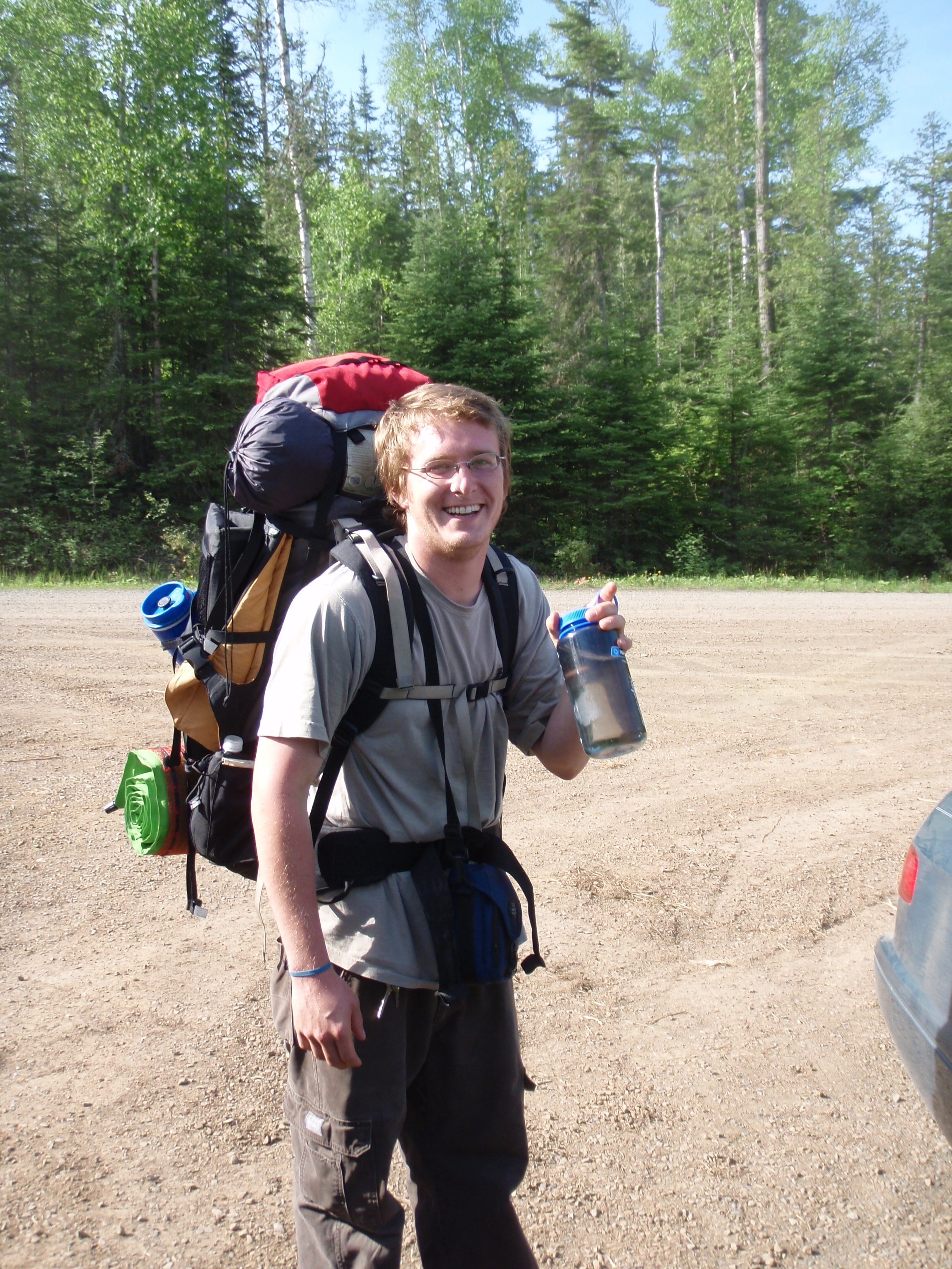
I looked in my map holder and found the copies of the Guidebook maps for west of the Arrowhead Trail. I wouldn’t need the maps anymore, because I already hiked that section. So, I gave the maps to Parker. I felt a little better that he wouldn’t get lost. We talked and then we said goodbye and he headed west.
I felt like I had done my good turn with Parker. Remember the other day when the Sheriffs from Wausau were fishing and the storm hit. One of their canoes tipped over and someone did a good turn by helping them. Then the younger sheriff did a good turn by driving me to Hovland. And now I passed the good turn on by helping Parker. I drove him back to his car from the Swamp River Campsite. And now I gave him some maps. Also, my Scoutmaster instincts kicked in when I was talking to Parker. We had talked about what colleges he might attend, and what type of work he might want to do. He is interested in becoming a Forest Ranger. I had given him a “I Saw Tman” card, and he said he would email me when he was able to, but being in the MCC he doesn’t get that much of a chance to be on a computer. I didn’t tell Parker about all the Good Turns, but now is his turn to do one. But, being in the MCC is very much like a good turn. The pay is low, the work is hard, and you’re doing stuff to help the forest, so that’s a good turn. Like the younger sheriff had said, that’s what people are for is for helping other people.
I got my gear ready and I was off. The trail is directly off the trailhead. I looks like the trail goes straight, but when you start, the trail veers to the left, away from the area I thought I would be hiking. I had heard that the BRTA had rerouted the trail around the Heliport. They did this during the last year or so, because last fall, Nimblewill Nomad walked through the Heliport when he did his hike. I think the reroute happened last fall and this spring, At any rate, I was on my way, and all my frustrations were over.
Maybe I got the wrong impression, but the impression that I got was that the next 13 miles of the Border Route is very well maintained. The first reason I had that impression is because we are no longer in the designated Wildnerness Area, we are in the Grand Portage State Forest. And since we are not in the wilderness area, motorize trail clearing can occur. This means motorized weed wackers, brush cutters and chain saws can all be used. But as I walked on the trail, it didn’t seem significantly better than some of the areas that I walked in the wilderness. In fact some areas were a little bit overgrown.
 It was a very bright an sunny day, which made for some interesting contrasts in the photos I took. The first landmark would be a Forest Road, and sure enough it didn’t take me that long to get to it. Then on map, it shows the Border Route going up a hill rather steeply to the first overlook on this section of the trail. But the hill didn’t seem all that strenuous. Maybe there were a couple hard uphill stretches, but nothing overbearing. Soon I made it to the first overlook, where I could see the Royal River down below. Then I could see the Royal River and South Fowl Lake at one spot. I continued on, seeing glimpses of stuff to my left. I hiked on top of the ridge for a while, and it was easy hiking.
Then I hiked to another overlook, which was definitely better than anything I’d seen this morning. It was a majestic over of South Fowl Lake, and I took many photos including a timed photo of myself. I continued hiking on the ridge south of the Royal River and South Fowl Lake. The Border Route Guidebooks shows that there will be 5 more overlooks within the next 2 miles or so. And hiking on top of the ridge was pretty flat and easy. There were a few spots that were a little overgrown, but then again most of the trail was clear, and there were even some rocky bare spots. And as far as downed trees there were very few of them.
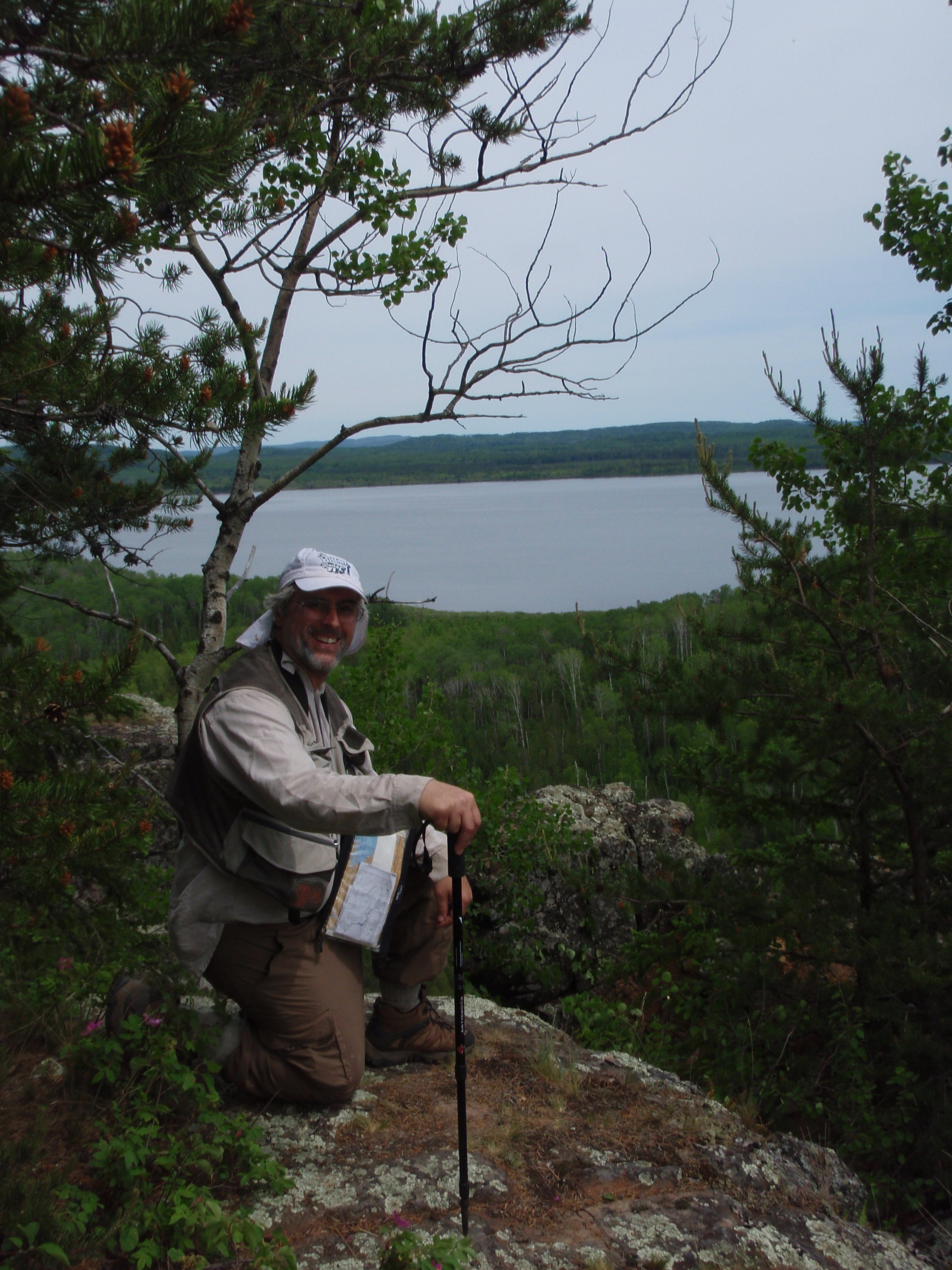
After hiking about twenty minutes from the last spectacular overlook, I came upon another spectacular overlook. This one included South Fowl Lake and a big hill with cliffs to the east. Again I took a bunch of photos here including a panoramic shot and a self shot. The one thing I noticed at this overlook was that there was some litter around it. Nothing much, just a candy wrapper or two, but it was enough to get me a little irritated. But then all of a sudden I started hearing voices as I walked down the trail. And I announced myself by saying “ahoy there, I can hear somebody.” Then I walked up to another overlook where there was some young men camping.
I walked into the overlook from the Border Route Trail. There was a path about 20 yards long leading into the overlook. There I met 5 young men from St Cloud, Minnesota. Evidently, some of them had just completed the Spring Semester at St Cloud State. They had two tents set up on this overlook and a small fire. And this was a spectacular overlook, with one rather big rock outcropping jutting out from it. I talked with the guys a little while, doing the usual conversation introducing myself. These guys appeared to be camping a little sloppy and heavy. They had camp chairs, which is not exactly an ultra-light backpacking piece of equipment.
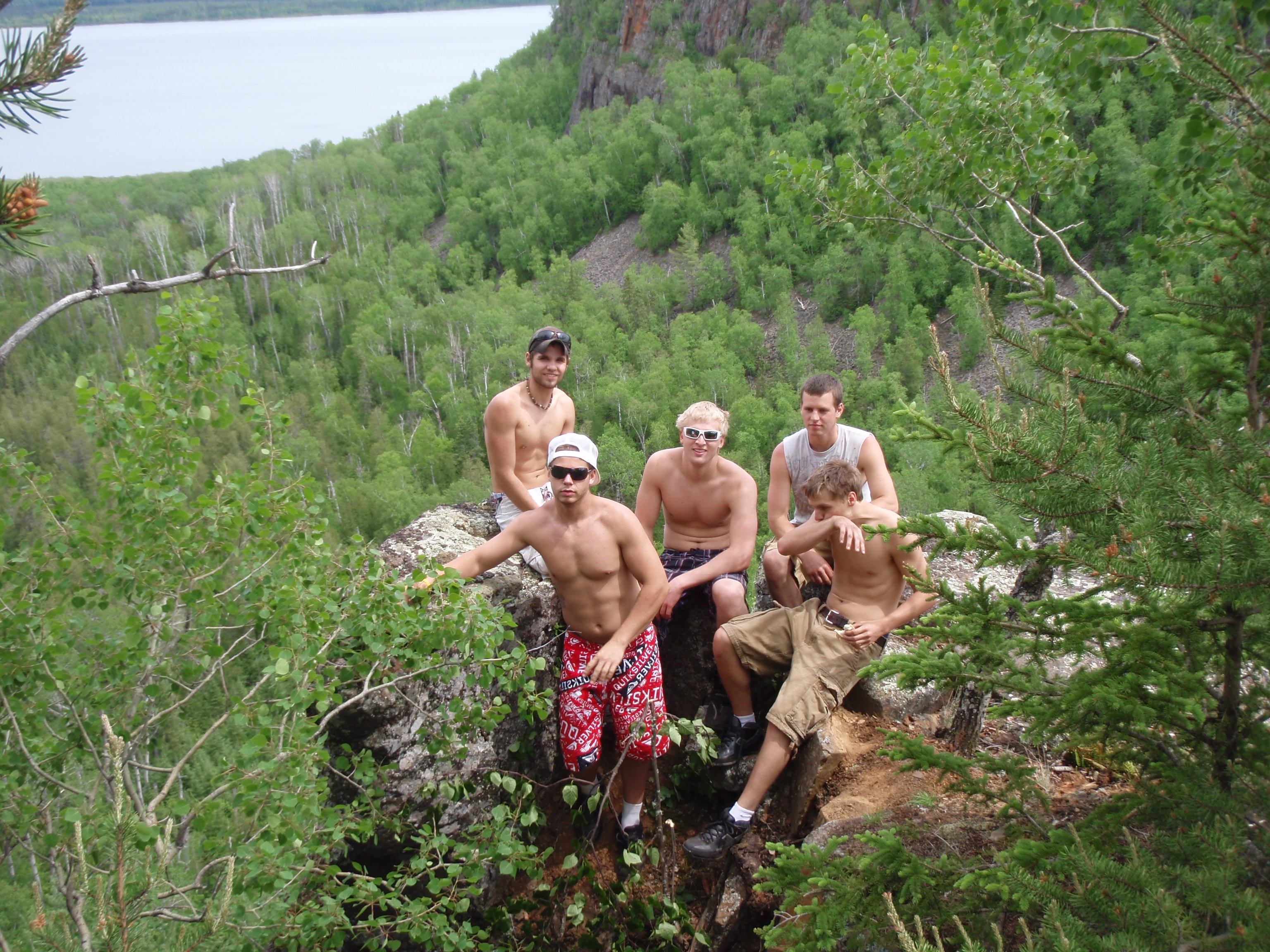
It was a very scenic overlook. I asked one of the guys if he would take my photo at the overlook and he took some shots. Then I asked the guys if I could take a photo of them for my backpacking website. They said sure, but they wanted me to take a photo of them on this big rock outcropping. Plus they wanted me to take a photo of them with a camera they had brought. I was more than happy to. Soon they were all scurrying out on this big rock outcropping. I knew one thing for sure, and it was that I wasn’t going to be going out there. First you had to climb down a ways, then you climbed up on the rock outcropping. Soon they were all on it, and I took their photos with both cameras.
After the photo shoot, I said goodbye to the guys and went on my way. I had noticed that they had a small fire. Boy, I thought, if that fire ever got out of control, it would be hell and gone to be able to get water to put it out. The map showed the trail going downhill about a 1/4 mile to a forest road that went out to South Fowl Lake, which was another 3/4 mile down the road. According to the map, the road went through some swampy areas, so maybe there is a creek before you get to South Fowl Lake. Nevertheless, if a fire ever broke out at the overlook, it would be a disaster. But I didn’t preach to the guys, after all, they had a really small fire. If they had a big fire, I think I would have preached. They were just five guys enjoying the outdoors after a semester of being penned up at school.
From the overlook it’s all downhill to that little forest road that goes to South Fowl Lake.
It isn’t very much of a road. It’s more like a jeep path or a ATV path. I know that I would not want to bring my van on the road because it was really rocky. I walked down the road a little ways and I did see some wet areas, but I did not see a creek.
I continued on the Border Route and knew that I would be walking up a big hill. This would be the hill that I seen at the overlook which has sheer cliffs on it. I thought I was in for a tough stretch of trail. But it wasn’t very bad. Sure it went uphill, but again, there wasn’t any overly strenuous sections. Whoever created this trail did a good job of it.
On this section of the trail, I came upon another notch log. A nog log is a log that is too big to clear, so the trail crew just puts a notch in it so that you can get over it easier. This log did have a notch in it, but it was an unusual notch. It was shaped like a W which reminded me of Wisconsin. So I guess that’s the Wisconsin notch log.
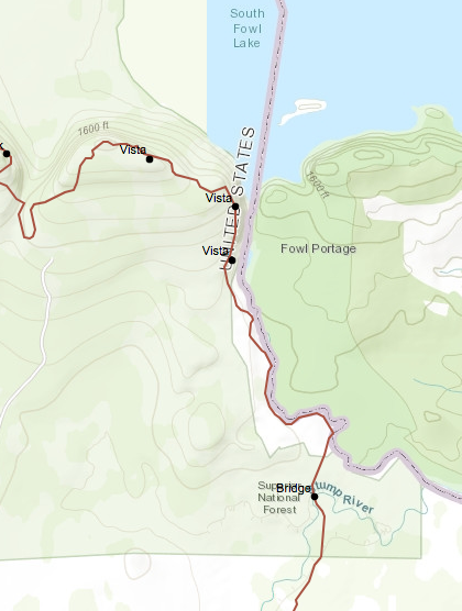
I continued up the hill, expecting to come to the big shear cliff that I had seen from the other overlook. But I didn’t see the cliff. In fact, I saw a sign saying “closed for restoration, and a pile of brush blocking the trail. The trail had been rerouted away from the cliffs. I suppose there were too many people camping up there and making a mess of things. I walked on the rerouted trail for about twenty minutes until I found the sign down the trail where the “closed for restoration” trail reconnects. Again, there was a sign and a pile of brush.
I hiked on, seeing glimpses of South Fowl Lake to my left. Soon I came upon another sign. This time it was a sign saying that I was hiking on land that was protected by the Nature Conservancy. I have always thought highly of the Nature Conservancy. They have a different philosophy than other Conservation groups like the Sierra Club. The Nature Conservancy protects the land by owning it. That’s the only way they feel that you can really protect it. So they have bought many critically important wild areas.
I hiked on and reached another really nice overlook. This was an overlook of the very southern section of South Fowl Lake, where it flows into the Pigeon River. I couldn’t see the river, but I could see a small island, and a big bluff with a shear cliff that was in Canada. The Pigeon River is the Border between the US and Canada, and I would soon be walking along the river. I hiked along, seeing glimpses of the bluff with the shear cliff then coming upon another view of the rolling hills that are to the south. It was a view that was completely of the forest lands, and no lake was seen. This is a big change from seeing South Fowl Lake, which I had all day up to this point.
As I hiked on, I could hear the rapids of the Pigeon River down to my left. But I could not see the river yet. According to the map, the trail would get right next to the river. All I had to do is be a little patient. I walked through the pine woods going slightly downhill, and I started to see glimpses of the river. The river was getting closer and closer to the trail. Or you might say the trail was getting closer and closer to the river. Whatever you prefer.
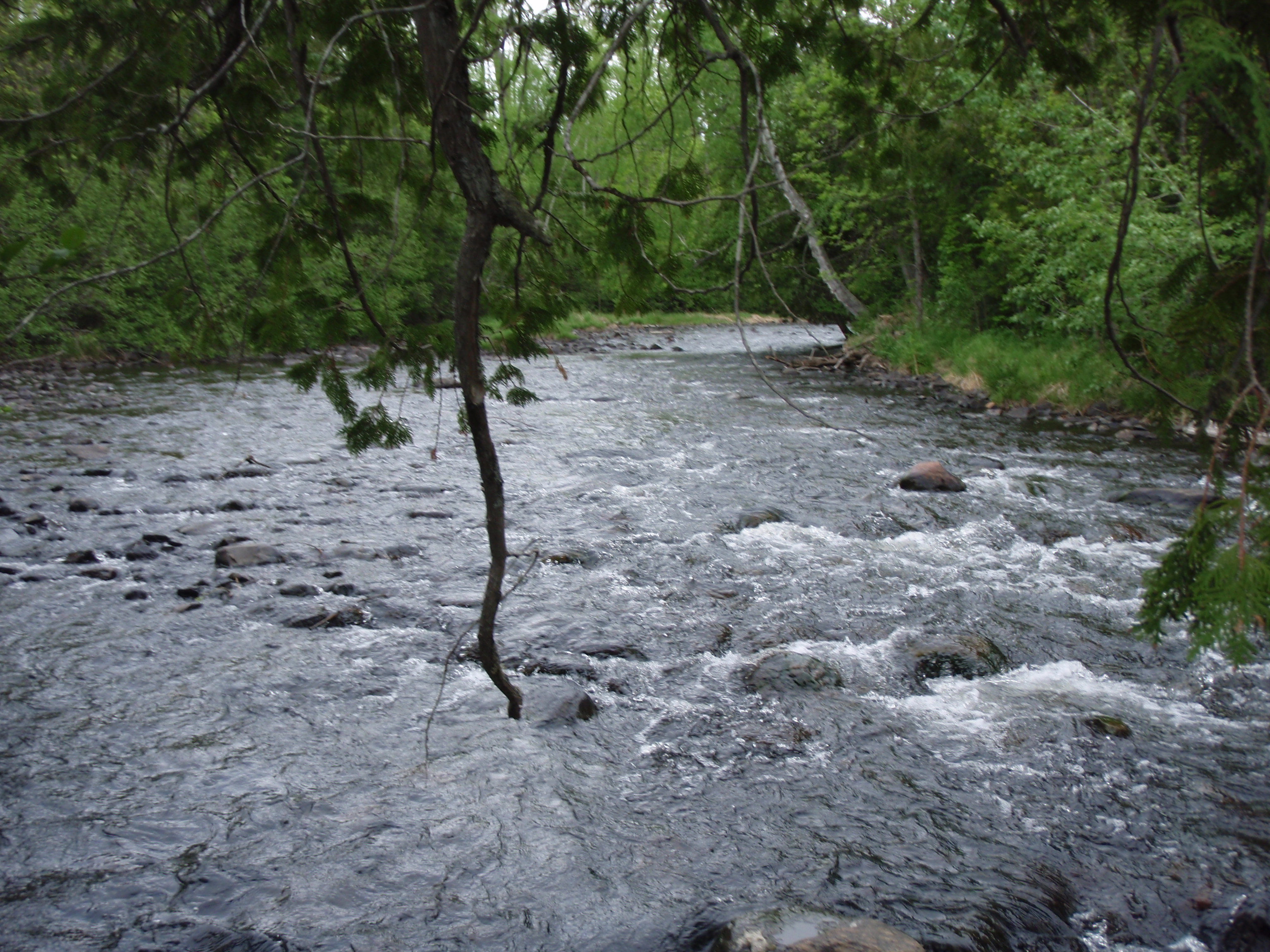
Soon the trail was right next to the river. I saw a spot where there had been a campfire on the trail. At least they put the campfire on the trail, and not wrecked some other sensitive area with their campfire. I stopped to pump some water. I only filled one bottle of water because I figured there were plenty of opportunities to stop for water over the next two miles. I would be crossing both the Stump River and the Portage Brook, so water opportunities would be plentiful on this section. Which is good, because there hasn’t been any water opportunities since the Arrowhead Trail.
I continued on, hiking through some scrubby woods next to the river. I crossed one small creek which had the yellow water flowers blooming from it. Then eventually reached a very grassy area. The Trail was well marked with ribbon, which was good in the grassy areas because you don’t know what is the Border Route and what is just an animal path.
I had been hiking away from the river for a ways, then all of a sudden I saw the river. Only this time it was the Stump River, because I came upon the Stump River Bridge
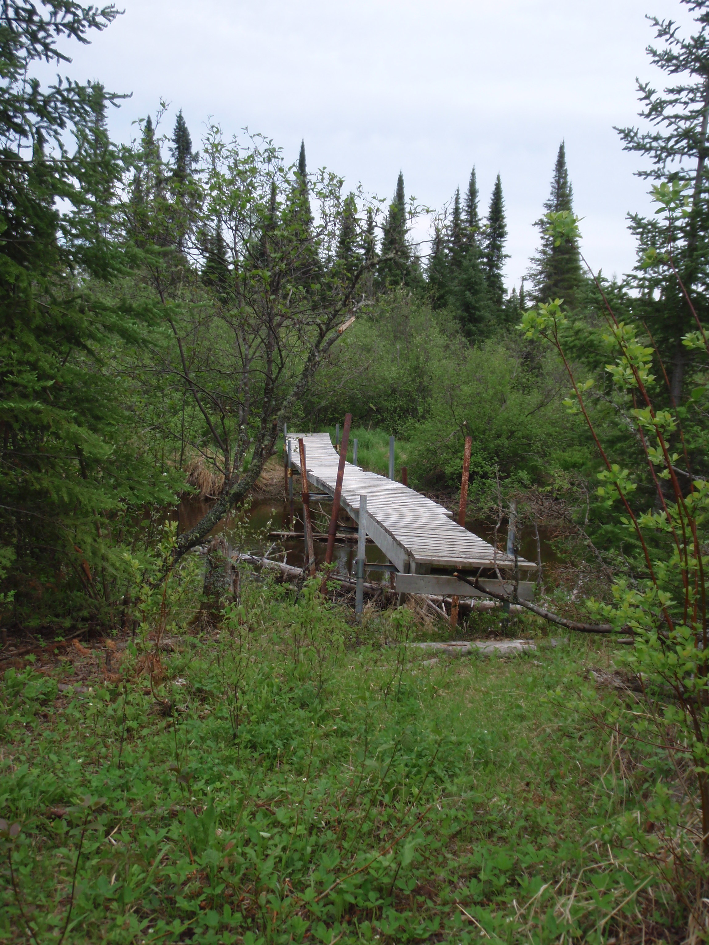
It is a very substantial bridge, which is about twenty yards long. I was made of metal poles going into the water, with wood planking. It kind of reminded me of a pier that you would see on the lakes in Wisconsin. The water in the Stump River is very brown, and the river meanders around with many curves. After crossing the bridge, the trail goes through some scrubby grasslands, and is very flat. The trail is flat and grassy for a very long ways. At one point there is a sign saying “Walking Trail, no Motorized Vehicles,” so there must have been a junction with a forest road, but I couldn’t tell, it was all one big scrubby grassland.
I looked down at my pants and it was loaded with ticks. There must have been ten of them crawling up my pants. Parker was right about the ticks. This is a sunny grassland area, and ticks just seem to thrive in these areas just like when I was in the sunny grassland areas of the burn zone last year. I brushed off the ticks and continued on.
The grasslands kept going for a long ways, perhaps over a mile. Luckily, the trail was really well marked, or it would be easy to stray onto an animal trail. I noticed that there was a big hill ahead of me, and the trail started going a little downhill, so I figured I should be getting to Portage Brook soon. And Sure enough, I did.
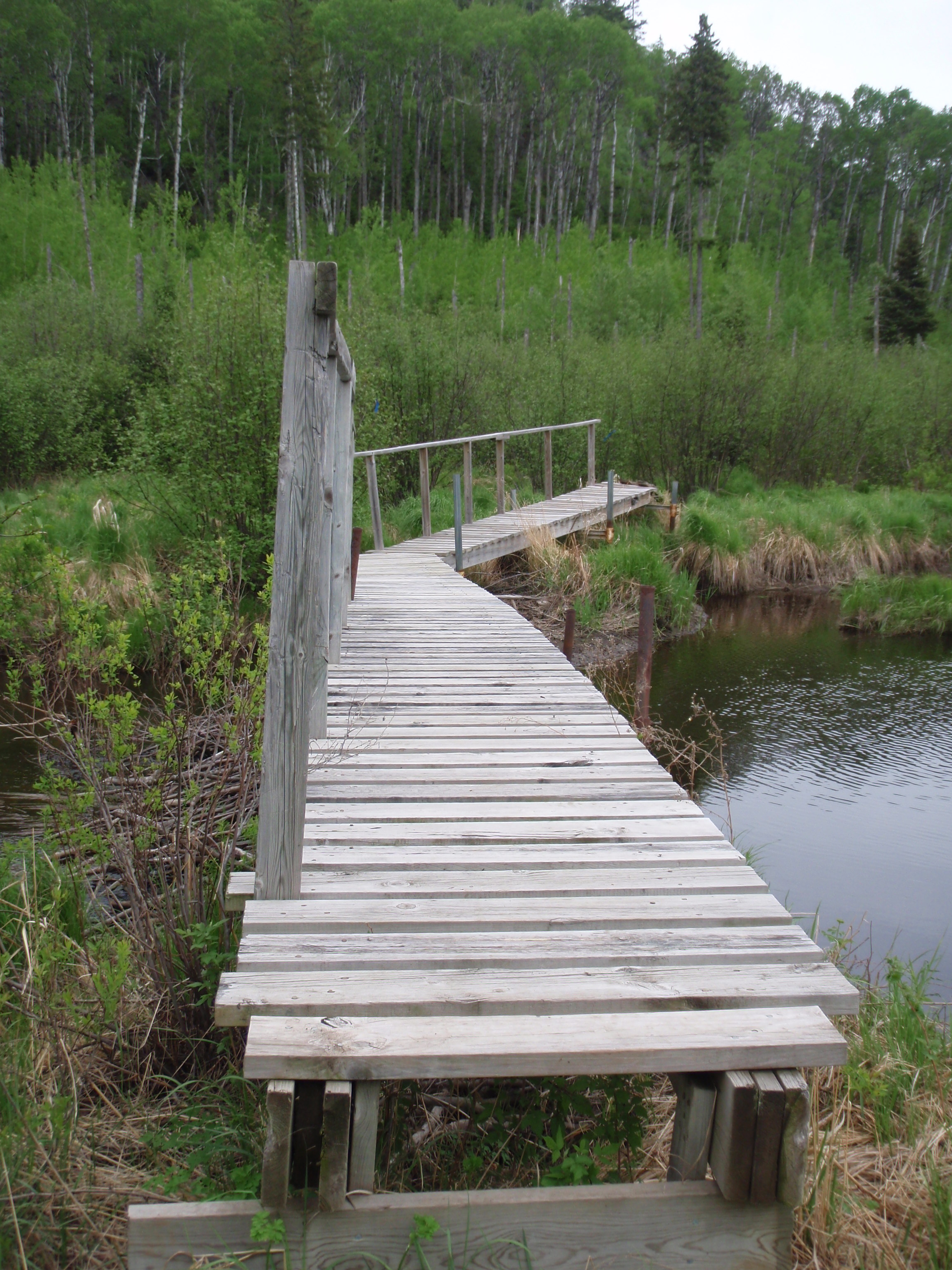
At Portage Brook there is a big bridge, perhaps twice as long as the one at the Stump River. And this bridge was shaped in a < Pattern, but a little straighter that that. It went out into the river, then the bridge turned to the right at an slight angle, and proceeded to the other side. I had never seen anything like it before. I suppose there is a perfectly good reason for it. It says in the guidebook that this bridge keeps getting wiped out and rebuilt. In fact this was the third such bridge here. But it looked very sturdy. I crossed it and hiked the grassy trail along the river. Soon the trail went away from the river a little bit and went slightly uphill. This is where I found the Portage Brook Campsite.
The campsite looked as though it had not been used in a long time. There was a worn down wooden picnic table and a concrete fire ring. A concrete fire ring, that must have been fun to bring in here. The campsite looked as though it could use a little clearing out because it was starting to get over grown in some of the tent areas. I sat my gear down on the table. This is where I would have to make a decision.
I checked my cell phone and it was 5 pm. I had a few choices on what I could do at this point. There was about 5 miles of the Border Route left for me to do. Perhaps I could complete it and camp at the Swamp River Campsite. I had about 5 hours of daylight left, and I was in pretty good condition. My nether regions had healed in the two days of rest and I was in good spirits. But did I really want to push it and have another disaster.
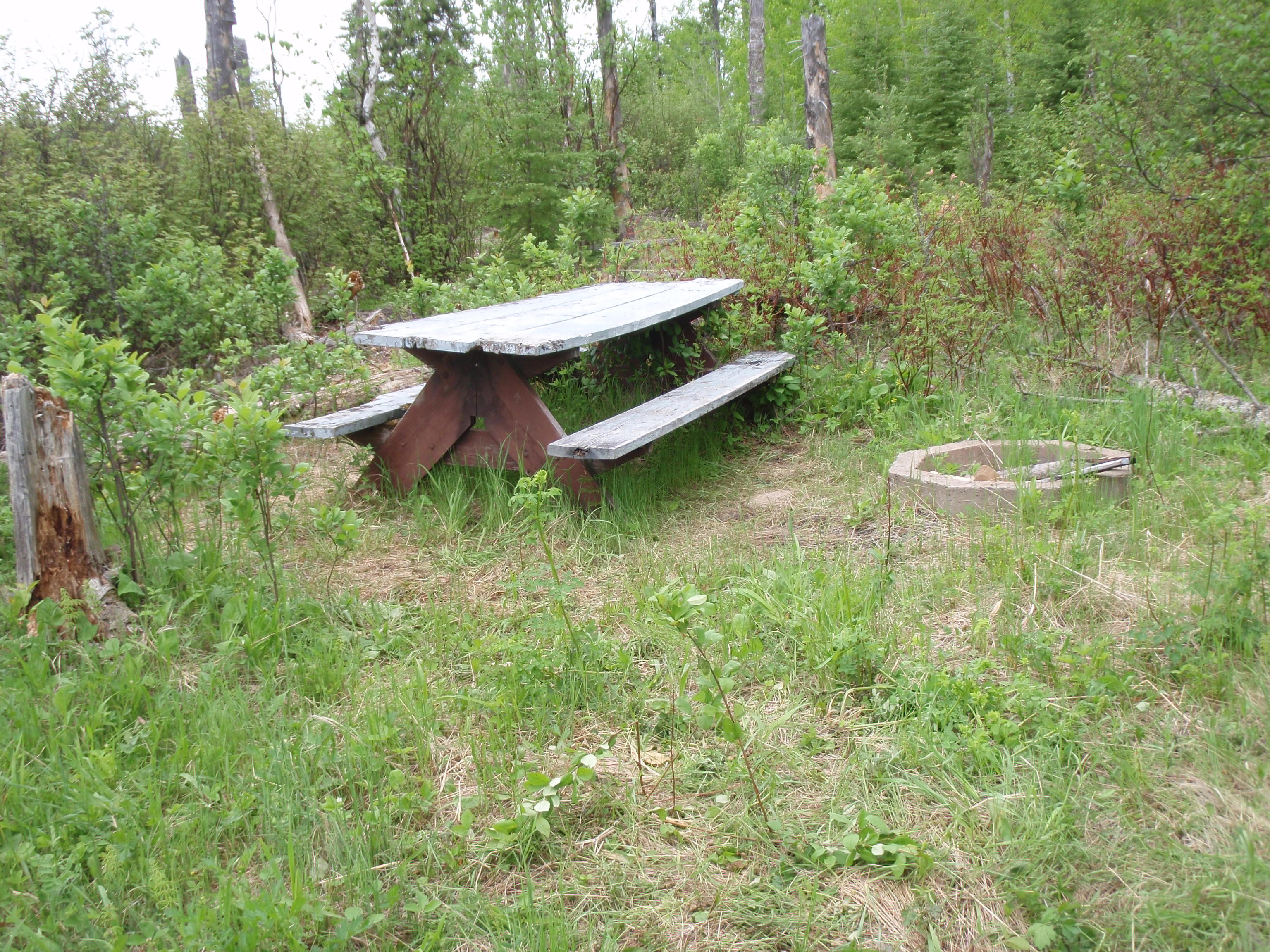
My second option was just to stay at the Portage Brook Campsite. But it still felt very early. So I nixed that idea and opted for a third idea. I would hike out to Otter Lake Road where I would have more options. At Otter Lake Road there is a campsite that I could stay at. Then I could stash most of my gear there in the morning, and do the rest of the Border Route with minimal gear. Or, once I get to Otter Lake Road, it is a short distance down to the Arrowhead Trail, where I could hitch a ride down to my car. Last night when I went down to Hovland to eat at Naniboujou Lodge, there seemed to be some traffic on the Arrowhead Trail. In the fifteen miles down the road, I must have passed at least a half of a dozen cars coming up the trail. So I decided to go to Otter Lake Road and see what happens.
 From the Portage Brook Campsite it is about a half mile to the Otter Lake Cutoff Trail Junction, then the Otter Lake Cutoff is about a mile long to get out to the road. I headed out. I walked along the grasslands next to the Portage Brook and crossed a small creek feeding into the brook. Actually, Portage Brook didn’t seem like a brook, it seemed bigger than that. It is bigger than the Stump River that I crossed a mile or two back and it had a much longer bridge to cross it.
The Border Route went along the Brook for a ways, then started going slightly uphill, It wasn’t long before I made it to the Otter Lake Cutoff Trail. And at the junction, there is a creek. Maybe it’s called the Otter Lake Cutoff Creek, for all I know. At any rate, there is some Border Route signs at the junction, pointing east and west.
I took the Cutoff Trail, and it wasn’t long before I was questioning my choice. This would be the steepest uphill climb of the day. From looking at the map, I really didn’t think it was going to be very bad. But it was. But there were other spots on the trail that I thought were going to be steep uphill section, and they were not. So I guess this makes up for that.
At least going up the hill I was in a forest again, and not in the tick infested grasslands that I had been walking through ever since the Pigeon River. I kept going up and up, and when I made it to the top, something really bad was in front of me. It was a big clear-cut area. I wandered out in the Clear Cut Area, trying to figure out where the trail was. It took me a while, but then I saw a blue painted mark on a tree on the edge of the clear-cut area. And then I saw some blue ribbons. So I was back on course again. And once I got used to walking through the Clear Cut Area, I could definitely see the trail in front of me because the grass is greener where the trail was.
The Trail was fairly clear in the clear-cut area. But seeing all the stumps where trees had previously had been was a little bit of a downer. I was walking on the Otter Lake Cutoff Trail, and the clear cutting sure made a new meaning of the word Cutoff.
Soon, I was out of the Clear Cut Area and was hiking through some scrubby grasslands. Surely I would be seeing Otter Lake soon, I thought, but it kept going and going. All I wanted to see was one of two things, either an otter or a lake. But I saw neither. Otter Lake is a triangle shaped lake with each side of the triangle being a least a half mile long. Surely, I would be seeing it soon. But then I saw a little pond to the right of the trail. Perhaps it was some sort of backwater area of the lake. Then up ahead on the trail I saw a campfire ring made of rocks. Now I knew I was getting close to Otter Lake Road. I got up to the Campfire Ring, and the road was only about 4 car lengths away from it, But I couldn’t see the road until I got to the Campfire Ring because of the slight uphill angle coming up to the campsite.
It was before 6 pm when I made it to Otter Lake Road. Now what should I do, I thought to myself. But I decided to stash my gear at the campsite, then walk down to the Arrowhead Trail, which is a half-mile away, and see if I could hitch a ride back to my van. So, I grabbed my hiking poles and started hiking down the road. Once I got to the Arrowhead Trail, I started hiking on it north in the direction of my van. It was easy walking on the road compared to walking on the trail, and I was making good time.
I stuck out my thumb for a few cars, but nobody stopped for me. I continued on, thinking maybe I would just walk back to my van. It would be about six miles, and it was just like walking on a treadmill at my health club, where I can walk 3 miles in 45 minutes, when I’m walking and not running. I figured I would have to walk about 6 miles to get back to my van. I was cruising. But then a Big Pickup Truck hauling a boat stopped and picked me up.
It was Sean and Kelly from Grand Marais. Their family has a cabin up at the top of the Arrowhead Trail on McFarland Lake. Their pickup truck was really big and had a full sized back seat where their two rather big dogs roamed. But I didn’t mind sitting in the back with them, at least it was a ride. At it seemed like a longer ride than I thought it would be. I would have been walking for a long time.
They drove me right down to my van. On the drive we talked about the old McFarland Lake Lodge, which burned down several years ago. Evidently, the Lodge was the home base for a seaplane that took fishermen out to some of the Boundary Waters lakes. But that was before the Boundary Waters was designated as a Wilderness Area. After the designation, the seaplane was no longer allowed to land on lakes inside the Wilderness. So the Lodge was losing a lot of business because of the new rules. Then it burned down.
The cabin Sean and Kelly were going to was one that had been in the family for generations, so they seemed to know the history of the area. I got to my van, took a photo of Sean and Kelly, thanked them and gave them a “I saw Tman” card. Thanks again for the ride.
I hopped in my van and headed down to Otter Lake to retrieve my gear. As I drove, I passed only one car on the way back, and it was driven by a young lady. I assumed a young lady would not have picked me up when I was hitchhiking, so I’m really glad Sean and Kelly picked me up. Or I may have been hiking for a long time.
As I rode back to Otter Lake, I noticed that I had a problem. I was getting really low on gas. I had less than an 1/8 of a tank. I was worried I wouldn’t make it to a gas station. I stopped at the Otter Lake campsite, picked up my gear, and put out my Spot Messenger, to mark the end of the hike for the day. I checked my maps while waiting for the Spot Messenger to send its message.
I figured it would be about 15 miles down to Hovland on the Arrowhead Trail, then another 15 miles to go to Grand Portage or Grand Marais for gas. But if I traveled east on Otter Lake Road that turns into Rengo Road, it would be about 18 to 20 miles through the Grand Portage Indian Reservation to get to Grand Portage. That’s the way I decided to go. It might save me from running out of gas. The Spot Messenger sent it’s message and I left the Otter Lake Trailhead and Campsite at around 7 pm.
I headed down Otter Lake road and stopped at the Border Route Trailhead to see if my Mountain Bike was still stashed in the woods near the latrene. It was there, so I headed on. The road was a reddish colored gravel road that was good as gravel roads go. I passed the junction with Jackson Lake Road, which is another gravel forest road. Then I reached a sign saying “Entering Grand Portage Indian Reservation. Casino 12 miles.” All of a sudden I was happy that it was only 12 miles to get gas. But once into the Reservation, the road deteriorated from a nice gravel road to a scary dirt road. I had to slow down very much, to about 24 or 30 miles per hour. And this road curved around going every which way. I saw a sign for an overlook. I kept going. I saw another Firefighting Heliport, similar to the one on the Arrowhead Trail, I kept going. I saw some forestry equipment and some logs pile up. I kept going. I kept going and going. I was hoping to hit the Old Highway 61, which is a paved road. I didn’t see any houses out in this area. So the Tribe must use it for mainly logging. I was hoping I wouldn’t reach a place where my van would not make it through. Someplace where the dirt road was flooded, or muddy. This was more of a road for a four wheel drive pick up or jeep, not a 2007 Town and Country Minivan.
Finally after the road twisted around a few more times I hit Old Highway 61, which is now County 17. I turned right, hoping that I was on the right road to take me to Grand Portage. The map shows two paved roads in the area. One goes towards Grand Portage, and the other goes all the way back towards Hovland. I looked a road intersection and it said I was on Mineral Center Road. I immediately thought of Warren Wooddard, the man that I met at the Grand Marais Best Western. Mineral Center was where he lived before his family was moved off the Reservation back in the 1940’s. I was traveling past where Warren used to live. But there is nothing there now, except for houses very infrequently.
The road turned 90 degrees to the left. Then I felt I was on the right road. Soon I was going downhill and could see Lake Superior ahead of me. When I got to the bottom I hit Highway 61. I had been diverting my eyes from looking at the gas gauge for a long time. It was on E. But at least now I was on the more heavily traveled Highway 61 if I ran out of gas, instead of being in the middle of some deep dark woods up in a remote area of the Reservation. I turned left, and within a mile there was a sign saying Grand Portage Casino next right, Food, Gas, Camping. I was happy to see Gas listed on the sign.
I turned right and pulled in the rather deluxe gas station. I filled up my tank with over $50 dollars worth of gas. It really was very low on gas. The Gas Station was big, with many pumps, and the building was part food court, part grocery store, part travel center and part Casino. Yes, they had a small room in the back that had a bunch of slot machines, and there was an armed guard watching over things.
Straight down towards Lake Superior from the Gas Station is a big parking lot and then the Casino. To the left of the Gas Station was the Campground and Marina. I headed down to the campground. The Campground is about 4 football fields long and a football field wide. It is unnaturally flat and doesn’t have any mature trees. I guess it must have been built this way, probably in the last 15 years or so. It was probably graded to make it flat. The campsite area looked like a flat plateau or butte, then down a little hill from the campsite area was the Restroom, Laundry and Shower House. Then down from that was the Marina, with another small marina building. I drove down to the Restroom/Shower Building.
I parked down near the Restroom Shower Building, and I noticed there was a man at a Pop up Camper up the hill from the Restroom. I said hi to him, and walked up the hill to talk to him. This is where I met Don, from the state of Oregon. The campground overlooked the marina and the Grand Portage Bay. The bay is about two miles wide with points of land jutting out on each side. And there is an Island out in the middle of it. Don said that he met a tribe member who said his grandfather had a trading post out on that island. I wondered if Don had talked to Tribe Member Ed Olson, who gave me a ride the other day.
At any rate, Don had a Pop up Camper that had metal sides that formed a peak, instead of canvas sides that had been extensions that folded out. I asked him what the advantage was of having the peak pop up camper. He said it was safer in bear areas. In a canvas Pop up camper, you would have to store all your food in the car. Since his camper has all metal sides, he can have his food inside the camper. Don is an older man, perhaps in his 60’s and he was camping with his grandson who was off playing with some kids at a RV a few campsites down. Since I asked about the pop up trailer, Don started showing me all the features of it. We walked around it and he showed me all the connections and storage compartments. Then he showed me the inside, which had a bed at each end and some kitchen appliances in the middle. He said the one bed folds up into a table. But he had a picnic table right outside the camper, so he left it as a bed for his grandson.
Don said he was an Actor and a writer. I didn’t ask him what he acted in. But he did have a laptop sitting out on the picnic table that he was doing some writing on. Perhaps I would become a character in one of his stories. He was going to be taking his grandson out to Isle Royale in the morning and stay overnight. He pointed out to the island, which you can see out in the distance in Lake Superior. I asked him if the casino had a restaurant and what time it closed. He said they have two restaurants and one of them is open until 9 pm. It was after 8 pm by now. I gave him a “I saw Tman” card. I told him best of luck on his Isle Royale trip. I had to get cleaned up so I could go in the Casino.
I went into the Restroom/Shower House. In the men’s restroom there was 2 sinks, 2 toilet stalls, 2 urinals, and 2 shower stalls. One of the park’s personnel riding around in a truck seen me down by the restroom, and he kept on going without questioning me. It doesn’t say anyplace that the shower house was just for the people at the campground. And if anybody would questioned me I would say that I really needed to take a shower before I went into the Casino, because I was hiking all day. All of this was true. I proceeded to take a shower.
The shower house seemed pretty new. I’d say it was built within the last 10 years or so. But it really needed to be kept up a little bit better. It definitely wasn’t the worst shower house I had ever been in. But it is a little disappointing to have such a new building, and that they don’t seem to care about it very much. What they need to do is to get all the paper products out of the restroom/shower area, then come in with a power washer and blast away at the cobwebs, etc. The Shower House/restrooms had three sections. On the left end was the Men’s room, on the right end was the Women’s room and in the middle was a room with a washer and dryer. I finished my shower and headed for the Casino.
The Casino looked to be on the left hand side of this big complex and the hotel was to the right. I walked into the Casino and walked around. To the right there was a big closed off room where people were playing bingo. The rest of the Casino was one big room with a ton of slot machines. I walked around trying to see if there was something else besides slot machines, and there wasn’t. There was a snack bar in the back, but that didn’t look too appealing so I went back to the front door and asked the Security Guard where the Restaurant was, and he pointed down a hallway to the right. So I walked down the hallway past the Bingo room. Then there was a bar down the hallway. Then I made it into the hotel part of the Casino where there was a restaurant to the left.
The restaurant has a great view of the Grand Portage Bay, and they sat me down at a table right near a window. My Waitress was a young black lady with an accent, who was from a Carribean Island. I asked her if she was up here for the summer, but she said she was up here for 18 months, then she would go back. I had a great supper. It was Atlantic Salmon and salad bar for only $12. The same meal cost me around $20 at Naniboujou Lodge. Maybe the restaurant doesn’t need to make a profit because it’s part of the Casino. Or they are using the restaurant as a write off. At any rate I had a good meal, then I returned to the Casino. I asked the lady at the bingo counter when another session of bingo would be starting, and she said tomorrow at 7pm. I guess I was out of luck with bingo. I walked around the Casino again, but I don’t particularly like playing the one armed bandits so I left to go out to my van. It was way passed dark by now, so I found a deserted part of the parking lot and parked my van. I went in the back of the van and went to sleep.
Saturday May 29, 2010
Otter Lake Cutoff to the Eastern Terminus of the Border Route Trail.
I slept out in my van in the parking lot of the Grand Portage Casino. I had a good night’s sleep and woke up at a decent time, not too early and not too late. I decided that I would not go into the Casino for breakfast. I wasn’t all that hungry because I had that Salmon dinner late last night, plus I had plenty of food that I had not used up for my backpacking trip. I went down to the restroom at the RV park and Campground. I used the facilities, filled up all my water bottles and took some photos of the bay in the morning. I noticed that Don’s camper was all buttoned up and that his car was gone. He and his grandson must be on their way to Isle Royale.
I decided I would drive around Grand Portage and take some photos. I drove down by Fort Williams, which wasn’t open yet because it was too early. I took some photos of the buildings in the downtown area of Grand Portage. Then I noticed a sign pointing to the Isle Royale Ferry Service, So, I decided to drive out and check it out. It’s out on a peninsula northeast of the town. I drove out about a mile and pulled in the parking lot. I noticed a bunch of people out on a pier
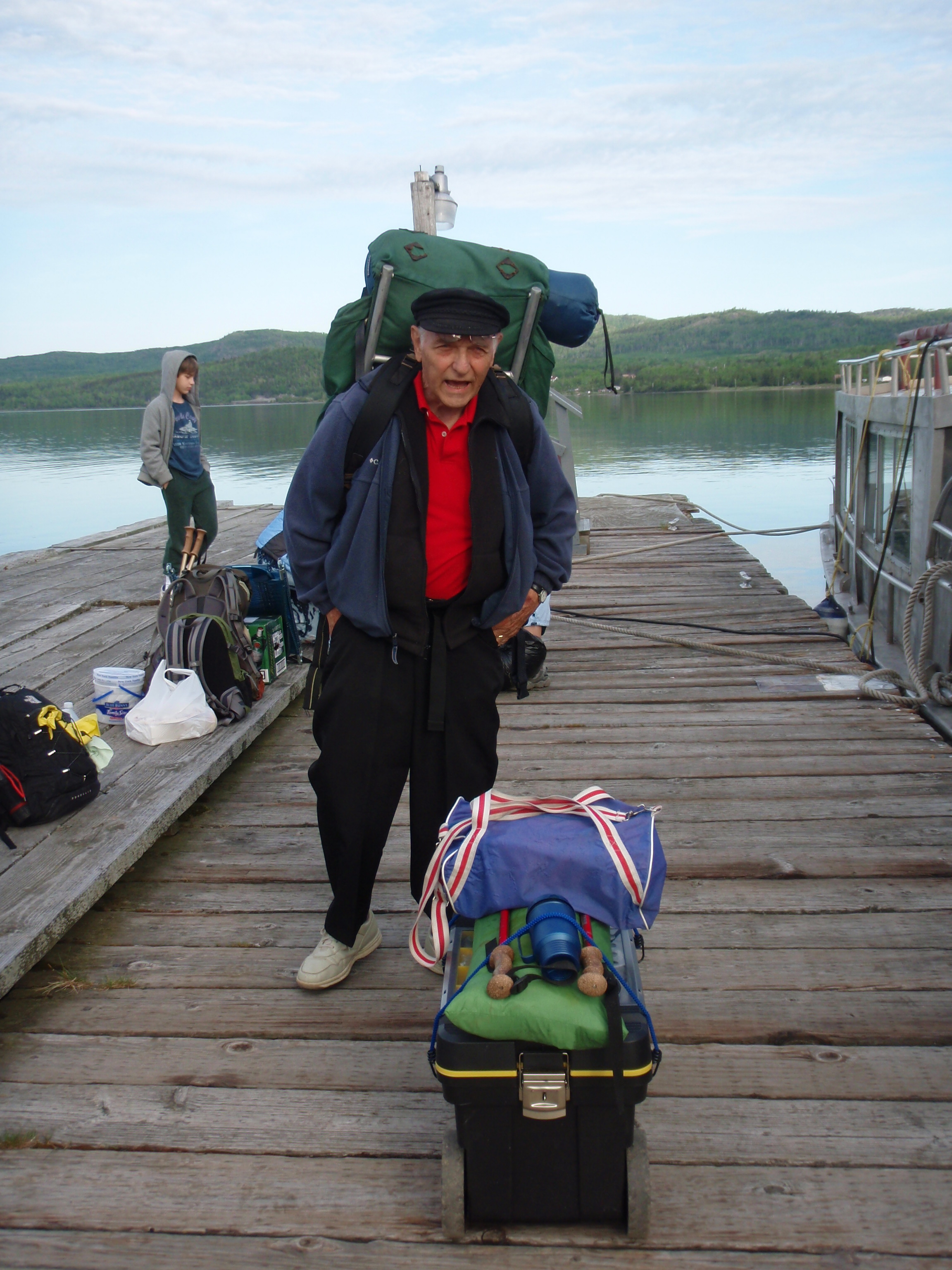
next to this rather old boat. But it was a fairly big boat. I went out on the dock and saw Don. He had an old external frame backpack on. I talked with Don for a while, and asked him how much it costs to ride the ferry. He said that the total cost for him and his grandson was about $120. They were going to be staying out on Isle Royale for just one night. I thought it was a lot to pay for just one night, after all, you’d be paying the same price for staying several nights. I said goodbye and good luck to Don and I was on my way. I roamed around Grand Portage some more, taking photos, then I thought I wasted enough time and should be on my was to finish the Border Route.
I drove down to Hovland and turned onto the Arrowhead Trail. I wasn’t going to be taking the roads through the Reservation this time. I had enough of the Reservation’s back roads. I drove up the Arrowhead Trail and turned right on to Otter Lake Road and parked at the Trailhead and Campsite at the Otter Lake Cutoff. The plan for today was simple. I would finish the last 5 miles of the Border Route, then I would ride my bike up Otter Lake Road to the van. I packed really light because I didn’t need my tent and sleeping bag, and I was off. Mostly what I packed was food and water. I hiked the flatlands near Otter Lake, went through the flat clear-cut area, then went down the major downhill section to the Border Route. It was easy to that point, but I knew I’d be going up to some overlooks in the next mile, so the easy part was over.
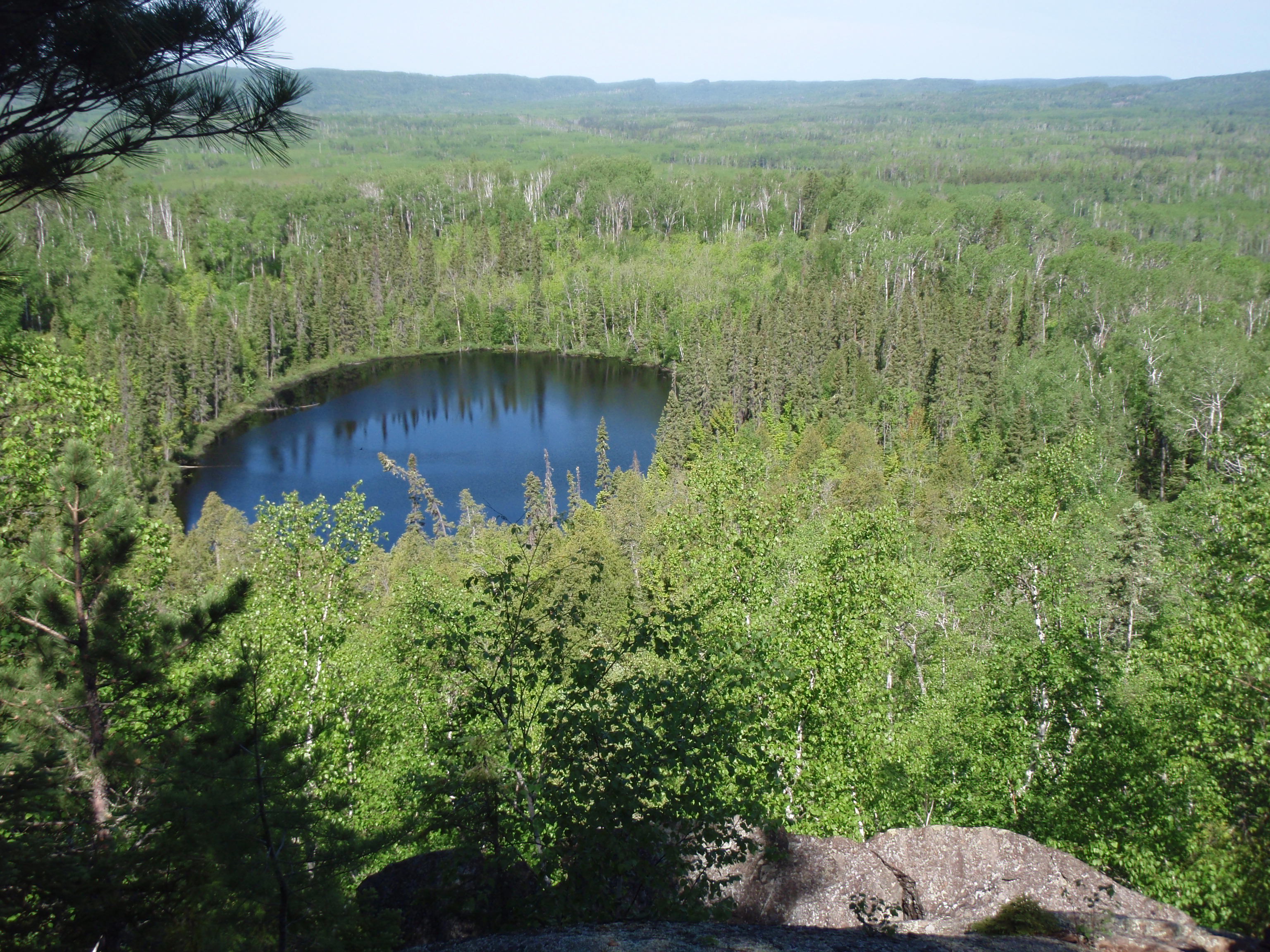
The Trail went up, but again, it was pretty gradual. There were only a couple spots that were a little strenuous. It was a gradual and steady uphill climb. Eventually, it started to look like I was getting to the top, and then I came upon the first overlook, and it was spectacular. There is a little lake down below the overlook. The Guidebook had said that you could bushwhack over to the little lake on the way up to the overlook. But I’ve got news for you buddy, I’m not bushwhacking anyplace unless I have to. I took many photos at this overlook, it was a beautiful sunny day, and the contrast of the sunlight in the woods made for some interesting photos. I picked up my gear, which I had placed on a big rock at the entrance of the overlook and I continued.
The Guidebook showed that I would be getting to another overlook within a mile. I was taking some photos of some beautiful majestic pine trees as I went. But it seemed like the trail was going down instead of going along a ridge to another overlook. I wondered if I went the wrong way at the overlook. And sure enough, I did, because I hit the Otter Lake Cutoff again. Boy was I mad.
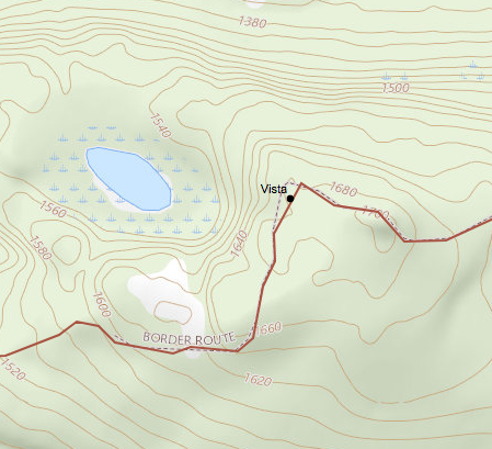 I started hiking back up the hill. And I went fast because I was not stopping to take photos. Soon I made it up to the overlook again, and started hiking the right direction. I usually take a simple step to make sure I am hiking the right way after an overlook. I usually hike past the overlook a little ways, then set my gear down and go back to look at the overlook. Then when I go back to my gear, I am headed in the right direction. But this time, there was such a nice rock at the overlook to set my gear down, that I did. And I didn’t hike past the overlook and set my gear down. I felt like Parker who went the wrong way on the Border Route at the Arrowhead Trail or the football player Jim Marshall who got spun around after getting a fumble and ran into the wrong end zone.
I had made a mistake almost everyday on this backpacking trip. Why should today be any different? Hopefully, that’s the only mistake I make today.
I continued hiking east along the Pigeon Ridge looking for the next overlook. It was pretty easy hiking up there. It was flat for a long time then it went gradually uphill and I made it to the next overlook. There was a big rock at this overlook, but I didn’t set my gear on it. I did hike past the overlook, set my gear down and came back. This was a great overlook of the Pigeon River Valley. I set out the Spot Messenger on the big rock, to mark my spot. I took a good self-shot of me sitting on the rock. I was enjoying it.
According to the guidebook, the trail went down into a little valley then went up again to two overlooks a half a mile away from the overlook that I was at. That’s pretty much what happened, but it wasn’t very much of a valley. Sure it went downhill, then it went uphill, but it all was pretty gradual. The trail went from totally clear because of rocky areas, to somewhat overgrown, but not overwhelmingly overgrown. The trail was pretty much completely clear of downed trees. Thank you Ed Solstad and all the Trail Crews. I made it to the two overlooks in good time. I was cruising. And they were great overlooks, There was no question on whether it was an overlook or not. But these overlooks were different than a lot of overlooks I had seen in the Boundary Waters. Mainly because there was no water involved. The overlooks were of the great massive woodlands looking into Canada. The Pigeon River was down there someplace, but I couldn’t tell where. The second overlook had a tall skinny pine tree sticking up in the middle of it. I continued on. From this point it would be over a mile to the last two overlooks. And I definitely would be going downhill then back up a hill. As I was going down the hill I saw another overlook, which I felt was not marked on the Guidebook map. I was pretty spoiled with all the overlooks. The Trail goes downhill, then is flat as you get to a rather large clear-cut area. Again, as in the Otter Lake Cutoff, it looked as though the Clear-Cutting had recently happened.
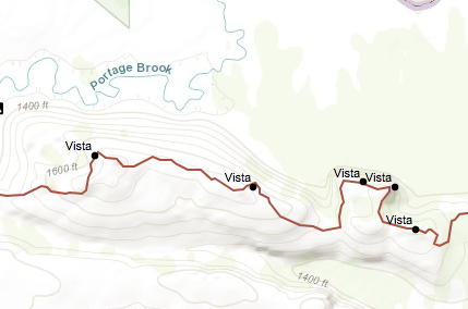 Again, the trail was well marked through the clear-cut area, and the grass was greener where the trail is, so it was easy to make out. I crossed the clear-cut area and made it back into the woods only to walk a few hundred more yards and hit another large clear-cut area. I made it across the second clear-cut area and made it back into the woods. This time I was hoping it would be the end of the clear-cut areas. And it was. The trail started to go uphill gradually, so I thought maybe I would be approaching the last two overlooks. Soon it started looking like I was getting to the top of the hill and I came upon the first overlook. It was a nice overlook of the wooded plain down below. I didn’t set my gear down here because according to the Guidebook, the next overlook would be the most spectacular one yet.
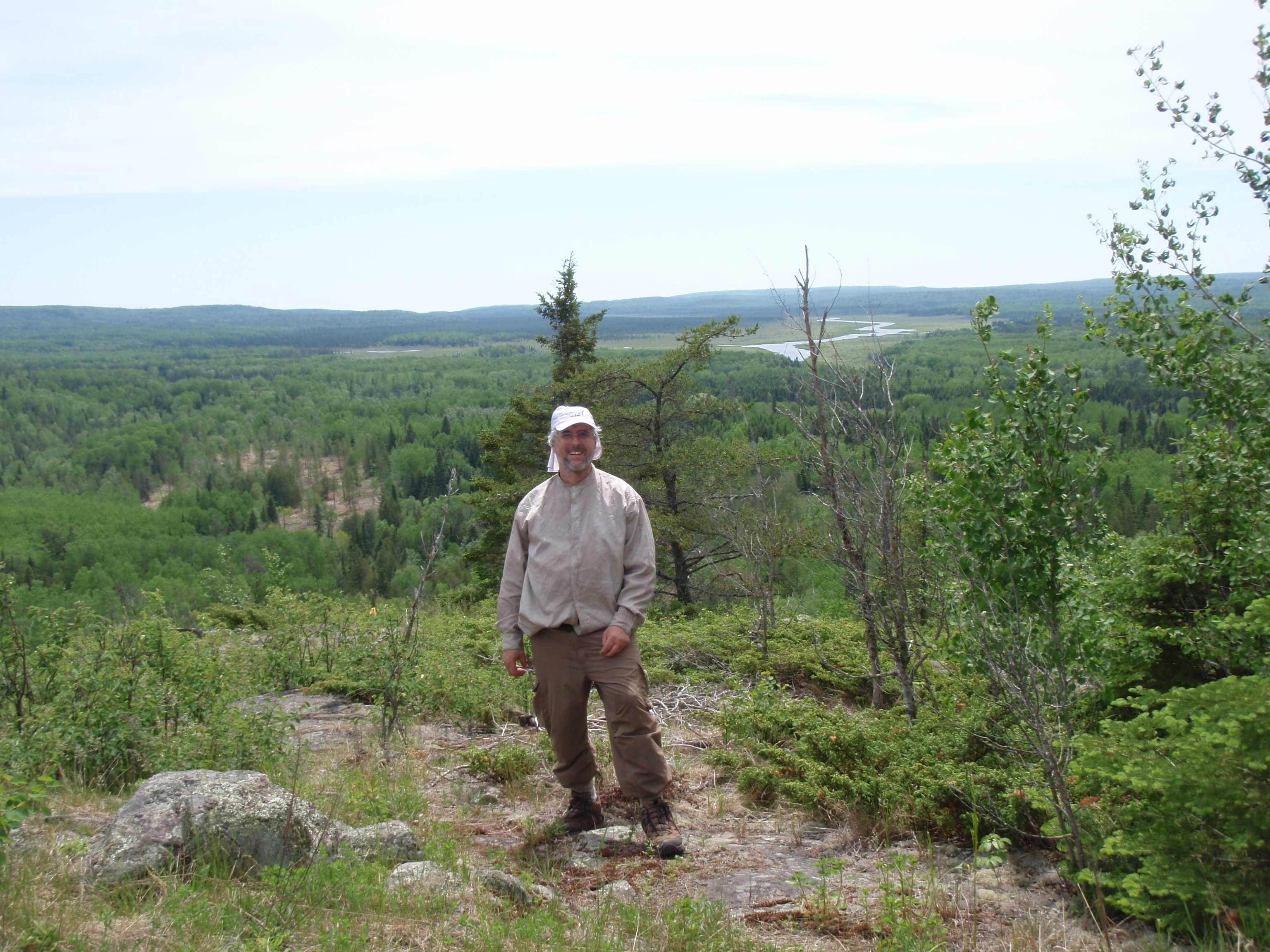
The next overlook would be on a spur trail going away from the Border Route about an 1/8th of a mile. I kept going through the woods with some easy hiking, and I found a trail junction and a sign saying “overlook” with an arrow. I set my gear down and started hiking up the trail. It went up at a fairly decent rate, but wasn’t too strenuous, besides, I didn’t have my gear on. Then I came out to a spectacular overlook. This was a 270 degree panorama. I could see the Swamp River to my south and the massive woodlands everywhere else. I took several photos here including a panorama shot and a self shot. This was the best overlook on this section. Perhaps the best  overlook on the whole Border Route. And I was enjoying life up there.
I was enjoying life because I knew that it was only .8 of a mile until the end of the Border Route, and most of it would be downhill. I hiked back to my gear at the junction, and headed out. It was mostly downhill for a long ways then it became very flat. At first I was hiking in the dark woods on the side of the hill, then the trail went into some scrubby woods. I thought I would be walking along the Swamp River soon. But I checked the map and the trail doesn’t go directly next to the Swamp River until near the end of trail. Instead, I would be hiking something else, a clear-cut area. I could see the clear-cut area to my left, but the trail never went into the clear-cut. Evidently, the Border Route Trail Association was rather mad about the other clear-cut areas, and had negotiated with the forest to keep the clear-cutting away from the trail. I continued and eventually cleared the clear-cut area. Then I came across a grassy forest road. It’s shown on the map, so I knew I had only about 1/4th of mile left. Soon I could hear the Swamp River to my left and saw glimpses of it. Then I made it to the Trailhead.
I HAD COMPLETED THE BORDER ROUTE TRAIL!!!!!!!!
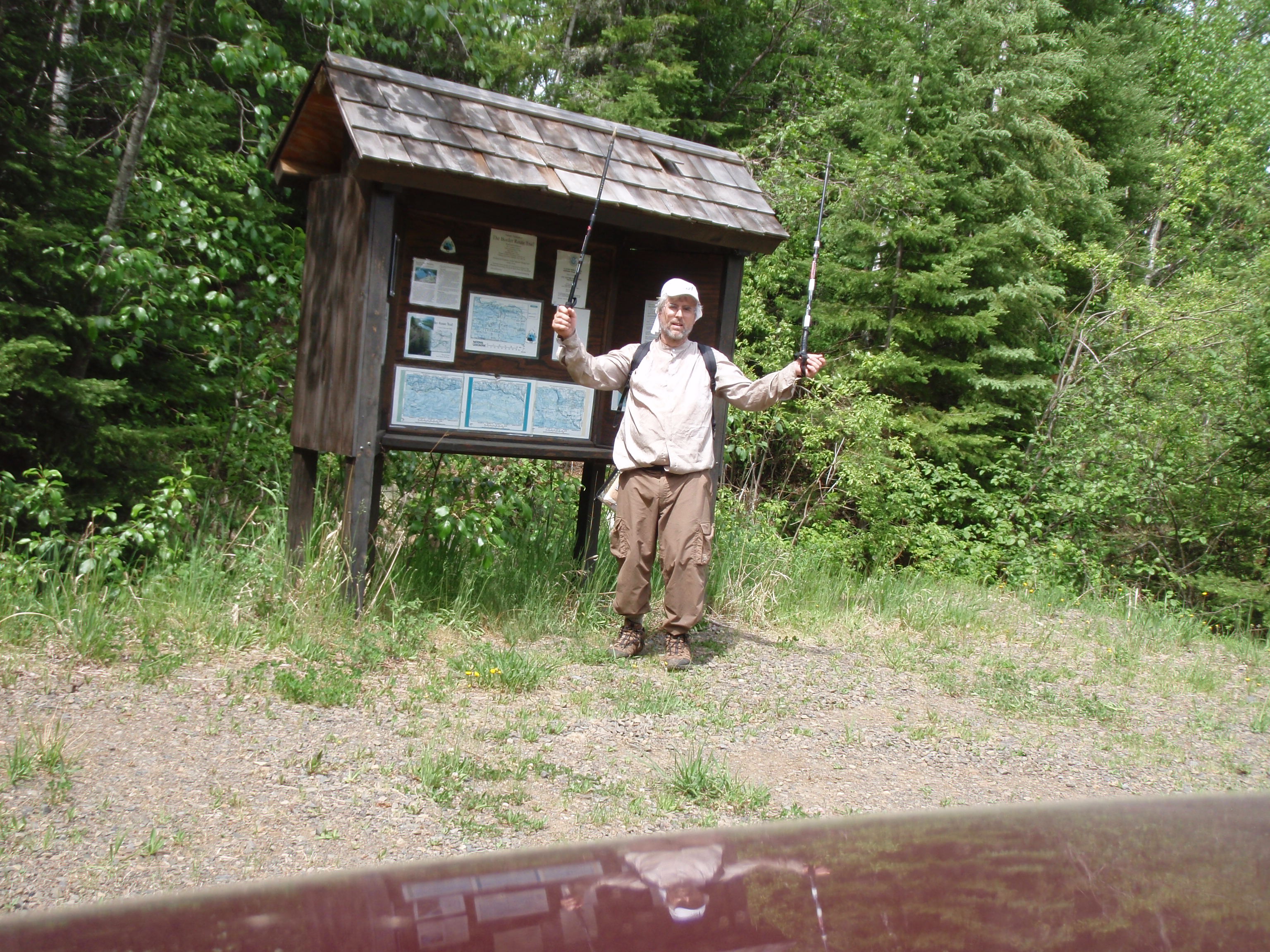
I was happy. There was one car in the parking lot, which I thought was funny because I had not encountered anyone. Perhaps they were using the two car system and had started at the Arrowhead Trail after I had.
I took photos at the trailhead to document my achievement. While I was doing that I truck pulling a boat pulled up and was backing into the Swamp River Boat Launch. This is no easy task, because the boat launch was about a football field back into the woods. I talked to the guy and he seemed confident that he could back his boat into the launch. And he proceeded to do so. As he was doing that I grabbed my bike that I had hidden in the woods next to the latrene and proceeded to duct tape my hiking poles onto the bike.
While I was doing that another truck came along hauling a boat and was getting ready to back into the boat launch. I went over and said Whoah to the driver and he rolled down his window. I told him that there was already a truck down at the boat launch. But they had been down there for a while, so they should be coming out soon. And it was only a couple minutes later when the first truck came out of the boat launch. Then the second guy started backing in. All of a sudden there had been a traffic jam at the boat launch when this was a really remote area. I thought about asking one of the guys with the boats for a ride up to my van, but I had my bicycle, so I decide just to bike it. Besides, they were busy with their boats.
So I headed up the road riding my bike. It was difficult biking on the red gravel, even with my mountain bike. During the uphill stretches I would have to get off my bike and walk it up the hill. But using the bike was definitely faster than walking the whole way. It took me about 40 minutes to cover the three miles back to the van. When I got there it was around 1:30 pm. I had made really good time hiking and biking that last segment.
The one thing I had forgotten to do back at the trailhead was mark my spot with the Spot Messenger. Oh well.
Now I had a decision to make. Should I start hiking the Superior Hiking Trail or should I call it quits. It was Saturday, and I knew that the Birch Terrace in Grand Marais had Karaoke on Thursday, Friday, and Saturday Nights. So, if I wanted to sing Karaoke, I would have to do so tonight, because it would be the last chance. So I decided I would pack it in and go sing Karaoke tonight to celebrate completing the Border Route. Then I could decide tomorrow if I wanted to hike some more.
I hopped in my van and headed down the Arrowhead Trail. I turned right on Highway 61 and made it down to Grand Marais. The first thing I did was stop at the Grand Marais Best Western and pick up my keys that I had left there. It was the keys with the UW-Milwaukee Lanyard. Then I went to Dairy Queen for my usual vanilla cone dipped in chocolate. It was the third or fourth time on the trip that I used the drive up at Dairy Queen. And always the same guy had worked the window. I had become a regular there.
Then I drove down to the Grand Marais Municipal Campground and swung around to the Restroom/Shower House next to the Ball Diamond. I just strolled right in and took a shower like I owned the place. To tell you the truth, there wasn’t anybody around except a couple old timers going to the bathroom and talking about the Cubs. This was a very nice facility and was very well kept up. I bet you there were 8 shower stalls, and a bunch of toilet stalls, urinals and sinks. The building was fairly new, and looked great. It was 2 pm in the afternoon, so it is to be expected that there would be nobody else taking showers at that time. I wasn’t a resident at the campground, but it didn’t say anything that the showers were for campers only. Perhaps some swimmers at the beach or ball players at the baseball diamond also use the showers. I used the shower and nobody confronted me about using them. And if I were confronted I’d use the same line as when I was at Grand Portage. I’d say I was hiking and needed to clean up before I went out for dinner and an evening of entertainment in Grand Marais. Hey, Grand Marais is my favorite place to spend money on the North Shore. I showered without incident and continued on.
Then I decided to go to the Laundrymat. I had planned not to go to the laundymat and had taken a lot of extra clothes. But I had been out and about for ten days and most of my clothes were dirty, except for what I had just put on at the shower house. So, I headed up the Gunflint Trail to the Laundrymat. I knew exactly where it was because I ducked into the Laundrymat last year when it started raining. There were two women at the Laundrymat while I was there. One of them was very young and I started talking to her. She had just graduated from Grand Marais High School and had an older sister that the other woman knew. I asked her what she was planning to do after High School. She said she was going to be attending YTech this fall. She wants to be an automobile mechanic and YTech has a good program she said. She had worked restoring old cars with her dad, that’s what got her interested in auto mechanics. I asked her where YTech was located, and she said Laramie, Wyoming. So then I thought it must be WyTech and not YTech.
I put my wash in the dryer except for my wool hiking socks which I laid out on the table.As some of my clothes started getting dry, I started folding them and putting them in my California Pack. I took some of my nicer clothes and went back into the restroom and changed into them. I was all set for a night out. I finished up at the Laundrymat and I headed for downtown Grand Marais.
I always wanted to try Sven and Ole’s Pizza place. I walked in and the place was packed. You order at the left of the front door, then the dining room was to the right of the front door. Then in the back of the dining room there is a mezanine that has a bar. I asked at the counter how long it would be to get a pizza. They said 40 minutes. That was a little long for me, but they had a heated glass rack that had pizza by the slice. I got a slice of sausage pizza and headed up to the bar area. I ordered a local brew and ate my pizza.
It wasn’t the best. I think it had been sitting around in that glass case for a while. But everybody who ordered a pizza got pizza that looked really good. Maybe I should have ordered a pizza.
It was getting to be around 7 pm and a bunch of people in the bar wanted the bartender to change the TV from baseball to the Stanley Cup Playoff game. Since there are 3 big widescreen TV’s in the bar, the bartender changed one of them to the hockey game..
It was game one, and everyone seemed to be rooting for the Chicago Blackhawks. Maybe it’s because that’s the team people rooted for before the Minnesota Wild came into existence. At any rate, the Blackhawks were doing well, so everybody was happy.
I finished my pizza and beer. I decided to stop over at the Birch Terrace to see if Karaoke would be starting soon. So I drove a few blocks over and went inside. To my surprise, Liz the bartender at the American Legion on Wednesday night was now my bartender at the Birch Terrace on Saturday night. I made a little joke like what bar should I go to tomorrow night to get a beer from you. She laughed and served me up a Miller Lite. The Slice of Pizza from Sven and Ole’s didn’t really fill me, so I asked to look at the menu.
I also asked when Karaoke would be starting and she said at 9 pm. I was over an hour and a half early. Then I stated that I thought Minnesota was hockey country and why don’t they have the hockey game on instead of some baseball game that wasn’t even the Twins. So she switched the station, and the Blackhawks were continuing to do well, I believe it was 2-0.
I ordered a burger and it arrived a lot faster than the burger I had at Burger Night at the American Legion. But there were many people that had ordered food right before me at the American Legion. Right now, I was probably the only person ordering food at the Birch Terrace. I ate my burger and drank my beer fairly leisurely while watching the hockey game. But I was getting tired, it had been a long day, so I told Liz I would come back later for Karaoke, because it wasn’t going to be starting for a while yet anyway. Then I drove up the hill from the Birch Terrace and found an empty church parking lot to park my van. I crawled into the back and took a nap.
I woke up at about 10 pm. I had taken a nap for at least an hour and a half. It felt good. I drove back down to the Birch Terrace where the Karaoke had already begun. They do Karaoke a little bit different in Grand Marais. A lot of people show up to request that Dave, the karaoke dj, to sing a song. They seem to turn in slips for Dave and a fairly regular rate. I turned in a slip to sing “Wild World” by Cat Stevens and after a couple songs it was my turn to sing. I introduced myself as Tman, a backpacker from Madison, Wisconsin. I told everybody that I had seen Stairway Falls, the Rose Cliffs, the Watap Cliffs and the Pigeon Cliffs while backpacking, so I knew it was a “Wild World.” I told everybody to help me with the chorus “Oh Baby it’s a Wild World.” The song started and soon I had everyone singing the chorus with me.
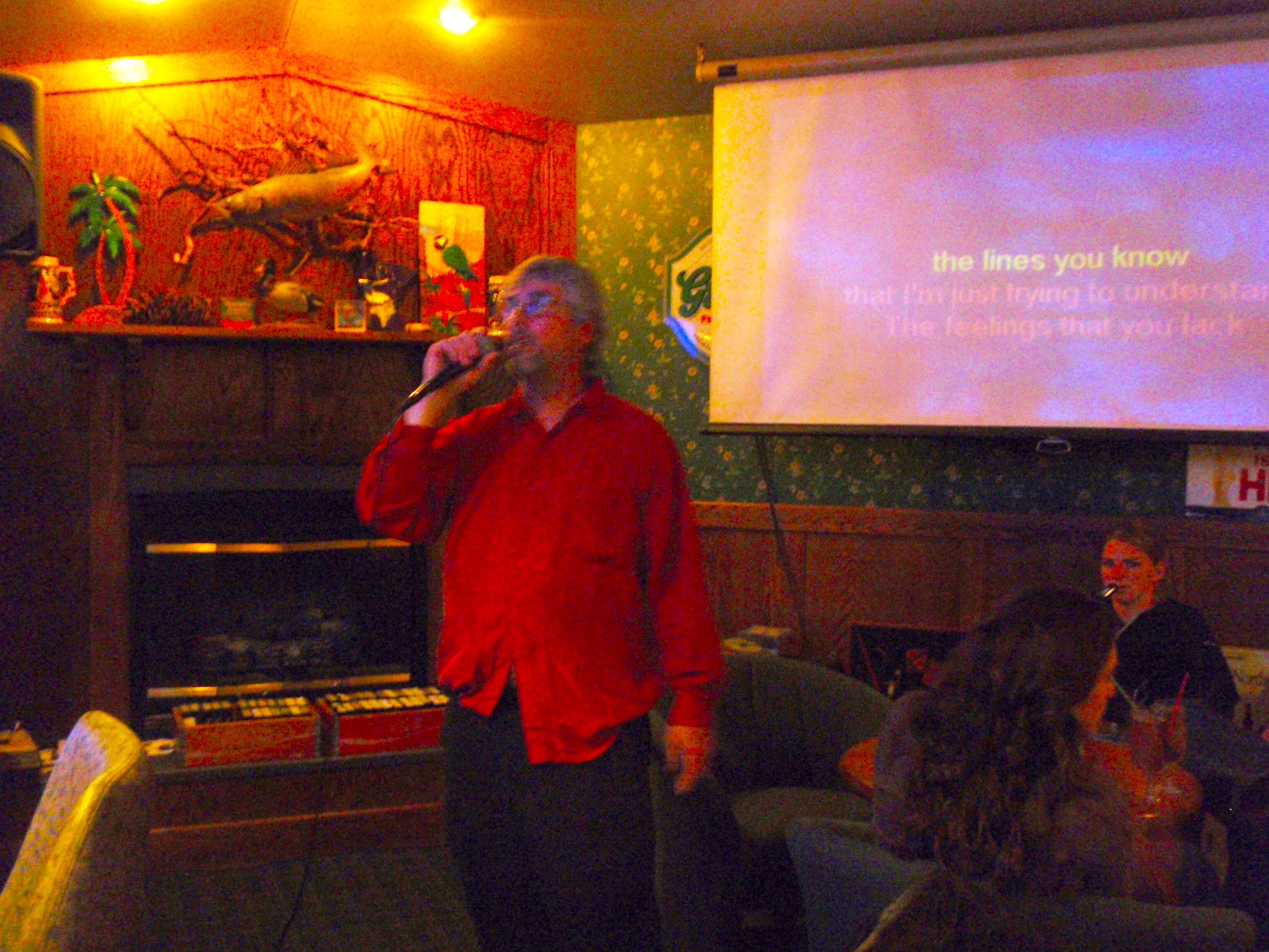
Dave had sung “The Wreck of the Edmond Fitzgerald” as a request from someone in the audience. Then another guy sang “Sundown.” All of a sudden we had a run on Gordon Lightfoot songs because the guy’s wife liked Gordon Lightfoot. I continued the trend with “Carefree Highway,” just to make the lady happy. Meanwhile, while sitting at the bar I met two ladies. One was named Ellie and the other Luba. Ellie was an older lady, I’d say in her 60’s and Luba was younger, I’d say in her 30’s. Luba had sung a song, but Ellie was still hesitant about singing. It turns out that Luba is from Russia and had been working in Grand Marais for 7 years before moving to the Twin Cities recently. And Ellie was a long time Grand Marais resident.
I continued singing songs when it was my turn. I sang “Fly Like an Eagle” by Steve Miller, which I dedicated to all the veterans. After all it was Memorial Day Weekend.
As the night wore on, Ellie finally got up the nerve to sing. She sang “Half Breed” by Cher. I continued the Gordon Lightfoot trend by singing “If I could read your mind.”
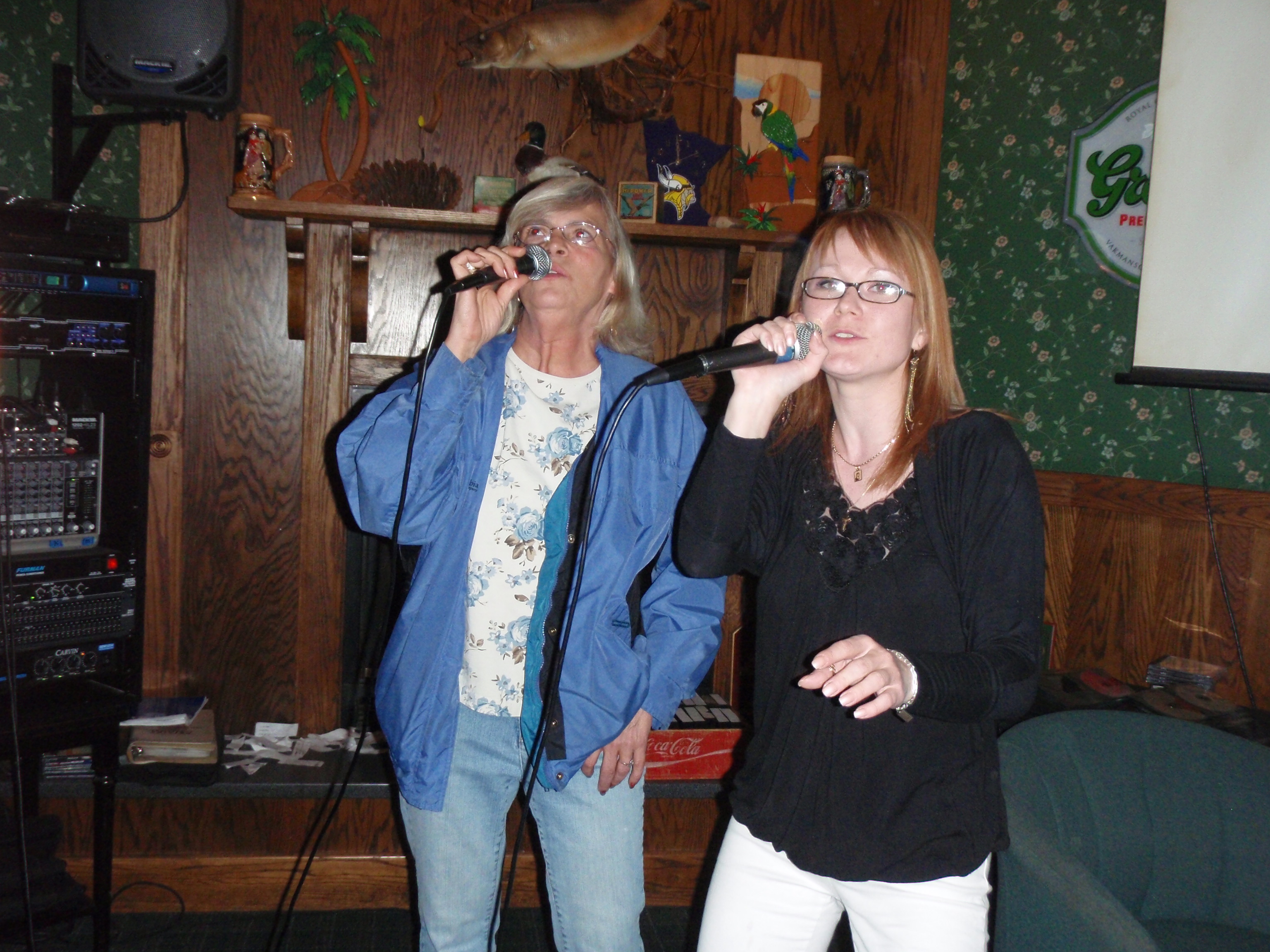
I encouraged Dave to sing “Beautiful” which was the last Gordon Lightfoot song in the book that had not been already sung. I didn’t know the song, and apparently neither did he because he didn’t sing it. The night wore on and people came and went. Luba and Ellie actually sang a song together. I could tell they were good friends. It was getting about time for Karaoke to be over with.
I had a nice conversation with Luba. She had a sales job down in the Twin Cities. She was pretty spunky, and not afraid to talk to people, so I could see how she would be a good salesperson. But she said she missed her parents who were back in Russia. And she had not seen them in seven years. I didn’t tell her that I haven’t seen either of my adult children since a rather nasty divorce 6 years ago. Is it any wonder why I’m hiking out in the wilderness by myself?
I figured out that Dave, the Karaoke DJ, was probably either the owner or the manager of the bar, because he had to go take care of some stuff. But he returned shortly and we continued singing. My last song of the night was “Don’t know what you’ve got til it’s gone” by Cinderella. What a fitting song for a backpacking trip where you don’t have a nice bed to sleep in and other comforts of home. I finished the song and karaoke was over. Dave thanked me for coming and singing. I finished off my sprite, because I had switched over from beer to soda. It was a good night, and the Blackhawks had won.
I drove my van up the Gunflint Trail to the Pincushion Mountain Trailhead. I parked the van and went to sleep in the back.
Sunday, May 30, 2010
Sight Seeing and Trip Home
I woke up around 8 am in the morning in my van at the Pincushion Mountain Trailhead. Evidently, this trailhead is the terminal for a cross country skiing area in the winter. In fact Grand Marais High School uses it for their Cross Country Sking tournaments. And Cross Country Skiing and Alpine Skiing are official High School sports up in these parts. I wasn’t the only person to sleep in a van at the trailhead. I saw another guy get out of his van and go to the restroom building.
I drove down into Grand Marais and headed for My Sister’s Place on Highway 61. I had been under the impression that it was a morning spot because it closed early in the evening. But I was under the wrong impression because they were closed. I went down into downtown Grand Marais and took some photos. I found that the Blue Water Café was open, and they seemed like they were the only place open. And they were jammed with people. All the tables were taken, so I went up and sat at the counter. I had placed my Spot Messenger out in the park across the street. I needed to let everyone know I was okay this bright and sunny morning. I sat at the counter at a spot where I could look out the window and keep and eye on my Spot. I had a conversation with a younger man who was a fireman. But he was not involved with fighting the Ham Lake Fire in 2007, He said there were two Fire Stations up the Gunflint Trail that was involved in that fire. I thought since it was the biggest fire in over a century, that every firefighter in Northern Minnesota would be involved. I had a good breakfast at the Blue Water Café. I finished and headed down to the World’s Best Donut shop for a couple donuts for the road.
At this point I was pretty much set on heading for home. I could go out and hike some of the Superior Hiking Trail, but my enthusiasm was pretty much gone. I had completed the Border Route. I had photographed the whole Border Route. Mission accomplished.
I started down Highway 61, this hike was officially over.
Now, I basically was a sightseer, I’ve always wanted to check out Lutsen Mountains Ski Area, so I turned off Highway 61 and drove 3 miles uphill. It is quite the development. It is it’s own little down up there. I drove past the ski area to the end of the road where the Superior Hiking Trail Trailhead was. It had a have a dozen cars parked there. I went back to the ski area and decided to ride the tram. The tram is just like a ski lift, but you sit in an enclosed coach that will fit 4 people. The Tram goes over to Moose Mountain which is for more advanced skiers and snowboarders. It was $13 for the Tram ride, and was well worth it. I got to see the whole labyrinth of ski runs and the Poplar River which ran right through the valley. There were several bridges crossing it for skiers to use.
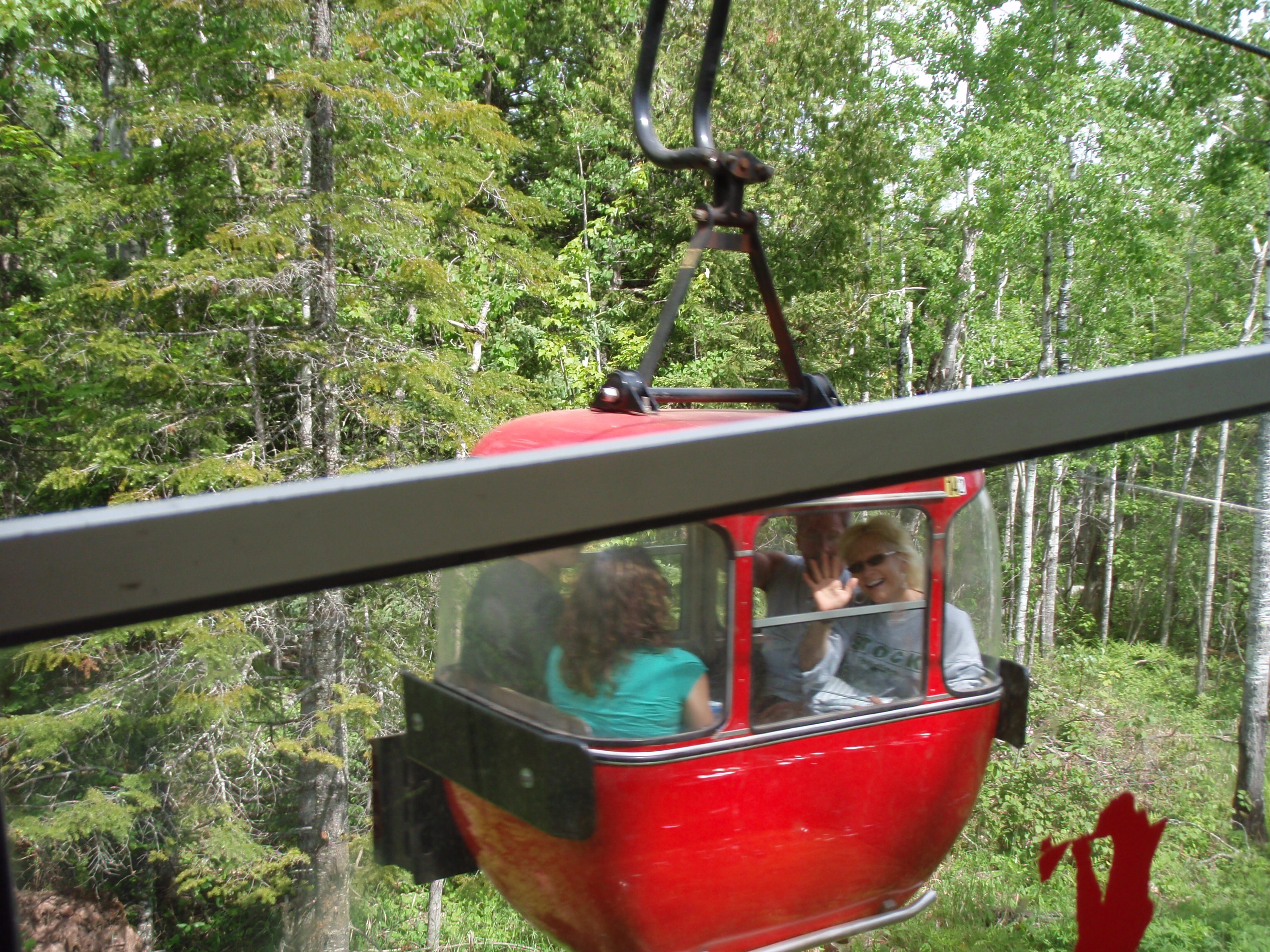
I made it over to Moose Mountain, which is quite the site. The Ski Chalet Building is situated at a beautiful overlook of Lake Superior. I took several photos there. Then you can hike back into the woods a little ways and come out at a beautiful overlook of the inland forest. Somewhere out there was the Superior Hiking Trail and I saw the spur trail leading away to the SHT. Evidently, there is a whole series of hiking trails around Lutsen Mountains. And some people use the tram to get over to Moose Mountain, then hike the Superior Hiking Trail back to Eagle Mountain where the main ski area is. That would be about a 4 mile day hike. But I had bought a two way ticket on the tram, so I was heading back to Eagle Mountain using the Tram. I rode it back, then headed out.
I drove Highway 61 down to Duluth, then crossed over to Superior, Wisconsin and headed south on Highway 53. When I made it down to Eau Claire, I merged into Highway 94 I stopped at Black River Fall for supper at the Mystic Pines Casino. They had a good Buffet for $10. Then I headed down to Madison. It was clear sailing all the way down from Lutsen. Not a traffic problem at all, and the road construction didn’t cause any delays except slowing down to 55 mph. Yes, it was clear sailing all the way down to Madison. But when I was driving on the beltline there was big traffic backup less than 1/2 mile from my exit. Welcome back to Madison.
Post Hike Notes:
Thanks to Ed Solstad, the Border Route Trail Association, and all the Trail Crews
Yes, first of all I have to say thanks to all the Border Route people. It is not easy taking care of a trail that goes through so many ups and downs. Also, clearing the trail in the wilderness can be a real challenge. I know, I spent 2 days on a Trail Crew.
Ed Solstad emailed me after the hike and wanted to know trail conditions and possible campsite locations on the 13 mile section from the Arrowhead Trail to the Eastern Terminus on Otter Lake Road. Here’s what I wrote back.
Hi Ed
My general impression of the trail east of the Arrowhead
Trail to the Eastern Terminus is it is relatively deadfall
clear. There were a few of them, but none of them
I remember as being a pain in the butt to get around
or over. Probably the worst spot was the clear cut area
west of the two most eastern overlooks.
I seen several deadfalls that had been recently cleared.
Thanks goes to you and your crew for doing such a good jobs.
I felt that the trail was a little thickety in spots, and
could use some weed wacking. I really appreciated
the trail being marked so well with tape. It is especially
helpful in the grassy areas between the Pigeon River
and Portage Brook.
As far as locations for campsites, I am very fire
prevention minded. I prefer having all campsites
close to a water source. For instance, the 5 young
men who were camping at the South Fowl Lake
Overlook. They had a small fire. If it ever got
out of control, they would be hell and gone from
water. So, to me the preferable spots for campsites
would be along the Pigeon River or near the Stump
River. You could also explore the possibility of
going down the atv trail to South Fowl Lake and
putting a campsite there. That campsite could be
used by both canoeists and backpackers.
The Portage Brook Campsite looked as though it
hasn’t been used in a while. It could use a little
clearing of some thickets. Backpacker Parker,
who I met at the Swamp River Campsite, bypassed
the Portage Brook Campsite because it looked too
sunny and hot.
At the eastern Trail head on Otter Lake Road,
you cannot see the outhouse that is across the
Road. It could use a little clearing so people
can see it from the trailhead.
So that is it about the physical aspects of the
Trail, now, I’d like to move into promoting this
section of the trail (from the Arrowhead Trail to
the Eastern Terminus). I think the BRTA should
be promoting it as an extension of the Superior
Hiking Trail. The Arrowhead Trail is a natural
ending spot for people hiking the northern section
of the SHT. People will be seeing over a dozen
beautiful overlooks in the section, which definitely
makes it worth while.
I think the Border Route Trail Association should
produce separate Map/guide for this section specifically
in mind for getting people who are hiking the SHT to
hike this section.
The Superior Hiking Trail Shuttle will pick you up
and drop you off at the northern terminus of the
SHT (by appointment and for a fee.) Perhaps the
BRTA can get the Superior Hiking Shuttle to also
pick up/drop off people at the BRT Arrowhead Trail
Trailhead (also by appointment and for a fee.)
Also, there is a nice State Forest Campground near
the Arrowhead Trail Trailhead. This should be mentioned
more prominently in BRTA literature.
That’s about it about the eastern section. I am still writing
my trip report so I definitely will be having more comments
in it.
Again, thanks for all your hard work.
I really enjoyed hiking the trail, but I had developed a rash
in my nether regions. So, I was thankful that I got a ride
into Grand Marais after I made it out to the Arrowhead Trail
from the west. I am glad I came back to the trail after
a couple days rest, and finished the eastern section.
Now I have pretty much all of the Border Route photographed.
If the Border Route wants to have a link to my
website for the photos, that would be great. I want people
who are thinking about hiking the trail to see what
the trail is like. Especially all the overlooks.
Regards from me, Todd McMahon aka Tman
Ed emailed me back saying thanking me and saying that he would take care of some of the stuff I mentioned in the email. The Border Route Trail Association will be having a hike on September 18, 2010 to look for possible Campsite locations on the 13 mile section from the Arrowhead Trail to the Eastern Terminus. Checkout and join the Border Route’s Meetup site for more information or check out their website at http://www.borderroutetrail.org/
I’d also like to thank the members of the Trail Crew I participated in. Thank you Tom Suter for being our leader. And thanks for lending me your water filter. Also thanks to the rest of the Crew Members who were Jeff, Martin, Jim, Illona, Walli, Dick and Paul. I had a great time clearing the trail with you guys. It was hard work, but you guys were the best.
I thought the whole Border Route was in pretty reasonable condition. Sure it was thickety in some parts, but most of the downed trees were cleared. And I didn’t have any sections where there were many down trees in a row. Last year getting to Topper Lake was such a bad section, but it’s clear now, due to the diligent efforts of the BRTA. The BRTA has responded, and has done an admirable job of adding extra trail crews to work on the trail
Other Thanks
I’d like to thank Tom Suter for driving my van back to Grand Marais for me. I also would like to thank the young sheriff for driving me down to Highway 61 and Ed Olson for driving me into Grand Marais.
I’d like to thank my sister for sewing some Velcro on the pockets of my hiking pants. She also took care of my website while I was gone, and watched for my spot messages to make sure I was all right.
I’d like to thank all the people who stayed with or checked on my mom while I was away. Those people were Leona Breuch, Scott Pyle, Mary Pyle, Mary Keehn and Kim Keehn.
I’d like to thank Bob Dresen for fixing my hiking pole.
I’d like to thank Greg Mackler for being my Backpacking Advisor.
Thank you all.
Conclusion
My conclusion is very simple. The Border Route Trail is a great trail. We should be honored to have the Border Route Trail, the Kekekabic Trail and the Superior Hiking Trail as part of our National Scenic Trail System. so I wrote the following letter.
The Honorable Herb Kohl
330 Hart Senate Office Building
United States Senate
Washington, DC 20510
Dear Senator
I would like to bring your attention to Bill S.553 introduced to the US Senate by Senator Klobuchar of Minnesota. This Bill reroutes the North Country Trail in Northern Minnesota. I am asking you to sign on to be a Co-Sponsor of the Bill.
The present route takes the North Country Trail through a large Tamarack swamp. A series of wooden Boardwalks would have to be built through this section of the trail. Building a boardwalk through swampy areas is much more expensive than building a trail on solid ground. Plus, maintaining these boardwalks could prove to be expensive over the years.
Rerouting the Trail makes sense because it will be using 300 miles of existing trails including the Superior Hiking Trail, Border Route Trail and Kekekabec Trail. The Superior Hiking Trail in particular is one the most outstanding achievements in outdoor recreation over the past 25 years. It is considered one of the best hiking trails in America and has won several awards. The Superior Hiking Trail Association, a strong volunteer organization, has built and is maintaining the Trail. The inclusion of such great trail builders as the SHTA would be a boost to the North Country Trail.
The Kekekabic Trail and the Border Route Trail are both outstanding trails, too. I can tell you this from first hand experience because I have hiked both of these trails within the last 14 months. And, I have worked on a Border Route Trail Crew in May. These two trails are very scenic, passing many beautiful waterfalls and overlooks. Enclosed are a couple photos of me at a couple of the overlooks.
Currently, Wisconsin has the longest continuous stretch of completed trail in the North Country Trail. The section I refer to is a 117 mile stretch from Solon Springs to Copper Falls State Park. If this Bill S 553 passes, and we can complete a section from Solon Springs to Minnesota’s Jay Cooke State Park, then we could have almost 500 miles of continuous trail completed. This would be a great achievement.
Currently, the bill is Co-Sponsored by Senators Russ Feingold, Carl Levin, Debbie Ann Stabenow, and Al Franken. But we need every Senator from all 7 North Country Trail states to help the bill by Co-sponsoring it. I urge you to sign on as a Co-Sponsor for Senate Bill S.553. Thank you.
Regards from me, Todd McMahon
The Arrowhead Reroute Bill finally passed Congress in 2019!!!!!