Hi Everyone
I carried an Olympus VN-5200PC Voice Recorder on my Backpacking Trip and almost every night I would record a description of the events that happened that day. So now I am writing a Trip Report based on those recordings. Here it is.
Wednesday, May 20, 2009
Madison to Minneapolis
I took the Megabus from Madison at 2pm, and we traveled up the interstate to Minneapolis. We only stopped once in Maustion for a break so the Bus Driver could have his supper. The Bus arrived in Minneapolis at 7:15 and I started walking towards the Minneapolis International hostel. I was walking in the general direction, but the streets start angling off to the southwest, instead of south, so I ended up walking about 5 blocks out of my way. But I got back on track and made it to the Hostel after about an hour walk.

The Minneapolis International Hostel is kind of an old rickety mansion. You go up to the third floor in this narrow back stairway to get to the men’s dormitory room with about 15 beds. There are other private rooms in the Hostel, but I stayed in the Men’s Dormitory. We had only about six guys staying there that night, and 3 of them were Asians. One of them actually was an exchange student from South Korea. I also met Jordan who is from the state of Virginia, who was in Minneapolis for an interview for a marketing job. He had just graduated from Old Dominion University. I told him about my website and he said that he would be following my progress. At around 10 pm Wednesday night I went out to a park across the street and tried to see if the Spot Beacon would work. I didn’t seem to work, because I checked the internet at the Hostel.
Thursday, May 21, 2009
Minneapolis to Ely
On Thursday Morning I got my stuff together and started backpacking. Overall, the experience at the Hostel was good. But sharing a room with several people I don’t know, always makes me leery that some of my gear might become missing. I kept double-checking that I had everything.
So I started backpacking to my pick up destination. The area around the Hostel is a very diverse neighborhood. I saw blacks, Mexicans, whites, middle easterners, and Asians. And when I was walking down Franklin Ave I went by a big Native American Center. It must have been 2 or 3 blocks long.
There was one particular incident that I remember from this hike. I was walking down Franklin Ave when two black men got off a bus across the street from me. One of the men looked at me with a comical expression on his face. And then he got his friend’s attention and pointed me out. They both had a chuckle together. I must have looked pretty funny backpacking down an urban street. I just smiled and walked on.
I made it over to Midwest Mountaineering early. Mark Stange of the Kekekabic Trail Club was to pick me up at noon. I bought a couple things I needed from the store and asked them where is the nearest place to make copies. They directed me to a Library on the University of Minnesota Campus just two blocks away. So I went over there and make some “I saw Tman” cards to hand out to people that I meet. The card has my email address and website address on it.
After that I went back to Midwest Mountaineer and set out the Spot Messenger by the freeway across the street. I tried for twenty minutes, but it didn’t seem to work. I called Mark Stange and he said he would be late because of some complications at work. Since I was hungry, I made arrangements for him to pick me up at the Quiznos just a few blocks from Midwest Mountaineering. We made the connection and we drove up to Mark Stange’s house, just north of the Twin Cities.
I set out the Spot Messenger at Mark’s house while we were packing up, and it worked. This is good news.
Mark likes to get out and take a walk every two hours when he’s driving, so we stopped at Cloquet at the Frank Llloyd Wright designed gas station. He knew I would be interested in Frank Llyod Wright because the architect is from southern Wisconsin. I took a few photos of the gas station, then we walked in the Veteran’s Park across the street.
We made it up to Ely and went to the Forest Ranger Station. This was a real eye opener for me.
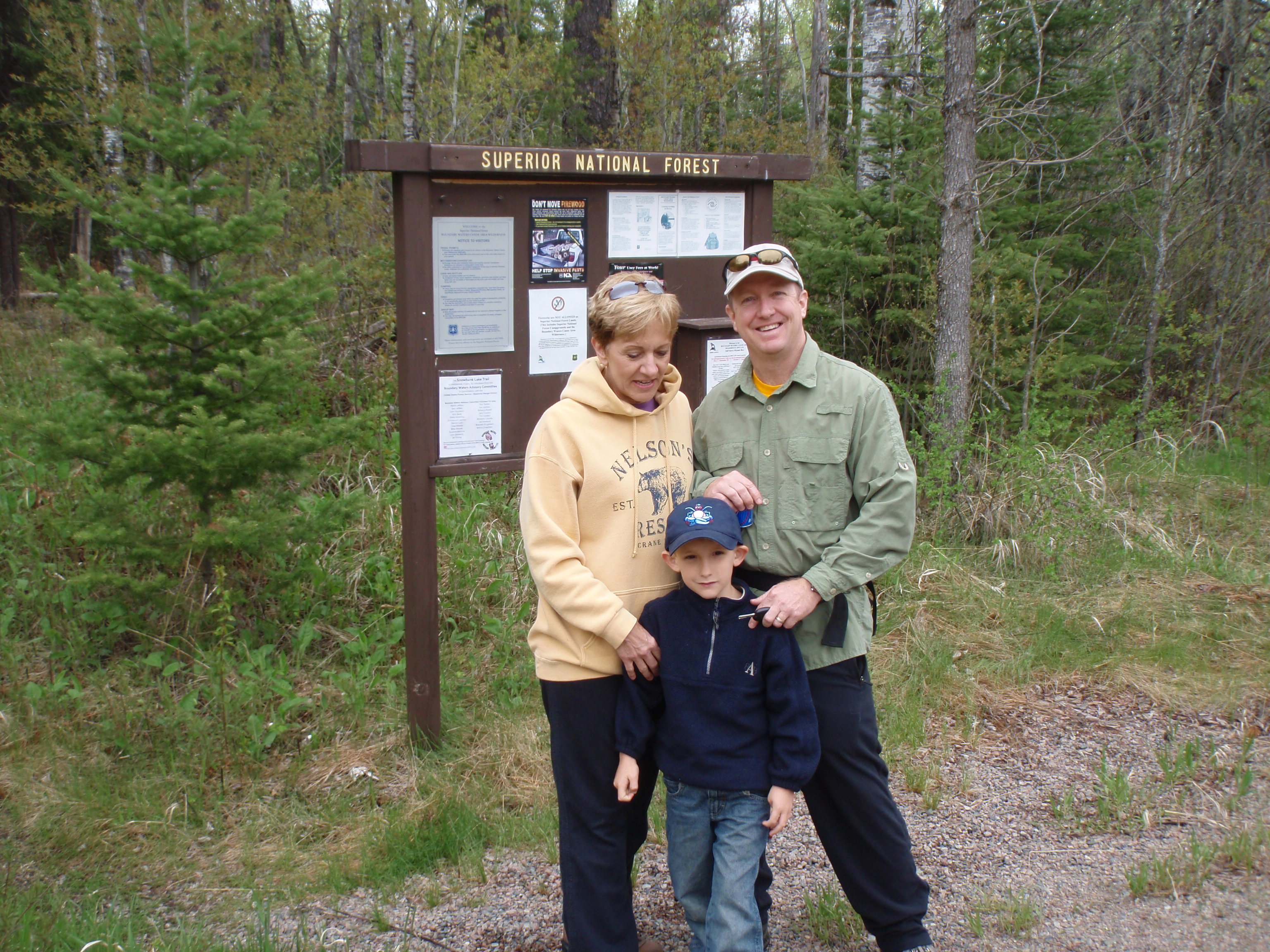
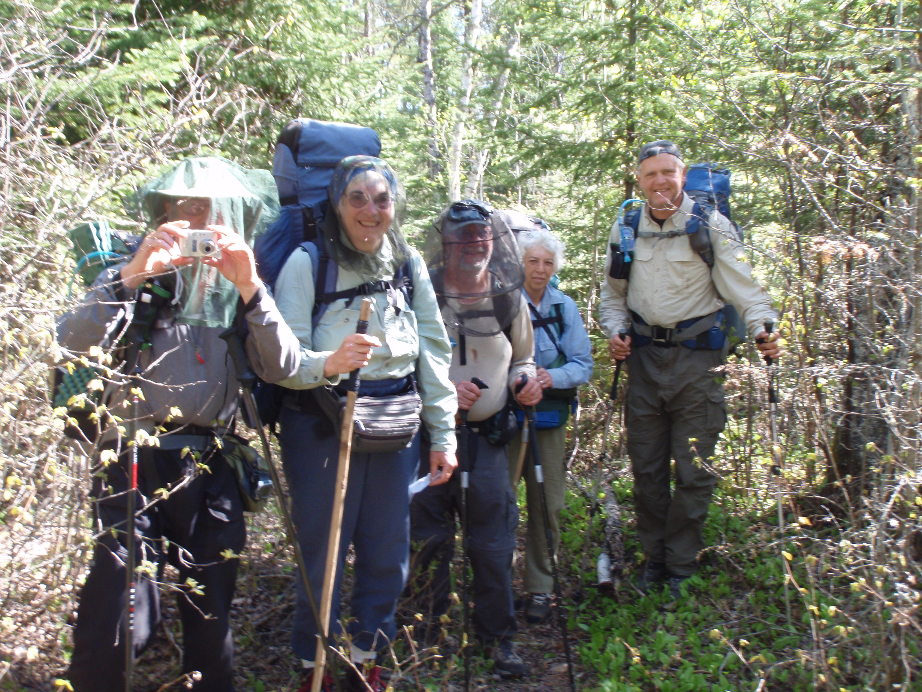
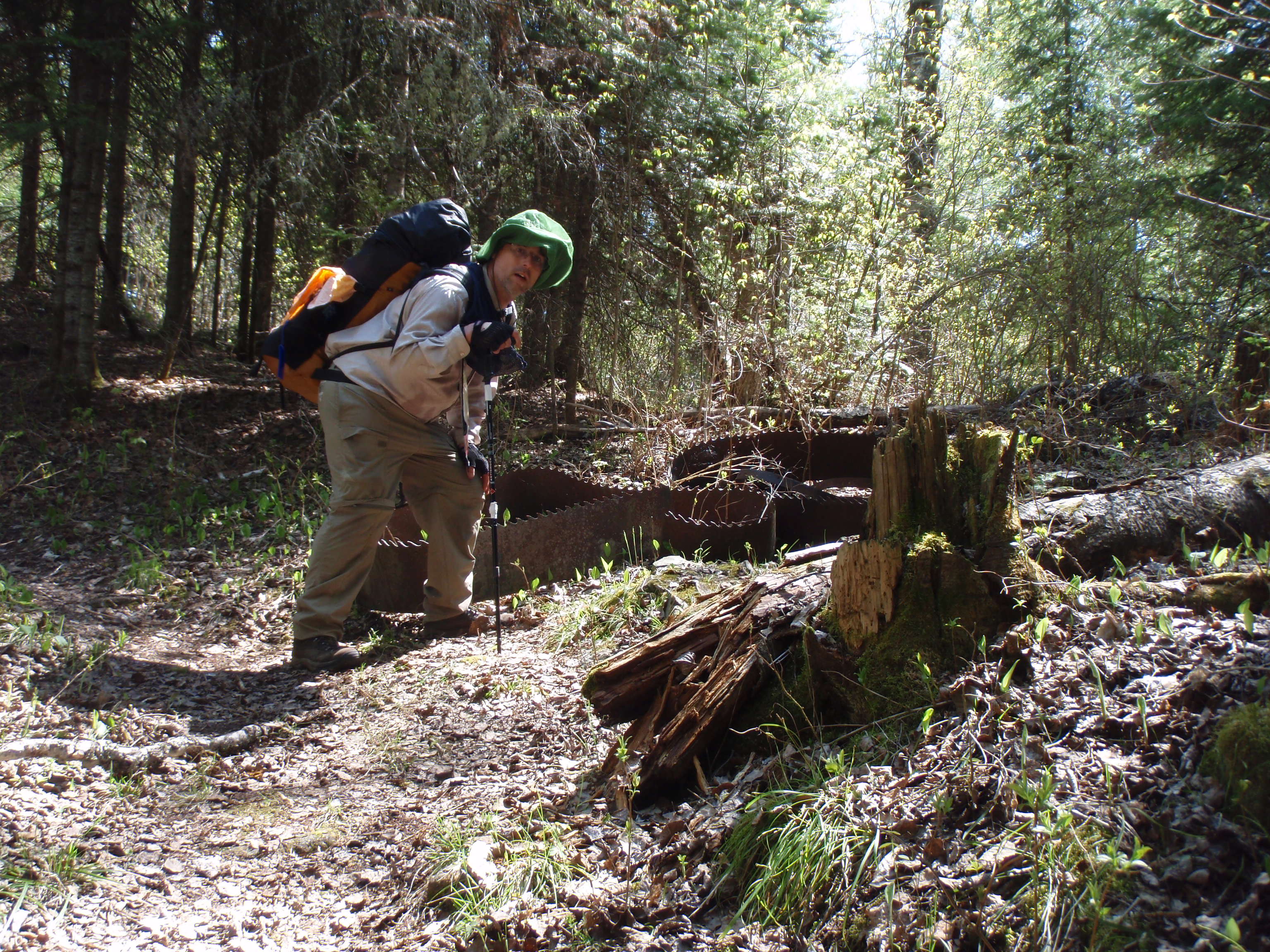
The Kekekabic Trail Club was having two trail crews that weekend. One led by Mark Stange and the other led by Jerry Swanson. All the facilities at the Ranger Station are fairly new. They had just moved to that location within the last few years. They have a dormitory building where Volunteers can stay. Trail Crews stay in the Dormitory the night before they head out. For the Trail Crews, the Forest service provides much of the equipment. They provide the saws, tools and canoes needed for the trip. Often the crews will canoe into the part of the trail they are clearing. The Trail Crew must provide their own food, tents and personal equipment.
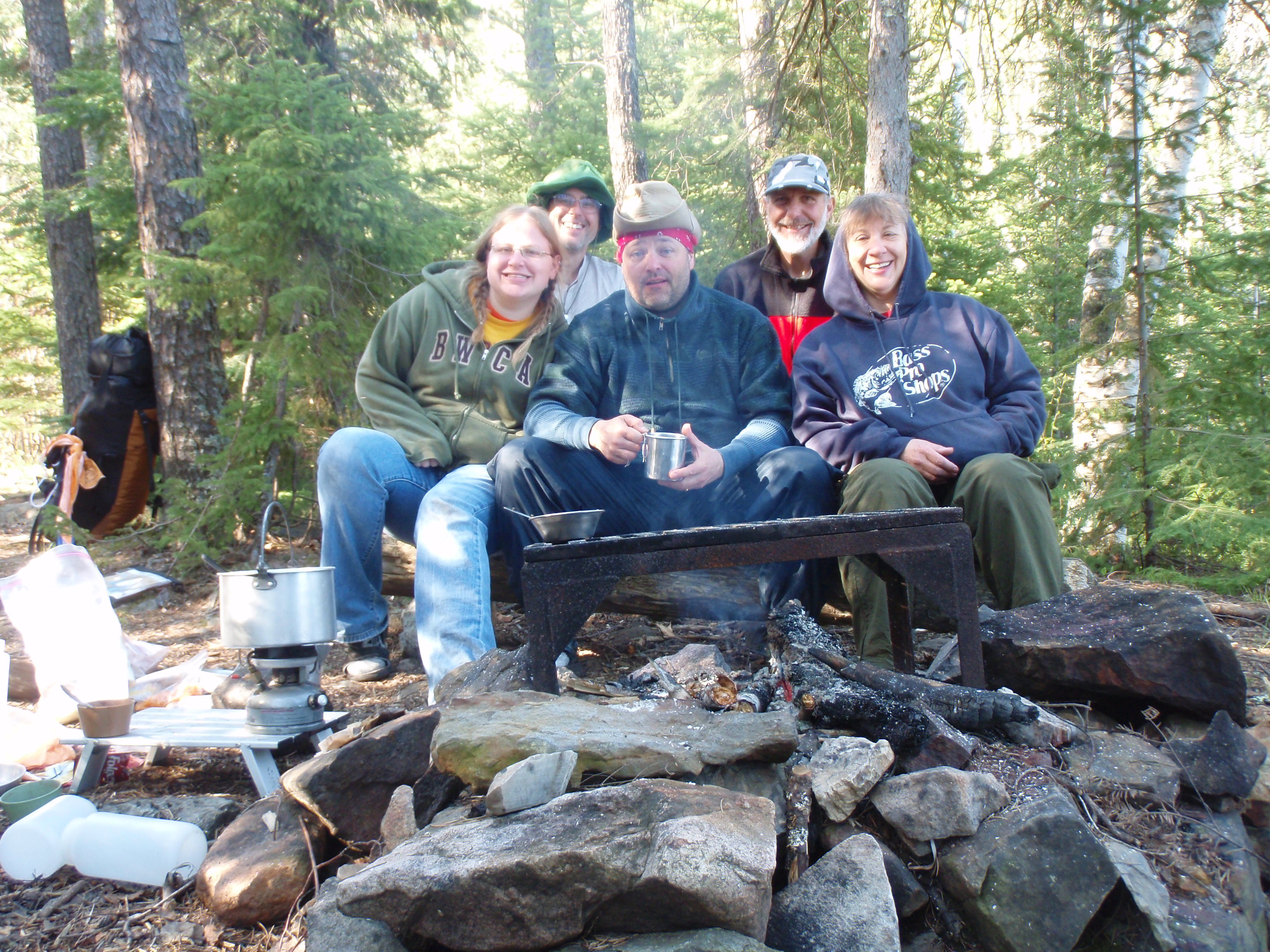
Cory Munsen was the Forest Ranger getting the equipment lined up. He told me where I could camp near the Ranger Station. And he also called the Voyaguers North Outfitters to see if they were still open so I could get a Boundary Waters permit. Mark and another volunteer on his Trail Crew named Liisa needed to go eat, so they agreed to take me to get my permit. It took a long time to get the permit because you have to watch a video. But Mark and Liisa stayed and watched it with me, which was nice, then we went for supper at the Grand Ely Lodge.
Afterwards we went back to the dormitory and I went off and set up my tent. I came back and talked with some of the Trail Crew Members. I gave my card to Jerry Swanson and Joe Johnston. Joe checked out my website with his blackberry. He also took two photos of me and sent them to my email address which my sister was monitoring. My sister posted the two photos to the website.
Friday, May 22, 2009
Ely to East of Fernberg Road
It was cold last night and I had a hard time sleeping. I woke up in the morning, got packed up and said goodbye to the Trail Crew. Joe Johnston had taken one last photo of me before I left. I started walking east on Fernberg Rd. I planned that this hike would be “From Ely to Grand Marails,” so I wanted to do the 20 mile road hike to the Kekekabic Trail so the hike could truly be “from Ely”
I hiked down the road and the first intersection I hit was Grant McMahan Blvd. I was humored that there was a McMahan in the area that was famous enough to have a road named after him. But it wasn’t the exact spelling as my last name, McMahon. But even so, I stopped and took a photo.
I continued hiking down the road past a town named Winton. They had a big sign out by the road that pointed to the location of the Winton Municipal Liquor Store. I thought I was unusual for a town to run the liquor store, but evidently in Minnesota, it’s fairly common.
I kept hiking and eventually the Two Trail Crews passed me by on the Road. They stopped and asked me if I was okay, and I said I was, so they continued driving down the road to their canoe landing. I kept walking and stopped for lunch at the Rookie Lake overlook. In the afternoon I made it to the Red Rock Store. I bought a pair of thermal long underwear. They were 50 bucks, but I felt like I needed them for sleeping.
I continued on and hit the intersection of Fernberg and Snowbank Roads. I had made up my mind that I would go to the Fernberg Road Trailhead of the Kekekabic Trail. It looked like a shorter hike.
Cory Munsen and Jerry Swanson had seemed to think that trail from Fernberg Road would be okay. But the trail from Snowbank Road is newer.
I hiked out to the Fernberg Road Trailhead and started hiking the Trail. I started following a trail with some pink ribbons marking it, but it didn’t seem to be going the right way. So I went back to the clearing and found a path headed in the eastern direction. I was happy because I found a cairn, which is a pile of rocks that mark the trail, so I thought I was on the right path. Everything was good for a while, then eventually the trail dissipated and I didn’t’ know where the trail was. But I thought if I just kept going east, I would hit the real trail. So I kept going away from the sun.
I was bushwhacking through a lot of muck, then I would head for a high spot. I did this several times and still didn’t find the traill. I thought if I kept going away from the sun, surely I would it the real trail. Well I must have done this for about two hours, and it was really tough going. I tried using the compass, but it didn’t seem to help that much, maybe because there is iron in the rocks, or something like that. At one point I lost my boot in the muck. Then I found out that I lost a water bottle and some gorp out of one of my backpack pockets. Unfortunately, the pack has only two pockets and they are for water bottles so they don’t close. I proceeded to tie my other water bottle onto my backpack, even though it’s in a pocket.
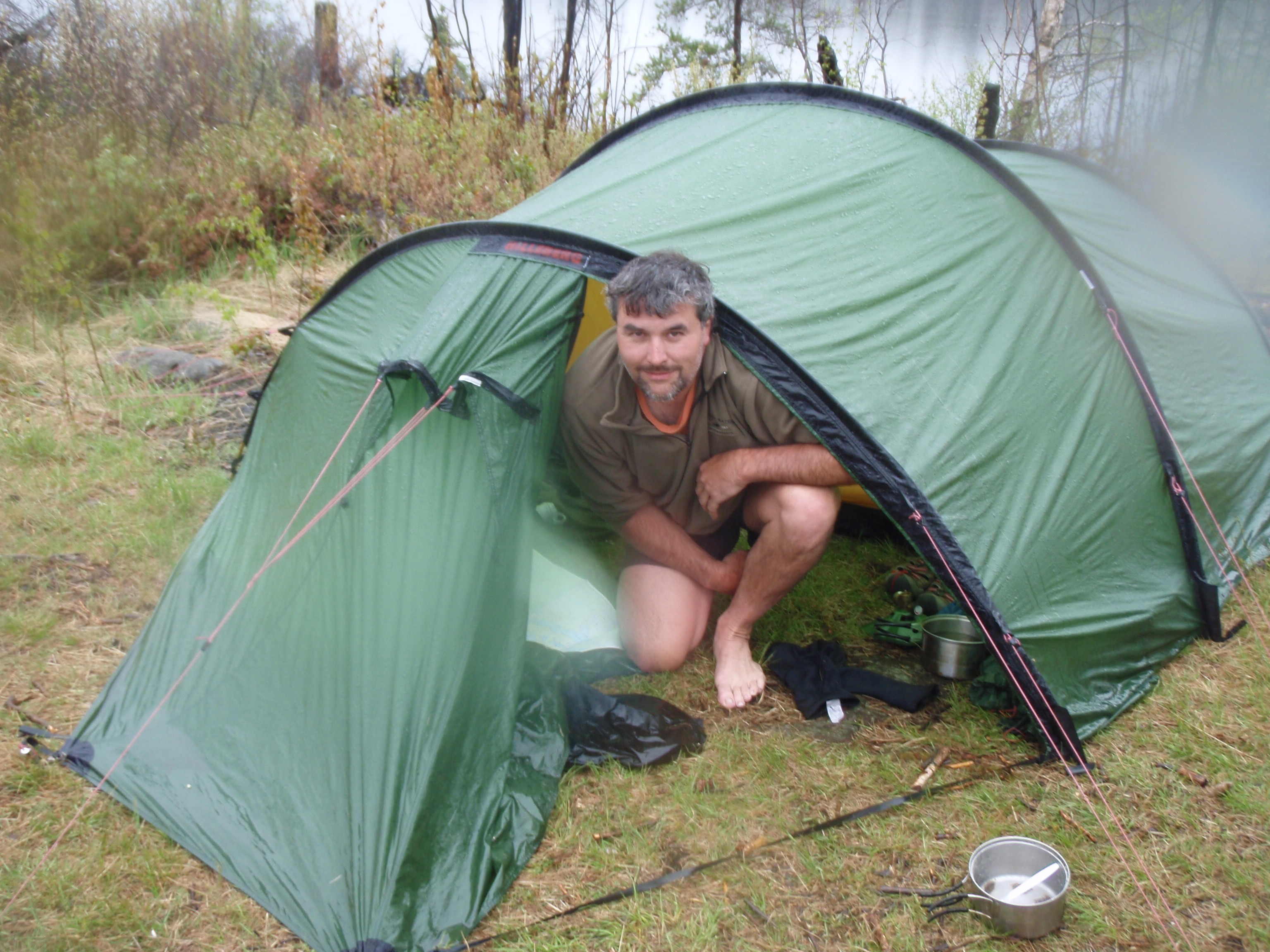
It was getting late so I found a nice spot to camp. It was a small grassy flat area on the side of a rocky hill. I set up my tent, then I went to the top to the hill to cook supper, and set out the beacon.
I hoisted my cell phone antennae and was able to call out. I called Greg Mackler and got a message so I told him I didn’t exactly know where I was, and hopefully he could check on the internet where the Spot Messenger says I’m at. The Spot Beacon did work, so I called Greg back and still got a message. So I left a message that I needed him to answer the phone the next time I call him.
At a rocky area on top of the hill I made supper using my alcohol stove. I just relaxed for a while, put up the bear bag and went to bed. I figured that I wasn’t really lost, but I didn’t exactly know where I was. I felt like I could always go back the way I came and get out on Fernberg Rd, but I wanted to find the real trail. I went to bed and decided to figure it out in the morning.
Saturday, May 23, 2009
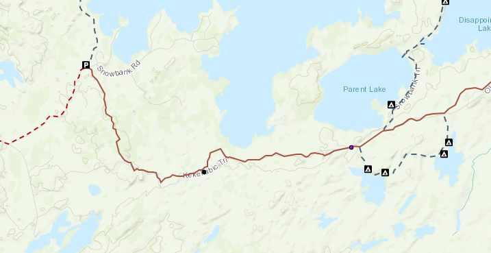
Kekekabic Trail, East of Fernberg Road to Parent Lake
Maybe it’s about time I explain how the Spot Messenger works. There are 4 buttons on this device. One button turns it on, and a little light starts blinking when it’s turned on. There is another button that you press for 3 seconds and it starts sending a message that you are OK. It has a light that also blinks with “on” button light. When the OK button light turns off, the OK message has been sent. Sometimes it takes up to a half an hour for the message to get sent to the Satellite. Then the Spot Messenger sends my exact location and the Okay message to up to 10 contacts to their email or text message accounts. The other two buttons are for Help. One is a non-emergency help and the other button alerts the local 911 center. I have never used those two buttons, in fact, I taped over them so I don’t accidentally set it off. The bad thing about the Spot Messenger is that it tells my contacts where I’m at, but there is no screen to tell me where I’m at.
I did an OK message first thing in the morning and it worked. Then I hoisted up my telephone antenna and called Greg Mackler. He answered and told me I was within 50 yards of the trail.
The conversation on the phone was breaking up. He said something about North, but I wasn’t sure if I had to go north or if I was north of the trail, which meant I had to go south. I tried to get him to tell me where I was in relation to Pickerel Bay. Pickerel Bay was one sure landmark I could go by.
The real Kekekabic Trail goes just south of Pickerel Bay. But evidentially he couldn’t see it on the map to tell me that information.
So, after I got off the phone I packed up and left my gear on top of the hill I was on. Then I proceeded to do a big loop around the hill in order to find the trail. But I didn’t find the trail anywhere. Then, I figured that if I went northwest, I would hit the trail no matter what. So I headed off in that direction. Although, I wasn’t completely sure I was going in the right direction because it was a cloudy day and I didn’t have very much faith in my compass.
Well I kept going and going in what I thought was the right direction. I was tough walking because I was bushwhacking through the forest, but I kept going. I kept thinking about how the Donner Party had taken a shortcut and how it turned out to be a disaster, I thought that this was going to be my disaster shortcut. But then out of the blue something miraculous happened. No, I didn’t find the real Kekekabic Trail.
I was bushwhacking through the forest when all of a sudden I see a big log house up on a hill. It was like a mirage, but it was real. The house was big. I thought it might be some type of resort or lodge. The closer I got to it the newer the house looked. In fact, I thought it was under construction. I saw a pickup near the house, so I thought there would be some construction workers there. I also noticed there was a bank of solar panels next to the house.
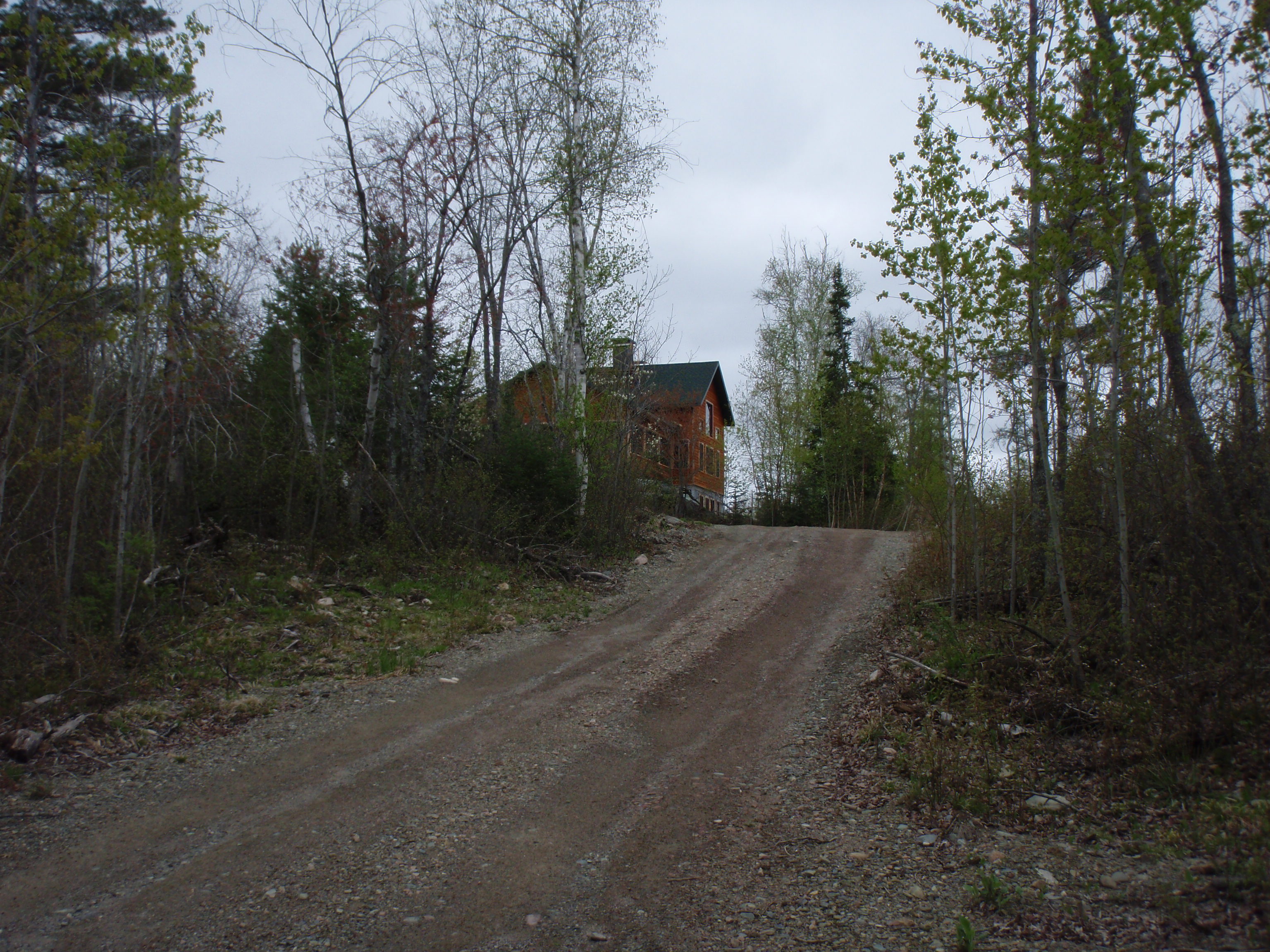
Well I made it up to the house and I yelled out “Hello, is anyone home.” And sure enough, there was a man over by the solar panels. Well I told him I was out hiking and I showed him my map and my Kekekabic Trail guidebook. I told him I had hiked in from the Fernberg Rd trailhead and got lost out there. He told me that the Trail from the Fernberg Road Trailhead had not been maintained for 10 years. He showed me on the map where he lived and told me if I go out his driveway and turn right, the newer trailhead is only 3/4 of a mile away. He said the new trail is really well marked and easy to follow.
He had a beautiful view from his house. I could see a big hill off in the distance. He said it was Eagle Mountain, which was one of the highest hills in Minnesota. I also found out that he was the owner of the house. They lived there only a short time and were still working on the house. He said they got all the electricity for the house from the solar panels. Wow, this was a cool house. It was like a mirage. He filled up my water bottle and I was on my way.
He made it sound so easy. All I had to do is go out to the end of his driveway and turn right. But what he didn’t tell me is that his driveway keeps going and going. The driveway must have been at least 3/4 of a mile long if not longer. The driveway was just dirt and gravel, but it was graded. It must have cost a pretty penny to put in. The house was really off the grid.
I made it to the end of the driveway, then up to the Snowbank Rd Trailhead. There were about 6 cars in the trailhead parking lot. I met up with a couple and their son, who were going to be hiking the Snowbank Trail to the north. The boy looked about the right age to be in Cub Scouts so I asked him if he was a Scout. I think they said that he was going to be a Cub Scout. Maybe he was too young. I told the boy good luck in Scouts, and probably told them that I am an Eagle Scout. I gave them my card, took their photo and I was off.
I started hiking the Kekekabic Trail to the south. Actually this part of the trail is also considered the Snowbank Trail too, because it is part of the Snowbank loop that goes around Snowbank Lake. After the ordeal I had in the morning, I actually didn’t start the Kekekabic Trail until 12:30 pm. I lost over a half a day being lost.
The guy at the log house was right. This trail was really well marked. Soon I came to an electric line right of way, which I saw on the map. Then the Trail makes it up to an overlook where you can see Snowbank Lake off in the distance through the trees. After a while I came to a rocky switchback area that is kind of a gully between two rock faces. There was a nice rock to put my stuff on so I stopped and decided to take my long underwear off. I had taken my pants off when I saw a younger couple approaching. Well, I talked to them in my long underwear. I told them it would have been a disaster if they had arrived a couple minutes later, because my bottom would have been completely naked. Their names were Mike and Brook and they were doing the Snowbank loop that weekend.
I gave them one of my cards and they were on their way. They looked like they were packing pretty light. You know what they say, two can pack lighter than one. (I actually received an email from Mike after the trip
I managed to take off my underwear and put my pants back on without any more incidents. I continued down the trail and made it to the clear cut area. The clear cut area looks like one big mess. Logs are sewn about everywhere. It’s hard to see the tread of the trail, but they have pink ribbons marking the trail. It was pretty well marked with the ribbon, but there were a few times where I had to stop and look around for the ribbon. I was hiking when all of a sudden I noticed a 4 foot high wall of water on my right-hand side. It kind of looked like one of those above ground pools but it was made out of wood. It was a beaver dam. I stopped to fill up my water bottle and put in the tablets. I sure hoped I wouldn’t get the Beaver Fever from drinking water from a beaver pond.
I continued on and soon I reached the point where I was directly south of Pickerel Bay. This was the point that I was referring to when I called Greg Mackler. You could see Pickerel Bay because of the clear cut. Otherwise, if it were a regular forest you probably won’t be able to see it because it’s a ways from the trail.
Finally made it out of the clear cut area and into a regular forest. The next landmark I was looking for was the sign marking the boundary of the Boundary Waters. Mark Stange had told me that when you get to the point where you actually are going into the Boundary Waters there’s a sign. They must do this because there are different rules for a Wilderness Area than just a National Forest.
But I never saw the boundary sign but eventually I found the Becoosin Loop sign. This meant I was already into to Boundary Waters at least a half a mile. The Bencoosin Loop heads south by the northern edge of Bencoosin Lake then heads east to the northern edge of Benzie Lake then reconnects with the Kekekabic Trail. I was happy I made it that far because I was I was still looking for the boundary sign. I stopped here because there is a nice rocky area nearby and a pond. I also saw an area that looked like a campsite, but wasn’t marked on the map. I set out the beacon and filled up my water bottle.
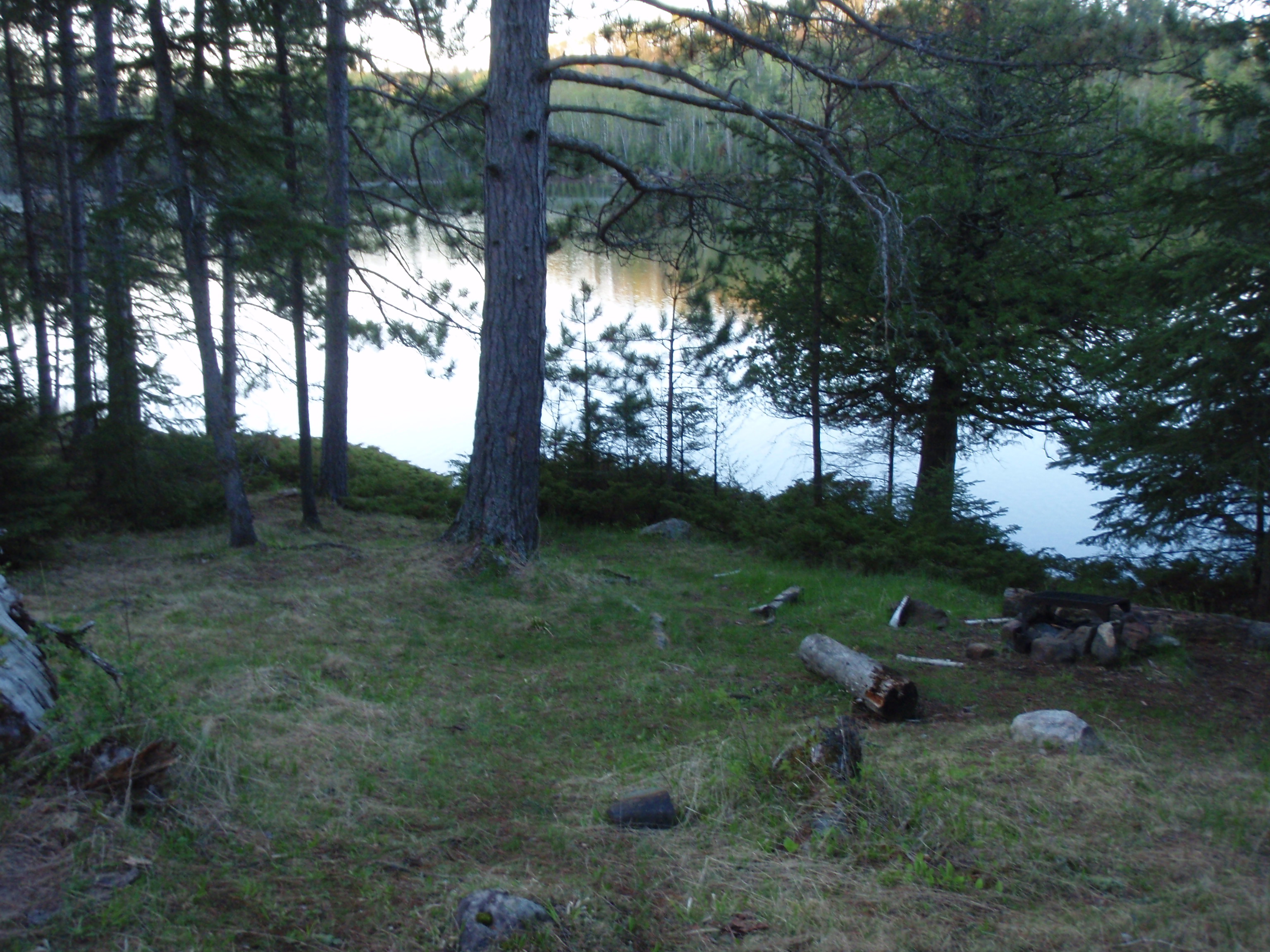
I kept going and saw glimpses of Parent Lake to the North. Then I found the cairn for the Snowbank Trail to the north. This is where Mike and Brook would have turned. I was thinking that I would make it out to Drumstick Lake to camp that evening. My next landmark would be the reconnection of the Bencoosin Loop Trail. But I didn’t make that far. I met up with Jerry Swanson and his wife. Each of them were carrying a lopper for cutting branches. They were finished trail clearing for the day and were headed back to their campsite on Parent Lake. I asked them if I could join them at their campsite and they said yes. I figured having some company that evening would be good for me after getting lost the night before. So we went back to the Snowbank Trail and headed 1/4 mile north to the campsite. But that 1/4 mile was really hard because it’s a lot of up and down.
Jerry said he was wondering about me and I told him about getting lost using the trailhead off of Fernberg Rd. I was setting up my tent when Joe Johnston and Rachel, Swanson’s daughter arrived at the campsite. They had the crosscut saw and had been cutting the bigger obstacles on the trail.
It turns out that they all have Scouting backgrounds. The Swanson told me stories of their Troop coming to the Boundary Waters. We had a really nice evening together.
Sunday, May 24, 2009
Kekekabic Trail, Parent Lake to Strup Lake
I woke up a couple times during the night because I was cold. I decided to empty out my backpack and put the bottom part of my sleeping bag into the backpack. It’s kind of a make shift sleeping bag cover. I woke up in the morning when I heard the Forest Service Radio that was in Jerry Swanson’s tent. Trail Crews have a 7 am check in time with the Forest Service. I asked Jerry to ask the forest service about the weather, and he said they have a weather service frequency on the radio.
It was cold so I got out of the tent and started a fire. An official forest service campsite has a forest service iron fire grate and a latrine. The campsite I saw yesterday at the Bencoosin Loop Junction wasn’t an official campsite because it had neither. Rachel got out of her tent and immediately came to the fire to warm up. She was so glad when she heard the crackling of the fire from her tent.
She started putting some bigger logs on the fire, but I said that I wouldn’t be there that long so I didn’t want to put any bigger stuff on the fire. She put the bigger logs on the fire and said she would tend to the fire after I left.
Jerry had checked the Weather Frequency on the radio and said that it was supposed to be good weather today but tomorrow was supposed to have thunderstorms. He told me to cover as much ground as I can today.
Soon everyone was up and we were making breakfast. They gave me some hot water for my “coco-oata.” This is a concoction I make with two packs of instant oatmeal and some hot chocolate all mixed together. I packed up. I gave them some stuff I didn’t feel like carrying anymore. They gave me some of their extra food. And off I went. I think it was around 8 am when I left.
I hiked the hard 1/4 mile up and down segment of the Snowbank Trail to get back to the Kekekabic.
The Kekekabic at that point was really easy hiking because it had been just cleared by the Swanson Crew. After I passed the reconnection of the Bencoosin Loop Trail, I met up with a group of 5 backpackers who were from Michigan and New York. I asked them where they started and they said they started 15 days ago in Grand Marais. Wow, I thought. They said this was their last day and they would be hiking out to the Snowbank Road Parking Lot. They asked if I had seen a Green SUV there, and I said I saw some vehicles in the parking lot but couldn’t remember what color they were.
I offered to look at my camera where I had a photo of the Trailhead, but they said it wasn’t necessary. I asked them if they stopped at the Gunflint Lodge, where I was planning on stopping, and they said yes. I told them that this part of the trail was pretty clear because I camped at Parent Lake with a Trail Crew that had just cleared it yesterday. I took their photo and gave them my card and went on.
At the time, I didn’t realize that one of the 5 hikers was Joan Young. She’s one of the best known thru hikers of the North Country Trail. According to her website, she has hike all but 900 miles of the 4600 mile trail. Plus she does a blog on the NCT website, and she has authored a book about the North Country Trail.
I made it up to the Drumstick Lake Campsite where there is a big sawblade from some sort of Forestry equipment marking the campsite trail. I decided this is where I’m going to take a break.
And this was also where I had the purification emergency. I went down to the lake to get water, then I came back to the fire grate, reached in my pocket, and all the purification pills were all over inside my pocket. There are two types of pills. One is for purification, and the other is the neutralizer to make the water taste good after purification. Both pill bottles had opened and the pills were all mixed in my pocket. I was thinking thank god my pocket didn’t get wet.
So I sorted out the pills and put them back in their bottles. I put the lids on tight, then put the bottles in a zip lock bag. I folded up the zip lock so the bottles would be separated. The purification emergency was over, but it took me an extra half hour to get it done. I used the outdoor toilet at the campsite and even took a humorous photo of me sitting on the pot
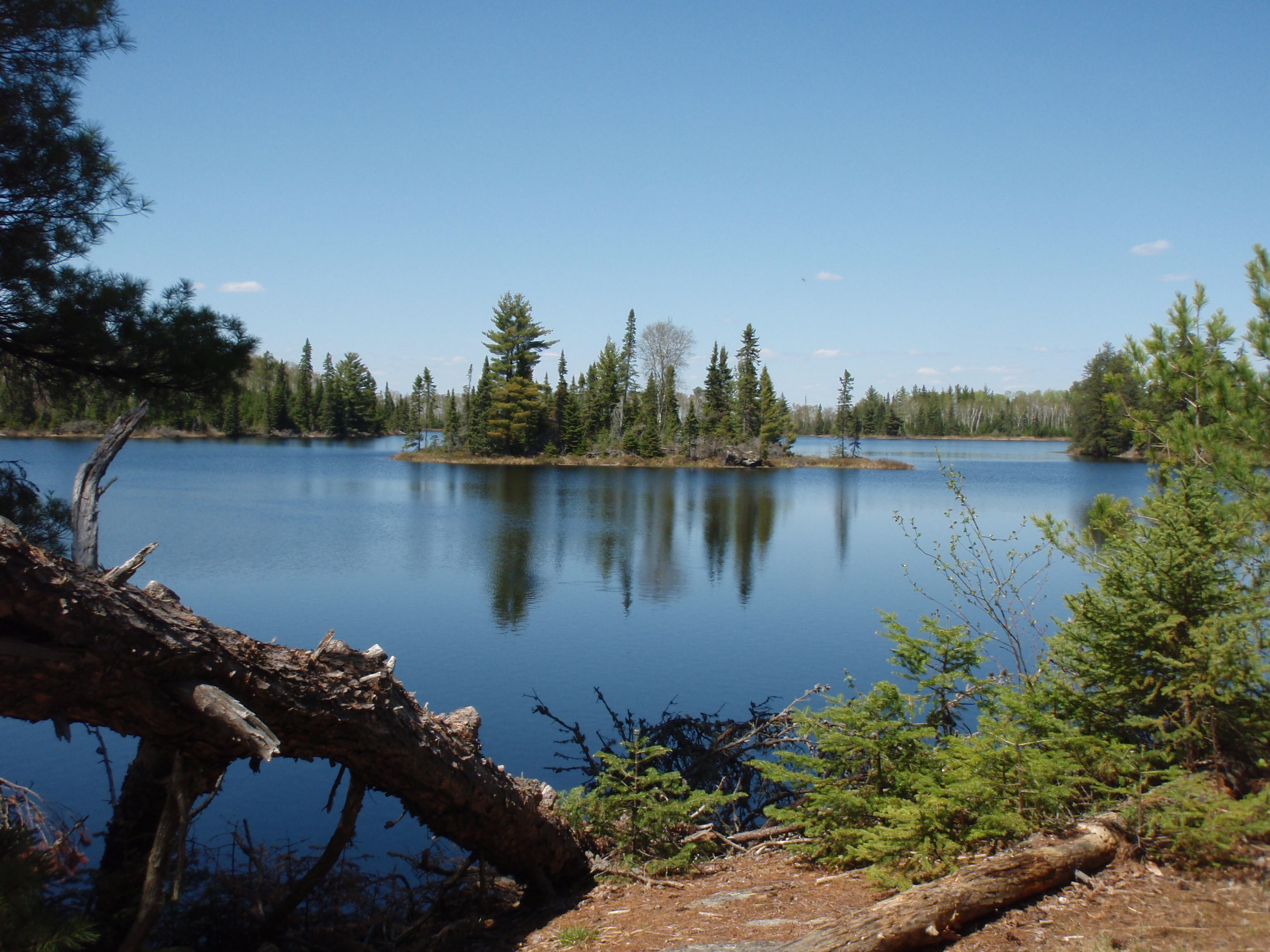
I went on and reached the campsite at Moiyaka Lake around 2 pm. This is a beautiful campsite on a beautiful lake. I took a seri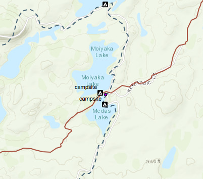 es of photos in hopes of stitching them all together for a panoramic photo. This was the prettiest campsite I seen yet. I took a break, ate some food and put out the beacon to mark my spot.
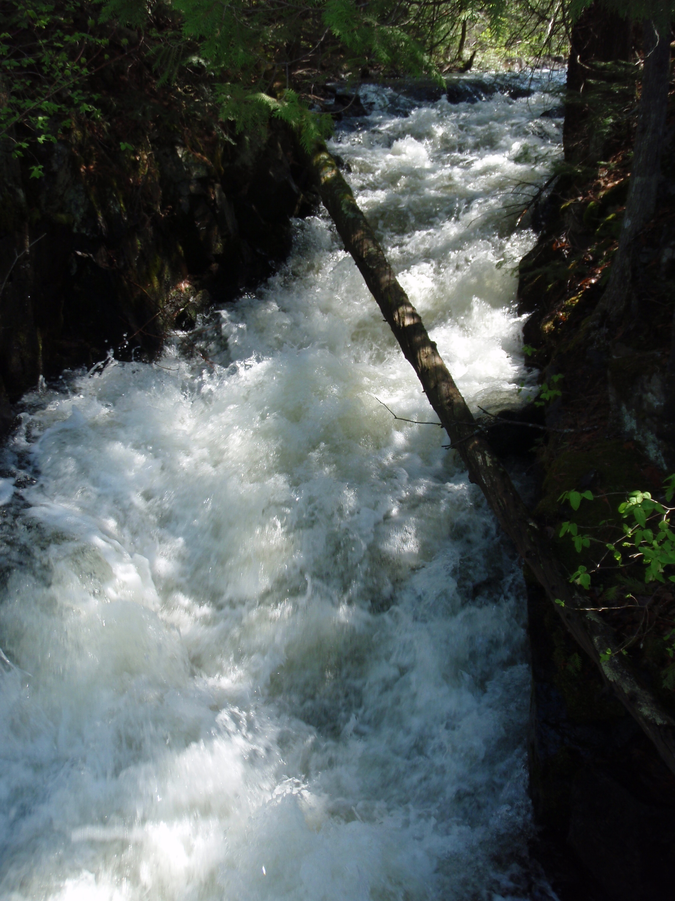
I hiked on and reached the Thomas Rapids. This is the place where Jerry Swanson had said that the Kekekabic Trail Club needs to build a bridge. He was right. There is a beaver dam and a series of rapids down from it. At one point there is a metal ring embedded in the rock. Maybe you are supposed to put a rope through it and cross there. But the water looked a little dangerous there.
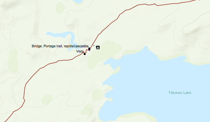
Instead I crossed above the beaver dam. The lake had a rocky bottom there, so I wouldn’t sink in and the water was about a foot and a half deep. Plus the water is calm there. After the crossing there is a portage. I lounged around on the portage resting for a while. Soon 3 men came by who were portaging. It was two middle aged men and one younger man that was college aged. I figured the younger man was one of the older men’s sons. I took their photos and gave them my card.
I didn’t look for the campsite that was supposed to be there. I just wanted to press on because there are supposed to be thunderstorms tomorrow. I looked at the map and it was a long stretch before the next campsite. It was around 5 pm so I still had around 4 hours of light. I decided I would hike to the next campsite. So I set off. “Go for the Gusto” I said to myself.
I came to a place where there are 3 beaver dams in a row. Each beaver dam was about 50 yards from each other. I believe this is the spot that Cory Munsen had warned me about. He said after the beaver dam you have to look around to find the trail. But I was having trouble figuring out which beaver dam to cross. I finally crossed one, and took a while to find the trail again, but I did.
Then I started walking in what I’m now calling the “big wicked thicket.” This part of the trail almost broke me. The brush is closing in on the trail, there are lots of gnarly downed trees, there are lots of wet areas to walk through and there’s moose droppings every ten feet. The moose must like the trail because the brush around the trail is thick. How can a big moose possibly walk through that thicket. The brush is thick and it’s closing in on the trail. I walked through these conditions for hours.
At one point I saw a portage cross the trail, so I thought I must be getting close to the Strup Lake Campsite. On the map it shows a portage then a campsite a little ways down. But I never saw the cairn for a campsite. I figured the portage must have been one of those unpublished portages. Cory Munsen had told me that there are sections of the Boundary waters that are called Primitive Maintainance Areas. In these areas they don’t publish the portages on the maps because they want to protect these areas.
Then I finally saw a Cairn and some ribbon marking a junction in the trail. I figured that this must be the trail for the campsite. So I went down the trail and there was no campsite. The Trail just kept going and going. Plus, there were plenty of big downed trees in the way. I set my gear down and walked back to the cairn. Evidently, the cairn was just there to mark a turn in the trail. The trail going forward didn’t look like it amounted to much.
I was convinced I was on the Kekekabic Trail, mainly because there are no other trails around.But the trail wasn’t getting any better. It was one big thicket, with downed trees and wet spots.
I kept going and going. If there was a clear section of the trail I would walk real fast, saying to myself that I needed to get somewhere. The light was fading. I was looking for anyplace big enough to set up a tent. But there was no such place. I thought I somehow must have missed Strup Lake. I must be way past it. This was becoming a little worrisome.
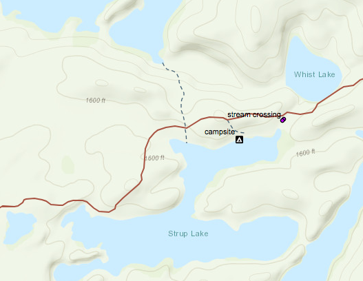
Then around 8:45 when the light was really fading I came across a portage. I traveled down the portage to the lake. The landing of the lake was big enough for me to pitch my tent, but it’s very rocky. I thought that this is where I’m going to camp for the night. I set my gear down and started looking at the map to figure out where I was. I looked at the lake and saw it’s shape and it kind of looked like Strup Lake on the Map. Could it be? If so there would be a campsite down a ways from the portage. So I left my gear at the portage, and hiked back to the Kekekabic Trail. After hiking about 6 minutes down the trail I found the cairn for the campsite. I was so happy.
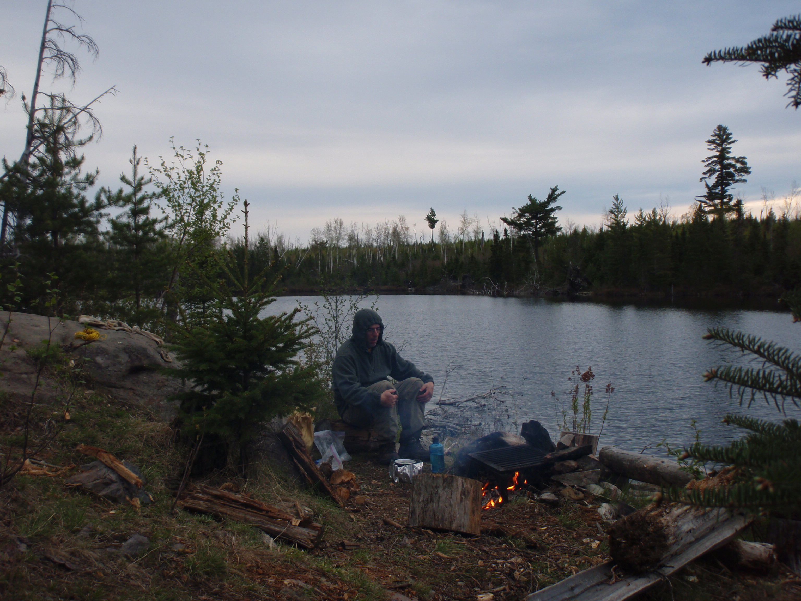
I hauled my gear to the campsite and immediately set up my tent and started a campfire. I also threw the rope up over two trees for the bear bag, even though I wasn’t going to hang the bear bag for a while yet. This campsite had the perfect little set up for cooking. It had this 4 foot high rock ledge that was good for putting your food and other gear on. Down from this rock about 7 feet was the fire grate area, and just down from that was the lake. I set out my food that I was going to cook on the rock ledge. This rock ledge was about ten feet across. It was pretty much dark out by now. When I was working on the food, all of a sudden I saw a mouse scurry across the top of the rock ledge. Then I saw another one. I thought to myself maybe this isn’t the perfect set up for cooking. Or maybe the mice think it’s the perfect set up. Well, I bundled up all of the food except what I was cooking and put it back in the bear bag.
I ate, put the bear bag up, and called it a night. It was past 11 pm when I got to bed.
Monday, May 25, 2009
Kekekabic Trail: Strup Lake to Agamok Falls Campsite
Again I was cold during the night. I got up and I was in no hurry to get going. I made a fire and boiled water on the alcohol stove for a “Coco-oata.” While I was eating a Loon swam by on the lake, making its Loon call. It seemed like it was taking a tour of the lake. I was hoping to see a moose come down to the lake for a drink, but it didn’t happen. It seemed as though my Loon friend had made it back to its nest. I have a lot of looney friends, but this one was the real deal. So I packed up and left. When I left the campsite, I took a photo of me with the rock cairn. I was so happy to see that cairn the night before.
I continued to head east on the Kekekabic Trail. This part of the trail was much nicer than the big wicked thicket. It was not very wet at all. There was one little creek with rapids that you have to cross between Strup Lake and Whist Lake. There were no marshy areas, but there were a lot of going up and down hills, which can be a pain. There were some downed trees crossing the trail, but none were as bad as the ones in the big wicked thicket.
I made it up to the cairn that marked the Kekekabic Lake Trail. This was the former site of the Kekekabic Lookout Tower. The Trail heads down to Kekekabic Lake where there is a Ranger Cabin.
There is no lookout tower at this site anymore. I dropped my gear and hiked down the trail to see if I could find the remains of the tower, or a scenic overlook to shoot photos. I found neither.
Evidently, the Ranger Cabin was the place that Cory Munsen had hiked to a few weeks earlier. But I didn’t want to hike all the way down to Kekekabic Lake to see it. So I took the best camera shot of the Lake that I could, then I went back to my gear at the cairn. I start hiking away from the Kekekabic Lake Trail. This segment is mostly hiking top of a hill. I would see glimpes of lakes out in the distance, and tried to figure out what lakes they were.
I made it to Harness Lake where I saw a campsite next to the lake. I didn’t go in the campsite because there was a downed tree blocking the way. There were a few downed trees in the campsite. It looked as it needed to be cleaned out. But I knew it was a campsite because I saw the iron fire grate. I hiked down the trail next to Harness Lake, and pretty soon I saw a rock cairn marking the trail. This rock cairn was unusual because it had a bear skull on top of it. Maybe it was a moose skull.
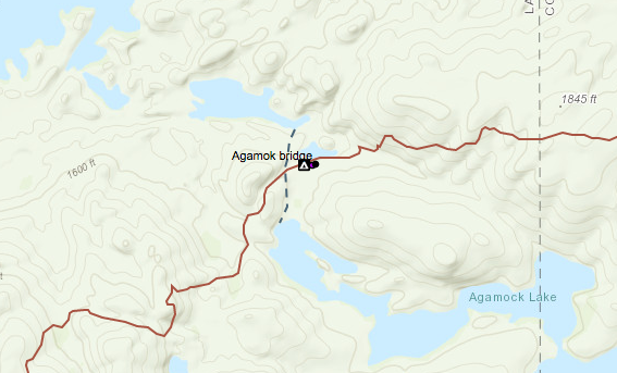
I kept walking and the trail continued to be fairly good. Again, there were lots of going up hills and down hills. Some parts of the trail were getting a little over grown with thickets. But it was paradise compared to yesterday evening. Again, I would see glimpse of lakes out in the distance. After walking a long time, I thought to myself that I surely must be coming up to the Aganok Bridge soon.
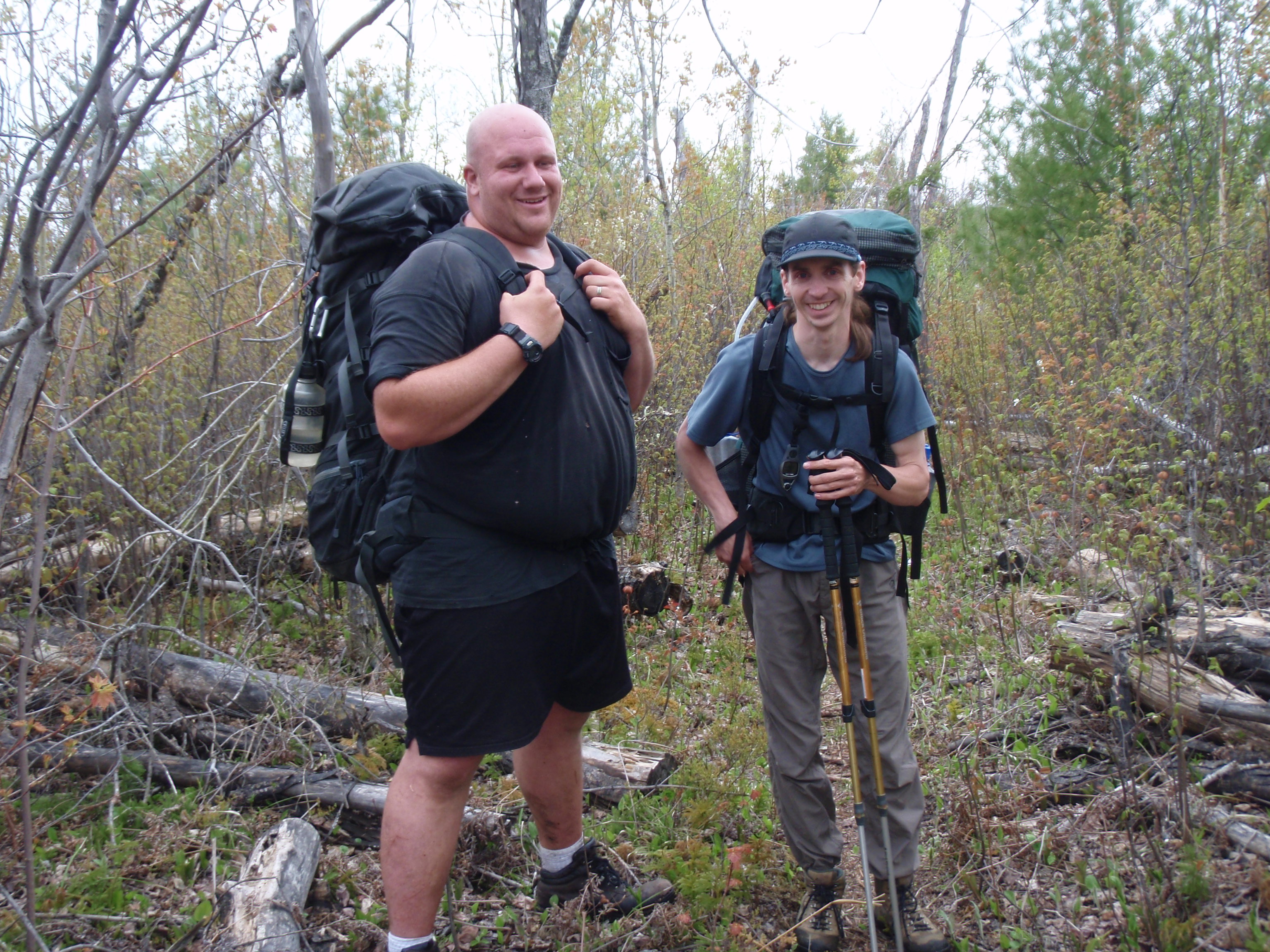
But then I met two young men who were backpacking west. One was a rather big guy with a bald head and the other was a small guy with long hair. They were from Owatonna, Minnesota, which is south of the Cities near Rochester. It was around 3:30 in the afternoon. I asked them how far the bridge is, and they said it’s about an hour and a half away. The said there is a real nice campsite right near the bridge. And that the next two campsites, the ones near Gabimichigami Lake and Howard Lake, didn’t look that good. I told them their next campsite is Harness Lake. When you get to the cairn with the skull on it, go down the trail another 200 yards and you’ll see a fire grate next to the lake. I told them that the campsite had several downed trees in it, so I didn’t know where they would set up a tent. The Big guy seemed to be carrying a lot of weight in his pack. But they were in good spirits. I took a photo of them, gave them my card and went on my merry way. (Mike, one of the two men, emailed me after the hike)
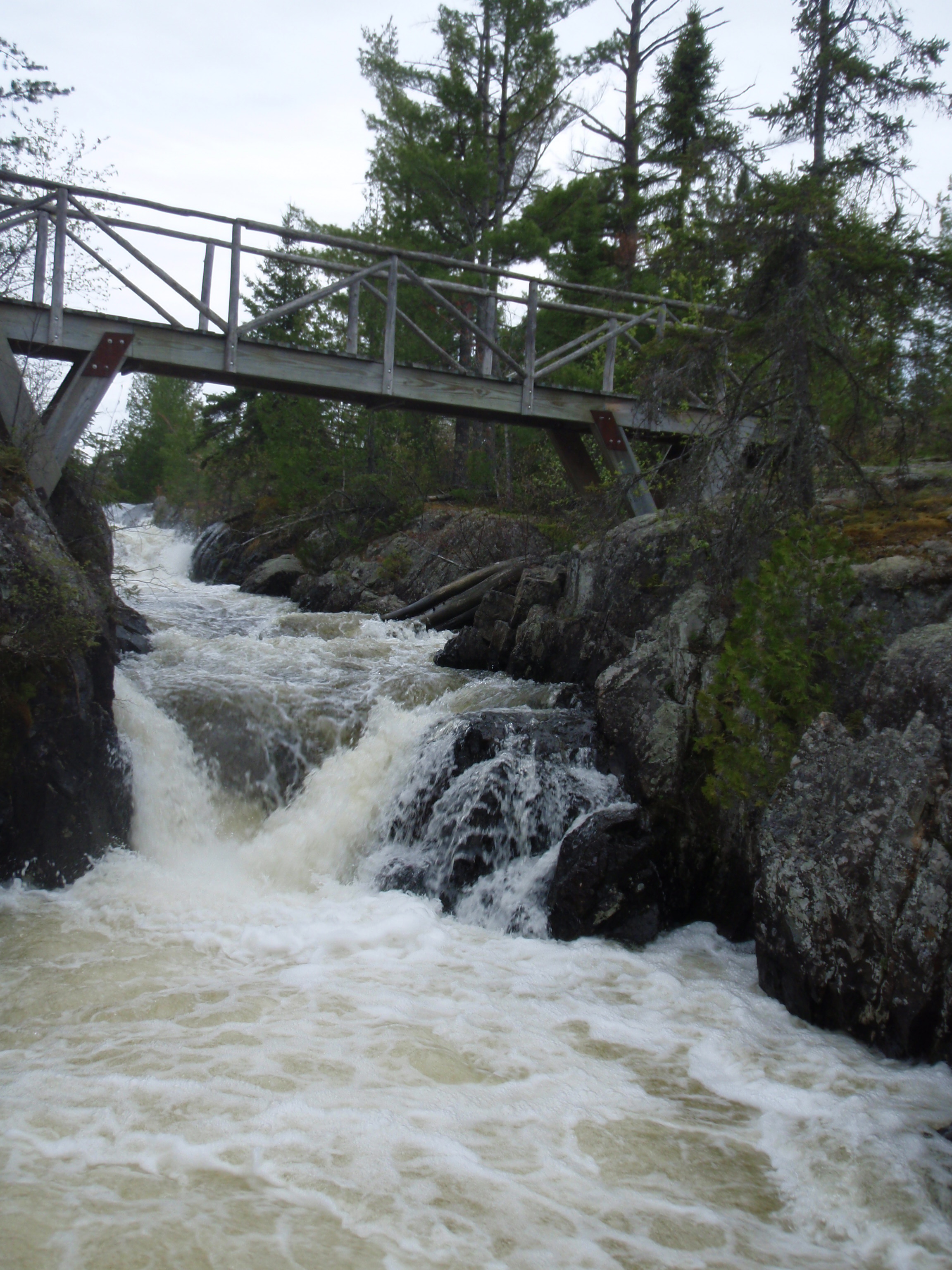
I was disappointed that Aganok Bridge and Aganok Falls were still an hour and a half away. But I pressed on. Again, the trail was pretty good with only a few obstructions. And it was up and down hills mostly with no swampy areas. I figured if it took them and hour and a half, it would take me two hours because they were much younger than me. And sure enough, around 5:30 pm I saw the portage and then the campsite then the bridge. I set my stuff down in the campsite and went to check out the falls, which are spectacular. Then I went to check out the campsite on the other side of the bridge. But I didn’t like that campsite nearly as much as the one I left my gear in. So I decided to camp where my gear was for the night.
I had stopped early, at 5:30 pm. I didn’t want to try to get to the Lake Gabimichigami campsite and have another incident like I had going to Strup Lake. My plan was to take it easy tonight, then get up early and hike out to the Gunflint Trail tomorrow. So I stayed at the Aganok Falls campsite. I was the only one there, so it was like I owned the falls for the night. I explored the area and took tons of photos.
It was a little windy, but there were no thunderstorms as predicted. The soil was rocky so it was hard to put stakes in the ground. So, I ended up putting rocks on my tent to help hold it down. When I went to bed found my first blister near my big toe. Other than that, it was a pretty good day.
Tuesday, May 26, 2009
Kekekabic Trail: Agamok Falls to the Gunflint Trail
I got up early, packed up, had a powerbar and hit the trail. I left Aganok Falls around 6am.
They were no longer my falls. I had felt that I owned them last night, because I was the only person camping there. Now they are free for someone else to come and claim.
My plan was simple. I would hike over to the Lake Gabimichigami campsite and cook breakfast there. I wanted to make some progress before I stop to make breakfast. Then I would try to walk out to the Gunflint Trail before the end of the day. So I worked my plan, but it wasn’t that easy.
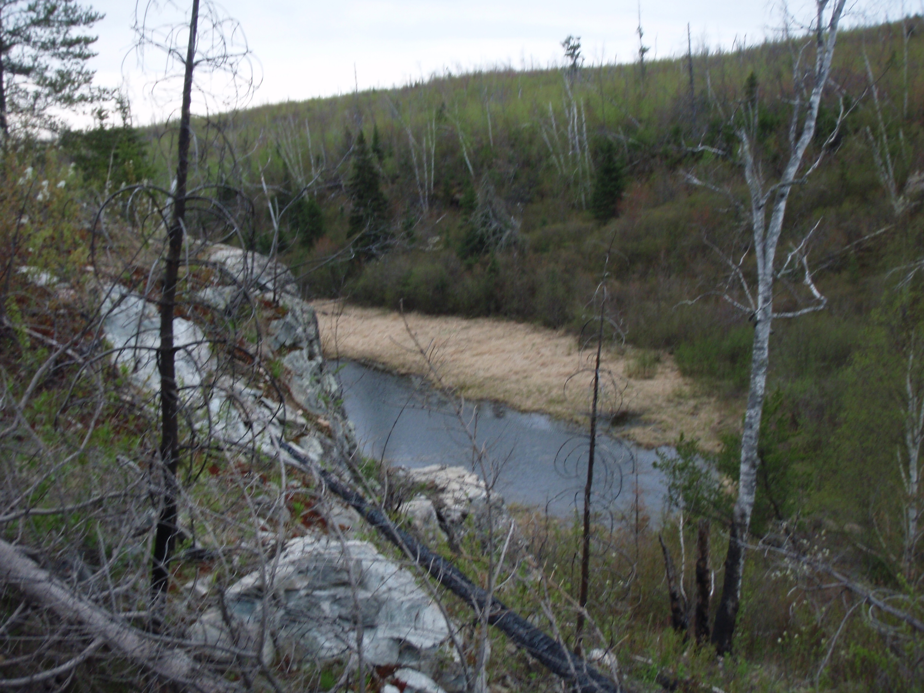
About twenty minutes after leaving Aganok Falls I reached a beaver dam and pond. Below the dam there was a small stream with little yellow water flowers. The stream was easy enough to cross, but after the stream the trail went up a gigantic hill. I started up the hill and every so often I would look back at the beaver pond and it kept on getting smaller. I thought I would be so happy when I made it to the top. But when I made it to the top, I wasn’t so happy.
There was another part of the hill that I hadn’t seen, that I had to go up. I looked back every so often and the beaver pond was still getting smaller. And I thought I was going to be so happy when I made it to the top of that hill. But I wasn’t very happy.
When I got to the top I saw another part of the hill that I had to go up. This was starting to not be funny. So I got to the top of that part of the hill, I realized that I was on top of everything. I wasn’t all that happy, just pooped out. And the beaver pond was really small when I looked down. From this vantage point I could see Gabimichigami Lake off in the distance, so that gave me some hope. That’s where I was headed.
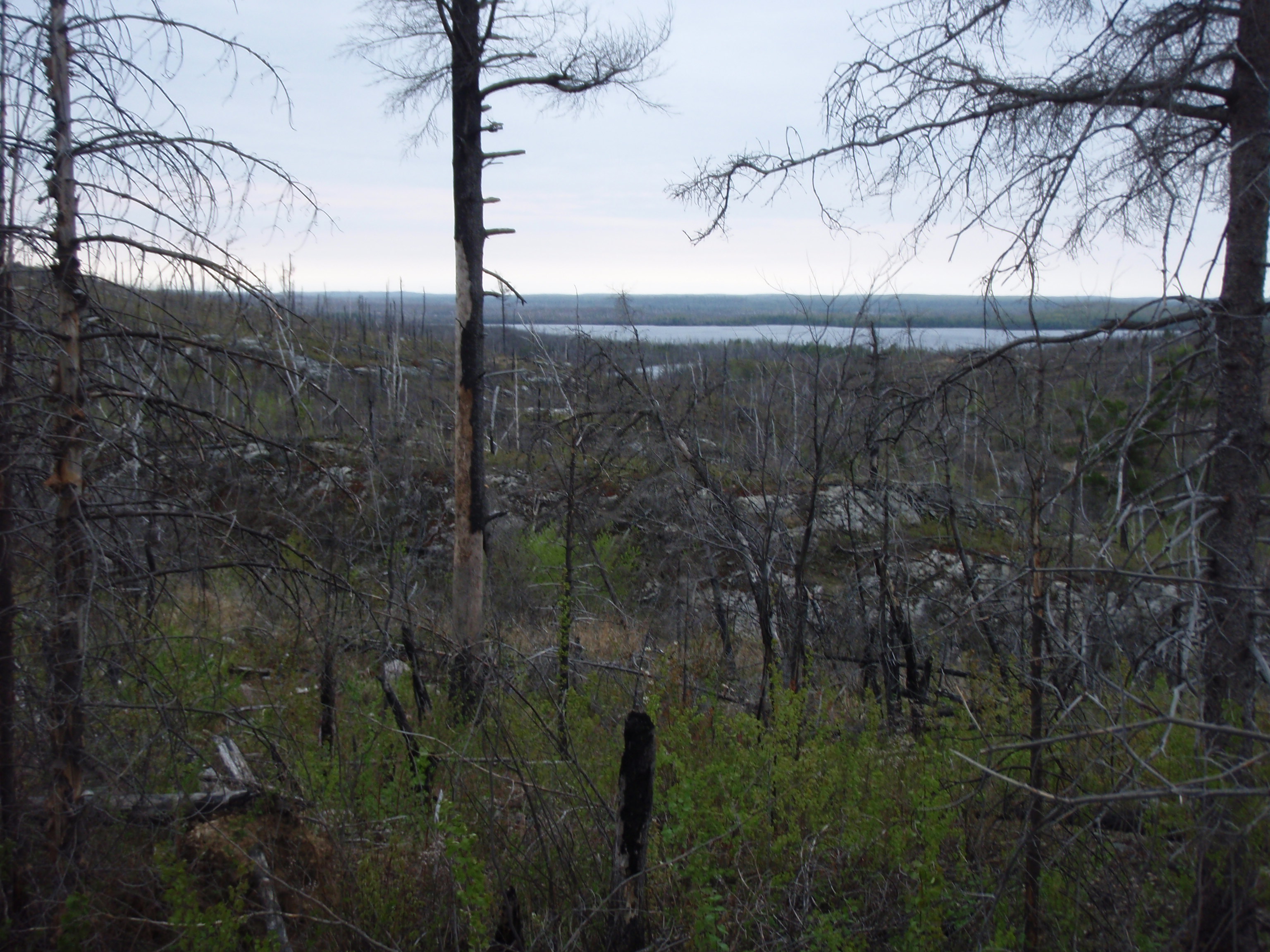
But the scenery on top of this huge bluff was different than I seen before. I was in the burn zone. It was a sad sight. Sadder than the clear cut area that I saw a few days earlier. It was a lot sadder because as far as you could see, everything was burnt. But after I got to the top of the hill is was easy walking because you were walking across the top of all theses hill. There were very few obstructions on the trail because everything was burnt up. Sometimes the tread of the trail was a little hard to follow, but they had ribbons marking the trail.
Jerry Swanson had said that the burn zone was marked with ribbon this spring. I assume that was after Nimblewill Nomad had backpacked the trail in early April, and he reported on his website that he was having a hard time following the trail. But when he came through here there was still snow on the ground. Maybe they marked the trail because two hikers from Duluth were lost on the eastern part of the Kek last October. Whatever it is, I’m the beneficiary of it.
On Sunday when I went through the big wicked thicket, I started to give nicknames to stuff. The big wicked thicket was an example of that. At that time I started giving the Kekekabic a new nickname.
At first I started calling it the keke-butt-kick because it was kicking my butt. Eventually that transformed to Get-your-butt-kicked. Yes, on Sunday, I was definitely on the Get-your-butt-kicked Trail. But now I felt much better. I was getting into a groove where I thought I could handle the rigors of the trail. I was getting closer and closer to Gabimichigami Lake. I even started giving it a nickname. I called it the Get-a-hug-from-your-mommy Lake. The Lake was getting bigger and bigger as I got closer to it.
Hiking was good on top of that hill. Eventually the trail went down through a little valley with rock faces on each side. Then I got to a point where I could see the northern arm of Gabimichigami Lake and nothing much else. I made it around the northern shore and came to the campsite. I looked at my watch and it was 8:30 am. I thought I made really good time getting over there. As planned I made breakfast at the campsite. Again it was the Coco-oata. The tent pads at this campsite were a little rocky, just as the hiker said the day before. I ate breakfast, packed up and left the campsite by around 9:15 am. I was off to Howard Lake.
Again the trail went up to the top of a hill, but it was a nice gradual walk up this time. I saw some lakes down below me, but I wasn’t sure if it was still Gabimichigami Lake or if it was Howard Lake. But soon I was able to see the northern arm of Howard Lake. I hiked up to it and hiked around the northern shore to the campsite. Again the campsite was pretty bumpy as the hiker had described it the day before. But all this site needed was a little clearing out. There were a few flat spots that would be good for tent pads if the brush was gone. I made it over there by 10:30 am. I was making good time.
I passed the campsite and got to a spot where there was a flat rectangular shaped rock up from the shoreline of the lake. I stepped up onto the rock and took a series of photos of the lake that I’m in hopes of stitching together for a panoramic photo. Although, it might be a dreary panoramic photo because Howard Lake is surrounded by the burn area.
It seemed like I was hiking away from Howard Lake for a long time. I wanted to see Chip Lake, which was the next lake, but I was continuing to see the eastern arm of Howard Lake. Finally I did make it up to Chip Lake, which was about 100 yards south of the trail.
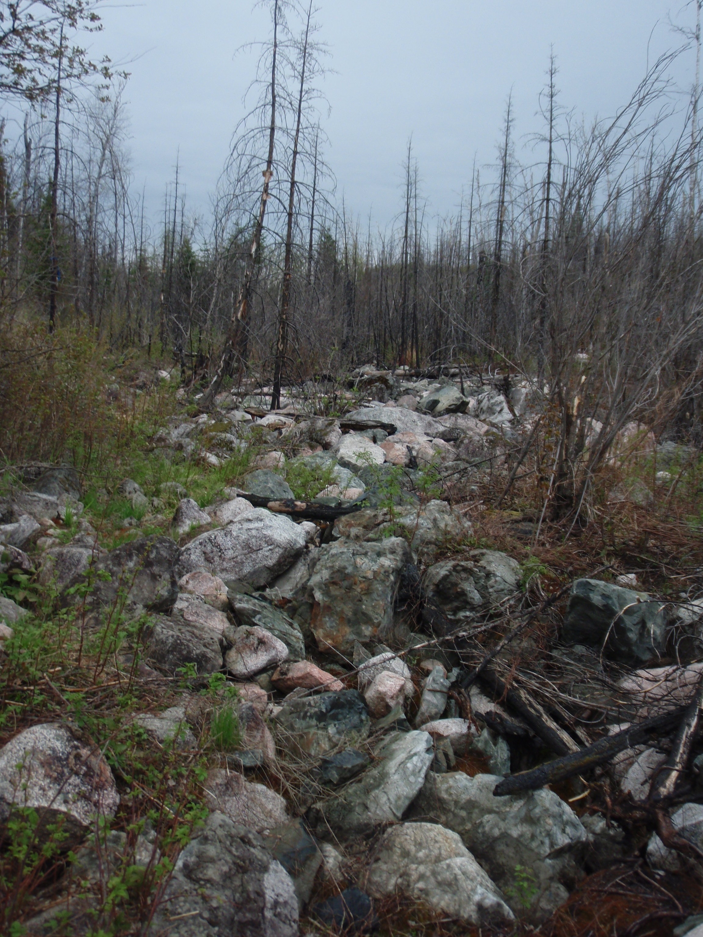
After Chip Lake, the trail runs down into a valley on the approach to Seahorse Lake. And this valley has all sorts of stuff in it. During one portion of it there is a long rock field where you have to walk on top of the rocks. There is a large marshy area, where I didn’t see the tread of the trail and I couldn’t see any ribbon markers either. I just kept walking in the same direction down the valley and eventually I saw another ribbon. And when you get closer to Seahorse Lake, there is a creek in the valley that you are waking next to.
The Trail skirts the edge of Seahorse Lake then crosses above the lake on an old beaver dam. The reason I think it’s called Seahorse Lake is because it’s kind of shaped like a Seahorse. Then you go up a smaller hill this time and are hiking parallel to the Chub River that is a ways down the hill from you. You get closer to the river and join a portage between the Chub River and Warclub Lake. This portage is to avoid some rapid and rocky areas of the river. I kept following the portage and missed the turn off to cross the river. When I got to the end of the portage, I was wondering where was the right place to cross, then I back tracked and found it. It was an easy crossing. I also believe that the reason Warclub Lake is called that is that it’s shaped like a Warclub.
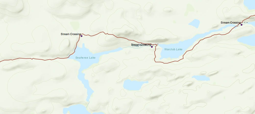 Once I crossed the river, it started to rain. I found a nice pine tree on the side of a hill to set my gear under. I set out the beacon, put on my poncho and had lunch. It was the peanut butter and bagel combination and some trail mix. After the beacon sent it’s message, and I refilled my water bottle, I headed up a small but steep hill. Now I was walking parallel to the shoreline of Warclub Lake, but up on the hill. Then down near the handle of the warclub the trail descented down to the lake again. Then it turned into a river again. I suppose it’s still considered the Chub River.
Then the Kekekabic Trail follows the portage between Warclub Lake and Fay Lake. Again, I kept following the portage and missed my turn off. I backtracked and found the turn off. It wasn’t well marked. The trail went up a small hill between Fay Lake and Glee Lake. I wondered if Fay Lake was called that because it looked like Fay, whoever she was.
By this time I was completely soaked because it kept on raining, and I was still hiking through the burn zone, which got to old after a while. I got a glimpse of Glee Lake and continued on to Bingshick Lake. I could tell it was Bingshick Lake because there is a little pennisula of land sticking out in it., just like the map shows. I went past the first campsite on Bingshick, which was a huge site with plenty of areas to pitch several tents. After that there was this cute little stream that had several rapids that you cross. It was easy because there are lots of rocks in the stream.
Pretty soon II seen a green object up from the shoreline ahead. It took me a minute to figure out what it was, because the green wasn’t the same type of green as the grass. It was a tent, a dome tent. I was approaching the second Campsite on Bingshick Lake. When I got a little bit closer to the campsite I shouted out “Ahoy Campers, is there anyone there.” And someone answered me back.
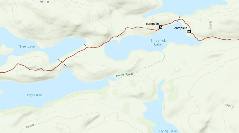
When I got up to the tent I seen the door open and there was a guy inside. He looked like he was trying to dry out. His name was Paul and he was from the Twin Cities. I asked him if he had hiked into the campsite and he said no, that his canoe was down by the lake. He had just arrived at the campsite less than a half an hour ago. I asked him what time it was, and it was 3:30 pm. He asked me where I was headed, and I said I was hiking out to the Gunflint Trail today and trying to make it to the Gunflint Lodge. I told him there’s a hamburger there with my name on it. He chuckled. Then I took his photo, gave him my card and was on my merry little way.
Paul was alone at his campsite. I thought that he was another Lone Ranger in the Wilderness just like me. I wondered if he was out fishing, or just canoeing. At any rate I continued on. At this point, all I wanted to do is get out of here. After a while I came upon a Boundary Waters boundary sign.
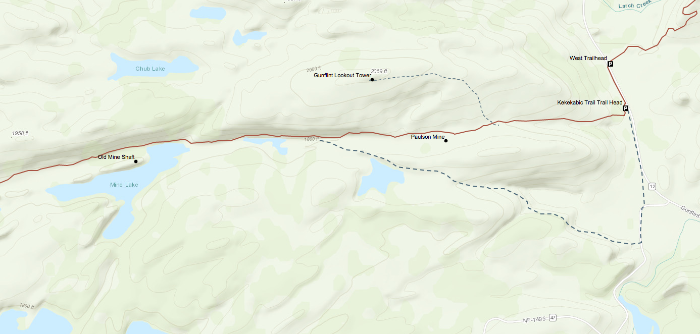
There was actually a sign here, because on Saturday near Pickerel Bay there was not a sign. I took a photo of me with the sign. I felt like I was making progress, I was out of the Boundary Waters. Now all I have to do is go past Mine Lake, then go past 3 beaver ponds, go up a little valley and I’m to the road. It’s less than 3 miles. Bada Bing, Bada Boom!
So I make it past Mine Lake and the three beaver ponds. I didn’t take very many photos because I wanted to get out of there, plus my camera fogging up. Also, I didn’t take any photos because I was running out of battery power. I had already used three batteries, and had only one left. My battery charger was sitting in a package waiting for me in Grand Marais. I figured I wouldn’t have enough battery power for the Border Route.
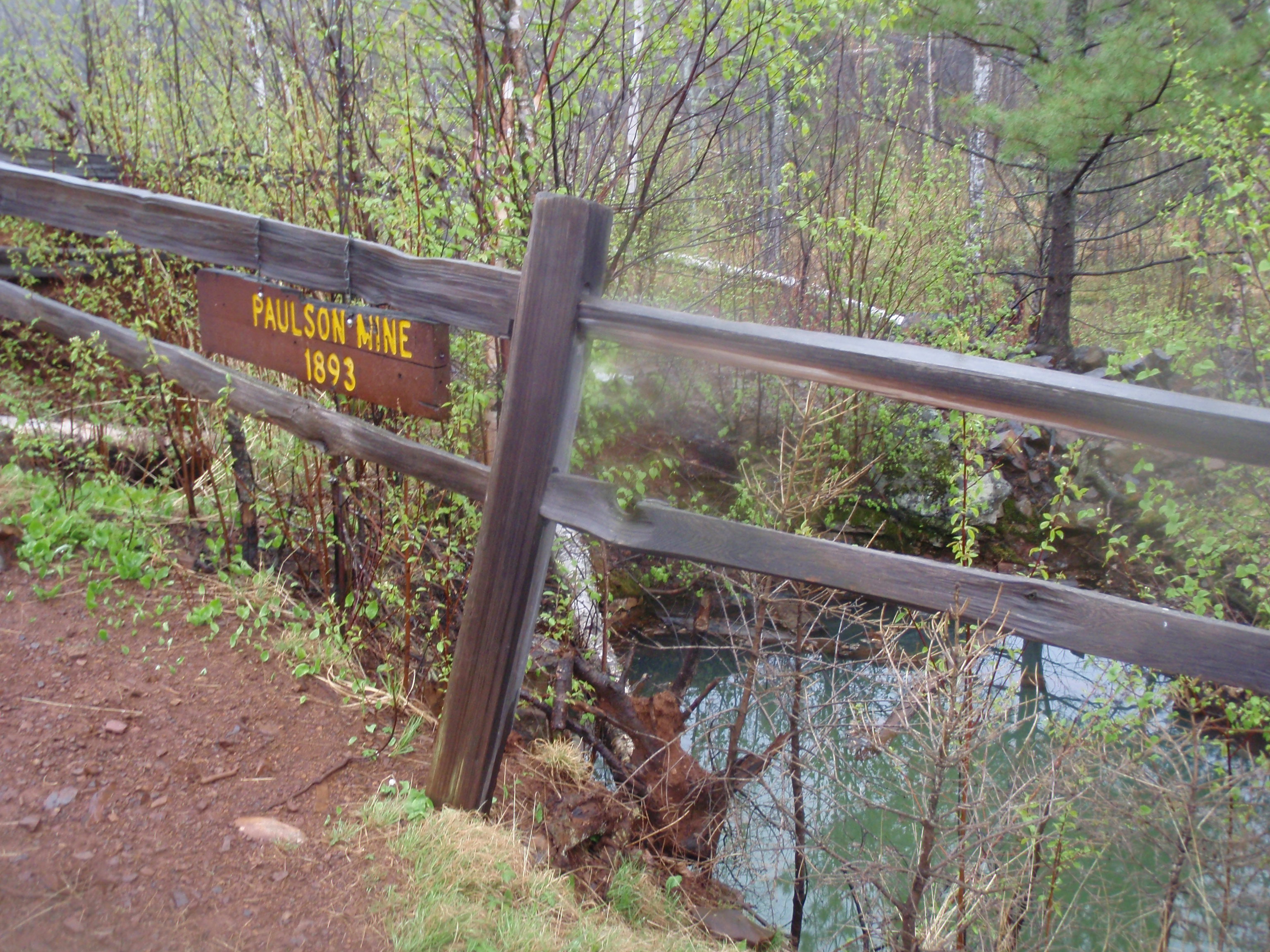
After I passed the third beaver pond, I thought I was getting to the end. But then I passed a 4th beaver pond, then a 5th, 6th, and 7th. It seems as though the beavers have been busy in this area, because it only shows 3 ponds on the map. Soon I was walking up the little valley towards the road. Down by the beaver ponds the trail was full of water. I looked at my shoes when I walked and every time I would step down, water would come up and go out of the boots by the shoe laces. Pretty soon I made it to an area that was fenced off with a wooden fence. It was the Paulson Mine, but it was filled up with water. The water was green, about the same color of Paul’s tent at Bingshick Lake.
Then I hiked a bit further a saw a sign pointing to the Old Gunflint Tower site, which was 3/4 mile away. Sorry, I wasn’t in the mood for any site trips today. Finally, I heard a car. Then I saw the road. At last I was done with the Kekekabic Trail. I took a photo of me triumphantly standing next to the Trailhead sign. I had conquered the Mighty Kek. Who got their butt kicked now?
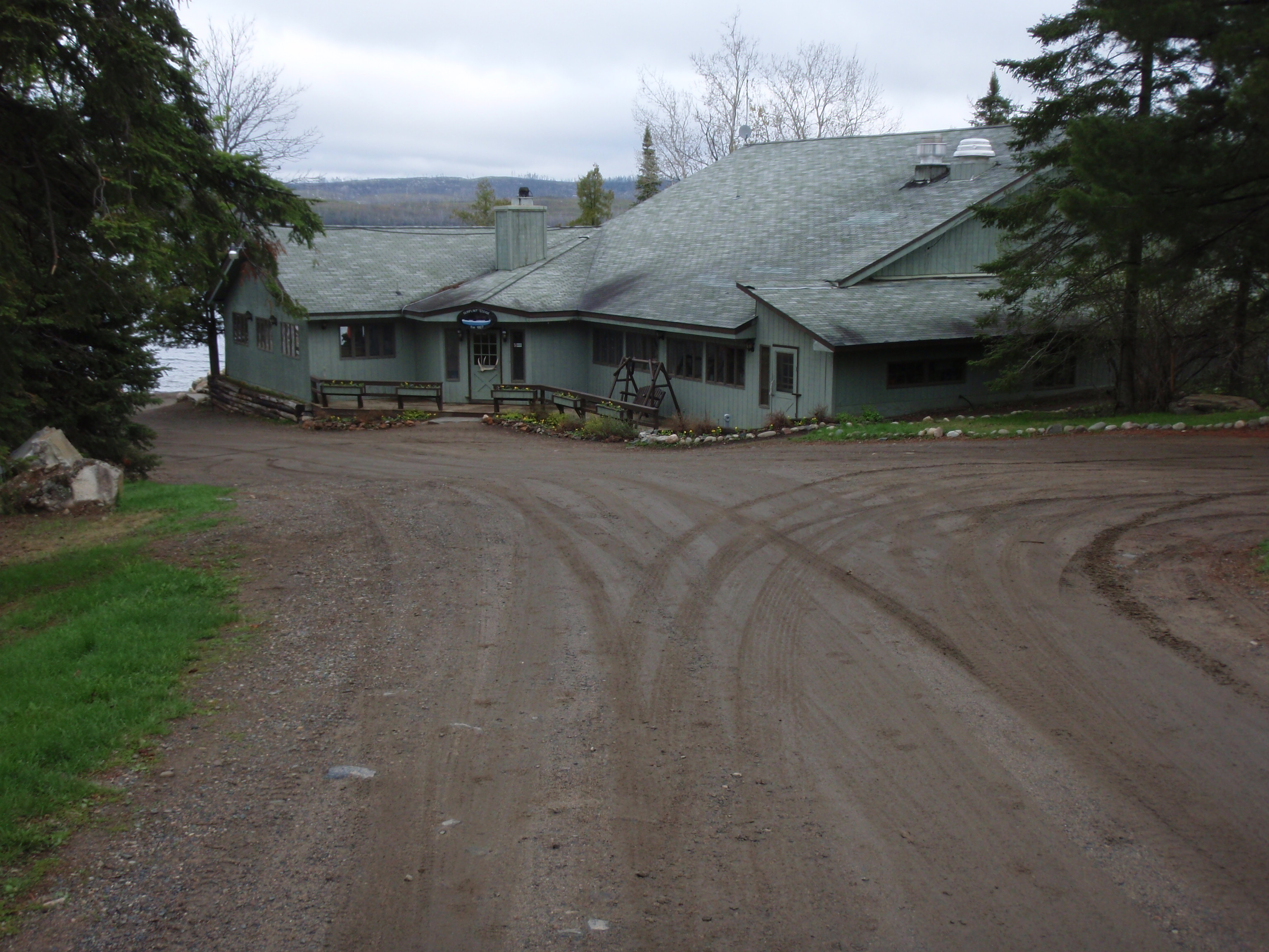
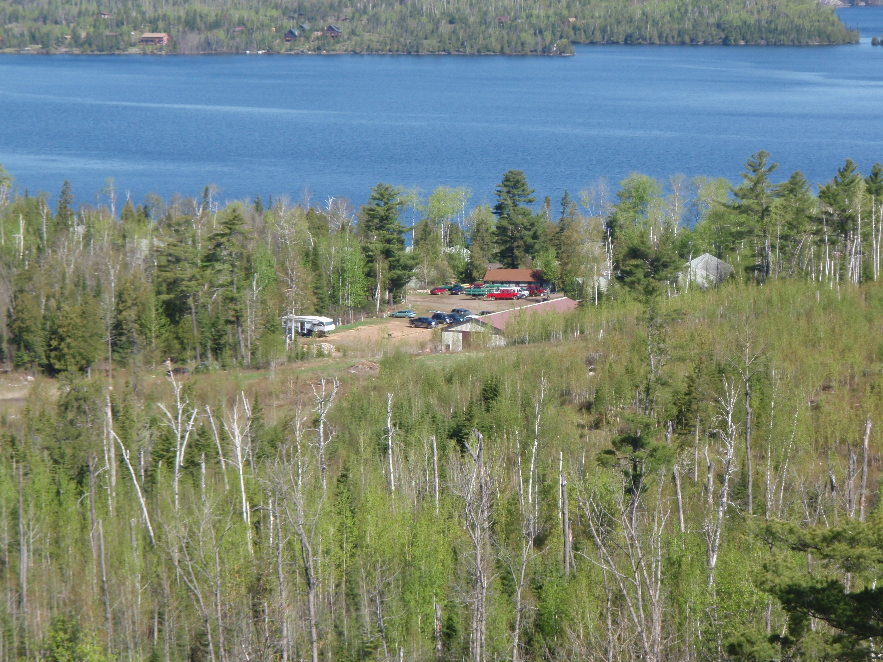
I started to hike down the road towards the Gunflint Lodge, but I really wanted to get a ride. After about 4 vehicles came by, someone stop. It was Kelly in a rather new pickup truck. I felt a little bad about messing up the inside of his truck with my wet clothes. But I was eternally grateful for the ride. He drove me right up to the door of the Gunflint Lodge. Kelly was a local resident, but I didn’t ask him what he did for a living. I thanked him, but should have offered to by him a beer or something. If he gets in touch with me I’ll send him a six pack of Spotted Cow.
I set my gear down and took off my boots in the foyer of the Gunflint Lodge. It was around 5;30 when I made it there. Then walked in to talk with the clerk. But before I got to the clerk, an older gentleman that works there came up to me and said “You’re here, we didn’t know if you were going to be able to make it today or if you would be camping near Mine Lake.” I was surprised that he had hearde about me. “we’ve got two messages for you and a package” he said “you’re getting quite the reputation around here.” I smiled and wondered if it was a good reputation of a bad one. Well I got the two messages. One was from Greg Mackler saying “Good Job,” and the other was from my sister and her family saying “Way to go!!, we love you.” Well, I was happy about getting the messages and my resupply package.
I was planning on staying at the Gunflint Lodge two nights. They have some bunkhouses that they rent out for $18 a night. I was glad to have the resupply package, but the package I really needed was sitting at the Grand Marais Post Office. My plan was to pick it up when I got to Grand Marais. But I needed the Camera Battery charger now. I asked the clerk what time they usually get their mail? And he said about noon. I told him about my package in Grand Marais, and whether he thought I could get it delivered tomorrow. He didn’t know, but he gave me the Phone number for the Grand Marais Post Office. He said there was a courtesy phone in the foyer and also in the Outfitters shower building.
So I tried the phone number and it was closed. My plan was to call there early in the morning. I asked the clerk how late the were serving food and they said the Bistro serves it until 9pm. So I had plenty of time. I told them that my boots were wet, and I was wondering if I came to the Bistro, If they would mind it I walked in with my wool sock. They said that was alright. I went back to the bunkhouse and unpacked. I changed my socks. My resupply package had some quart sized ziplock bags in it, so I put each foot with a dry sock on it in a ziplock bag. Then I put them in the wet boots. This is an old scout trick.
I should have showered first, but I was hungry so I went back to the Bistro. But an amazing thing happened when I got back to the Gunflint Lodge. The Older Gentleman came up to me and said he had a pair of shoes for me. And he would take my boots to some furnace room where they would dry. WOW!!! They must have been a pair of shoes that were in the lost in found, but they were great!!
I went into the Bistro to eat, and I parked myself at a table that was away from the other customers, because I was still very grungy. I placed the beacon outside on the patio. Then I order that hamburger that had my name on it. But I was embarrassed because when I the Waitress came over by me, a tic started crawling up my neck. I don’t think she saw it, but at any rate it was an uncomfortable moment. I went into the bathroom and threw the tick and 4 of his buddies into the toilet and flushed them. About ten minutes later I had to make another trip to the bathroom for some more ticks. I only had 1 tick on me up until today. I’m not sure why I had so many ticks on me now. Maybe the ticks thrive in the burn area.
The hamburger was great and was reasonably priced. Picked up the beacon, which sent the Okay message, then I went back to my bunkhouse and then to the shower house. While I was taking my shower, I kept finding ticks on me. This was no fun. After the shower and shave I went out in the hallway where they have a courtesy phone. I tried calling my sister and my mother collect. But I couldn’t figure out how to do it. I pressed 0 to get the operator and it didn’t work. Oh well.
Then I just went back to my bunkhouse and went to sleep.
Wednesday, May 27, 2009
Border Route Trail: Gunflint Trail to the Gunflint Lodge
I left my hometown of Madison, Wisconsin one week ago.
I woke up early and went over to the shower building and called the Grand Marais Post Office. I said I had a package there. The lady who answered the phone seemed to know about the package. I asked if they could have the package delivered to the Gunflint Lodge today. because it had my Camera Battery Charger. The lady said they could deliver it. That was great. It was 6 am and I already had one victory under my belt for today.
So I decided I would start doing a photo log of the photos that were on the camera card. I decided that I was going to send the camera card back to Keith, my sister’s husband and he could post some of them on my website. I started the log at breakfast at the Gunflint Lodge. But, also at breakfast I met Tracy and her son Daniel. Tracy looked to be in her 20’s or 30’s and Daniel looked to be 8 or so. Daniel was quite fidgety. Tracy said he had autism. I was showing Tracy photos on my camera. I went through the highlights of my trip, especially Aganok Falls. She told me that she was a nurse from Kansas City and that they were going on a 5 day, 4 night canoe trip. Daniel looked like he would be a little hard to control sometimes. She said he had good days and bad days. But they had already done lots of Kayaking, if fact Daniel had his own kayak. But this was the first time Daniel would be in a canoe. Man, I thought, this lady has a lot of balls for taking a potentially problematic boy into the wilderness. But it’s something she really wants to do.
I finished my fantastic breakfast, again at a reasonable price. I ask the Lodge Front desk clerk where the laundry facilities were. He said they didn’t have a Laundromat at the Gunflint Lodge, but less than a half mile down the road, the Gunflint Pines had a Laundromat. I went up to the Gunflint Outfitters Store. I was looking for a sleeping bag cover to keep me from getting cold at night. They didn’t have one, but they had a sleeping bag insert. It was more like a sheet, but maybe it would help. So I bought the insert and a T shirt. I asked Bonnie, the person that runs the Gunflint Outfitters, how much it would cost to have someone run me down to the Magnetic Rock Trailhead this afternoon. She said it was free for people who were staying there. Wow, again. I said I would have to do my laundry first. I also asked about how to make a collect call, and she said I had to dial 1-800-COLLECT. That’s what I was doing wrong.
So I went back to my bunkhouse and gather up my clothes. When I was coming out of the bunkhouse, Tracy and Daniel were outside. They were getting ready for their canoe trip. I offered to go down and take a photo of them launching their canoe. But she said they were going to Seagull Lake to launch. But I could take a picture of her and Daniel in front of the bunkhouse. So I did. And I gave her my card. She had a small SUV with two kayaks on top of it. I asked her if she could run me down the road to the Laundry, and she said yes. So she ran me down to the Gunflint Pines. That’s the last I saw of Tracy, I was hoping she’d email me to let me know how her trip turned out.
They have a real nice Laundromat there. But I needed some change and detergent, so I went across the road to the Gunflint Pines Store. This place is part food store, part liquor store, part outdoor supply store, part bait shop, part Ice cream stand and part coffee shop. And it had all sorts of moose and deer antlers on the walls, so it was part nature center too. I got my change and detergent and went back to the laundry. Since there was nobody there, I decided to do all my laundry, even the clothes I had on. I put on the new Gunflint Outfitters T shirt and wore the sleeping bag insert around my waist like a skirt. There was a table and chair there, so I sat down and continued working on my photo log for Keith. I had over 500 photos on the camera card. While I was there, Ron and Betty, two summer employees of the Gunflint Pines came and got their laundry out of the dryer. Then Jen, a guest at the Gunflint Pines came and started her laundry. But she left, and I was able to get my pants back on after they dried. When I left I met up with Jen again. She said her husband and two boys were out fishing and she was enjoying the peace and quiet. I gave her my card and took a photo of her at the Laundromat.
I hiked back to the Gunflint Lodge and started getting ready for my day hike. I put a few items in my backpack, like the first aid kit, the water bottle and some snacks, then I headed down to the Gunflint Lodge to get the boots that were drying. They said the boots were up at the Gunflint Outfitters by their fireplace. It was past noon so I got my package and went back to my bunkhouse and started charging batteries
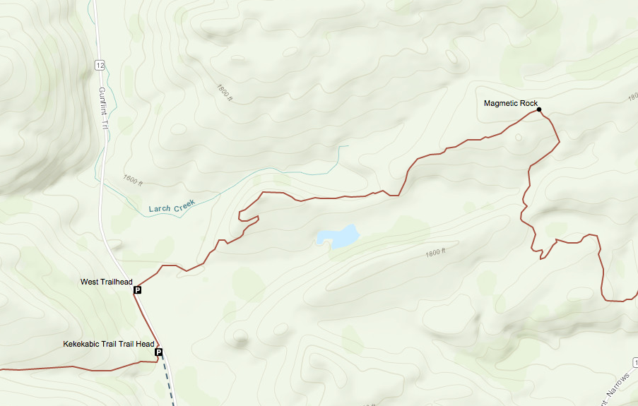
Then I went up to the Gunflint Outffitters and picked up my boots. They were dry!! I put on the boots and Bonnie arranged for Hudson to take me down to the Magnetic Rock Trailhead. The Trailhead was only about 200 yards down the Road from the Kekekabic Trailhead. So it was about 4 or 5 miles from the Gunflint Lodge. But, it’s about 8 miles hiking back on the Border Route Trail. The Magnetic Rock Trail is part of the Border Route Trail. I know that’s a little confusing, but it happens a lot. In fact, the Kekekabic Trail, the Border Route Trail and the Superior Hiking Trail are all going to be a part of the North Country Trail. Did I confuse you some more. Well, nevermind all that.
I had arrived at the Trailhead around 1:30 pm. I took a photo of myself at the Trailhead, then headed down the trail. I came to a spot where a stream had cut its way through a rocky area. It was really cool looking. I was in the burn area again. The area around the Gunflint Lodge was not burnt. It must be an interesting story on how they saved that area from the fire.
I continued down the trail and it started to go up next to some rocky ledges. You could see the valleys below, with little pothole ponds in them. Then there were more hills past the valleys. There were lots of burnt up rocky hills and valleys, in every direction, everywhere you look. There are several places where you can go up to a rocky ledge and look down. You walked across big rocky slabs with interesting patterns on them. There were plenty of rocks and boulders to be seen. Most of them were either white or gray in color .
But which one of these rocks was Magnetic Rock. According to the Border Route Guidebook, Magnetic Rock was an orange colored 40 foot high monolithic rock that looked like something from 2001: A Space Oddessy. I had not seen anything like that yet. I kept on following the trail on a ridge with rocky hills and valleys to be seen everywhere.
Soon, off in the distance I saw a big thin flat rock standing straight up. Could this be Magnetic Rock. Yes it was. The closer I got to it the more amazed I was. It was totally different than all the other rocks around. This rock was thin, jagged and standing straight up. All the other are rounded.
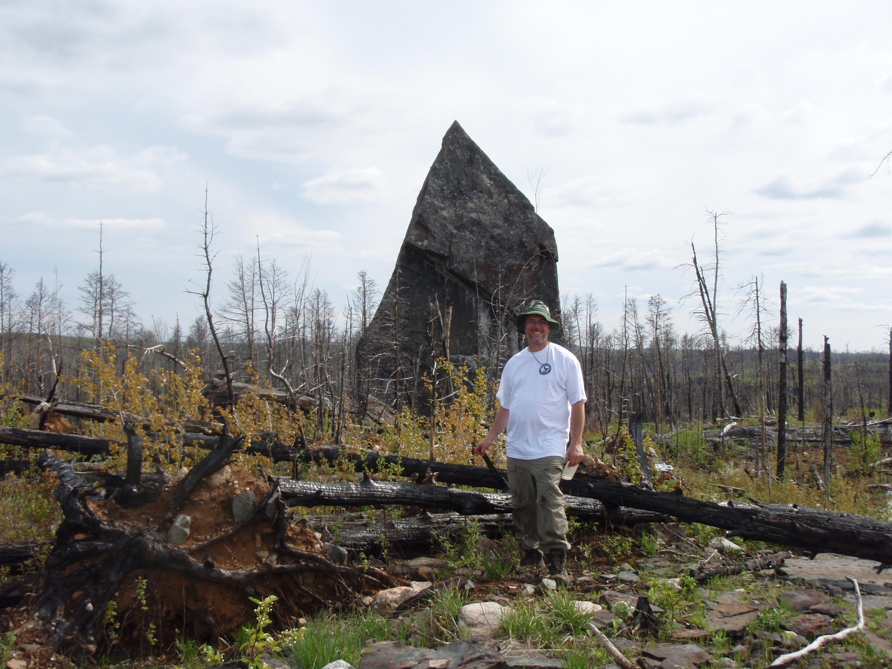
It’s though god had thrown his giant razor blade, and it ended up here. I must have spent a good half an hour taking photos around Mag Rock.
There are so many footpaths around Magnetic Rock, that it’s hard to figure out which one is the Border Route. I checked the guidebook and it shows the trail turns right before the rock. I went back a ways and found the trail. The trail heads east down a valley from Mag Rock. You go past several rocky outcroppings going down valley. There were also a couple downed trees across the path.
Soon you are hiking up a hill again, but It’s not bad. And it’s the same thing as before Magnetic Rock. You’re hiking past rocky ledges and seeing rocky hills that are all burnt up. And you’re also seeing small ponds in the valleys. In one section of the trail you go down by a small pond with the yellow water flowers in it. But then go up a hill where you can make out a road in the distance.
You see a straight ribbon of land down below you. I saw a car go by, so I knew it was a road. Up there you are also getting your first glimpses of the western end of Gunflint Lake.
Soon you are crossing the road, and then the Border Route joins a Ski Trail. It is very easy walking here, but the rest of the trail wasn’t very hard either. Soon you’re seeing more of Gunflint Lake and you are seeing more ski trail junctions. But I followed the ski trail I was on right down to another road. This Road was at the western edge of Gunflint Lake. The Border route turns Right on the Road, crosses a bridge then turns right again. I came up to the bridge and there were two men fishing. It was Phil and his son, they were vacationers who weren’t having much luck fishing.. The bridge they were standing on was crossing the Cross River. I asked Phil what time it was and he said 6 pm. I took their photo and gave them my card then went on.
After the Bridge the Border Route turns right and goes westward for a ways then it turns east and comes back across the road down about a third of a mile. I decided to skip it and just walk down the road until it reconnects. Phil had said it was 6 pm. I was really making slow time. But it was supposed to be a day of rest so I was taking it easy. But my attitude changed now, I wanted to get back. So I walked down the road and reconnected with the Border Route. The trail is still a ski trail. And the map shows the ski trail zig zagging around. I came upon a foot trail that I thought was a short cut to skip the zig zag, and sure enough it was. It met up with the zag part of the trail. Pretty soon I saw a trail going up an electric line right of way that I thought would be a short cut up to the road, and it was. Then it was just a short walk down the road to the Gunflint Lodge. I had made great time since seeing Phil and his son at the Cross River Bridge. And all my short cuts worked out.
When I got back to the Gunflint Lodge, I made the same mistake as the night before. I went right to the Bistro and ate. I really should have taken a shower first, but I wasn’t nearly as grungy as the day before. But at the restaurant I kept finding ticks on me again. I had taken several precautions on the hike, but to no avail. I usually have chicken or fish when I go out to eat, but I had a hamburger again.
At Supper I devised a new plan for my hike. I wanted to hike all day Thursday and Friday, and on Friday hike out to the Clearwater Lodge. Then Saturday could be a rest day. I would send my supply package on Thursday, and since it’s a local delivery, maybe I could get the post office to deliver it to the Clearwater Lodge on Friday. I called over to the Clearwater Lodge and told the lady my plan. She said that they have a Screen bunkhouse that she would rent to me for $16 a night. She said my package and directions to the Screen Bunkhouse would be waiting for me on the porch of the Lodge, because they would be closed by the time I got there on Friday. Boy, I said to myself, she doesn’t have very much faith that I’m going to get there very early.
With this new plan, I would only have to carry 2 to 3 days worth of supplies instead of the 6 or 7 days worth to get to Hovland. Going to Clearwater would add 3 miles each way to my trip. But it would be worth it if I didn’t have to carry so much.
At Supper, Greg Mackler called me at the Gunflint Lodge. I called him earlier, because he was the only one I could get through to on 1-800-COLLECT. 1-800-COLLECT doesn’t except Visa and my mom is on the do not call collect list, so I wasn’t able to call her. Greg was going to set up a 3 way call with my mom, so he called her and all we got was the answering machine. So, I left a message that I was Okay and everything was going good.
After supper I went back to the bunkhouse and got all my maps and writing materials then went to the Trapper’s Shack. The Trapper’s Shack is a little recreation hall with a ping bong tables and some regular tables. The problem with the bunkhouse is there is no place to sit except on the bunks. So I went to the Trapper’s Shack and spread out all my maps on the table to look at. I finished up my photo log for my sister’s husband Keith. All I had to do is write about today’s photos from the Magnetic Rock Trail. Everything else was written up at the Laundromat in the morning. So I got the camera card ready and put it in an envelope with the photo log.
Then I wrote a trip report to Cory Munsen, the Forest Ranger in Ely. He wanted me to write him up something on the conditions on the Kekekabic Trail. Of course I wrote that I got lost using the Fernberg Road Trailhead and that the stretch between Thomas Lake and Strump Lake (the Big Wicked Thicket as I call it) was pretty bad. I gave him some pretty good details like how I thought that both the Howard Lake and Harness Lake Campsites needed to be cleaned out. After I got that done I took a shower then went back to my bunkhouse and turned in.
Thursday May 28, 2009
Border Route Trail: Gunflint Lodge to Topper Lake
I woke up before 6 and walked over to the Shower House to call the Post Office. I asked the lady if they could pick up a package at the Gunflint Lodge today and since it was a local delivery, take it to the Clearwater Lodge on Friday. She said they could do that. Another victory early in the morning.
I went back to the bunkhouse and started sorting out what was going in my backpack and what was going in the package to Clearwater Lodge. I went down to the restaurant at the Gunflint Lodge right at 7am when they opened up for breakfast. This would be my last good meal for a while.
After breakfast I went back to the bunkhouse and finished packing up. I brought my package and two letters down to the Gunflint Lodge to mail. Unfortunately, my package had Priority Mail taped all over it. So the clerk had to find another box for it because it was a local delivery. This took a while.
I also got an envelope and wrote a note to the staff of the Gunflint Lodge on how great they were to me. I left a little something in the envelope. I got my backpack and went up to the Gunflint Outfitters Store and said goodbye to Bonnie. But she was pretty busy because a high school group had just come in off the lake. So I when out back of the Gunflint Outfitters and started hiking up the hill. It was around 9 am. when I left, which was a little latter than I wanted.
I had talked to Dustin, the Gunflint Lodge Naturalist, and he told me to take the High Cliffs Trail up to connect with the South Rim Trail, which is the Border Route. So I hiked up the High Cliffs Trail which was really well marked. There were other trails connecting with the High Cliffs Trail, with signs pointing out the directions of the trails. In parts the trail was really steep. I walked right next to some big rock faces as I went up. Then I got to a spot where I thought it was the end of the High Cliffs Trail where it connected with another trail. There was no sign there. But I did see some blue ribbon marking the new trail, so I thought it was the South Rim Trail which is the Border Route. Soon I got to a beautiful overlook. It was great. you could see the Gunflint Lodge way down below and also magnificent views of Gunflint Lake. I figured this had to be the South Rim Trail. I took several photos at this location.
So I continued to follow the trail that was marked with blue ribbon. I followed it for about 20 minutes, then it connected with a Ski Trail. There was a sign there. It showed the Lonely Lake Ski Trail going to the east and the Mid Cliffs Trail going to the West. So I wasn’t on the South Rim Trail at all, I was on the Mid Cliffs Trail. Well, at that point, I didn’t want to backtrack that far, so I looked at the map and the Lonely Lake Ski Trail intersects the Border Route down by Heston’s, which is another mile or so down the Trail. So I followed the Lonely Lake Ski Trail. I was so used to the Kekekabic and the Border Route being marked with blue ribbon, I just naturally started following the blue ribbon. That’s where I how I made the mistake. But when you are thru hiking, it is Okay to take acceptable alternatives to the official trail. Lots of times if there is high water, or something like that, you have to make a change anyway. I thought the Mid Cliffs Trail and Lonely Lake Trails were more than good enough to be considered an acceptable alternative.
Soon I made it down by Heston’s and reconnected with the Border Route. The sign at the intersection said that Bridal Falls would was 3.3 miles away. That’s going to be the next big thing for me to take photos of. Shortly after the reconnection, you cross the Loon Lake Road. Loon Lake Road connects with the South Gunflint Road that the Gunflint Lodge, Gunflint Pines and Heston’s is on. The Trail heads southeast towards Loon Lake. The Trail is easy walking here. It is not as wide as a ski trail, but it is wide for a hiking trail. Everybody was saying how much better the Border Route is maintained than the Kekekabic. At this point I would have to agree. The trail heads down next to Loon Lake where the Trail has some wet spots, but it isn’t bad.
The trail turns to the northwest and gradually climbs a hill. Some interesting things happens when you get up on top of the ridge. First, you have some great views of Gunflint Lake and second, you are right at the edge of the burn zone. On the north side of the ridge near Gunflint Lake, everything is burnt up. On the south side of the ridge near Loon Lake, it’s not burnt. I remember looking at one very tall majestic pine tree at the edge of the burn zone. I was thinking to myself that god had saved that tree. It was very beautiful.
The trail continued going up a ridge. A one point it reached the high point, a place with a beautiful overlook of Gunflint Lake. There is an island down below and a little penisula of land jutting out into the lake. There was a small motorboat trowweling down by the point of the penisula. I wanted to wave at them, or somehow signal them, but I decided against it, because maybe they would think it’s a distress signal. I stopped for a snack and put out the beacon at this overlook.
After the overlook, the trail gradually started to go down hill. Eventually I made it to a bridge. The one thing that I’ve learned about bridges on the trail, there’s always something good underneath them. Of course I heard the falls for a distance, too.
Underneath the bridge there was a 10 foot wide chute of water known as Bridal Falls. I set my stuff down and took photos. The chute was very long and not very wide. And there was whitewater coming down the whole stretch. It was a nice falls, but I decided to move on.
After the falls the trail gradually went up to a top of a ridge. This was much like before Bridal Falls. you could see the east end of Gunflint Lake. But now as I looked forward to the east I can see glimpses on South Lake. Gunflint Lake is a long lake. I’ve been seeing it all day. Soon, I got to where I was past Gunflint Lake, but everytime I looked back I could still see it. I couldn’t hike far enough to get it out of my sight. Then I went up over a hill and it was out of my sight.
I didn’t see the Crab Lake Cutoff Trail, or a sign for it. And I didn’t see a sign for officially entering the Boundary Waters Wilderness Area again. I was hiking along a hill then it descended a little bit and I reached the junction with the Crab Lake Access Trail. The trail had been really well maintained up to Bridal Falls. After Bridal Falls, the trail looked a little less maintained, but it was marked with blue ribbons. After the Crab Lake Access Trail, the Border Route was no longer marked with blue ribbon.
The Trail went gradually up a hill, and I looked back. There it was again, I could see Gunflint Lake off in the distance. This would be the last time I would see it. But what I started seeing was very nasty. The thickets started closing in on the trail and there were downed trees everywhere.
This continued for a long time. It was really slow going. At one point, when I was crossing a downed tree I fell really hard. I had fallen several times on the trip, but my hiking poles saved me from falling many times. I was praying that I’d seen Topper Lake soon.
I was wondering why all the bad stuff happens to me late in the day. My episode going to Strup Lake happened really late in the day. Now, it was in the early evening on my approach to Topper Lake. Then finally I saw the portage, then the lake, then the post for the campsite. It was around 6 pm when I made it there. I debated whether I should go on to the Sock Lake Campsite. That campsite is a mile and a half ahead on the trail, but then you half to go down a spur trail which is a third of a mile at least. I imagined that the Border Route still might not be very good hiking for that whole length. And then what if the spur trail, which probably doesn’t get used that often is terrible. I stayed at Topper Lake, vowing to wake up early and head out.
I had a nice evening at Topper Lake. The weather was beautiful. I had a good meal and was relaxing. But all of a sudden when I was trying to put my bear bag up, my left leg felt a little sprained.
I was suddenly very worried. I suppose it happened when I fell at that downed tree. At any rate, I started having visions of being hauled out of here by the Forest Service. What a defeat that would be. We’ll see what happens in the morning, maybe it will perk up.
Friday May 29, 2009
Border Route Trail: Topper Lake to Clearwater Lodge
I got up early and started away from the Topper Lake Campsite. The trail wasn’t any better than the night before. There were plenty of obstructions in the way. I went past the trail to the Sock Lake Campsite and I didn’t bother to see how bad the spur trail was, I just kept going. The Border Route followed a ridge, and there were a few spots were I could see some lakes off in the distance, but I didn’t bother to check my map to figure out what lakes they were. I had a lot of ground to cover today, if I was going to make it out to the Clearwater Lodge.
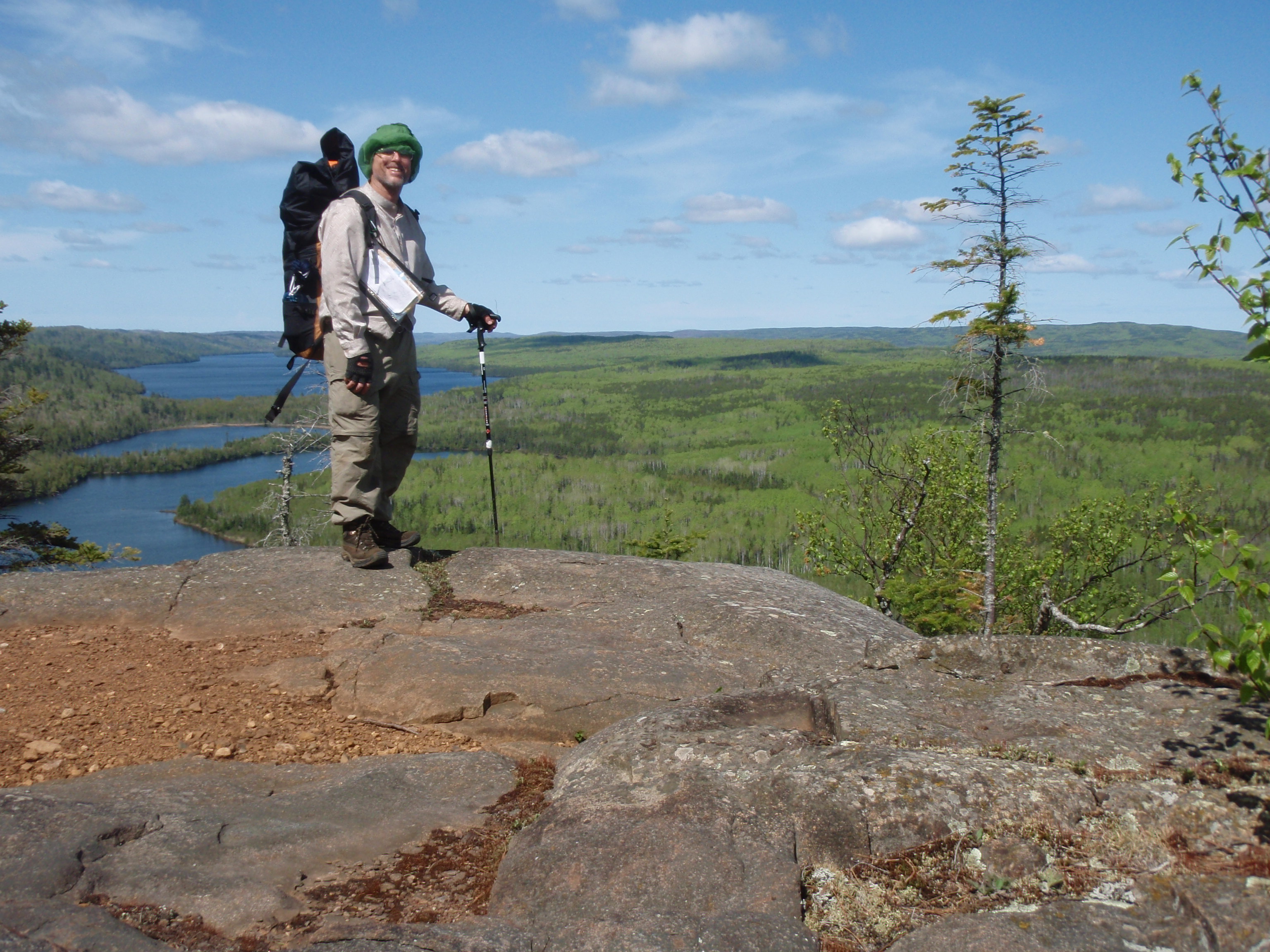
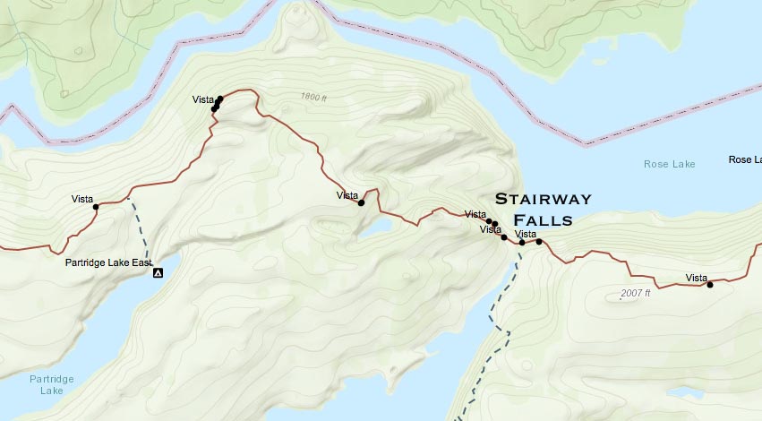
Eventually I made it passed a little lake called Mucker Lake. It looked like a rather large beaver pond, but I didn’t see a beaver dam. Then I made it to the South Lake Trail junction. The Trail was pretty reasonable up until then, with only downed trees in the way. After the South Lake Trail Junction, the brush and small pine trees start to move in on the Border Route. Before you get to the Partridge Lake Campsite Trail, you are treated to some pretty good views. But it’s nothing compared to was you see after Partridge Lake. Soon you are treated to the Rose Cliffs and one of the most spectacular views on the trip. To the west, I could see for miles. I could see Rose Lake, below me, then Rat Lake, then South Lake out in the distance. I took several photos of me on top of the cliff. To the East, you couldn’t see that far because there is a ridge after a couple miles or so. Rose Lake made a turn to the east of these Cliffs, and there was a hill in the way, so I couldn’t see the rest of Rose Lake. Actually, that part of the Lake is the wide section, where the part down below me was rather narrow.
I continued on and soon was looking at my map pocket for directions and noticed my map was gone. I still had my copied sheets of the Border Route Guidebook, but I was rather distressed that I didn’t have my big map. I checked out my camera, and figured out I must have just lost the map, because it was still in my map pocket during the photos on top of the cliffs. I retraced my steps and found the map on top of a cliff. I was surprised it didn’t blow away. I must have burned at least 20 minutes retrieving the map.
I continued on, and still the Border Route continued to be closed in upon by little pine trees and thickets. Soon I arrived at an overlook of a small pothole lake that is between Rose Lake and Duncan Lake. It has it’s own little valley and was it’s own little ecosystem between the much larger lakes. Soon I came to some wonderful overlooks of the east end of Rose Lade. This is the much wider part of the lake. I knew it wouldn’t be much further until I made it to Stairway Falls. On the top of the overlook, I thought the trail went down sharply to the east. So I went down. When I got to the bottom, I could not find the trail.
I figured Stairway Falls and Portage could not be that far away to the east, so if I just went east I would be alright. I started bushwhacking through the brush and eventually I found the trail again. Did I mention that I hate bushwhacking. But I didn’t want to climb up that steep hill. Again, the Border Route is not marked with ribbon here.
And I was right, Stairway Falls and Portage wasn’t that far. I crossed the bridge and set my stuff down on a nice rock ledge that was just the right height. When I crossed the portage before the Bridge, I saw a wooden stairway about 20 yards long. I figure that must be the stairway they’re talking about. But the incredible waterfalls, is like a stairway too. There is one huge drop part of the waterfalls that is absolutely spectacular. But then the falls has many smaller drops that do look like a stairway. I proceeded to take photos of all the falls. I was actually stepping down right next to the falls. When I was right next to the falls, I saw a tree with a memorial on it. The little wooden plaque said “JRG 10/2/66 – 3/6/08.” I figured someone wanted their ashes to be put in Stairway Falls.
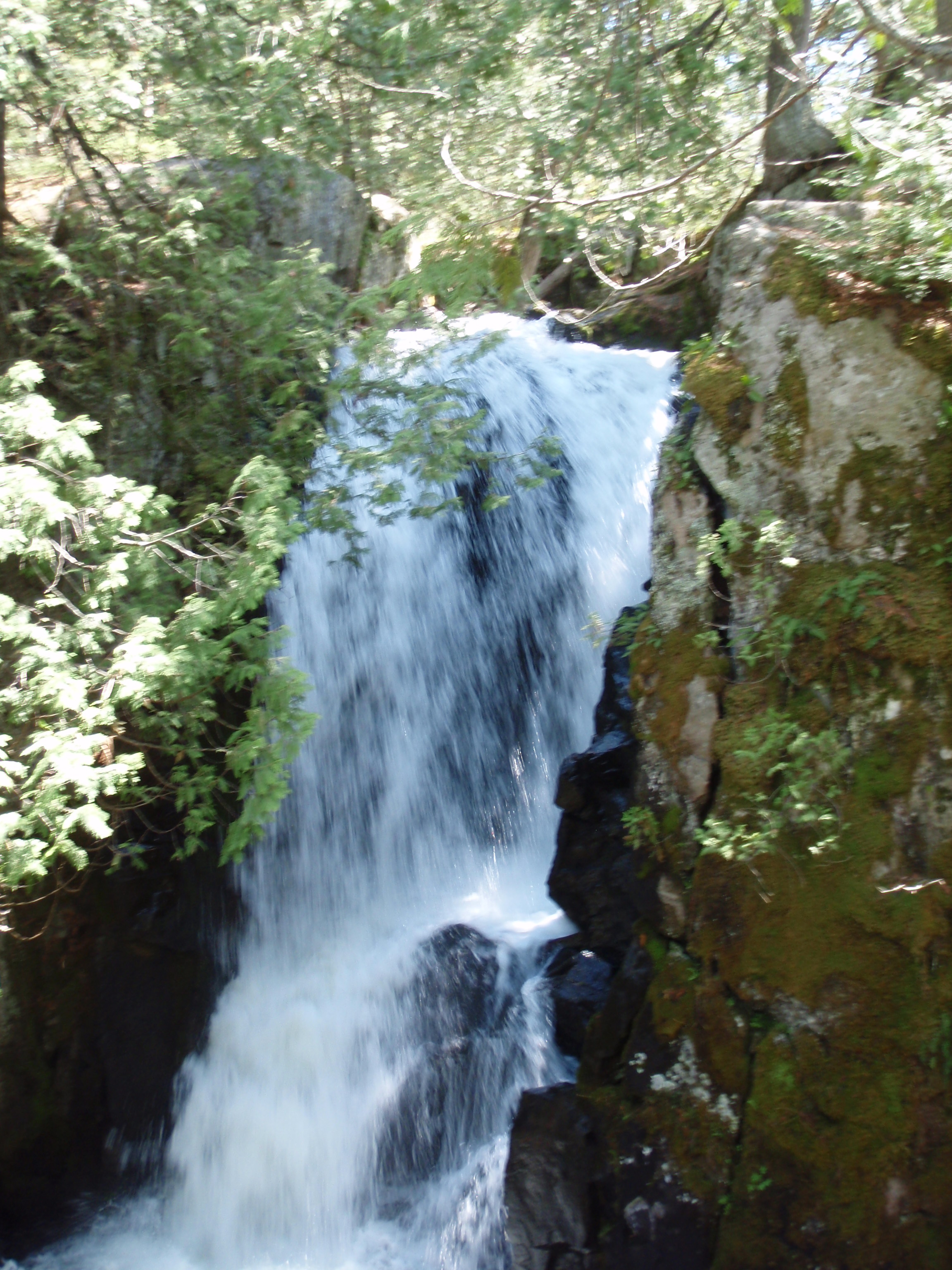
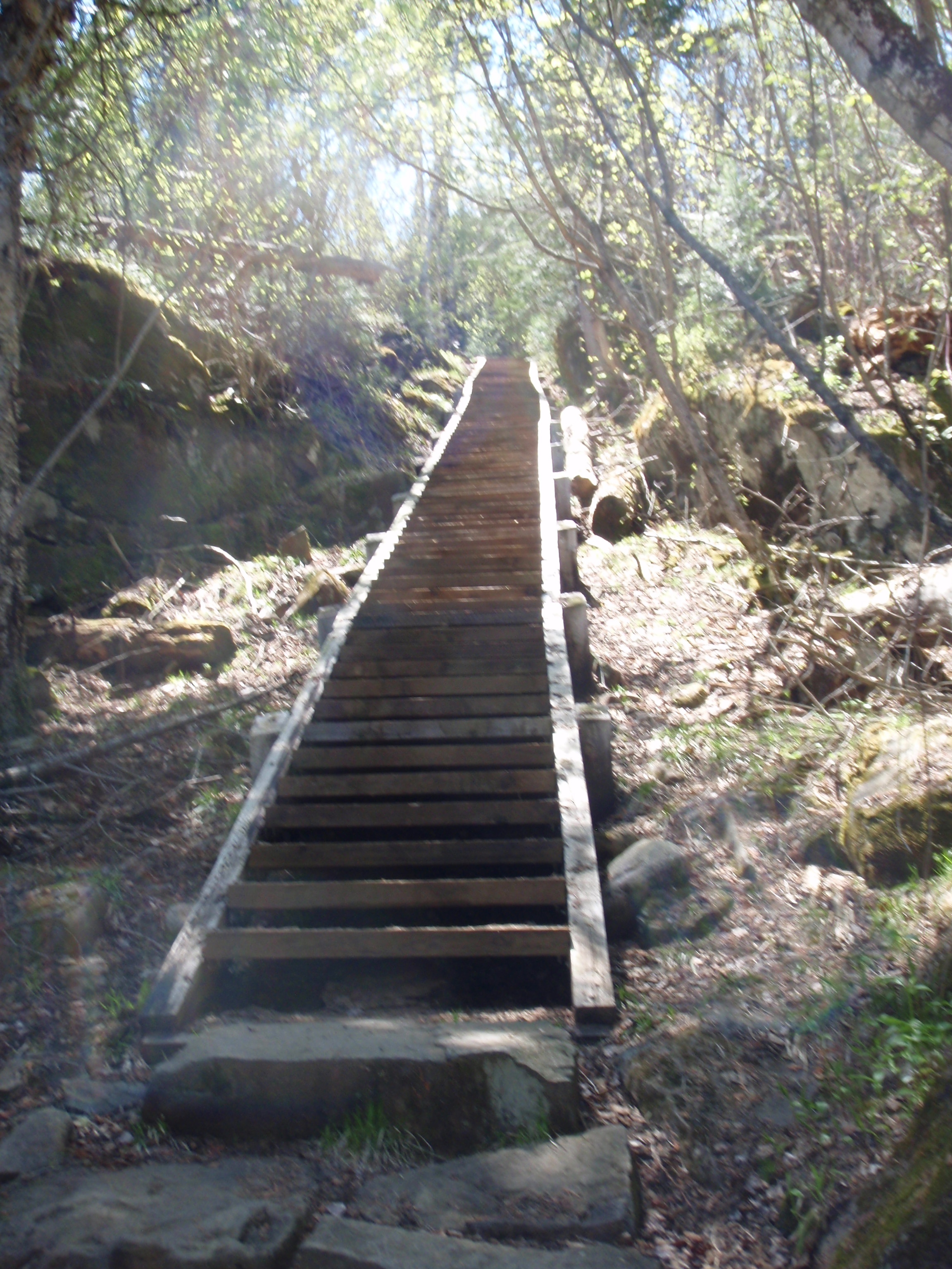
As I kept going down and more down, taking more and more photos, I came across something that is the most peculiar sight I’ve ever seen in the wilderness. It’s a long wooden staircase. This Staircaseeclipses the other staircase I seen up above. This one must have been around 50 yards long. I would hate to have to haul a canoe up that staircase. It was hard enough getting up it with just a camera.
After Stairway Falls, the Border Route starts going up a hill again. Right after Stairway Falls I passed this very tall majestic pine tree that had tipped over. I was saddened because the tree was still green on top, so it just must have tipped over recently. The problem with the Boundary Waters is there is not much topsoil, and under the topsoil it’s all rock. Trees have trouble putting a taproot in the ground.
I was saddened by the downed tree, but at least now I was walking through a real forest, not a burnt up landscape. The burn zone was such a drag after a while. But, going through a real forest has its disadvantages too. The Trail is being closed in by all sorts of vegetation. Lots of little pine trees need to be cleared.
The trail rises up to some more scenic cliffs overlooking the east end of Rose Lake. This is a beautiful sight. But you have to be careful at these cliffs because there are crevices that you step over that are about a foot wide and about 20 feet deep. I stepped over one crevice thinking that it was only a few feet deep. I was surprised when I saw how deep it was. But the views are just amazing up there. Across the lake to the north is Canada.
After the cliffs, the trail goes on top of a ridge for a while, then descents in a zig zag switchback to Rose Lake. Right when you get down to the shoreline of the lake, you pass through a campsite. It looked like a real nice campsite. Then the trail goes along the shoreline of Rose Lake. Across the lake in Canada there is a really tall cliff on a hill. It sticks out like a sore thumb.
I made it to the second campsite on Rose Lake where I took a break. It was around 5 pm, and I thought I would surely make it to the Clearwater Lodge before it closes. I had 4 miles to go, and it’s all supposed to be easy walking because it’s on an old railroad bed. I was looking forward to some easy walking because I had been pushing through a lot of brush all day up to that point. In fact, I was feeling a little run down. My leg that I thought was sprained was holding up well
The campsite I stopped at was really nice. I ate some gorp and set out the beacon. After the beacon send its message, I headed out.
The trail was really easy walking after Rose Lake. The first mile of the trail was actually a portage too. Usually the Forest Service has the portages cleared really good. The Border Route Guidebook said that this part of the trail and the Daniels Lake Access Trail was an old railroad bed. The bed didn’t look wide enough to be a regular railroad, so I figured it must have been a short gauge railroad. At any rate, there is no sign of a railroad now.
Next to the Trail there is a nice little river with lots of rapids. And on the other side of the river, it’s Canada. A mile from Rose Lake, the Border Route intersects the Daniels Lake Access Trail.
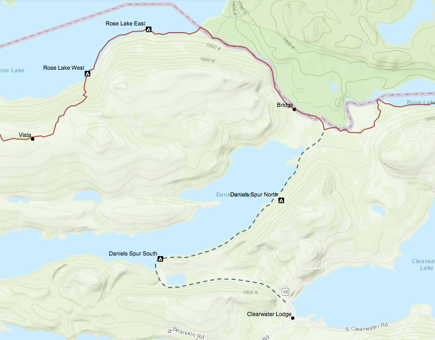
The Border Route goes east from there, and the Daneils Lake Trail goes south about two miles then turns sharply to the east for a mile. That’s the way I was headed.
It was really easy walking along Daneils Lake. I was making real good time, even though I was getting tired. I passed the first campsite, which looked really nice, then made it down to the second campsite which is near the turn in the trail. I decided to stop here for one last break. It‘s a nice campsite too. I figured things were going so good that one last little rest stop wouldn’t hurt
After that campsite, the trail turns away from Daneils Lakes, and heads east to Clearwater Road.
I passed a little pond on the left side of the trail. Everything was going good, then it started going really bad. I got to a spot where the trail had become a little river. Everywhere was wet, and there was a current in it. This lasted for over 50 yards. Wow, I wasn’t expecting that, because the trail on the old railroad bed had been so great up until then. The trail had another dry stretch, but then was under water for another 20 yards again. Finally I made it down to Clearwater Road, but the trailhead was under water too.
I got on Clearwater Road, and saw some houses on Clearwater Lake, which is across the road.
I wasn’t sure which way to go to get to the Clearwater Lodge, so I went up to a house and asked for directions. The lady who answered the door said the Clearwater Lodge was down to the right about a block.
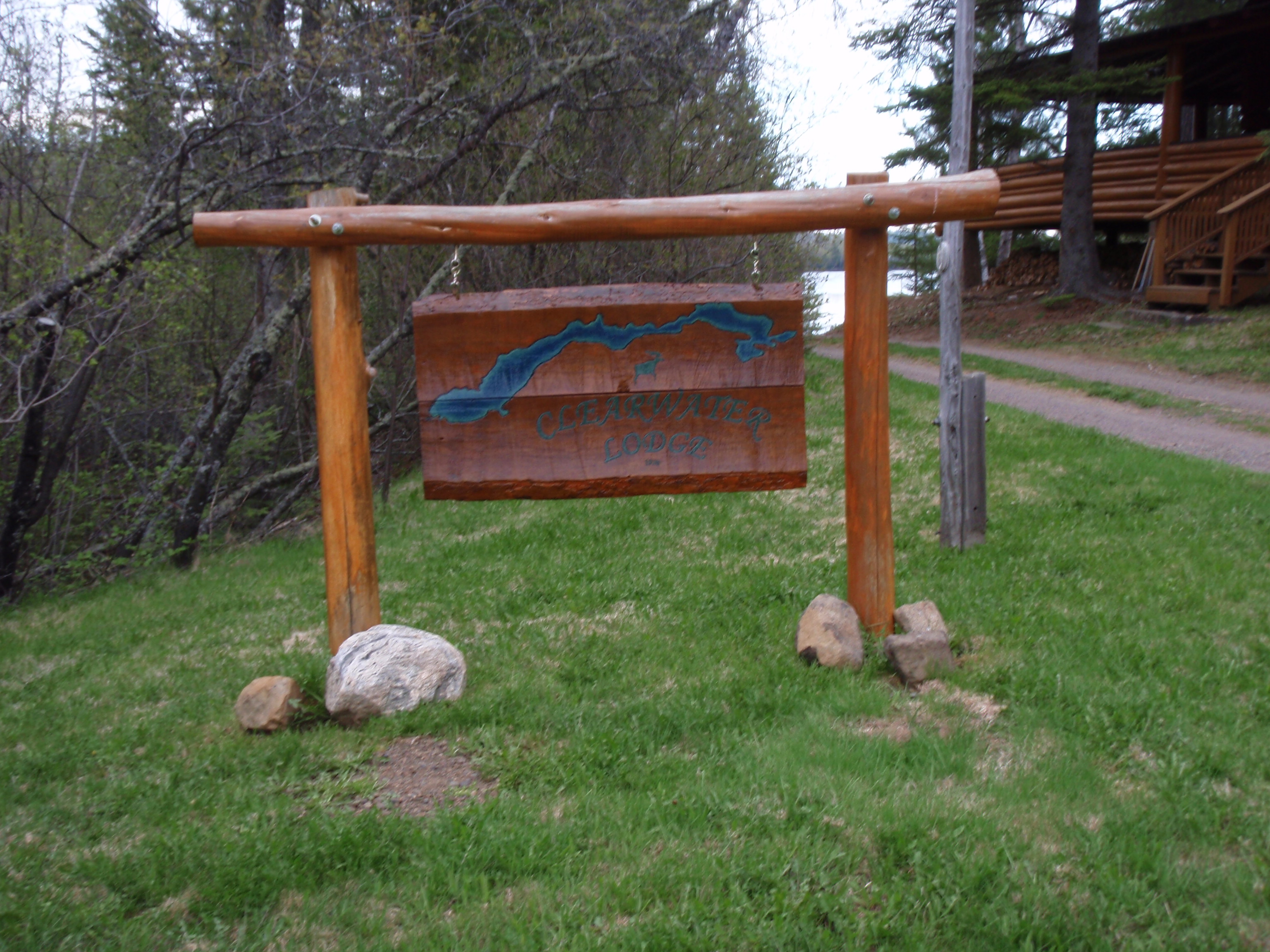
I made it down to the Clearwater Lodge at 7:30 pm. I was thinking that they surely must still be open, but they weren’t. It’s a Friday night in late May, I thought the place would be hopping with customers coming in to go on weekend fishing trips. But the place looked like a ghost town. I went up on the porch of the Lodge to get my package and a map to the Screen Hut.
I walked down towards the screen hut and met up with three college students that were near a maintenance building. They were summer workers for the lodge, but now they were off duty and just goofing around. They pointed out the Screen Hut and shower building. The Screen Hut is just like its name. It’s a little screen building with a wooden frame. It has tarps that cover up the screens for bad weather. The Screen Hut has two bunk beds, so it can sleep 4 people. It must mainly be for people going out on fishing trips.
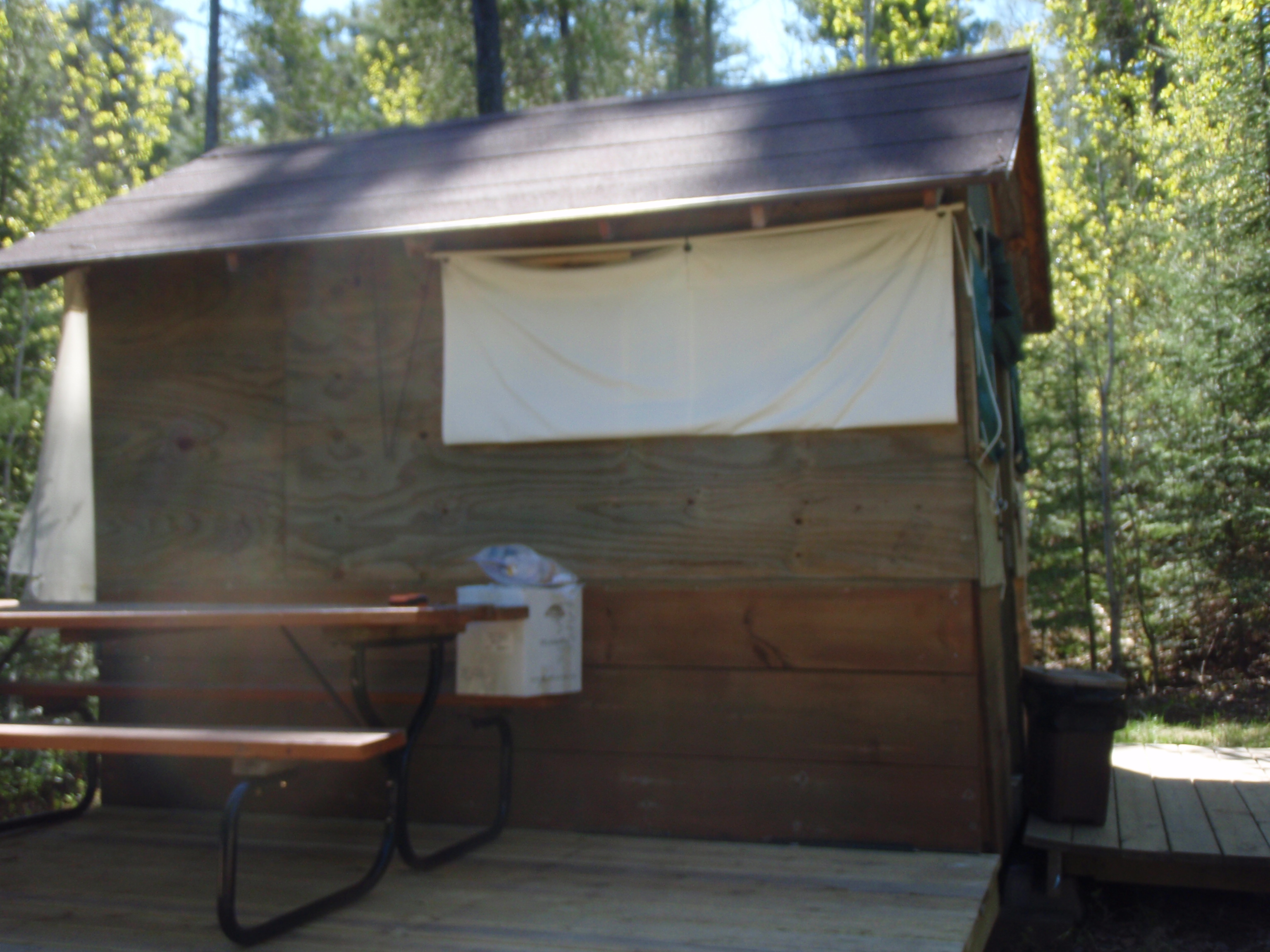
Well, I took a shower, tried drying out my boots, then went to bed. I was beat.
Saturday, May 31, 2009
Zero Day in Grand Marais
I woke up rather late and didn’t feel very good. The rigors of the trail had taken a toll on my body. I ached all over. And all the tick and biting fly bites over the course of the last week had me feeling very itchy. After looking at the maps and thinking about it for a while, I decided that I didn’t want to do the rest of the Border Route. I figured it was a 45 mile backpacking hike from Clearwater Lodge to Hovland. I knew that about 25 miles from the Clearwater Lodge, the Border Route crosses the Arrowhead Trail. And at the Arrowhead Trail there is a forest campground. But there is no assurance that there would be anybody camping at that campground. And there is no assurance that anyone would be traveling on the Arrowhead Trail, because it is a very remote road.
Hovland would be the only sure destination where there are people and businesses. And I really didn’t want to risk going that far in my now run down condition. Plus I didn’t want to hike out to the Border Route on the Daneils Lake Access Trail, which I know has major wet areas. And what if the Border Route has a lot of obstructions like I’d seen on other parts of the trail. So I decided I would do something different. I would catch a ride into Grand Marais, then I would hike the Superior Hiking Trail south. At least on the Superior Hiking Trail there would be a town or state park every 8 miles or so. And I would be close to the well-traveled Highway 61 that runs up the coast of Lake Superior.
I hiked down to the Clearwater Lodge. It is a really old log building that looked really well maintained. The rest of the facilities looked rather run down. They had a rather beat up van that they must have used to carry people and canoes to boat landings. Clearly this was not as nice as the Gunflint Lodge. The one thing I noticed was there didn’t seem to be any customers around. I went in and talked to the woman in the Lodge. The Lodge looked as though it had a dining area, so I asked the lady if the were serving breakfast. She said no. She also said that I owed $5 postage on the package I sent.
And she didn’t seem very happy about it. It seemed as though she thought that I was intentionally trying to short change her. I didn’t bother telling her that the people at the Gunflint Lodge had figured out the postage, not me.
Then I asked her if there was any way I could get a ride into Grand Marais today. She said she wasn’t planning on going into town. I asked if there was anybody coming in off the lake today that could maybe take me into town, and she said no. Boy, I thought, I must be their only customer right now. Then she started asking me a bunch of questions like an inquisition. She asked me if I had a contact that could come and pick me up, and I said no. She asked me how I was originally planning on getting into Grand Marais. I said I was planning on hiking the Border Route and the Superior Hiking Trail to get there, but I wasn’t feeling that great so I wanted to stop my backpacking trip. She said there was another person earlier in the week that did the same thing. That wasn’t exactly comforting. She made it sound as though it was some type of epidemic.
Then she said they would take me into town for $80. Wow, I thought, I wasn’t expecting it to be anywhere close to that much. I thought about it for a minute. At this point all I wanted to do was get the heck out of there. So I agreed. I said it would take me a while to get packed up. I paid all my bills and headed back to the screen hut to pack up. About a half hour later one of the college students came and checked if I was ready. Then he drove me into town.
As we went into town, he told me that the forest service had to haul someone out of the Boundary Waters the week before. The guy had rented a canoe from Clearwater Lodge and then he didn’t show up at the pick up point. They checked the next day and he wasn’t there again. Then they called the Forest Service to go find him. The guy had suffered a pinched nerve in his back. He was still trying to get to the pick up point, but he was going really slow. At any rate the Forest Service found him and helped him get out. All of a sudden I was feeling a little better about paying the $80 to get into town.
I also thought that the Gunflint Lodge had given me excellent service, where I thought the Clearwater Lodge didn’t. Maybe that’s why the Gunflint Lodge had customers in the middle of the week, where the Clearwater Lodge didn’t have customers even on the weekend.
The college student dropped me off at the Best Western in Grand Marais. I had done my research ahead of time, and knew that the Best Western had a computer for guests to use and they also had a complimentary breakfast in the morning. I check into a really nice room, immediately took a bath and had a nap.
After the nap, I went out of the hotel and put the beacon out. The Best Western is right on the shore of Lake Superior, and they have a nice walkway out by the lake. I saw a couple lounging around on the shoreline. It looked as though they had backpacks, so I went over and talked with them. They were David and Rachel, and they just had backpacked from Cascade State Park to Grand Marais.
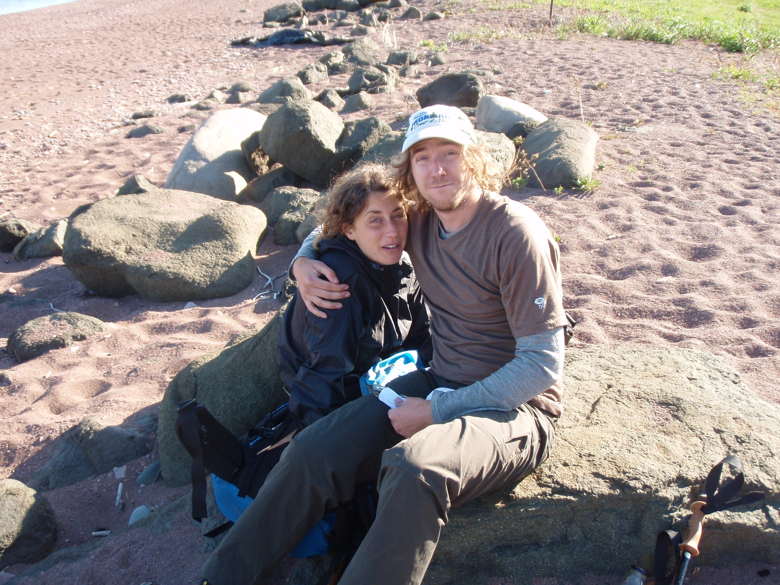
I told them about my tough going on the Border Route and asked them about the conditions on the Superior Hiking Trail. They said the trail was good with only a couple downed trees. I was really happy with their report.
After the beacon sent its message. I went out and started exploring Grand Marais. It’s a quaint little tourist town that’s not too overdone like many other tourist towns. They had several northwoods style murals on buildings around town. I took a photo of every mural I seen. The town has a nice harbor area with a cute little coast guard station in the harbor. It was very scenic. I should have been looking for a sleeping bag cover as I visited the shops, but that didn’t occur to me. Instead I was looking for some cheap clothes that I could wear when I did my laundry. I found a little thrift shop that was run by some church ladies. They were even having a sale on men’s clothes. So I got a pair of pants and a “Phish” T shirt for a grand total of $4. I stopped at the Dairy Queen across the street from the thrift store. It was a vanilla only DQ, so I had a vanilla cone dipped in chocolate. I went back to the Hotel and did my laundry.
When I was doing my laundry, I finally realized that I should get a sleeping bag cover. But it was 5:30 pm and the Hotel clerk called two stores to see if they were still open. Jones Department Store was closed and was not open on Sunday. The Lake Superior Trading Post was closed too, but the owner answered the phone and offered to help me even though they were closed. I asked him what time they opened in the morning, and he said 9 am so I said I would come to the store then. I thought it was good of him to offer to help me after hours, and was amazed that they opened at 9 am on a Sunday, I was expecting it to open around noon.
While I was doing my laundry, I was also working on the hotel’s computer doing some updates to my isawtman website. Finally I finished my laundry and was starting to get a little hungry. I asked the Hotel Clerk to recommend someplace to eat. She recommended a couple places but said they would be closing in an hour. I said I wanted to go to someplace that stayed open later, so I asked her if there was a bar around that served good food. She recommended the Gunflint Tavern and said they would be having some entertainment down there too.
So I took a leisurely stroll, during the last light of the day, down to the Gunflint Tavern. I walked in and noticed the bar was an L shaped room with a folksy band playing in the corner of the L. I found a barstool with a good view of the band, and asked the bartender for a menu and a local brew. She served me up a Schell’s. This time I avoided the hamburger and ordered the Salmon.
The band was called Tres Amigos. It consisted of an electric guitarist, an acoustic guitarist and a fiddle player. They are a very good group. What I liked about them is that they localized the lyrics of some of the songs. They sang Charlie Pride’s “Is anybody going to San Antoine.” During one of the verses they changed the lyrics from “sleeping under a picnic table at a roadside park” to “sleeping under a picnic table at Cascade State Park.” I talked to the fiddle player at the break, and he said they were not very serious about the band. They were three friends that played together a few times a year. At any rate, I thought they were very entertaining.
The Salmon was very good and so was the beer. I decided to splurge on dessert for a hot fudge sunday. I thought it would be in a little bowl and cost around 3 or 4 dollars. Instead, I got this big plate full of ice cream with all the fixings. It was worth the 6 bucks. Overall I had a great time at the Gunflint Tavern. Good food, good beer, good atmosphere, good entertainment and a good dessert, what’s not to like?

I headed back to the Hotel and took a dip in the Hotel’s hot tub. Then I hit the hay. It was a very enjoyable evening.
Sunday, May 31, 2009
Superior Hiking Trail: Grand Marais to the North Bally Creek Campsite
I woke up and went down to the breakfast area near the lobby of the hotel. My philosophy at hotels that offer breakfast is to eat early and often. Since no one was using the computer, I decided to make some new “I Saw Tman” cards. These were definitely nicer and more legible than the ones I had before, because the new ones are typed out instead of hand written. I went back to my room and started to get my stuff together.
I headed over to the Lake Superior Trading Post, which is about 4 blocks from the hotel. As I walked I saw the fiddle player from the night before pass me by in an older pick up truck. He waved at me. It made me feel as if I was becoming well known in the town. I arrived at the Lake Superior Trading Post a few minutes early, but the store was dark inside, showing no signs that it was about to open. I figured that this was a small town and the people who opened would show up at the last moment. I am so accustomed to working in larger stores in Madison, where the store personnel arrive early, get stuff ready and have a last minute meeting before they open the store.
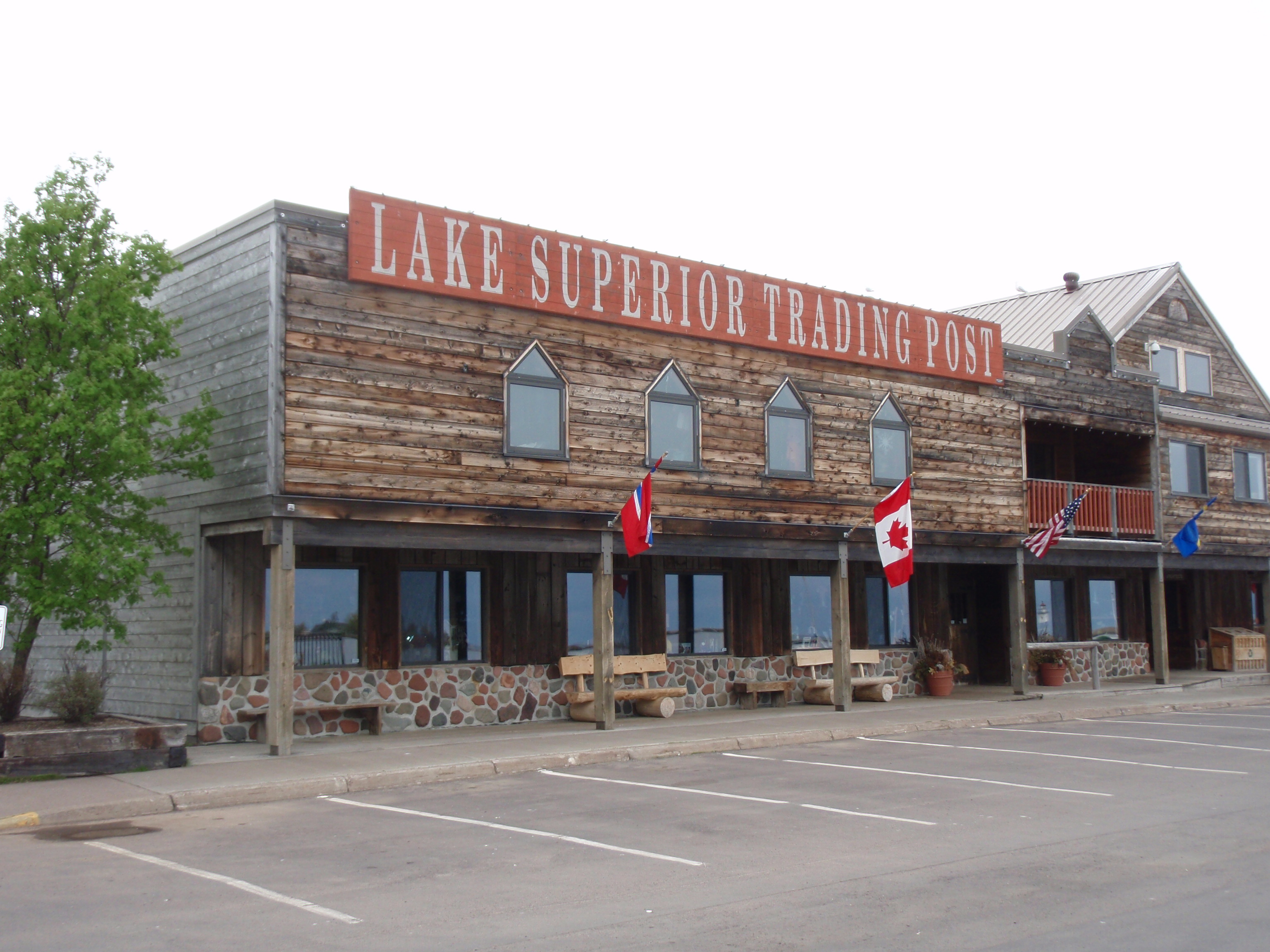
I walked down to the end of the building where there is a small coffee shop. The college student who was running it was wondering why his back room wasn’t opened yet. Evidently, the Lake Superior Trading Post opens up the back room so he can get supplies. There were customers driving up and parking, waiting for the store to open, but still no sign of life.
I walked down to the other end of the building and saw a young lady standing near the side door as if she were waiting to be let in. I went down to talk to her and she said that whoever was supposed to open did not show up. Soon a second young lady showed up and learned of the situation. She said she was going up to a church and getting the owner. I thought it was a good sign that the owner attended church regularly enough that the employees knew that’s where he would be.
Well, finally after about 9:30 the store opened. The owner apologized. Evidently he didn’t schedule any manager to open the store that morning. It was some sort of clerical oversight. The owner was quick to help me. I decided that I would buy a new sleeping bag to keep me warm, something that I should have done in the first place. I also bought some bug spray and some other items.
When I went to pay my bill, my credit card did not work. I called my sister and she put it on her card. That was nice of her. I wondered if I had met my limit on the card, but I didn’t think so. At any rate, when I went back to the hotel I went on the computer and put some money on my card.
Then I had another problem. I was going to send my mail package home. But now that I was sending my old sleeping bag home, I needed a larger box. I went over to Super America next door and they gave me a box. I stuffed all the stuff I would no longer need into the box and took it to Whole Foods to weigh it. They could weigh it, but they didn’t have any tape to seal up the box. So I had to go down to the combination Gas Station/Hardware Hank Hardware store to get some tape. So after going to three stores, I managed to get my mail package sealed up.
Then I went on the Hotel’s Computer and printed off a mailing label. Since I have not used the Post Office Website for a long time, I had to register again, which took extra time. My Credit Card worked on the Postal Service Website, but it was only for $15. I gave the hotel clerk my mail package and headed back to my room to get going. It was around noon when I started hiking, a lot later than I had expected.
My plan was simple at this point. I would hike up the hill that is west of Grand Marais and connect with the Superior Hiking Trail. But I also had a plan for ending my hike. I was going to hike a couple days to get down to Lutsen, then I would hike up to the Lutsen Mountain Gondola and take a ride on it. What a wonderful way to end my hike. On Saturday, I had called down to Lutsen Mountain, and they said it was $10 to ride on the Gondola.
So I hiked through the streets of Grand Marais and connected with the Gunflint Trail. It started to rain. I stopped at a laundrymat to change into my rain gear. Soon I was headed out of town. I was I hiking on the side of the road. My plan was to hike up the electric line right of way to and then I would connect with the Superior Hiking Trail. At the base of the hill, near the Gunflint Trail, there is a cylinder type water tower with the words “Grand Marais Welcome to Gunflint Trail Scenic Byway.”
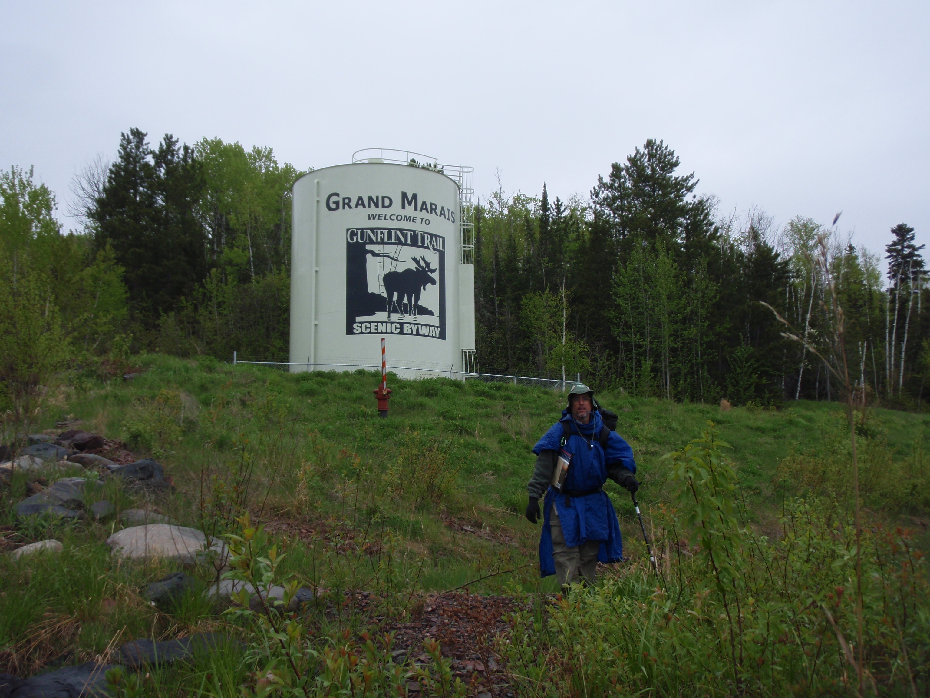
It also has a moose painted on it. What a surprise. I took a photo of myself in front of the water tower. Then headed up the hill.
At first it was pretty easy walking up the electric line right of way. It was fairly steep, but it was grassy. The fact that it was raining made it a little more difficult to walk. I looked back and was getting some good views of Grand Marais. I wasn’t sure when I would connect with the Superior Hiking Trail. I thought I might connect with it while I was going up the hill. I kept looking for the Blue Markings, because I had read that the Superior Hiking Trail had been completely marked with the North Country Trail Blue Markings.
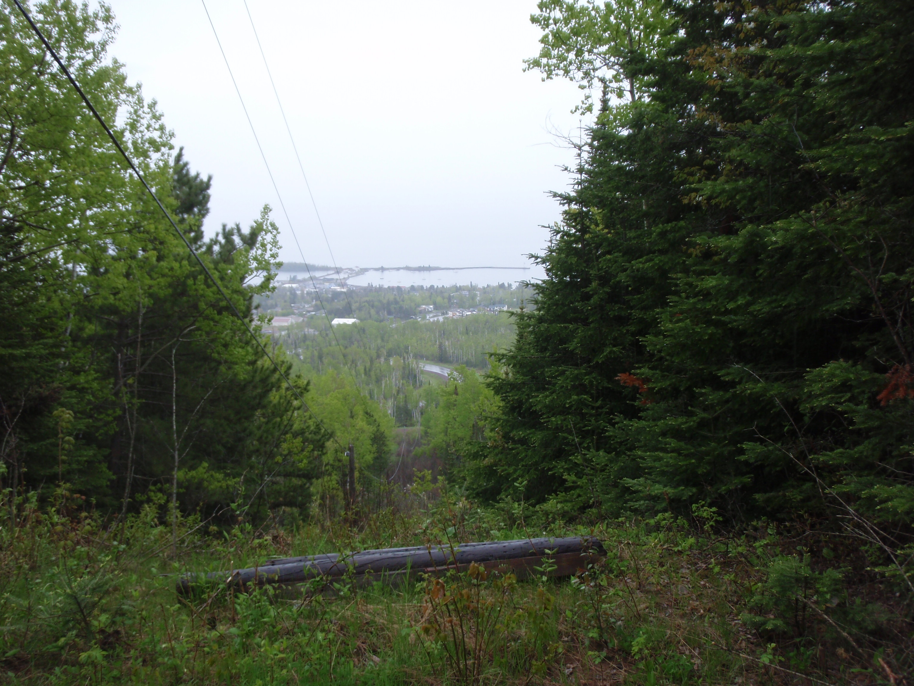
The Electric Light right of way starts getting steeper and starts looking more like a rocky ravine. I passed a washing machine that someone had tried to roll down the hill. Finally, I made it to the top of the hill near all the radio and TV towers. I still had not connected to the Superior Hiking Trail. I checked the Guidebook. The Guidebook shows the trail crossing Tower Road, so I hiked down the road. After about 5 minutes I spotted a silver car parked along side the road, and I had reached the Trail. The trail was really well marked with a gate and a sign saying foot traffic only.
The Trail at this point is also a snowmobile trail, so it’s nice and wide. I thought I was in heaven. The scenery isn’t particularly outstanding, you’re just walking through some woods, but the trail is really well maintained. Eventually you get to a point where there is a nice little creek right next to the trail.
I was walking along and I saw two men off in the distance. When we got closer together I called out “Hi, are you the people with the silver car on Tower Road?” And they said yes. Their names were Chuck and Tim. They were just out hiking around. They were from the Twin Cities and they were renting a cabin in Grand Marais. For some reason I didn’t take a photo of them, which is pretty unusual for me. But I gave them my card and continued on.
The Superior Hiking Trail turns off the snowmobile trail then crosses Cook County Road 6. There is a nice sign there with the distances to future landmarks. Sundling Creek is 2.3 miles and campsites are 2.9 and 3.0 miles away. I went on and crossed Forest Road 115 three times over the next mile and a half. Forest Road 115 deteriorated from a dirt road the first time I crossed it to a grassy road that last time I crossed it. In fact, the last time I crossed Forest Road 115 it looked more like a ski trail.
The Superior Hiking Trail is really well maintained. David and Rachel, the backpackers I seen the day before on the shoreline, were right, there were no obstructions on the trail. The trail even has little wooden bridges to cross even the smallest creeks. It really is “One of the Top 10 prime trails that leave all other in the dust” as Backpacker Magazine calls it
Soon I came upon the Sundling Creek crossing where there is a fairly big beaver dam pond. You cross the beaver dam on a long series of boardwalks. It looks like some people walk in the grass next to the boardwalk, which is good too.
I hiked on and after a while I noticed a campsite down a short hill from me. There was a faint path going to it, so I took it. When I made it to the campsite, I saw another better path coming into the campsite, which was the main entrance. I had taken the back door into the site. The site was nice, with a wooden L shaped bench around the campfire ring made using 2 sturdy boards that are 8 feet long. At least I would have a nice flat place to sit.
I checked the Superior Hiking Trail Guidebook and found out that I was at the North Bally Creek Campsite. I had come into the campsite down a small hill, then the campsite was fairly flat, then down from the campsite I could see a marshy area, which must be Bally Creek. According to the Guidebook, there is another campsite on the other side of Bally Creek called the South Bally Creek Campsite. So I decided to leave my gear and go down and check it out in case I wanted to camp there instead. I hiked down about 100 yards and crossed the bridge over Bally Creek. Then after about 25 more yards I found the spur trail to the campsite. The trail is on the other side of the marshy area from the North Bally campsite. At any rate, the spur trail seemed really long. I checked the guidebook and it said the spur trail is 2 tenths of a mile long. Finally, I made it to the campsite. It was a nice campsite, but I thought it wasn’t worth all the distance I would have to hike my gear. It was around 5:30 pm, and I also thought it wasn’t worth going to the next campsite which was 6 miles from the Bally Creek Campsites. So, I decided just to stay at the North Bally Creek Campsite.
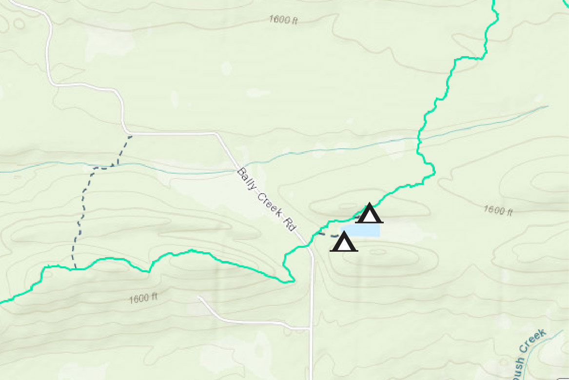
So I went back to the North Bally Creek Campsite and I grabbed the driest wood I could find along the way. I searched under pine trees where the wood was fairly dry. The rain had stopped, but still everything was pretty wet. When I made it back to the campsite, I immediately made a fire. I used some alcohol from my stove to help get the fire going.
After I got the fire going, I set up my tent. I thought I better set it up and put my gear in it in case it started raining again. Soon I was off looking for some more firewood under pine trees. When I came back with the firewood, all of a sudden I heard some voices up the hill from me. One person said “There’s the campsite” and another person said “but how do we get down into it?” I called out “just go down the trail a little ways and there is a entrance.” Sure enough, a couple minutes later two college aged men walked into the campsite.
“ Are you Todd?” one of the men asked, and I said yes. I was surprised they knew my name. They said Chuck and Tim, who I had seen earlier, had told them about me. They introduced themselves to me. Their names are Eric and Matt. Eric just graduated from the University of Minnesota. They asked if they could share the campsite with me and I said “Sure, I would like the company.”
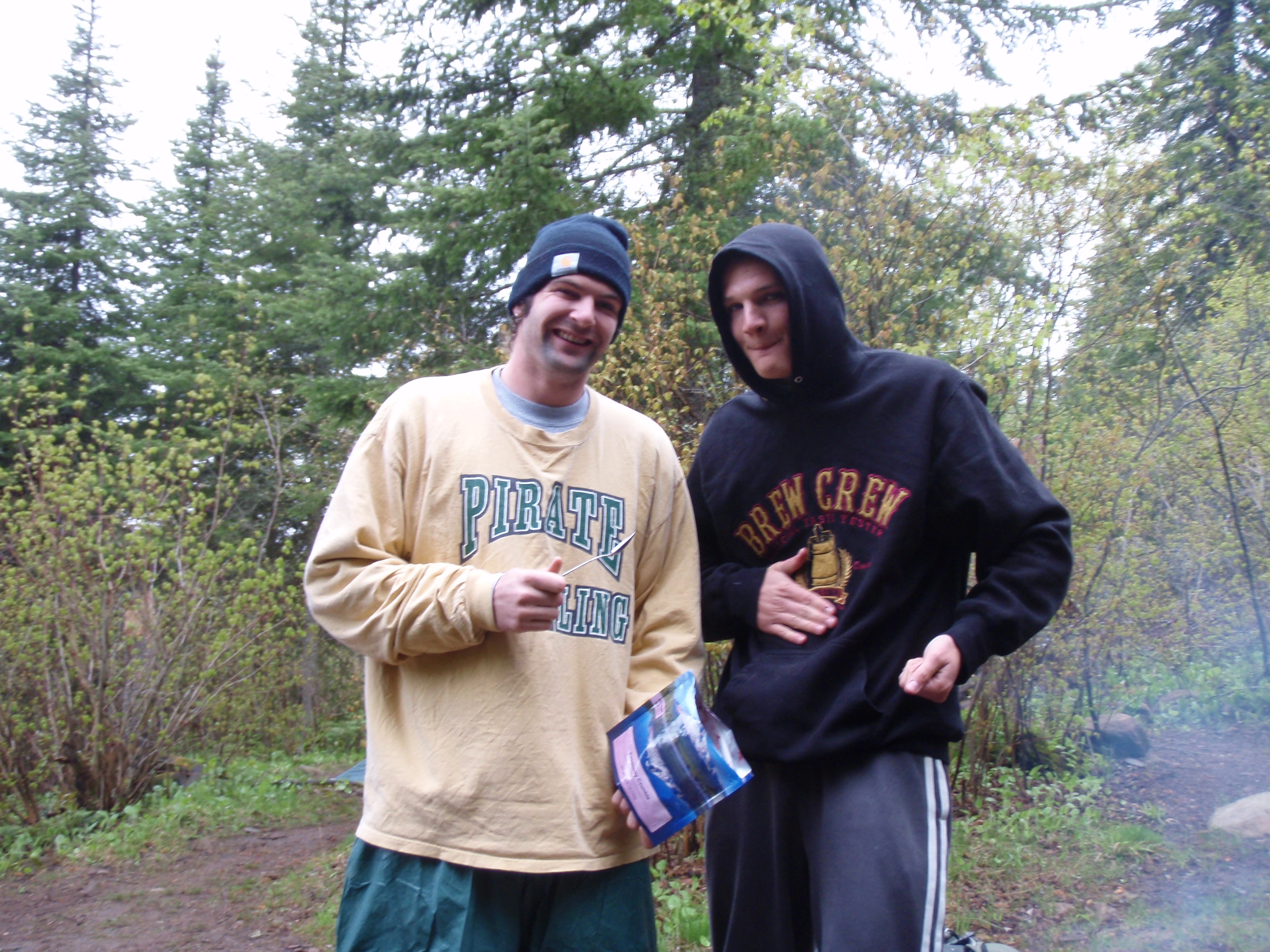
They seemed really happy that I had a campfire going. In fact they were wondering how I got it going since everything was wet from the rain. They started unpacking some of their gear to get their extra pair of shoes. I noticed that they had pretty heavy packs and were carrying a bunch of unnecessary weigh. For instance they had a whole roll of duct tape, where I had carried some duct tape that I had wrapped around my trekking poles and trowel handle. But the problem with their duct tape was it was a big 6 inch diameter roll instead of being a smaller roll of tape.
Eric had said that it was there first time out backpacking, and that there was supposed to be a third person coming on the trip but he got an internship and couldn’t come. Evidently, the third person was the one who was the experienced backpacker. Eric didn’t seem to think that they could of got the fire going. So they were happy that I was there.
I said that I had used some “Girl Scout Water” to help get it going. Eric didn’t know what to think about that. Somehow he thought that I was calling him and Matt Girl Scouts. But I said that “Girl Scout Water” was a generic term that we use in Boy Scouts that described any fluid that you use to accelerate the fire. In this case I had used some Alcohol from my Alcohol Stove to help start the fire. But charcoal fluid and White gas could also be called Girl Scout Water. He said that he had some Everclear that he could use to help start a fire. I didn’t know what that was and he said it was a high-octane liquor that isn’t even legal to buy in Minnesota. You can have it in your possession, but no liquor store can sell it in Minnesota. Eric said he could also use the Everclear as a disinfectant on any wounds they would get. Evidently, they were not planning on drinking the Everclear.
Eric and Matt put their extra pair of shoes on, then put their boots on the rocks next to the fire. I put some dry socks on and put my feet in ziplock bags, and also put my boots next to the fire. The fire place was just a bunch of rocks in a circle, there was no forest service iron fire grate that I had grown use to in the Boundary Waters. I had grown fond of the iron fire grates because they worked good for drying boots and socks. I would put two pieces of wood on the fire grate, then put my boots on the wood so they wouldn’t melt on the iron.
They set up their tent, which I thought was kind of small for two people, but it had a door on each side of the tent and a vestibule on each side of the tent too. It took them a while to set up the tent. They had rented the tent from the University of Minnesota Outdoor Club, so this was actually the first time that they set up the tent. This was actually their first night out and they had started near Grand Marais.
We boiled water on our backpacking stoves and used the hot water for our dehydrated food packs.
It was nice having some company for the night.
Monday, June 1, 2009
Superior Hiking Trail: North Bally Creek Campsite to Lookout Mountain
It was a good night and we didn’t get up particularly early. At this point I was planning my end game for the hike. I had asked Eric and Matt when they were planning to go back to the Twin Cities. They said they wanted to backpack until Sunday. That was too late for me, I really wanted to start heading for home sometime in the mid-week. At any rate, while I was in Grand Marais, I had posted an ad in the rideshare section of the Duluth Craigslist for a ride from the North Shore to Duluth or the Twin Cities. I was hoping someone would call me because I posted my phone number in the ad. It said in the ad that the best way to contact me was my phone, and that I had no access to a computer because I was backpacking. I had called the Forest Service before my trip, and they said that for the most part, my cell phone would work on the Superior Hiking Trail. I figured that when I got down near Lutsen, my phone would definitely work because it is a ski resort community.
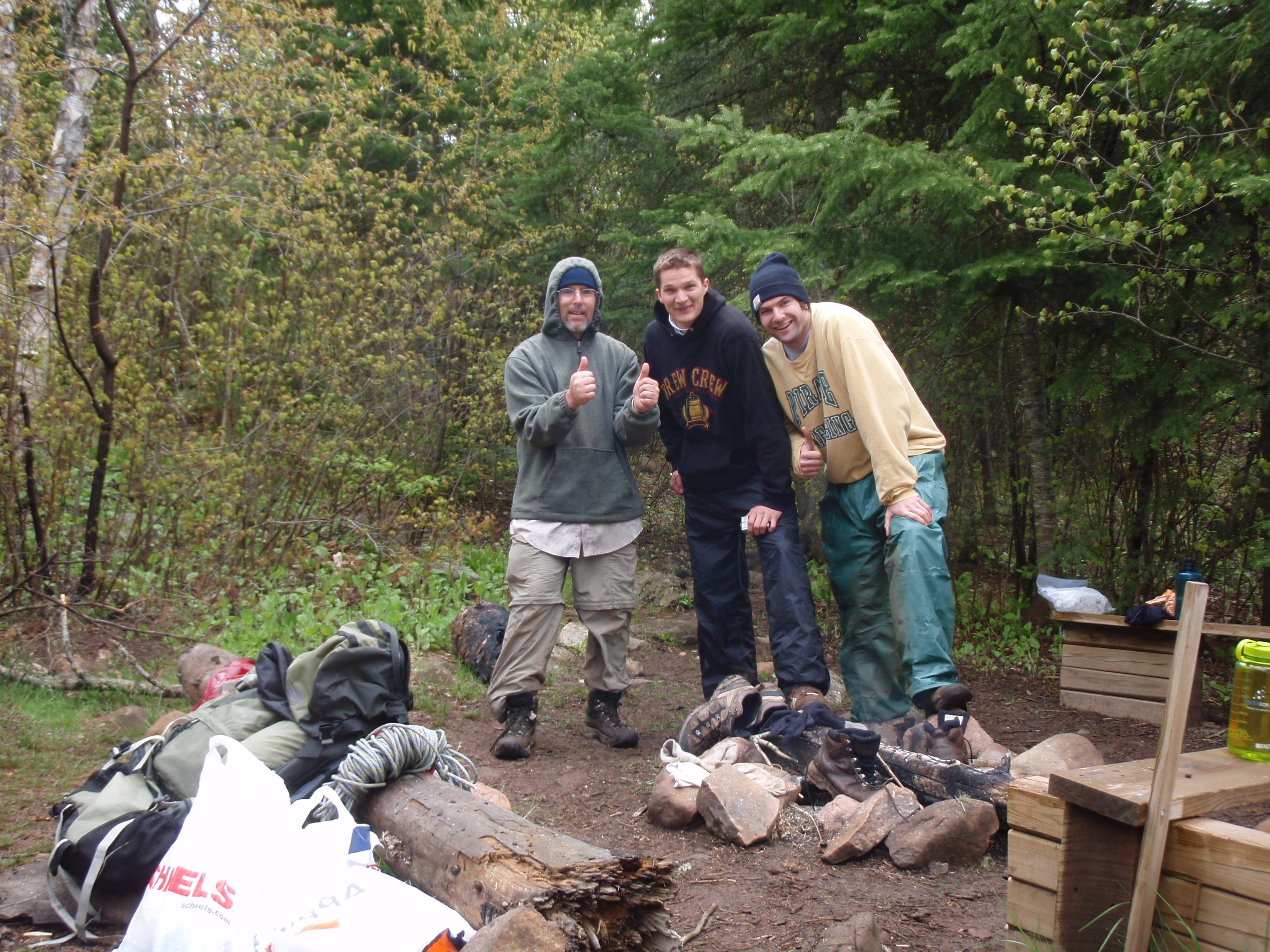
Eric, Matt and I decided we were going to hike together today. I figured I could keep up with them because they had much heavier backpacks. We ate breakfast and got our gear together. I managed to get my gear together pretty fast compared to them, so I waited around, I was in no hurry. They finally got ready and off we went. We walked down across Bally Creek, passed the spur trail to the South Bally Creek Campsite and we soon came to Bally Road. At the road there was another nice sign with the distances to future landmarks. Highway 45 would be in 5.6 miles and Cascade State Park would be in 9 miles. I assumed that meant the main campground of the Cascade State Park is in 9 miles because the park boundary is actually near Highway 45.
We kept going and were soon treated to some nice views through the woods of some hills off in the distance. After a mile or so, it became apparent that Eric and Matt were too fast for me. They kept pulling away from me. At one flat easy place in the trail, I ran to catch up with them. So finally I told them to stop. I told them that I wouldn’t be able to keep up so we should just split up. I said I was planning to take the east side of the river route when I got to Cascade State Park and there is a State park Campground down near Highway 61. I said that when I got to the Campground I would check to see if they were camping there. At any rate, we went on, and soon they pulled ahead of me again. I took one last photo of them way ahead of me and that was it. They were gone.
Again, the trail was really nice. You could see some hills off in the distance through the woods, but there wasn’t any place that was an overlook spot where I could take a photo without having the woods in the photo. I kept hiking at my leisurely pace, soon I came across a ski trail junction. They even had a map of the ski trails posted at that spot. So I checked it out, because I’m a map person. I always try to keep track of where I am on the map. Eric and Matt didn’t keep track of themselves on the map. The night before, I had to show them where they were. They thought they were much farther along on the map.
Soon I came across a forest boundary sign with a geographical marker and a bearing tree. I suppose that’s for people with gps units. I continued on and eventually came to the North Cascade Multigroup Campsite. I had caught up with Eric and Matt. They were talking to two guys from Des Moines, Iowa named Tyler and Aiden. Eric and Matt had taken off a layer of clothes and were all set to go again.
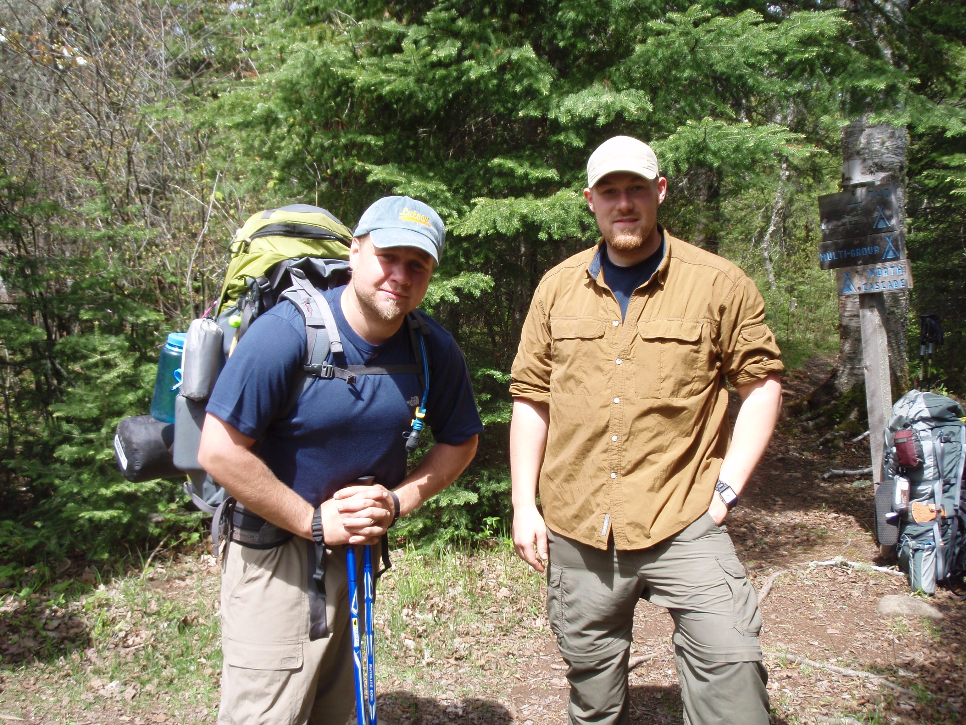
So they took off. There is a nice bench at the entrance of the Campsite, so I set my stuff down and talked to Tyler and Aiden. They said they were hiking up to the Devil’s Track, just north of Grand Marais. I asked them why they came up here to hike, all the way from Des Moines. Aiden said he heard about the trail when he lived in the Twin Cities, and always wanted to hike it. I gave them my card, took their photo, and they were off. Tyler and Aiden had the look of experienced backpackers. They had trekking poles and appeared to be packing fairly light. At any rate, they looked as though they knew what they were doing.
After they left I hiked around the North Cascade Multigroup Campsite. I needed to use the facilities, anyway. The Multigroup Campsite was the biggest campsite I had seen yet. It must have had 3 or 4 fire rings with the L shaped benches around them. The sites were nice and flat, but you have to go down the hill to the Cascade River to get water. I looked down the hill and I didn’t see the river. I really didn’t want to go down that far, so I just went back to the entrance of the Campsite. At the Entrance, there is a little wooden box hanging on a post. I went over and opened it and saw a spiral notebook and a pen. This is the Journal for the campsite. People would write about their experiences and where they were from. Matt had written a rather cursing note on how bad the weather was. He said it rained and was really cold. I thought the rain we had the day before wasn’t that bad. It wasn’t nearly as bad as the day I hiked out to the Gunflint Trail on the Kekekabic Trail. And I wasn’t cold at all during the night because of my new sleeping bag.
I continued on, soon I could here the rapids in the river down the hill from me. But there was no spot along the trail that had a very good view of the river. The river kept getting louder and louder, but I still wasn’t able to see it very well. Then I came across a creek that was making some noise, too. It was a fairly big creek as creeks go and it had a fairly substantial bridge across it. It was called Minnow Trap Creek. I kept hiking and soon I came up to Highway 45. There is a big bridge crossing the river on Highway 45. Before the bridge there is a trailhead parking lot. I went down into the parking lot and suddenly had some great views of the river.
Set my stuff down in the parking lot and went down by the river. There were lots of rapids there so I decided to take a bunch of photos there including some self shots. Then I decided to get going
There are two ways you can hike from the parking lot. If you go across the Highway 45 bridge you can take the West of the River Trail. In the parking lot there is the East of the River Trail that starts under the bridge. I told Eric and Matt that I was taking the east route, so that’s the way I went. There is another nice sign in the parking lot with future landmarks listed. Hidden Falls would be in .3 miles. I thought to myself that I was going to be seeing something good.
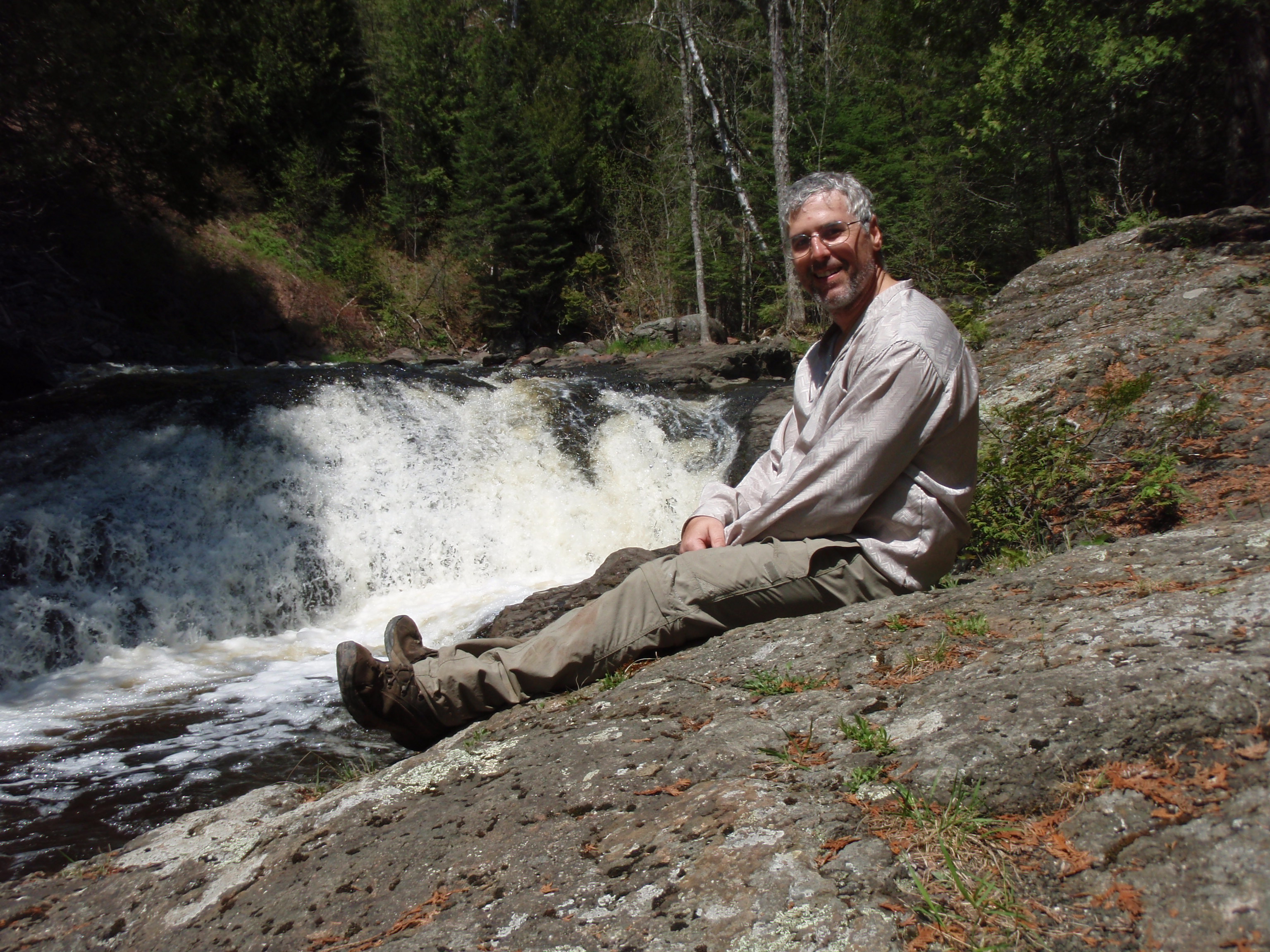
I hiked along the river, which is completely filled with rapids. I kept going as the trail went down some steps and over a boardwalk. It seemed like I went more than .3 mile and I still didn’t see the Hidden Falls. Maybe it was Hidden from me. The river was all rapids. Which one of these rapids is the Hidden Falls? I thought. But then I came upon a big section of waterfalls. The water was flowing fast and there were a couple of big drops. I set down my stuff and went down to the falls to take some photos. It was quite the sight.
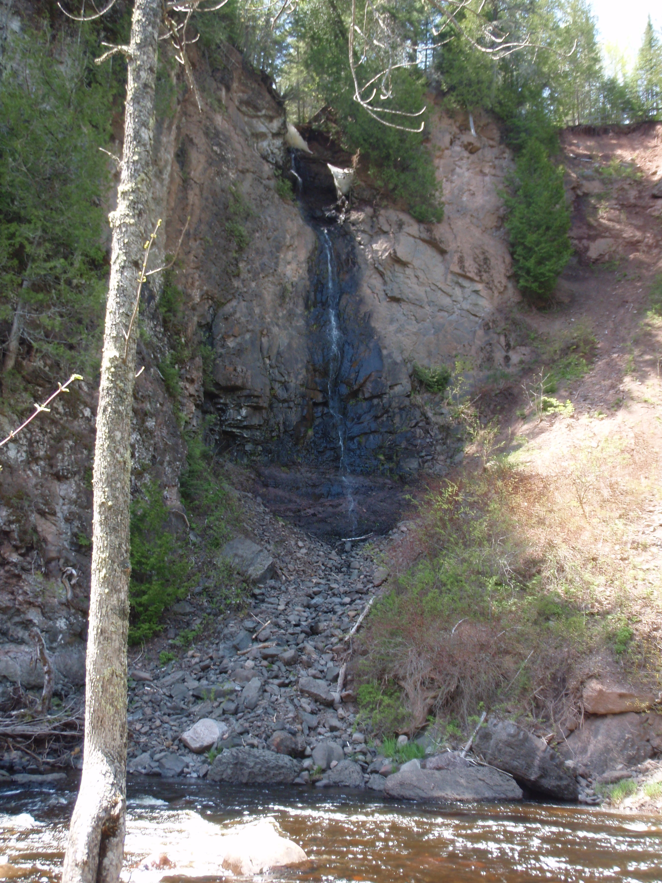
Soon I noticed a big bluff on the other side of the river from me. And up on the bluff, there is a little stream of water falling off of it. I would have missed it if I had not set down my gear and went down near the water. Surely that must be the Hidden Falls. I took lots of photos of the falls, including some self shots. As I looked up the big bluff, I noticed a cordwood fence at the top. That must be for the west of the river trail, I thought. I was sure glad I didn’t go that way, or I would have had to walk up that gigantic bluff.
I kept going on the east of the river trail. The trail stayed along the river for quite some time. Then it started going up a hill. There were log steps for erosion control. It kept going, and going up. All of a sudden I was feeling that I wasn’t quite so lucky going on the east of the river trail. But the west of the river trail surely would have been a monster, too. At any rate, this hill was kicking my butt. It kept going up and up. I made it to the top and seen an unusual sight. There were two trees growing up from the ledge of the hill. It looked as though the two trees were holding on for dear life. But that’s the way they grew there. They were fairly big trees too, at least a foot and a half diameter. On top of the hill it was easy walking, but I was pooped out from going up the hill. Eventually I made it to the Trout Creek Campsite. Then I knew I wasn’t very far from the main park campground. After the campsite there was a fairly big bridge over this gulley of a creek. The creek was only five feet wide but the gulley was more like 20 feet wide. It looks as though during the spring thaw, the creek fills up the whole gulley. And the bridge crossed the whole gulley. This was Trout Creek.
Then I went along a portion of the trail that was fenced in. I could hear the river down below, but evidently park visitors had caused too much damage along the riverbank, so the Park Rangers fenced it off. Or perhaps that portion of the riverbank was too dangerous. I couldn’t tell because I was too far from the river. But I could hear it, so there must be some falls or rapids in the river. Soon I got to a spot where there is a footbridge crossing the river. And the view from the footbridge is spectacular. There is a series of beautiful waterfalls upstream from the bridge down in a gorge. I figured that’s why they had the trail fenced off. The sides of the gorge looked pretty dangerous.
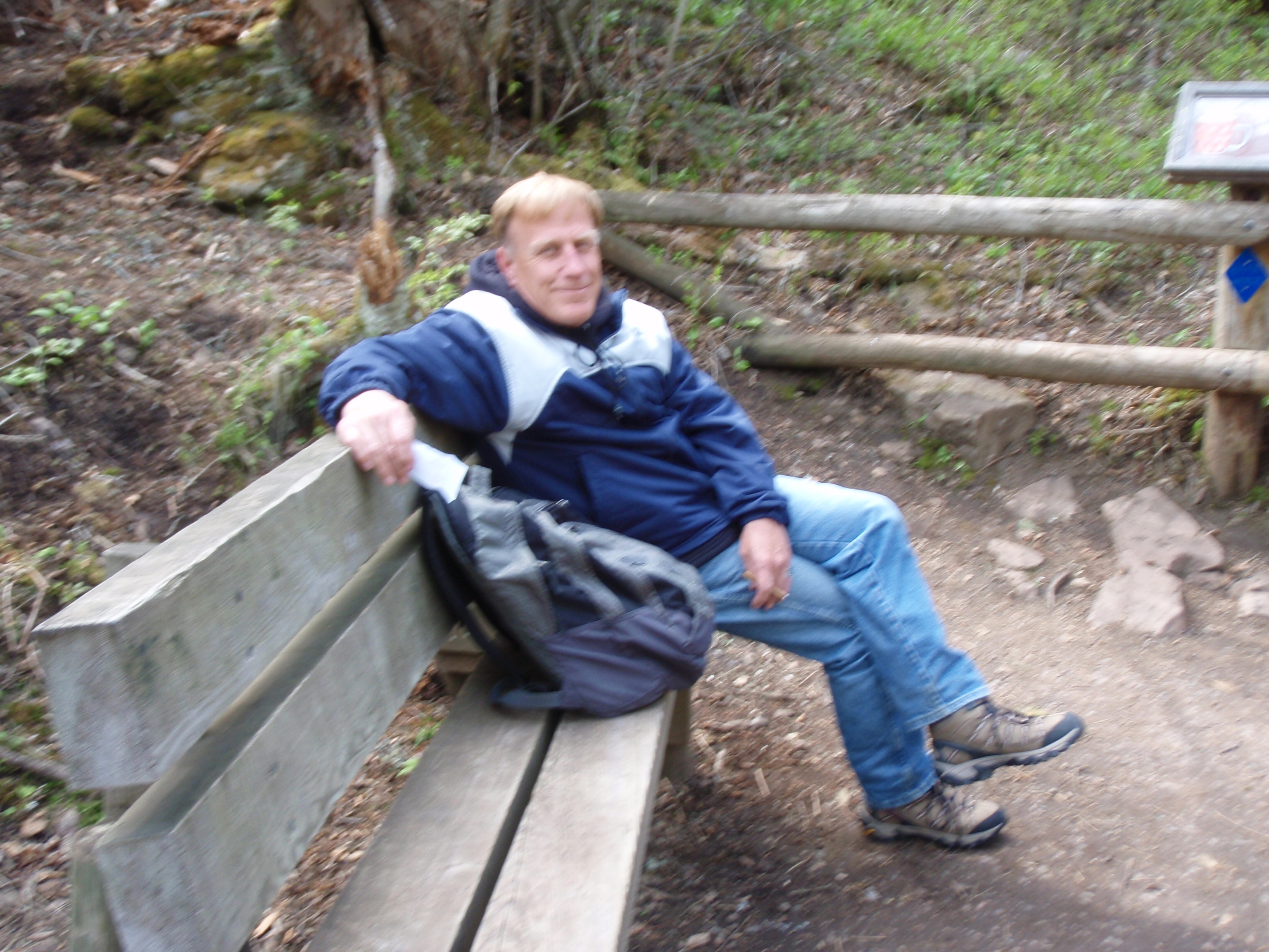
After the bridge, there is a little overlook area with a cordwood railing and some benches. That’s where I met Don from Grand Marais. He said it was his day off, and this was one of his favorite spots. He was just sitting down on the bench relaxing, enjoying his surroundings. I took his photo and gave him my card. He pointed me in the direction of the campground and I left him to enjoy his favorite spot in peace again.
I set my gear down on a picnic table at the campground, then searched the campground to see if Eric and Matt were there. I looked around and nobody was there. The campground was completely empty. I headed down to Highway 61 to see the Lower Falls that Don had talked about.
I crossed the Cascade River bridge on Highway 61, and below the bridge upstream there was another beautiful waterfall. And also to the east was a good view of Lake Superior.
Soon I saw a trail and a sign pointing to Cascade Lodge, so I decided to go check it out. Soon I was hiking up on a hill going parallel to highway 61. First I saw the Cascade Restaurant, then I saw the Cascade Lodge, then I saw some cabins up the hill in back of the lodge. I walked into the Lodge and ask the lady if they had a bunkhouse that I could stay in for the night. She said she had a room in the lodge for $69. After thinking about it I said yes, because I was pretty beat. Cascade State Park had kicked my butt. But again my Credit Card did not work. Wow, and I had just put $300.00 onto my credit card the day before.
I figured if I stayed at the lodge, maybe I could meet some people who could take me to Duluth the next day. I was getting pretty tired of this hike and just wanted to get out of there. The Lady at the Lodge said that my cell phone would work if I walked up the hill by the upper cabin. I asked the lady if there was a campsite on top of Lookout Mountain, like I had seen on one of the Park signs. She said yes. So I said that if I couldn’t get my credit card figured out, I would just hike up there and camp. She said there is a trail right near the upper cabin that would take me to the top of Lookout Mountain.
I also asked her if there was any bus or shuttle that traveled down the coast to Duluth. She gave me a sheet of paper from D&J Shuttle Service. It had a whole schedule of when it stopped at different places along the coast. I was happy about that. Now maybe I could get a ride to Duluth.
I started up towards the upper cabin and when I arrived there I tried calling my Credit Union. But it was too late, they were closed. So, I said to heck with it and just started hiking up Lookout Mountain.
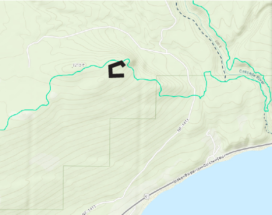 And incredibly, it was fairly easy walking. The trail was well marked. There were signs with maps every so often. I figured that this was a tourist area, so that’s why it’s so well marked. After a while I started seeing some pretty great views. I was at a rock ledge and I could see Cascade State park down below and Lake Superior all the way out to the horizon. It was gorgeous. It was a nice evening too, so I didn’t feel bad about camping out. Then I got to a point where there was a great view of the Sawtooth Mountains to the west. I decided to take a break here and call Visa.
Visa couldn’t really help me, they said I would have to call my Credit Union In the morning.
Then my ex-girlfriend Maria called me. My cell phone was definitely working now. She had just returned from a college class trip to Germany, and she wanted to show me the photos. You can read into that whatever you want. She’s old to be a college student, but you gotta do what you gotta do in this economy. I told her I was on top of Lookout Mountain in northern Minnesota. Maybe I’d be back in Madison later that week. I told her I was backpacking, and that I had lots of beautiful photos too. In fact, where I was standing was a wonderful spot to take a photo.
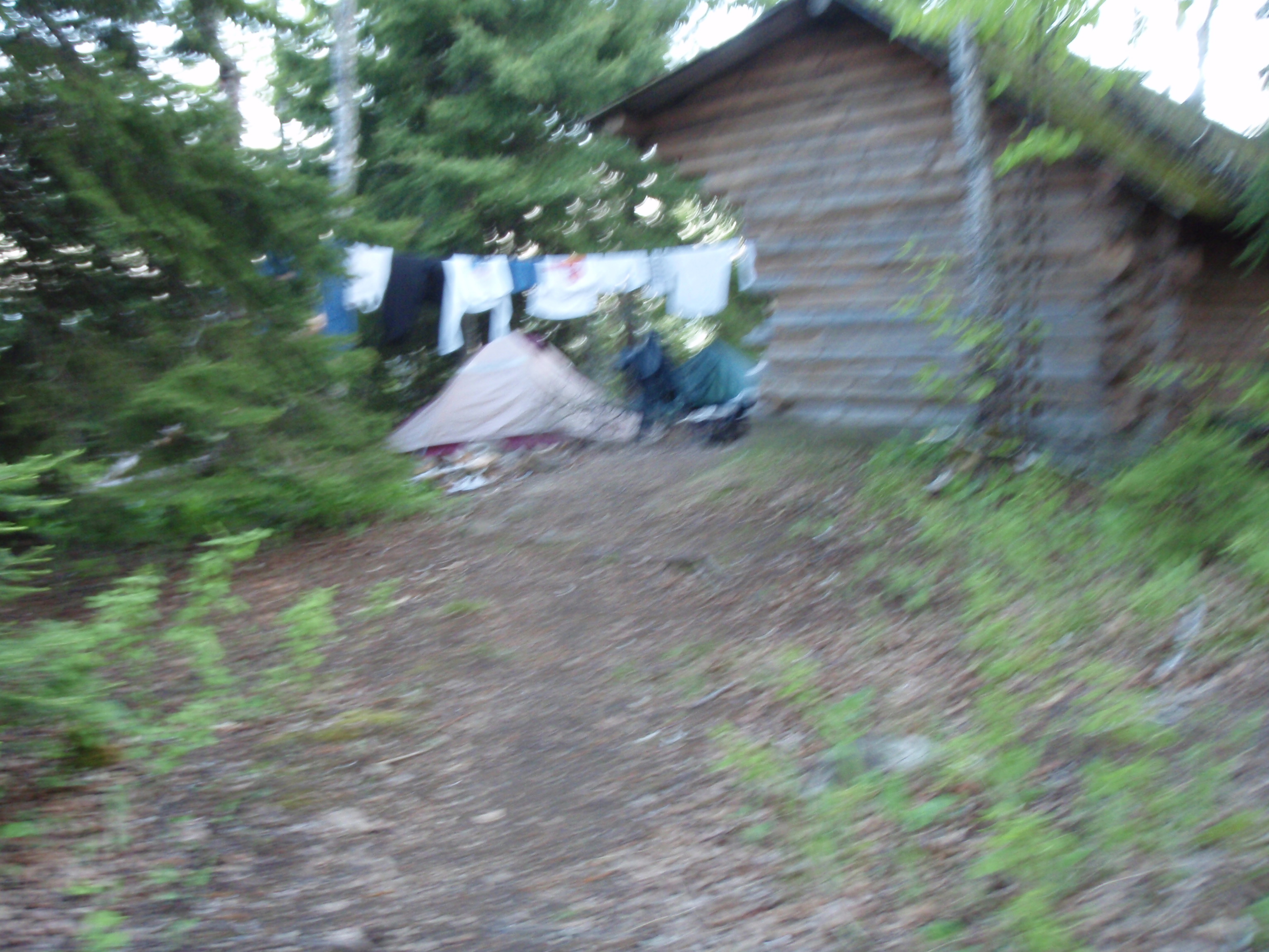
The phone call ended and I went off to look for the campsite that is supposed to be on top of Lookout Mountain. Shortly after, I saw a small wooden building so I walked towards it. The building was a Trail shelter, and I seen some smoke rising up near it. I also saw a big clothes line with a bunch of clothes hanging on it. As I got closer, I saw Matt bending down next to the fire.
Matt was real happy to see me. He started giving me a tour of the shelter. It was a three sided shelter with the side headed east being open. There was a picnic table inside of it and two benches to sleep on. On the side of the shelter there is a metal bin that looked like a mini fridge, but it actually was a place to store your food where the bears wouldn’t smell it. And there was an outhouse out in back of the shelter.
I asked him where Eric was and explained that Eric went down to get some water. The closest water was Indian Camp Creek, which is over a mile away. It was getting a little cold, and I asked him if they were planning to stay in the shelter that night. He thought they would, but then I said it probably would be warmer in the tent because the shelter had one side completely open. If we had a tarp or something to cover the open end, the shelter would have been good. But we didn’t have anything like that. So we started setting up the tents.
Eric came back with 3 Nalgene bottles of water. Eric was happy and surprised to see me. Eric said that the next campsite, the Indian Camp Creek Campsite, was a really nice campsite, and maybe we should go down there. It was only about a mile away, and we still had plenty of light. But Matt said that we had too many nice ammenties here such as the outhouse, bear box, picnic table and shelter, and that he wanted to stay here. So we stayed.
We cooked supper, then Matt and Eric played cribbage on the picnic table. I don’t know much about cribbage. Matt was winning at first, the Eric came back and won. I told Matt that’s what he gets for playing against a Math and Statistics Major.
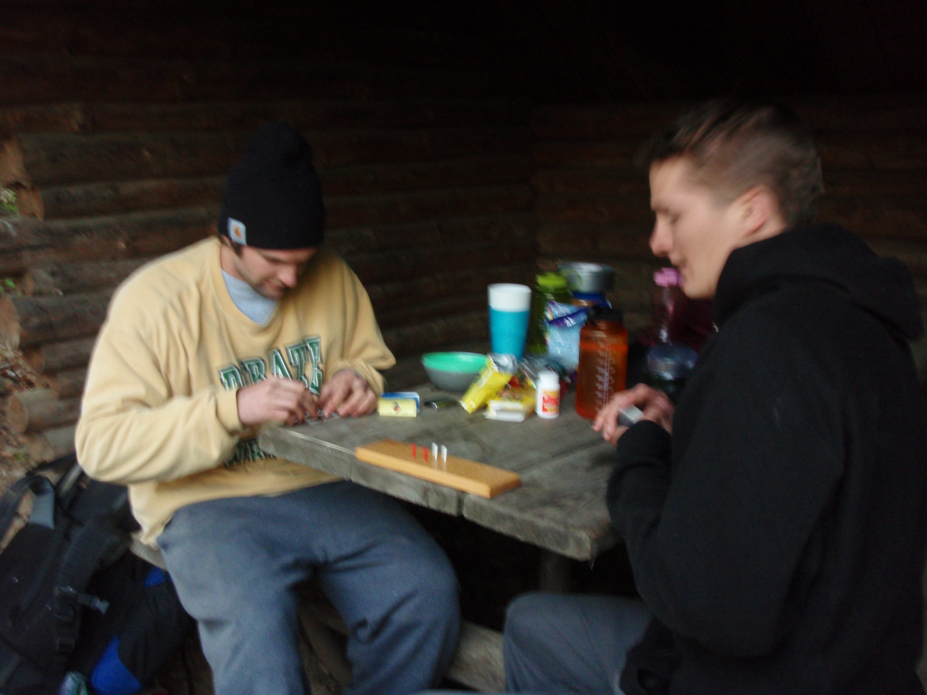
I showed Eric the sheet of paper about the shuttle to Duluth and told him that I was planning on taking it. But Eric pointed out that the Shuttle only runs on Mondays and Fridays. I looked at the sheet and he was right. I was a little bummed after that. Eric said that he and Matt were making good progress getting back to Matt’s car, which was parked in Tofte. And after getting back to the car they were planning to go up to Grand Marais and backpack the Devil’s Track portion of the Superior Hiking Trail. Eric’s car was parked at the Grand Marais Trailhead, so they would have to go up there to retrieve it anyway. Aiden and Tyler had convinced them that the Devil’s Track had some great scenery.
We had a nice evening together. It was dry but a little cold. Everyone was pretty content. I told Matt and Eric that I was going to wake up early, pack up, have a power bar, and leave. I didn’t want to wait around for them like I did this morning at North Bally Creek. I had heard that the Lutsen Mountain Gondola closed at 5 pm, so I wanted to get up early to make it there. I told them that they would catch up to me anyway. It was getting cold, so I snuck into bed.
Tuesday, June 2, 2009
Superior Hiking Trail: Lookout Mountain to the Caribou Trail, then Duluth
I woke up and looked up. I saw the shadow of two worms that had crawled up the outside of the tent. It had rained during the night, and worms come out of the ground sometimes when it rains. I slapped the side of the tent and the worms were gone.
I got up and went out for an early morning photo safari on top of Lookout Mountain. And I took some fantastic shots, especially the ones of the fog coming off the Cascade River down below Lookout Mountain. I went back to the shelter and started packing up.
Eric got up and started a fire. They have a nice metal fire ring around the fire. But I kept on thinking that the nearest water source is over a mile away, so I hope the fire up here never gets out of control.
That would be bad. I walked through a burn zone enough on this trip.
I finished packing up my stuff and ate a power bar. I had to borrow some water from Eric to wash the Power bar down. I put Eric’s phone number in my phone and called him to see if it worked. It did. Then I said goodbye to Eric and Matt. Matt was just coming out of the tent. He was kind of lagging and slow to get going this morning. You know how college kids are. Then I headed on my way.
The hiking was easy at this point because it was all a steady downhill hike. It was not very steep going down, just a gradual descent. I decided I would try to hike as fast and as efficiently as I could.
It seemed like I made it down to the Indian Camp Creek in no time. My main concern was getting water, so I skipped looking at the Indian Camp Creek Multigroup campsite and went down to where there is a footbridge crossing the creek. I set my stuff down, got some water in my nalgene bottle and put the aqua pills in it. Indian Camp Creek is like a smaller version of the Cascade river with little rapids and waterfalls,
The bad thing about using the Aqua pills is that there is no immediate pay off. You have to wait a half an hour for the pills to work. When you use a water filter, you can drink the water right away, but I didn’t want to carry a water filter. I usually leave about a cup of water in the bottle until I get to a water source. Then I drink my last cup of water, and fill up my bottle. But at this point I didn’t have the luxury of saving some water because I used it all on Lookout Mountain.
After I got the water bottle settled, I took a little hike around the Multigroup Campsite. It has about 3 fire areas with benches. The tent sites were grassy and flat. Eric had tried to get us to come down here last night to camp. He said it was a nice campsite and he was right. I didn’t stick around very long. I went back to the footbridge and put my gear on.
After the bridge, the Superior Hiking Trail goes up a hill. It is difficult for a little ways, but not nearly as difficult as the bluff I walked up in Cascade State Park. Then the trail gets easier because you are on top of this hill for a long time. And the views are beautiful. There are ledges with rock out cropping that you can walk on. But the views are pretty much the same as Lookout Mountain. This keeps going for a long time. In fact I was starting to get tired of all the wonderful views, because they all were pretty much the same.
Then the trail gradually descended to Spruce Creek. Almost the entire length of the 3.3 miles between Indian Camp Creek and Spruce Creek had beautiful views. Spruce Creek was another smaller version of the Cascade River with lots of little rapids and waterfalls. It also had a nice little footbridge crossing it. Before you get to the footbridge, on the left side of the trail, is the Spruce Creek Multigroup Campsite. It is located among some tall pine trees right next to the creek. I suppose the pine trees are Spruce trees, hence the name Spruce Creek. This is a really bumpy campsite with all the tree roots and rocks. It didn’t look like I would get a good night’s sleep at that site. But it’s right next to this beautiful little creek, so it has some nice qualities. It has two fire areas with benches around them. I would much rather camp at the Indian Camp Creek Campsite than at Spruce Creek. It had nice flat grassy tent pads, plus it had a nice little creek there too. Maybe that’s why the Indians camped there.
After Spruce Creek the trail goes up a hill gradually again, and there are more beautiful views of the Sawtooth Mountains. It was much like I had seen all day since Lookout Mountain. I do think this would be a spectacular hike during the fall when the leaves are colorful.
After hiking with the beautiful views for a while, the trail descended to a marshy area. Soon I came upon a canoe sitting next to a beaver pond. There is a long series of boardwalks crossing the beaver dam. It is a good-sized beaver pond. After getting almost across the boardwalk, you see a campsite to your left. I went in and set my stuff down at the benches around the campfire. It was 11:30 and I was taking my lunch break here. I was at the Jonvick Creek Campsite, and the beaver pond was part of Jonvick Creek. I set the beacon out.
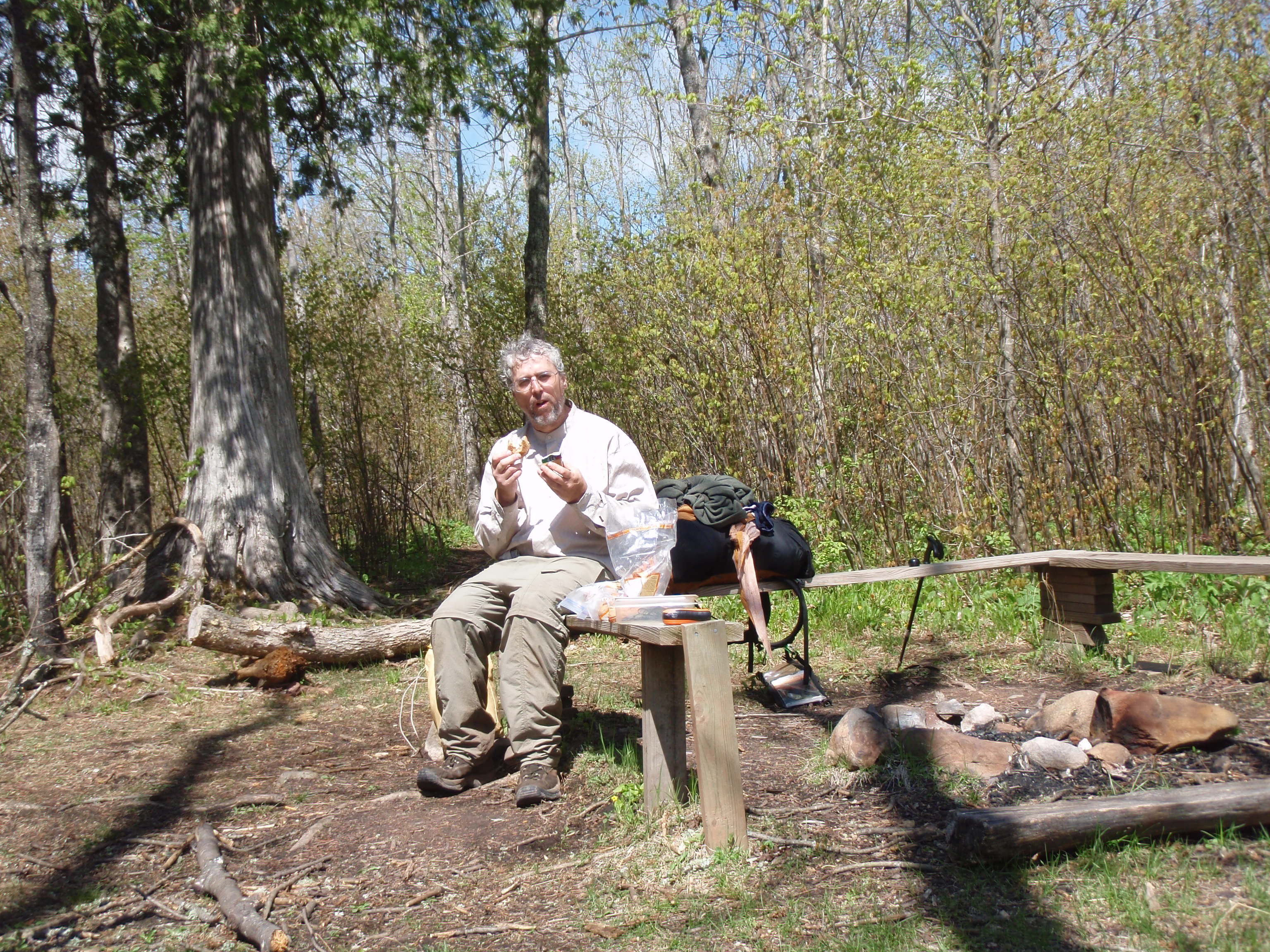
I needed a rest. I had been pushing it because I wanted to make it to the Lutsen Gondola by 5 pm when they closed. I thought I would be able to make it by then. But still, I was very worn down due to all the days on the trail. I was very ready to go home. I was hoping someone would call me about my Craigslist Ad. I called my credit union while I was having lunch. They said that I had overspent my limit, that’s why I couldn’t buy anything at the Lake Superior Trading Post or book a room at the Cascade Lodge. She said the payment I put on the card on Sunday had been processed and now I had some money on the card. I told her to transfer another three hundred dollars onto the card so I could be sure I made it home. All the extra money I spent must of put me over the limit. There were a few expenses I wasn’t expecting, like $50 for long underwear at the Red Rocks store and the $80 I spent at the Clearwater Lodge to get into town. That all added up. But now I was sure I had enough money on the card to get home.
I was checking out the Superior Hiking Trail Guidebook and I noticed that the mileage to Lutsen Mountain was screwed up. If you went by the mileage from campsite to campsite, it was shorter. Then I figured out that there was a .8 mile spur trail to the Cariboo Trail Parking Lot. The mileage in the section from Cascade State Park to the Cariboo Trail had included that .8 mile spur trail. The Section in the book from the Cariboo Trail to Lutsen Mountain had also included the .8 mile spur trail.
So I figured my hike to Lutsen Mountain was at least an .8 mile shorter than advertised.
I continued on and the trail gradually went up a hill. Soon I saw some good views again, but these were different. There was a lake down below in the valley. It was Cariboo Lake, and it looked very scenic. There was a sign on the trail saying “private property, please stay on the trail.” I looked at the Guidebook and it said the property belonged to the Cathedral of the Pines Camp. As I walked I could see the camp buildings down next to Cariboo Lake. Then I came across a spot that that was a Campfire Bowl for the Camp. It had over a dozen benches and there was an excellent view of the lake below.
Then the Trail went down a hill fairly steeply. They had log steps for erosion control. It seemed like a fairly long descent. While I was going down I met Randy and Amber. They were backpacking and looked to be experienced. I told them that I had been out backpacking for 10 days and I wanted to end my hike today after I took a ride on the Lutsen Gondola. They said they had walked by the Gondola and that it didn’t seem to be operating today. That was something I wasn’t expecting. I was going to take their photo but my battery was empty. They wanted to move on so I just gave them my card.
Soon after Randy and Amber left, I made it to the bottom of the hill and met up with Jeff. He was out day hiking. I still didn’t have my batteries changed so I just gave him my card and he went on. I stopped there to change the batteries in case I met up with some more people. All of a sudden I was meeting people frequently. I hiked on and crossed County Road 39. I kept going because I knew the Cariboo Trail was just a short distance. After I passed a climbing structure for the Cathedral of the Pines Camp, I made it to the Cariboo Trail. It is a nice blacktopped road.
Again, at the Cariboo Trail, there was another nice sign with distances to future landmarks. It would be 1.1 miles to Lake Agnes and 6.5 miles to the Lutsen Parking Lot. But I wasn’t going to the Parking lot, which was down another spur trail, I was going to the Gondola. But I was worried because Randy and Amber had said they didn’t see the Gondola moving. So I set down my stuff and call Greg Mackler. I asked him to go on his computer and find the phone number to Lutsen Mountain. He said he was driving, but Terry was home and she could look it up if I called her.
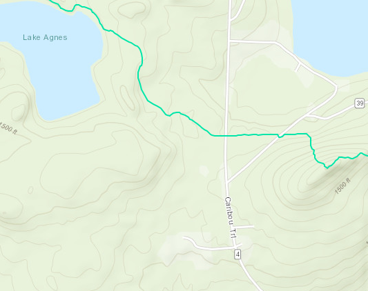 So I called Terry. I asked her to look up the number for Lutsen Mountain on the internet. She said she would but it would take her a few minutes because she would have to go upstairs to the computer, so I said I’d call her back.
I called her back and she gave me the number for Lutsen Mountain. I called over there and they said the Gondola only operates on the weekend during this time of year. I had previously called Lutsen Mountain on Saturday, and I didn’t ask them what days it was open, they just said it was open until 5 pm. I was a little dejected that I wouldn’t be able to ride the Lutsen Gondola to end my hike. It was around 1 pm when I got done with the phone calls. At that point, I said to heck with it, I’m going to road walk into Lutsen and maybe I can arrange a ride to Duluth. Maybe I could stay overnight in a cheap motel and someone would call me about my Craigslist Ad.
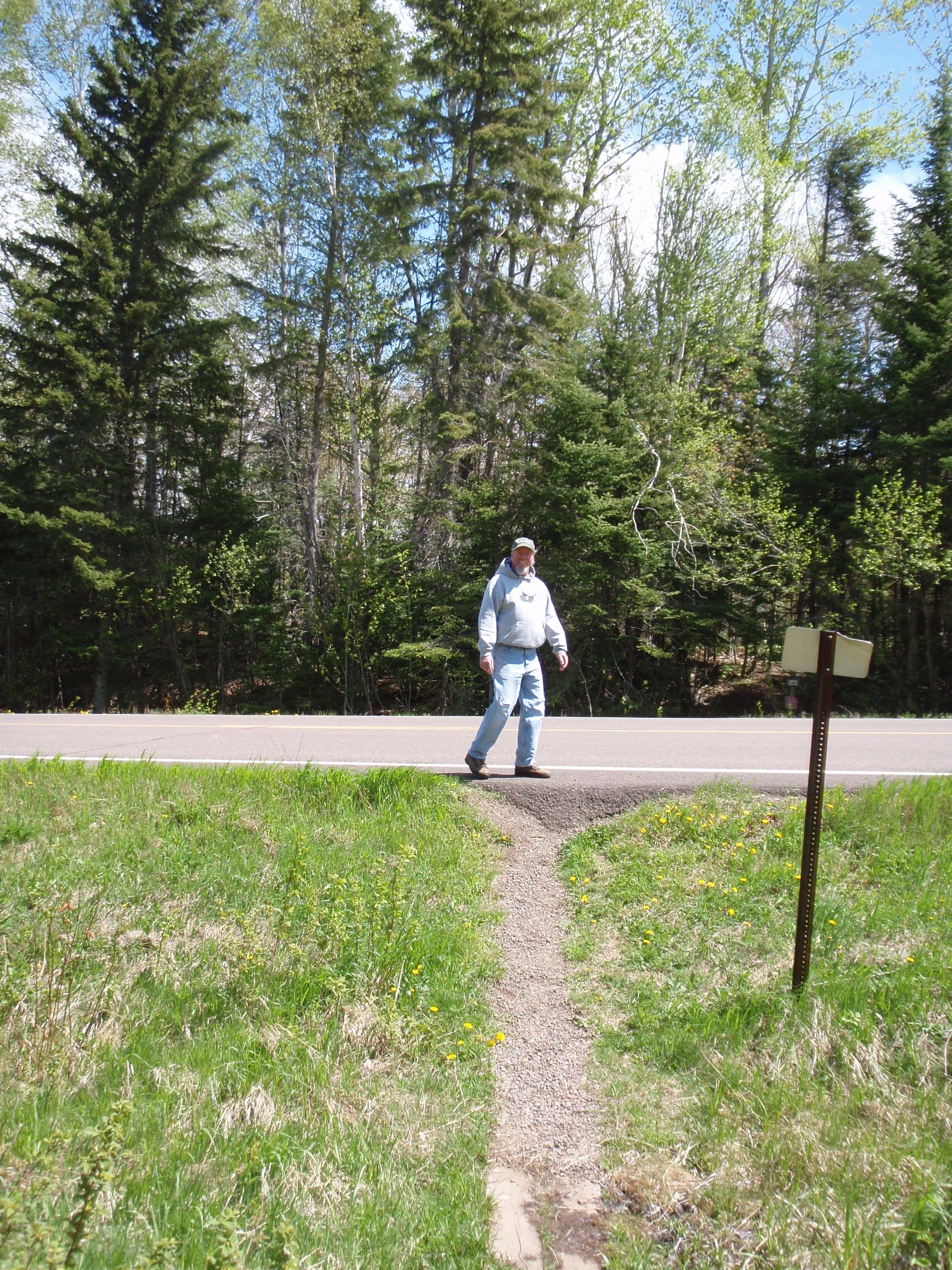
By this time I saw someone walking down the Cariboo Trail from the north. As he got closer to me I could see it was Jeff, who I had met at the bottom of the hill on the Cathedral of the Pines section of the trail. Jeff was going my way on the road, so I walked with him. Jeff is an EMT in Lutsen. He was out doing a loop hike that is his normal hike that he does. We had a nice conversation then he had to turn onto Highway 39 to complete his loop. I said goodbye and continued on. At least this time I got a photo of him. When I met him on the trail earlier, my batteries were dead.
I continued on walking down the Cariboo Trail. I looked in my Map pocket and found the sheet of paper for the D&J Shuttle. The Shuttle only ran on Monday and Friday, but maybe they would know of someone that does the trip in the middle of the week. So I called them and Dennis answered. I told him I was backpacking near Lutsen and I wanted to know if he knew of anyone that could give me a ride down to Duluth. He said he could come pick me up. I wasn’t expecting that. I asked him how much that would be. He must have been shuffling some papers around or looking at a map. Then he said it would be $90. I said I didn’t know for sure and that I would call him back.
I thought that $90 was a good price for going from Lutsen to Duluth. I looked on the sheet and it says that they charge $60 from Lutsen to Duluth on Mondays and Fridays when they have a regularly scheduled route. Compared to the $80 that the Clearwater Lodge had charged me just to get into Grand Marais, this was a good deal. But it said on the sheet that they operated on a cash only basis and I didn’t have $90 on me.
I figured if Dennis traveled through Lutsen on a regular basis, maybe he would know if there is a bank in Lutsen. So I called Dennis and asked him. He said he didn’t know if there was a bank in Lutsen, but if he came and picked me up, we could stop at a bank on the way to Duluth.
That sounded good to me so I agreed to have him come pick me up. He said it would take him a while to get here, but he would call me when he got close. That sounded good to me.
I was relieved that my backpacking trip was coming to an end. I was weary from being on the trail so long. I continued walking on the Cariboo Trail down towards Lutsen. I decided I would call Eric to tell him I got a ride to Duluth. Frankly, I was surprised that Eric and Matt did not catch up to me.
Maybe Cascade State Park kicked their butts, too. So I left a message on Eric’s phone.
Finally, I made it down to Highway 61. There is a Fire Station near the corner. When I got to the fire station, there was a man in a pickup truck about ready to pull out from the Fire Station. I flagged him down and asked him if there was a bank in Lutsen. He said that there wasn’t a bank, but there was an ATM at the Credit Union. It was located down Highway 61. I asked him if he could give me a ride down there, and he said yes. I wanted to get the money before Dennis arrived, so I was happy about getting the ride. The man in the pickup truck was named Frank, and he is the Fire Chief in Lutsen. I thanked him for the ride, and gave him one of my cards.
He dropped me off at the North Shore Credit Union which is in a strip mall. I went into the Credit Union and managed to get $150 off my credit card. I asked the teller where I could wait for my ride and she said there is a coffee shop right next door. So I went to the Moondance Coffeehouse. It is actually a combination coffeehouse and realty agency. The Lutsen Real Estate Group is located there.
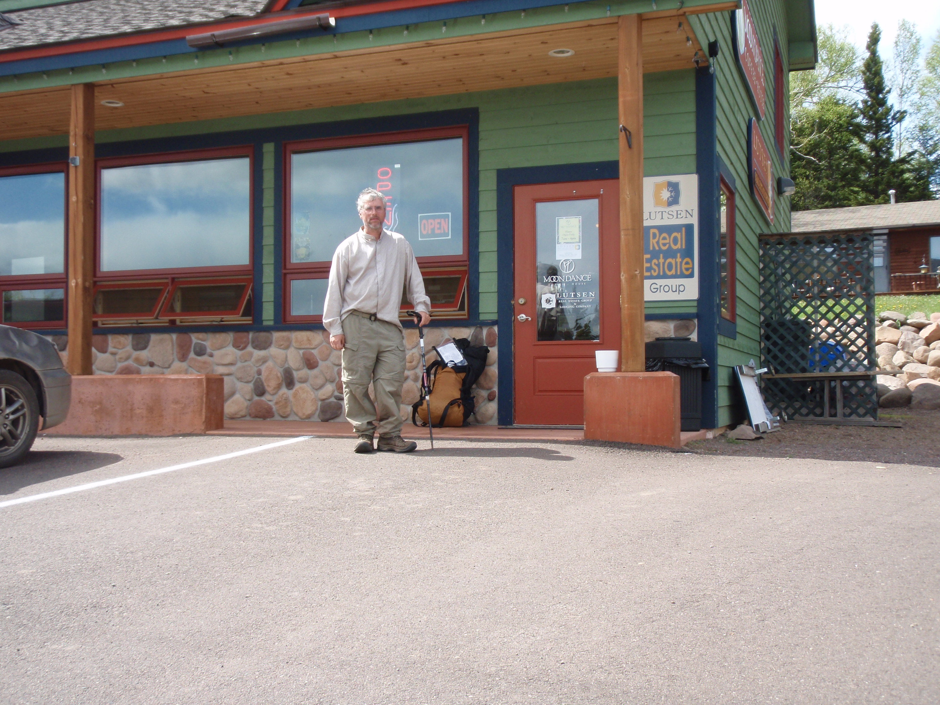
When you go in the door you are in the coffeehouse part of the building. Then there is the Realty further to the left of the coffeehouse. There is an open air stairway going up to some loft offices that kind of separates the two businesses.
I was hungry, so I ordered a turkey paninni sandwich. I called my sister and asked her to find out when the Skyline Shuttle leaves Duluth for the Twin Cities. She looked it up on the internet and said the last shuttle was at 5 pm. I thought if Dennis picked me up by around 3 pm, that maybe I would make it. Then I noticed that the coffeehouse had a computer for customers to use over by the stairway. I went on the computer and updated my Isawtman webpage. I ate my Paninni Sandwich while I was surfing the web. I lounged around the coffeehouse and noticed that the realty was selling “fractured ownership” of cabins at the Gunflint Lodge. I never had heard of fractured ownership.
I went back to my table and relaxed. One of the Real Estate people saw my gear and asked where I had been backpacking. I gave him a condensed version of my trip. I said that I had stayed overnight at the Gunflint Lodge and I was wondering what fractured ownership was. He said that you are buying the cabin for ten weeks a year. Then I said that it’s kind of like a time share. But he said that you actually get a deed for the property. I asked him how do they decide what 10 weeks a person gets the cabin. He said it was pre-determined, but if you want to trade weeks with another owner you can do so. That was interesting. I gave him on of my cards and he went back to work.
At about 2:45 I decided to call Dennis and tell him I was at the Moondance Coffeehouse. He said he was just coming out of Two Harbors and that it would still be about an hour before he got here. Another customer had delayed him. I thought that I would never make the 5 pm Skyline Shuttle and would have to get the one early in the morning. So I continued to wait around at the Coffeehouse. I went outside and took a photo of me in front of the Coffeehouse, and in front of the sign in front of the parking lot. This is where my backpacking trip officially ended.
The Coffeehouse has one guy running it. He takes your order, cooks the food and brings it out to you. I think the Pannini grill is timed so it won’t overcook your sandwich, so he doesn’t have to watch over it that much. We had a couple good conversations. I asked him if he had more than one job. The women clerks at the Lake Superior Trading Post had told me that everyone up here has more than one job to make ends meet. The guy at the Moondance Coffeehouse said that this was his only job, but at one time he worked at two different restaurants. He told me a humorous story about being the waiter for a couple in the morning at one restaurant and being their waiter again in the evening at a different restaurant.
It was 3:30 and the guy at the coffeehouse was beginning to clean up because it closed at 4 pm.
I got a call from Dennis saying that he was 6 miles away and would be here shortly. So I took my gear outside and wait. After a few minutes, Dennis pulls up in a big 15 passenger van. I wasn’t expecting something quite that big for just me. Dennis went into the Coffeehouse to use the facilities then we left.

I could tell right away the Dennis was a real character. Evidently, this was the third Taxi Service that he had owned. He had sold the other two. This shuttle service, the D & J Shuttle, specialized in long distance shuttles, where his previous Taxi Services had been for just the Duluth area. He said he takes a lot of workers from the Carribean up to work at the resorts along the North Shore. He also takes Sailors who miss their freighters to Sault St Marie so they can get back on their Freighter.
At first I thought Dennis was part of the Superior Hiking Trail Shuttle Service. It’s a service on the weekend that takes hikers between trailheads. But Dennis’s shuttle is totally different.
I told Dennis that I was planning on taking the Skyline Shuttle in the morning. And that I wanted to find a hotel near the Marriot, because that’s where the Skyline Shuttle stops. He said that there is a Best Western only 3 blocks away that is only $60 a night. I said that would be good. But Dennis also said I should check out the Greyhound bus, they might be a better deal. In fact Dennis had the Greyhound Station’s phone number programmed in his sell phone. But the Greyhound Station wasn’t open. Dennis said they may be only open to meet the buses, and so they may be closed until an 8 pm bus comes in.
I told Dennis that he needed to get information about his shuttle on the Internet. I had researched the internet before my trip and I didn’t see anything about his north shore shuttle service. He said that the service on Mondays and Fridays was brand new. I told him the only way I found out about it was that I asked the lady at the Cascade Lodge
Having Dennis as your driver is like having your own tour guide. He would point out places along the way such as the Split Rock Lighthouse and Gooseberry Falls. He showed me the two tunnels the state had to build for Highway 61, because the old road was on a cliff and was dangerous. There was also a nice paved bicycle trail next to the highway. Dennis said they built it when they rebuilt the highway. I really want to go biking on that trail. He showed me some of the big houses on the shoreline of Duluth, and pointed out the ships in the harbor.
Dennis took me to the Best Western in downtown Duluth, and he showed me where the Marriot Hotel is so I could catch the Skyline Shuttle in the morning. And he told me to check out the Greyhound Bus Schedule because that might work better for me. He said the Greyhound Depot was located away from downtown and was a $10 cab ride. I gave Dennis $90 for the ride and a $10 tip.
The Best Western was an older hotel that looked like it was built before the Disability Accessability Laws had become popular. This Hotel was built going up a hill and had plenty of steps. I rented a room and took a shower. Then I went down to the Hotel’s Lobby and used the computer for the guests. I checked out the Greyhound Bus website and saw they had a bus at 8 am in the morning arriving at downtown Minneapolis at 10:45 am. I thought this would be much better than taking the Skyline Shuttle.
The problem with the Skyline Shuttle is that it stops in St Paul and then at the Airport. I would have to take the shuttle all the way to the airport, then take a Metro Train to get to downtown Minneapolis.
I needed to be in downtown Minneapolis by 1:45 pm to catch the Megabus to Madison. The Greyhound would take me directly to downtown Minneapolis where it would only be a 10 block walk to get to the Megabus. So I purchased an online ticket for the Greyhound and called Dennis to pick me up in the morning.
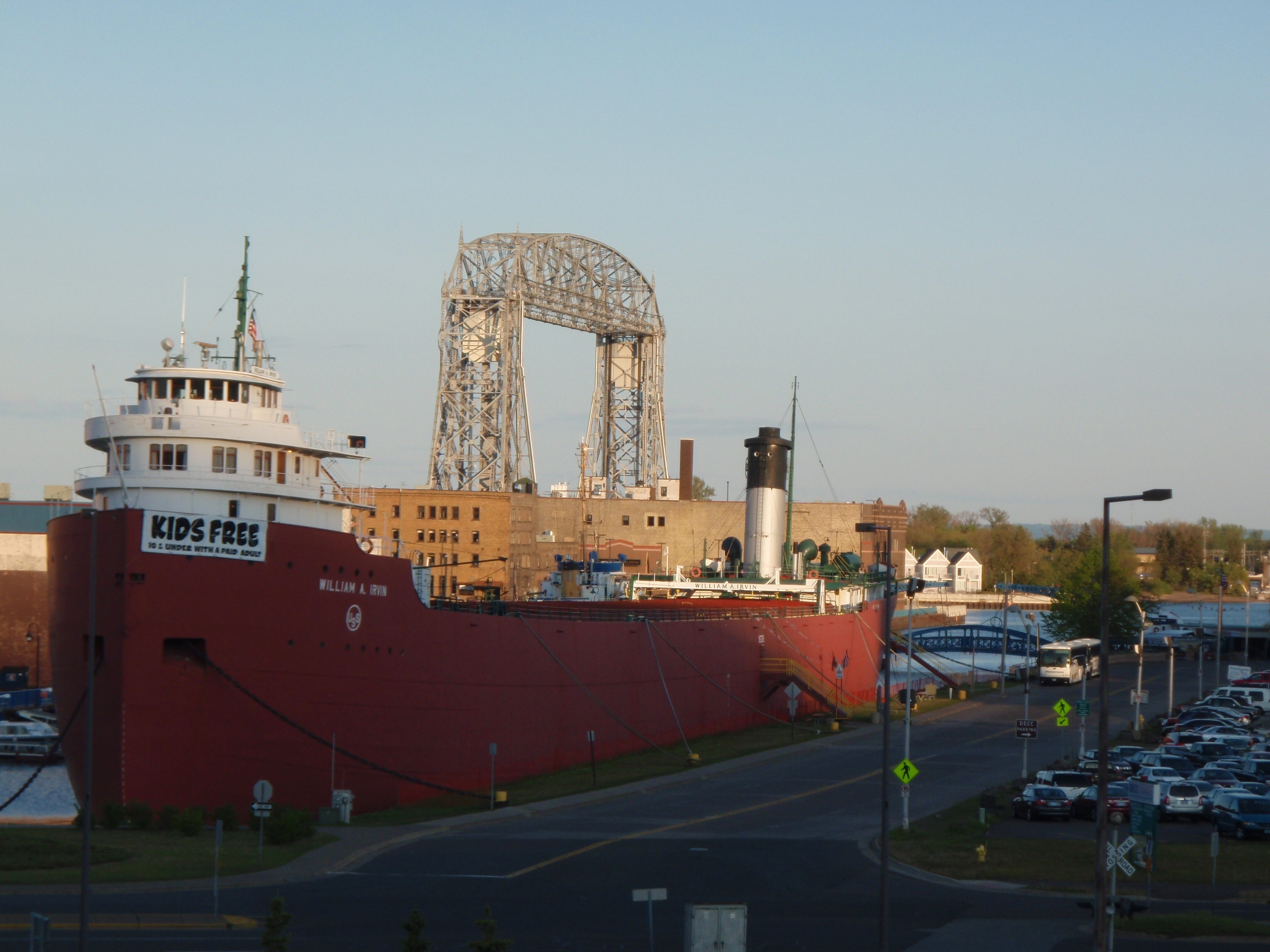
It was around 7pm by then, and I decided to go out and explore Downtown Duluth. It was pretty dead. I took photos of the harbor and the famous lift bridge. Then I found an Irish bar that was open. It was not very busy either, but the bartender said that they are packed on the weekends when there is a comedy show in the banquet room. After a good meal, I went back to the hotel and went to bed.
Wednesday, June 2, 2009
Duluth to Madison
I woke up and got my stuff together. I went down to the lobby and ate breakfast. Dennis picked me up at 7:15 am and took me to the bus station. Again, I told Dennis he needed to get his north shore shuttle service on the internet. (I recently called Dennis and he says that he goes up the north shore almost daily now, not just Mondays and Fridays, so call him at 218-940-8088 if you need a ride. Plus he can shuttle people in northern Wisconsin too.) I said goodbye to Dennis and he was on his way. The rest of the day went pretty much as planned. I rode the Greyhound to Minneapolis then the Megabus to Madison. My trip had ended.